
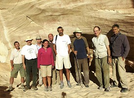
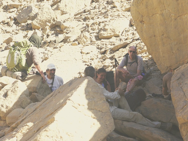
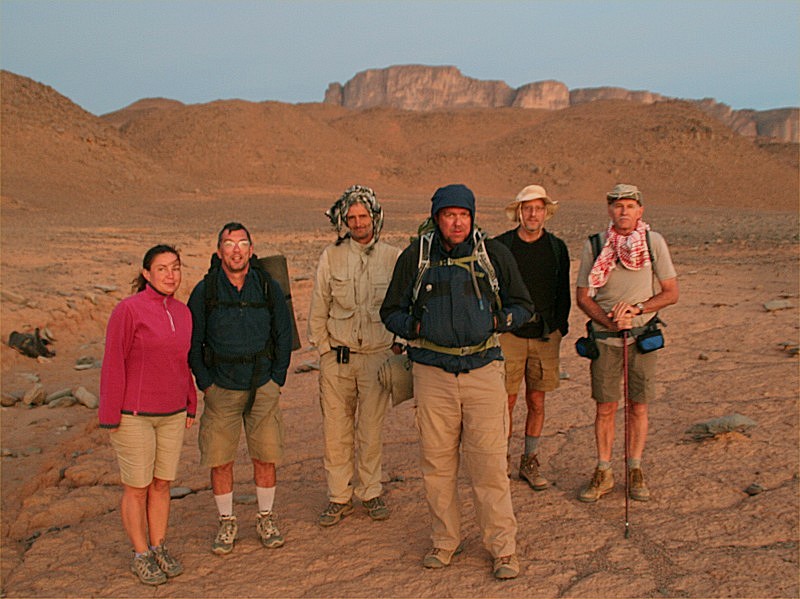
 Click on image for list of participants |
Jebel Uweinat & Gilf Kebir Expedition, Egypt 7th - 21st November, 2009 |
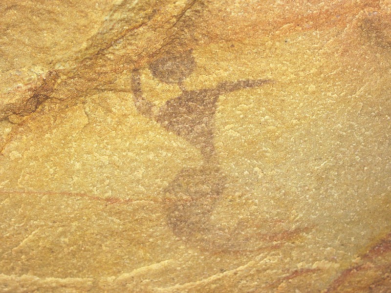
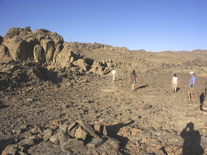
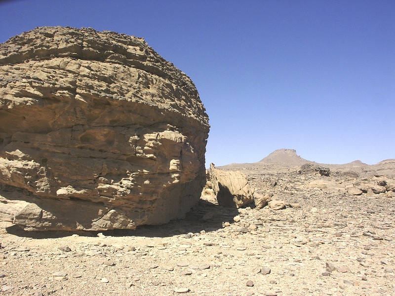
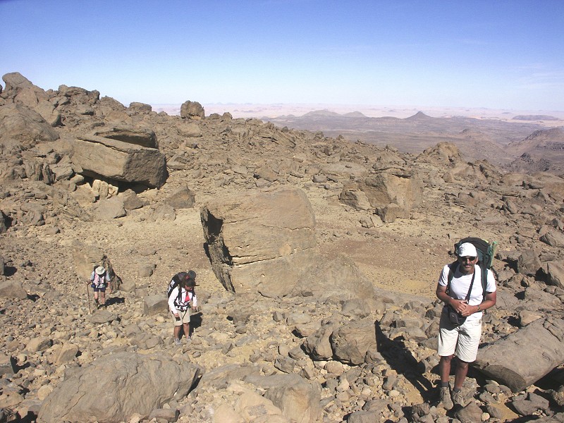
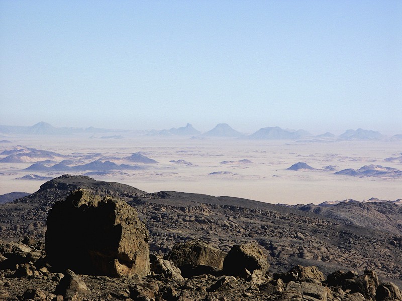
After an absence of over a year and a half due to security concerns we returned to Jebel Uweinat to continue exploring the remaining blank spots. We have spent eight days trekking in the upper areas on the mountain, succeeded in scaling the summit once more, and some of the explored areas yielded truly spectacular new rock art finds.
Day 1. - Cairo - Dakhla
The first day was the usual full day drive on the road to Dakhla Oasis, starting from Cairo at dawn before 6am. The only novelty was the choice of our departure point, as the Cosmopolitan Hotel, our regular past haunt, started charging ridiculous prices for their rather mediocre services. We moved to the newly completed Novotel el Borg (at a superb location at the tip of Gezira island), which proved to be a very pleasant choice. Having reached Dakhla by sunset, we had a nasty surprise learning that our regular gas station just beside the Mebarez hotel was out of fuel. To cut the long story short, it took until past midnight for all three cars to be fueled at the other station, at which there was a two hundred metre queue. However the easy going attitude of Egypt is amazing - I'm not sure one could have gotten away anywhere else in the world taking 30 minutes per car to take the 600 litres of diesel each at the single pump while holding up the entire queue, however here aside the usual bustling and lively discussion not a single word was spoken in anger. My fullest compliments to the patient and friendly people of Dakhla.
Day 2. - Dakhla - Selima Sand Sheet
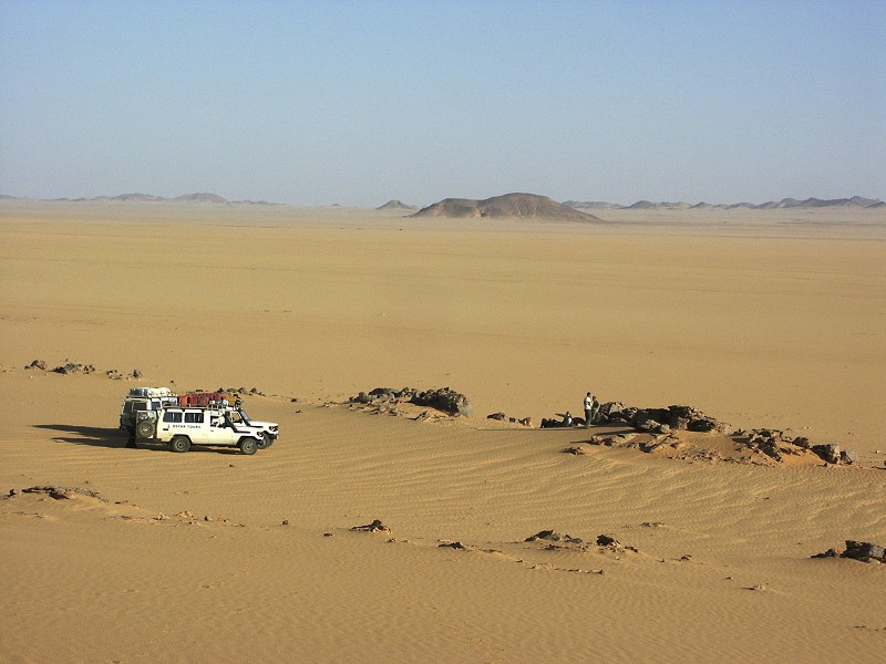
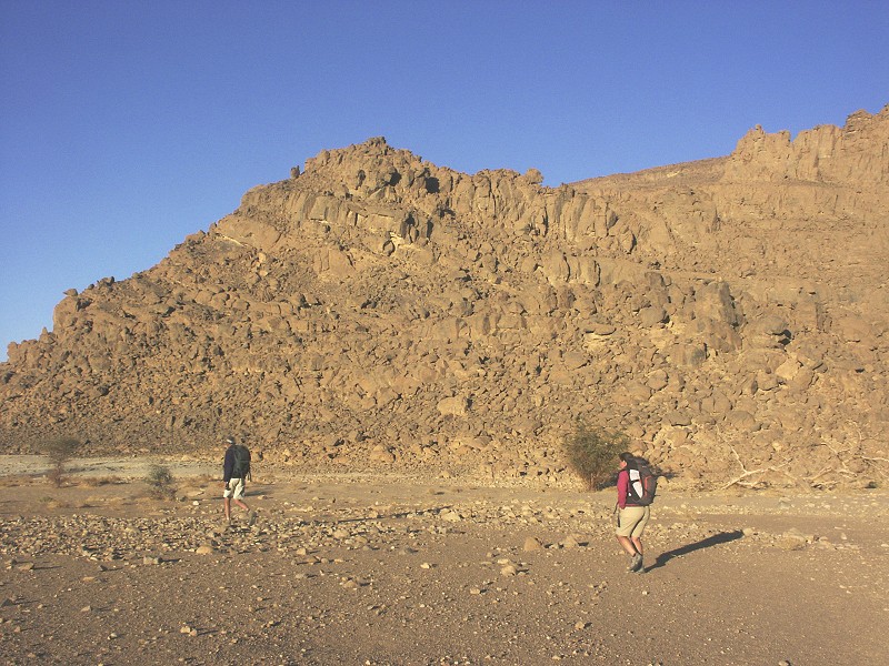
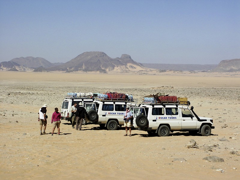
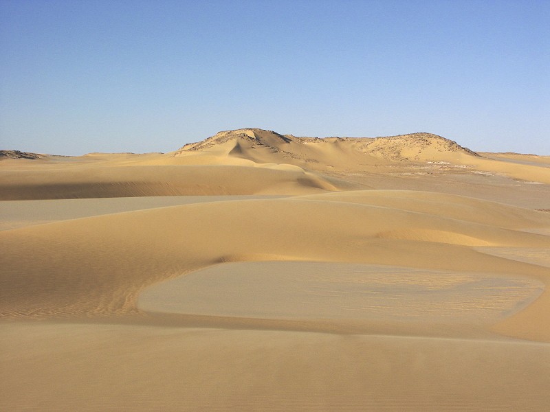
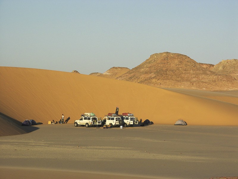
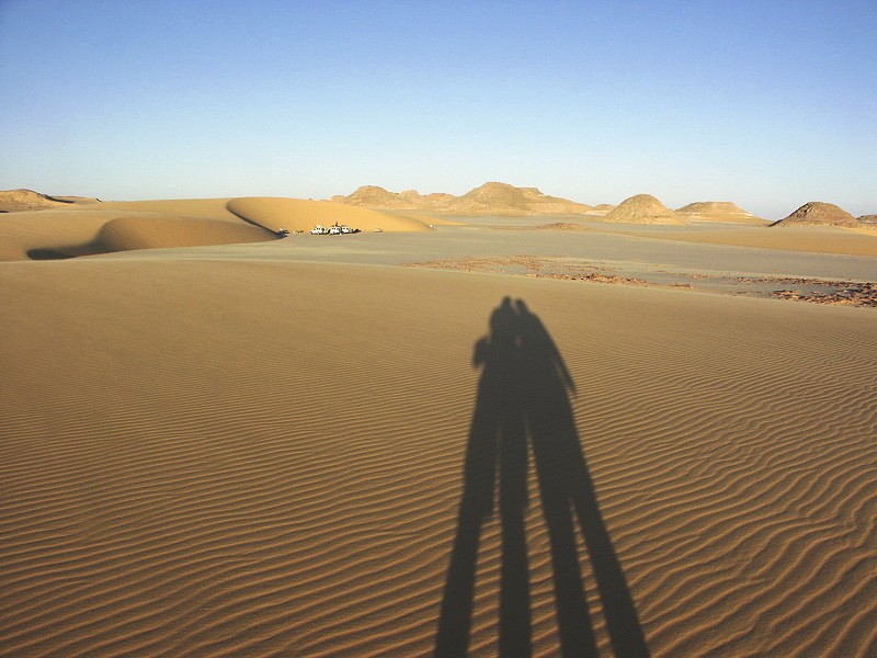
Our morning start was delayed somewhat by a wait for our officer (the poor fellow was only told the day before that he needs to come with us and had driven all night from Cairo to join us), but in retrospect it was worth it, Lt. Mohammed turning out to be a thorougly pleasant and helpful companion throughout the trip. Clearing the checkpoints along the road south took little time, and before midday we turned off the road about 50 kilometres north of Bir Terfawi towards the West. We paused for lunch at the Abu Hussein dunes, then drove accross the Selima Sand Sheet to the next range of dunes, where we made an early camp, the dunes being the only sheltered camping spot in a circle of about 100 kilometres.
Day 3. - Selima Sand Sheet - Jebel Uweinat
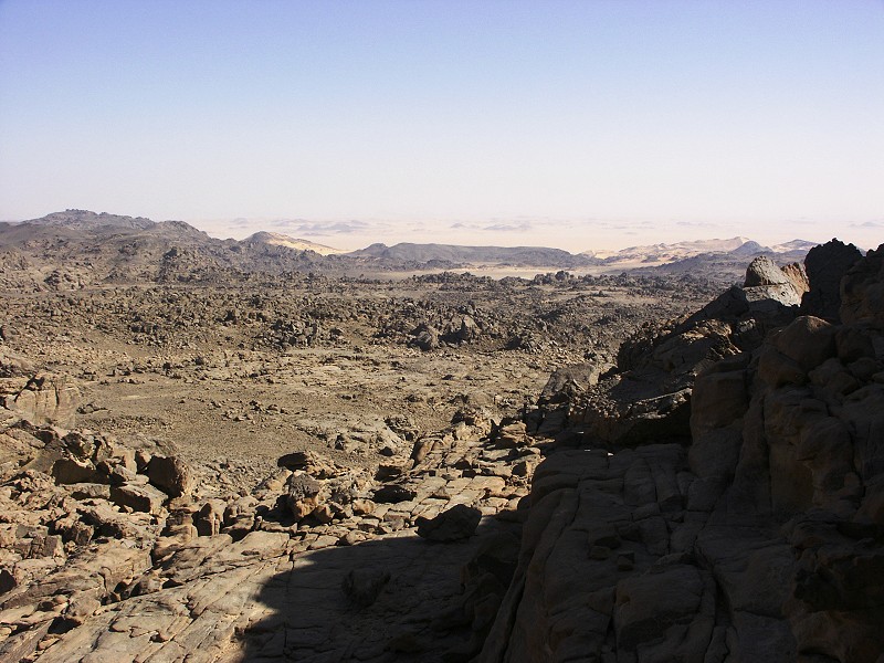
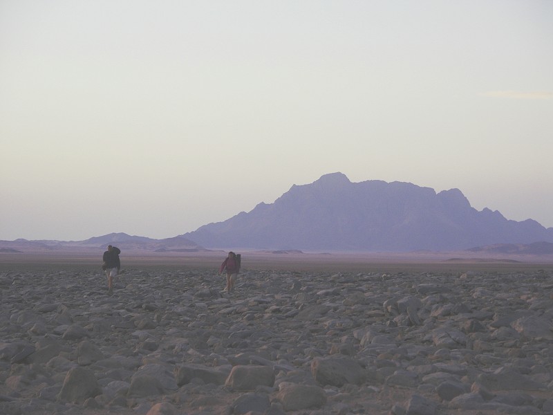
From camp we drove slightly south west, aiming for the northern tip of the dune belt that forms an effective barrier about 20 kilometres west of Jebel Kamil. Our plan was to make a straight course for Jebel Uweinat from there, bypassing the southern Gilf Kebir altogether, something that we have not attempted before based on out bad experience with the terrain on our very first trip, in October 1998. However newly released high resolution Google Earth imagery enabled the plotting of an easy looking course, and indeed the new route proved to be fine going all along on firm flat sandy plains and valleys.
There was a tense moment approaching the tip of the dune belt, as we spotted a group of five or six vehicles in the distance. After taking careful looks with binoculars and discussing with Lt. Mohammed, we came to the conclusion that it is an Egyptian Army convoy, encountered in the desert for the very first time in ten years. We approached them to find that one of the huge russian six wheel drive tanker trucks, probably full of water, was hopelessly bogged down in the sand, having gone too close to the dunes (the northern side of barchans is always soft and deceptively smooth, must be given a wide berth). There were about two dozen soldiers shoving and pushing in a rather futile looking attempt to get it unstuck, it looked like a two day job to me. There was little we could do to help, after establishing our identity and exchanging greetings we continued towards Uweinat.
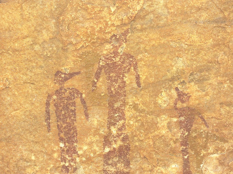
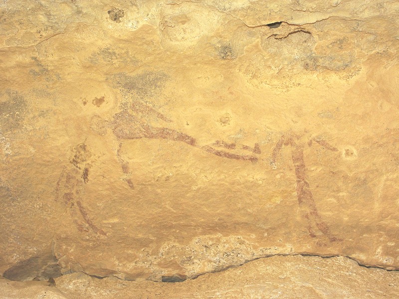
Our objective for the day was to visit a number of rock art sites that Mark Borda found on one of his expeditions earlier this year. Mark surveyed the row of scattered hills to the North-east of Uweinat, and found a series of very interesting paintings, including several of the early "Uweinat roundhead" period.
In the afternoon we took some time exploring a number of other hills in the vicinity which Mark did not have the opportunity of doing so on his last trip, however this time we were not lucky. As sunset was rapidly approaching, we made our way to Jebel Uweinat, to our campsite in Wadi Handal, to make preparations for the planned trek the next day.
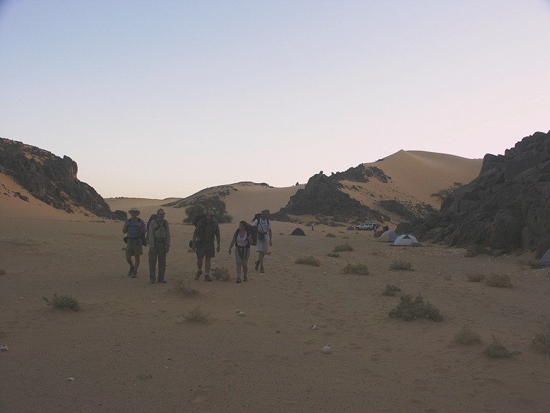
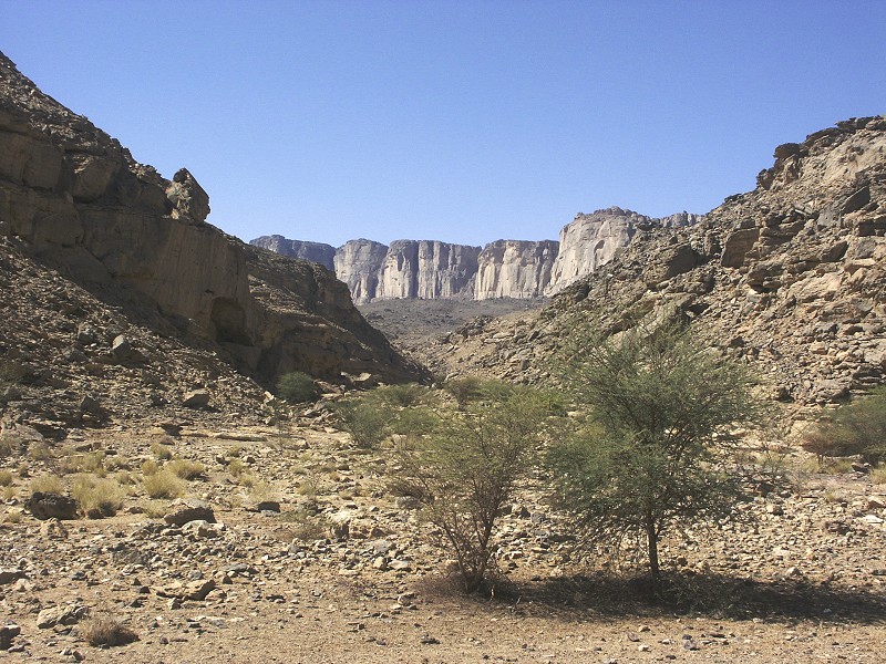
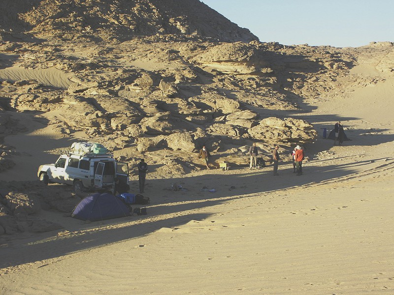
Days 4-5. - Upper Wadi Handal
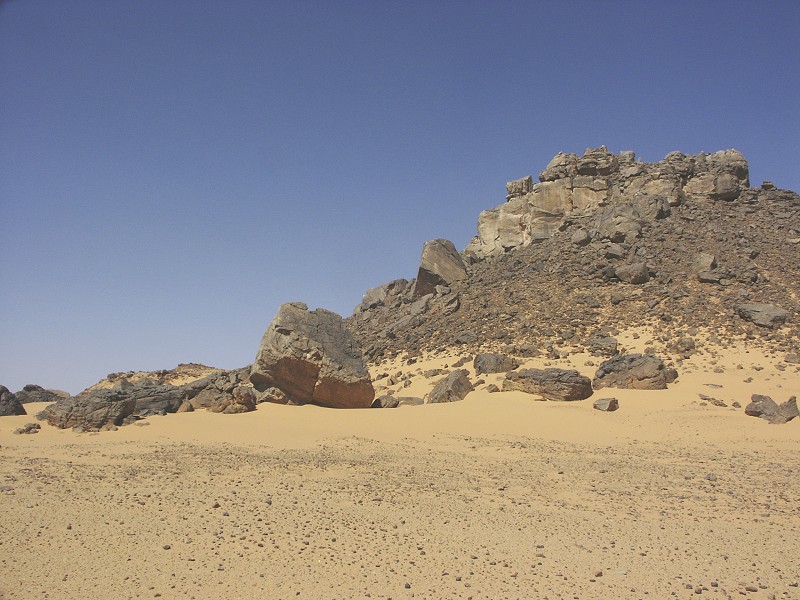
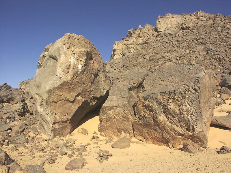
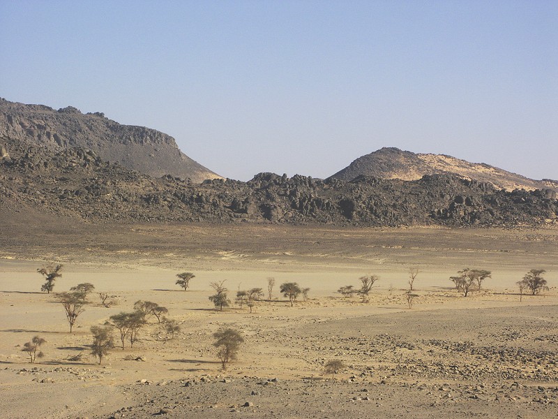
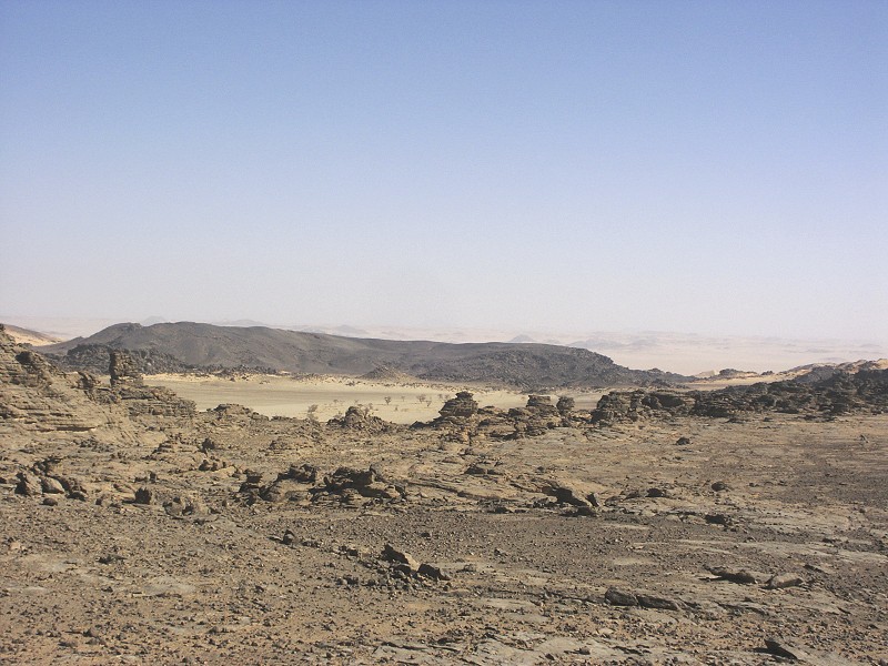
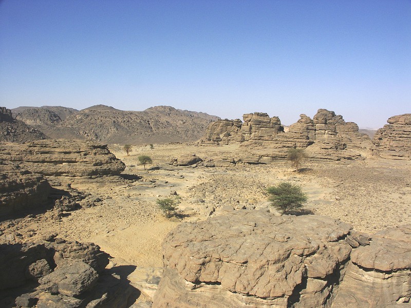
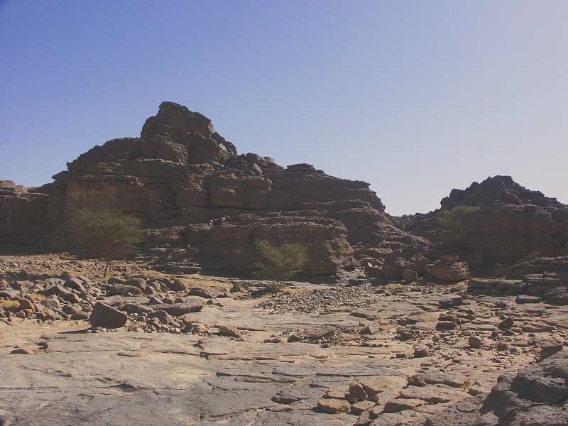
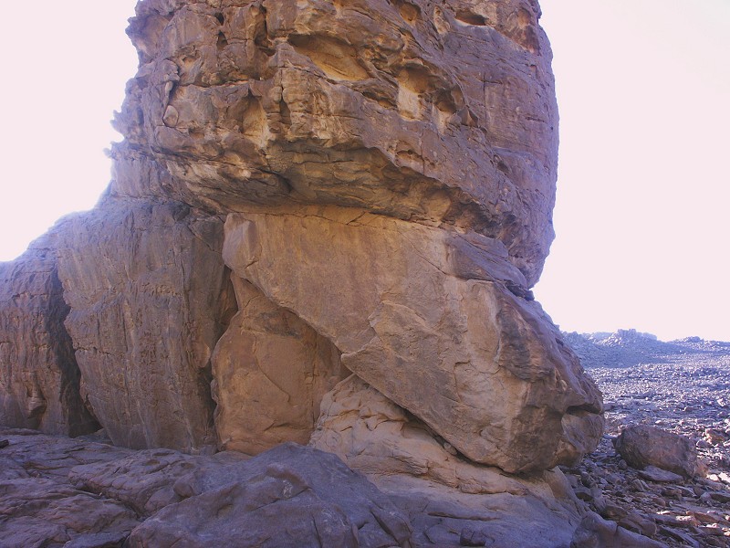
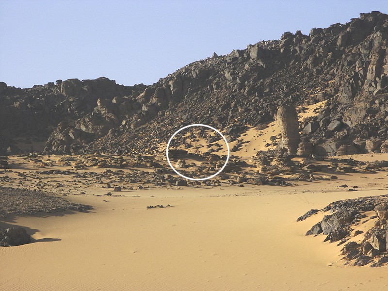
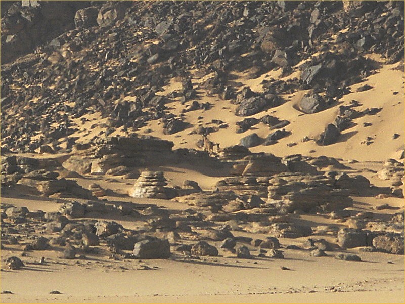
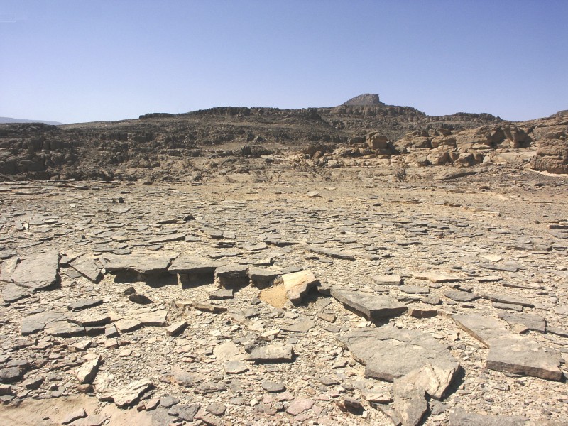
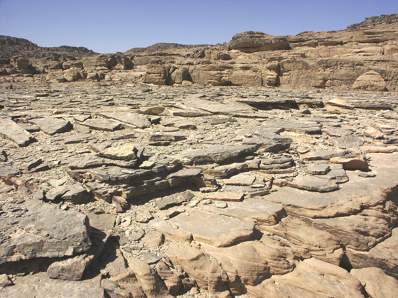
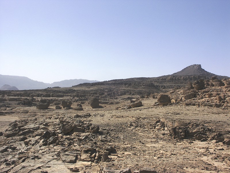
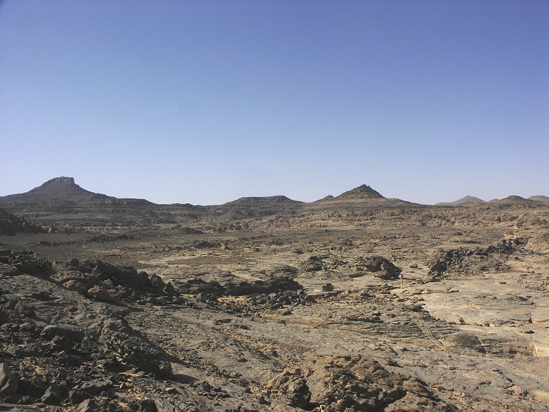
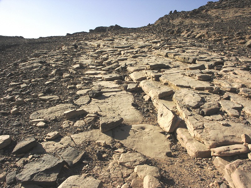
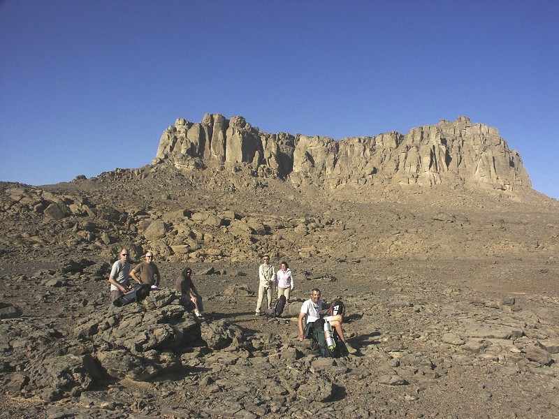
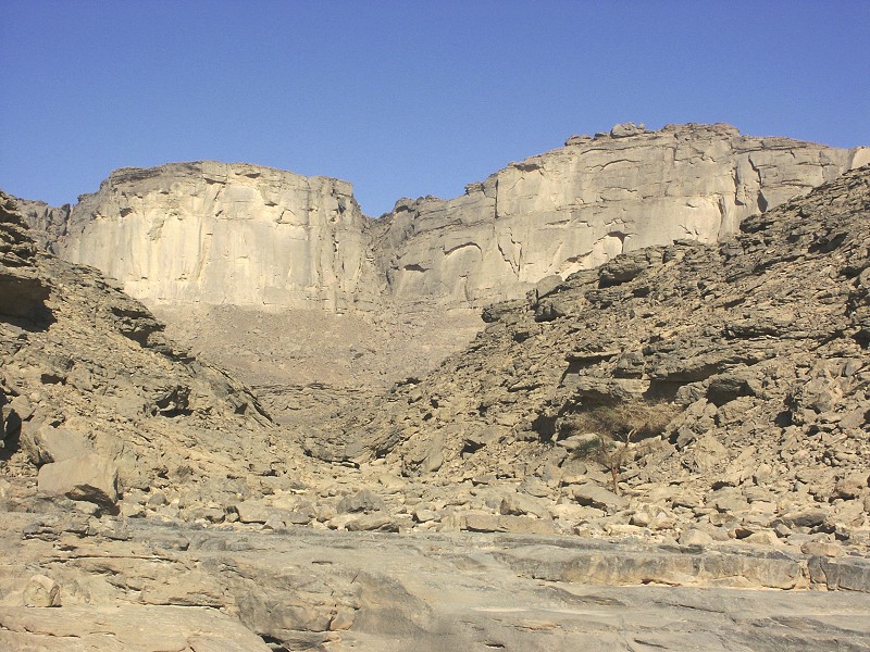
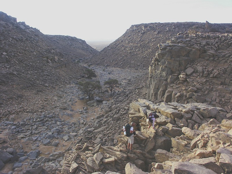
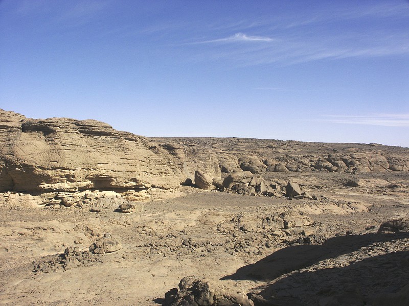
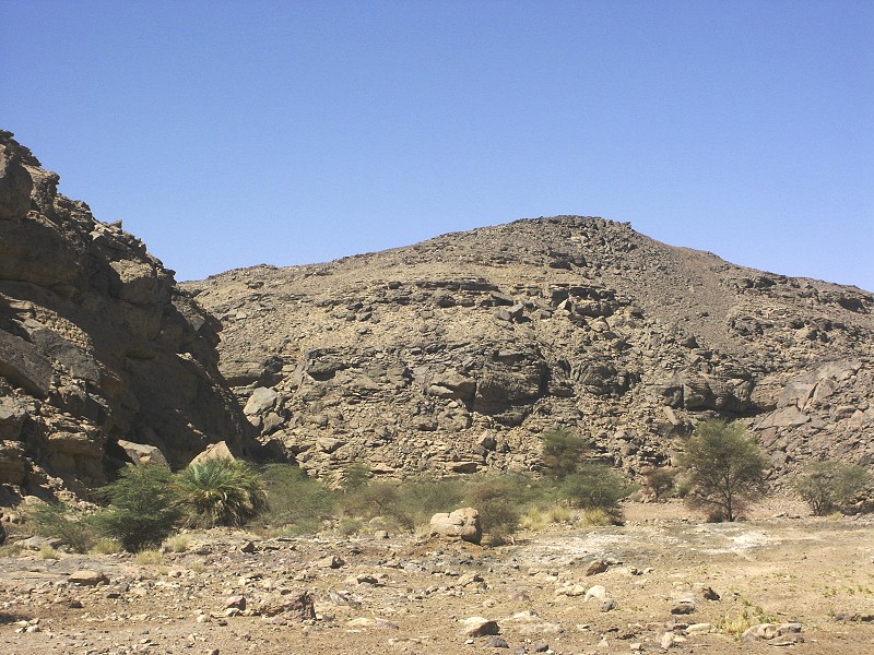
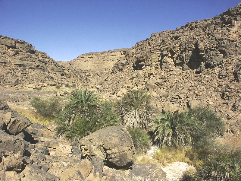
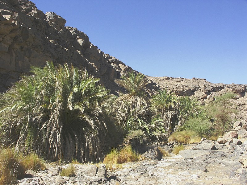
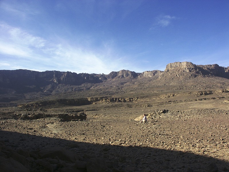
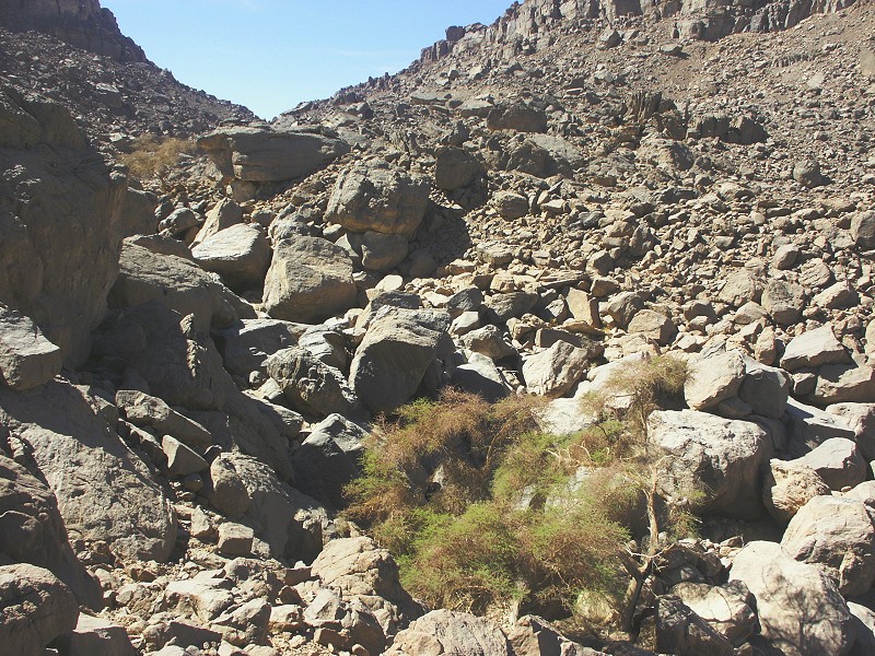
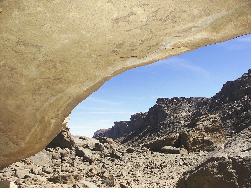
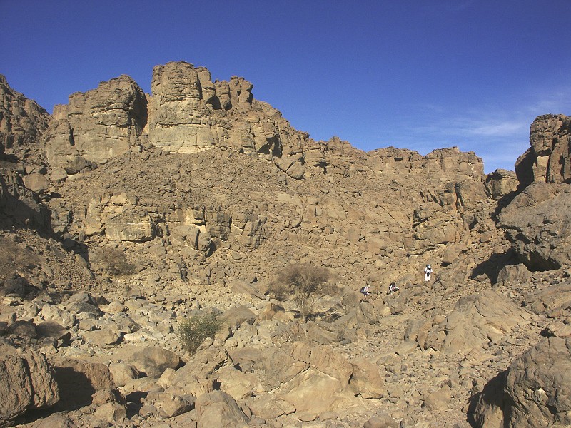
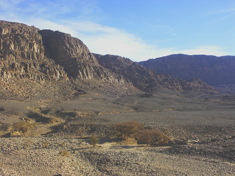
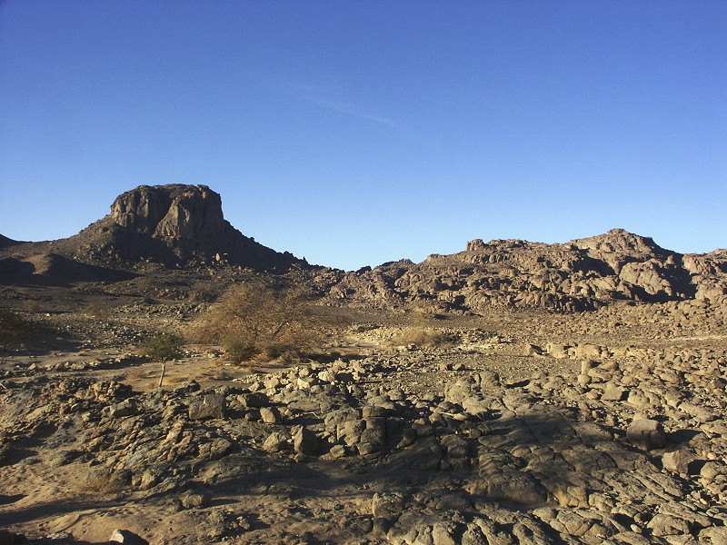
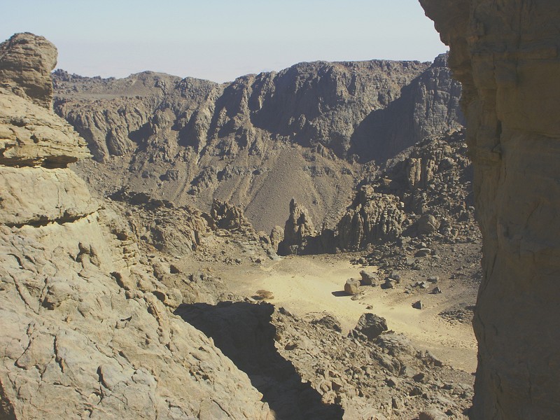
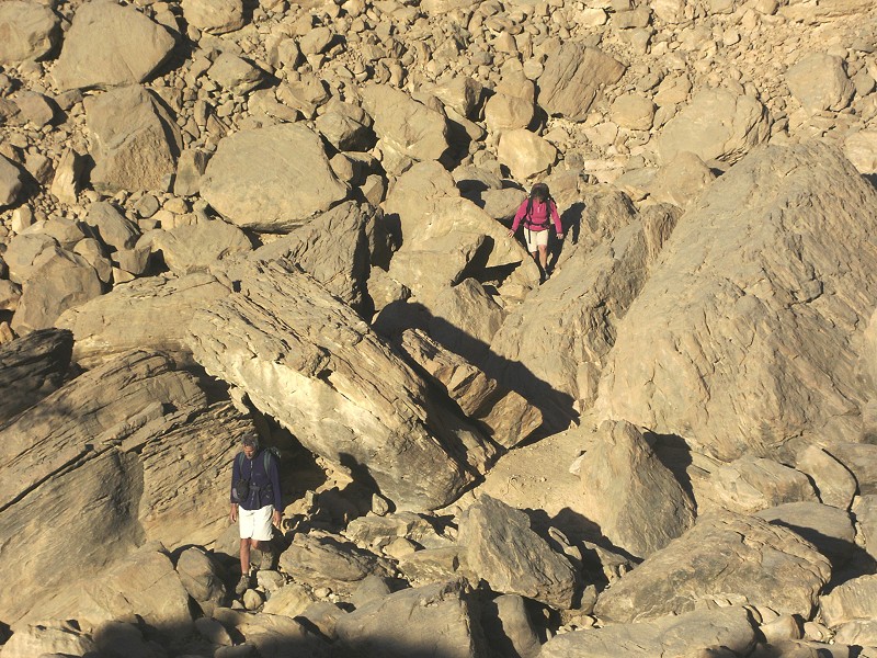
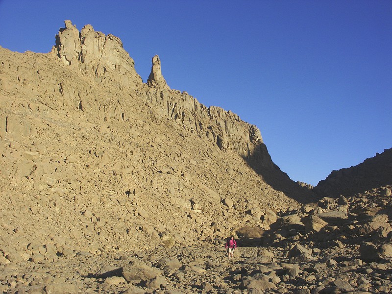
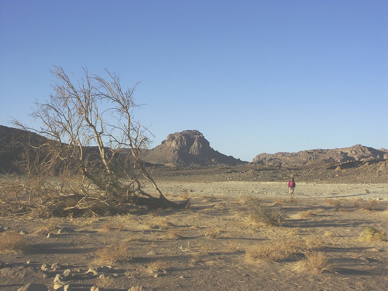
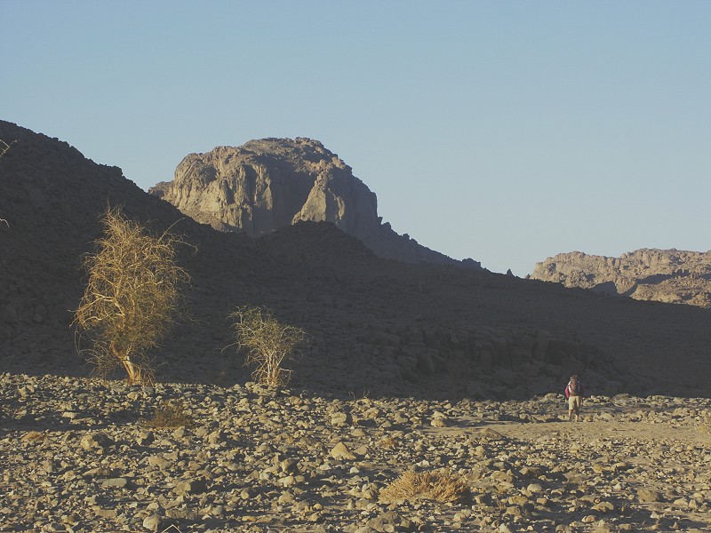
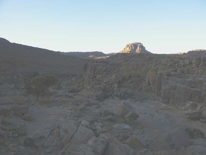
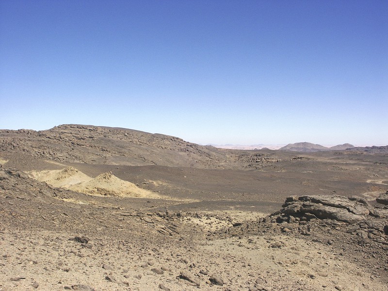
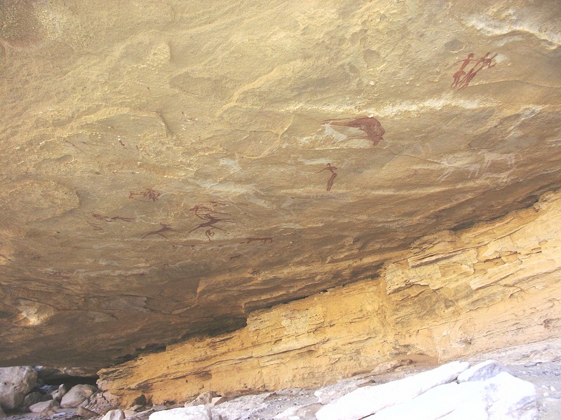
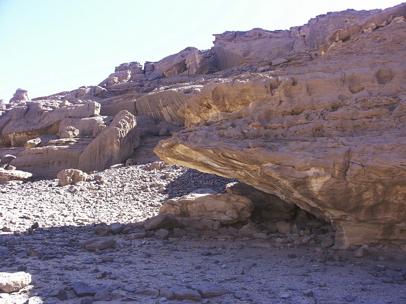
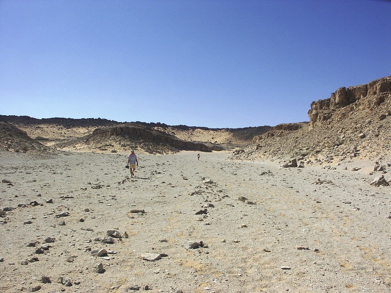
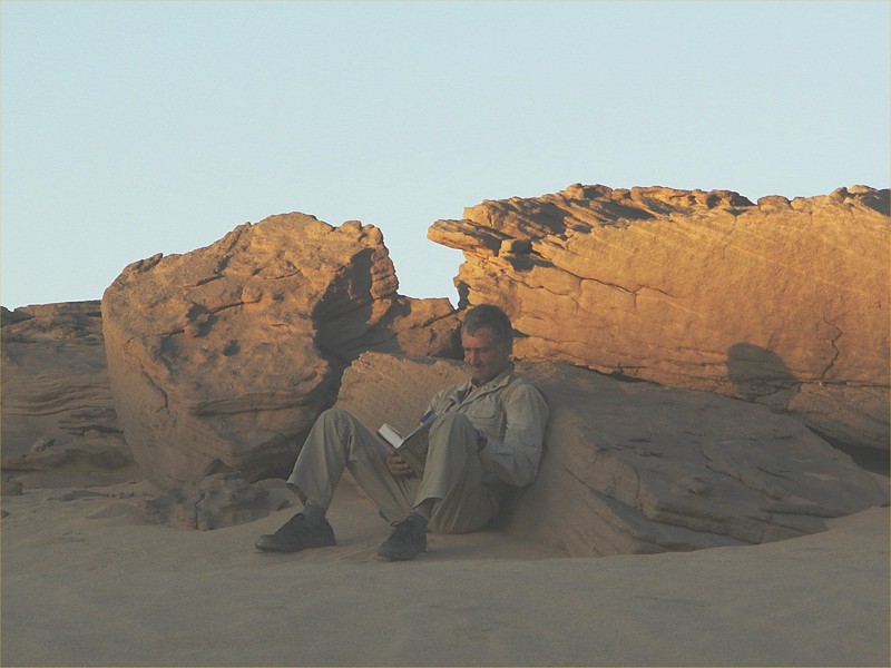
The Wadi Handal basin at the northern tip of Jebel Uweinat is the only valley system that lies almost entirely within the boundaries of Egypt. Little attention had been paid to it in the past, aside two brief visits by J. Léonard (Belgian expedition, 1968) and Vance Haynes (with el Baz, 1978) noone had done any serious surveying of the valley, which rises rapidly in a narrow gorge to a large flat basin, which is surrounded on all sides by broken rocky terrain that looks promising for rock art sites. In October 2006 and October 2007 we have spent a day each surveying some of the upper areas (with some nice finds in 2007), however a number of promising areas remained. We planned a two day trek to survey the likely rock outcrops in detail.
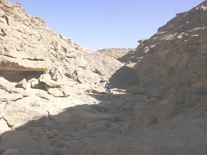
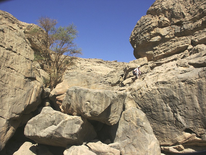
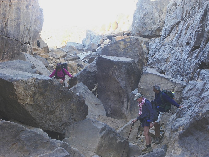
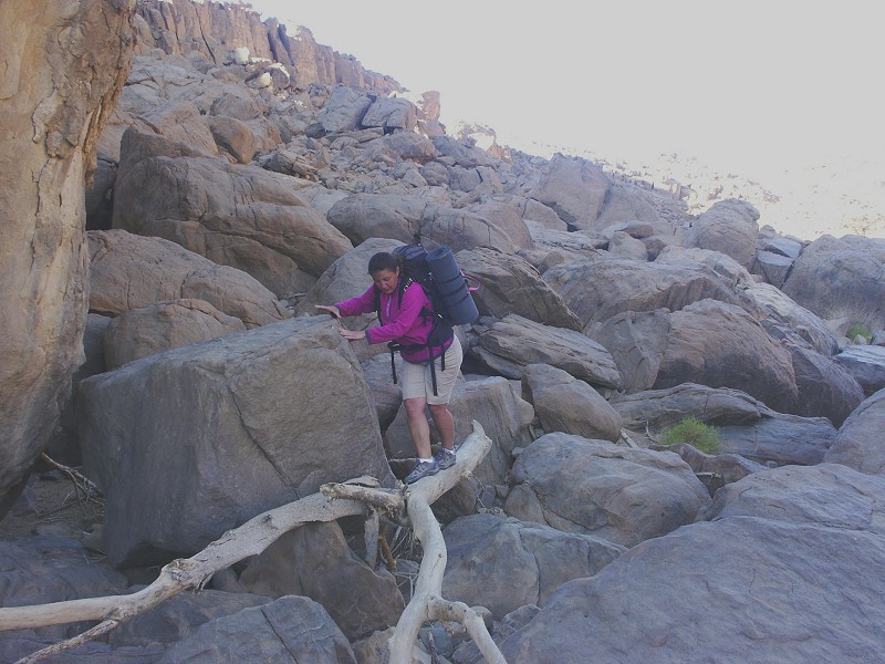
We started out at dawn to make most of the cool of the morning when we are climbing uphill. It was unseasonably warm, it did not drop below 20 degrees even in the night, and the day was rather unpleasantly hot. We made our way up the gorge then accross the flat basin, climbing the scree slope at the south western end of the basin.
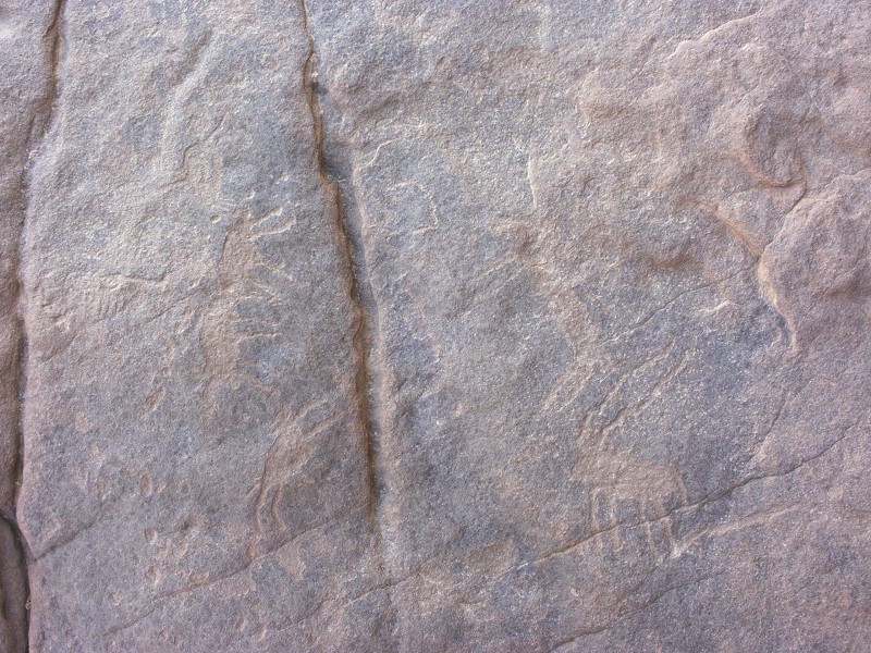
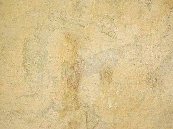
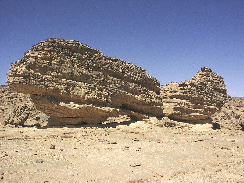
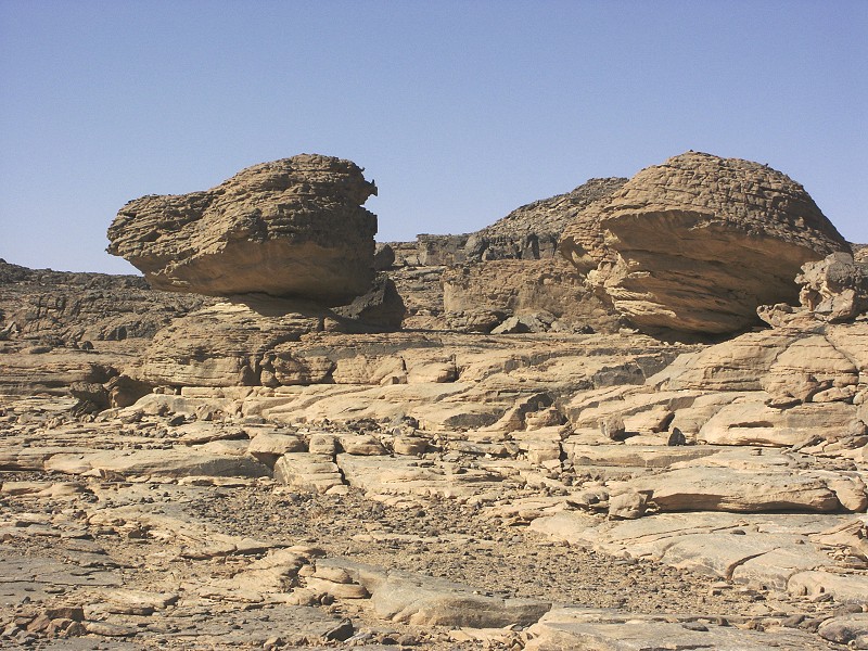
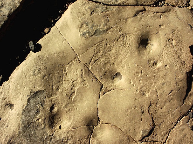
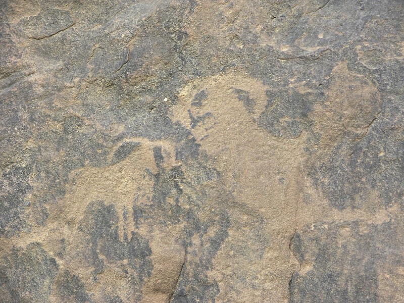
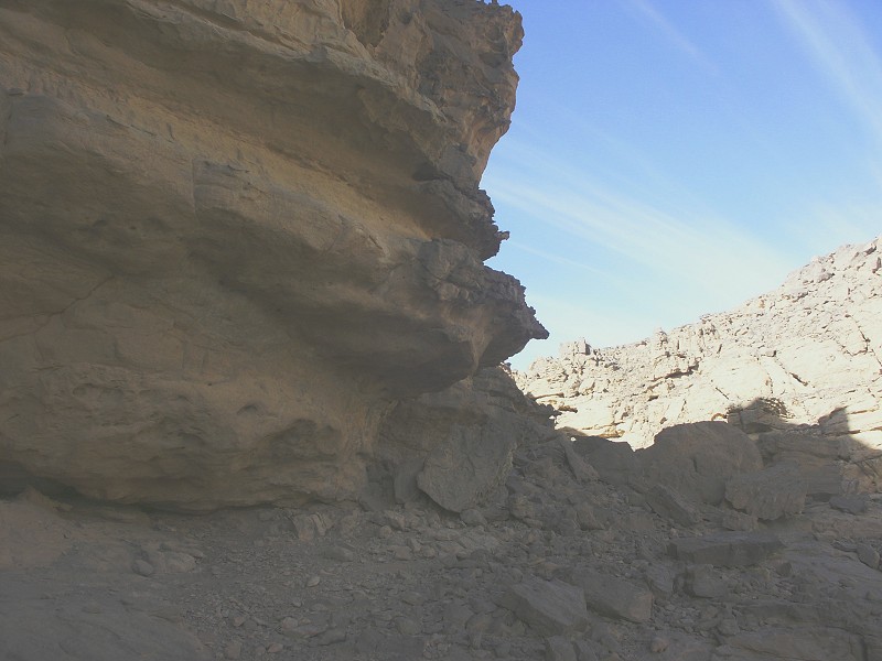
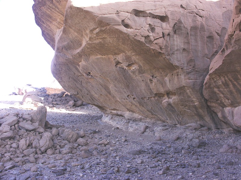
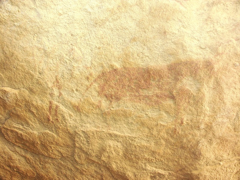
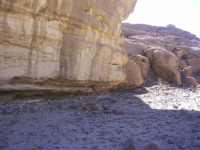
Some distance beyond the edge of the low cliffs, we spotted a promising large north facing shelter. On close look the suspicions were confirmed, it contained some unfortunately very weathered paintings, and the rock in front of it was full of engravings.
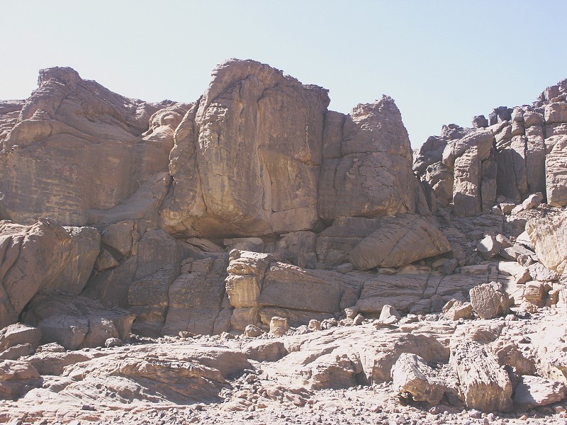
Encouraged by this find we thoroughly explored the edge of this terrace, however there were no further finds. Satisfied that the area had been fully surveyed, we continued among the broken and eroded rock spires to the next level, where we have found the large shelter in 2007. It was the full heat of midday, the wise elected to remain in the shade and work on the lingering jetlag, while the more insane scrambled to search the surrounding area for more sites.
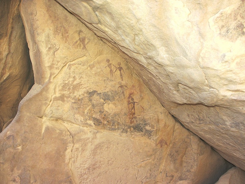
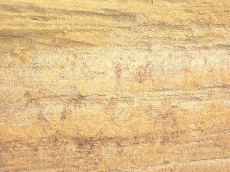
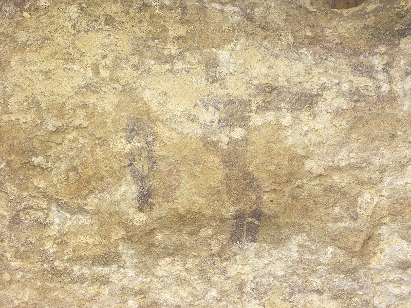
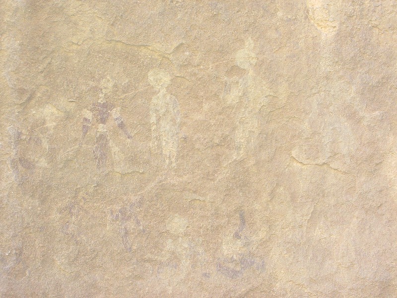
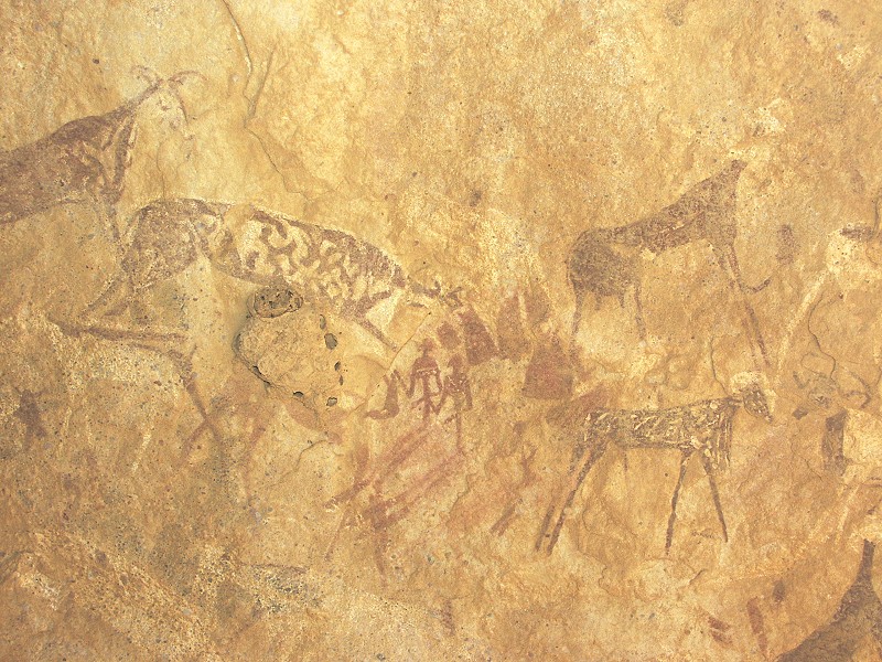
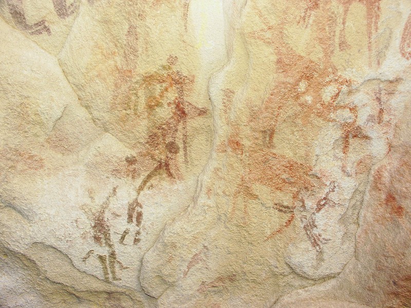
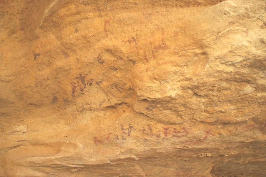
With Magdi we chose the northern direction, among the maze of broken rocks and narrow ravines. Working our way down to the level where we found the first site of the day, but further west, we have come accross a similar flat area where we found four shelters that contained paintings, mostly very faint and weathered. The last one turned out to be the most interesting, traces of dozens of human figures were still discernible.
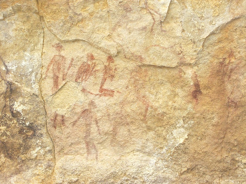
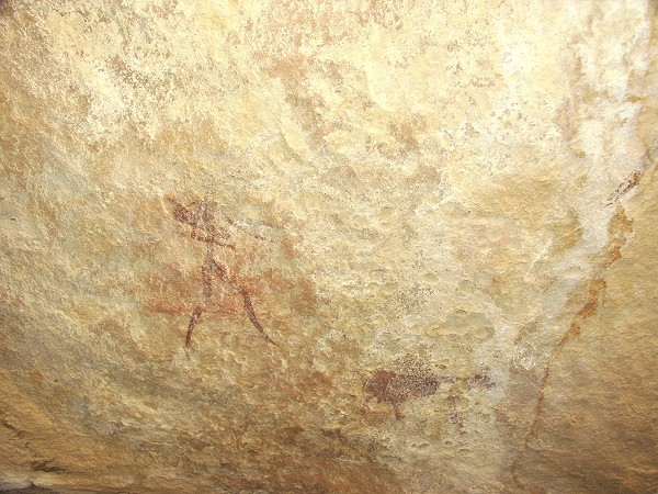
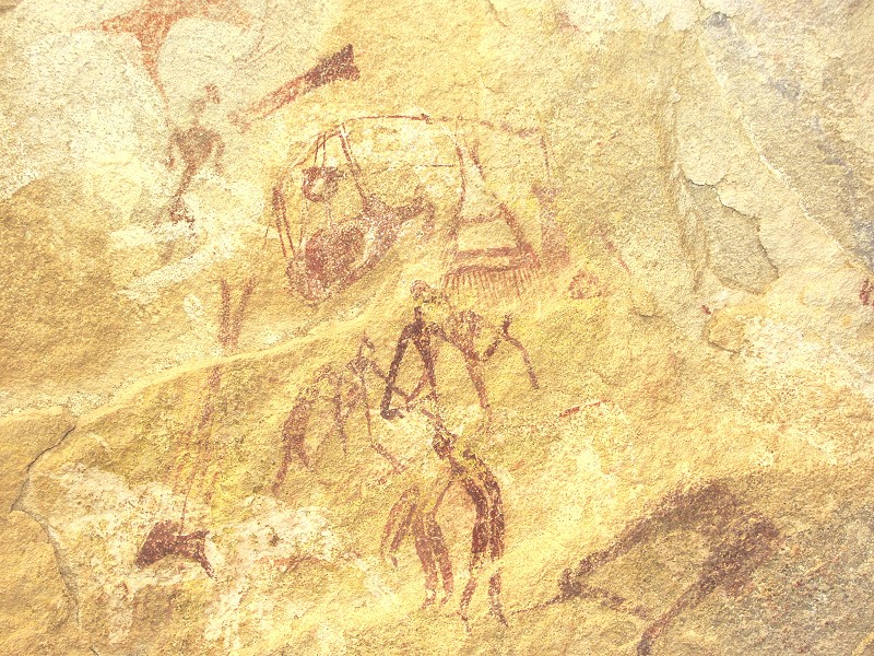
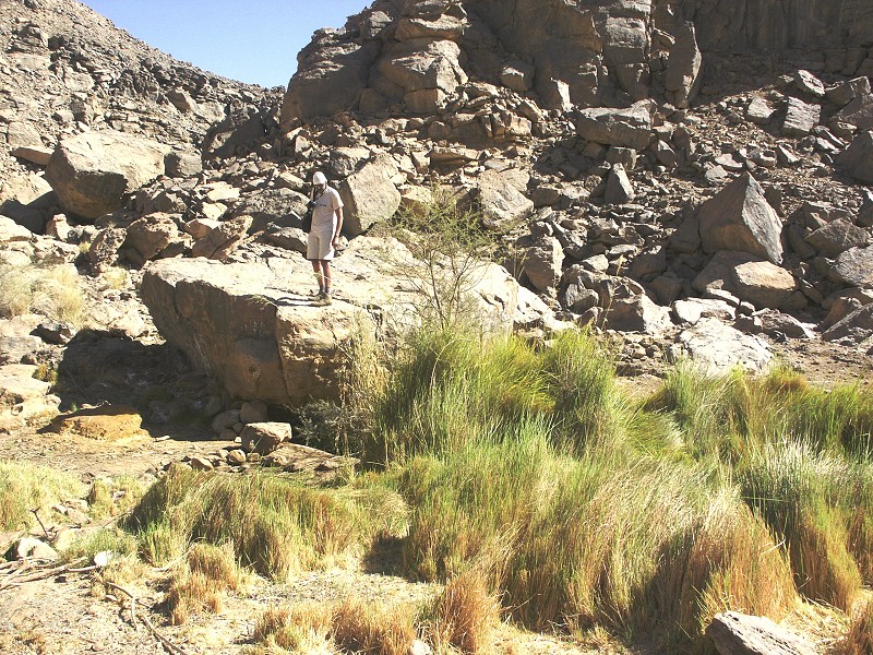
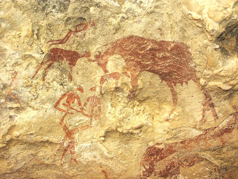
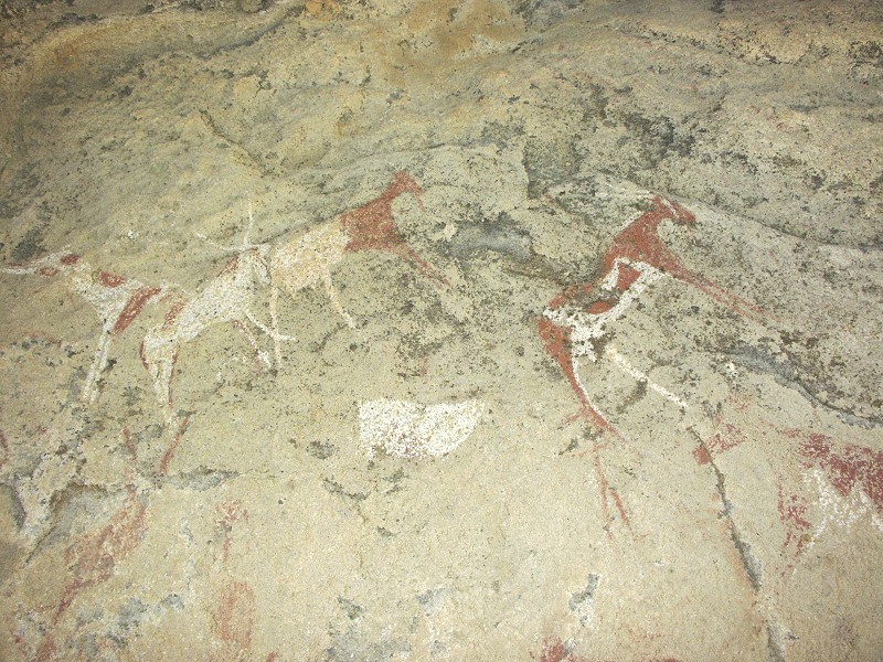
When we returned, it emerged that we were the only ones to find something. With the area exhausted and the heat dissipating a bit, we started out for a cluster of large rocks about two kilometres away, one of our primary objectives. We left our packs in a small flat basin surrounded by rocks that appeared the only suitable bivouac spot, and set out to explore the surrounding rock spires. On the northern side I came upon an isolated rock with a little sheltered overhang, that on close look was found to contain one of the best preserved panel of the very early "Uweinat roundhead" style paintings found to date. Returning to announce the find, it I was greeted with the news that Mark and Kent have both been lucky, finding sites on the far side of the rocks.
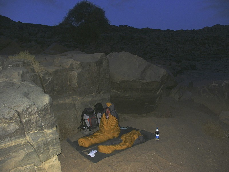
We spent a very warm night at our bivouac, it must have been around 25 degrees even at dawn, something very unusual (and not boding well for our planned attempt at the summit). The heat was showing on our water consumption too, many of us were already well into their third bottles. After dawn we set out together to visit the sites found the previous evening, then leaving our packs behind, we started out for another similar group of rocks about a kilometre away.
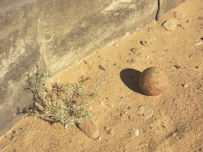
The second group of rocks, tough very similar in setting to the first, was found to be void of rock art, though there were numerous signs of prehistoric human presence. The most interesting was a perfectly round man-made quartzite ball. We have found similar artifacts in the Great Sand Sea, their purpose remains a mystery, but certainly a great deal of effort must have gone into their making.
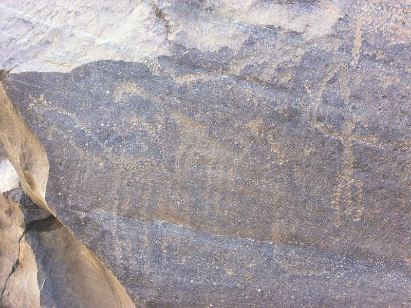
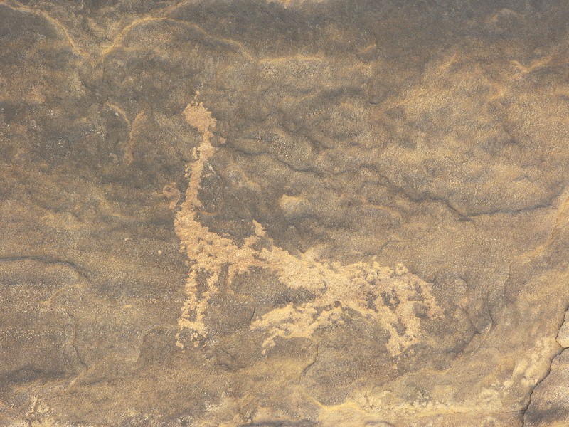
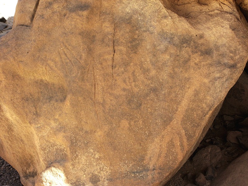
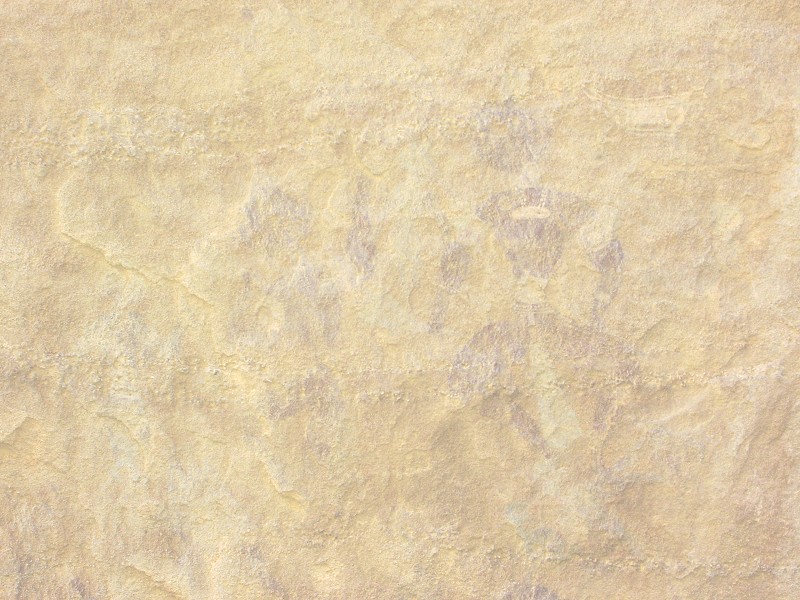
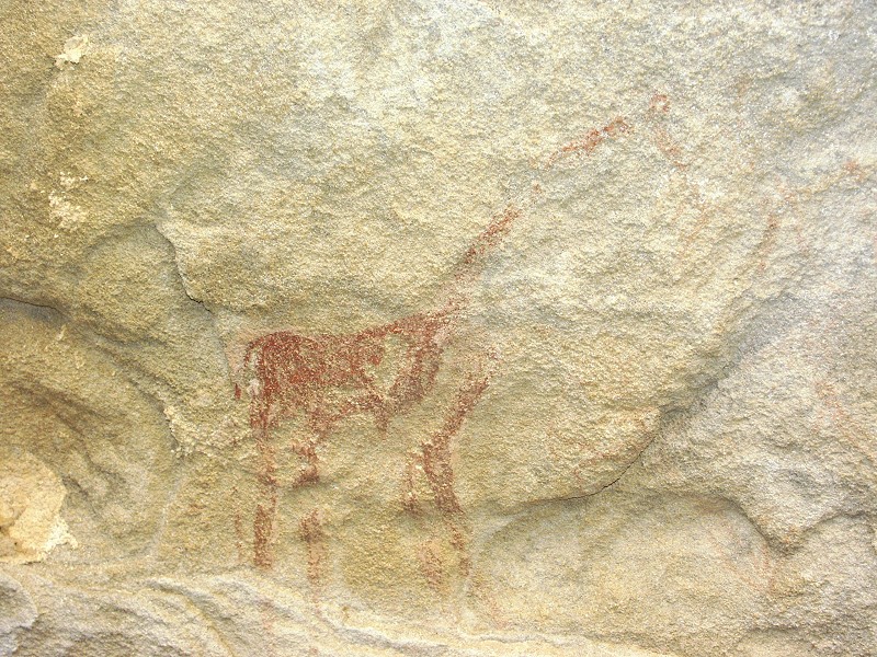
By the time we finished surveying the rocks it was midday, the weather was becoming very hot again. We returned to pick up our packs, and started moving downstream along the main watercourse, which was already surveyed in 2007. As we reached the basin which was filled with water when we first saw it in October 2005, I was startled to see a number of engraved giraffes and a conspicious human figure on a rock overlooking the basin, where we have passed numerous times in the past. It must have been the different light that played the trick, as I remember having had a good look at these rocks several times before.
It was a rather tired lot that stumbled down to the camp by the late afternoon, but we had nothing to complain about: we have found ten new rock art sites in the upper reaches of the valley during the two days, certainly a good start.
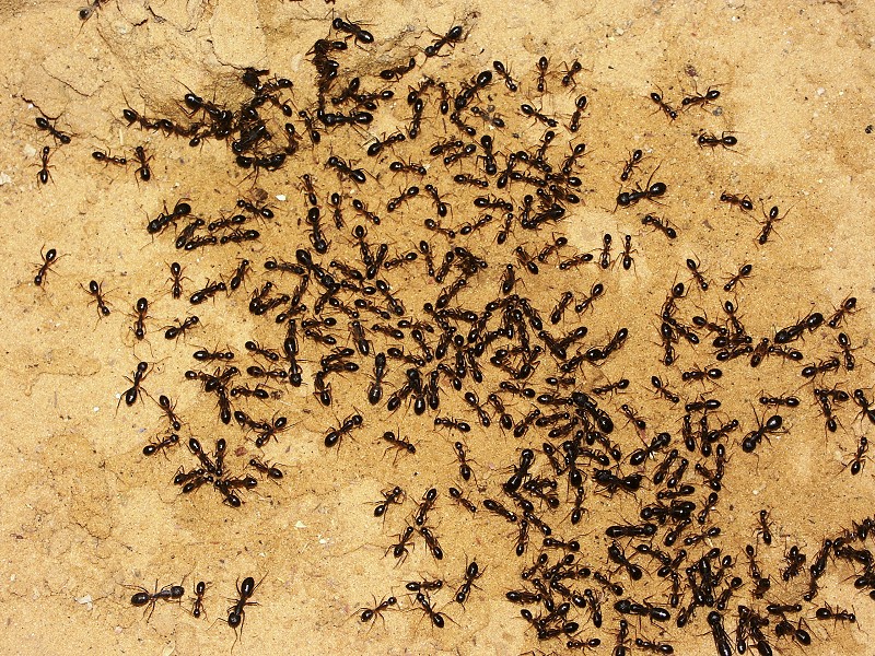
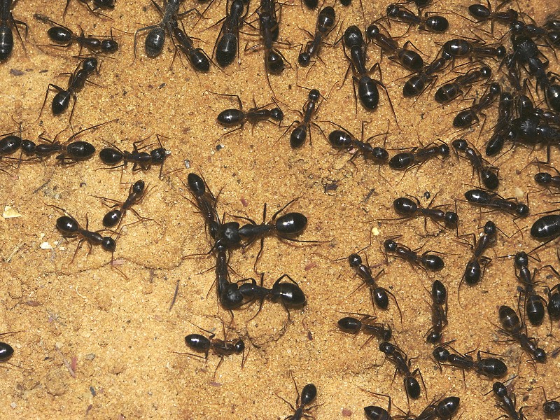
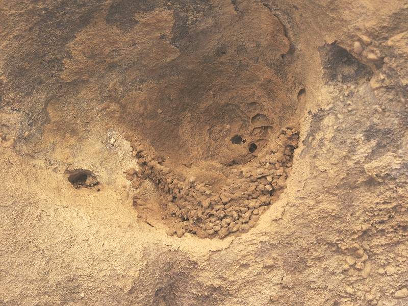
As we were cooking our evening meal, some water spilled from the jerrycan. After an hour or so I was astonished to see hundreds of the big black desert ants (Cataglyphis fortis) converging on the spot, sucking up whatever remained. I have never seen them before together in such numbers. Salama soon found the entrance to their nest, which turned out to be just behind our kitchen.
Day 6. - Karkur Talh
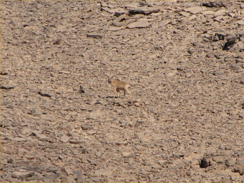
The next morning we broke camp and moved to Karkur Talh, our base for the next six days. As we entered the valley, about three kilometres from the mouth Salama spotted a pair of waddan (Barbary sheep, Ammotragus lervia) running away up the hillside. Racing to catch up at full throttle, I was just able to take two snapshots of what was clearly an ewe with a little lamb no older than a year or so.
We made our camp at the usual spot, with half of the group staying at camp and vicinity having a rest day, while Kent, Richard, Mark and myself went to explore parts of the country north of the main valley of Karkur Talh. While much of this area had already been surveyed, we have never been up to the area at the foot of the conspicious mesa dominating the area. A french group found a number of fine paintings and engravings in the area, our objective was primarily to find these, plus of course to see if anything else may be up there. On our way towards the flat topped hill we have come accross a couple of crude, previously unnoted engravings and some rather faint and weathered paintings, but nothing spectacular.
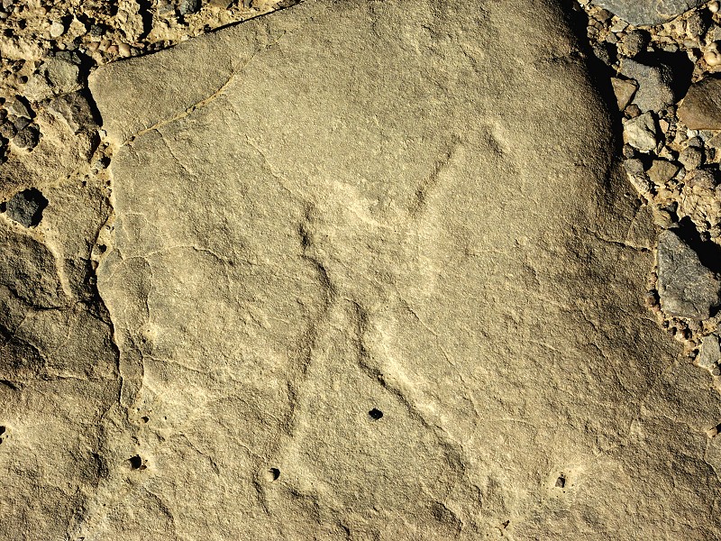
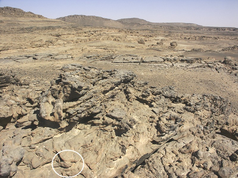
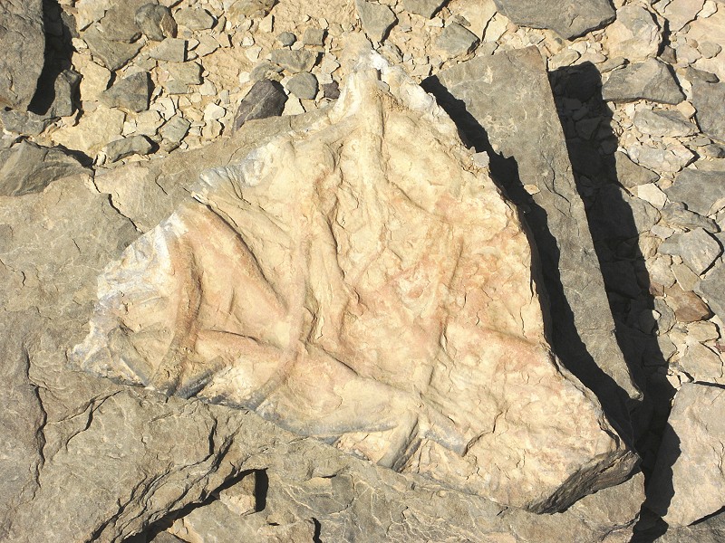
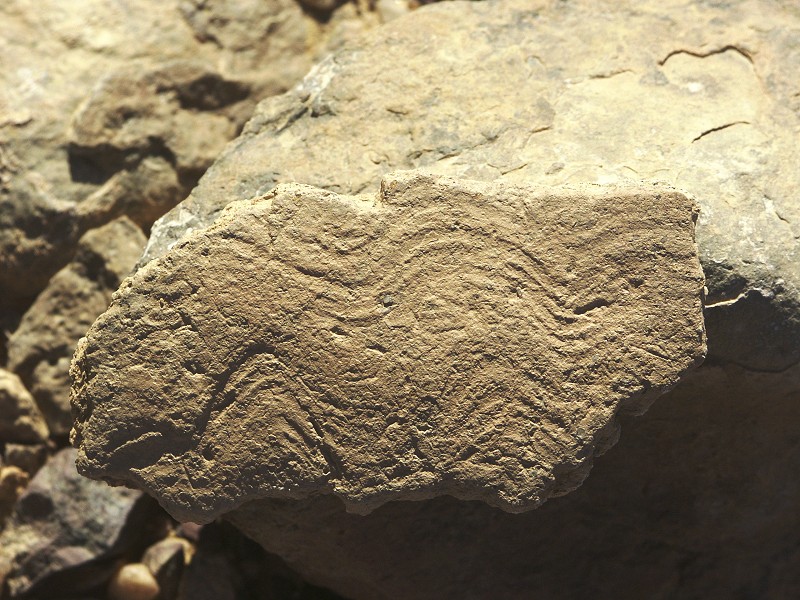
We were much more lucky with fossils. Just past the last set of engravings, Richard picked up a small stone that had a perfect imprint of a carboniferous Lycopsid (ancient family of plants containing Lepidodendron, Sigillaria, etc.). It is currently under identification, Norbert Brügge believes the find is Sigillaria.
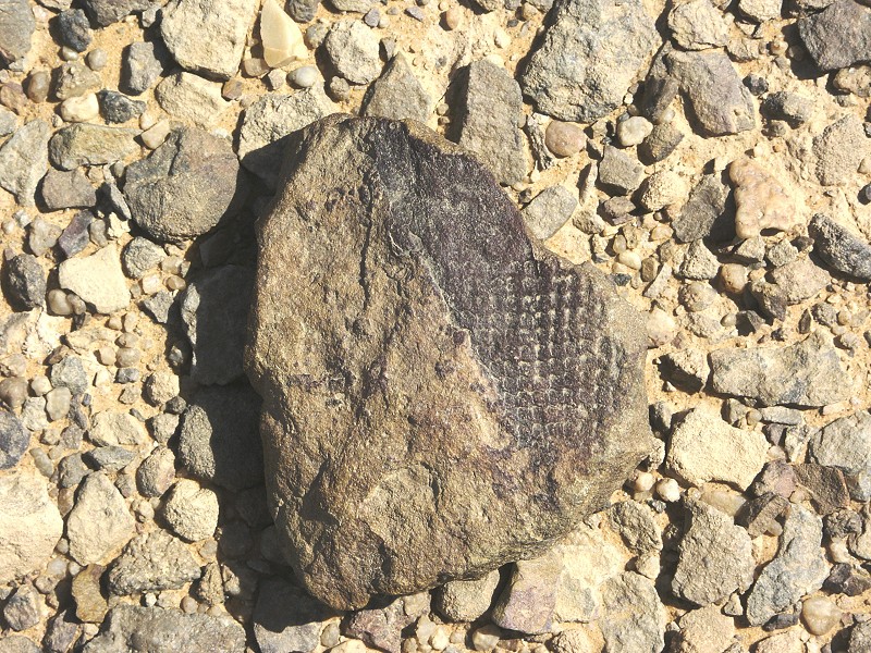
We searched the base of the hill in vain for the sites reported by the french group. However in the process we have made a very significant paleontological find. Again it was Richard who spotted them, a series of Lycopsid imprints in the rock, however this time in-situ in the bedrock, not on a loose pebble like all previously found plant remains in the Karkur Talh basin.
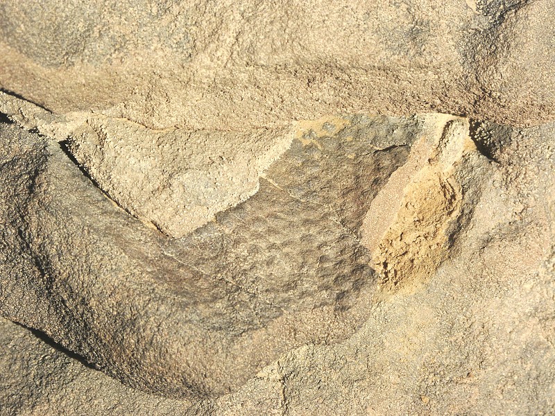
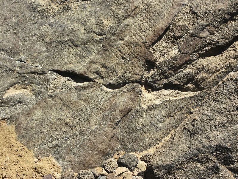
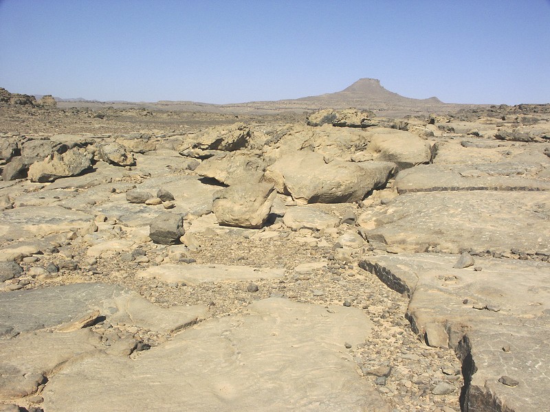
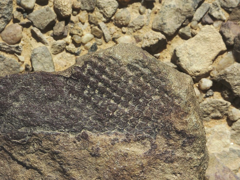
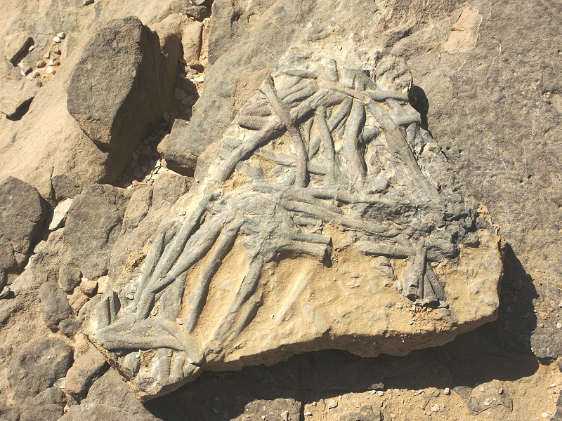
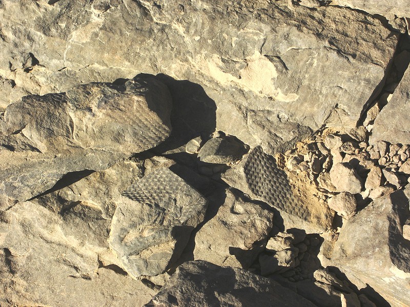
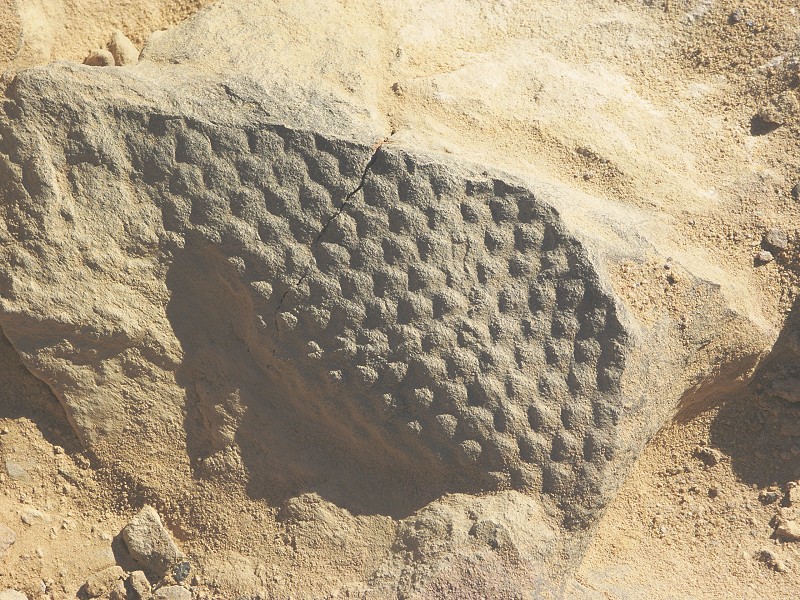
On a slightly lower (about 30-40 metres) level, we have found the hard sandstone layer with Arthropycus harlani ichnofossils on the underside capping a thin layer of softer laminate shales. We have observed this same horizon in the southern branch of Karkur Talh near our base camp in March 2008, and the same layer with the characteristic burrows forms a part of the ceiling in the large shelter discovered by the Belgian expedition in western Karkur Talh in 1968 (site KT 83). This find confirms that at least the area within the triangle formed by these three points (essentially all of the lower Karkur Talh area) are a single sedimentary sequence.
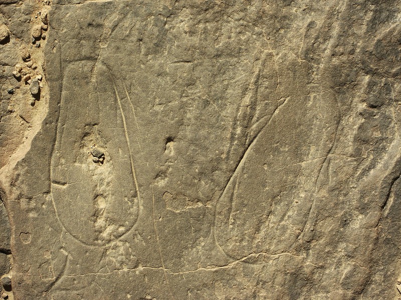
Near the Arthropycus fossils we found a big rock with an open archway in the middle, containing some very weathered paintings on the arch ceiling, and a couple of better preserved but crude engravings nearby.
We started following the layer weathering into the big isolated rocks and boulders towards the known areas. In one spot we have found a couple of engravings, however none of our finds matched those of the french group, which must still be out there somewhere (I was only given a general description, no exact location info).
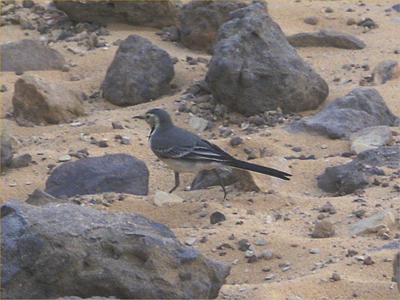
We walked back to the main valley to our agreed rendez-vous point with Salama along the ancient trail leading up to the guelta and the rock art sites we found in October 2002. The path was in perfect light, the smoothed rocks where thousands of cattle (and probably also camels in Tibou times) passed rocky outcrops showed clearly, as well as the numerous engravings on the rocks either side along the path. Where the path descends into Karkur Talh, a part of the side is built up with rock rubble, probably dating from prehistoric times. As we sat in the shade at the bottom waiting for Salama to arrive, a very friendly wagtail (Motacilla alba) approached us, sometimes hopping right up to our shoes.
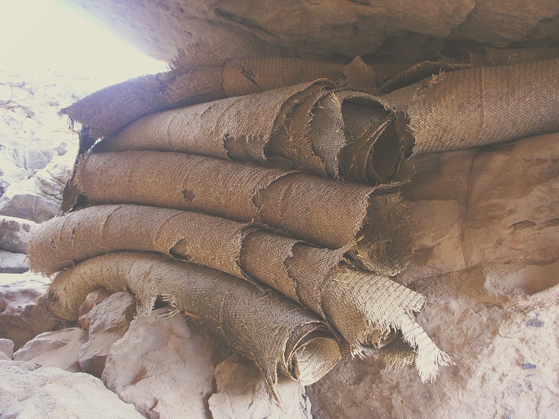
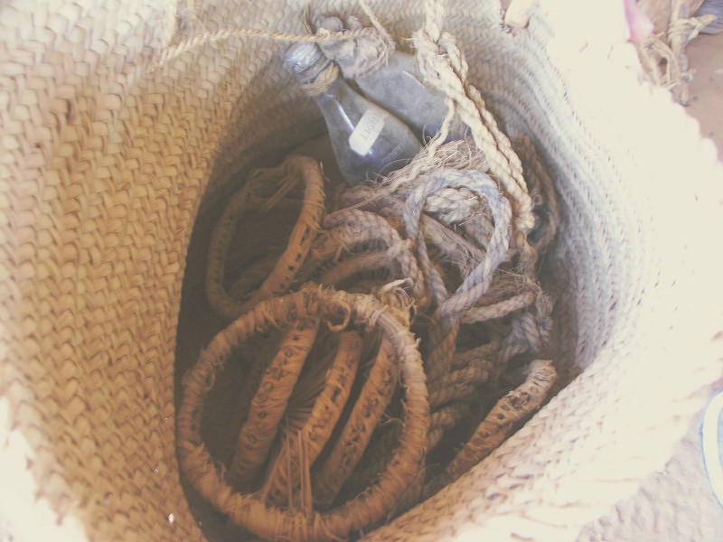
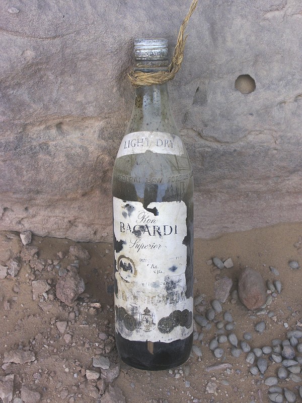
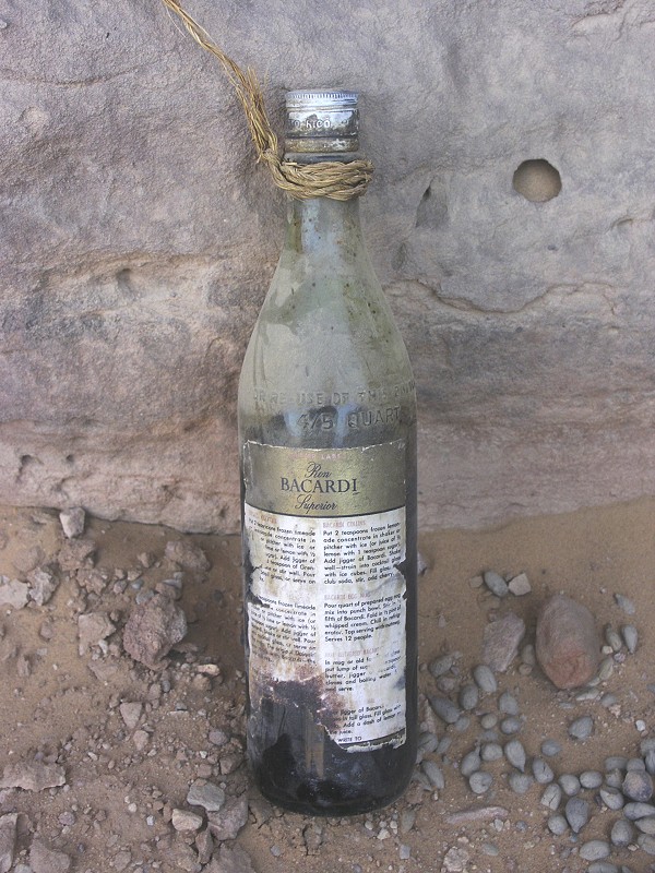
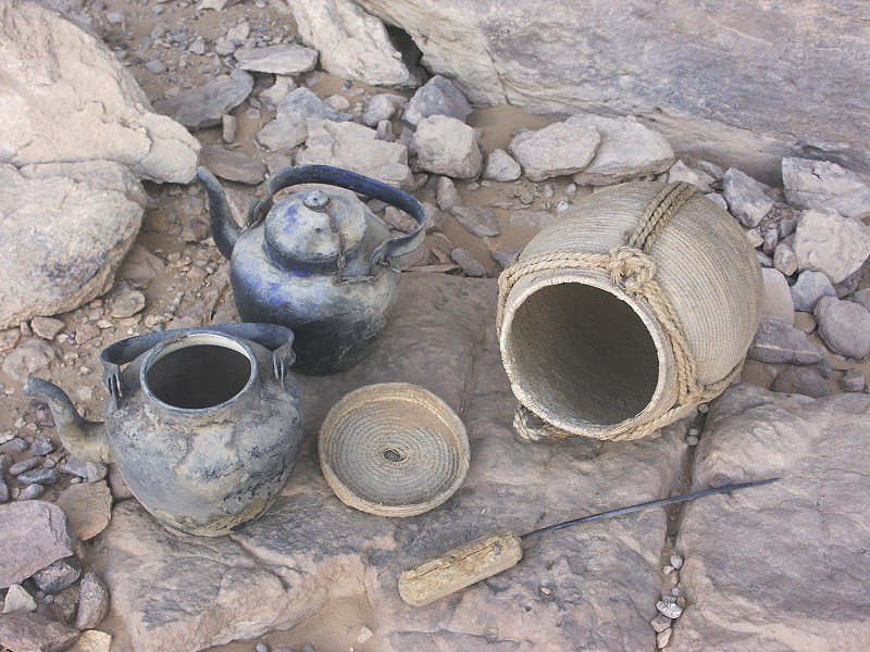
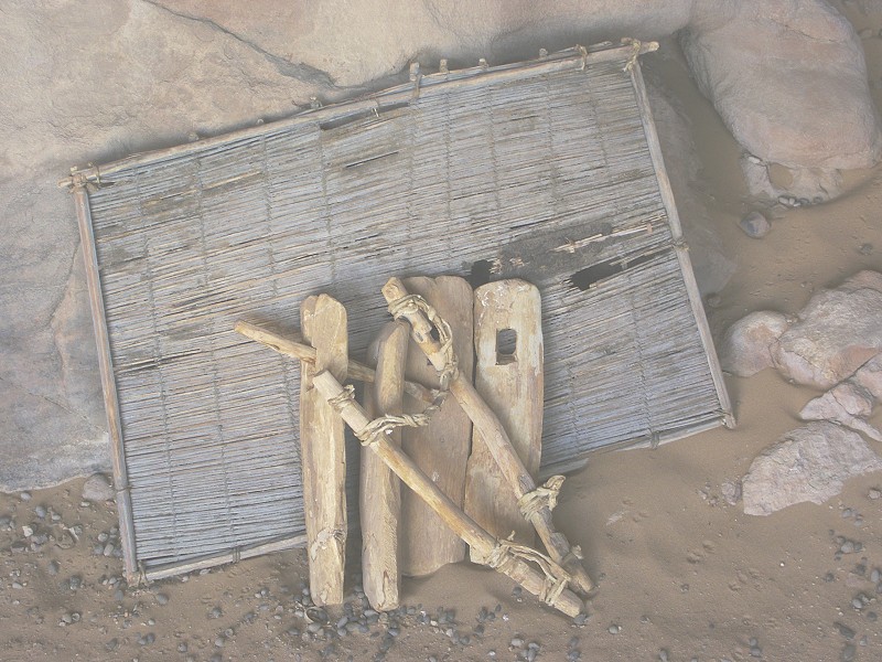
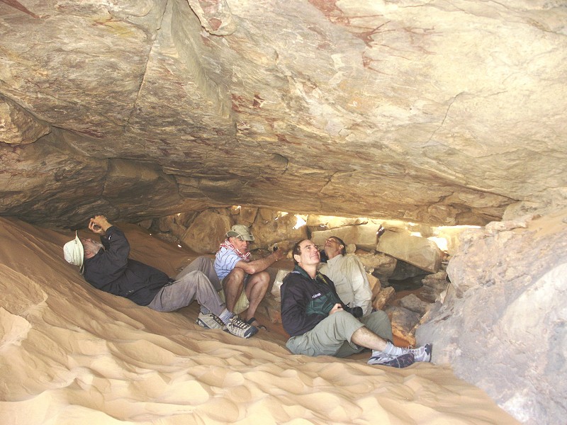
Since we still had some time before sunset, we re-visited a shelter I have discovered by chance on the plateau some distance above the main valley in March 2008 (the photos were on the lost memory card). The shelter is only visible from above, is hidden from view on approach, one walks right past it - hence it lay undisturbed for so long. There are a few prehistoric engravings at the entrance, but the true wonder lies inside: the prized posessions of a band of Tibou nomads, carefully stashed away awaiting their return, which never happened. The view of baskets and water skins hanging from pegs driven into crevices in the ceiling or carved from the rock are virtually the same as the shelter scenes in prehistoric paintings.
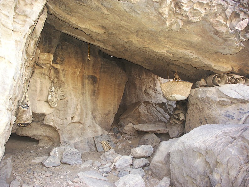
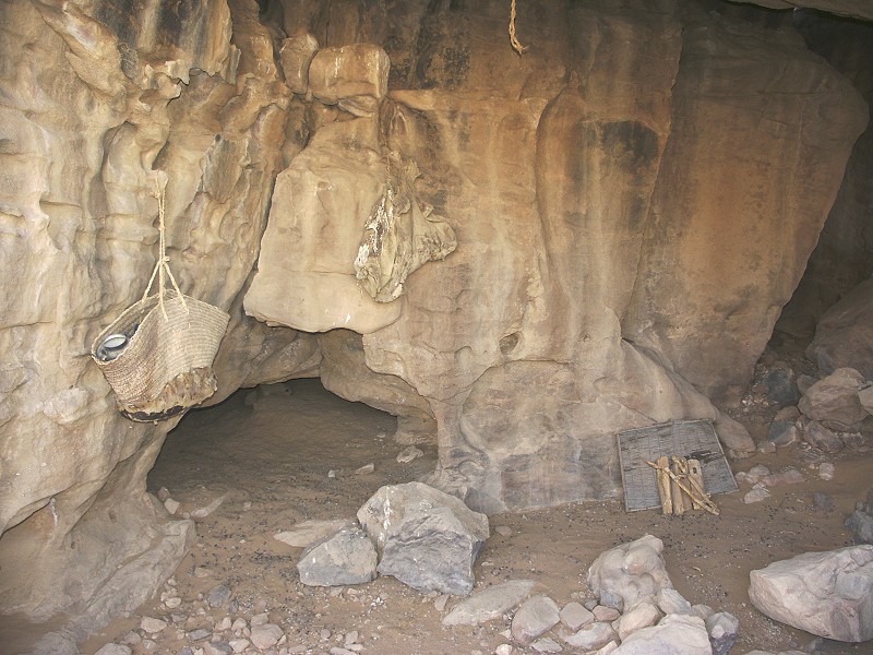
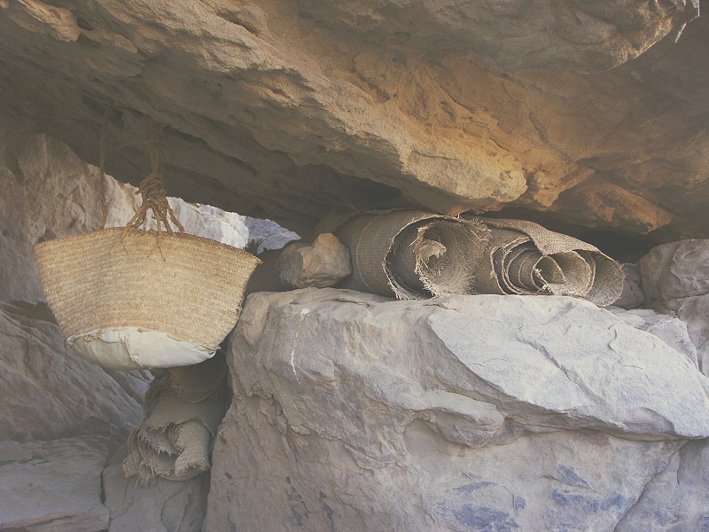
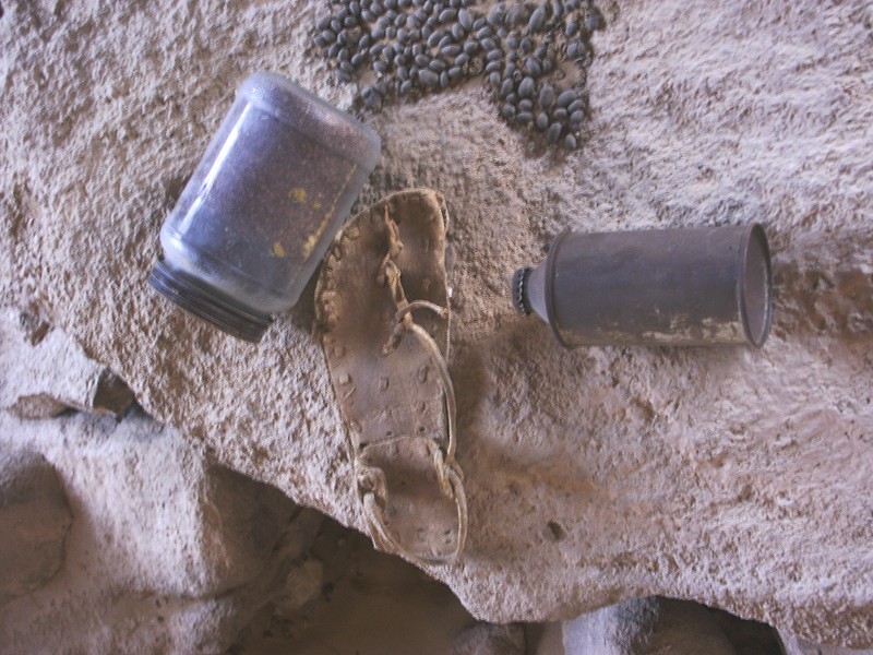
The basket next to the rolled woven palm leaf mats (which were used primarily to make walls of huts, not for covering the ground) contained numerous animal traps, ropes and two bottles containing petroleum. One bottle still had its label, it was Bacardi Rum made in Puerto Rico. Based on this bottle and label, the finds are from the late nineteen fifties or early sixties. The Bacardi bottle probably originates from oil exploration in Libya during that period, and cannot be younger than 1964 (that is when the mandatory post prohibition bottle labeling prohibiting re-use was discontinued). The other basket contained two tea pots, a small woven utensil with lid, an awl and sevelar sticks (not shown). Aside the two baskets there was a goatskin water carrier (guerba) hanging from the wall, and a donkey saddle next to a framed mesh of unknown purpose leaning against the shelter wall. Stashed away in a crevice Salama found a jar with cooking spices, an empty beer can and a single sandal.
We have replaced everything as found, the location is deliberately kept vague in hope of keeping the place undisturbed.
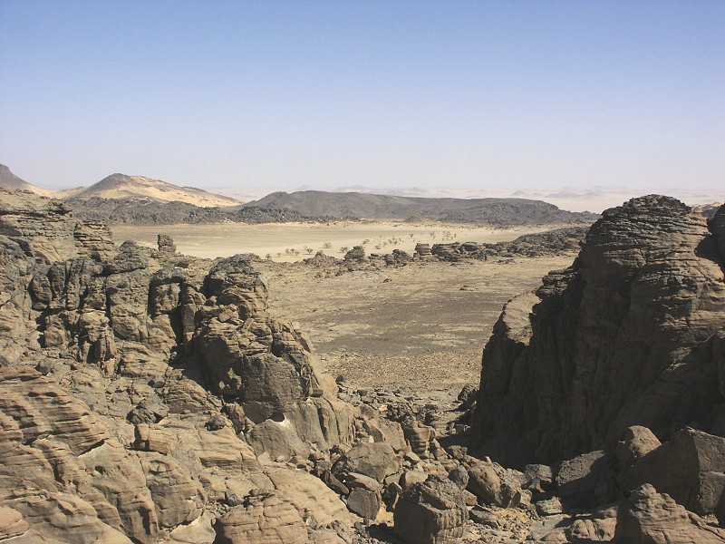
Days 7-8. - Southern Uweinat
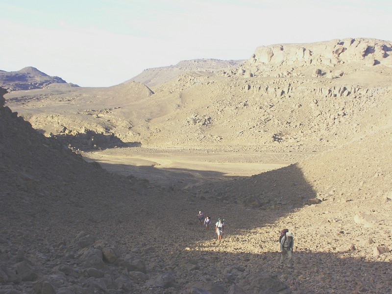
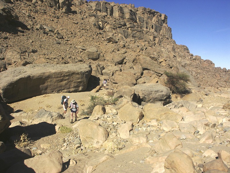
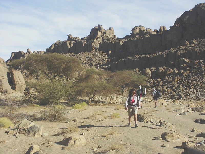
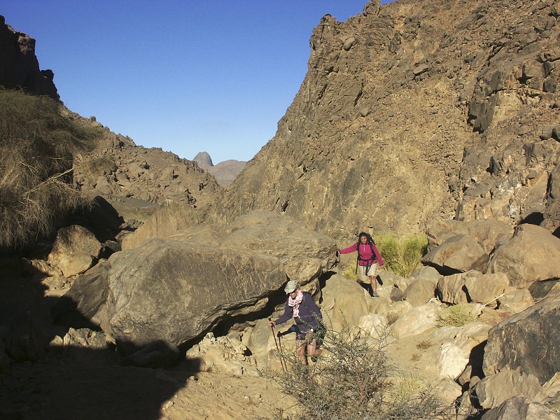
After the rest day we were planning to make our three-day trek to the summit, but the weather remained very hot, with our water consumption still not quite down to two bottles. In such weather attempting the summit with the maximum seven bottles we could carry would have been quite risky, we postponed it two days in hope of the weather cooling off somewhat. Instead, we set out for a two day trek to the area west of Karkur Murr, where we have done some exploration in October 2006, but many blank spots remained. We started out via Winkler's site 75 (also re-discovered in 2006), from where Ralph & Bill returned to spend two days visiting the sites in the main valley, while the rest of us continued towards the unknown.
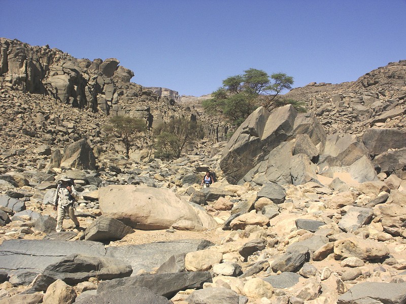
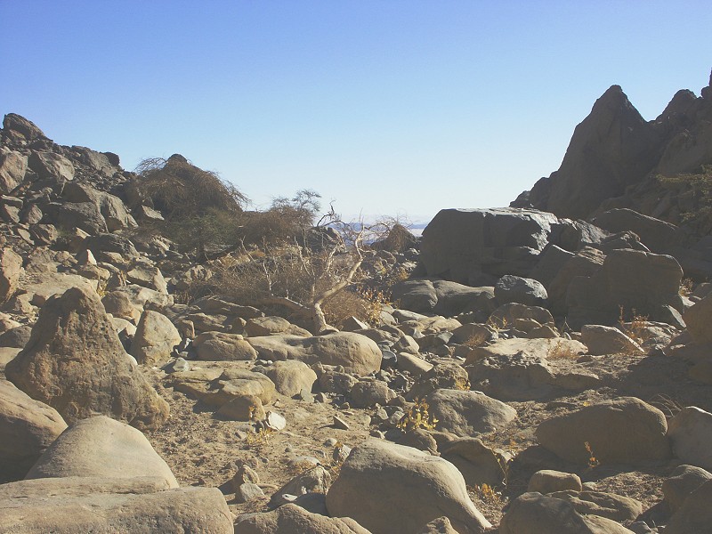
We have extensively explored the ravines leading down from the Hassanein plateau towards the south, however aside the already known paintings and engravings we have found nothing new. Much of the country was very difficult going, the valleys descending steeply like Wadi Wahesh does, with huge fallen boulders choking the wadi floor, often blocking the way and requiring straineous detours.
The weather was again excruciatingly hot, between midday and 3pm we probably spent more time sitting in the shade than walking, and our enthusiasm for climbing up to yet another rock or shelter that was bound to be empty was rapidly waning. We made our way down to the level of the plain in a side wadi of Karkur Murr, and after establishing that the place was totally deserted and empty, bivouaced in a shallow sand filled wadi.
In the middle of the night the long-awaited weather change came. The light breeze of the evening strengthened to a strong northern wind, with a temperature drop of at least ten degrees. In the morning the sky was covered with clouds, and we finally needed the warm jumpers that up till now were just an added weight on our shoulders.
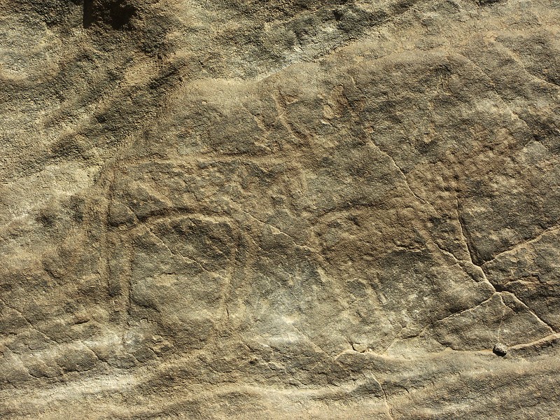
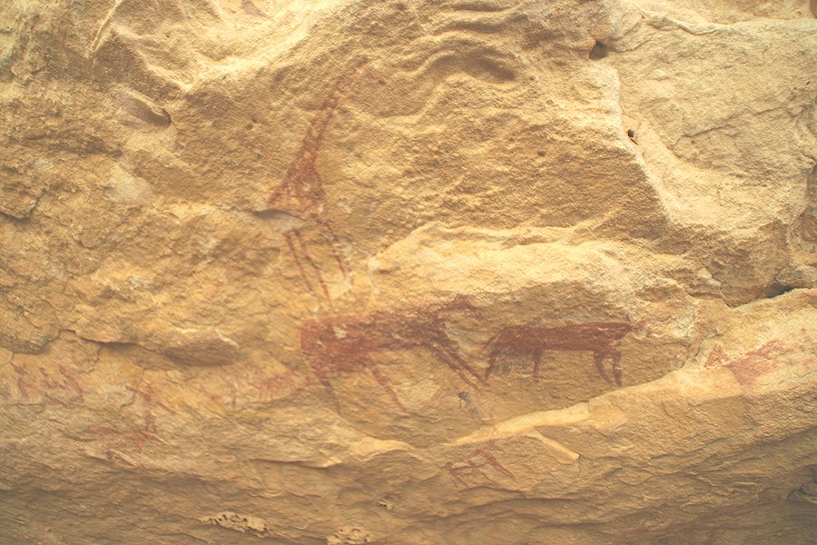
With the weather our enthusiasm and luck improved as well, as we made our way upstream in another wadi we soon found a big block with a couple of engraved barbary sheep on it.
The cooler weather and the clouds allowed for a much quicker going. We ascended a pass to enter the basin in the upper end of a western tributary of Karkur Murr, which we have explored briefly with Mark in October 2005 looking for Winkler's site 75, but only in a very superficial manner. At that time we have found two shelters with faint paintings, however the surrounding area suggested there might be plenty more.
Immediately on entering the basin we encountered a shelter that we saw from a distance the last time, but had no time left to check it out. On first look it appeared empty, but Richard's sharp eye spotted a faint but fine human figure. In a small rock hollow, we also found a swallow's nest, the first indicaton that this species at some time may have been a permanent inhabitant of Uweinat.
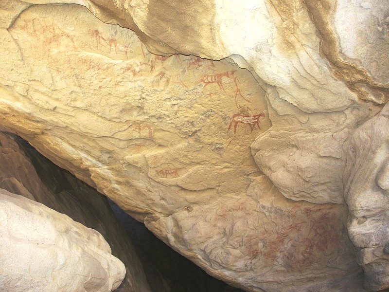
The biggest find of the day was made again by Richard, who climbed to the ridge above the basin while we photographed the 2005 sites. He found a large south facing shelter with a commanding view of the southern plains towards Jebel Kissu, with numerous paintings including several of the early pre-cattle periods.
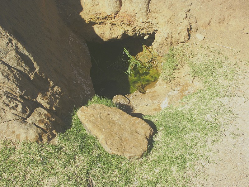
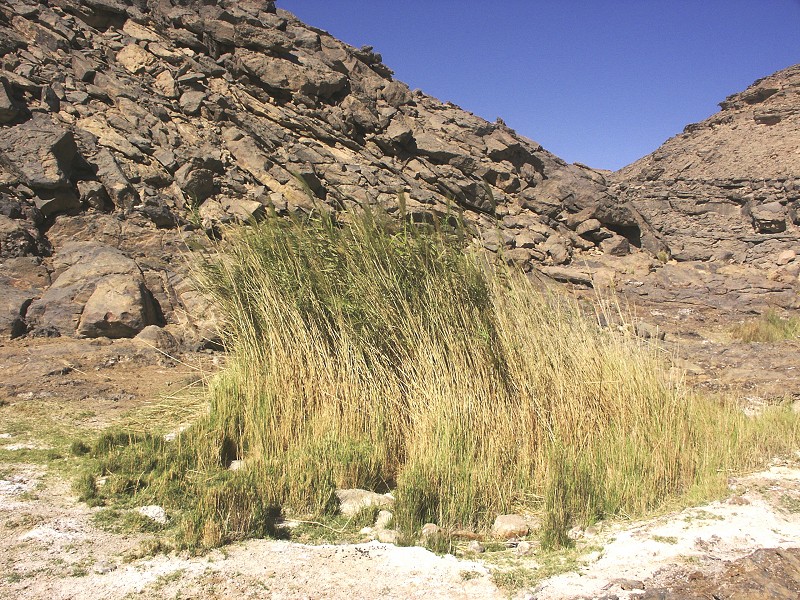
From the basin we made our way along the plateau top to the upper spring, Ain Murr. We have found the place deserted, there was no sign of any recent human activity. The main spring was overgrown with reeds, unlike on our last visit in 2006 when it appeared to have been freshly cleared.
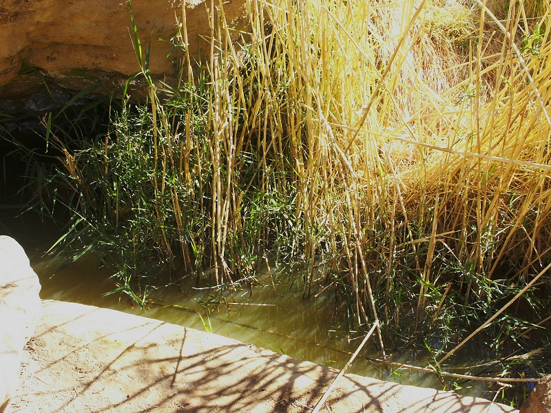
A welcome change was the smaller spring under a rock a hundred metres or so below the larger one. While the water of the latter was murky and tasted the usual bitterish, the small spring had crystal clear and almost tasteless water if taken from under the rock (the sun-lit part was thick with green moss and algae). Aside the two springs, there was no trace of any water seepage elsewhere (observed on some earlier trips), only the thick white dry salt crust.
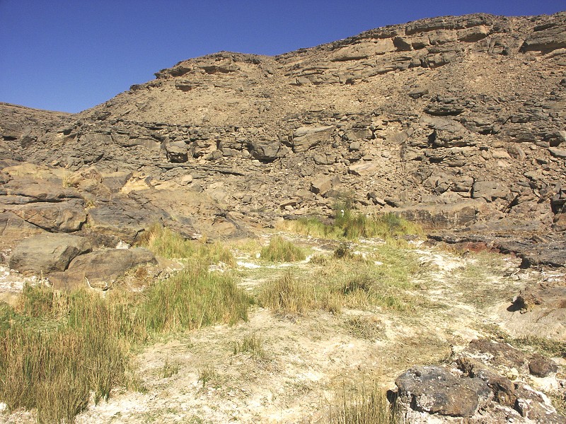
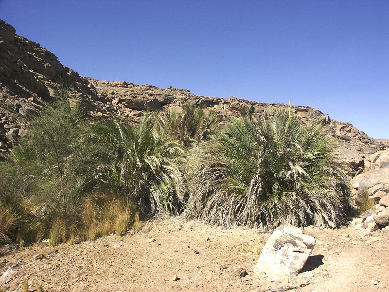
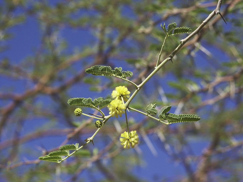
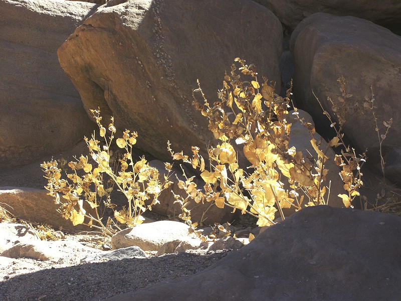
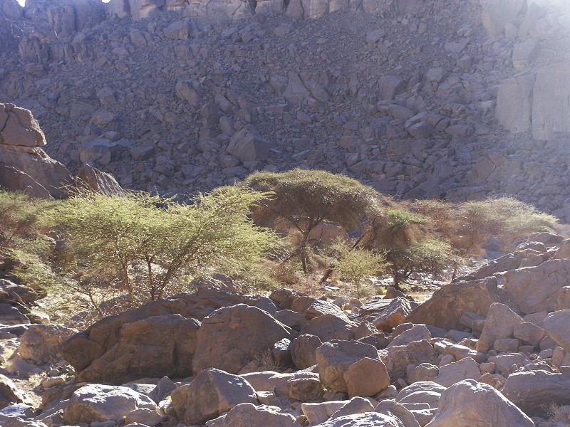
The cluster of date palms a few hundred metres below the springs showed litle change. They still bore no fruit, and I have not seen any significant fresh growth. However a little acacia among the palms was in full bloom, with pretty tufts of yellow flowers.
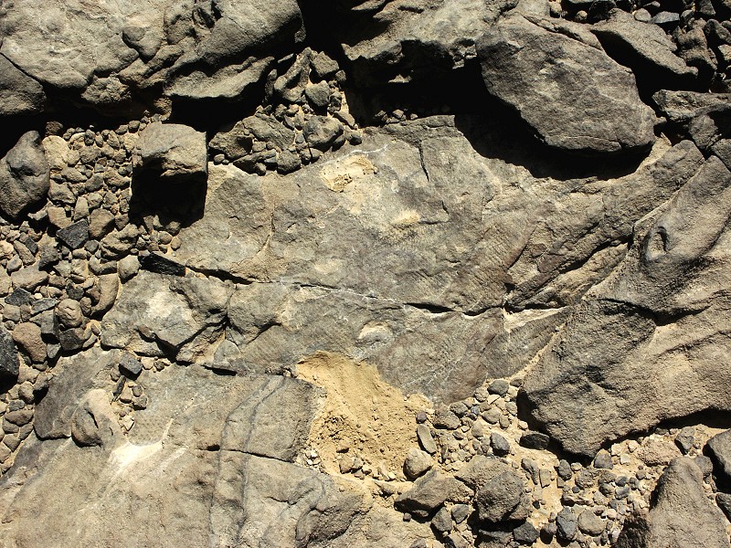
We have taken the usual path back towards our camp in Karkur Talh, accross the rather featureless plateau. At one rock outcrop however we made a surprising find - a section of a Lycopsid stem (possibly Lepidodendron) still embedded in the rock, together with a part of the negative that has fallen away. This find confirmed that the carboniferous strata are continuous from the northern part of the mountain till the low plateaus near Karkur Murr.
As we approached the southern branch of Karkur Talh, we have come accross a well-worn path that descended into the valley along the easiest possible route. At first we assumed it must be a camel path to Karkur Murr, however there was a panel of engraved cattle where the path began its descent into the valley, so it may have been a prehistoric trail. Certainly something to investigate further on a future trip.
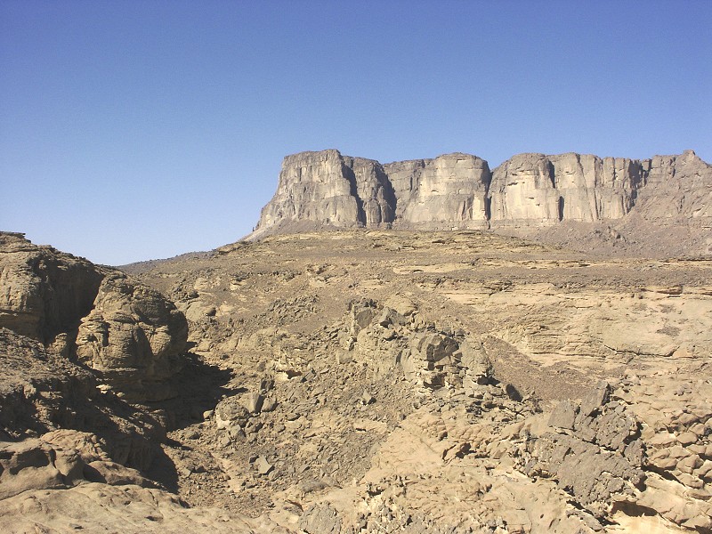
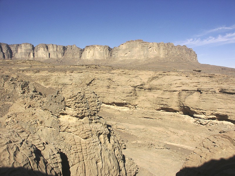
Days 9-11. - Upper Karkur Talh & the summit of Jebel Uweinat
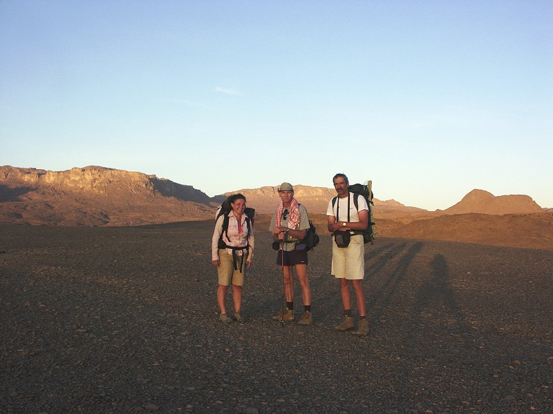
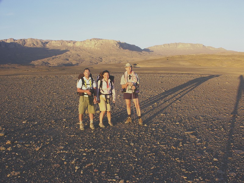
It proved to be a wise decision to swap the itineraries, as it was a distinctly cold dawn when Salama dropped us off at the end of the drivable section of the South-western branch of Karkur Talh. The summit party consisted of Magdi, Gábor, Richard and myself, the rest of the group electing to spend the three days visiting the main sites in the lower Karkur Talh basin with Salama's guidance. For the first day our objective was to make it up to the col where the Southern branch of the main North-western branch of Karkur Talh descends between the North-western and Northern sandstone plateaus (both unnamed), and make a base camp on the high plateau beyond from where we can scale the summit without unnecessary gear and water on the following day. At start our packs were weighted with seven bottles of water, two per planned day plus one in reserve.
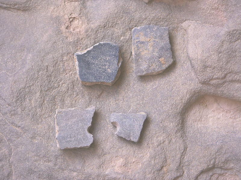
Our first target was the conspicious group of rounded rocks on the ridge between the South-western and North-western branches of Karkur Talh, the site of a spectacular find by Hardy Böckli and Mahmoud Marei back in 2007. We have camped at this spot prior to the ascent of the North-western plateau in October 2007, this time I managed to get better shots of the important "Uweinat roundhead" site with daylight rather than pitch darkness and a torch to focus the camera with. At the foot of the rock wall that barely qualifies as a shelter, we found a thick potsherd with wavy line decoration. As there were no other paintings at this shelter other than the early "Uweinat roundhead" ones, it may be possible to tentatively associate this distinct ceramic style with the early paintings.
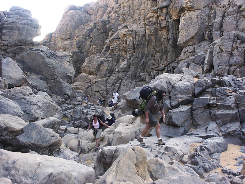
We continued past the shelter along the side of the scree slope bordering the North-western plateau. Initially the going was easy following narrow terraces, however soon one needs to start climbing the rough bouldery slopes, making slow progress among car sized boulders.
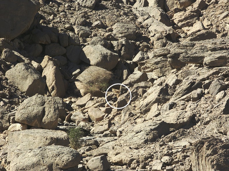
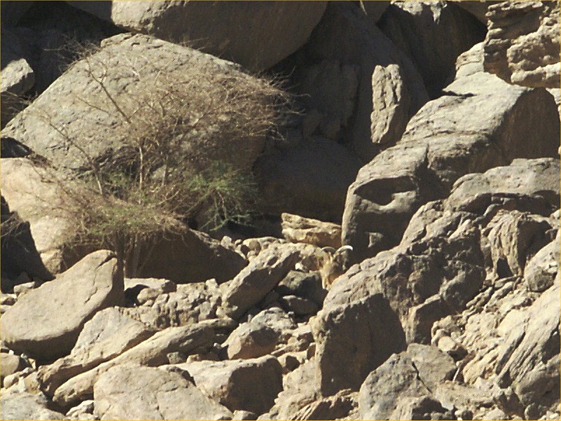
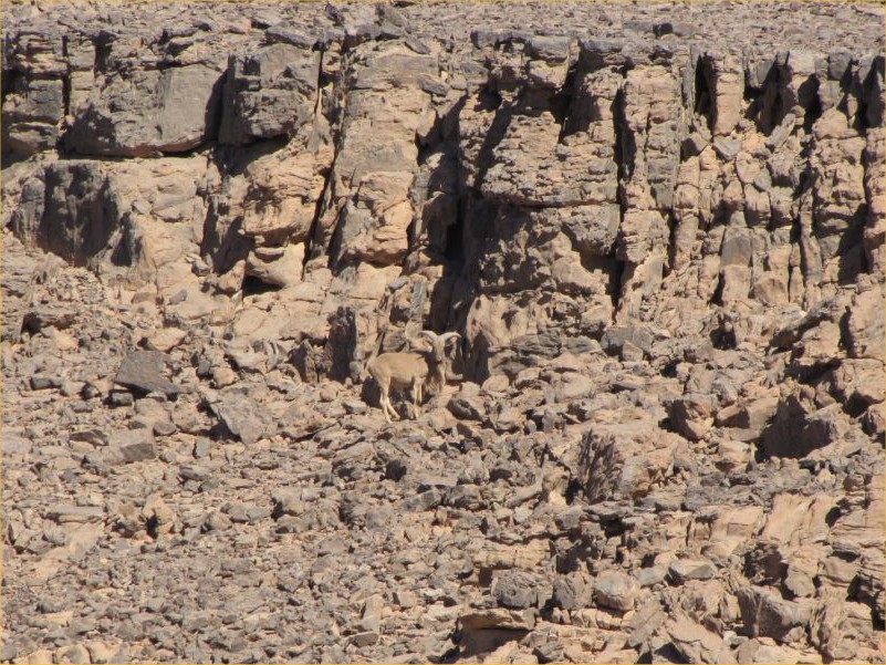
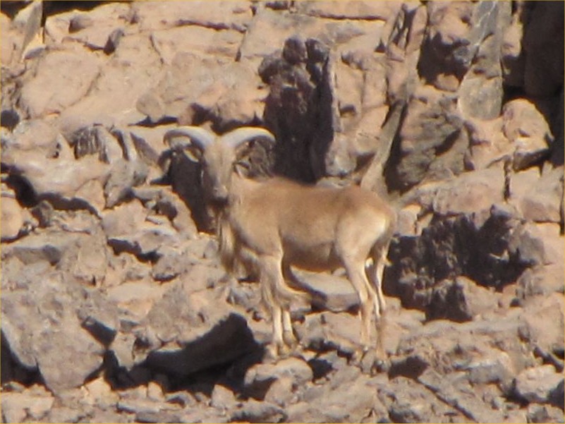
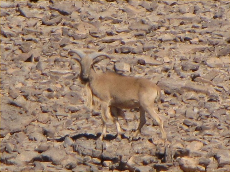
As we were making our way uphill among the rocks, one usually walks looking down at each footstep, only raising the head every now-and-then to look ahead to scout the path, then it is nose to the ground again. As I looked up after a longer flat stretch, I sensed but have not quite registered that there is something ahead not quite fitting in with the pattern of the mountain and the rocks beyond. After focusing both my sight and mind, the realisation suddenly struck - there was a huge male waddan (Barbary sheep, Ammotragus lervia) raising its head from behind a rock no more than twenty metres away, looking straight into my eyes with a curious rather than frightened look. I froze, and we stared at each other for several long seconds. However as soon as I moved my hand for the camera, it jumped away and ran up a small wadi with a loud rattle. I just managed to snap a photo of its behind when it was already a good hundred metres away, however the moment will remain one of my most cherished memories.
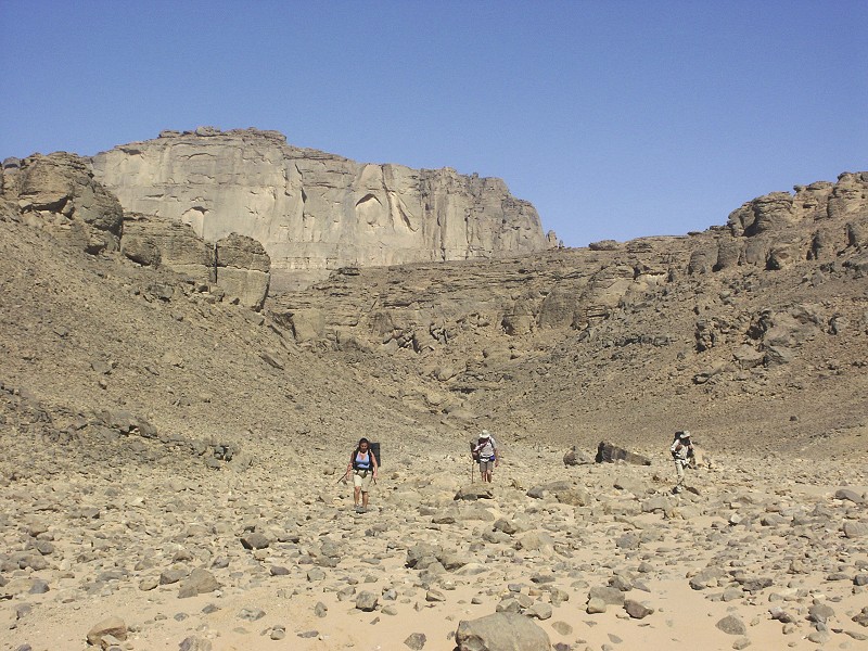
As we climbed ever higher the weather remained pleasantly cool. At stops instead of scurrying off to the shade, we all looked for a nice sunlit rock to lie on - a sure sign that the heat passed. Looking back, it became evident that we made good progress, we were already a good five hundred metres above our starting altitude and it was not even midday.
One of the very few nasty creatures inhabiting Uweinat is the Sheep nasal botfly (Oestrus ovis), which has the unpleasant habit of laying its tiny live larvae in the eyes or mouth of sheep (in this case the poor waddan) from where they make their way to the nasal pasages where they grow to the pupal stage, when they are sneezed out to hatch. However if there is no sheep, any creature will do, including humans. On several trips I had the unpleasant experience of having to remove a dozen or two little maggots from my own or somebody else's eyes. While once gone they usually leave no lasting harm, in March 2005 both Magdi & myself contacted a nasty eye inflammation from them. Since then we always have our nets at hand, to be used as soon as one is spotted (they can be told apart from normal "friendly" flies by their light colour, and their ability to hover in one spot). On this trip we did encounter a few, and one started following us persistently about halfway up to the col. On occasion it disappeared, but as soon as we got our nets off, it was back again. With an uncommon spell of luck, as it made one close pass Magdi struck towards it with her foot in the slim hope of squashing it against the rock behind. Of course that did not happen, however the evasive maneuvre landed it straight into the few surviving threads of a rather ancient looking spider web, perhaps the only one within kilometres, spiders being very rare. Caught by the threads, I managed to snap a photo of it (which is normally very difficult, as they never stop still long enough - only two exist on the entire web), before beating it to pulp with a stone with great relish.
By early afternoon we reached the large shelter under a fallen block that was found by Mahmoud Marei early in 2003 (KTW 14). We had our lunch and an hour's rest before making the final push for the col.

The remaining distance and altitude till the col was not much, but the clutter of boulders made going very slow. It took a good hour to cover the remaining kilometre or so. As we crossed the watercourse several times, it was evident that the valley flowed with water after the rains of 2005 or 2006, the valley floor was filled with dried remains of Schouwia thebaica.
Once we reached the col, the valley flattened and broadened, with a pleasant acacia grove. It was in this vicinity that Hardy Böckli and Mahmoud Marei found a very nice shelter in 2007 with fine cattle period paintings (KTW 15/A) a little way up the side of the Northern plateau.
We left our packs beside a large basin in the valley that would hold water for a substantial period after rains, and started exploring the terraced broken rocky country above to the north where based on Hardy's description the paintings were thought to be. On a broad terrace we did find a couple of paintings under a small shelter, but these proved to be new, unreported ones. A large shelter loomed in the background - we were certain we will find Hardy's scenes, however it turned out to be a fine new site, with a number of well preserved cattle pastoralist paintings. I'm certain we have been very close to Hardy's site, but we never found it.
We still had an hour till sunset, we decided to press on to get closer to our starting point for the trek up to the peak, following the watercourse. Here the wadi flows accross a broad plain that fills the basin between ithe North-west plateau to the East, and the granite hills accross in Libya just a few hundred metres to the west.
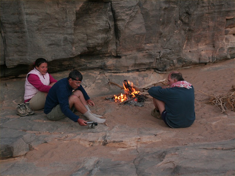
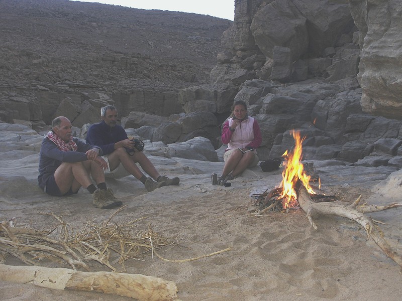
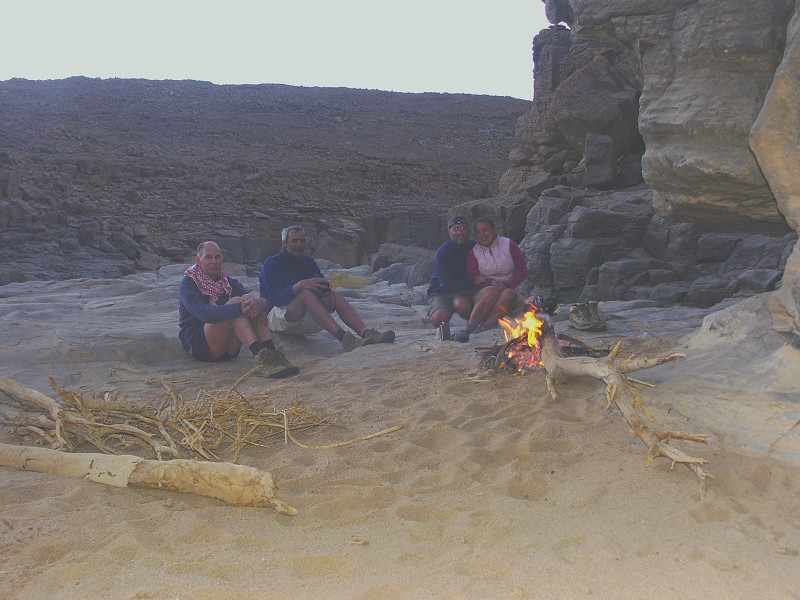
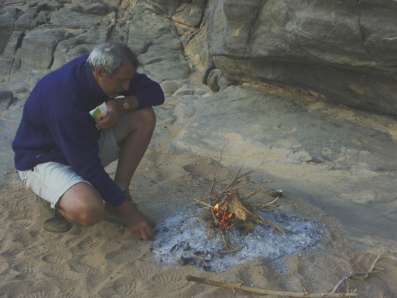
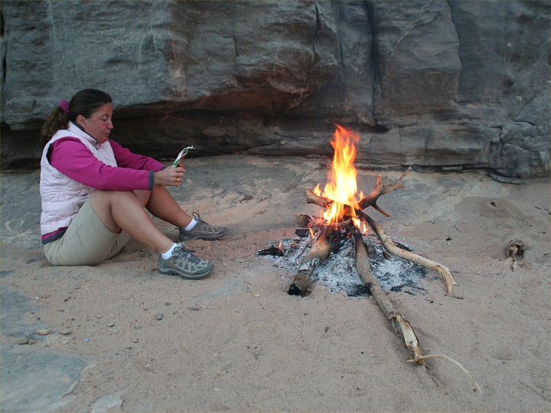
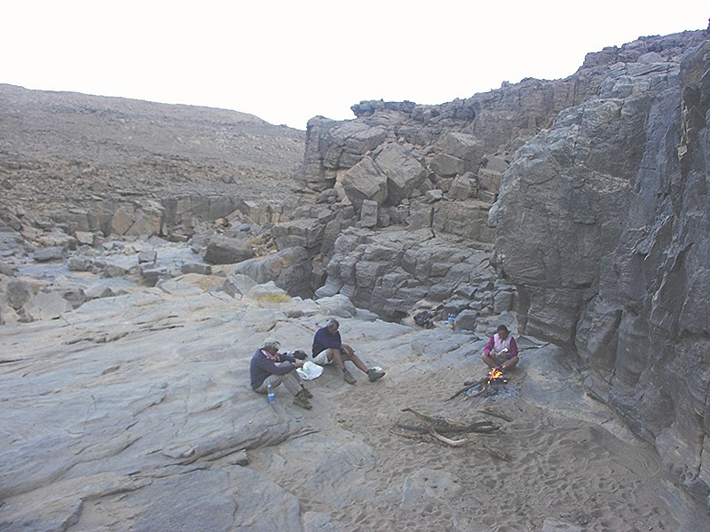
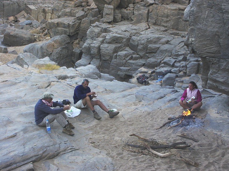
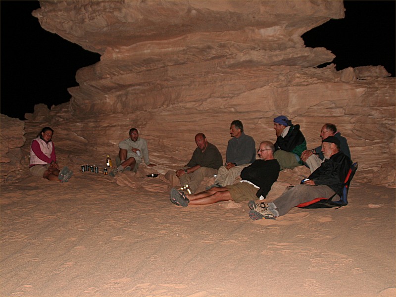
The only sheltered spot we could hope to find against the now rather cold northern wind would be in the wadi bed, so we followed the watercourse until reaching a dry waterfall surrounded on all sides by several metre high vertical rock walls, with patches of soft sand along the bottom. We could not have imagined a better bivouac. We gathered some firewood for the evening before sunset, and settled around the comfortably warm fire for a rather welcome sip of Cognac followed by our dinner before crawling off for an early sleep before the climb.
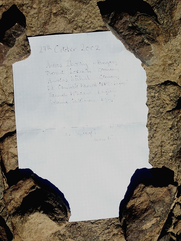
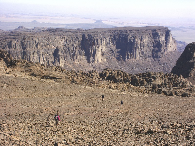
The night was bitterly cold, it must have been no more than 4-5 degrees at twilight, when we started getting up to prepare for the climb. We stashed away all unnecessary gear - surplus water, food, matresses, took only two bottles of water and a little food to make the backpack as light as possible. We warmed ourselves around the fire for a while then set out following the wadi as it bends back east again between the two high plateaus, the unnamed North-western plateau, and the southern Italia Plateau with the highest point of the mountain. This is the same route that we took on the way up during our October 2002 ascent, however learning from that experience, this time we split the trek into a manageable three days instead of the rather brutal two.
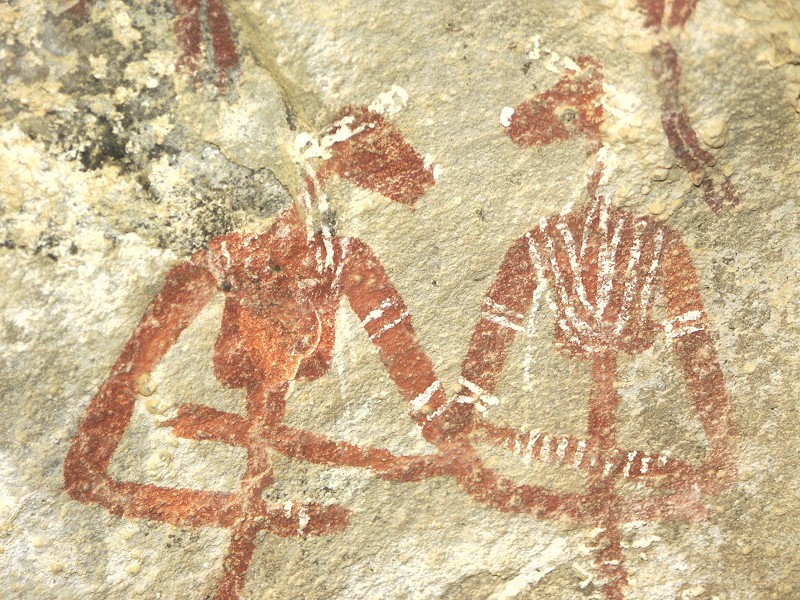
Our base camp was at an an elevation of about 1300 metres, we had a mere 500 to go to the summit. In about an hour we reached the little flat basin where we spent our night in 2002, and continued up the watercourse to the shelter with the lovely scene of the two embracing women we found that time, the highest altitude painting (almost 1500 metres) known at Uweinat, definitely one of my favorites.
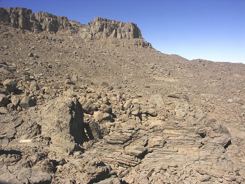
Beyond the rock art site we followed our 2002 route for a while, but instead of turning uphill among the maze of rocks that proved so difficult at the time, we crossed the bed of upper Karkur Talh, and started climbing a scree slope on the far side, which according to satellite imagery should lead in a series of steps all the way to the base of the final rise with the summit.
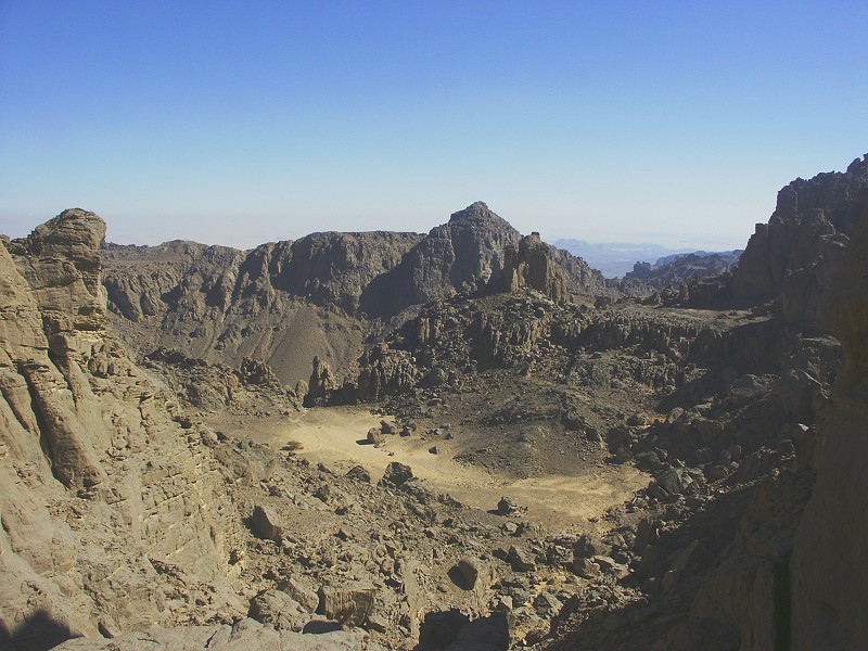
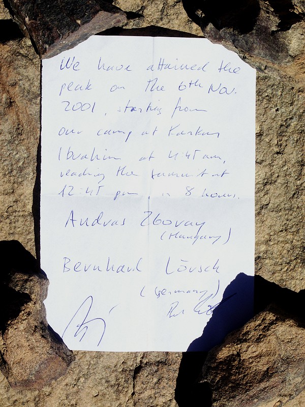
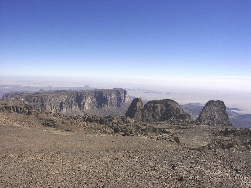
The satellite imagery was correct, by 11 am we scaled the last slopes, and were finally standing beside Bagnold's cairn holding the two sets of documents we placed there in 2001 and 2002.
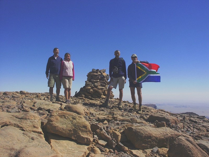
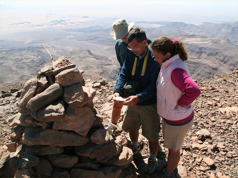
There was no record of anyone having been up there, however the cairn built by the Marchesi party on the true high point (Bagnold's is a little offset to be clearly visible from the plain below) was re-built from it's 2002 collapsed state. Somebody had definitely been up there, without leaving any note. If anybody has any information, please let me know.
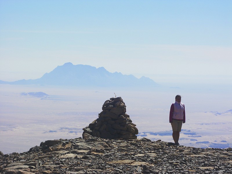
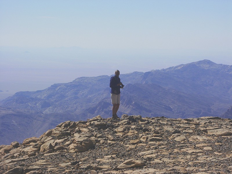
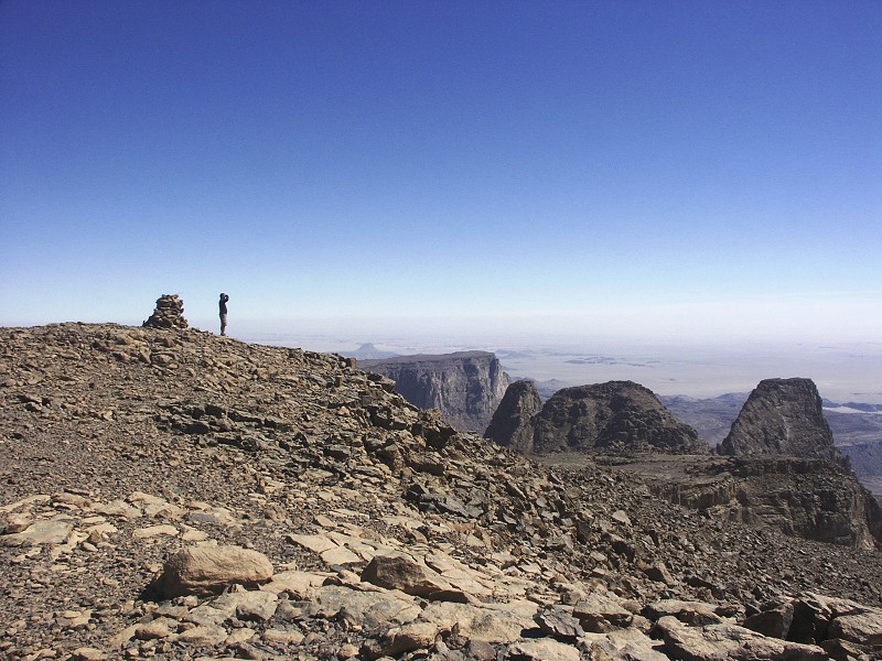
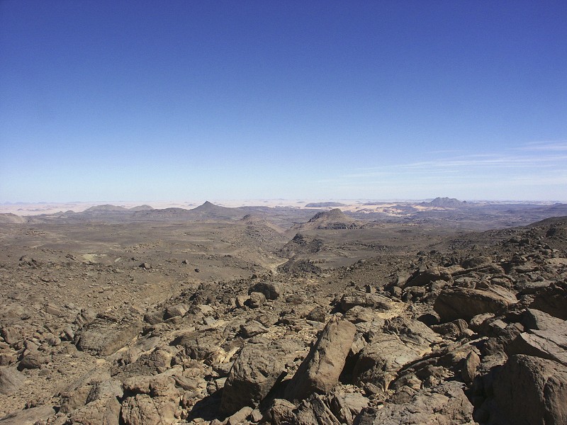
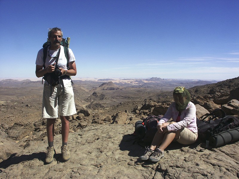
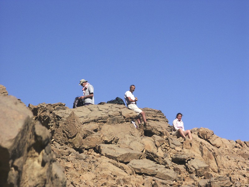
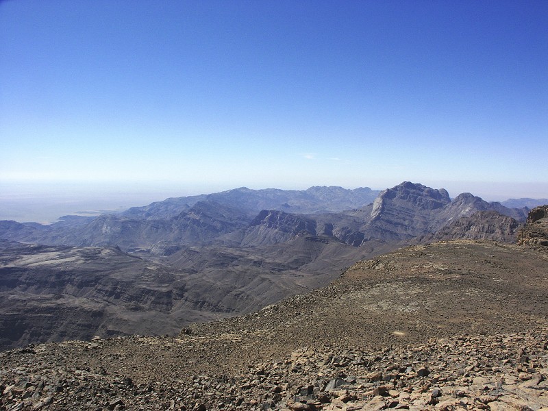
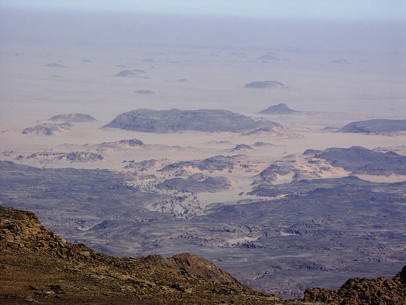
We lingered at the peak for an hour, photographing and just taking in the breathtaking scenery. Visibility was good, we could see for a distance of perhaps a hundred kilometres or even more.
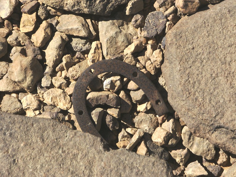
As we started our descent, in the gully providing the natural way up the first slope under the summit rise, we found an old shoe iron. While impossible to pinpoint exactly its provenance, it is likely to have been lost by a Sudanese soldier in either F.G.B. Arkwright's party in 1934, or on one of the two subsequent S.D.F. ascents.
Our return was along the same route we have taken on the way up. It took us practically the same time as the ascent, we reached the level of the plain with our base camp late in the afternoon.

It took another half hour to reach our bivouac spot, just about when the sun dipped below the granite hills on the western horizon.
It is amazing how quickly one can become accustomed to relative comforts. Dropping the backpacks, kicking off the hiking boots and getting the fire going felt as if we have always called that little sandy sheltered spot among the rocks of upper Uweinat home.
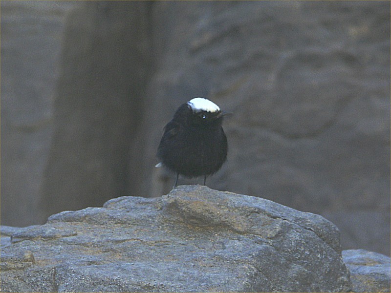
The night was a couple of degrees warmer than the previous one, but it was still nice to warm around the fire till sunrise. As we had breakfast, we were entertained by a little Zarzur bird (white crowned wheatear, Oenanthe leucopyga) constantly hopping and chirping around us, picking up some crumbs, but never quite bold enough to come more than a couple of metres to us. As we packed our gear and remaining supplies, we noted we have a water problem - just the exact opposite of the one we feared. With the cool weather we were hardly drinking, we all made the previous day's climb with a single bottle. We all had four full bottles remaining to carry down, and eventually made it down to the cars with everyone having three still full. We have accomplished the three day climb on just six litres of water, something that would have been impossible in the heat just a few days earlier.
Our route down to Marei's site KTW 14 was the same as we took on the way up, following the bed of the wadi, and scrambling along the sides when the middle became choked with boulders.
We did not stop at the site, but continued straight down along a series of terraces and scree slopes, much better going than the bouldery slope on the south-west side of the valley, but of course having the deep gorge of Karkur Talh now to our right, which we would have needed to cross losing all altitude we have gained on the initial easy climb on our first day. We were aiming for a conspicious group of house sized boulders at the edge of the last terrace before the ground drops to an undulating but generally level plateau flanking the valley to the north. We stoped for a rest there, and exploring the surrounding rocks did reveal two very faint set of paintings.
We have come down very fast, it was still before noon, so we had time for an optionally planned side-trek to explore the upper reaches of a tributary wadi of Karkur Talh that drained the plateau in front of us. The detour was a couple of kilometres accross the plateau, to the area where satellite imagery showed promising looking rock outcrops, similar to those where rock art sites have been found in the past. This valley had been on our potential areas list for years, just circumstances always prevented a visit.
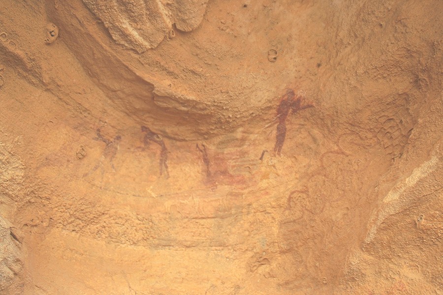
The initial survey at the upper end of the valley revealed several promising shelters along the wadi banks, but all had badly weathered crumbly rock, there was no chance of any of them containing preserved paintings. We were nearing the end of the suitable-looking rocks, and were about to give up and start going towards the agreed pick-up point, when in a large shelter we spotted a couple of faint paintings. Further investigation revealed more better preserved ones, all of the cattle pastoral period. The hunch from the satellite imagery was good after all!
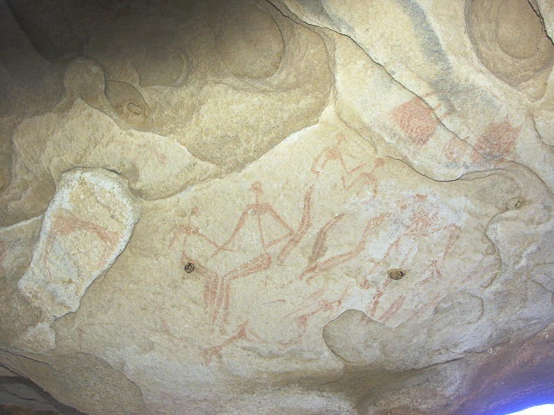
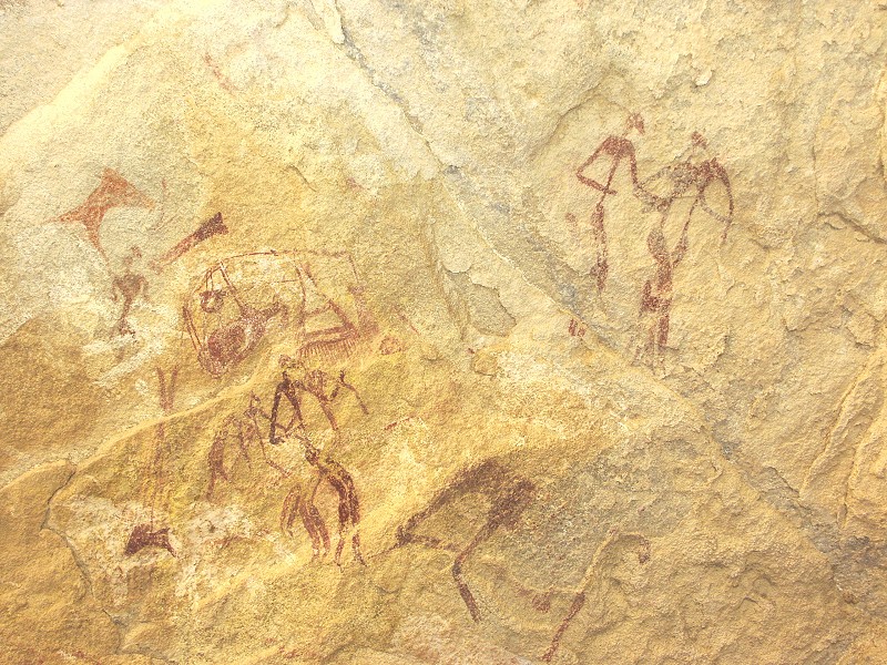
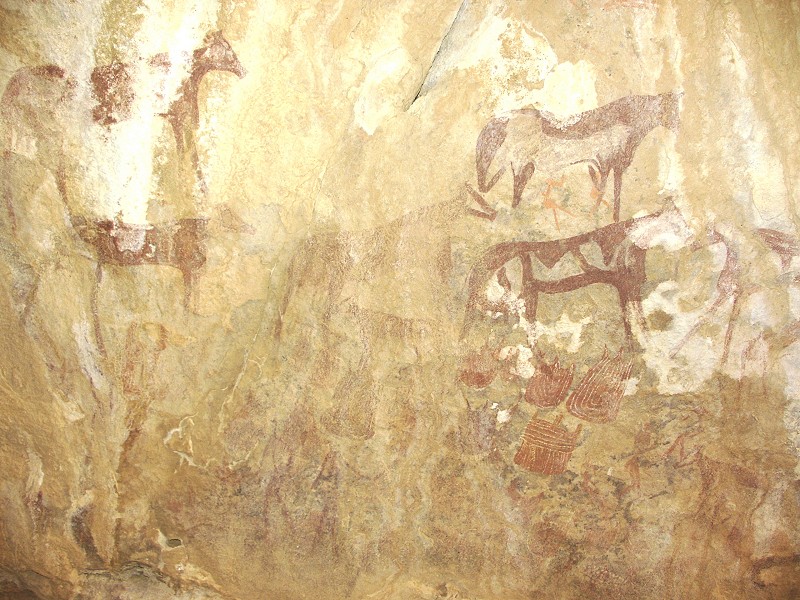
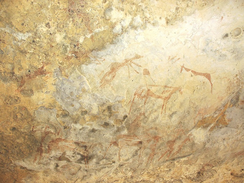
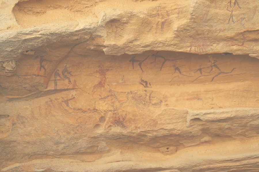
Gábor climbed the far bank to check out some (unfortunately empty) large shelters, and he spotted a large deep shelter behind fallen boulders which obscured it from view from the valley bottom. He directed me to it, and looking inside I saw a multitude of pristine beautifully executed paintings covering parts of the ceiling and the rear wall. This was certainly a major find! As luck goes, my camera batteries were close to dead, and the pricey solar charger I bought specifically for this trek did a rather miserable job putting any life back to them. Helped out with a pair of half-used ones from Richard, I just about managed to photograph the entire shelter before all remaining batteries gave up for dead. The site will be published (together with our other finds) in the forthcoming issue of Sahara.
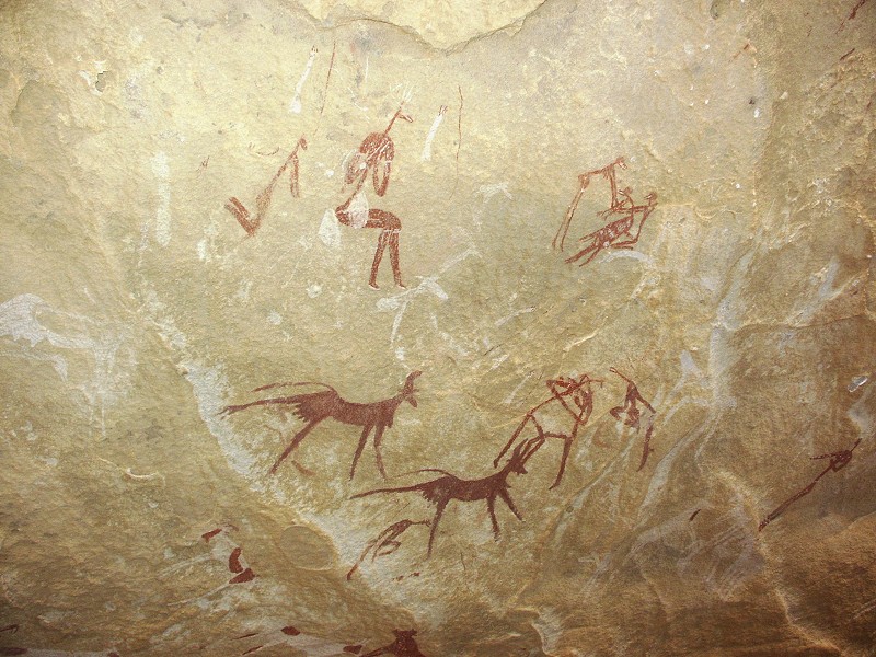
As I was photographing, Richard went a little further downstream, and found another shelter which contained some weathered but clearly recognisable paintings of the "Uweinat roundhead" style, with some overpaintings from the cattle period, an important adition to the chronological puzzle of the area. This site also contained a couple of uncommon painted giraffe. With the solar charger finally breathing a little life into a set of batteries, I could take a couple of photos before they were dead again, but they cover most of the site.
By this time it was becoming late, well past the designated 2:30 pm at which time we should have started out to comfortably reach the car waiting for us in the north-western branch of Karkur Talh by sunset (just after five). Reluctantly leaving the last site, we started downstream, encountering after a couple of hundred metres a very long and low shelter along the wadi bank. On close scutiny this too proved to be full of beautifully preserved paintings, with many of the strange human figures painted in a style never seen before. This find surpassed all the others in importance - with no time or batteries left... Urging the others on to start the descent, I did manage to take a couple of dozen photos in about ten minutes using Gábor's camera, which he very generously lent to me. Unfortunately it had no manual flash mode, but still some record remains of this amazing site - however a re-visit is definitely in order for a forthcoming trip.
Fortunately my estimate of three hours till the car proved to be a bit conservative, in little over two hours we made it back. The sun set just as we descended into Karkur Talh at the bend above the Belgians' sites. It started to become dark as we passed the huge painted shelter, but from hereon we were on known ground, we could make our way along the path easily having traversed it dozens of times. We reached the waiting Zayed just after six, and half an hour later we could share our finds and adventures with the others at the well earned evening bar.
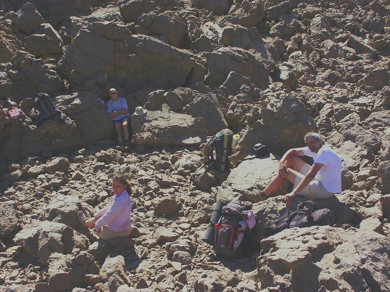
Those who stayed behind spent the three days visiting the Belgians' sites, the sites in upper South-western Karkur Talh (found on the February 2003 expedition), and the sites in the lateral wadis of Southern Karkur Talh. Kent and Mark did a bit of exploration along the plateau top beyond the Belgians' sites, and encountered a fine waddan (Barbary sheep, Ammotragus lervia), of which Kent managed to take some excellent photos.
Day 12. - Jebel Uweinat - Wadi Sora
Next morning we broke camp and started out North towards Wadi Sora, stopping at some of the rock art sites discovered by Mark in 2008 and Clayton's Craters along the way.
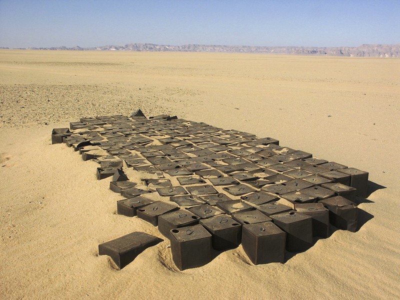
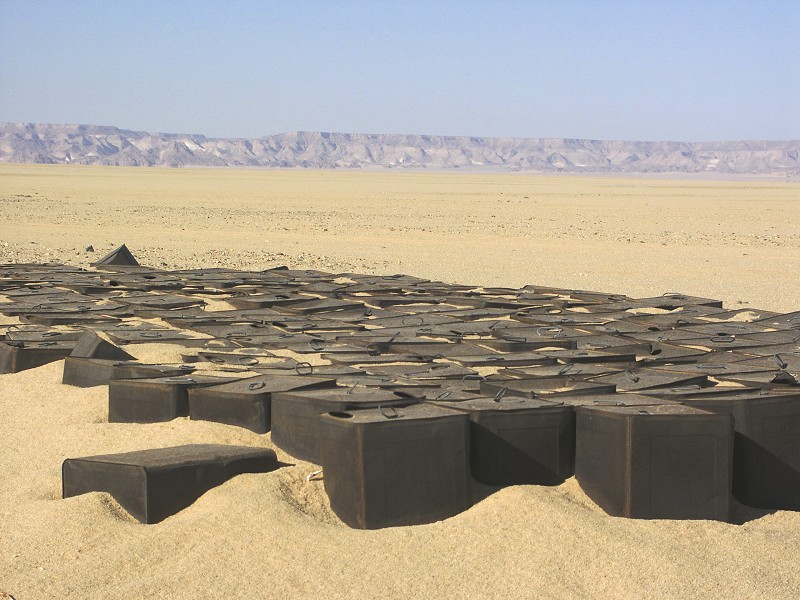
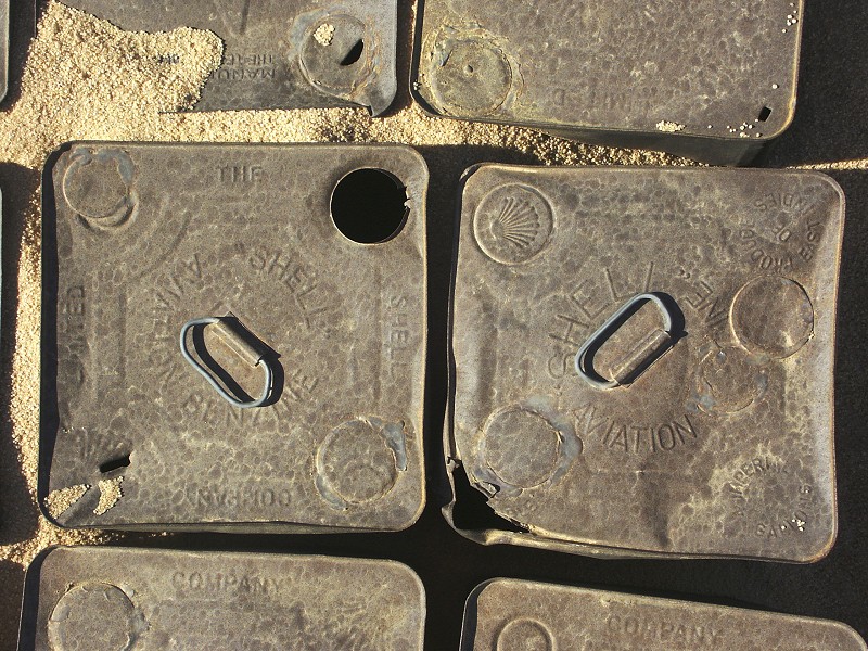
On the plain outside Wadi Sora, we passed a stash of empty petrol tins dating from the WWII Kufra Convoys times. This particular batch was never noted by us before, as illustrated by the bag of LRDG signalman Alec Ross any number of historic relics may still be out there along the convoy route.
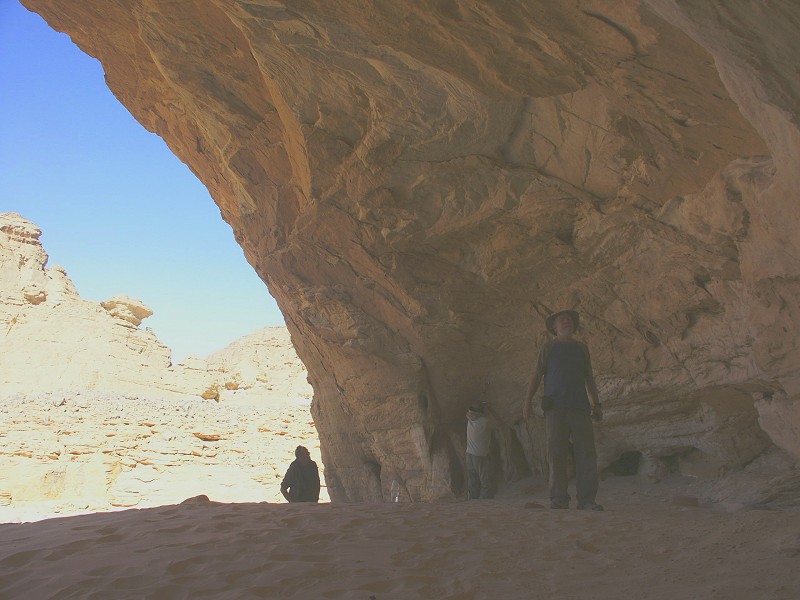
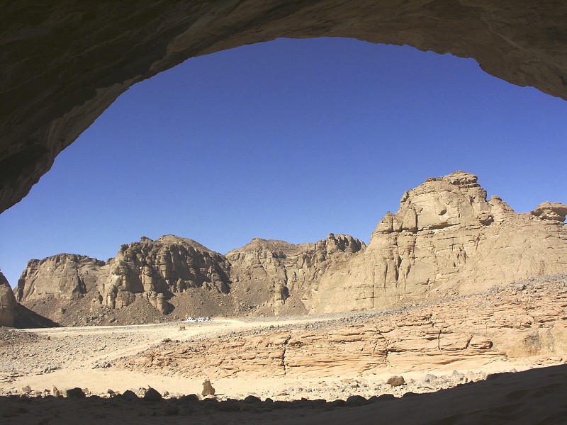
On reaching Wadi Sora, we drove immediately to the "Cave of the Beasts" (site WG 21), expecting to find the Heinrich Barth Institut team there, having agreed to meet on this date in advance. However there was no trace of the German's camp at the site, we have done a bit of searching just in case they moved to a less exposed location, but all we found was a French group with a Baharya tour operator camping behind one of the low hills. (I learned from Rudolph Kuper after we returned to Cairo that the team finished their tasks at Wadi Sora earlier than planned, so they moved to Wadi Hamra to do some further work there.) There was nothing to do but to make camp at a sheltered spot ourselves (very close to our March 2005 camp of the "Nous sommes perdu!" fame), where we spent a leisurely late afternoon and evening.
Day 13. - Wadi Sora - Camp at East of Gilf Kebir
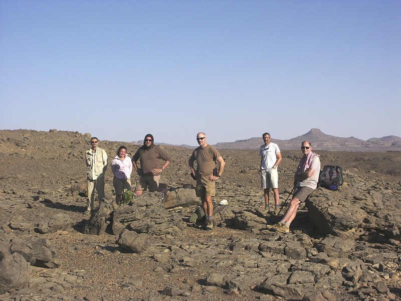
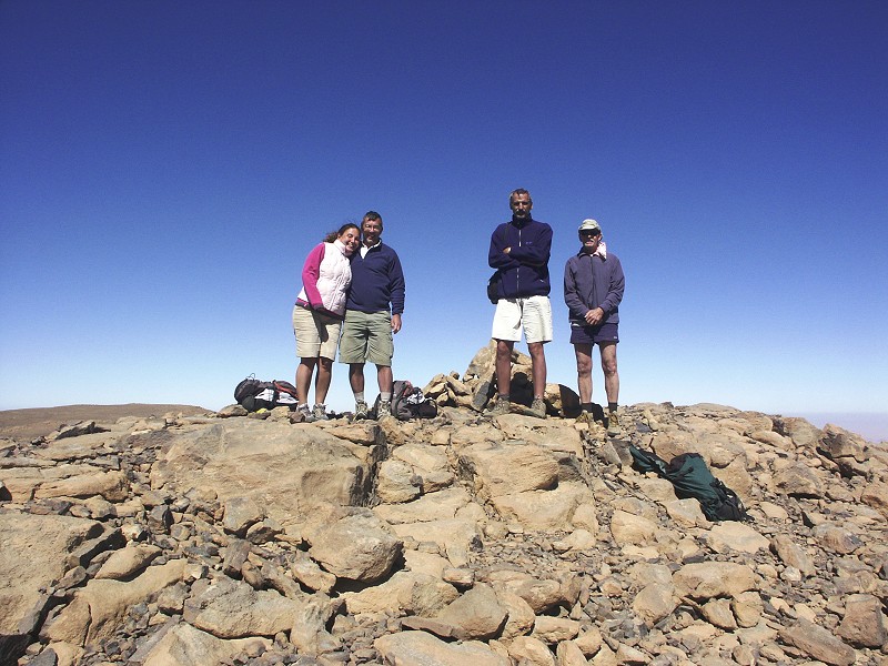
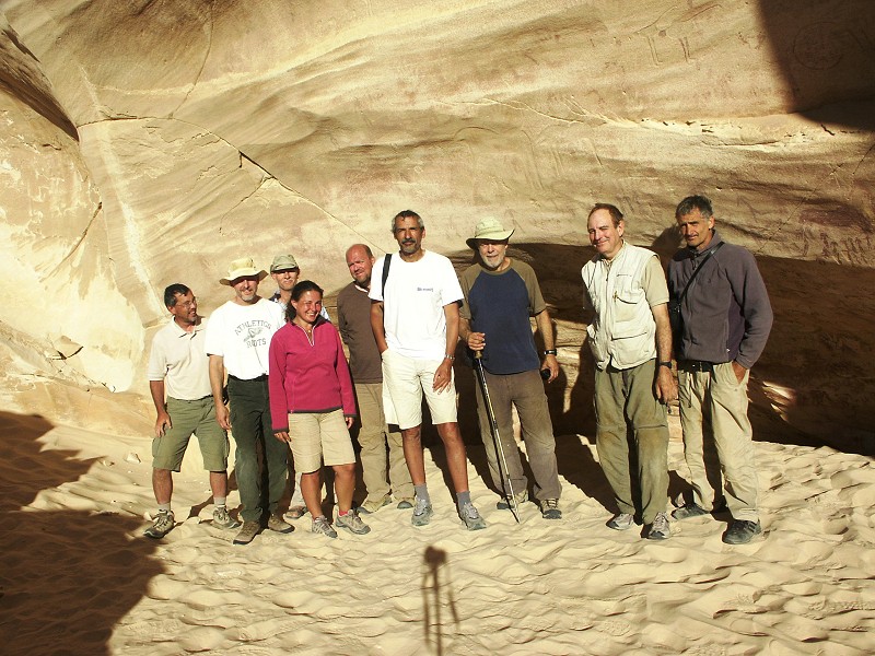
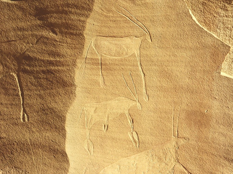
The next morning we climbed up to the "Cave of the Beasts" which was walking distance from our Camp. I have never been there so early in the morning with the sun being so low, the light was ideal for photographing the engravings above and to the left of the shelter. We also took our obligatory group photo in the perfect morning light.
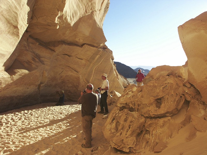
After visiting the site we broke camp and visited the row of rock art sites to the north of Wadi Sora proper, finishing at the Cave of the Swimmers.
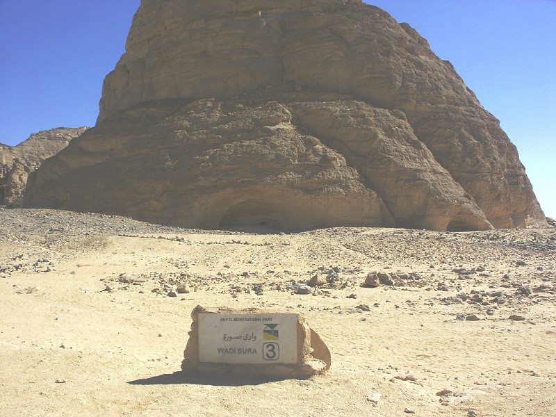
At Wadi Sora there was a rather unfitting and uninformative new marble and concrete sign declaring the place to be monument #3 of the Gilf Kebir National Park, the only sign of any park related activity on behalf of the high authorities (may it stay like that for a long time...).
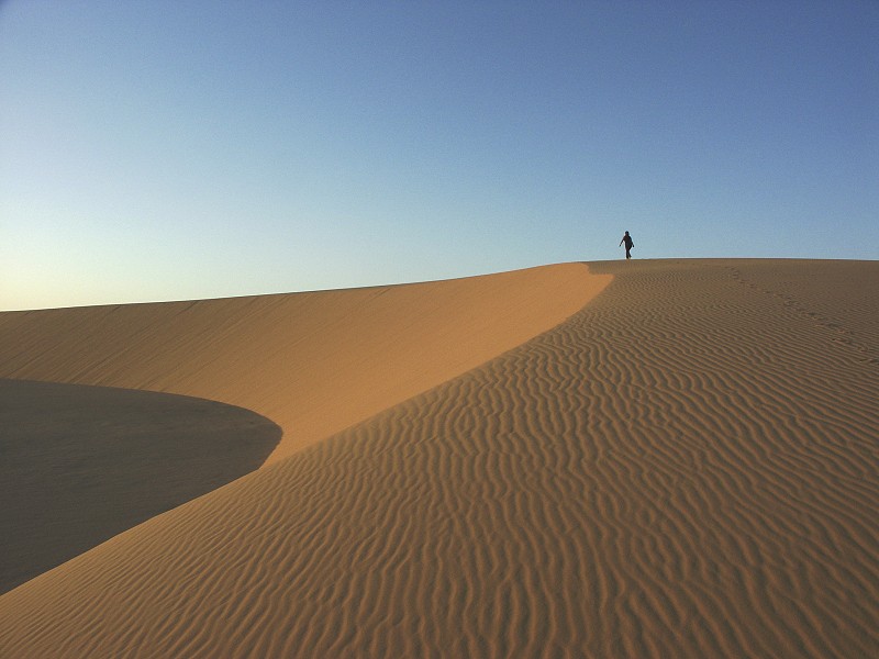
After leaving Wadi Sora before midday, we drove pretty much continuously along the western edge of the Gilf till the mouth of Wadi Firaq, where we crossed to the east, and continued to the area of low hills and golden barchan dunes to the north-east of Eight Bells for our last desert camp.
Day 14. - Camp - Dakhla Oasis
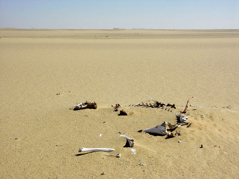
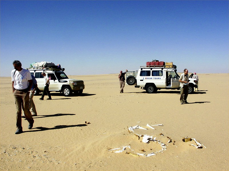
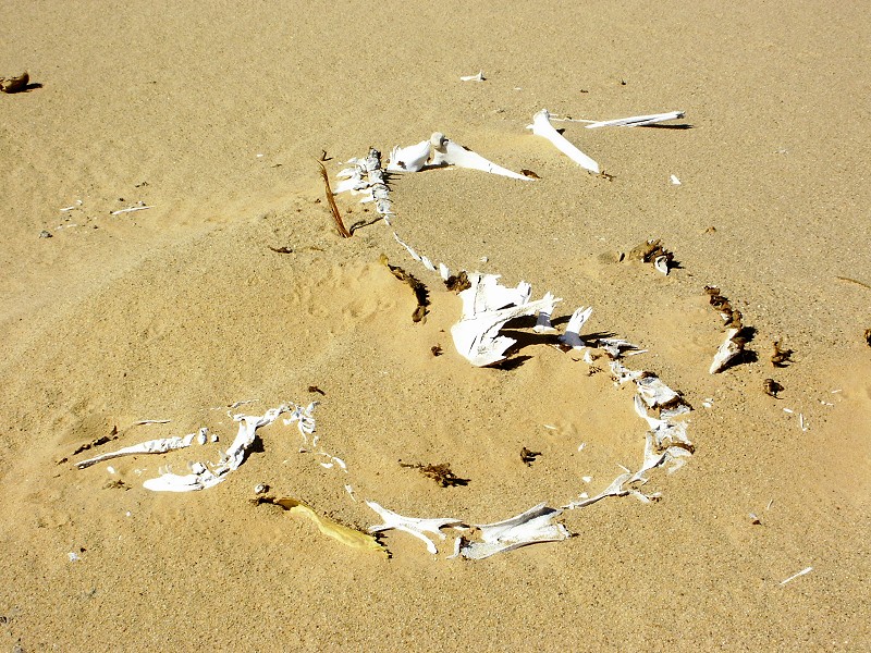
Our last desert day was a rather uneventful drive accross the Selima Sand Sheet along the most direct route till the Abu Hussein dunes, then on towards the tarmac road. Before reaching the road we encountered a couple of camel skeletons, from the time when the Darb Terfawi, the road linking Dakhla Oasis with Bir Terfawi was a little used side-road of the Darb El Arbain, the main caravan and slave trade route linking the Darfur with Kharga and Assiut.
We reached the road around lunchtime, and reached Dakhla 200 kilometres further north well before sunset, staying at the Mebarez for the night.
Day 15. - Dakhla - Cairo
Full day drive back to Cairo on the oasis road, reaching the haven of the Novotel after an hour and a half in the Cairo rush hour traffic, a rather rude awakening from the solitude and silence of the desert.