Click on image for list of participants
|
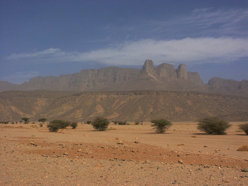
Jebel Uweinat - Gilf Kebir Expedition
26th February - 13th March, 2005
NOTICE: The rock art photos on this page are strictly copyrighted ! No photo may be copied / used for any purpose without written permission.
|
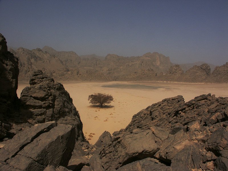
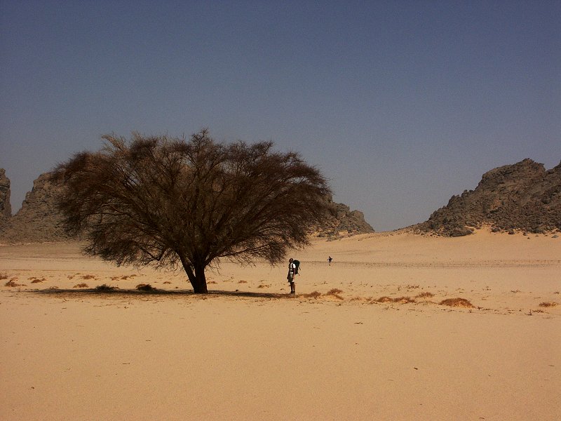
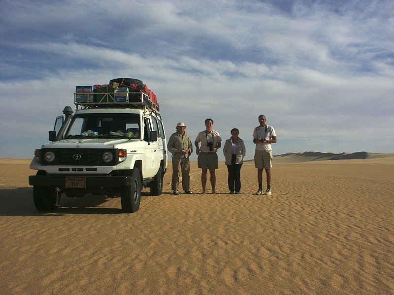
By the middle of January it became clear, that the situation in Darfur was so volatiole that the planned Sudan expedition needs to be cancelled. Some of the participants agreed to do a short expedition to Jebel Uweinat instead, continuing our exploration of the unknown parts of the mountain.
Pre-trip excursion to the Fayum desert.
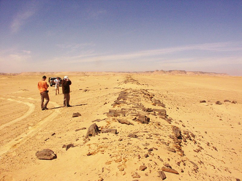
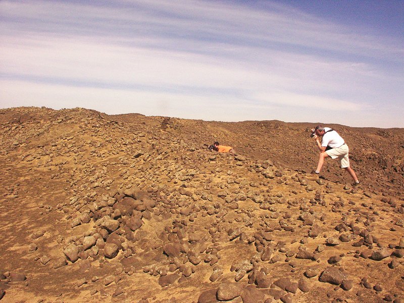
On the week-end before the trip started, the four of us already in Cairo (Attila, Gábor, Raymond & myself) made a short but very pleasant two day excursion to the northern Fayum desert with a rented Jeep. We scaled the pass behind Qasr el Sagha temple, and started off visiting the quarry road (the most ancient paved road anywhere in the world) and the basalt quarries of Widan el Faras.
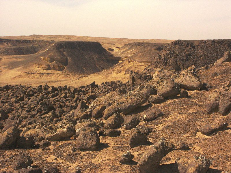
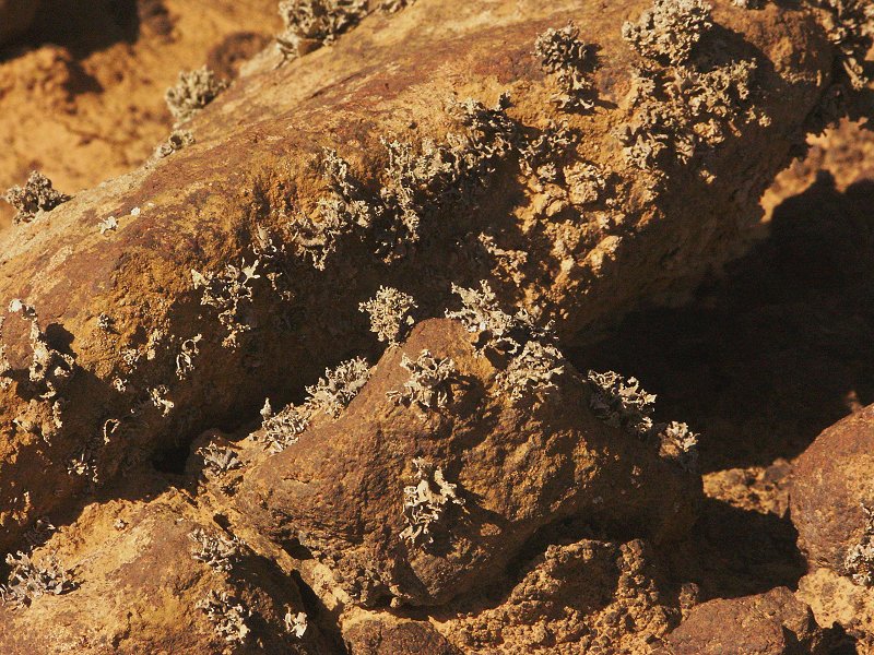
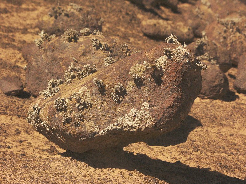
In a small very localised spot at the edge of the scarp behind the basalt quarries, there is a unique colony of lichens growing on the eroding basalt boulders. This amazing habitat is to my knowledge unique in Egypt, and possibly in the whole Sahara. It represents a very special microclimate, probably created by the Birket Qarun (Fayum lake) at the foot of the series of scarps in the Fayum depression. On almost every trip we have noted thick fog on the Oasis road at dawn just a short distance to the west of this area, which is the only conceivable source of moisture for the lichens to survive. I'm not sure whether this special microflora was ever recognised and discribed by anyone. They bear a strong resemblance to the much more abundant lichen fields along the Namib coastal desert. (Subsequently the species has been identified as Ramalina maciformis by Imre Friedmann & Chris McKay.)
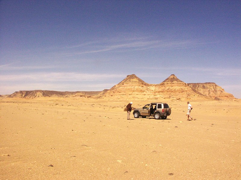
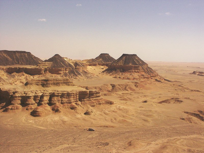
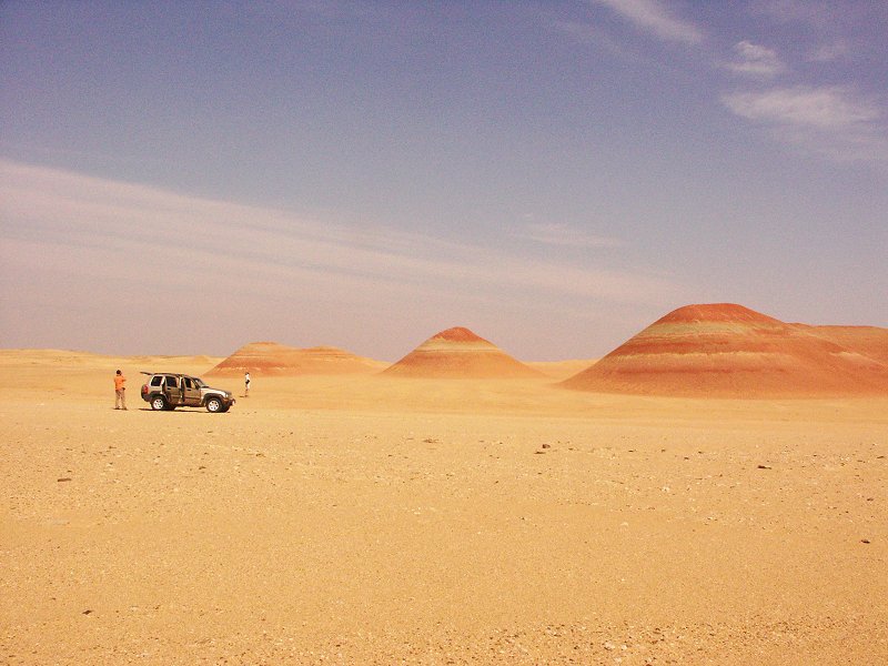
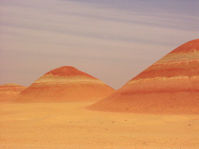
Another wonder in the northern Fayum is a group of three low eroded hills of shale, sporting alternating bands of red, yellow and grey. They lie a short distance to the west of Widan el Faras.
In the afternoon we proceeded to the famous fossil beds of the Fayum, and camped at the very spot where Granger and company of the 1907 New York Natural History Museum expedition. (To read more on Granger and the Fayum fossils, visit the The Granger Papers Project website)
The next morning we descended from the high scarp to the lakeshore, visiting the roman town of Dîme and the Qasr el Sagha temple before driving back to Cairo in the early afternoon to meet Salama & Zayed and start loading the cars.
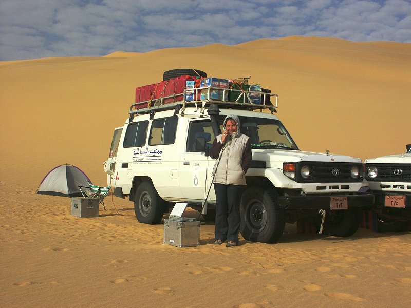
Day 1 - 2. - Cairo - Dakhla - western Gilf Kebir.
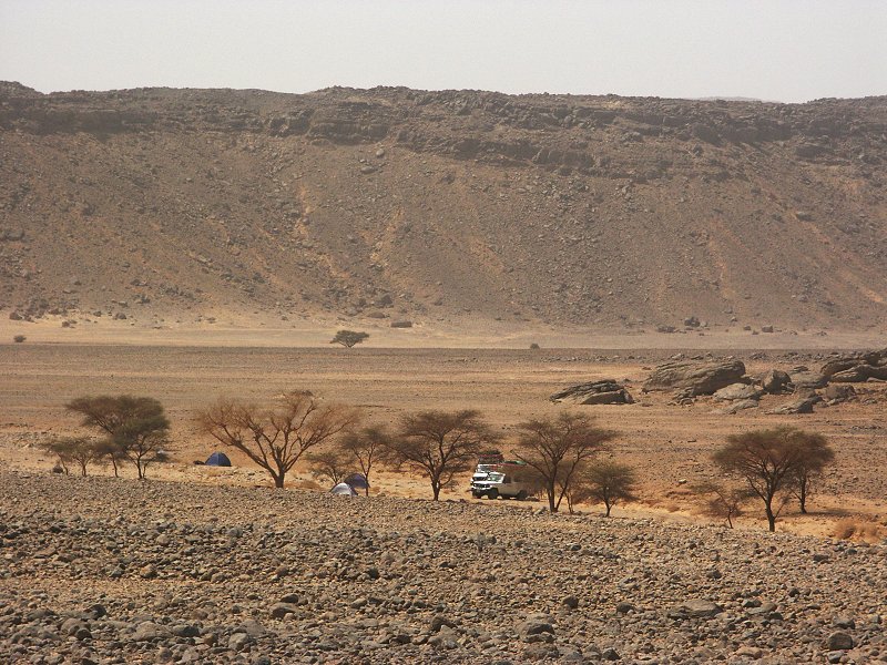
After collecting Magdi at dawn at the airport, we started off on the usual itinerary, staying for the night in the Mebarez Hotel at Dakhla. Next day we continued south along the road, then crossed the Selima Sandsheet towards the foothills of the Gilf where we had our first desert camp.
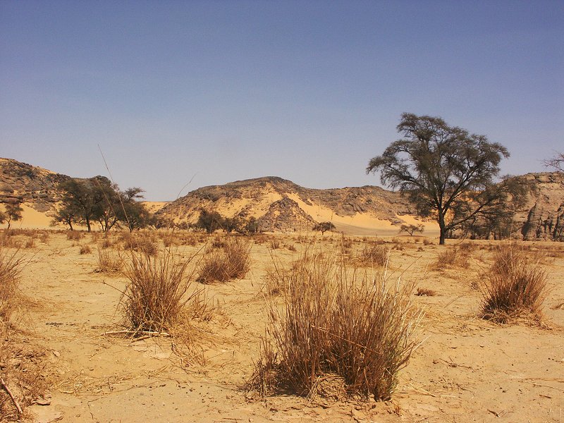
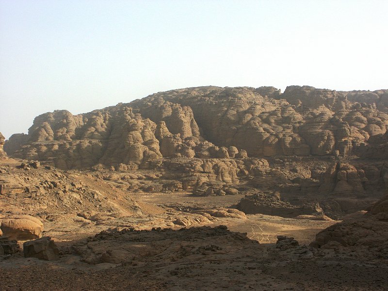
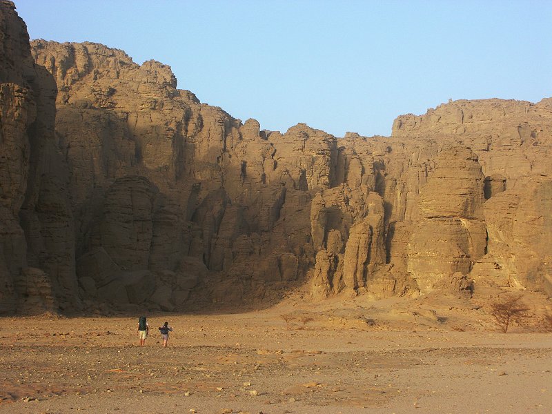
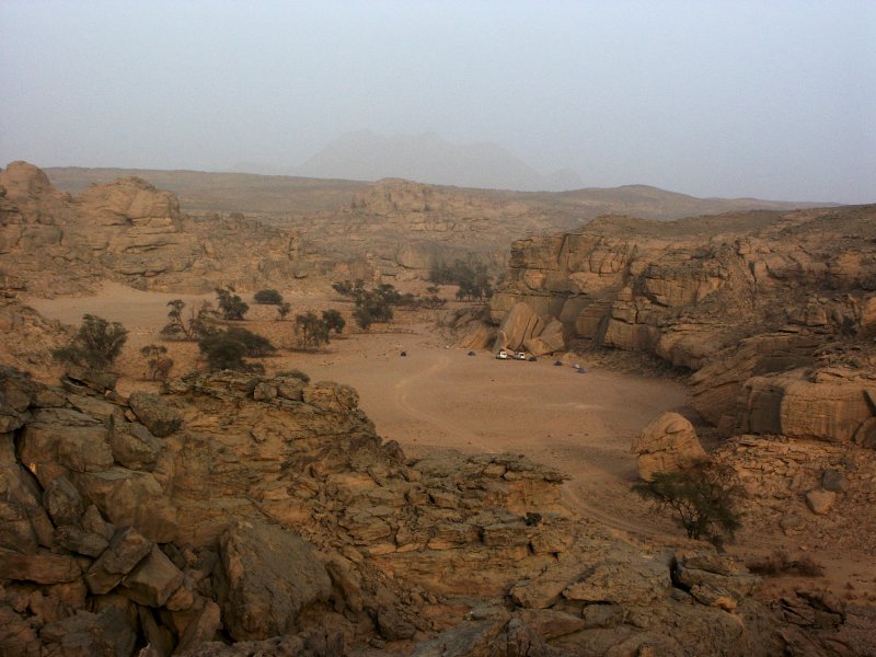
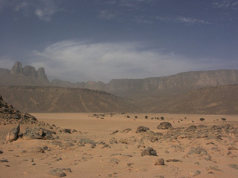
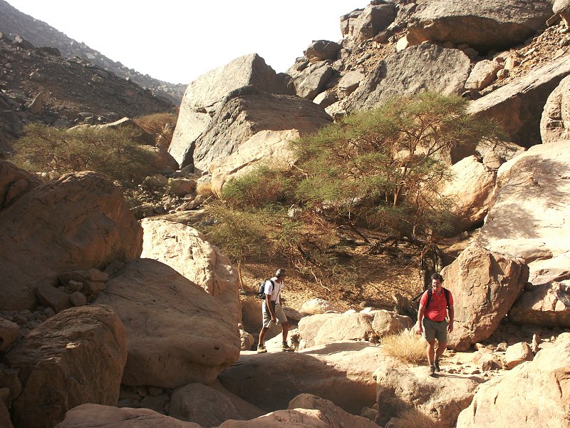
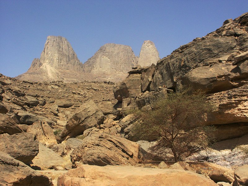
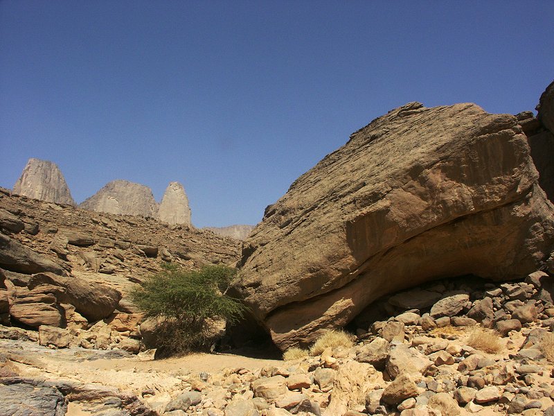
Day 3. - Karkur Talh.
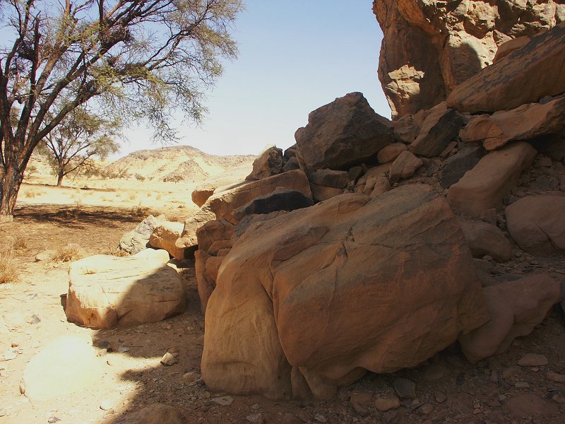
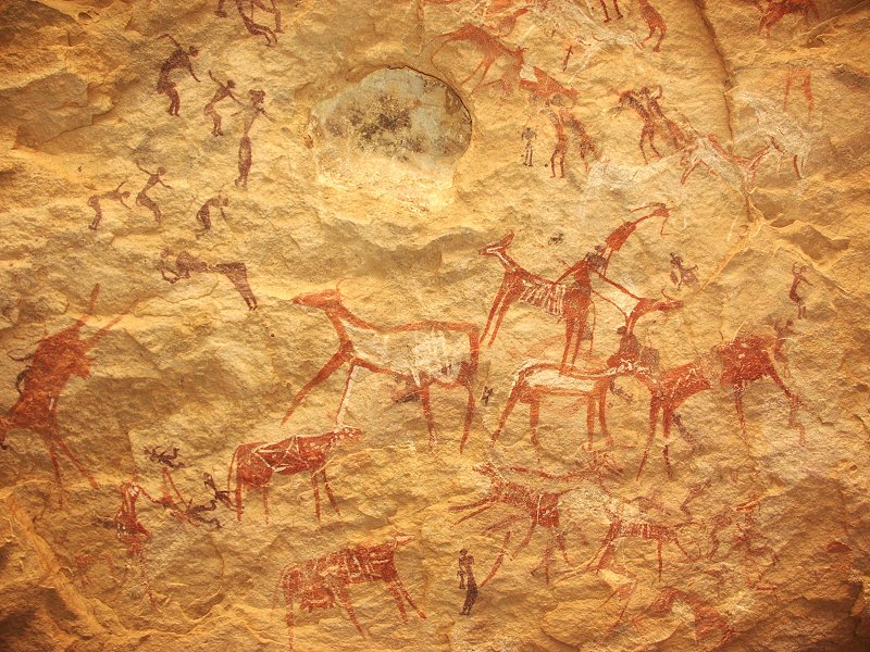
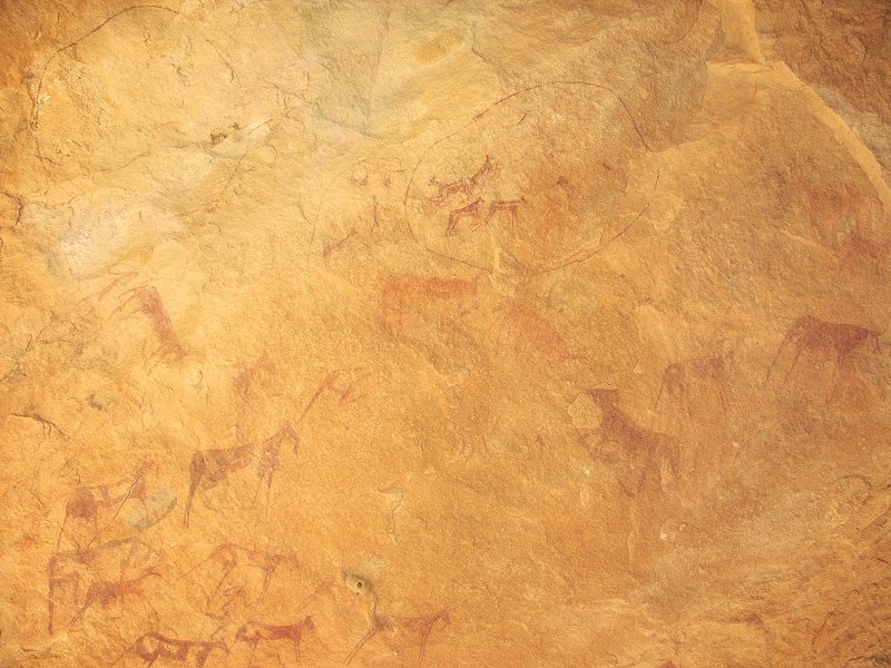
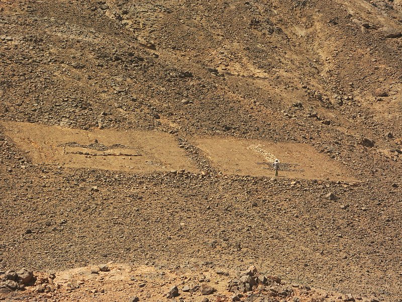
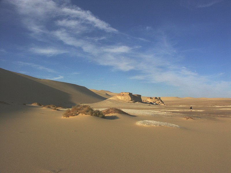
In the morning we continued without stopping to Karkur Talh arriving in the late morning. This time we camped near the end of the drivable section of the south-west branch, to facilitate our climb of the Hassanein Plateau the next day. The afternoon was spent visiting several areas in the main valley, tying off loose ends in the rock art documentation project. Finally I have managed to locate a site reported by Kemal el Din (el Dine & Breuil, 1928, fig. 43), which was right on the path we have taken on every single previous trip, just facing rearwards and invisible in the morning light.
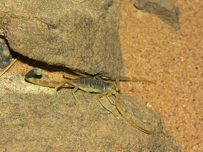
In the evening, as we pictched our tents, I found the first scorpion ever seen at uweinat under a stone picked up as a tent anchor. It was a yellow Leirus quinquestriatus, the same species we saw in the northern Great Sand sea in March 2004.
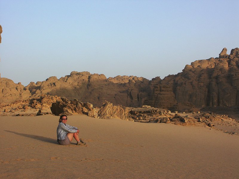
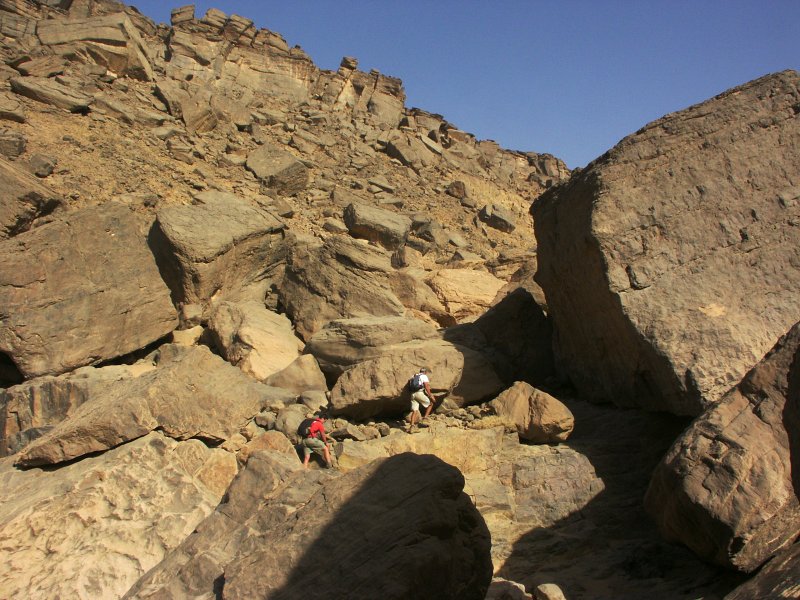
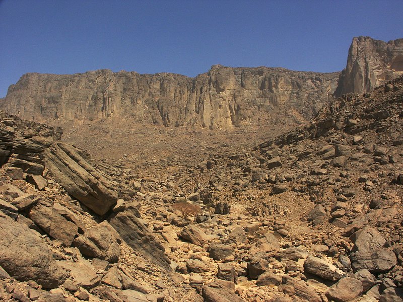
Day 4 - 5. - Exploring the Hassanein Plateau.
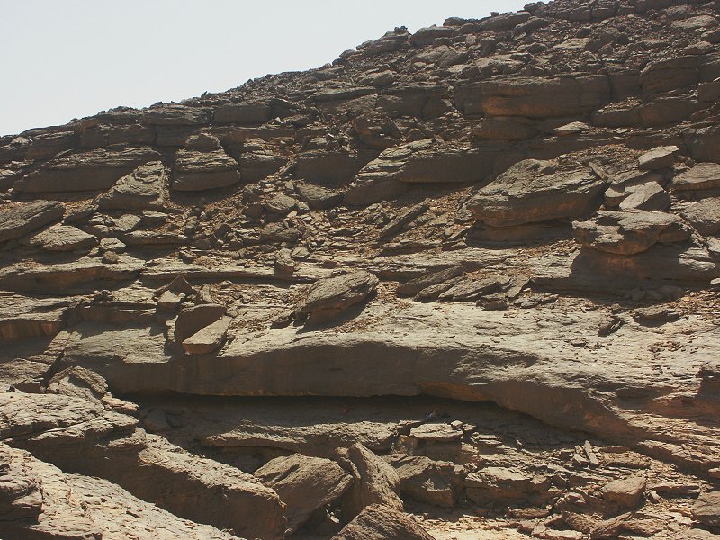
we set out from camp at first light, to make use of the cool of the morning. There was a strange haze that lasted all day. We continued together till the rock art sites in the upper valley found in February 2003, where we left Attila and Raymond to explore the sites and spend the night, while the rest of us, including Salama, continued scaling the plateau above.
We used for the ascent the steep ravine pioneered in March 2004 for the descent, which proved easier than anticipated, we were at the top by midday. Unfortunately the ascent was marred by a mishap, one of the million buzzing flies managed to score a direct hit into Magdi's right eye, filling it with dozens of larvae. Every five minutes we had to stop, plucking yet another couple with a clean tissue. Finally by the top of the pass all larvae were gone from her eye and all seemed well, save for the unpleasant experience. We set out to explore the eroded valley system to the east of the main central wadi (explored in March 2004), and found two new rock art sites.
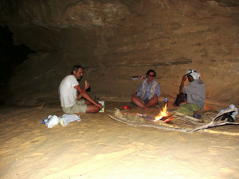
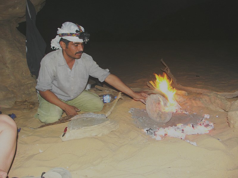
Camp was in a little sandy nook of the main valley, Salama baking his famous desert bread as usual.
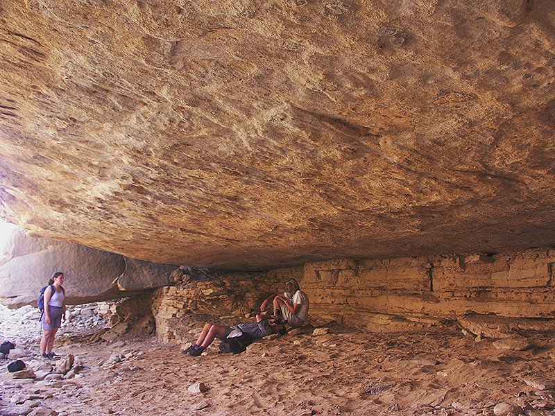
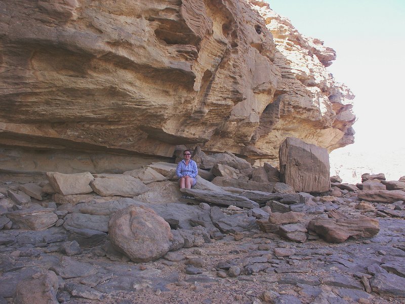
The morning started with a nasty surprise. Magdi's right eye was inflamed and swollen to the size of a pingpong ball, and she was unable to open her eyelid. Even though we had several cases of fly larva getting into eyes on the past trips, once they were removed there were no further symptoms. This time however Magdi's eves were badly infected, and we were as far away as possible from the medical chest containing the eye drops. After some discussion we decided to start a hasty descent by way of the "white spot", as that route is the easier one. This also allowed for a quick pass by the large shelter found in March 2004.
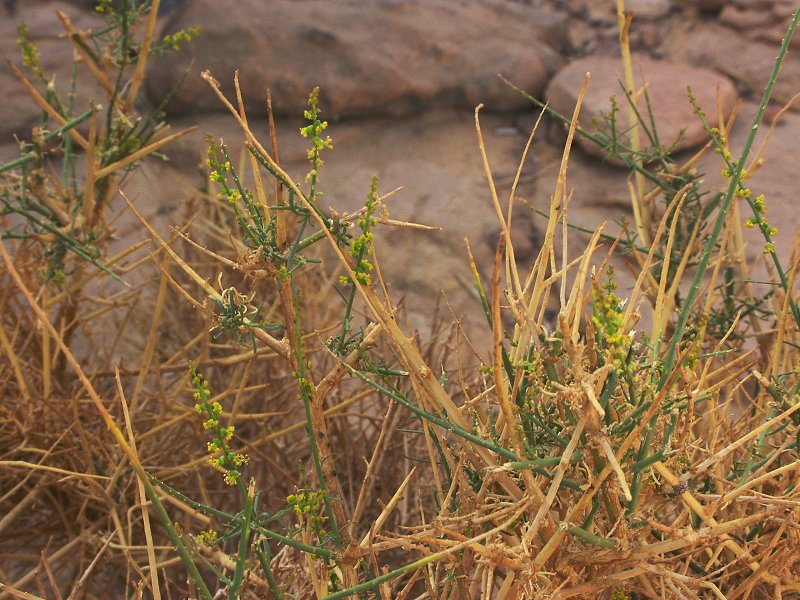
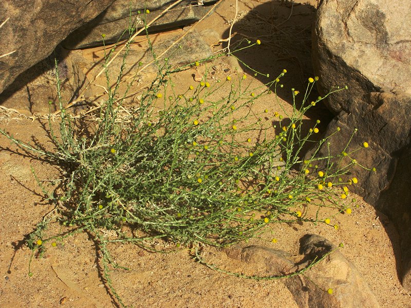
As we passed the large guelta near the shelter, we noted that the unidentified plants growing in the valley were sporting little yellow flowers, finally enabling a positive identification (Ochradenus baccatus).
With Magdi having no sense of depth of field, the descent was very long and arduous over the loose scree at the base of the cliffs. We finally limped in to camp just before dusk.
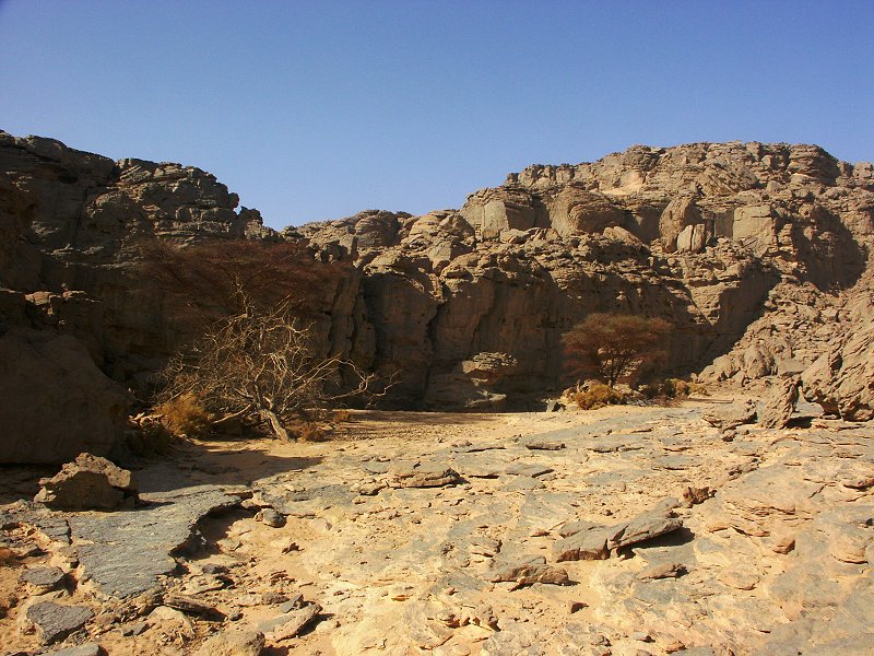
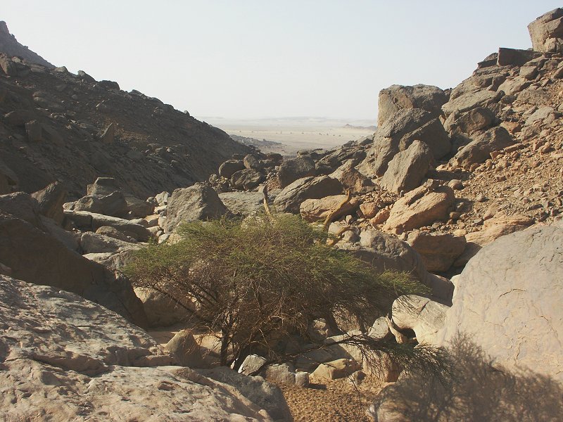
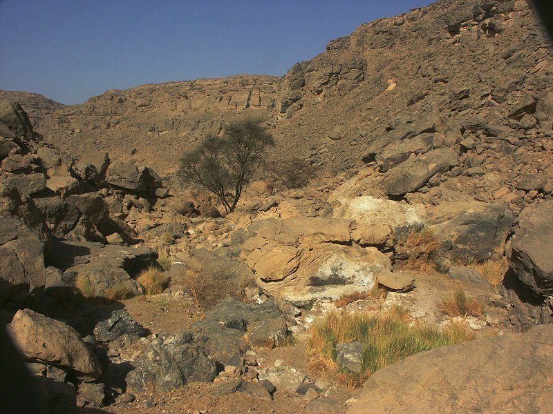
Day 6 - 7. - Exploring the Wadi Wahesh
Fortunately the antibiotics did their work quickly, by the next morning Magdi could even manage a smile with both eyes open, though perhaps not quite fit for a beauty contest yet. Much relieved, we continued to the southern side of the mountain, making camp at the mouth of Wadi Wahesh, to continue the exploration of the valley beyond the point reached in November 2004. Late morning we thoroughly explored the mouth area, and found several sites that were unnoticed the last time, including a shelter with "roundhead" paintings.
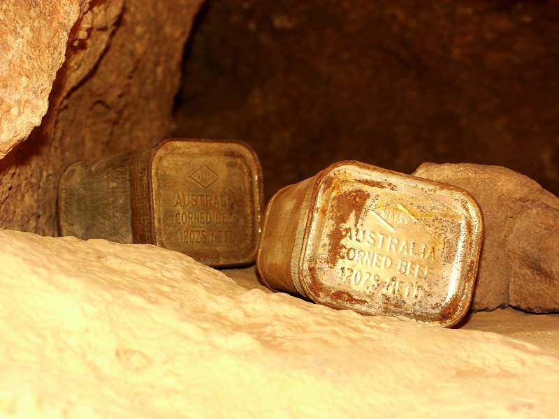
In the afternoon we visited the rock art sites further west, found in November 2004. At one shelter we noted, that we were not the first to see them in modern times: on a ledge inside the shelter there were two empty WWII vintage australian corned beef tins, most probably left there by drivers of the Kufra supply convoys who used the site as a shelter from the sun.
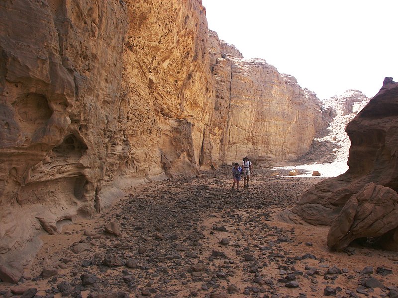
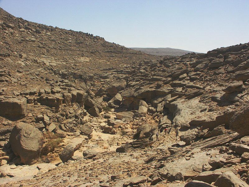
Next morning Attila, Gábor and myself set out to explore the upper reaches of the wadi. The going was extremely difficult, with house sized boulders choking the valley bottom. We soon realized why the Belgians gave the wadi it's name ("The bad wadi"). It took several hours to cover the torturous two kilometres, until the wadi rose to the level of the first sandstone scarp capping the underlying granites. Along the way bad luck in the form of flies reached me too - one scored a near hit on my nose, but I could not wipe the larvae off quick enough, and a few made it into my eye. It took a while to get them out, but it seemed I got away without much ill effect.
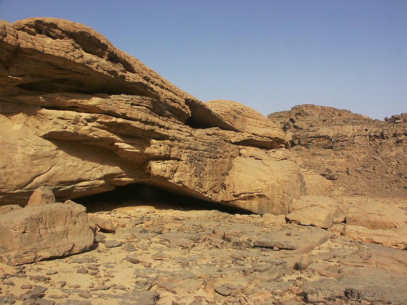
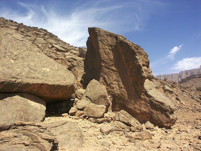
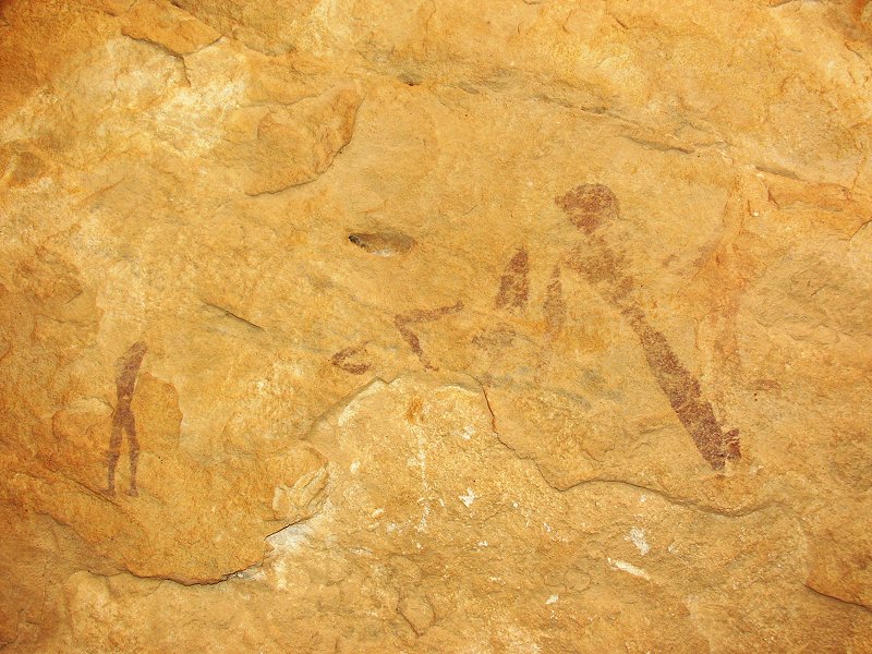
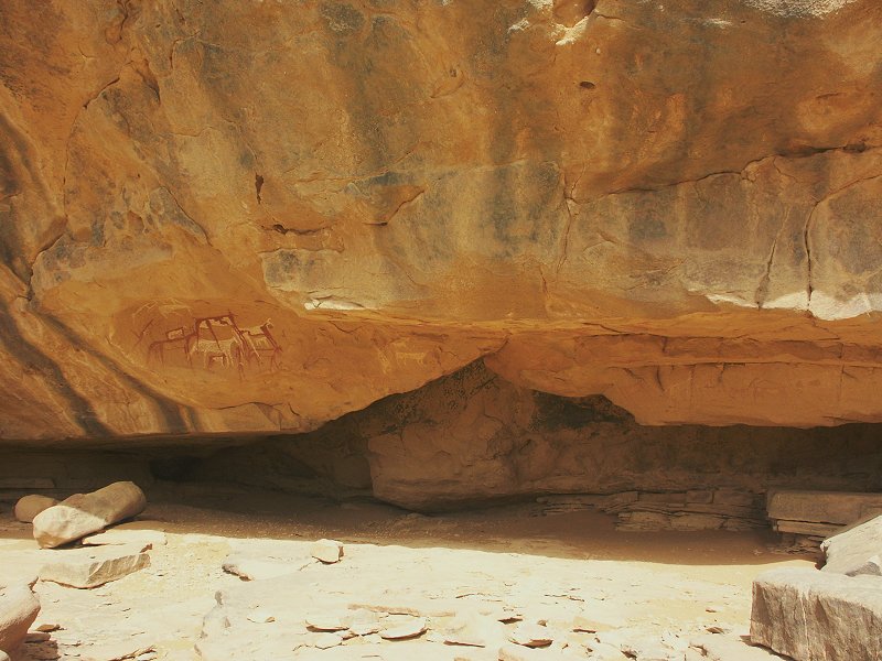
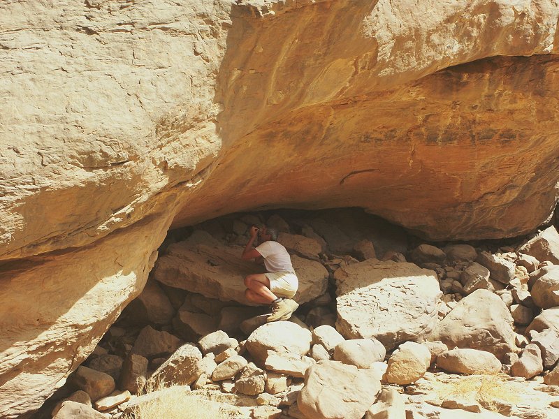
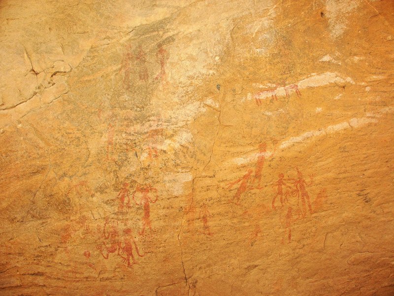
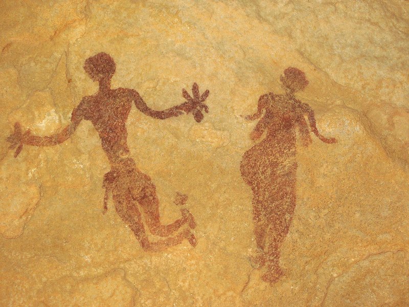
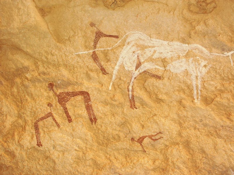
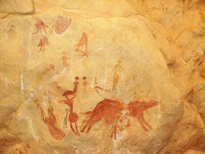
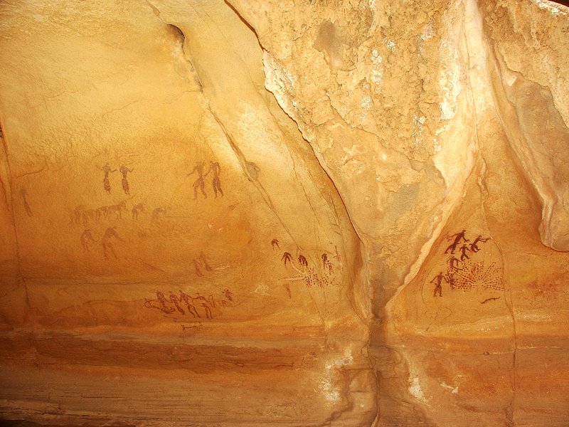
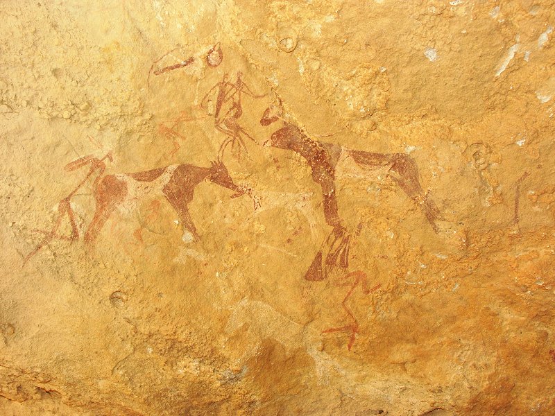
As the wadi levelled off, we noticed a big boulder with a shallow shelter in its side. It contained very strange paintings, red figures with very exaggerated hands and feet, unlike anything we have seen before in the region.
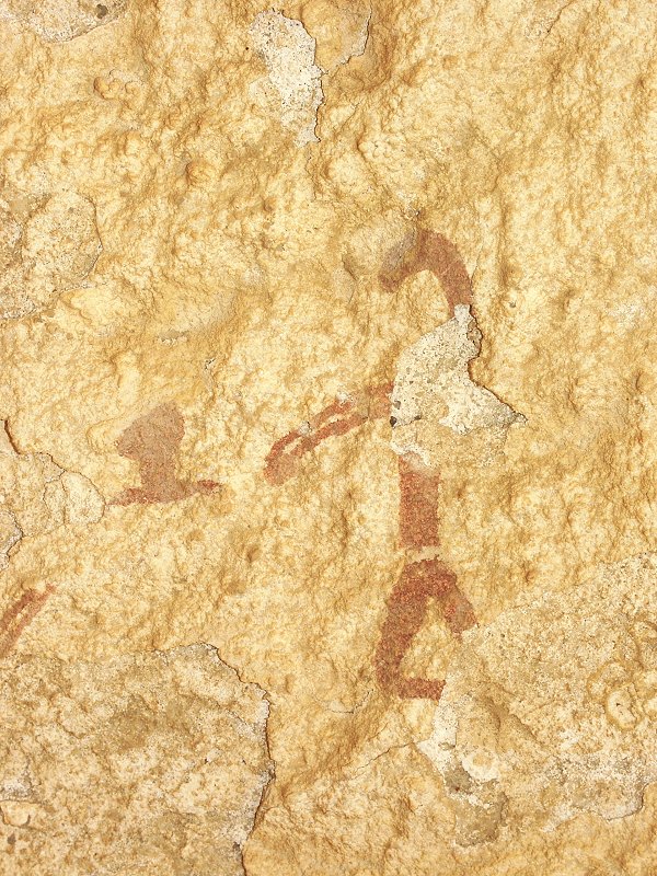
Immediately upstream, we noticed a very long shelter along the wadi side. This proved to be the most spectacular find, as the ceiling was covered for practically its whole length with paintings, many of them in the same new style. Many of the figures bore some similarity with the Wadi Sora style, and the resemblance was further strengthened by the presence of negative handprints, executed in yellow.
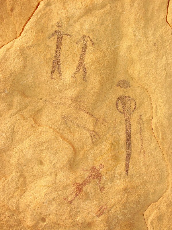
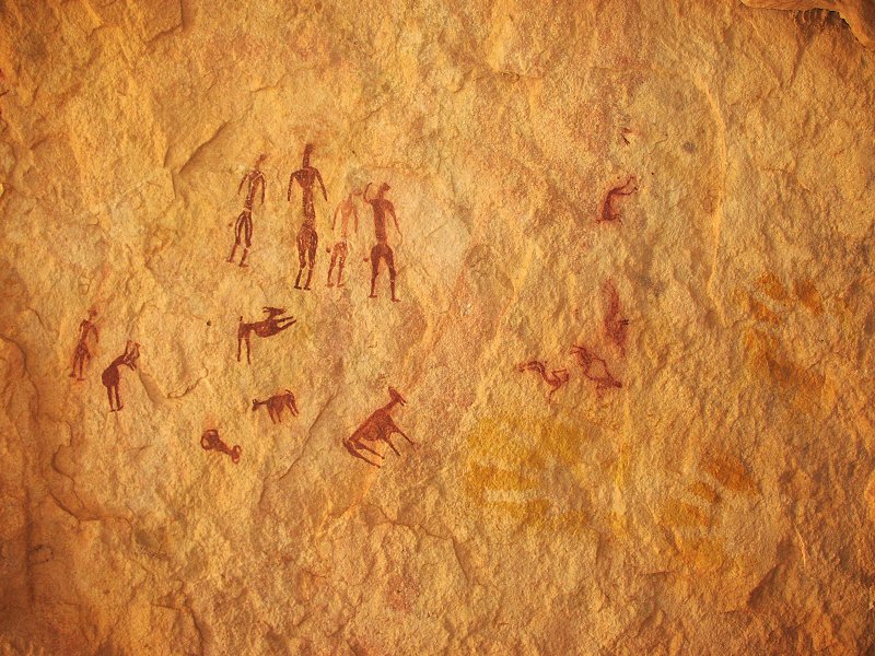
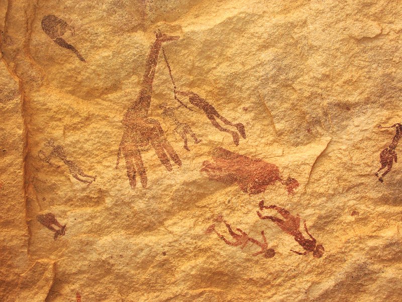
There were several further shelters upstream in the immediate vicinity, mostly containing cattle herder period paintings.
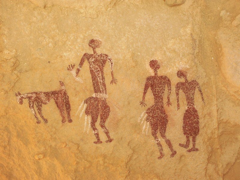
The last shelter was a little removed from the main grouping, containing very well preserved scenes of this curious new "Wadi Wahesh style" paintings.
Day 8. - Karkur Murr - Wadi Sora
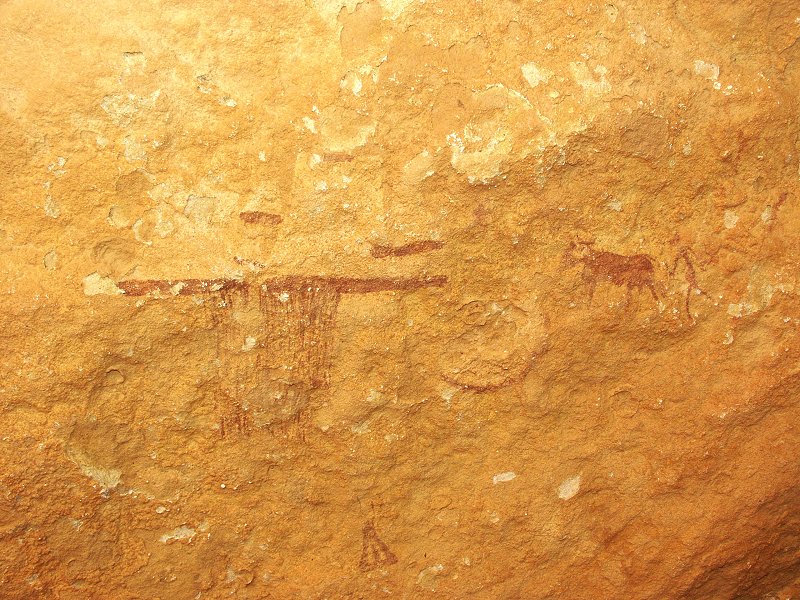
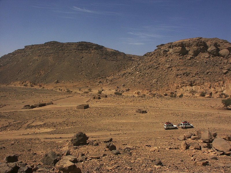
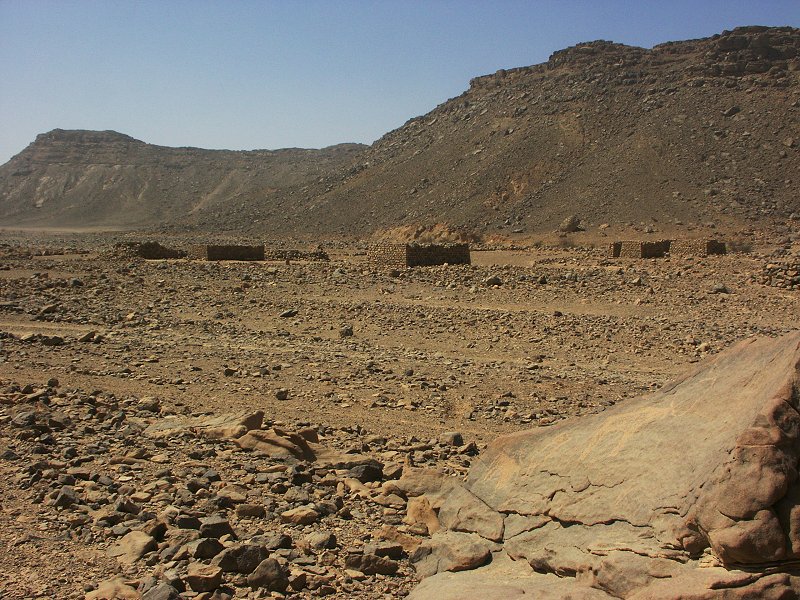
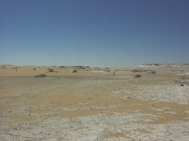
The pattern continued, despite no signs the previous day, by morning my eye looked just as bad as Magdi's three days earlier. Fortunately it looked worse than it felt, and with frequent doses of eyedrops it was only a nuisance. We moved to the mouth of Karkur Murr in the morning, and while the others went to visit Bir Murr inthe upper reaches, I went off to explore the eastern branch draining the large basin south of the Karkur Talh watershed. Following a rock filled ravine the wadi flattened out, and along the south side there was a shelter with well preserved paintings of the cattle period.
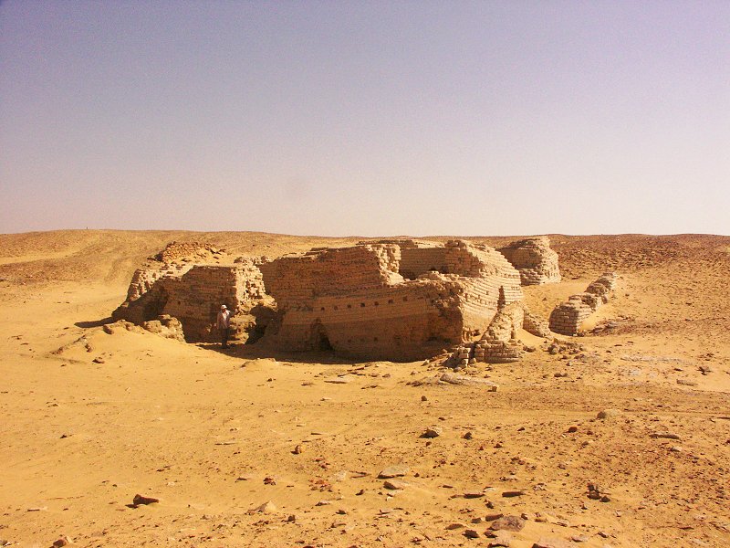
As the others returned, we explored the SDF camp established by F.G.B. Arkwright in 1934. Not far from the huts there is a series of fine engraved cattle, I'm surprised noone has noted them before. A little further out, on the side of a hill, we found the insignia of the No. 1 Motor Maghine Gun Battery of the SDF, and alonsgide another unidentified unit.
In the afternoon we continued north towards Wadi Sora, stopping only at the golden dunes near "three castles" for a stretch.
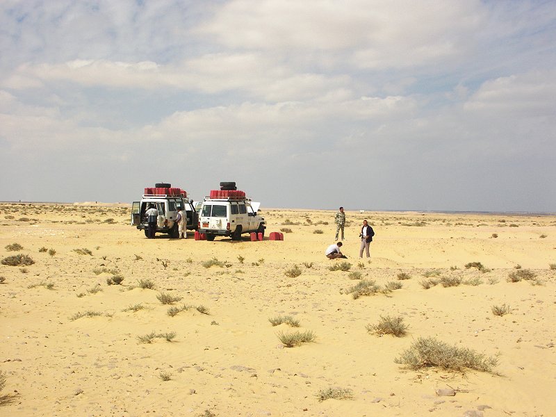
We made camp near the new Wadi Sora shelter mid-afternoon. I went to take a short nap in the shade of a small rock, but soon Khaled came calling after me. From what I could make out, some french people arrived, and I was needed as noone understood them. As I walked back to camp, I saw a Toyota pickup with several Sudanese and a single European, who walked up to me, and summarily stated "Nous sommes perdus !". I could hardly beilieve my ears - lost ? here ? After all the centre of the most arid part of the Sahara is not exactly a place one goes off for a little afternoon stroll... As we started talking, an incredible story emerged: a French group started out from Dongola with two vehicles and a local guide to visit Uweinat. They too intended to visit Darfur, but the events made them change plans, and visiting Uweinat sounded like a good idea. In the haze the 'guide' missed Uweinat, and even though some members of the group reading their GPS raised concern, they pressed on at the insistence of the guide. They saw our fresh tracks, and leaving one car with the bulk of the group, they followed them to our camp. They were quite astonished to hear they were almost 200 kilometres north of Uweinat. They were obviously distressed, so I asked Khaled to accompany them to the remainder of the group, and guide them back to camp to assess the situation.
The remainder of the group (some eight in all) returned after two hours, they were left behind somewhere near "three castles". The second car turned out to be a very dilapidated model -80 Landcruiser. The group were 8 Europeans and five sudanese between the two cars. The tires were pumped rock hard, explaining why they took so long to arrive. They had ample water left, but only 80 litres of diesel for the two cars! Apparently they were told that there is fuel at the "Sudanese checkpoint" at Uweinat, and they only carried enough fuel to get there. It is extremely fortunate that they caught up with us there - had they followed our northward tracks a day later, they would have ran out of fuel at the northern Gilf, 300 kilometres from anywhere.
After a sundowner and a dinner together the spirits were suitably raised to discuss their options. Actually option - there was no alternative but to go straight for Kufra, as their fuel reserves were insufficient for anything else, and we could not spare any of our precious reserves. There was much discussion among the group and the Sudanese, but finally they accepted the fact, and we agreed to start out together, and guide them to a point over the Gilf foothills from where they can take a straight and easy course for Kufra.
Day 9. - Wadi Sora - Silica Glass area.
In the morning we set out north via Mushroom rock and "Bab al Misr" together, and at the spot where the tracks of the SDF convoys left our course to Kufra we parted, wishing them a safe journey.
Some weeks after our trip I received an email from a member of the group notifying us that they made it safely to Kufra, but only with one car, as the Landcruiser broke down 100 kilometres before Kufra. They had a surprising welcome in Kufra from the Libyan authorities, were free to move about and recover the Landcruiser until the visa applications were processed via the French embassy in Tripoli. With visas approved, they could fly out in three days, while the Sudanese drivers and 'guide' returned to Dongola via Uweinat.
We ourselves had an uneventful trip up the western side of the Gilf, then through Wadi Gubba to the edge of the Great Sand Sea.
Day 10. - Silica Glass area.
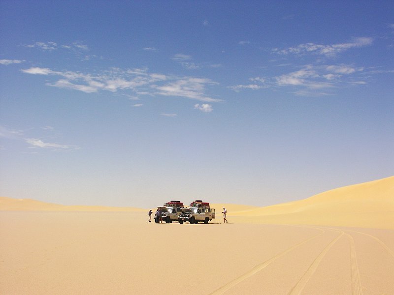
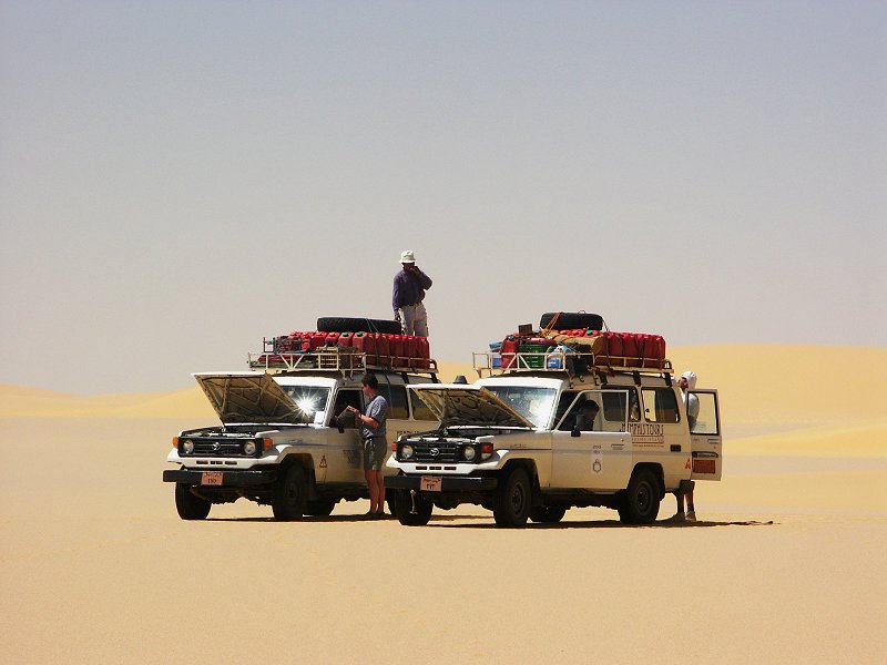
We spent a day among the big dunes and corridors in the Silica Glass Area. Since the day before the weather has turned bitterly cold, and all our previously unused warm clothes were needed to survive the evenings.
Day 11. - Silica Glass Area - Big Cairn.
In the morning we started the drive north along the western edge of the Great Sand Sea, camping in the vicinity of "Big Cairn".
Day 12. - Great Sand Sea.
We continued north, and soon entered the sandy corridors between the dunes. We had no difficulties, and camped 30 kilometres to the south of Siwa.
Day 13. - Siwa.
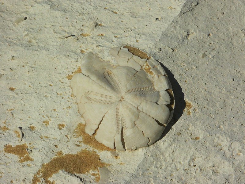
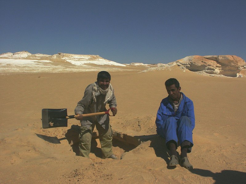
In the morning we spent some time at the fossil bearing chalk outcrops to the south of Siwa, while Salama and Zayed amused themselves by digging a big hole in the sand for no apparent reason. Later in the morning we drove to Siwa, and spent a leisurely afternoon in the oasis.
Day 14. - Siwa - Cairo.
The last day was spent driving to Cairo, only stopping briefly to fuel the cars from the last remaining jerrycans on the Alamein - Wadi Natrun road.
An article describing in detail the paintings found in the upper Wadi Wassa was published in Sahara 16