
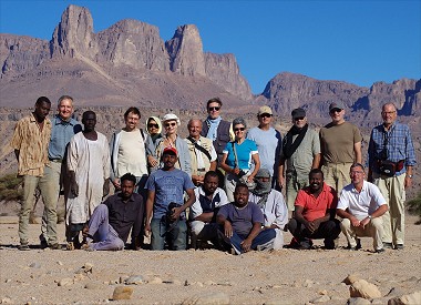
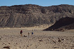
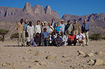
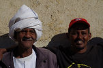
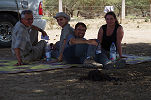
 Click on image for list of participants |
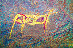
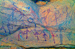
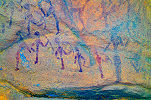
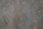
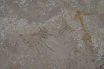
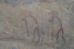
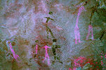
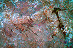
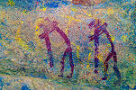
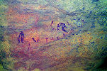
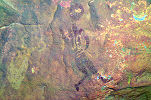
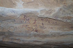
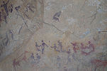
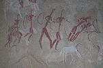
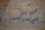
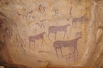
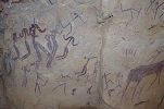
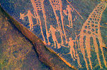
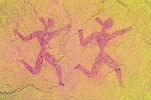
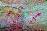
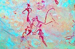
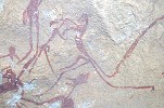
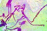
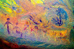
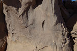
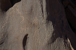
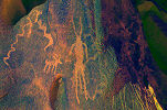
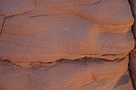
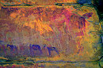
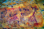
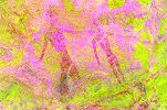
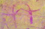
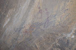
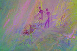
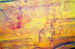
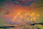
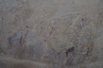
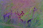
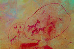
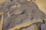
Jebel Uweinat Expedition, Sudan 16th November - 5th December, 2017 False colour images processed with dStretch, a freely available software developed by Jon Harman |
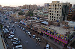
Day 1. - Khartum - Soleb
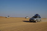
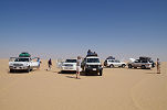
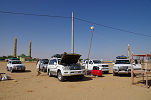
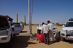
Our party arrived at various times the day before or overnight. With the cars having been packed the evening before and paperwork much swifter than on our previous experiences, we were ready to depart by 9am and were hoping to reach Soleb by the evening, a feat accomplished in two days on previous trips. There were more checkpoints along the Omdurman - Dabbah road than last time, and while the encounters were in good spirits and they took just a few minutes, the frequent halts slowed our progress considerably. By lunchtime we only reached the half-way point rest-house at Tam-Tam, which is slowly growing into a small city along the road.
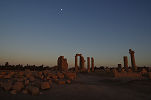
After lunch we continued on the road, passing the Nile junction and turning towards Dongola without any stops. We made much better progress than in the morning, but it still took till sunset to cover the 500 kilometres from Khartoum. Having ascertained over the phone that diesel was available at the miner's camp North of Soleb, we decided to continue for the remaining 100 kilometres after a dinner at one of the small street restaurants in Dongola. It turned out to be a good choice, we reached the expedition house beside Soleb temple around 9pm.
Day 2. - Soleb - camp near "Egyptian farm"
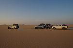
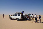
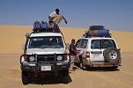
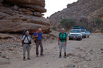
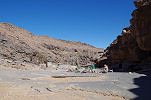
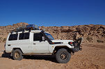
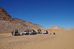
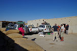
Our cars left in the morning to fuel and fetch water at the gold miners' camp about two dozen kilometres North of Soleb. While they were away we took the time to visit the temple and re-pack our supplies in an organised manner for easy access. The wait for the cars turned to be a fairly long one, we finally received a call that the electric pump was broken at the filling station, and we had to uplift 2000 litres of diesel into the large jerrycans with hand-crank. It was well past midday when the cars finally returned with all the needed fuel and water, after a quick lunch we departed for he turn-off point about 45 kilometre North of Soleb.
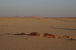
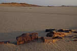
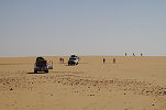
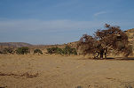
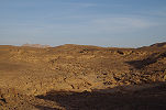
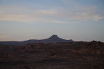
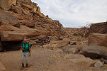
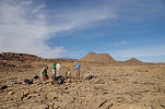
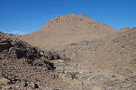
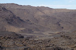
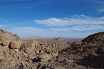
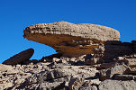
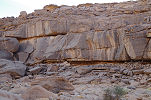
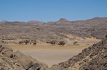
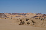
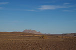
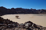
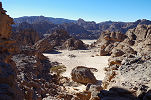
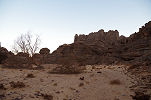
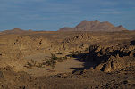
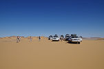
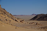
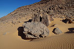
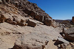
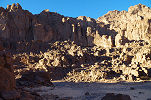
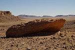
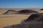
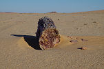
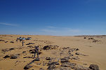
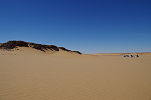
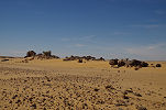
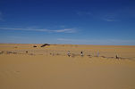
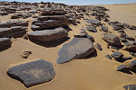
We had no particular goal to reach, after leaving the tarmac road and lowering the tyre pressures we set out on a course roughly following the main truck route to the gold mines near Uweinat, but keeping to the side a bit to avoid the deep ruts made by the heavy vehicles. We managed about two hours of driving, generally in the direction of Selima oasis, reaching the area of fossilised trees littering the desert by the late afternoon.
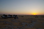
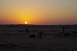
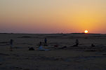
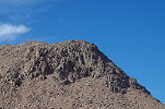
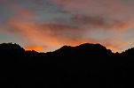
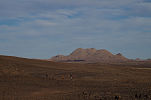
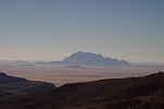
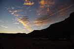
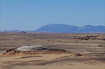
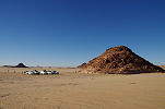
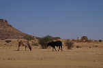
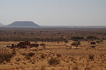
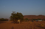
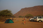
It was getting close to sunset, with not much choice in the generally flat desert we headed to the foot of a low hillock to make camp as the sun disappeared. After nightfall we could see the lights of the "Egyptian farm" on the horizon, a large circular irrigation project to the South east of Selima, very much like East Uweinat to the North of the border.
Day 3. Selima Sand Sheet
In the morning we were up at sunrise, quickly taking breakfast and packing up to make the most of the daylight.
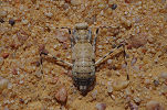
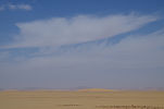
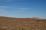
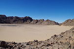
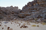
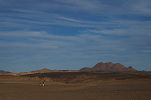
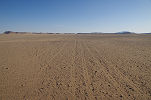
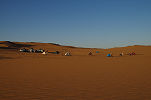
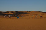
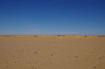
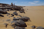
The rest of the morning was completely uneventful, we passed the rocky country to the south of Selima Oasis and reached the vast flat expanse of the Selima Sand Sheet, only stopping briefly to fuel the Hi-Lux which had a much smaller tank than the Landcruisers. During the stop we saw a large desert mantid (Eremiaphila species) which untypically stayed still long enough to take a few good photos.
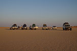
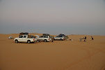
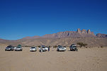
We made another stop at lunchtime in the lee of one of the large barchans marking the mid-point between Selima and Jebel Uweinat, also using this longer stop to fuel all our vehicles.
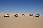
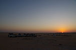
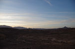
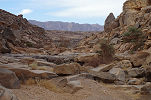
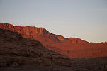
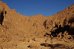
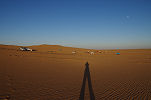
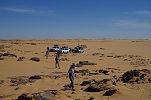
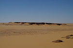
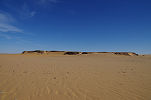
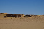
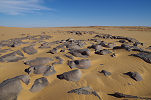
Continuing, we reached the dune barrier at about 27° East mid-afternoon. We followed the edge of the dunes north till a point where a passage (and fresh tracks) appeared to offer an easy crossing. This was not to be, despite the warnings to our drivers keep their distance we managed to get three of the six cars stuck to their floorboards in a patch of soft sand. The ensuing recovery took more than an hour, and by this time the sun was getting rather low, so rather than risking another attempt we made camp in a suitable patch among the dunes. The weather turned markedly cooler from the previous days, we had a cold wind throughout the night with temperatures dropping to just a few degrees above zero.
Day 4. Selima Sand Sheet - Jebel Uweinat
The next morning we circumvented the northern tip of the dunes, having to pass in the deep ruts made by the passing trucks in the very soft sand. At the very tip of the dunes we were surprised to find a small hut with a row of drums of water and diesel guarded by two people. Some enterprising Sudanese decided to set up shop here to cater to the gold miner traffic.
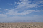
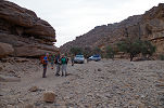
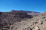
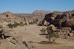
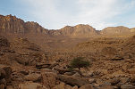
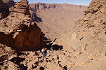
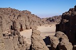
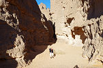
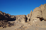
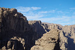
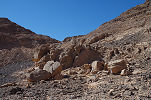
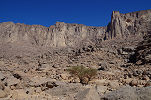
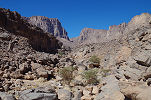
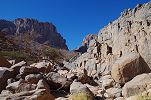
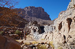
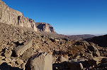
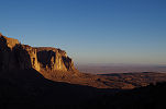
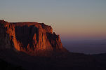
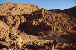
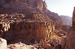
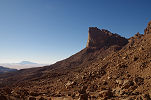
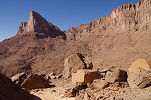
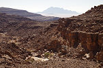
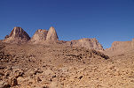
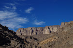
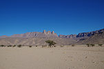
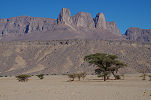
We did not stop, struggling in the soft sand for several kilometres beyond the dunes until hitting firm ground again. We only stopped to fuel the Hi-Lux, then continued towards Uweinat which soon appeared on the horizon. Making a wide loop around the gold miners' town and the surrounding mines, we passed unseen into the valley flanking Ras el Abd, and entered Karkur Talh by the "back door", reaching our campsite in the south-western branch by lunchtime. It was much faster progress than the 4.5-5 days required on previous trips from Sudan, approaching the 3 days needed in the old days from Cairo to Karkur Talh.
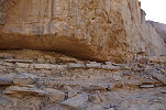
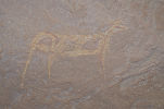
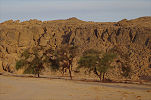
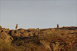
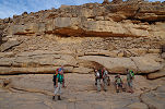
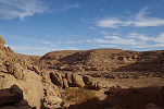
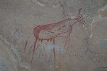
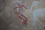
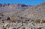
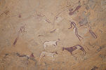
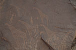
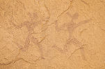
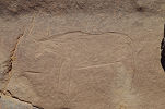
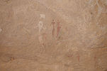
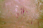
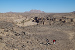
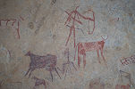
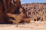
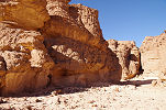
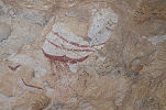
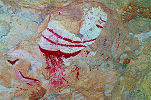
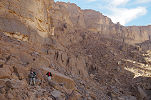
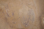
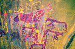
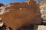
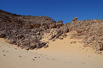
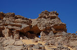
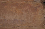
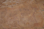
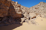
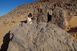
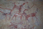
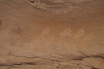
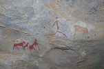
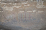
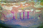
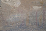
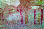
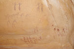
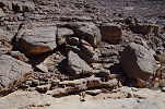
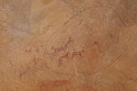
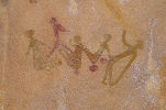
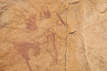
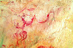
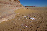
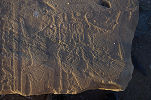
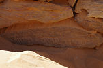
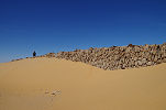
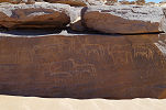
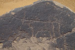
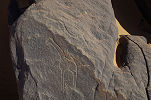
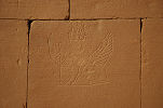
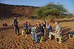
With our arrival as planned, we had ten useful days at Uweinat, which we intended to split between visiting the principal known sites, making some treks to the upper parts of the mountain, and exploring some remaining blank spots. As nearly everyone of our party visited Uweinat before and had a good understanding of the terrain and sights, we planned to split into smaller groups to match personal interests. After lunch and making camp we all set out to visit sites in the vicinity. Not far from camp we passed a large shelter which I'm sure we have checked out about a dozen times to find it empty, yet this time I was surprised to spot a fairly well visible cattle, unusually executed in a yellow & red colour (designated site KT 91/G).
I had a fairly long personal to-do list, needing to re-photograph some sites for the planned Third Edition of rock art catalogue. With some of our party we proceeded past the row of engravings along the southern side of the valley towards the group of sites I have found in November 2004 in the small South eastern side valley from where the camel trail continues to Karkur Murr.
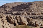
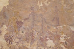
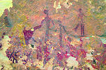
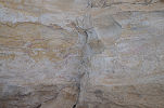
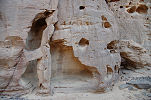
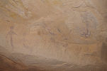
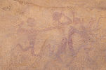
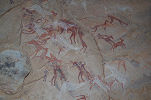
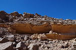
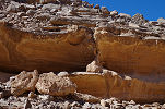
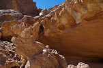
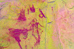
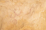
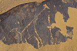
The first of the sites is in a small shelter along the edge of a terrace above the valley floor, hidden from below, with a small Tibu storage hut in front of it. I have not visited this site since its discovery in 2004, the photos taken at the time showed a number of very faint "Uweinat roundhead" figures. On the present higher resolution photographs dStretch shows a multitude of other figures not visible to the naked eye.
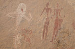
We continued to site KT 99/C, a large East facing shelter deeper inside the valley past the camel trail junction. I have briefly re-visited it in October 2006 with Jon Hales, but the taken photos were not satisfactory, this side too was badly in need of some good high quality photos.
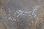
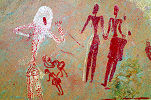
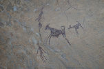
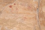
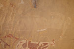
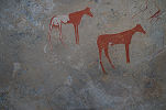
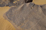
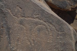
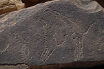
The site contains a number of very interesting but hard to discern archaic scenes, including a number of "elongated roundhead" figures which have not been noted before.
We only had some time for a brief visit to site KT 99/D on the far side of the valley (with some interesting miniature style paintings), then had to make our way back to camp before nightfall.
Day 5 6. Trek to upper North-western Karkur Talh
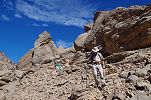
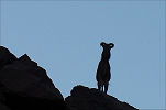
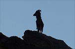
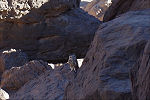
In the early morning half of our party set out to make the climb to the cluster of sites discovered in November 2009. There still remained a large adjacent unsurveyed area, and the relatively easy trek was also a good warm-up to the planned climb to the Hassanein Plateau. We started shortly after sunrise, driving to the end of the motorable section of the North western branch. Along the way we spotted two waddan (Ammotragus lervia) dashing up the valley side. Sitting on the roof rack (with some anticipation...) I could snap two lucky shots before they disappeared on beyond the top of the cliff.
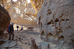
Leaving the cars, we set out along the riverbed towards the Belgians' sites, then further upstream along the wadi. We made few stops, the majority of the engravings and paintings were left for the return the next day.
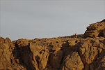
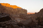
Before the big right turn of the valley where we needed to ascend to the plateau top above, we passed a long shallow shelter which we passed several times before. From below it looked completely empty and unsuitable for any paintings, and for some strange reason none of us ever checked it out close-up. This time I decided to drop the pack and climb up while the others waited below, and was rather surprised to find a number of faint but well preserved "Uweinat roundhead" style figures on the rough rocks of the rear wall of the shelter (designated site KT 89/D).
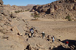
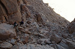
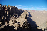
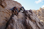
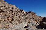
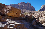
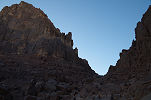
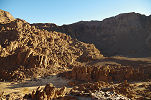
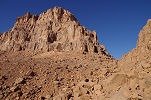
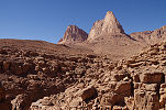
After the lucky find we scrambled up the bouldery pass to the plateau top, aiming for the prominent pair of basalt hills, with the valley passing between them in a narrow gorge.
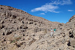
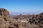
This time the weather remained pleasantly cool, with thin clouds coming and going in front of the sun. This allowed a faster going, not needing to stop in the shade so frequently, and also our water consumption was much less than planned. We left a bottle each at the bottom of the steep part of the climb before getting up to the small side valley hiding the concentration of paintings. We reached the main site past midday, and after a quick lunch and a short rest set out to explore the rocky hill to the North of the valley and the sites. We have explored parts of this area (successfully) in March 2010 and (without finding any further sites) in November 2015. Satellite imagery showed some promising rocky areas flanking a high terrace of the far side of the hill, it required some climbing to get up to it. Reaching the col between the two branches of North-western Karkur Talh, we had a superb view down into the basin formed by the Northern branch. There also were a number of good shelters formed by large boulders, and the surface artifact scatter clearly indicated human habitation. However, the rock was soft and crumbly everywhere, unsuitable for the preservation of any paintings. We checked out a number of shelters that looked very promising from a distance, but very clearly the area while living up to expectations in terms of landscape, was void of any rock art.
We returned to the principal shelter (KTW 51), and spent the remaining daylight visiting and photographing the cluster of sites found in 2009.
We spent a rather cold night in the small protected sandy patch in the riverbed below the principal site, awaking as the sun rose. While the others waited in their sleeping bags for the sun to make its presence felt, I re-photographed the principal site (in 2015 I left my camera on a high ISO setting, rendering the photos useless for dStretch).
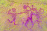
After the sun warmed us up a bit, leaving our packs we climbed up to the large "Uweinat roundhead" site (KTW 55) we found in November 2015, one of the finest panel of paintings of this archaic style.
Mid-morning we started making our way down, in order to have some time left at the Belgians' sites before returning to the car and camp. We stopped for lunch and a little rest on the smooth rocks of the canyon between the basalt hills (unlike other times, it was so cool that it was pleasant to lie on the warm rocks on the sun), then we continued down the valley and along the plateau towards our new find of the previous morning.
We reached the Belgians' sites mid-afternoon (meeting Rosa and Santi there), allowing us a good hour and a half to enjoy and re-photograph the principal scenes.
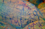
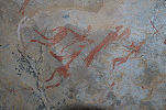
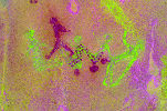
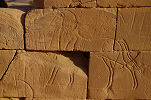
I have also taken some photos of the fine giraffe engravings (sites KT 88/A and KT 88/C) near the paintings, which turned out to be a perfect exercise in demonstrating the usefulness of dStretch in revealing faint engravings.
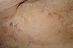
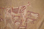
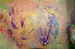
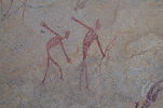
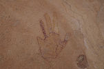
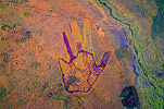
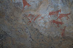
On the way back to the cars I took some time to re-photograph site KT 81/C with the unique positive handprints, and KT 81/B with the abstract-looking white cattle. We have walked past these sites over a dozen times, but have not photographed them since 2004.
Day 7. Karkur Talh - Western Karkur Talh
We were planning a trek up the Hassanein plateau the following day, and to make the climb easier we intended to make the walk to the end of the South western branch of Karkur Talh in the afternoon. After the long walk of the previous two days most elected to have a lazy morning in camp, while with Moez and one car we went to photograph some fine sites which we found with Salama in November 2003 and November 2004, and not visited ever since. We started with KTE 13, a large shelter at the sde of a low hill a few hundred metres East of the main valley (towards the entrance of the valley from Sudan) with a number of "Uweinat roundhead" style paintings.
On the far side of the same hill there is KTE 14, another large shelter with many pastoralist scenes, and two running "Uweinat roundhead" figures on the shelter ceiling with very strange, atypical heads.
Returning to the main valley we drove to the bottom of the slope under KT 14, a very fine site that takes some serious scrambling to get up to. On the rocks below the shelter I noticed an engraved cattle that was not recorded before, plus many new details in the unique paintings that were not visible on previous photographs.
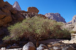
Before returning to camp we passed by the lower part of the main valley, where there still was some vestige vegetation of green colocynth plants (Citrullus colocynthis) from the 2014 August rains, though no longer flowering or bearing fruit.
After lunch a somewhat diminished trekking party set out towards the West, after the rather strenuous experience of the past two days the remaining ones electing to visit sites in the valley rather than make the difficult climb. We took the usual route across the low plateau to the rock art sites at the western end of the valley, by the way of the solitary Maerua crassifolia marking a spot where water must collect after rains in a shallow water channel.
We made our bivouac in the sandy spot in front of site KTW 24, then set about to see the paintings until darkness fell, including the unique dog on leash, one of the earliest known such representations.
Day 8 - 9. Ascent to Hassanein Plateau
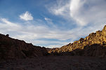
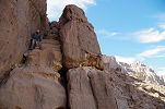
After a cold night we started out at dawn towards the towering cliffs, still wearing everything we could put on to keep ourselves warm. It was well below 10 degrees as we trudged upstream along the riverbed then up the scree slopes towards the dark gash in the cliffs hiding the way up to the plateau top. We continued in the shadow of the mountain, reaching the bottom of the scree slope then slowly making our way up the steep and difficult ascent. It was late morning by the time we emerged once again into the sunlight at the top of the ascending chimney.
Reaching the main valley of the plateau we dropped our packs (and ourselves) in the little sandy crevasse used previously as the bivouac spot. Unsurprisingly the lower grinding stone last used as our dinner table ten years ago was still there, as was Salama's stick used for making bread. While the others took some rest and a quick lunch, I made a round of the group of sites in the South east corner of the sandy plain, and found a panel between two of the sites which we have missed on the previous visits.
In the early afternoon we set out without our packs to visit the circular "White Spot" at the Western end of the plateau. Climbing up along the only access way found by Salama in March 2004 we reached the dissected plateau top, making our way towards the east.
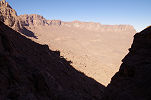
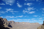
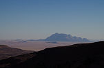
In my memory the way was much shorter (or simply I was 10 years younger...), it took us over an hour to reach the high point from where there was an unobstructed view towards the North and the East, with Jebel Arkenu just peeking out behind the North-western Plateau.
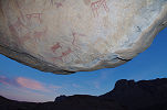
It took another half an hour to reach the top of the ridge from where we could finally take a peek into the "White Spot", with the grey patch of the eroded basalt pipe in its middle. Unfortunately we did not have enough time to reach the bottom and make it back to the bivouac before darkness, we had to console ourselves with the view.
I did manage a very quick dash down to the adjacent valley to visit the two sites (HP 11 & HP 12) we discovered in February 2003, finally obtaining the photos needed to have a proper look at the details with dStretch.
From the ridge we took our photos overlooking the "White Spot", then we started making our way back along the way we came to our bivouac in the main valley, reaching it just before darkness.
As anticipated we had a very cold night on the plateau. While the others elected to remain in their sleeping bags until sunrise, at first light I made a quick foray to gorge at the outlet of the valley, where we met with a dead end with Salama in March 2004, but discovered a curious site (HP 36) in this closed valley. Again in my memory the way was shorter, it took me a good forty five minutes and a steep descent to get into the gorge and reach the site which I have not seen ever since.
The paintings in the small low shelter are rather unusual. They consist of a group of "bird headed" human figures, recognisably of the Uweinat cattle pastoralist style, but drawn in an unusually stylized manner. The central figure appears to have an animal head and a long tail, unclear if it is a therianthrope (common in the central Sahara but there are no unambiguous examples at Uweinat) or just a human with some unusual appendages.
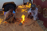
By the time I returned the others were warming themselves around a nice fire. After a quick breakfast we started our long descent along the same way as we came up.
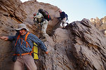
While we were scrambling down the steep narrow chimney the clouds put on a spectacular show, but it also remained very cold for most of the morning. We kept our jackets and fleeces on until finally emerging into the sunlit scree slopes under the cliff. By midday we were approaching the valley with the cluster of rock art sites, and could make out some small moving specks - the rest of our party visiting the sites.
We had a couple of hours to visit the cluster of sites before we had to start our return, allowing me to tick off a number of missing details at several panels.
Mid afternoon we started together on our way back across the flat dark plateau in the direction of the conspicuous hill along the South branch of Karkur Talh, making it back to camp well before sunset.
Day 10. Eastern Uweinat
After five days of trekking we planned a relaxing day to visit a number of sites along the Eastern edge of the mountain discovered by Flavio & Maria Emilia in February 2010. Not being in any hurry we packed up camp in a leisurely fashion and left Karkur Talh the same way we entered, through the sand filled "back door".
We started at the columnar sandstone rock in the centre of a large bay along the eastern edge of the mountain, which is almost completely covered with engravings all around. The most striking ones are a number of snakes (apparently horned vipers) which have no parallels elsewhere on the mountain.
We also visited the cluster of engravings at the end of the bay which we found in March 2010. On a subsequent visit in November 2011 Flavio & Maria Emilia found some further engravings in the general area on several rocks.
Descending the low scarp and the sand-filled pass between two outliers we continued towards Ras el Abd, then turned east into one of the valleys which we have not explored previously.
In this valley Flavio & Maria Emilia found a tunnel-like shelter in 2011 crossing from one side to the other along the crest of a ridge, with a number of engravings including a very fine row of ostriches scattered on the rocks leading up to the shelter.
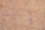
There is a large but rather damaged panel of pastoralist paintings inside the tunnel, but more interestingly a number of almost invisible archaic figures in a shallow shelter outside the western entrance of the tunnel.
After lunch we continued to the next valley further south, where Mark Borda found in October 2012 a very fine "Uweinat roundhead" site.
We visited this site in March 2013, but I only noticed an intriguing detail later when processing the photographs with dStretch. There is a pair of long-necked human figures holding hands, which I could now photograph close-up. They are unlike anything else seen among this style of paintings.
Along the side of the valley there is a cluster of rocks, on a different visit Flavio & Maria Emilia found an engraving of a giraffe on one of the rocks.
At the entrance of the wadi we passed by the large boulder full of Carboniferous plant fossils at the base of a larger hill found by Mark Borda during our March 2013 expedition, the finest example known from Uweinat.
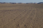
We left the valley to round the prominent volcanic hill of Ras el Abd. Cutting across the surrounding gravel plain we came upon a series of tracks that did not look right ... Something subconscious made me instruct our driver and the ones coming behind us to stop before our own tracks would have obliterated them. They were a series of very old narrow tyre tracks, my initial thought was Bagnold and company who passed here in 1931. However Bagnold's Fords had single tracks, while these were clearly double tracks. It took some time before it clicked: the only vehicles using double narrow tyres to have ever come this way were the Citroën B2 of Prince Kemal el Din, passing here in January 1926, more than 91 years ago! (Almásy's photo in his book Ismeretlen Szahara (Unknown Sahara) shows identical tracks attributed to the Prince).
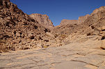
We continued past Ras el Abd, then along the rough rocky plain to the south of the mountain. It was late in the afternoon when we entered the Wadi Wahesh to make camp at our usual spot, at the very end of the drivable section among the grove of acacias in the riverbed.
Day 11 - 12. Wadi Wahesh
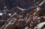
At first light our trekking party set out after a couple of warm cups of coffee towards the upper reaches of Wadi Wahesh. We trudged up the steep and difficult route along the scree of the slopes as the valley itself is clogged with house-sized boulders. It took us about two hours to reach the main group of sites in the upper Wadi Wahesh, found during our March 2005 expedition. Most of our party only came up till here and was planning to descend the same afternoon, while with Kent we planned to continue exploring the upper reaches of the valley, one of the last remaining "blank spots". Before continuing, we had a good rest inside the main shelter (site WW 52) with the multitude of figures covering the ceiling.
Late morning we started out with Kent, following the bouldery riverbed, making frequent detours to the scree along the side. Reaching the big left bend about a kilometre upstream of the main sites we started looking for a smaller site we found in October 2007 during our descent along the same way. Among the big boulders flanking the valley I came upon a large vertical rock wall with a panel of unnoted paintings, not far from the ones already known.
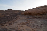
Just before reaching the now dry basin which was full of water in October 2007 I noticed a section of rock in the riverbed that looked a bit different than the surrounding sandstones. It turned out to be an outcrop of the underlying Precambrian basement, very similar in texture to the similar but lower lying outcrop in the South western branch of Karkur Talh. It must have been a local high point in the already eroded basement terrain when it was unconformably overlain by the Ordovican sandstones, the earliest layer of the sandstone sequence.
After about two hours from the start from site WW 52 we reached the rock with paintings (site WW 61) above a large dry waterfall, the highest point reached in 2007. Beyond here we were exploring unknown country (though J.Leonard did make it up here in 1968, but he only recorded the flora and we do not know the exact route he took). dStretch reveals many more figures at the site than what was known from the earlier photos.

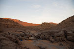
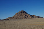
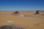
Continuing past the paintings, we climbed for about a kilometre in a fairly featureless section of the wadi, until we reached a wall-like barrier with a small step-like dry waterfall in the middle. On close scrutiny the rock turned out to be not sandstone, but some crumbly igneous rock, to my untrained eye most resembling the trachytes found in Clayton's Craters. It was almost certainly a volcanic dyke, probably related to the basalt plug of the "White Spot" (laterally a mere 1200 metres away) and the other basalt domes scattered about the mountain.
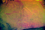
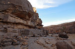
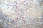
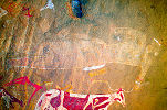
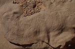
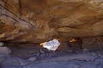
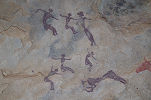
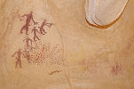
The smoothed volcanic rock formed the bed of the river for a good 100 metre section. Near the upper end a large sandstone boulder was perched on the edge of the gorge, with a deep shelter underneath that looked very much like a place one would find rock art. We were not mistaken, faint figures appeared as we approached, however they turned out to be something completely baffling. We could make out two large "Uweinat roundhead" figures, however they were apparently associated with a herd of white sheep-like animals, whether wild or domesticates is anybody's guess. The panel certainly has no analogies anywhere at Uweinat or the broader region.
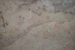
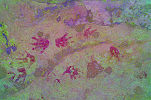
Under the lip of the boulder there was another shelter with a few very faint paintings, one of them a well recognisable drawn and elaborately decorated handprint (with a missing little finger) of the type also known from a few other sites at Jebel Uweinat.
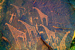
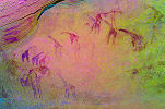
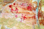
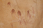
Climbing further, we came upon a pleasant flat terrace adjacent to the rocky riverbed that appeared to be a good living site. Once again our senses proved correct, on the side of the boulder bordering the terrace we found some remarkable paintings. There were numerous quite well preserved "Uweinat roundhead" roundhead figures which would have been interesting enough by itself, but here they were clearly associated with two giraffes, drawn in a style not seen anywhere else. This is the only known unambiguous association of these round-headed human figures with animals of any kind.
We were rather pleased with our finds, but we still had a long way to go to our target for the evening, the head of the Wadi Wahesh. The steep section started here, and for an hour we scrambled up ever higher among the large boulders and steep scree slopes. Looking back our altitude was evident, but still the valley was rising ahead of us. There was a large tree visible on the horizon, we decided to gather our last strength and make it up till there to at least see what is beyond, and make a bivouac there.
As it approached sunset and the cliffs turned deep red behind us, it became clear that the tree is beyond our reach. We picked a little sandy patch for our bivouac, and started preparing our places to lay out our sleeping bags, when Kent quietly whispered "there is a waddan behind you". Turning around it was an amazing sight - a large male waddan was standing on a rock up on the ridge beside the tree, gazing at us but apparently not afraid. There was a strong wind blowing from the west so it could not smell us, and probably even the sounds we made were blown away, as while snapping photos and slowly getting a bit closer we could even talk at a low tone without frightening the animal. We stared at each other for several minutes, until it thought better of it, slowly turned around and the next moment vanished from view.
The night was cool but after the effort of the previous day we slept like a log till dawn. Taking an assessment of the time needed to get up to this point, we reckoned that we must start on our way down at 9am, leaving us just three hours to explore the upper parts of the valley (in practice meaning an hour and a half to go further up, after which we had to return). Leaving our packs behind, we only continued with cameras and a bottle of water. We soon found out that the tree did not mark the top of the ascent, there was a further half an hour of climb up the steep section until finally we reached the part where the valley started to level off between the two high plateaus. In about an hour from start we reached the sand-filled flat valley which we identified as our target on satellite imagery.
We found nothing of interest in the valley aside the grandiose scenery and a few heavily grazed Ochradenus baccatus plants, hitherto only seen on the Hassanein Plateau. As we were about to turn back and start our descent, I spotted a large shelter at the base of the cliff a fair altitude above the plain. Fully expecting it to be empty, but also knowing that it would keep bothering me forever, I decided to make the climb up to the shelter, fully knowing that it would delay our return. Climbing up, the shelter proved to be larger than expected, resembling the big site (HP 21) on the Hasanein Plateau, with a magnificent view over the upper Wadi Wahesh.
At first the shelter did appear empty, but then near its middle section I came upon several small but excellently preserved groups of paintings, mostly cattle pastoralist scenes, but also some figures that appeared older. A little further on the outside there was an enigmatic panel which is very hard to decipher, even with dStretch
After taking very hurried photos of the paintings I scrambled down to Kent who was patiently waiting for the news below. We were well past our agreed turn-around time, so we made a rapid retreat along the watercourse, then down the rocky slope to our bivouac. Knowing the route made the descent faster, we were down by our packs just a few minutes past 9am. We took a quick breakfast then started descending the way we came up.
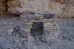
In October 2002 we already did part of this descent, on our way down from the summit after the unexpected encounter with the deep chasm of the Wadi Wahesh not evident from the available low resolution Landsat imagery. Then we dd not have any time to explore, just pushed on along the most feasible route to reach our camp in Karkur Talh. I remembered that we fund a relatively easy gong along a series of terraces at the foot of the Southern cliffs of the Hassanein plateau, so instead of following the riverbed we took the same route over the scree, in many places coming across the small stone markers of Salama who was leading our descent.
The chosen way was indeed faster, in an hour we were half way down, taking about half the time needed during the ascent in the more difficult riverbed. We even had time to explore the boulders along the series of terraces on the slope of the mountain. We found plenty of traces of the prehistoric inhabitants, but no further rock art sites.
We continued down the alternating scree slopes and terraces, diverging after a while from the 2002 route towards the valley, which we finally reached a little upstream of the big bend a kilometre or so before the concentration of rock art sites.
By midday we reached the Northernmost of the cluster of sites, WW 56. This site has a unique seting, the shallow shelter was once surrounded by a spring, which cleft thick deposits of calcareous tufa above the shelter and along the water channels. It is not yet known whether the spring was contemporary with the paintings of not, but we have retrieved some samples to find out.
We made our way down to the principal rock art sites, and once again made a base in the large shelter WW 52, taking lunch and a short rest before setting out to explore the other sites.
With the much faster than anticipated descent we had a relaxing two hours to wander about all the sites and re-photograph the many details, some of which were missed on previous visits.
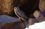
Mid-afternoon we started to make our way down the valley, following the little cairns set up to aid the rest of our party the day before. We were almost at the bottom when our approach startled a large bird that flew away with flapping wings, then alighted some distance away looking at us with curiosity. It was too far to make it out, but zooming in on the camera photo revealed it to be an owl. When I tried to make an approach it few away out of my sight, but fortunately Kent could follow it to among a cluster of rocks on the far side of the valley. Another look at the zoomed photos revealed it to be sitting in a dark crevasse. Leaving my pack behind I could get up to about 20 metres from it, with the photos revealing the gleaming orange eyes, before it took off again, this time disappearing into the distance. Later it was identified as a Pharaoh Eagle-Owl (Bubo ascalaphus), a species seen in 1968 by Xavier Misonne, and heard by Sherif Baha el Din in 2007, but none were ever photographed at Uweinat before.
We reached the camp well before sunset, spending our last evening at Uweinat exchanging stories of the finds and events of the past two days.
Day 13. South Uweinat - camp East of Uweinat
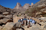
It was again very cold overnight, not being in any particular hurry we waited until the sun was up to take breakfast and pack the camp before starting out on our return journey towards the Nile. At the entrance of Wadi Wahesh we used the classic backdrop of the mountain to take our group photo, then continued Eastwards on the track.
Making our way along the southern foothills, we stopped at a couple of sites found by Mark Borda on some earlier visits, mostly the usual cattle pastoralist paintings with a few nice homestead scenes, and a few of the strange white and red blobs which are most likely representations of rain clouds.
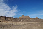
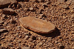
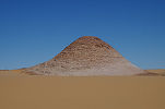
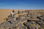
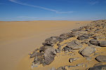
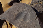
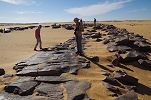
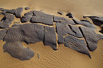
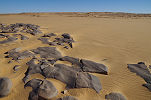
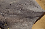
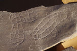
Taking a wide detour towards the south to avoid the gold mines and the mining town we drove to a cluster of conical hills which look very different from the surrounding dark sandstone mounds. They are the eroded remnants of the Silurian marine and near-shore layers (which may also be found in a thinner section at Uweinat). We parked at the foot of one of the hills to have lunch and explore the environs. The slabs on the hillside were full of the familiar Cruziana trace fossils, and a number of them showed a pattern of fossilized mud cracks.
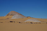
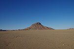
There was a particularly interesting perfectly circular white feature visible on satellite imagery on the far side of the hill where we stopped, in the direction of the mines. From the top of the hill it became obvious that it was just another low circular hill of the same white marine sediments. From the hilltop there was also a good view over the numerous mines in the distance, and the shanty town housing the miners.
On Google Earth it was possible to make out some possible stone circles on the top of one of the hills, but on exploring all the hilltops we found nothing. Reasonably satisfied that we have found everything worth seeing at these hills, we continued towards the East for the rest of the afternoon without interruption.
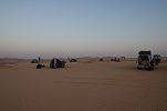
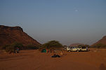
Around sunset we started looking for a suitable campsite about 80 kilometres to the East of Uweinat, not far from the dune belt at the edge of the Selima Sand Sea. With the generally flat featureless country there was not much choice, in the end we settled for a sandy patch between some low hills that barely offered any protection against the cold wind, but at least we were mostly out of sight from the main track.
Day 14. Selima Sand sheet
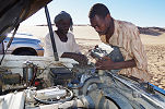
This was a long uneventful day, spent crossing the Selima Sand Sheet along the way we came. The cold started taking a toll on the car batteries, two out of the six refused to start in the morning, but a little African ingenuity did the job...
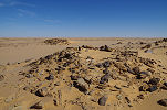
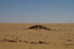
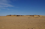
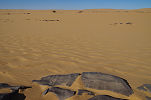
In the late afternoon we reached the cluster of low hills to the South of Selima Oasis, with a number of camel skeletons marking the old Darb el Arbain, the route of the Darfur slave caravans 150 years ago. We soon made camp among some low hills about 80 kilometres from the Nile.
Day 15. Selima Sand sheet - Soleb
This was our coldest night of the trip, we measured 2 degrees in the morning before sunrise, made worse by a chilly wind. We cuddled in the lee of the cars until the sun started slowly to raise the temperature to a bearable level.
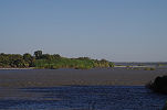
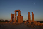
With our fast progress back across the Selima Sand sheet we reached the tarmac road late morning, and were comfortably settled into the expedition house at Soleb by lunchtime. As this was our reserve day in case we were to be delayed, we had a relaxed afternoon at Soleb visiting the temple and the Nile bank.
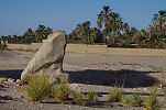
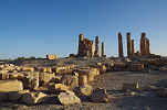
For sunset we all converged once again on the temple, then retreated to the comfortable house for dinner and the night.
Day 16. Soleb - Dongola - Wadi Howar
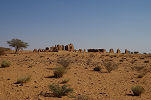
In the morning we thanked our hosts, loaded the cars and set out on the road south towards Dongola. Our plan was to visit the fortress of Gala Abu Ahmed in the lower Wadi Howar before returning to Khartoum by Sunday evening.
Being Friday, Dongola was mostly closed down, but we could find the most important things - some fresh bread and vegetables for the coming two days. While Moez and the drivers attended their chores we waited at the local coffee shop, then continued our way south. Near a village we made a lunch stop among a grove of palm trees, then continued towards Dibbah where we needed to turn West into the lower Wadi Howar.
The landscape we traversed changed completely since we last came this way in November 2015. A huge farm with circular irrigation fields sprang up along the ancient riverbed, continuing for a good 15 kilometres inland. This helped our progress considerably, as a fine new road was built where two years earlier there only was soft sand. We continued for another 20 kilometres beyond the farm, making camp at the foot of a group of hills about 50 kilometres short of our goal.
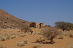
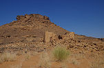
Day 17. Gala Abu Ahmed
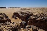
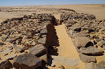
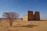
The next morning we covered the remaining distance to Gala Abu Ahmed in little over an hour, learning from our 2015 mistakes and avoiding the worst parts of the dune belt East of the fortress. Unlike last time, the weather was fine with clear visibility.
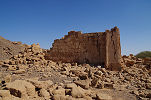
With plenty of time on our hands we started with a leisurely walk around the perimeter of the fortress, then moving in to explore the interior.

Along the wall of the main (Northern) entrance Rosa located one of the engravings reported by the excavators, which needed to be uncovered from the wind-blown sand once again.
In one of the Cologne University excavation reports there was a passing mention to some engravings located some 10 kilometres West of the fortress along the banks of the Wadi Howar. No further information or details were furnished, but we had the whole day for the area so could afford to search for them. We drove 10 kilometres North, where almost exactly at the indicated distance we found a prominent quartzite outcrop. There was nothing on the rock itself, but on the opposite bank of the dry riverbed we did find some crude engravings along some flat stones.
A few kilometres back Rosa spotted a panel of cattle as we drove along the river bank. We returned to take a closer look, and the site turned out to be a very rich concentration of engravings. For a stretch of about 200 metres the flat rocks along the Southern bank of the former river were densely covered with animal figures, mostly giraffe and cattle. We elected to have lunch here, and spend some time to thoroughly explore the area. It is not yet known whether we stumbled upon an unsurveyed site, or it was one of the localities seen by the Cologne team.
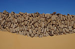
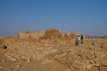
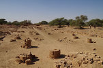
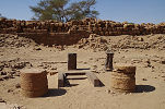
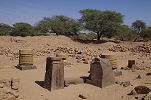
A short distance further back towards the fortress there was a large cemetery with a number of circular tumuli. They all appeared opened, but I found no reference to them in the excavation reports.
Mid-afternoon we returned to the fortress to take some photos of the Northern gate in the different afternoon light.
We finished our day at the smooth flat rocks of the riverbed a kilometre downstream from the fortress, which contain a large number of enigmatic abstract engravings.
Going through all these sites at a slow pace took up all our day, in the remaining hour of daylight we drove back to the came campsite that we left in the morning, at the half-way point to the road by the Nile.
Day 18. Wadi Howar - Khartoum
Starting in the morning we soon reached the road, and continued towards the junction of the Omdurman road, where we stopped to put air in the tyres and allow the drivers a proper breakfast.
From the junction we drove without interruption till the Tam-Tam rest house for a quick lunch before continuing towards Khartoum, which we reached mid-afternoon.
Day 19. Naqa - Musawwarat es Sufra
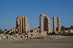
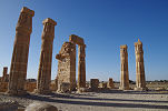
The Uweinat trip was completed, but there was an optional two-day add-on to visit the Meroitic sites North of Khartoum for those having a more flexible schedule. Kent and our Italian friends left with an early morning flight, however in exchange Magdi joined us, also arriving early morning. Uli and Zsolt elected to remain in Khartoum, so in the end it was seven of us who started out at 7am from the Regency Hotel. With the heavy traffic out of Khartoum and along the road leading North, it was approaching midday when we reached our first target, the temples of Naqa located about 30 kilometres inland from the Nile and the main road.
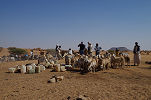
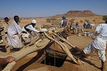
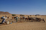
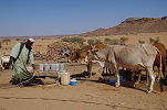
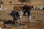
A major novelty compared to our last visit in March 2013 was the presence of cattle around the well, plus the replacement of most of the traditional ghirbas with plastic containers.
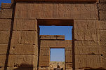
After a quick lunch we set out to visit the other side of the site with the reconstructed Temple of Amon, which was just a pile of rubble when I first visited in 1981.
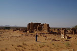
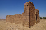
This time we also had time to visit the small ruined and undecorated temple at the base of the hill adjacent to the site. While the ruins were not particularly exciting, the flanks of the hill offered a superb view over the whole ancient town.
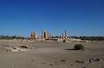
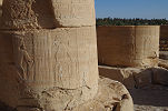
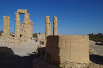
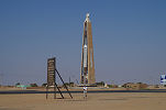
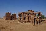
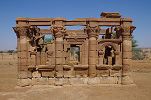
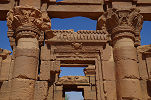
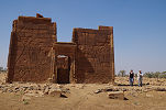
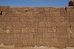
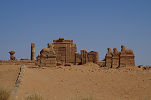
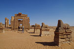
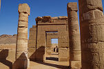
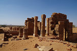
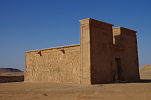
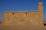
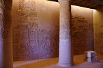
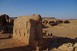
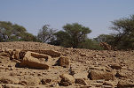
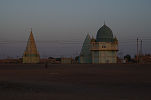
Mid-afternoon we continued to Musawwarat es Sufra, another Meroitic town and temple complex about 25 kilometres from Naqa among the hills, which I have not seen since 1981. This site too sports a lion temple with fine reliefs on the inside and outside walls, restored by an East German team in the nineteen sixties.
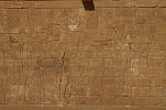
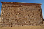
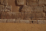
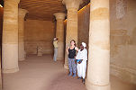
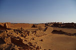
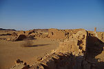
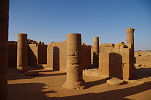
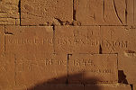
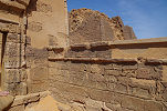
The main structure at the site is the Great Enclosure, a complex of buildings with an unclear function. The complex contains at least three temples, interconnected with a series of corridors, ramps and courtyards. The walls have been covered in many places with graffiti, some contemporary and ancient, but also one may find the inscription of the 1844 Lepsius expedition.
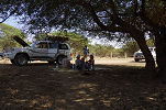
For camp we moved to a lush green wadi a few kilometres from the main ruins, the soft sand in the riverbed made it an ideal spot to pitch the tents.
Day 20. Meroë
In the morning we had some visitors to camp, several local children who were looking at us curiously, but not disturbing us in any other way. We had our breakfast then set out towards Meroë about sixty kilometres away.
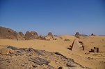
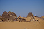
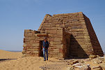
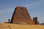
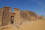
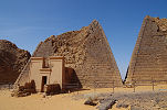
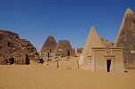
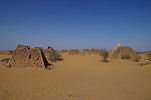
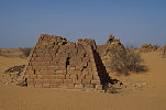
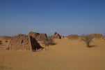
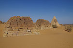
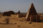
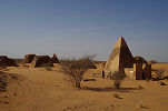
Arriving around 10am we had plenty of time to visit the Royal Cemeteries with the small pyramids. Here it was evident that much work was accomplished since our last visit in March 2013. All of the small funerary chapels in the Northern group (all of which were in ruins on my very first visit in 1981) have been now restored, and there was much consolidation work on the crumbling smaller pyramids. Work is now continuing in the Southern group.
We finished at the pyramids by midday, and said good-bye to Werner and Christian who had to leave with one car to catch a late afternoon flight in Khartoum. The rest of us had flights overnight or the next day, so we could afford to stay longer and visit the town site which was missed the last time. We had lunch beside the rear entrance, then spent a leisurely one hour going through the huge area. The cold of the desert was gone, it was full midday heat, most of the visit consisted of going from one shady tree to another. The town itself only has some rather meager ruins, the most impressive is the Great Temple of Amon, but nothing much changed since I walked about here 36 years earlier.
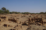
We finished our round of the Meroë monuments at the Western group of pyramids, the cemetery of royal relatives and courtiers. These pyramids are much smaller and more neglected, the few tourists who do come all go to the royal cemeteries.
In the afternoon we made the three and a half hour drive back to Khartoum, approaching the city at dusk.
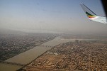
While the others left overnight, with Magdi we stayed till the next morning, catching the midday Ethiopian flight to Addis Ababa then on to Hargeisa for our next adventure.
Taking advantage of the current sitiation while it lasts, another expedition is planned to Jebel Uweinat from Sudan, tentatively targeted for March 2019. Please visit the planned itinerary page for more details, to be updated as new information becomes available (or "like" the FJ Expeditions FaceBook page to receive notices of news and updates).