
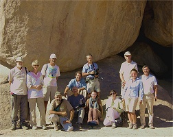
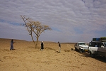
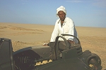
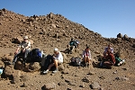
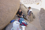
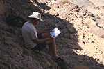
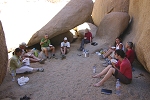
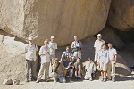
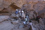
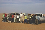
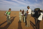
 Click on image for list of participants |
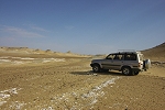
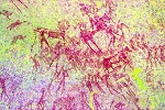
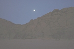
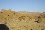
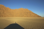
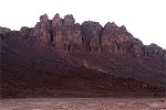
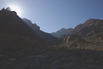
Jebel Uweinat Expedition, Libya 9th - 29th November, 2010 NOTICE: The rock art photos on this page are strictly copyrighted ! No photo may be copied / used for any purpose without written permission. Site numbers in text below refer to Rock Art of the Libyan Desert, 2nd Expanded Edition False colour images precessed with dStretch, a freely available software developed by Jon Harman |
9th November - Tripoli - Sebha
Our initial logistics were quite complicated, as we had to combine the planned flights to Kufra with contingencies in case the flights are cancelled or delayed indefinitely, something not entirely impossible based on our past experience. By late September we knew that the Sunday Benghazi - Kufra flights will operate, it was decided that the bulk of our group will fly in to Tripoli on Friday the 12th, allowing a day to do the police registration in Tripoli, and fly to Benghazi in the afternoon. Paolo with Ettore and Michele took the ferry from Genoa to Tunis on the 6th, and it was agreed that we will meet in Sebha on the 9th evening, with me flying in that day.
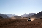
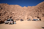
The flight to Tripoli with Alitalia was uneventful until reaching the North African coast, which was covered in a thick yellow haze. It was a very bumpy landing, with a stong ghibli creating near sandstorm conditions, something quite unusual for this time of the year. I had some concerns about the new visa procedures (no visa issued by embassies, just an authorisation letter arranged by the sponsoring agency, with visa to be picked up at the airport), especially with our group arriving at different times and flights, but was very pleasantly surprised. At the designated window it took less than five minutes to find the original of the paper, the whole process took less than in the old days with the already issued visa. Aboubaker was waiting for me in the arrival hall, and confirmed all our prior arrangements, including all the flights for the rest of the group. The only hiccup was my flight to Sebha, the ghibli caused havoc with domestic schedules that day, the original Libyan Airlines flight was cancelled, and I was rebooked on the one five hours later, (which was a brand new Airbus, still smelling of paint), getting me into Sebha close to midnight. I was met by Omar, Aboubaker's brother and Mohammed, our lead driver to be, and was whisked away to the Fezzan Camping, a place with a lovely garden and very pleasant bungalows. The others have savely arrived that afternoon and by then were fast asleep after the long drive, everything appeared in order for our departure.
10th November - Sebha - Timsah
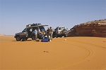
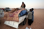
We met with Paolo, Michele & Ettore at breakfast to make our plans. They had a smooth uneventful drive from Tunis to Sebha, save for being knocked by another car along the way, denting the rear bumper a bit. As we had nothing else left but do our shopping, we decided not to stay in Sebha for the night (as originally planned) but to start out in the afternoon, and make it to Timsah where we needed to pick up our guide.
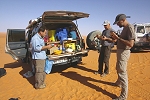
With Mohammed we first went to the police to do my police registration (the 'triangular stamp' in the passport), again a very pleasant surprise, everything was completed in ten minutes, all in a very polite athmosphere. We continued to the town centre, which showed a much improved appearance since our last visit eight years ago, with a conspicious cleanliness everywhere. A lage new supermarket contained practically everything required for the trip. While we did our shopping, our pickup went off to fill the large built-in tank and the extra jerrycans with fuel, by early afternoon we were ready to leave.
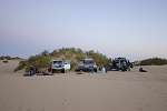
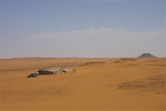
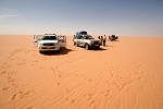
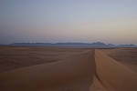
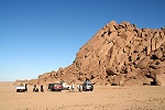
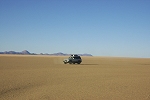
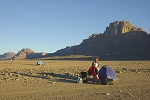
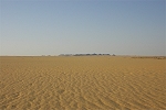
We took the direct Sebha - Timsah piste that saved us around 80 kilometres compared to the asphalt road. I'm not sure whether we saved any time though, the piste was rather corrugated in places, the faster speed on the road probably balances out the longer distance. We reached Timsah after sunset and were invited for a very nice dinner by our guide, the old Hajj Ali al Senoussi, in whom I was not entirely delighted to recognise our old guide of eight years ago. This time though he proved to be an excellent host, and much to my relief caused no delays on departure the next morning. After dinner we drove out to the edge of the dunes south of town to camp.
11th November - Timsah - Wau Namus
Before sunrise Mohammed went back to town to fetch Hajj Ali, and we could start just at sunrise on the direct route towards Wau Namus (bypassing Wau Kebir). After a couple of hours we turned towards a small wadi hidden from view from the main track, where Hajj Ali promised we could find abundant firewood. Sure enough, the wadi had abundant vegetation, and from the few dead trees we could stock up on wood for the next three days to Kufra.
The old man showed impressive strength, teaching us 'young lads' how to chop up branches of thigh thickness by popping them up on stones, then swinging large boulders lifted high above his head with outstretched hands on the intended breaking spot. His throw hit all the time, when I tried my score was at best two out of seven...
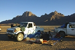
We continued towards Wau Namus at a very good pace. Mohammed showed excellent driving skills, driving as fast as possible but never recklessly, always anticipating the occasional gully and rough ground that would have sent a less experienced driver flying. By midday we reached the junction to the Wau Kebir - Wau Namus piste, stopping for lunch near the last cluster of vegetation before the volcano.
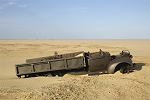
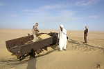
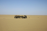
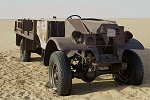
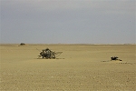
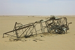
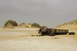
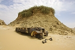
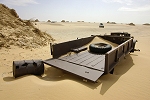
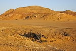
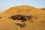
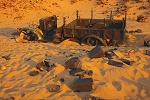
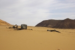
While our objective was to make it to Kufra by saturday evening, we still had time for some smalll detours to do some sightseeing. After the Wau Namus checkpoint (which we found abandoned) we turned off the track towards the North to see the wrecked 1942 Chevrolet pickup, that many have mistaken for a LRDG vehicle. While the truck is of the same model as the LRDG had used in the later years, it is clearly equipped differently. It is truck No.11 of the 2nd patrol of "Detachement Guillebon", commanded by Adjudant Forrestier during the first Free French campaign into Fezzan in early March 1942. The truck suffered a mechanical breakdown and could not be repaired on the spot. It was therefore set on fire and the crew returned on another truck (No. 10) of the same patrol (information provided by Kuno Gross). The truck is very well preserved, and fortunately shows little sign of vandalism, let us hope it stays that way.
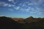
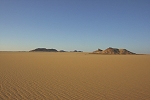
We continued to the Wau Namus volcano, just a dozen kilometres away, already clearly showing up on the horizon. The visit was primarily for Ettore, who had never before been to the place, we drove up to the rim and along the western side, with the crater basking in the perfect low light of the setting sun.
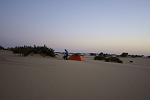
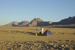
We drove for a further 30 kilometres east of Wau Namus to make camp. On the flat serir there were no sheltered spots to chose from, fortunately it was a warm and calm evening without the need for any protection. Nobody bothered to pitch tents, it was one of those perfect still desert nights. If only the thin overcast didn't obscure the stars...
12th November - Wau Namus - Tazerbo
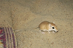
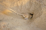
Around midnight, as I was lying half-asleep in my sleeping bag, I felt something soft nudge my nose. It happened so gently that I was not startled, only opened my eyes to see a little dark shadow scurry away in the moonlight. Soon it was back, bold as ever, first sniffing all about me, then crawling accros my back, finally settling in the corner of my neck for a warm resting place. I could feel its rythmic breathing, until it decided to go on it's way again. I guessed it was a small rodent, but could not quite make it out in the low light.
In the morning the culprit was very much evident, scurrying all about us, even proceeding to dig a burrow right under the matress where we were having breakfast. It was a little gerbil (Gerbillus pyramidum), a different species from the ones I have seen at the Gilf Kebir. It showed no fear at all, could be approached up to half metres, we had to take care when starting the cars that it would not get under the rolling wheels. It probably never saw human beings before in that desolate spot, and the chances are it will never see any again.
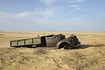
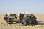
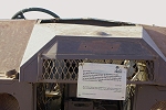
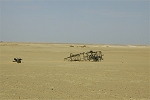
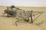
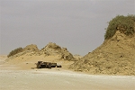
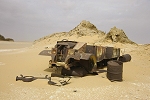
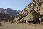
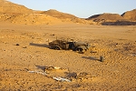
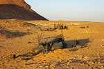
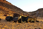
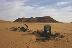
Our first target was an abandoned CMP Chevrolet truck standing on the flat serir some 50 kilometres from our camp, complete with original wheels and tyres. Of it's history not much is known. This type of truck was definitely not used by the Free French during their Libyan campaigns. A former Foreign Legion member had a photo of exactly such truck taken in 1954. When he was involved in some journeys from Sebha to Chad they found such truck, repaired and used it. It could be either this truck, or the one abandoned at Bir Maaruf. The numbers painted on the inside of the hood of one of them indicates that it was assembled in Cairo in 1941, but the numbers on the back of the truck are clearly of French origin. No more is known at present (Information provided by Kuno Gross). Kuno Gross placed a plaque with english/arabic inscription, requesting all visitors to keep the wreck intact, unfortunately this did not deter an italian and a french group from putting stickers on the door, and local drivers from spray-painting inscriptions on it. The vicinity of the truck was full of rubbish, we made an attempt at tidying up the place the best we could.
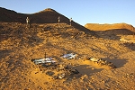
We continued towards Bir Maaruf, to see another wrecked CMP truck, as well as the remains of the Ro-1 aeroplane. Hajj Ali warned that the country to the south of Bir Maaruf will be very difficult, sure enough soon we were soon struggling axle deep in white powdery fech-fech with the consistency of flour. The diesel HZJ75-s we use in Egypt would have become hopelessly stuck, but the petrol engines made all the difference, we did not have any troubles aside the all encompassing fine white dust.
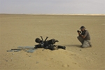
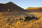
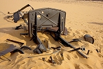
We soon reached the aircraft wreck, a Meridionali (IMAM) Ro-1, a license-built version of the Fokker C.V, in construction between 1927 and 1935. This particular aircraft was used for reconnaissance preceding the occupation of Kufra in 1931, making a crash landing here. The aircraft burned in the subsequent fire, but the pilot escaped with light injuries. Michele has been working for some time tracing the history of this wreck, and we were delighted to discover in a few places the stamped serial number of the aircraft, confirming that Michele's research so far had been correct. Unfortunately there were signs of recent vandalism. The complete instrument panel, still in place in 2003, was missing. Michele has since completed an article together with Roberto Chiarvetto describing the history of the wreck in detail, it was published in Rivista Aeronautica, No6/2010.
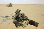
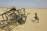
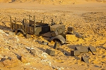
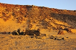
We proceeded to the wrecked CMP truck, tucked away behind a cluster of tamarisk mounds a few kilometres from the aircraft wreck. It was so well hidden, that even though it was just off the piste, it remained unnoticed till a few years ago. It is nearly identical to the other truck standing on the serir, but this one appears to be a Ford, not a Chevrolet (the Canadian divisions of both car makers were building this model to identical blueprints). Nothing is known about it's history, other than what was written for the other truck. It was clearly stripped of all useable parts, only the chassis and body left here.
From Bir Maaruf we followed the piste leading to Tazerbo. The weather changed, with dense overcast and a cool north-western wind, we even had a few drops of rain. We continued all afternoon at a good pace, approaching Tazerbo before sunset.
We made camp among the tamarisk mounds to the north of Tazerbo, that provided some shelter from the cold wind. We were in mobile coverage, we soon received the news from Aboubaker that half of the group had already arrived to Tripoli.
13th November - Tazerbo - Kufra
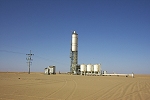
In the morning we received the news that everyone arrived safely to Tripoli, and were due to fly to Benghasi that afternoon as planned. We had fuel till Kufra, so there was no need for us to go into Tazerbo. We drove around the vegetation belt surrounding the oasis, and turned towards the south east, taking the direct route towards Kufra. We soon passed the rows of huge water pumping stations, supplying the Tazerbo branch of the 'Great Manmade River'.
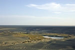
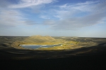
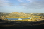
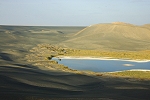
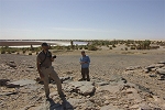
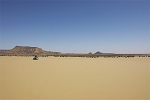
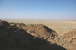
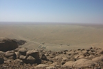
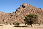
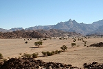
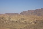
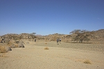
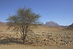
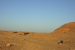
We continued on the flat serir for another hour, and just as we reached the first patches of yellow sand, a large flat topped hill appeared straight ahead, Jebel Buseima. The little oasis and abandoned town lay to the west of it, as we were well ahead of our schedule, we decided to pay a visit.
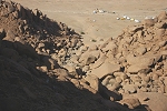
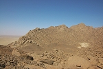
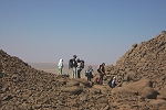
We drove down a slope of treacherous soft sand to the bottom of the basin containing the lake and the abandoned town. We first climbed a small hill to the west of the town, offering the best vantage point.
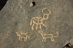
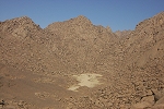
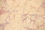
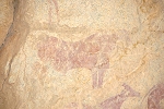
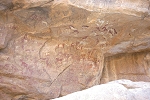
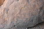
The rocks around the base of the hill contain several panels of engravings, which were noted by Paolo and Michele on an earlier visit some years ago. Some of them appear to be historic or even modern, but there are several engravings of cattle that appear very ancient, and of a similar style as the cattle pastoralist engravings at Uweinat. They certainly appear to be prehistoric.
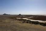
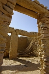
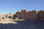
The town was abandoned several decades ago, the inhabitants having moved to Tazerbo. As this happened before brick and concrete buildings replaced the old stone and adobe constructions, Buseima is the only surviving traditional oasis village left in Libya.
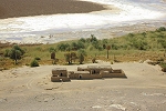
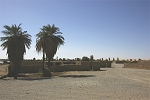
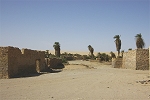

Everything of reusable value was taken, but what remains is in the state as the last inhabitants left them, the adobe slowly crumbling away, but the stone buildings will remain standing for a long time.
After our short visit, we climbed out of the basin on the steep sand slope to the west, as the bottom of the basin around the oasis is filled with very soft sand, an unwise route. The longer but safer option is to get up to the top of the sand, and make a wide circle around the oasis before turning towards Kufra.
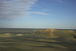
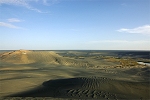
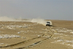
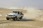
Beyond Buseima we entered the Rebiana Sand Sea in earnest, having to cross a series of long seif dunes running roughly at right angles to our direction. Mohammed showed great skill in tackling the dunes, it was evident that he had substantial experience. He was smiling at my feeble suggestions to perhaps go for the easiest spots, and I soon experienced the immense difference between the 4.2 petrol engine compared to the 4.8 diesels we have in our Egyptian HZJ-s. We easily climbed such steep sand slopes where the diesel would have stalled half-way. On the other hand, getting unstuck was a much more delicate exercise. With the extra power, the petrol 'cruiser has a tendency to dig itself in much faster if one is not careful on the pedals.
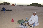
Hajj Ali was sitting with us, and it was rather amusing to watch his interaction with Mohammed. The old man obviously felt that noone can have an experience anywhere close to his, and was constantly instructing Mohammed on the best route and technique. Mohammed just ignored him and took his own ways, which very visibly irritated Hajj Ali. As soon as we stopped to refuel, he pointedly went away from the drivers to make his tea alone...
After an hour and a half we reached the flat sandy plain on the far side of the dunes, and sped towards Kufra. We stopped for lunch just a few kilometres from the edge of the oasis, surrounded by the characteristic red sand of the Kufra area.
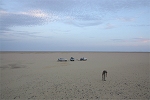
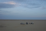
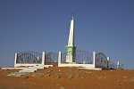
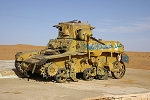
Following the track we were soon in the outskirts of Kufra, at the northernmost town of Hauwari. By accident we have reached the Oasis at the site where the battle of Hauwari was fought on the 19th of January 1931, where the advancing Italian columns defeated the Senoussi and took posession of Kufra. The place is marked by a modern monument in the fine white/green theme of the land, tastefully covered by graffiti, and an assortment of wrecked military vehicles (of WWII vintage, nothing to do with the actual events) which have been assembled here some years ago to produce a small display. Of the original Italian monument nothing remains, probably it was erected at the same spot as the modern one. Hajj Ali emphasized that we are seeing one of Graziani's tanks, not willing to accept that he was in fact waiving at a US made M3A1 Stuart tank... (According to research done by Kuno Gross, it is almost 100% certain this particular tank was intended for the SAS, and was trucked in from Wadi Halfa in 1942. It was abandoned north of Kufra - probably very near it's present location - for unknown reasons.)
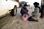
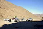
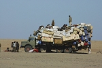
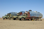
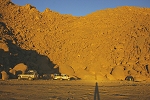
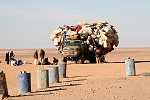
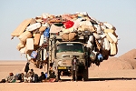
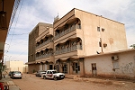
After our Hauwari stop we went into Kufra, and settled into the surprisingly acceptable Sudan Hotel, which had a closed courtyerd suitable for unloading and re-packing our vehicles. Our other two cars arrived in the evening from Zella, a Model 90 landcruider driven by Musa, a rather grim looking touareg fellow (who despite his initial reservedness, turned out to be an absolutely wonderful companion), and a Hilux twin-cab driven by Mohammed, who in contrast was constantly cheerful. We fuelled up all the vehicles, purchased our water and fresh vegetables, and had nothing left to do but to wait for the rest of the group to arrive. We soon got the word that everyone made it to Benghasi, and the flight to Kufra was supposed to depart on schedule in the morning. With Mohammed we had another matter to attend to. Much to my delight it was Mohammed who brought up the question of why do we need Hajj Ali at all, following an argument related to the fact that from hereon the Hajj will have to sit in the pickup, but ours will remain the lead car. I was under the impression that a guide was mandatory, but it soon turned out that Mohammed was perfectly suitable to act as one, the Hajj was entirely superfluous, and had sufficiently irritated Mohammed on the way here to the point that he was entirely happy to leave him behind. After a tense discussion, the old man accepted the offer to receive his full pay and return home without making any fuss, a win-win situation for all of us.
14th November - Kufra
The Air Libya flight from Benghasi did leave reasonably on time (an hour's delay was well within the Libyan definition of 'on time'), while the flight was in the air Mohammed went to the army office with the pasport copies to get the onward permits. This too turned out to be a pleasant surprise, he was back after fifteen minutes, all paperwork completed. As we drove to the airport the plane, a BAe-146 landed, and our group was soon re-united, all excited to get on the way.
Unfortunately the excitement soon turned to gloom, as we realised that some of the luggage did not arrive. It was apparent that we were not alone, many angry locals were already confronting the local airline staff, who of course had absolutely no idea what was happening. Fortunately after a while the captain came to the rescue, who radioed back to Benghasi and found out that some of the luggage was indeed not loaded, due to a lack of space. It tells a lot about the operation that the flight crew were not informed... The flight was continuing to Khartoum, the captain promised to take a couple of us back to Benghasi in the evening on their return, and personally help sort out the matter. He was genuinely ashamed of the outfit he was working for now, very clearly he was used to different standards earlier in his career. The ground staff were very helpful too, it was decided that Gábor and Richard will go back, the two tickets were immediately issued, and we had to resign ourselves to waiting for a day in the fine city of Kufra, starting with lunch in Kufra's top-end eating establishment just down a corner from the Hotel, then spending the rest of the afternoon scheming and planning our route.
15th November - Kufra - Jebel Arkenu
The flight in the morning was on a vintage Boeing 727 (I was rather envious, last time I flew one was from Kufra in 2003), Gábor & Richard had a beautiful view of the Calanascio Sand Sea on the way.
Once they landed, we loaded the cars without much ado, and started out on the track towards Uweinat. As we left Kufra, the laxeness of the rules were once again evident, we did not have to stop at the checkpoints which caused so many frustrating delays on our last trip. We drove continuously on the flat sandy plain towards the south-east, only stopping briefly beside a low rocky hill for lunch.
We continued along the track towards Jebel Arkenu, passing the half-way checkpoint, which had a rather impressive two storey (though not quite completed) big brick and concrete building instead of the makeshift tents. Again my anticipation was groundless, after a couple of "Kef Halek"-s were exchanged between the soldiers and our accompanying policeman, we were on our way again. There was no checking of paperwork, passports or anything, a welcome surprise.
As we neared the dune field before Jebel Arkenu, Ettore, Michele & Paolo spotted some objects sticking out of the sand. As the other cars were ahead, they were the only ones to stop and investigate. By a stroke of luck, they have stumbled upon the remains of one of the emergency landing grounds established along the Benghasi-Kufra-Uweinat air route in 1934.
The following information was provided by Michele Soffiantini:
The Bengasi-Cufra-el Auenàt air route in Cirenaica was established soon after the Italian occupation of Cufra in 1931, to supply the small garrison at Ain Doua, the principal purpose of which was to assert Italian claim to the area; by September 1934 it had a large number of airfields available for its needs. Air Force Colonel Roberto Lordi, and later Colonel Gino Sozzani, commanders of the Aviazione della Cirenaica, dedicated much of their efforts to the establishment of the important route between Bengasi and Tessenei (Italian Eritrea), in view of the impending Italian conquest of Abyssinia in 1935.
The Bengasi-Cufra leg beyond Bengasi airport included the series of eight emergency landing grounds (campi di fortuna) called No1, No2, No3, No4, No5, No6 (Bir Dacar), No7 and No8, at intervals of roughly 100 km along the Palificata (the ground route to Cufra marked by iron poles), which joined it to the big Cufra airfield, located in the Buma oasis about 4 km from the et-Tag fort.
The Cufra-Auenàt leg had two intermediate landing grounds, Garet Cudi about 100 km from Cufra and the emergency LG of Archenu, near Garet Farna, to the north of the Gebel Archenu, about 118 km from Garet Cudi and 105 from Auenàt.
The Archenu landing ground was 1000 x 1000 m, on a flat sandy serir about 500 m above sea level; its corners were marked with four sheet metal square-based pyramids and it had a windsock and a small sheet metal hut with an arrow sign pointing towards Auenàt.
With the advent of aircraft with a greater range (Caproni Ca.101, Savoia Marchetti S.79 and S.81), these intermediate landing grounds were no longer necessary and were abandoned.
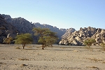
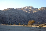
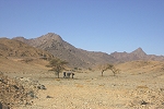
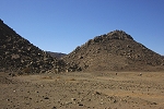
By the time we crossed the first band of dunes, sunset was catching up with us. Our plans were to make it to our base camp at Uweinat, still 80 kilometres away, but the prospect of crossing the broad belt of dunes between Arkenu and Uwenat at dusk was not a particularly attractive one. We decided to make camp among a narrow belt of dunes skirting the north-western corner of Jebel Arkenu.
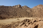
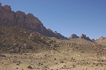
16th November - Jebel Uweinat (Ain Zueia)
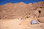
Not reaching Uweinat the previous evening required a small re-adjustment of our plans. The planned two-day trek was postponed to start the following day, and we bought forward the planned exploration of a small flat sandy bottomed valley near Ain Zueia, conspiciously showing up on satellite imagery, somewhat resembling a salamander. It was rather chilly in the morning, a welcome change of weather in light of our planned long treks. We packed up camp, and set out towards the police post at Ain Zueia.
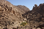
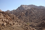
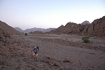
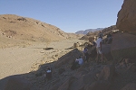
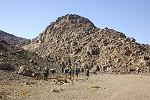
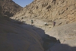
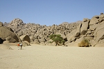
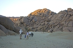
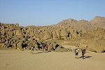
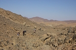
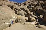
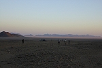
We drove up to the police post at Ain Zueia, where the athmosphere was very cordial. We explained our plans to the commanding officer, and his comment was that we are welcome to do as we please, as long as we don't stray into Sudan or go south of the post without checking in first. To allay any suspicions, we offered to leave our passports there for the full ten days of our intended stay at Uweinat, and started preparing ourselves for our first trek. We started out on the camel track leading up to Ain Zueia, as the flat upper contour of the ridge above the spring offered an easier looking route north towards the valley than the direct route in a boulder strewn steep valley.
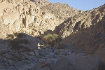
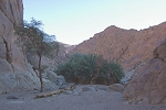
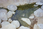
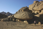
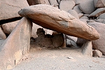
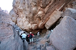
It was a roughly one hour hike to reach Ain Zueia. The remains of the old italian pipeline are still there, together with parts of the broken pump, but now the police post gets the water from a well drilled at the base of the mountain. The spring itself is located within a mass of boulders, hidden behind a patch of reeds.
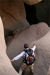
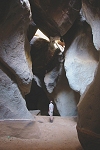
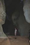
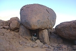
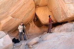
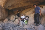
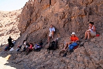
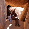
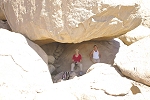
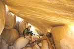
While the rest of the group continued from the spring up the ridge towards the North, with Gábor and Richard we made a quick side-trip to see the Monterin cave, re-discovered by Alessandro, Michele and Paolo in 2006. The cave was formed by the descending wadi runoff washing out a series of large halls underneath the mass of jumbled granite boulders barring this point in the valley. We could only enter the first main hall, the lower sections require ropes and safety equipment as there are several deep vertical drops.
We climbed after the others, and were soon up on the top of the ridge, looking down at the police post almost directly beneath us. As we climbed, we met our policeman, who accompanied the others till a little further up, but found the going too tiring and started going back to the spring. He considered waiting for us to return, but I made it very clear to him that if we do not return by 3pm, we have taken the dirct way down from the valley, and he needs to make it down by himself on the track we have ascended on. He seems to have understood, at least nodded in agreement, so we left him under the shade of a large rock.
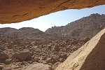
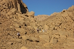
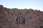
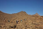
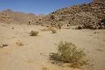
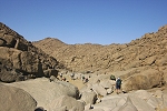
We soon caught up with the rest of the group, and after another half an hour we reached the col from where we could look down into the valley. To our understanding it has never been explored in a systematic way, at least it is not mentioned in any publication we are aware of. With binoculars we could spot several promising large boulders casting deep shadows, we started our descent into the basin hoping to find at least some rock art.
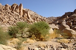
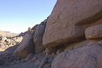
We reached the bottom of the valley after a half-hour scramble, and before moving on to explore, we had a peek down the steep boulder strewn outlet. It appeared manageable, which gave us an extra two hours for exploring, not having to go back the longer route we came. However the valley turned out to be a bit of a disappointment. While we did find some meagre traces of prehistoric inhabitants, all of the promising shelters and boulders were void of any paintings.

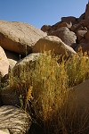
We did find some green vegetation in the valley. In the middle of the watercourse there were a couple of green and flowering Cleome crysantha, a species normally associated with rainfall. The last known rain on the mountain was in August 2007, this is the first record of this species so long after a rain event.
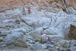
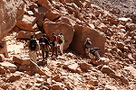
After a thorough search of the valley, we started our descent in the outlet wadi. The valley was choked with boulders, but it was not too difficult to find a passable route along the side of the valley. It was not an easy stroll, but everyone made it down safely, it was a good practice for the more serious treks we were about to undertake.
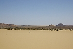
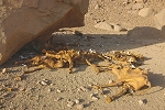
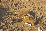
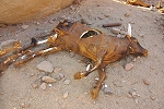
The place where we reached the plain level a kilometre or so north of the Ain Zoueia post was littered with mummified carcasses. I expected the usual camel corpses, the 'leftovers' of the huge camel caravans being herded up from Sudan (and now Chad, as we found out later) to the Kufra market. However these were cattle, dozens of them. How they got here is a mystery, they could not have been herded on foot, possibly they were transported by truck and the ones that did not make it were discarded here.
As we got back to the cars by the police post, our policeman was nowhere to be seen. We returned quite early, we waited another half an hour, but it soon became evident that we need to launch a rescue mission, he probably became lost on the way back. With Michele and Musa we set out on the path towards Ain Zueia, all the time in radio contact with the others just in case he returns. After a half hour at a tough pace we reached the spring, and our friend was nowhere to be seen. There was no response to our yells and whistles. Finally after some anxious minutes I spotted him staggering along a far away ridge. He finally heared our calls, and started towards us. When he reached us, it was evident that he was confused and exhausted, his water bottle empty. After giving him a good drink and letting him rest, it emerged that he waited till mid afternoon, but when we did not return, instead of returning to the post as agreed, he decided it is a good idea to follow us in case something happened. By that time his water was finished, and it never occurred to him to get some more from the spring. Not finding any trace of us, he wandered about till finally he heared our call.
We radioed back that all was fine, so the others could leave for the Karkur Ibrahim base camp while there was still some light left. We reached the police post at dusk, and it was pitch dark by the time we arrived to our camp at the little side valley of Karkur Ibrahim leading up to Ain Duarme. As we got out of the car, a quiet thank you confirmed that our policeman understood what situation he had gotten himself into.
17th & 18th November - trek to "Marchesi valley" & Cima Marchesi
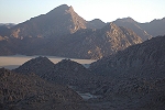
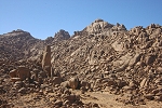
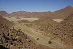
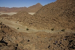
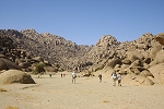
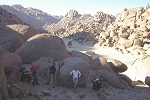
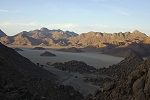
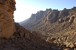
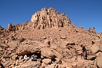
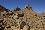
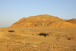
In the morning we were finally ready to start out for one of our principal trip objectives, a large flat bottomed valley system at the north-western corner of the large crescent-shaped Emeri Highland, which makes up the lower half of the granitic part of the mountain (practically the whole area to the south of Karkur Ibrahim). This undulating dissected plateau of granite and other igneous rocks can only be accessed via a few very difficult routes from the north, the western and southern ramparts of the mountain are too steep and clogged with boulders to be practical for an ascent. Our objective was dubbed the "Marchesi valley", on account of it lying in the shadow of Cima Marchesi, the most prominent peak of the western part of the granite complex. On previous expeditions Alessandro, Michele & Paolo found major rock art sites in the other two principal valley systems of the Emeri, we had hopes that this yet unexplored valley will yield more. Michele & Paolo had another objective - on the return they wished to attain the summit of Cima Marchesi, a peak that to our knowledge was never climbed.
Our planned route was about eight kilometres, first ascending 600 metres from camp to the plateau level. We started out a dawn along the little ravine next to camp, and followed Alessandro's previous routes till the top of the climb.
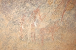
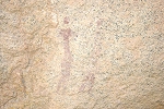
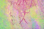
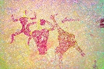
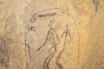
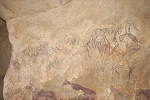
Our climb took us past a small rock art site, KI 63, which was found by Alessandro & Michele in 2006 on their second Emeri expedition. It is on the underside of a large granite bulder, and aside some cattle in varying state of preservation it contains a splendid nice pair of human figures.
We continued struggling up the rather nasty, boulder strewn slopes, fortunately shaded by a large hill to our east, and eventually reached the watershed between Karkur Ibrahim and the Emeri plateau (which drains towards the perimeter of the mountain, principally via the Ain Zueia wadi). On the crest we made a water cache of two bottles each to facilitate our planned three-day trek to the principal southern valleys of the Emeri.
We continued along reasonably flat terrain for another four hours, stopping for rest every now and then, but slowly making progress. What appears flat ground from ahead always reveals hidden gullies, boulder filled valleys, requiring constant detours from the straight line, with final walking distances probably double that planned on the map. The conspicious pyramidial peak of Cima Marchesi was looming ever closer, we passed it to the south on our way to the valley beyond.
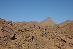
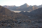
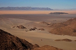
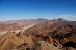
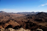
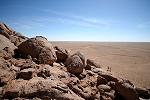
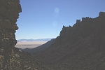
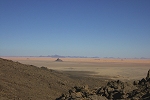
Finally we have reached a ridge, from where our target valley appeared in full view, with the plain and dunes beyond Uweinat to the west clearly visible.
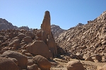
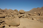
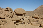
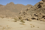
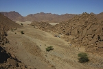
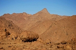
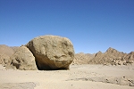
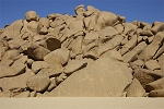
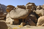
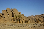
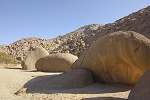
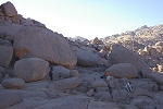
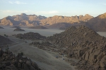
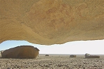
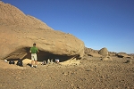
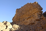
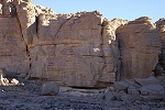
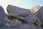
It was another hour till we reached the bottom of the valley, and it's true splendor became evident. The central part of the valley was occupied by a large pile of granite boulders, with an immense rock pointing upwards like a finger. We all agreed even if we find nothing, the trek was worth it just for the fablous scenery.
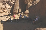
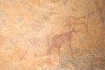
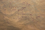
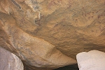
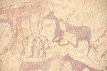
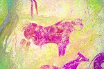
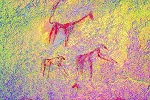
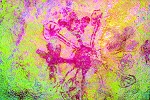
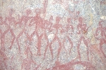
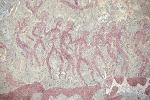
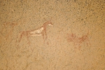
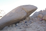
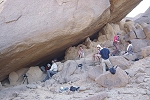
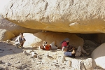
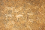
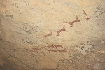
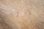
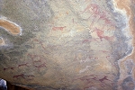
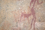
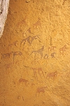
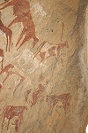
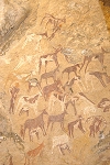
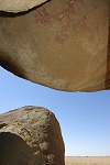
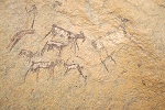
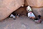
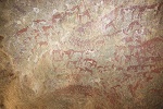
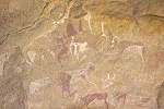
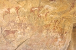
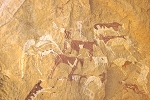
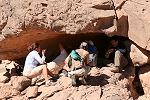
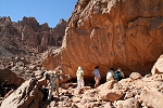
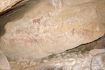
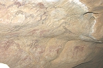
We had a late lunch in the shade of the immense rock pillar, then set about to explore the valley. Right accross from our resting place there was an enormous rock mushroom, and beyond an inviting large shelter. On close investigation, the shelter was found to contain a very large panel of paintings, numerous cattle and human figures, some overlying faint figures of earlier periods. This was certainly a major find, proving once again that all suitable valleys at Uweinat have once been inhabited by both the prehistoric pastoralists, and their antescendents.
The light was not good for photographing the new find, and in any case a full survey of the valley was a more pressing priority. Having left our packs at the rock pillar, we split into smaller groups to explore the south-north oriented valley system. The ones visiting the southern basin were luckier, after finding a rock with some barely discernible paintings (so barely, that we could only ascertain that they were paintings after returning home, after digitally enhancing our photos), Paolo & Ettore came upon a very large rock, with a spacious shelter underneath. The shelter only contained a single very small but well preserved group of human figures, but more importantly the northern side of the rock was covered with very weathered, but still discernible human figures from the most ancient periods of Uweinat rock art.
The northern basin, though a much larger area and with more vegetation, proved to be void of any rock art, at least we did not find anything despite repeated surveys by almost all of the group. Interestingly the watercourse did not breach the granite hills along the perimeter of the mountain, but instead disappeared underground, probably forming a series of underground chambers similar to the Monterin Cave in the Ain Zueia wadi. Here however the entrance was too narrow for us to be able to explore any further.
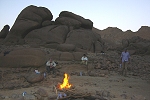
With all of the valley explored, we returned to the central part, and spent most of the late afternoon and early evening photographing the principal site, with our bivouac spot and campfire close by.
The next morning the rock art site had a brief spell of direct sunlight, followed by perfect reflected illumination, we have spent a couple of hours taking more photos, finding numerous faint details that we have missed the night before details. In the mean time Michele and Paolo departed, making a stratight line for the western slopes of Cima Marchesi.
The rest of us started on our long way back, re-tracing our track of the day before. We tried several times to contact Michele and Paolo via radio, but they were silent - we could only hope that it was because they were in the shadow of the peak. By early afternoon we reached our water cache, with still no word from the peak party.
After a brief lunch-stop we continued back towards our camp. As we were nearing the final slope, finally the crackling voice of Paolo came on the radio, announcing that they have made the very difficult way around the mountain, and now they were just 100 metres below the peak.
Michele and Paolo had a very tough time, the slopes of the mountain were very steep, and in places they had to make big detours due to impassable smooth granite walls. As they neared the peak, it looked increasingly impossible with sheer vertical rock faces, but in the end they did manage to find a way up, finally standing on the peak just as we reached camp below.
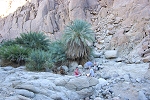
While Michele & Paolo started their long descent back towards camp (making a direct route for Karkur Ibrahim), we decided to visit the small spring of Ain Duarmé about a kilometre above camp in the small wadi. It took about an hour's steep climb among the bigh boulders of the wadi bed to reach the spring with the cluster of palm trees, and the two brackish puddles that miraculously never dry out.

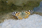
The water was not perticularly attractive, but Gábor, Lenka and Magdi decided to have a wash, while the rest of us watched the amusing show. There was substantial life around the pools, with many insects and birds coming in for a drink. One rather unwelcome visitor was a botfly (Oestrus ovis), which was quickly swatted after the photo was taken.
Soon more benign creatures came to the water, including an Isabelline wheatear (Oenanthe isabellina), a painted lady butterfly (Vanessa cardui), a caterpillar hunting wasp (Delta dimidiatipenne) and a very large sphynx moth (Hyles lineata) that made a sound like a miniature helicopter as it hovered just over the water, lowering it's proboscis for a drink.
As we were making it back towards the camp, with Gábor we spotted a small crevasse with some clear water seeping out a couple of dozen metres below the main spring. We tried the water, it was cool and absolutely perfect to drink.
19th November - Karkur Ibrahim & Karkur Idriss
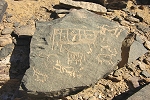
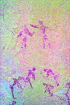
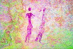
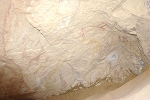
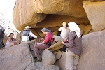
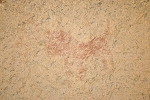
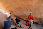
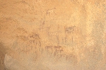
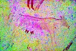
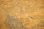
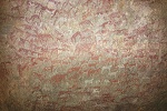
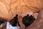
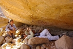
We have planned a day of rest between the two longer treks, which gave a perfect opportunity to visit the principal sites in the Karkur Ibrahim and Karkur Idriss areas, as well as some of Mark Borda's new finds on the rock island at the edge of the dunes facing the mouth of Karkur Idriss. We started off visiting a cluster of rocks near the entrance of our small side wadi, which contained one of the known rock art sites published by Jean-Loïc Le Quellec (Sahara 10, 1998). I have seen this site in 2001, but incorrectly marked it's location and failed to find it on a further visit. Fortunately Alessandro has re-located this site (KI 41) the previous afternoon, while the rest of us were up at the spring. The site contains very faint, weathered paintings of human figures in the "Uweinat roundhead" style. While hardly anything is discernible on the spot, it is one of those sites on which DStretch software does wonders, revealing never-before seen details.
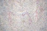
Our Italian friends drove out in Paolo's car to the area to the south of the mouth of Karkur Ibrahim to survey the areas in more detail where they have found some lesser sites in 2006. The rest of us drove up in Karkur Ibrahim to see the central cluster (KI Area 4.). We first stopped at KI 43, where aside the known figures we have found several very faint ones that were not recorded before. DStretch revealed that the best preserved figure was female, another unnoted detail.
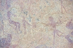
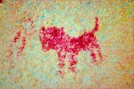
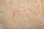
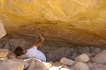
We continued to the main site in the area, KI 44/A. The site is quite high up in a rock niche, it is not possible to photograph it closeup, this time with a telephoto lens I was able to capture fine details. One intriguing animal figure at the upper left part of the panel appeared to be a possible feline, it certainly did not appear cattle-like. However DStretch revealed the horn tips, it is a partially eroded but still recognisable bull, a rare depiction among the much more common cattle with the prominent udders.
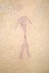
Behind the main shelter Flavio Cambieri had reported finding a small shelter last year, containing a single headless human figure (KI 44/B). Even with GPS coordinates it proved difficult to relocate this site, but once found, photos taken with flash revealed that the figure is not headless at all, in fact it is one of the best preserved examples of the "Elongated roundhead" style.
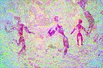
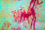
Finishing with the central cluster, we moved downstream to Area 3, a series of sites along some prominent granite islands and boulders along the northern side of Karkur Ibrahim. We have explored this area in 2003 and found several new ones in addition to the lovely site reported by Jean-Loïc Le Quellec. Last year Flavio Cambieri and companions have found a new site on an isolated granite island a short distance from the main grouping, we started off seeing this one (KI 34/A). The panel of paintings are in a shallow shelter along the side of an immense granite boulder, and are very faint. However DStretch enhancement reveals a remarkable series of paintings, with numerous groups of human figures, and some fine yellow cattle.
Nearby a large boulder appeared empty, but on close scrutiny Jon spotted a few barly discernable red spots. They were paintings, but with the naked eye it was impossible to make out what they depicted. They turned out to be several cattle and some human figures, including a group of archers.
We moved on to the main cluster of sites, starting off with Jean-Loïc's giraffe shelter (KI 31/A). In a small hollow to the left of the main shelter we spotted a fine giraffe and a couple of cattle, a scene that was missed on all previous visits.
As we visited and photographed the adjacent sites, I noted an unidentifiable blob of paint in the shelter KI 32/A, which I have not seen before. In the dark shelter it was impossible to make it out, I just pointed the camera in the general direction, however even with flash the resulting photo did not appear to make much sense. Back home, DStretch revealed a very strange and startling shape, nothing remotely similar had been seen at any other Uweinat area or Gilf Kebir rock art site.
We finished off the morning at a large site on the southern side of Karkur Ibrahim near the entrance, KI 23/B. This site too was seen in 2003, but due to the high ceiling I was unable to get good detailed photos. Now with a telephoto lens the figures could be discerned much better, showing a unique yellow neck and armband. Also what was thought to be a half eroded human clearly stands out as a giraffe with DStretch.
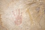
We returned to camp for lunch, and sat in the shade until the worst of the midday heat passed, then set out again, this time aiming for the small rock island opposite the entrance of Karkur Idriss, at the edge of the dunes between Uweinat and Arkenu. Mark Borda explored this small hill in October 2009, and found a spectacular shelter near it's eastern tip, with numerous "Elongated roundhead" figures, fine giraffe and many positive hand prints on the ceiling.
With the sun lowering rapidly, we started back to camp via Karkur Idriss, where we stopped briefly at the principal rock art sites of Bu Helega for a quick photography session.
The other party too had a very successful day. They have re-located the triangulation cairn of the 1933 Marchesi expedition, from which point the height of "Cima Marchesi" was originally established (but the peak never climbed). Continuing, they found a further four sites with paintings among the granite boulders along the foot of the western slopes Jebel Uweinat.
20th - 22nd November - Emeri Highland
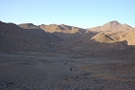
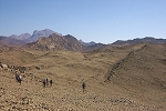
The next morning we started out on our longest trek, planned for three days, to visit the principal valleys and sites of the Emeri Highland, explored by Alessandro, Michele & Paolo on their 2005 and 2006 expeditions. Paolo decided to stay behind, with the strain of the ascent of Cima Marchesi still very evident. However our policeman has recovered sufficiently from the scare of Ain Zueia (no doubt also urged on by the teasing from our drivers), that he decided to join, after all his job was to protect us, irrespective of whether there was anything ar anyone we needed to be protected from. He was not discouraged by his totally unsuitable shoes (flimsy tenis shoes) or the lack of a proper backpack, nor the fact that he needed to carry two extra bottles of water as he did not make a cache some days earlier. We started out before sunrise, and despite the obvious discomfort he trudged on with clenched teeth. We followed more-or-less the same route up the boulder strewn loose rubble slopes as three days before, upp to our water cache. The sun was blazing hot by the time we reached the col, and our policeman was visibly exhausted, drinking a full bottle of water by this time, well over his planned ration.
After a short rest, we descended into the Emeri Plateau on the far side of the ridge, and started following the long shallow wadi that eventually drains into Karkur Gabor, the largest open valley on the plateau. We walked along the shadeless wadi for several hours, until finally coming to a small rock art site (EH 12) just before where the valley becomes more rugged, making a steeper descent till Karkur Gabor. The site itself is very weathered, but the spot provided for the first shady resting stop since early morning. We dropped down in exhaustion, and were quite pleased just to not do anything for a while.
As we continued down the wadi, the terrain grew more difficult, with several steep boulder filled rocky sections to tackle. After some struggle, we finally made it down to the mouth of Karkur Kabor, where we dropped our packs and had a longer rest before moving on to explore the valley. Miraculously Ettore produced a small stove from his backpack, so we even had warm coffe with our meal, an exceptional luxury.
As we started out, Gábor suggested we pay him an entrance fee as the valley was named after him, but in fact the name has a very different origin, "gabor" meaning "hidden" in the Teda (Tibou) language, a name given to this valley on it's first visit in 2005. The valley has a flat gravely bottom with many trees growing along the main watercourse, surrounded by towering granite peaks on all sides.
Our primary objectives were to see the sites found in 2005, we were not planning any surveying as the valley was pretty thoroughly explored at the time. We started out with a site in the middle section of the valley (EH 23), which contains an intruguing animal figure that definitely looks like a large feline (lion ?).
We continued to the Northern basin of Karkur Gabor, which is separated from the main valley by a little tunnel carved out by the flowing water among a low ridge of granite boulders.
This part of the valley was somewhat less explored than the rest, nevertheless Alessandro & companions did find a shelter under a large boulder containing a fine painted bull. We visited the site, then made a round of the basin to see if we can find anything else, with no further results.
As we were starting our way back to the main basin and the principal paintings, Jon spotted a low shelter under an immense boulder that was only visible form a certain angle. At first it appeared empty, but close scrutiny revealed several faint small human figures in the "miniature" style. Soon it became evident that it was a major find, we found another larger cluster of faint human figures in a unique style and composition.
We have spent a long time photographing our new find, but still had time to make a quick dash to the southern part of the valley, to see the other finds of the 2005 Italian expedition. We have done some quick photography, but the light was rapidly fading, it was time to go back to our packs and camping spot in the approaching darkness.
In the morning we parted with Liz and Jon, who were planning on returning to camp by the evening, checking out some other sites along the way, in order to spend a full day at Bu Helega photographing the principal sites in detail, while we continue our explorations on the Emeri. Our policeman joined them as well, deciding that he has done enough trekking, and apparently there was indeed nothing to protect us from, not to mention that our excitement on seeing another bunch of painted cattle was perhaps weird, but certainly not suspicious. The rest of us continued along a wadi linking Karkur Gabor with Karkur Ruzzi, another flat bottomed valley system some kilometres to the east. Right at the beginning of the wadi we had a look at a site with very faint paintings of "Uweinat roundhead" figures and some barely discernible positive handprints (EH 25) found by Alessandro & Michele on their 2005 visit.
The remainder of the wadi linking the two principal valleys up till about a kilometre before Karkur Ruzzi was never explored. We were hoping to find at least a few sites, especially in a small flat bottomed valley showing up conspiciously on sattelite imagery south of the wadi we were traversing. All of this was unknown territory, and the satellite photos did not suggest an easy terrain, but we were hoping to find a negotiable way up to the valley, about a hundred metres in elevation above the wadi floor.
The wadi proved to be wide and reasonably flat, with few promising rock outcrops along either side. We split into two groups to scout both sides, but found nothing up to the spot where we had to make our ascent in a very rough, boulder filled wadi up to the flat bottomed valley.
We left the backpacks at the junction, attempting the climb with just cameras and a bottle of water. Fortunately after some failed attempts we found a passable way around the nasty boulder filled section of the ascending wadi, and reached the entrance of the flat bottomed valley. It was very picturesque with the towering granite peaks all about, and looked very promising in light of our previous experience of all such valleys harboring rock art sites.
As soon as we reached the centre of the valley, we noticed two conspicious shelters not too far apart. Close scrutiny revealed a series of paintings in both of them, the first one a small panel of cattle and goats, the second a larger site with dozens of very weathered but still recognisable paintings of dozens of cattle and human figures.
We thoroughly explored the remainder of the valley without finding anything, nevertheless we were very pleased with ourselves, especially how predictions made by looking at satellite imagery came true once again.
We descended from the valley to our packs, and continued along the wadi which remained void of any rock art. After an hour or so, we reached a large dry waterfall, marking the section untill this wadi had been explored coming downstream. Rather than tackling the very difficult wadi bottom, we ascended a ridge, and followed a prominent dyke till hitting a well traveled camel trail (probably dating from Tibou times) leading towards Karkur Ruzzi. After a big loop we joined the wadi again at it's shallow upper section, and soon reached the entrance of Karkur Ruzzi, making our base at a cluster of rocks offering some meagre shade.
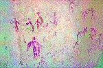
In the afternoon we spent a leisurely time visiting the principal sites of Karkur Ruzzi, all found by Alessandro & Michele on their 2006 expedition. We started with a site under an enormous boulder (EH 32) with a slanting ceiling covered with paintings, and a stepped floor giving a very realistic impression of a cinema, with room for at least a dozen people if not more. The "screen" shows over a hundred figures of cattle, goats and humans.
Another site lies just a few hundred metres to the south, painted on the vertical wall of a very large shelter at the end of an immense slanting boulder. Though much weathered, the paintings are very intriguing, with a series of older "Uweinat roundhead" figures under the more recent cattle pastoralist paintings, including a couple of ostrich, which are a very rare theme among paintings at Uweinat (just 4 other examples).
The southern end of the valley narrows, with tall piles of granite boulders surrounding a smaller basin full of bright green acacias, a very picturesque sight. The basin only contains a single painted cattle, in a shallow shelter very close to ground level, it's a mystery why the frequent wadi runoffs have not obliterated this very exposed painting.
We finished the day in a large eastern bay adjacent to the main valley, with a series of four paintings in shelters among the hoge granite boulders at the foot of the bordering slope. All these sites have been seen before by Alessandro and Michele, we have done a rather thorugh checking of all the suitable looking rocks along the valley edge, but have found no new sites.
Next morning at sunrise, leaving our packs behind, we climbed up to a little side valley to the east about a kilometre away, where Michele found a site with paintings in 2006 on a very brief visit.
The valley was a good 100 metres higher than the floor of Karkur Ruzzi, and from a col on the edge we had an uninterrupted view till the Hassanein Plateau and two of the 'Three Graces' beyond. Michele's site (EH 35) was in a shallow shelter, containing faint figures of a giraffe and humans in the "miniature" style (not "Uweinat roundheads" as suggested in Sahara 17). Not far there was another shelter, noted but not documented on the previous visit, containing very weathered paintings of cattle and human figures.
Up on the hillside above the two sites there was a shelter that looked promising. It's true depth was only appreciated when we made the twenty metre or so ascent, and were delighted to find a large panel of cattle pastoralist paintings with several unique scenes.
Mid morning we started making our descent to Karkur Ruzzi. After a brief pause to colect our gear, we continued on our long way back towards the camp in Karkur Ibrahim, this time making a direct traverse accross the Emeri Plateau.
Initially we followed the same camel trail as on our way here, then we walked along the shallow wadis of the plateau. Along the way we stopped at several rock art sites (EH 13/A-B & EH 14), all found in 2006 when the area was first explored. While all were rather weathered, one of them contained a large rock that contains dozens of human figures, properly visible only with DStretch.
Eventually after a long walk in the unpleasant shingle and sand of the wadi beds, we reached the fork where the wadi leading to Karkur Gabor starts making it's descent. At the fork we found a small cairn, where Liz and Jon left their surplus water for us as agreed. The vertical cliffs of the wadi side offered the only shady spot for miles, we took the opportunity for a brief lunch.
After lunch we followed the main Emeri wadi upstream towards the watershed with Karkur Ibrahim, where we left our water cache. However before heading back to camp, we had plans to visit a side wadi, where a cluster of rock art sites were found in 2005 & 2006.
The six sites (EH 11/A - F) are distributed among boulders on a steep slope bordering the side wadi. We only saw the last three this time, the other three are minor sites a bit removed from the others, and by this time the low angle of the sun suggested we make a quick move towards camp.
A charming little detail emerged when processing the images back home. In EH 11/E a red line and a couple of tiny triangular objects caught my eye. On the spot nothing else showed, even when looking at the photos taken with flash. With the magic of DStretch, all of a sudden the full scene was revealed, leaving no doubt as to the meaning of the line and triangles (I have never seen before such contour lines around any figure). Another scene at the same site on close scrutiny turned out to be a dog on a leash, painted over a series of small human figures.
As we made it up to the col between the Emeri and the Karkur Ibrahim basin, a dramatic curtain of cirrus clouds started moving in, suggesting a change of weather for the cooler. Up till now it was pleasantly warm but not hot, long sleeves were bearable during the day, but the evenings were never chilly.
As we descended into Karkur Ibrahim, we passed by the rock art site KI 63. During our ascent on the first trek, Richard noted a deep horizontal hole in one of the adjacent granite boulders that appeared to be artificially blocked with stones. At the time we did not have time to investigate, but now we were fine timewise, we stopped to have a look. Looking into the hole some light was visible behind the blocking stones, so evidently there was an outlet on the top of the rock. I climbed up, and sure enough there was a roughly 20 cm wide opening on the top of the boulder. It was impossible to maneuvre to look into the hole, the risk of slipping was too great, however it was evident that the tube-like hole traversed the entire boulder. It must have been of a natural origin, probably with some softer infill that long since eroded away, it was very strange nevertheless.
There was little less than an hour to go, we reached camp before just before sunset, with a fabulous view as we made our last descent on the steep slope above our camp.
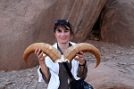
In camp Liz & Jon greeted us with an amazing story. They have spent the day visiting sites in Karkur Idriss, and while driving down the middle section of the wadi they spotted a waddan (barbary sheep, Ammotragus lervia) out on the plain. Musa decided to make a chase, and soon caught up with it with the Landcruiser. When reaching it, Musa slammed the brakes, jumped out and ran after the tired creature, and amazingly caught it by the horns with his bare hands. It turned out to be a young female, with strong insistance from Liz & Jon it was released after taking a number of photos. Musa remembered being told by his grandfather many years ago, that a waddan will become totally submissive if caught by the horns, will kick and bite otherwise. Musa never imagined he would get an opportunity to try it out in practice, waddan having been hunted to extinction long time ago in the Acacus and the Tassili.
23rd November - Ain Dua
We have been entirely succesful in our treks to the Emeri, it was time to move on to our next target area, the vicinity of Ain Dua. Tired from the long walks, we made a rather lazy start, packing camp and moving out to the entrance of Karkur Ibrahim.
We drove past the entrance to the police post at Ain Zueia, where several large Sudanese trucks were parked, in process of completing the border formalities. We just made a brief stop to inform the police that we are going to Ain Dua, then moved on.
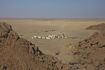
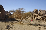
We continued to Ain Dua, where we received a very friendly welcome from the military. We were invited to wander about the rock art sites as we pleased, and no objections were raised to our plans to camp in the western vicinity, then explore the country to the immediate east of the military post on foot in the afternoon. We spent the remainder of the morning climbing up among the boulders (and piles of rubbish) to the two principal sites at Ain Dua, AD 1 & AD 2. I was particularly relieved to see that there was no other recent damage than the ones already seen and documented in 2001.
Finised with the paintings, we took the opportinity to take a quick wash at the spring, before moving to search for a suitable camping site.
We drove about three kilometres west of Ain Dua, where another watercourse descending from the heights reached the plain. The outflow at one time must have been greater than Ain Dua itself, based on the sizeable alluvial fan deposited at the foot of the mountain, showing up conspiciously on satellite imagery. There were plenty of large boulders which offered shade for lunch, and the soft sand in the bed of the watercourse made for ideal tent spots, a perfect campsite.
We had lunch and a rest till the worst of the midday heat was over (which did not prevent some of the more insane of us from searching the surrounding schorching rocks, resulting in four shelters with faint paintings...), then we drove back to the post at Ain Dua, and set out on foot to explore the foot of the mountain to the east of the spring. Alessandro did find a single shelter with paintings in 2008 about 150 metres to the east ofthe spring, but to our knowledge the foot of the mountain has never been searched systematically up to a point about 3 kilometres forther east, where Jean-Loïc LeQuellec found some paintings in 1996. Making the traverse along the edge of the boulder slope, we did find five new sites, including three right next to the sites reported by Jean-Loïc. All these new finds were a confirmation that a systematic survey of the perimeter of Uweinat will yield further results at all locations, not only in the vicinity of known sites.

We did not only find prehistoric remains, a broken glass bottle had the initials of the Reggia Aeronautica on the bottom, attesting that the area was at least visited in Italian times. As we were finishing the photography of the new sites, Ettore arrived with three black and white puppies in tow, following him all the way from Ain Dua. Enthusiastically he informed us that he and Paolo found a very nice shelter with a painted giraffe and cattle a little way back, which the rest of us walked past in our eagerness to reach the cluster of rocks harboring the known sites.
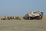
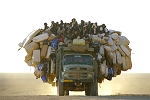
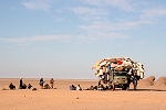
We walked back to our cars at Ain Dua, just in time to catch the arrival of the huge Sudanese truck we saw earlier that day at Ain Zueia, with at least forty people riding on the top. It constantly amazes me how these vehicles manage to stay upright...
With the sun low, we drove back to camp to pitch the tents, just in time to catch the setting sun.
24th November - West of Ain Dua
Our plans for the day were to visit Yerguehda Hill, a solitary granite and basalt outcrop about 80 kilometres straight south from Ain Doua, where Bagnold and Shaw found some very interesting rock paintings in 1932. In November 2001 we could visit the place easily, but two years later our guide and drivers conspired against venturing that far south towards Chad. This time we asked the soldiers at Ain Doua, given the sensitivities involved with going anywhere near Sudan, and the day earlier the answer was positive, they even offered an escort to make sure we do not run into any trouble. However overnight our policeman seems to have chickened out and decided eighty kilometres further south was way outside his comfort zone. We went back to Ain Doua to have a discussion with the soldiers again in the hope of swaying his mind, but it was to no avail, our policeman stubbornly dug his heels in, and refused to listen to anybody. It was a bit disappointing, as we were counting on visiting the locality to properly document the sites. However it was far from a disaster, we had plenty to do around Uweinat, and we had a contingency day to visit the best sites of Mark Borda at Arkenu, planned exactly for this eventuality. In the mean time we had some time to spend at Ain Doua, as the discussions were on hold until the commanding officer has woken up... The place was rather lively as the Sudanese truck and it's riders were still there, preparing breakfast and then getting ready to leave for the long journey south.
We spent our waiting time walking along the foot of the mountain a few hundred metres to the east, where we knew there was a site found by Rhotert in 1933 (Ain Dua E) under a large flat boulder, which none of us had visited before. There were supposedly at least another five sites here, three of which were recorded by Di Caporiacco in May, 1933, and five were noted by Rhotert in the autumn of the same year (not necessarily overlapping). In 2001 I have found two sites in the area, however none of the scenes matched those copied by Di Caporiacco, and only one matched Rhotert's photos (Rhotert only documented one site, Ain Dua H, the rest were just photos of the rocks without any closeups of the paintings). Thus there were potentially up to nine sites in the area, plus Rhotert's site E. This time we have only managed to re-locate just one site I saw previously (the one Rhotert also saw), but we easily found the conspicious large flat rock that was Ain Dua E, with the cattle and human figures familiar from Pauli's copies on the ceiling. A little way back, we came upon a site with faint "miniature" style figures that apparently did not match any of the previously reported sites.
Once it was evident that Yerghueda is off the day's agenda, we switched to our plan that was already agreed the evening before, after the views of our policeman were known. We planned to explore the foot of the mountain from Ain Doua to our camp on foot, then continue in the afternoon from camp westwards, as far as we can reach to return before sunset. We easily covered the ground till camp in about an hour and half, with Pascale finding one new site with some very faint "Uweinat roundhead" style figures. One pleasant surprise was that while the vicinity of the Ain Dua post was filled with all imaginable rubbish, beyond a distance of about three-four hundred metres the desert was pristine and untouched, even tyre tracks were scarce on account of the numerous shallow but very bumpy watercourses close to the foot of the mountain. We visited the sites found a day earlier by Alessandro, before settling down in the shade of the big rock where we had lunch also the day before.
While the majority of us walked back, Paolo & Michele drove out to the site of the old Italian landing ground of Ain Dua, where they still found several relics dating from the thirties
In the afternoon we continued surveying the foot of the mountain. Not far west from camp there was an immense flat boulder, standing dolmen like on a number of smaller rocks. It formed a very inviting shelter, on close scrutiny some very faint paintings were revealed, unfortunately the vast majority were destroyed by water runoff. When intact, this site must have rivalled the big shelter at Bu Helega. A few hundred metres further we found another site, this time with some faint but redily discernible "Uweinat roundhead" figures under a later layer of cattle. This was a splendid find, one of the most important we have made on this trip. There were a further couple of minor sites, then for several kilometres we found nothing, just a jumble of granite boulders piled up at the edge of the plain. As the sun lowered the towering granite turned a golden yellow, it was all very lovely and peaceful as we slowly converged on camp for the evening.
25th November - Jebel Uweinat - Jebel Bahari
Next morning we broke camp to begin our return journey Northwards. We still had a few places to tick off at Uweinat, and our plan was to make it to Jebel Arkenu for the evening. We started off driving towards Ain Zueia a little beyond the point reached on foot the previous afternoon. In the general area Jean-Loïc Le Quellec found a site in 1996, the precise location was not known, but a group of conspicious looking big boulders at the foot of the mountain looked inviting (as it must have been so for Jean-Loïc too...). Parking the cars we spread out to search the area. The known site was found fairly quickly, being a sizeable shelter under the most conspicious of the boulders. It soon emerged that the single photo of Jean-Loïc did not do the site justice, there were several well preserved scenes of cattle, humans and goats. A little further north we found another site, with a number of weathered cattle.
We continued to the police post at Ain Zueia to collect our passports, said farewell to the policemen and continued to a rock island north of the entrance of Karkur Ibrahim.
While we were doing our second trek on the Emeri Plateau, Paolo spent some time driving around the multitude of small rocky hills at the entrance of Karkur Ibrahim. At one of them, he spotted a shelter in a deep crevasse, and found a very nice panel of paintings with a large archer, giraffe and other animals. Nearby there was another shelter with faint cattle paintings. We visited both sites, and proceeded to have a long lunch break, while little Mohammed went back along our route from Ain Zueia to (unsuccessfully) look for a tool set that must have dropped out of the back of his Hilux at a larger bump.
When Mohammed returned, we moved on to Bu Helega, stopping along the way at a couple or rock clusters, but finding nothing. We just made a brief stop at Bu Helega to take a few detail shots of the big "Uweinat roundhead" site (BH 4), and taking the opportunity for our group photo in front of the paintings.
The stop also a gave me a chance to take some good wide angle panorama shots with flash of the adjacent great vault of Bu Helega (BH 3) to replace my miserably failed attempts of the previous visit.
The last stop of the day was at the small rock island ("l'Isolotto" on the 1933 Marchesi map) at the edge of the dunes separating Uweinat and Arkenu, facing the entrance of Karkur Idriss. We located the sites along the western side found by Mark Borda in late 2009, and were lucky to find another site close-by with some faint "Uweinat roundhead" figures. When we finished, we continued accross the dunes towards the eastern side of Jebel Arkenu.

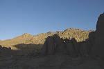
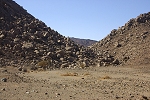
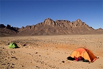
The eastern side of Arkenu is surrounded by a band of several kilometres of talus and rubble, criscrossed by innumerable shallow boulder filled wadis. It is practically impossible to drive up to the edge of the mountain. We drove as far as we could towards the steep wadi which we intended to climb the next day, and made camp in a rare sandy patch in one of the shallow wadi beds.
26th November - Jebel Arkenu
Mark Borda visited Jebel Arkenu in November 2009 and again in January 2010, and made some impressive rock art finds, especially in the unexplored eastern, sandstone part of the mountain (published in Sahara 21 (2010)). Ascending the high sandstone plateau, he found a similar environment as on the much higher sandstone plateaux of Uweinat, with flat bottomed wadis harboring shelters with some very fine paintings. Our plan was to ascend the principal south-eastern wadi up to Mark's site AR 43, the most specatcular among all his finds. We also had the opportunity to visit some lesser sites along the ascent. We started before dawn, to make as much as possible of the climb in the cool of the morning.
Unfortunately the way up was directly open towards the rising sun, after an hour or so we were struggling up the increasingly steep slopes along the sides of the wadi in blazing sunlight, bypassing a cluster of sites to be seen on the way down.
We reached the top of the plateau in about three hours, surprisingly fast compared to how difficult the way up appeared from below. The plateau top was a dissected wonderland of vertical rock towers, very much like the top of the Hassanein Plateau at Uweinat. We had to walk another hour among the maze of rocks to reach the site, a shallow shelter in the side of a vertical rock face, filled with brilliantly preserved paintings of the cattle pastoral period.
We spent about an hour and half at the site, photographing every cow to the last detail, then started making our way back to the cars in the worst of the midday heat.
We stopped at the two sites found by Mark under large fallen boulders in the wadi bed (AR 42/A & 42/B). While not as spectacular as the main site on the plateau, there were a number of interesting details in both shelters.
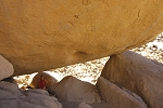
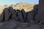
As we continued down from the second site, one of us decided to take a shortcut down a rubble slope between two rocks, rather than taking the easier looking, but longer way around. At the bottom of the slope, we came upon a large shelter under the left rock, which we found to contain a beautifully preserved panel of cattle and human figures on the ceiling deep inside the shelter. More importantly, on the face of the boulder we found in a small indentation a large composition of "Elongated roundhead" figures, one of the best preserved and elaborate examples of this peculiar and rather rare style. We soon realised that this was the most important find of our entire trip. Needless to say, the lunch waiting for us down at the cars was rapidly forgotten, we spent almost two hours fully documenting this new site.
It was well into the afternoon when we reluctantly made our descent, passing by another of Mark's sites along the way.
We were planning on visiting some more paintings found by Mark along the Northern side of Arkenu, but our new find needed a re-assessment of our plan. We just had enough time to have a quick bite, pack up the camp and start moving to a new campsite along the northern side of the mountain, positioned so we may at least see the most important sites in the area.
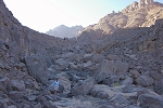
Driving around Jebel Arkenu is a rather miserable affair. The ground is boulder strewn and dissected with small wadis for several kilometres around the mountain. It looks deceptively smooth, but the barely noticeable watercourses brings one to a halt every couple of metres. We crawled along for a good hour to cover the little more than ten kilometres to the northern side.
Our campsite was very similar to the one the night before, no shelter just a few patches of sandy ground in the shallow wadi on an otherwise rocky plain. We were within sight of the sites we planned to visit the next morning, all of them near the mouth of a wadi as it entered the plain. Fortunately the evening was calm and peaceful, it turned out to be pleasant despite the rather bleak spot..
27th November - Jebel Arkenu - Jebel Sherif
At break of day we set out for the dark mouth of the wadi, about two kilometres away. Mark found three sites here, one about 100 metres above the plain elevation is one of the principal Arkenu sites. We walked past the other sites at the wadi entrance to be visited coming down, going straight for the principal shelter to beat the rising sun. After climbing a short but unpleasantly steep rocky stretch, we reached the immense boulder with the paintings underneath (AR 55/C).
A short distance above the main shelter, we found another rock which on close scrutiny revealed a row of very faint, but clearly recognisable "Elongated roundhead" figures. Possibly a systematic survey of the valley may reveal more paintings sometime in the future.
On the way down we split into two groups, one party coming down the western side of the wadi to see a large shelter with both paintings and engravings at the entrance, while the others who stopped here on the way up scouted the eastern side, and found two very fine panels of engravings, depicting giraffe and other wild fauna.
Getting back to the cars we double checked with Aboubaker the flight schedule from Kufra the next afternoon. All was unchanged at 7pm, so we practically had all of the next day to get to Kufra, allowing us to visit Jebel Sherif on the way back. We already planned the route the evening before, that was to take us practically all the way on smooth sand plains, without any difficult terrain. The only obstacles were the dunes immediately to the North of Arkenu, which we tackled relatively easily, only the Hilux getting stuck once getting up on the soft southern slopes. Among the dunes, we chanced upon a wrecked truck chassis, a fairly modern army truck by the look of it.
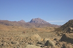
We drove pretty much non-stop for about five hours, save for a brief pause for lunch. The terrain proved to be easy as anticipated, by four in the afternoon we had Jebel Sherif, a cluster of low hills in sight on the horizon. These hills would be just like any of another dozen similar looking ones in the vicinity, except that this was the place where LRDG T Patrol led by Patrick Clayon (who was captured in the incident) clashed with the Compania Auto-Sahariana in 1941 (for the full story, see Kuno Gross's excellent book, Incident at Jebel Sherif, available through www.jebelsherif.org).
The remnants of the small battle still lie almost exactly as they were left there at the end of the day on the 31st January, 1941. T patrol lost three vehicles, set on fire by Italian machine gun fire, which also killed Corporal Beech and the Italian postman of Murzuq, Colicchia (who was captured earlier during the Murzuq raid). They have been burried there nine days later by a Free French patrol, their graves marked by the New Zealand and Italian flags by Kuno, Roberto Chiarvetto and Brendan O'Carrol during their visit in 2008. The same French patrol set fire to a slightly damaged Fiat truck that was left there by the Italian patrol for later recovery. It was evident from the numerous fresh car tracks and footprints that the locality is now firmly on the tourist trail. Forunately it appears that recent visitors, Libyan and foreign alike seem to have respected the place so far, we found no sign of vandalism or piles of rubbish that litter so many other Libyan historic sites. We can only hope it stays this way...
At sunset we left the battleground, and made camp west of the hills, finding a little shelter from the cold northern wind. Up till now we were lucky with the weather, it was warm but never too hot, this was our first distinctly cold evening.
28th November - Jebel Sherif - Kufra - Benghazi
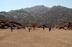
We awoke to a rather chilly morning. With the flight from Kufra in the evening we were not in a hurry, Kufra was just an easy 150 kilometres away. We packed our last desert camp in a leisurely fashion, took several group photos with our drivers, and signed the t-shirts that Michele made for the occasion.
Before starting back to Kufra, we returned to the battle scene to photograph the remains of the Fiat truck in better light. Evidently the engine and other useable parts have been removed, this wreck is in the poorest condition.
The drive back to Kufra was short (just under two hours) and uneventful, except for an encounter with two huge trucks that were going towards Chad, now the busier of the two trade routes going out of Kufra with the troubles in Darfur. The offer to purchase fresh meat was politely declined, explaining we were about to go to town...
Once in Kufra, we drove up to the fine Sudan Hotel, where we had the opportunity to take a hot shower after two weeks (amazingly the hot water lasted the entire group), change into civilised clothes and pack our gear before heading to the airport.
The Air Libya (formerly Tibesti Airlines) flight was returning from Khartum, not surprisingly it was expected late. As soon as we had word that it actually left Khartum, we said our farewells to Ettore, Michele and Paolo, who departed accompanied by Musa on their drive North. Our remaining three Mohammeds patiently waited with us until the aircraft arrived and it appeared that we were definitely leaving.
Needless to say the flight was late into Benghasi, missing the last connection to Tripoli, so we spent the night in a downtown hotel courtesy Air Libya. This was only a problem for Pascale, who had a flight to Paris at nine the next morning. We managed to re-book onto the first Libyan Airlines flight at seven in the morning, and hoped for the best.
28th November - Benghazi - Tripoli
The Libyan Airlines flight was perfectly on time, we landed in Tripoli little after eight. There were a couple of anxious moments as the luggage took ages to arrive, but Pascale just made it, with some welcome support from Aboubaker. The rest of us waited at the airport for our various flights, spending the time scheming about future trips. Lenka and Richard left at noon to Ubari for a couple of further days in the Fezzan, while the rest of us took our afternoon flights back to Europe. As we flew to Rome, we had a superb clear view of the gently steaming Mt. Etna.
Reaching home was a rather shocking affair, as there were snowstorms all over Europe. We reached home to find two white lumps in front of the house where we were quite certain we left the two cars as we left for Libya... Looking out into the garden, it was hard to believe that we have just left Kufra a day earlier.
The scientific results of this expedition were published in two separate articles in consecutive issues of the Sahara Journal:
Alessandro Menardi Noguera and András Zboray Rock art in the landscape setting of the western Jebel Uweinat (Libya), Sahara 22, 2011
Alessandro Menardi Noguera and András Zboray Elongated human figures, large cows and tethered wild animals from the northern Jebel Arkenu (Libya), Sahara 23, 2012