
|
Click here for larger map in new window |
Wau Namus |
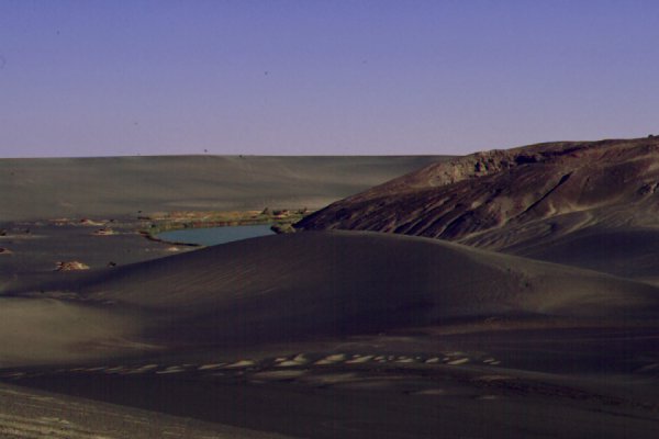
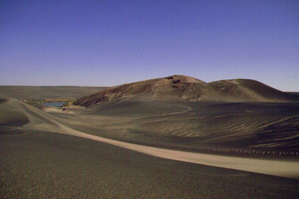
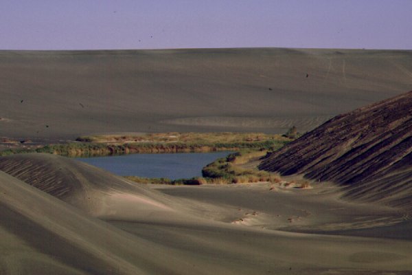
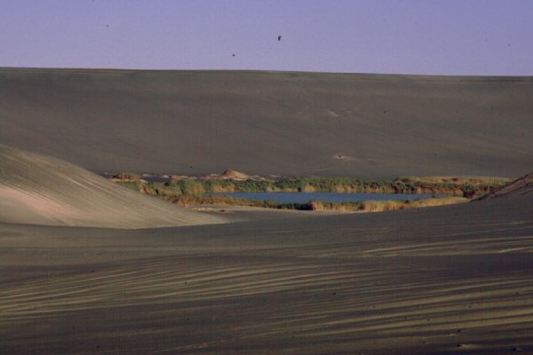
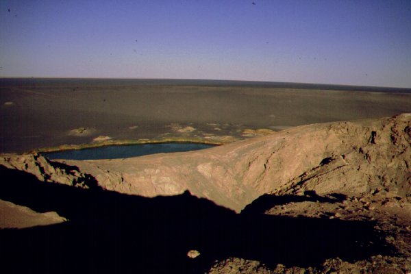
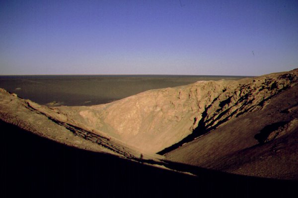
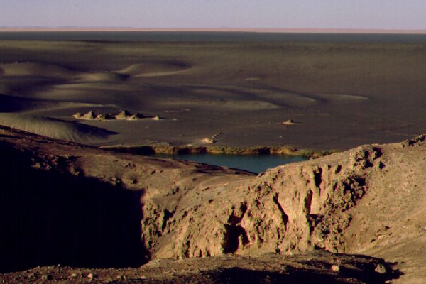
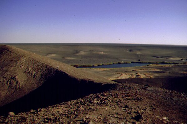
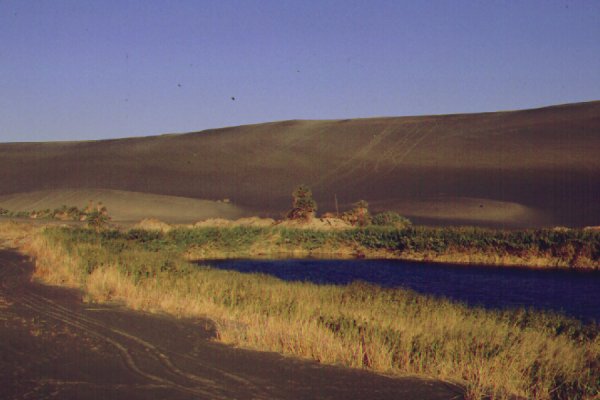
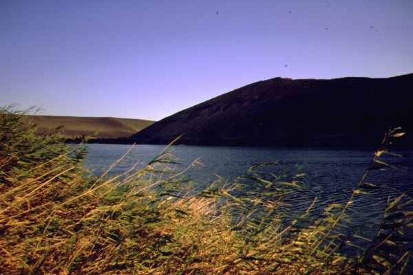
The Wau Namus caldera ranks among the greatest natural wonders of the world. The dormant volcano lies on the border between the Fezzan the Libyan Desert, on the plain to the north of the Tibesti mountains. The ancient caldera broke through the aquifyer layer beneath the desert, and a number of shallow lakes formed at it's center. More recently a fresh eruption built a small central cone, and probably produced the fine black ejecta that covers all the caldera and the surrounding desert in a radius of 10-20 kilometres. The vista is shocking for the first time visitor, as from the outside nothing is revealed. One drives through featureless desert for hundreds of kilometres, then all of a sudden the landscape turns dark, and after negotiating a low rise, one stands unexpectedly at the lip of the crater, gazing into the huge dish shaped depression.
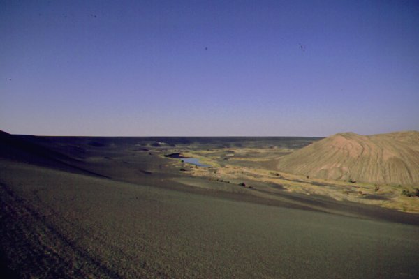
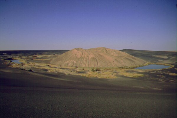
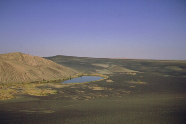
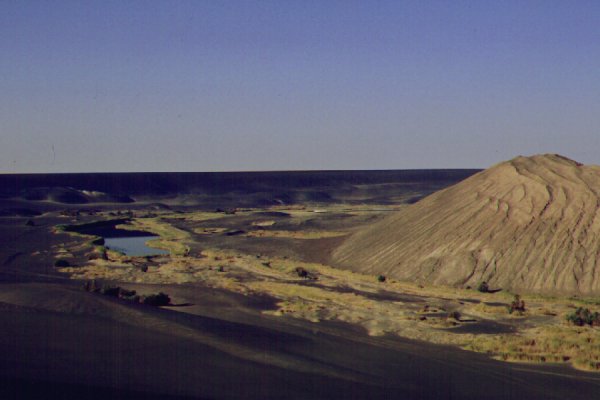
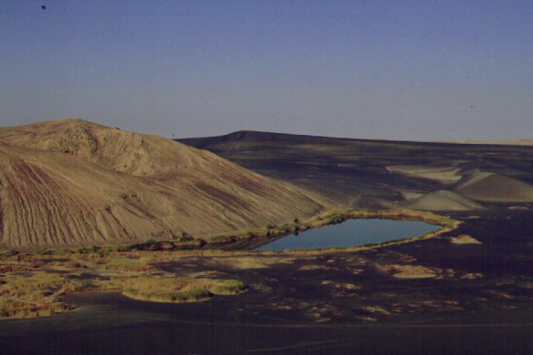
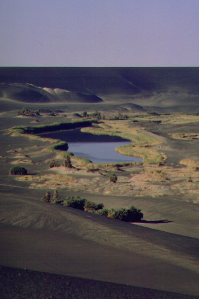
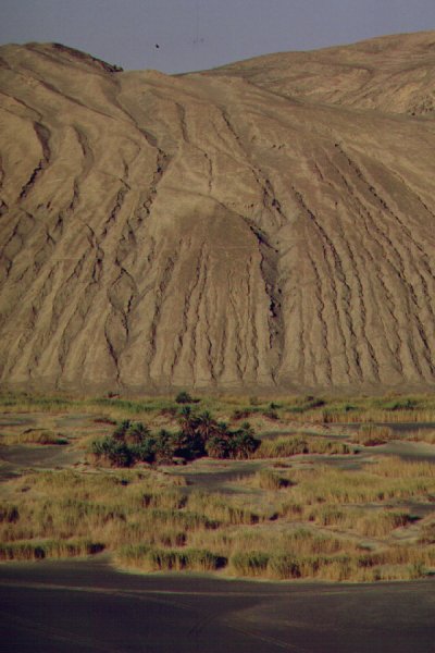
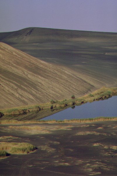
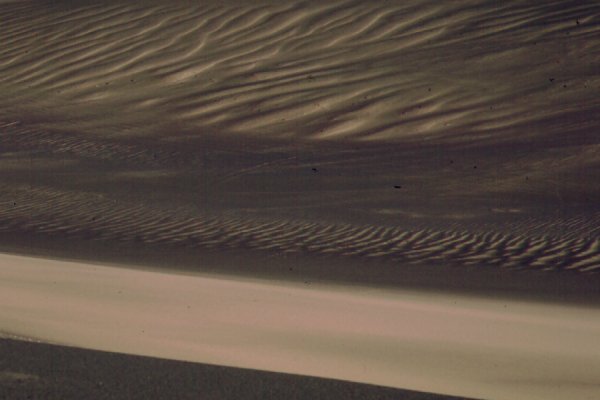
The jet black volcanic gravel (it's not sand, the particles are 2-5 mm) covered everything, and stabilized any sand surface, even the giant sand ripples on the side of the caldera. In places fresh sand was blown in, making a surreal landscape of alternating yellow and black patches. The lakes around the central cone add a further dramatic touch with their vivid blue colour. The surface is very fragile, the black layer is only a few milimetres thick. If disturbed, the original light desert colour appears immediately, especially in vehicle tracks. Once the damage is done, it is irreversibe. Fortunately there are few visitors, and most behave responsibly, but a note if you should ever have the opportunity to get there: please do not drive in to the caldera, and stay on existing tracks, so no fresh ones are made.
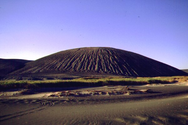
The central volcano looks very fresh, but in the rainless desert the appearance can be deceptive. The deep erosion channels on it's sides indicate that at some time rain was much more frequent, thus possibly the eruption happend during the later part of the neolithic pluvial 3000-4000 years ago.
A number of early explorers of the Sahara heared about the oasis, but due to it's remoteness it remained unseen till 1918, when the French Laurant Lapierre was taken through it, taken captive by the natives, however understandably his reports were very shetchy. The true nature of the volcano was described by the Italian geographer, Ardito Desio, who led an expedition starting from Tazerbo. In 1942 Nikolaus Benjamin Richter visited the volcano during the Sonderkommando Dora operation.
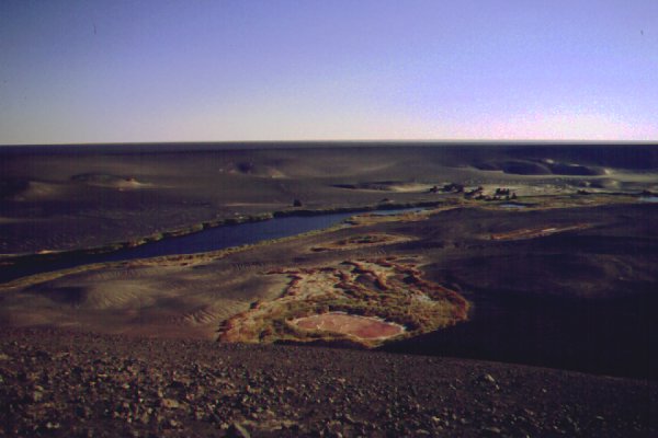
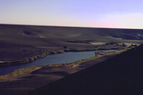
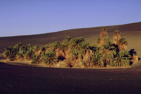
The name comes from the supposed millions of mosquitoes inhabiting the salt lakes (Wau Namus = "oasis of mosquitoes"), however during our visit in 2001 we have not seen any. There is lush vegetation around the lakes, mainly reeds, clusters of date palms, and slightly farther tamarisk mounds. We have noted several species of water birds on the lakes, but the thick curtain of reeds all around made a close look impossible.
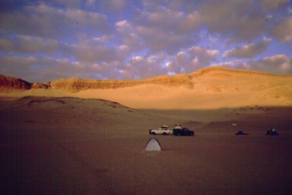
About 5 kilometres from the north west lip of the caldera there is a smaller crater surrounded by a low mound, clearly visible on the satelite photo. This is not covered by the black ejecta, however this is probably due to wind action as it's appears to be significantly older than the central cone of the main caldera. It's rim is covered by large patches of salt deposits. The crater is open towards the north west, and makes the best camping spot in the area.

|

|

|