
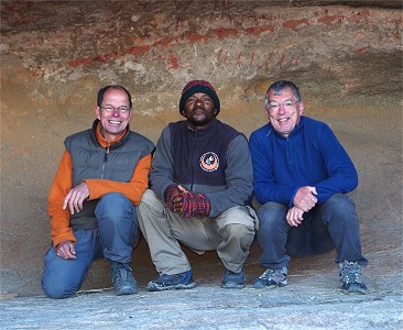
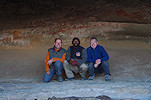
 Click on image for list of participants |
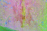
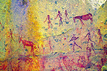
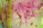
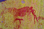
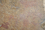
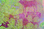
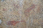
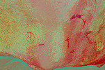
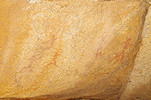
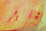
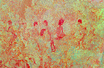
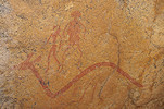
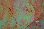
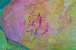
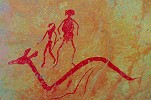
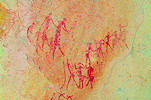
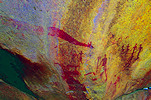
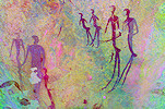
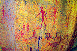
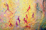
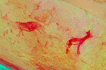
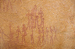
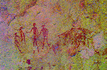
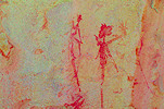
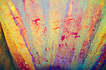
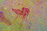
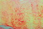
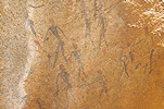
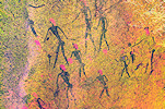
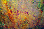
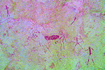
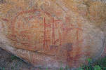
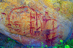
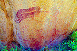
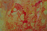
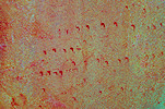
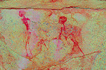
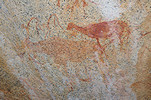
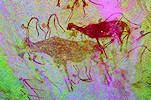
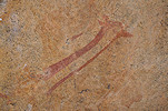
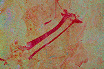
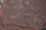
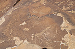
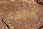
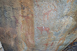
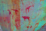
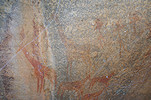
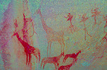
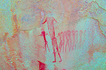
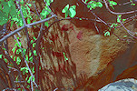
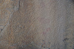
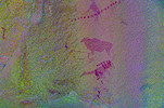
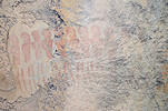
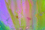
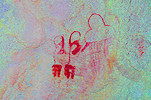
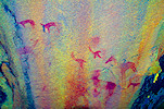
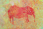
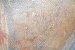
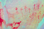
Rock Art of Namibia 2nd - 16thJune, 2022 Site references based on numbering system of Harald Pager (Upper Brandberg) and Ernst-Rudolf Scherz False colour images processed with dStretch, a freely available software developed by Jon Harman |
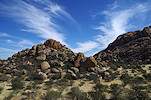
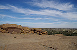
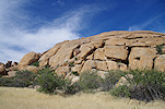
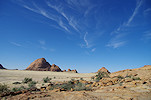
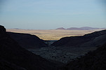
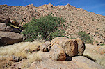
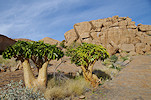
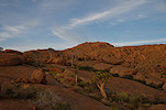
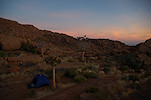
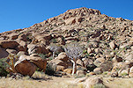
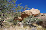
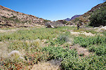
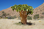
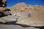
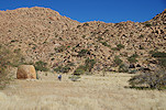
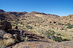
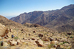
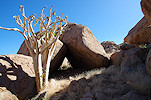
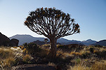
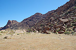
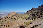
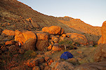
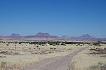
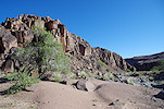
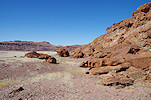
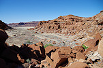
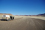
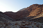
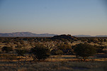
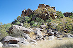
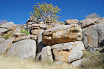
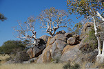
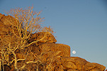
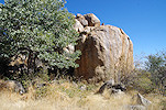
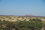
Day 1. - Windhoek - Ameib
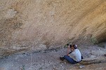
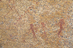
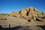
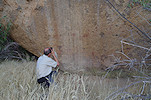
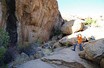
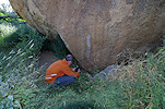
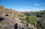
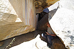
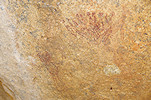
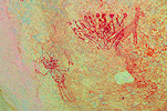
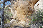
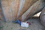
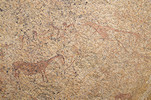
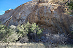
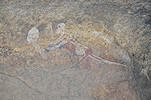
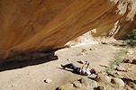
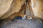
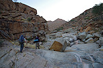
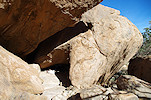
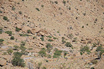
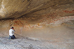
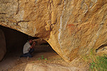
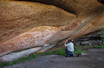
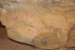
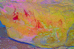
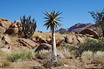
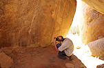
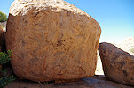
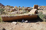
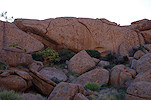
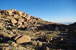
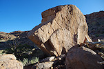
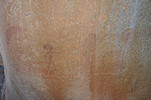
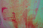
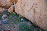
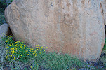
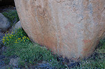
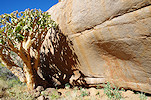
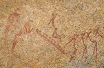
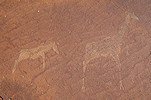
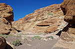
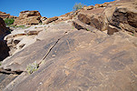
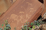
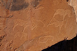
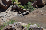
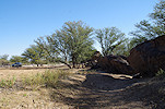
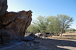
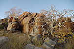
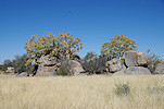
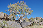
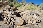
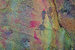
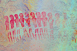
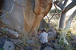
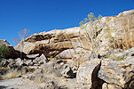
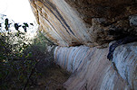
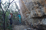
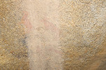
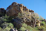
Uwe arrived with the morning Frankfurt flight (me the previous afternoon), after a quick visit to the National Heritage Council to arrange our Brandberg trekking permits and some shopping in Windhoek we set out for Ameib Ranch in the southern Erongo, reaching it shortly after noon. After settling in we continued straight to see the Jatow grotte (Scherz site 149), on the eastern part of the vast property.
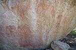
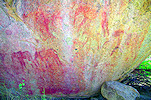
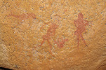
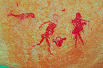
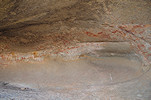
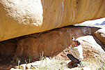
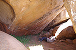
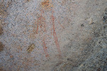
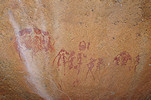
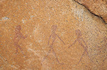
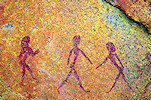
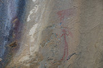
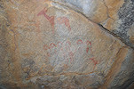
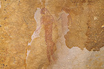
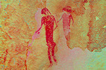
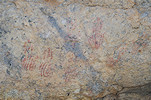
The site is composed of two separate levels, with only a fairly difficult circuitous route connecting them. The lower one is the main shelter with the majority of the fine panels of paintings. The upper level is not much more than a rock wall with some very faded scenes, plus a well preserved group of human figures at the very end of the shelter.
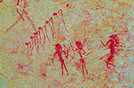
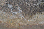
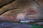
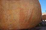
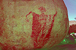
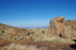
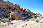
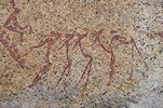
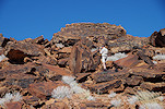
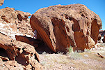
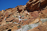
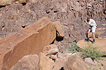
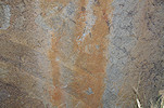
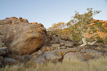
We still had enough of the afternoon left to look for Scherz's site 147/C, a group of three rocks with paintings a few hundred metres to the south east of the Klein Ameib spring. As usual with Scherz's sites, the map and description was rather vague. While the cluster of boulders was fairly obvious, an hour's search failed to locate any of the paintings. Finally as we were about to return to our car, a few very faint figures were spotted on a prominent boulder. Checking against Scherz's descriptions, it is likely that we found an unrecorded site (147/D), the published ones still remain to be re-located.
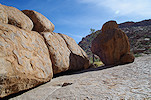
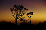
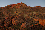
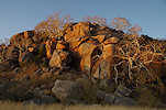
On our way back to the Ameib farmhouse we stopped at the "Geisterkampf" site (Scherz site 150) which just came into the shade with the sun setting behind the Erongo.
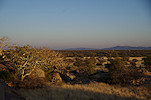
Day 2. - Ameib - Omandumba West
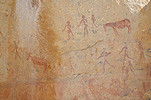
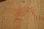
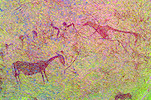
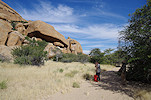
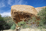
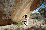
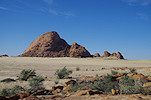
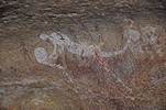
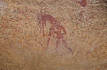
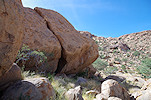
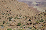
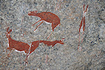
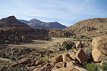
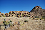
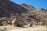
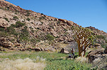
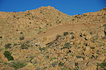
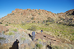
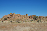
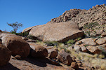
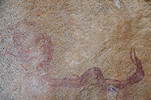
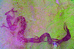
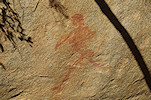
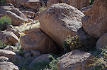
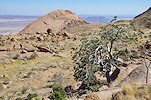
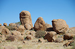
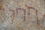
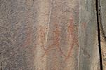
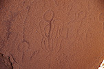
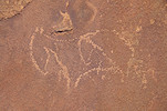
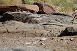
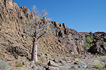
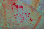
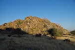
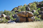
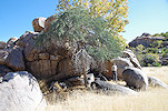
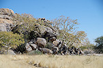
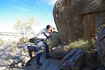
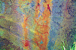
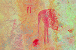
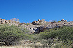
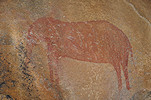
The Ameib property is very rich in rock art, but as a private nature reserve most of the more remote localities are understandably off-limits to visitors. This year we received the rare privilege of being permitted, accompanied by a local guide, to visit the "Minendam" (Scherz 154) and "Tal der Riesenblöcke" (Scherz 152) sites. After breakfast we immediately set out on the track towards the old mine dam, and leaving the car behind in the riverbed we continued on foot towards the dam and the sites beyond. The most interesting site is 154/D, a huge rock wall on the slope just above the dam, with a rhino headed therianthrope among the many other well preserved figures.
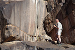
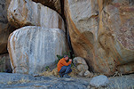
A little further upstream we readily found the huge boulder of site 154/E, however the rock appeared empty until swiping away the dense undergrowth we found the two very fine human figures at the very base of the rock, completely hidden from sight.
Site 154/K was in a shelter someway up the hillside somewhere upstream of 154/E, we spent a good hour looking for it on very difficult terrain, but in the end we gave up as our time was running out, with many more sites to find. Somewhat reluctantly we returned to the now completely silted up dam, which still bore the marble plaque dating from 1930 proudly commemorating its constructors.
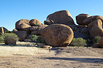
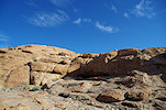
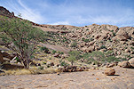
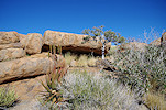
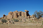
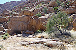
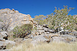
There are some low granite ridges to the west of the Minendam, with several sites scattered about. Site 154/C was a minor site, but 154/F a major one with numerous panels of fine paintings scattered about on several adjacent boulders.
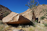
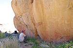
Site 154/A was a few hundred metres away on a huge granite boulder in the middle of the valley, with a number of fine panels all around the block. Some were out on the sun, but fortunately the main scenes were already in the shade on the east side of the boulder.
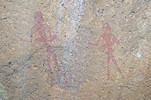
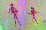
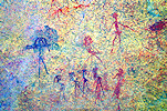
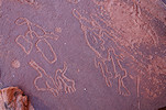
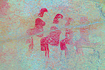
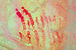
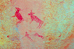
A further group of sites was on the far side of the valley, along the sides of several low granite ridges. The first, site 154/G had many well preserved figures, including a rather bizarre one with a single body but two heads, two sets of legs, and a bow and arrow held by the only two hands.
Along the sides of the valley beyond 154/G there were two more sites, 154/H with a nice panel of paintings, and the unassuming 154/X that could be reached through an uncomfortably tight low tunnel that crossed right under the granite ridge.
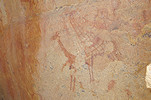
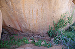
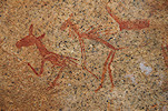
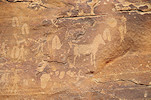
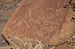
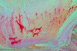
The last site of the Minendam cluster is 154/I, a good kilometre to the west of the dam, under a cluster of huge boulders at the base of an isolated granite hill. There are several panels of paintings on the sides of the shelter underneath the rocks, including a large panel with at least five recognisable elephants.
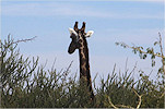
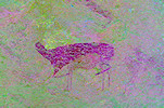
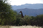
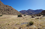
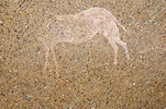
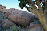
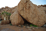
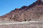
We returned to the parked car and drove back a few kilometres along the track towards the mouth of the "Tal der Riesenblöcke" (valley of the giant boulder). As we drove, our guide spotted the head of a fine giraffe sticking out of the bush, a nice change after seeing all the painted giraffes. As we rolled slowly forward it soon came fully into sight, before disappearing again among the dense shrubs. Leaving the car on the track we again we continued on foot towards the left side of the entrance of the valley where among a cluster of boulders I hoped I have correctly identified some of Scherz's sites on Google Earth. As customary, this was not the case. We found nothing at the expected place, after an extensive search we found a site a good two hundred metres away that matched the description of Scherz's 162/G. There was a large panel of paintings on the side of the rock, but mostly damaged with only a few well recognisable figures.
Sites H, I and K were all supposedly within shouting range, but having searched all the rocks in the vicinity, we only found 152/I, with just a few recognisable paintings.
Being short on time, we did not search any further, but proceeded into the valley proper, till the giant boulder about a kilometre upstream that gave the valley its name. The huge boulder had a large shelter under its western side (site 152/F), unfortunately now slowly coming fully into the sun in the afternoon light. The shelter wall was full of paintings, but barely visible in this light. Providing shading to each other the best we could, we photographed what could be made out, taking a mental note to re-visit this site in the early morning the next time we can visit.
There were two more sites, L & M a few hundred metres further upstream, but checking the watch we had to leave these for another visit. We had to reach Omandumba by sunset, and it was already past the time we set for ourselves to be back at the farmhouse to depart. We made a hasty retreat towards the car, passing two more sites along the east bank of the valley, 152/E & 152/D, fortunately both easy to find under conspicuous boulders pretty much where they were expected based on Scherz's map.
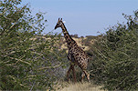
Leaving the valley we encountered probably the same giraffe that we saw earlier. Being on foot we tried to get closer, but as soon as we would have had a clear view it withdrew into the bush.

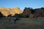
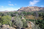
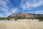
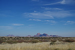
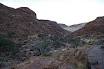
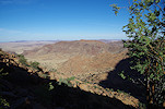
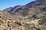
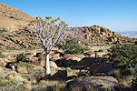
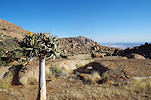
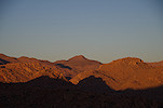
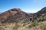
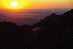
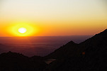
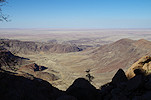
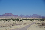
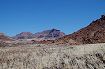
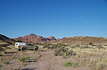
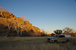
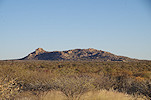
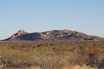
We returned to the farmhouse to drop off our guide and say good bye to our hosts, then we set out on the road skirting the Erongo towards Omandumba, with a superb view of the mountain along the way in the late afternoon light.
We spent the night at the Bushcamp at Omandumba West, paying a quick visit to Deike and Harald Rust, our hosts on many previous trips.
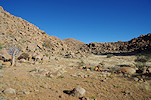
Day 3. - Omandumba - Klein Spitzkoppe - Amis Gorge
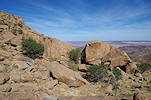
After breakfast we said good bye to Deike and Harald till the next year, and set out on a circuitous road towards Uis and the Brandberg, our main target for the trip. On previous trips Uwe never had the chance to visit the Klein Spitzkoppe sites, now there was a good opportunity, so we set out towards the south. Shortly after passing Tubusis there is a low granite hill just beside the D2306 road. I have long suspected that this hill must be Scherz's site 99 (Tumib), but we never had the time to stop and check it out. Now there was no rush, and as we approached the hill from the road we immediately came upon a shallow shelter with paintings inside, which matched those described by Scherz.
We continued via the D1927 towards Spitzkoppe. Having already visited the main Spitzkoppe sites together, we drove past towards the Klein Spitzpoppe, straight to the "White Ghost" shelter (Scherz site 89/A) which we successfully located in June 2017.
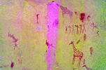
After taking out time to photograph the numerous scenes in the "White Ghost" shelter we crossed to the other side of the valley for a brief visit to the "White Giraffe" shelter (site 89/C), so named after the very fine giraffe depictions.
The Abbé Breuil and Scherz recorded a number of other sites in the Klein Spitzkoppe area. It would need at least a full day (if not two) to find all (and some are probably destroyed by granite mining in the area), but one site in particular, 89/G looked both interesting and easily accessible. We drove to the likely spot, and immediately found a shelter with some faint paintings, though none matching Scherz's described scenes.
Searching further among the rocks, we found two adjacent shelters with paintings, the first matching scene G2 of Scherz, so we were definitely on the right spot. The second again did not match any of Scherz's reported scenes, and despite an extensive search of the area we found no trace the remarkable scene of the two facing ghost-like figures of Scherz's G1.
Our plan was to camp in the Amis Gorge to be able to make the ascent at first light the following morning, so we had to give up further searching and take the road to Uis. We were there by the early afternoon, and after fueling and meeting up with our NHC guide John, we left town and drove straight to Amis Gorge.
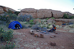
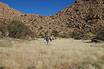
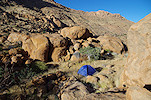
Making camp at the end of the Amis Gorge track, we still had enough daylight left to make a search for Scherz's missing site 75/M, which we searched for with Gábor & Seth the year before, but could not find it. We searched the rocks again in the indicated area on the slopes to the west of the main watercourse, but again found nothing. Returning somewhat disappointed, it was John who checked the rear of an inconspicuous boulder in the middle of a large island flanked by the river on both sides, and by pure accident found the site we were looking for. The paintings were now fully exposed to the afternoon sun, but as the ascent path led right by the site, we decided to stop in the morning to photograph it, rather than to wait for the sun to set.
Day 4. - Amis Gorge
In the morning we were up at first light, and after quickly packing our gear we left the car and set out for the climb around 6:30am. The fist stage was short, stopping at site 75/M which we found the evening before. The paintings turned out to be a very nice panel of gazelle, almost invisible in the evening direct sunlight.
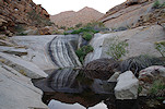
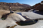
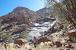
After another 20 minutes of climbing along the gently rising trail we reached a rock basin that was full of water, raising our hopes that we will find plenty of water on the mountain. To make the climb easy we only carried three full bottles each (plus two empty 5l bottles), with the expectation that we will be able to re-supply at the reliable Amis waterhole. Were it to be dry, we would have had only enough water to make an immediate descent.
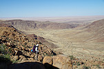
We continued steadily along the gently but steadily rising well-built path. I was told that the Amis is the most comfortable of all the Brandberg ascents, hitherto I had no experience, but after the first three hours I had to agree. We were still climbing in the shade, the rising sun being blocked by the mass of the mountain. Starting from a 750m elevation at the car, by 9am we reached 1300 metres, having accomplished more than half of the day's target of a thousand metre ascent.
Soon we reached the midway terrace with the cluster of rock art sites at an elevation of about 1350m, one of our major objectives on this trip. The first of the sites, A2 was underneath a huge boulder perched right at the edge of the terrace, with several panels of paintings dispersed on the ceiling and smaller rocks surrounding the underlying rather cramped shelter. The most interesting panel depicted several eared serpents, plus there were numerous groups of human figures.
Site A3 was just a few dozen metres away, on the far side of the same rock cluster, under another huge boulder which his time created a spacious comfortable shelter. Here too there is a fine panel with an eared serpent and human figures, plus a number of smaller scenes.
We spent a long time searching for site A4, drawn to lie somewhere just above A3 on Pager's sketch map. In reality it is a good hundred metres away, Uwe found it by accident when wandering off while me and John were systematically searching the boulders near A3. Having found A4, A65 was straight forward, a very inconspicuous site on a low rock outcrop just above A4 with just two painted figures at the end of a rock.
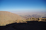
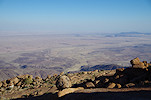
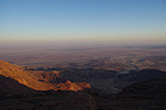
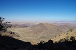
We continued up, and after gaining another hundred metres on a roughly 3:1 gradient we reached another terrace with a big boulder at the edge, site A66, with a few rather faint human figures on the sunlit side of the rock. We continued climbing, and by midday we reached another terrace, a further 100 metres higher, where we hoped to locate site A5. The site was nowhere to be fond, but we had a superb view of the sites we just visited below, as well as the entire valley. This was a perfect spot for a quick lunch and some rest before continuing the climb. The weather was pleasantly cool, it was more comfortable to stay out on the sun than to move into the shade, where it was distinctly cold.
From our lunch spot we could already clearly see the big granite dome with the crack that was the Amis waterhole, about 200 metres above us. We set out towards it, and in les than half an hour we were on the smooth granite ledge below the dome. Site A7 was somewhere under the waterhole, leaving our packs we set out to search the rocks, and on a small terrace we did find not one, but two separate panels of paintings. This was rather puzzling, but a quick consultation of the Pager tracings cleared things up. Unexpectedly we stumbled upon site A5, thought to be at a much lower elevation. We continued searching for A7 among the rocks above, but this proved to be futile, finding a faint panel on a small boulder of which hundreds litter the slope is next to impossible unless one knows exactly where to look.
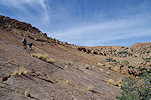
The route further up continues in the main watercourse to avoid the nasty terrain littered with boulders at the foot of the granite dome, after a short burst of steep climbing on the smooth granite plates we were standing at the entrance of the Lufthöhle (A6), one of the most spectacular sites on the Brandberg. The climb was much easier and shorter than anticipated, not counting the time spent at rock art sites and the midday rest, it only took about four and a half hours from the car to the Lufthöhle, an ascent of 1000 metres over a horizontal distance of ~3.8 kilometres.
The last time I have been to the Lufthöhle ("wind shelter") was together with Uwe on the helicopter supported expedition in June 2013. At the time we both had less capable cameras, so we spent a lengthy photo session to re-capture all the details in better resolution.
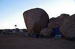
John showed us a very pleasant campsite just a short distance from the Lufthöhle, also on the direct route towards the waterhole below. John volunteered to check out the waterhole, while with Uwe we set out to search for a still missing site, A17, supposed to lie somewhere to the south of A10 ("Riesenhöhle"). In June 2013 we did search this area, and have successfully located sites A14-16, but gave up on A17 after searching the hillside for an hour. This time it was no different. Usually sites can be readily identified based on Pager's site plans on Google Earth and in the field, but in this case I could not spot the likely place with any certainty, and all the visited promising sites proved wrong. In the end we gave up again, and proceeded to site A12 where we spent the remainder of the afternoon till sunset.
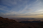
We returned to our bivouac, with sunset putting up a splendid spectacle with some high altitude clouds providing a perfect dramatic backdrop to the photos. From John we have learned that despite the abundant water at the base of the mountain, the waterhole here was almost empty, with just some murky water left at the bottom, barely sufficient for our needs but not very appealing. We still hoped that we might find some better water in Numas Gorge the following day.
Day 5. - Amis Gorge - Numas Gorge
Our plans on the mountain were contingent on the water situation. Knowing that there is sufficient (though not very good) water at Amis, we could afford a day's excursion to the Silberweide and lower cascades in the adjacent Numas Gorge, a short and relatively easy trek. We left or camping gear in John's tent (with Uwe we only brought a sleeping bag and mattress to save weight), and set out towards the north with only a light pack (and plenty of empty bottles). Before crossing over into Numas we made the obligatory visit to site A10 A10 ("Riesenhöhle") which was also last visited on our June 2013 helicopter expedition.

Climbing to the col separating the two valleys, we searched for the minor site N7, which was supposedly just off the path. It was fairly easy to find, but not very spectacular. We continued down the side valley of Numas, past the huge boulder of site N8, then down the slope leading down into the Silberweide, the broad flat grassy terrace below the lower cascades of Numas (the starting point of our June 2011 helicopter supported expedition).
On previous trips we never had time to properly explore the area, it was only used to transit between campsites to more important sites. With no published volume available for the Numas sites (Pager did complete the tracings, but the HBI did not have enough funds to complete this 7th volume) I was not aware of the site locations, we relied on Angula's memory. We came upon the main site of the Silberweide, N21 purely by accident in June 2010 when making our way towards the Amis sites. Now with better information and time on our hands, we intended to visit the lesser sites scattered about the edge of the plain. We started at N21, where the small site of N27 was just beyond the 30m limit set by Pager to denote different panels of the same site.
Downstream from N21 there is another small site, N9, with a small faint panel hidden at the very end of the rock. I'm sure we checked this rock out before, without finding the paintings.
There are three sites along the southern edge of the Silberweide. In June 2012 we passed along here, on our way from N10 deep below in the valley to our supply cache above the cascades. However it was late and we were tired, there was neither the time nor the mood to look for any minor sites. Now we started out to look for them, and after some searching we did find N19 along both sides of a prominent granite ridge, much farther up the hillside than expected. There were many paintings, but with the exception of a white zebra (?) the rest were very faint, barely visible.

Site N18 was found on a low rock a few hundred metres downstream, while the last site, N17 was on a huge rock with a spacious shelter underneath right at the edge of the plain, where the river started making a steep descent. Despite the good shelter, there was only a pair of small human figures on the ceiling.
To be honest we were a little disappointed with the rather meager paintings at the last sites, with nothing more to find in the Silberweide we followed the main watercourse towards the lower cascades. There was abundant fresh green vegetation everywhere, indicating that plenty of water flowed here in the not too distant past.
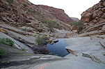
As we progressed, we passed the basin at the bottom of the cascades, which was completely dry. However as e climbed up the steep rocks, we soon reached the pools in the upper end of the cascades, which were all full of water, at the very top the river was still flowing at a trickling pace.
The cascades area was always just a water source and transit route on previous trips, we never spent time to properly explore the area (and also lacked information on the sites). This is how we never visited N23, an extensive site with several panels spread across a number of boulders on the ridge overlooking the pools towards the south.
The huge towering cluster of rocks right next to the pools is N24. This too has a number of panels scattered about on the rocks, there were several which we did not notice previously.
Strangely the main site with the most numerous paintings of the cascades area is not N24 as one would expect, but N25, a relatively small and insignificant shelter a few dozen metres above the pools among the rocks. This is another site which we last visited together with Uwe in June 2013. A little beyond we found N26 which we have not seen before, a flat rock with a very low shelter underneath, a very unlikely location for paintings.
There are several more scattered minor sites surrounding the plain above the cascades which we never visited, but with the lengthening shadows we decided to spend a little time relaxing around the pools before heading back, rather than a long walk in the bush for a few faint figures.
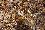
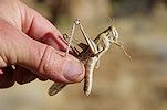
The return was uneventful across the Silberweide and the slope up to the southern side valley. The biggest excitement was caused by a small moving leaf spotted by Uwe, which turned out to be a Spike Wilter (Pephricus sp.), a small bug that mimics dried leaves, even its movement suggested a leaf swaying back and forth in the breeze. We had another insect encounter up in the side valley, where the shrubs were rustling with a number of Red Locusts (Nomadacris septemfasciata), very similar in appearance to the Desert Locusts we encounter in the Sahara.
We were back on the col between Numas and Amis by 4pm, a good hour before sunset, so we still had time to visit site A11 on the western edge of the terrace. This spacious shelter only has a few faint figures, but it offers a rare insight into the working techniques of Harald Pager, as he forgot a paper clip holding the tracing sheets that still remains glued to the shelter ceiling.
We reached our camp shortly before sunset, which still produced some amazing colours despite the lack of the dramatic clouds of the previous evening.
Day 6. - Western Amis Gorge
With all our water bottles filled with the good water from Numas, we had enough to last for another three days, which we planned to spend exploring the western Amis and Dom saddle sites. In June 2012 we visited Western Amis with Angula and Thomas, but then we relied on Angula's memory, and missed a number of the lesser sites. There is also a number of major sites on the saddle linking the Dom peak to the main mass of the mountain, some in Amis, some technically in Dom Gorge just across the watershed, but in reality all the same cluster. These sites were too far to be visited in 2012, now we hoped to clear this remaining blank spot on the mountain.
After a quick visit to the waterhole to top-up our cooking water (we carried the usual freeze-dried meal packs that only need boiling water to be added) we made a quick pass by the Lufthöhle before continuing towards the western part of Amis.
We still had some unfinished business left in the main Amis basin. On earlier trips even though we looked, we could not find A21, one of the lesser sites on a stand-alone boulder. Spending some time over Google Earth with the Pager site plan, I thought I have identified the place, so we went to check it out. My hunch was correct, but we only found an unrecognisable red smudge on the rock, instead of the expected gazelle.
There was another site, A25 on the far side of the main basin. In all fairness I don't know why we did not visit it before, as it s on a prominent rock posing no difficulty to find it. We could see it from afar as we started towards it, taking time to stop at A22 along the way, a site we knew well but always worth another look.
The route from eastern to western Amis leads through a series of long narrow terraces. There is only one site reported from here, A26, a minor site with a very nondescript location which we could not identify. A brief search at one likely location yielded nothing, so we continued along the terraces, passing a spectacular cluster of rocks which from a distance appears very much like Stonehenge (strangely no rock art reported there despite the nice terrace and the prominent location).
A27 was somewhere high up on another terrace about 100 metres above "Stonehenge". We were a bit hesitant to make this climb, as it was off our direct course, and the elevation gained would have been useless as we needed do descend again in the adjacent western valley. We decided to have a look from the terrace immediately above the main plain, and much to our surprise spotted the rock familiar from Pager's site plan much closer and lower than expected. We also startled a Klipspringer on the terrace, which after the initial fright stopped, and looked at us curiously, apparently not being familiar with humans. Reaching A27 we saw that the detour was well worth it, there is a fine panel with another of the strange amorphous shapes (like Snake Rock or the Mason Shelter) plus a large "alien" figure.
From A27 we found a relatively easy way leading up to a col, with the far side dropping away into Numas. Skirting the contour, we continued around a rock outcrop until we were almost directly above the Numas/Amis watershed. A steep descent of about 100 metres led us straight to a huge flat rock only a few dozen metres inside Amis. This was site A28, the first of the chain of western Amis sites along a series of terraces high above the rapidly dropping watercourse.
A29 was nearby, but frustratingly difficult to find, with no rocks that readily matched Pager's site plan. Finally we found it a mere 70 metres from A28 on the edge of the same terrace, after a 15 minute scramble among the rocks on the hillside.
A30 is one of the more interesting sites of the western Amis, with a group of dark human figures on the side of a conspicuous boulder perched on the edge of a terrace some distance below sites A28-29.
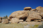
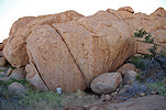
The main site of this series of lower sites roughly along the 1750-1800m contour is A31, on the edge of the last terrace after which the valley side drops steeply towards the gorge bottom, by now a good 300m below. A cluster of giant boulders created a tunnel and several good shelters, which are covered with large panels of paintings.
Not knowing the terrain and the speed of progress, our plan was to reach site A31 by the evening. However it was still only 2pm, the going on the terraces proved to be much easier than expected, so there was enough time to reach the sites on the higher levels up the slope. We found a straight forward route towards the next terrace, leading past a huge star-chestnut tree then up the smooth granite plates. In less than 30 minutes we climbed the 100 metre elevation, and found the boulder with site A33 not far from where we reached the terrace.
We have already visited this terrace in June 2012 with Angula, then it was near sunset and we had to rush back to our distant camp, so we only had time for a brief visit at site A32 with the bizarre pair of intertwined eared serpents. Now with more time we found several faint smaller scenes which we missed the last time.
It was still only 3pm, so we ascended to the next level, with the major site of A34 almost immediately above A32 but requiring a circuitous route. The broad flat terrace in front of A34 was a perfect camping spot, we left our packs there and followed the contour for a couple of hundred metres to site A36, another minor site we dd not see in June 2012.
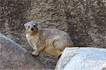
As we returned to our bivouac we spotted something small and brown moving in the grass. It froze as we did, enabling a few quick photos before it thought better and disappeared among the rocks. We thought it to be a rock hyrax, but after checking the photos it became clear that it had a long tufty tail - it was a Dassie Rat (Petromus typicus), a rarely sighted large rodent living in the same environment as hyraxes. We have seen them a few times, but never managed a photo.
We still had nearly two hours of daylight left, we spent this time finding and photographing all the panels of sites A34 and the adjacent A35. The two sites are really one continuous series of painted boulders, however there is a gap just exceeding 30 metres between the nearest boulders of the two sites. With detailed information and sufficient time, we could find many of the panels which I have not seen on the previous visit.

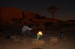
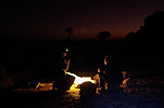
With the day coming to an end, we prepared our bivouacs and lit a nice fire to keep ourselves warm for the dinner in the calm but rather chilly evening.
Day 7. - Western Amis Gorge - Dom Gorge
As usual we were up at first light, packing our gear after a quick breakfast and setting out towards the west, to the other Western Amis sites. This day was to be mostly on known ground, as I have visited most of these sites in June 2012, but it was all new for Uwe.
We started at the little plain where we had our June 2012 landing ground and base camp, having site A50 with the striking baboon depiction on the far side among some large boulders.
I remembered the path from the small plain to the terraces with further sites below to be rather steep, rocky and unpleasant. It changed nothing in the intervening ten years, it took us an hour and a half to reach site A51 a mere 450 metres away horizontally but with a good 160 metre drop. A51 is an interesting site with many paintings along a wide horseshoe shaped shelter, but as it faces east, it was fully exposed to the sun, requiring much shading to capture the scenes.
On the far side of the ridge behind A51 we passed A52, a good shelter but a minor site with only a few damaged paintings.
Site A60 is just a short distance below, and is the most important site of the lower cluster of western Amis sites. As it is well shaded the entire day, we left our packs there and set out to find the three minor sites on long terrace facing the site. The first one, A61 was right under the main site at the edge of the plain, barely over the 30 metre distance to qualify as a separate site. The paintings are not very exciting, just a group of faint wigs remaining, the associated human figures have completely disappeared (if there ever were any).
At the far end of the plain site A62 was somewhere along a rocky ridge, but Pager's tracing gave little clue to the surroundings. We spent a long time trying to find it, until finally we came upon the site, not along a low ridge in the valley as expected, but in a fairly large shelter at the foot of a high cliff bordering the valley. The paintings are rather unimpressive, here too there are many wigs with mostly missing figures.
While Uwe returned to site A60 to take time to photograph all the scenes, I spent much time in the valley leading out of the plain to find site A63, which was somewhere there, with some nice animal figures. However despite checking out all the rocks for a considerable distance downstream, I found nothing that matched Pager's site plan. After a half an hour I gave up and re-joined Uwe at A60.
When finished, we continued down to the plain of western Amis, one of the largest flat basins in the south west part of the mountain. Not surprisingly there are a number of sites all around the plain, even though there is no good reliable water source anywhere. We went straight to the huge rock of the main site, A57, where the shady side offered a perfect spot for a quick lunch and a place to leave our packs.
Leaving our packs behind, we spent the early afternoon visiting the other three sites around the plain, A59 and A58 opposite A57, while A56 spread out over several boulders at the far western end of the plain, including several panels which we did not see earlier.

The Amis-Dom col was only a kilometre away in a straight-line distance, but looking at the terrain it was clear that we first needed to descend into the valley below on the Amis side, the hillside appeared too rough and bouldery to be able to follow the contour. With uncharted territory ahead, we made an early start at 2pm to be sure we will reach our intended destination by the evening, hopefully with some time left for the sites. The first part of the way leading out of the Amis plain was easy on a relatively gentle slope, but then the descent steepened among large boulders, a fairly difficult going. In the end it was a good hour to cover 800 metres from the edge of the plain to the huge boulder with site A53 in the valley below the col.
The main panel of A53 was facing west, straight into the sun, we left it for the following morning as it was right on our descent path. We continued past it up the slope, and after a steep but relatively short climb we reached site A54 with its fine panels of human figures, perched on the Amis side of the col.
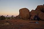
We looked for a suitable camping spot, and found a perfect little flat terrace right on the watershed, with one end dropping into Dom gorge, the other leading out towards Amis. Leaving or packs, we started exploring the vicinity, and soon found site D2 behind the rocky ridge separating our bivouac from the main mass of Dom peak.
Site A55 was in the opposite direction, a short distance beyond A54 on the edge of another larger terrace. Site D1 was on the far side of the terrace, perched at the edge of the steep drop into Dom Gorge. Here too the main panels were facing west, this was a site for the following morning.
We still had an hour left till sunset, the huge rock of site D3 was just 250 metres away, but 80 metres below us in the steep rocky gorge, with the Dom plain just an arms legth beyond. Originally we did not plan to visit, as it only contains some rather meager paintings, but with an hour to spare and D1 requiring a wait till the next day with Uwe we made a rapid decision to make a go for it. In retrospect I'm not quite sure it was worth the effort, it was a mean half an hour struggle among the boulders in the riverbed to get down, finding the paintings again fully on the sun.

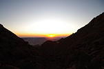
The far slope where we made the return ascent looked a bit better, but appearances are misleading, it was an equally difficult nasty climb, we just made it back to the campsite by sunset. With a clear unobstructed view directly towards the west, this was the first (and last) actual sunset we saw on our trip.
Day 8. - Dom Gorge - Uis
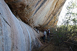
At first light we packed camp and moved to site D1, which is clearly the main site of the area, with some lovely and fairly well preserved panels. Photography was not easy, because a thick tree was right in front of the shelter (probably it grew since it was cleared by Tilman Lenssen-Erz in the late nineteen eighties), we had to dodge the branches to be able to make overview shots of the main panel. These were the finest paintings new to us on this trip, we spent a good hour photographing all the finer details.
We needed to move on as there was still site A53 below, and with our dwindling water reserves we needed to get down as quick as possible. We descended to the basin below the saddle on the Amis side, the big rock in the middle was still completely in the shade, only the top of Dom was out in the rising sun. Here too there is a huge panel, dominated by a long thin eared serpent across the length of the rock (which in fact are two intertwined serpents, at least near their heads), with human figures moving along it. There are many more hard to see figures, unfortunately this panel is not as well preserved as D1.
We started down at 8:30am, cutting across the basin before reaching the steep part of the western Amis. Fortunately the mass of the mountain covered the rising sun for another hour and a half, we could complete the first stretch in the shade. Fortunately John had been up at the saddle not too long ago with some climbers scaling the Dom peak, so he knew the best route in the rather difficult steep valley. At least the steepness meant that it was short, and with only a half bottle of water left our packs were light, by noon we were down at the bottom, and in another half an hour reached the car in the other branch.
Once at the car we did not linger, we immediately set off for Uis, dropping off John at his house in the Location, then continuing to Analene at the White Lady B&B for a hot shower and a nice relaxed afternoon by the poolside.
Day 9. - Uis - Twyfelfontein - Mikberg area
After the five days on the mountain we could afford a more relaxed pace for the day, after the usual nice breakfast we said good bye to Analene and started to roll. Our first objective was Twyfelfontein, the last gas station where we could fuel before heading out into the wilderness. We made a brief stop at the Twyfelfontein Country Lodge for the benefit of Uwe to see the engravings at the lodge entrance, then continued to the gas station, which we found closed, but after some time a lad came running with the magic keys, apparently he spotted the dust trail from the nearby village. After fueling we set out towards the remote outpost of De Riet and the Mikberg.
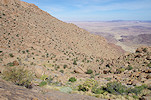
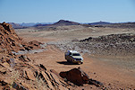
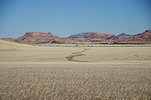
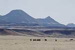
The Mikberg area is a part of the Torra conservancy, and together with the Messum crater area presents the only freely visitable area of Namibia where true desert conditions exist. The Mikberg is actually a cluster of eroded rocky hills about 25 kilometres to the west of Twyfelfontein, encircled by a series of 4x4 tracks, accessible via De Riet or via the "Burnt mountain" near Twyfelfontein. Local rock art enthusiasts have surveyed the area and found many engravings and paintings scattered about the valleys. These were studied by Peter Breunig of Cologne University, however a comprehensive publication is still lacking. Now we planned to spend three days to visit some of the known rock art sites and just enjoy the spectacular landscape and solitude. We made the approach past some large dunes in one of the valleys densely vegetated with Salvadora persica, adding to the Sahara-like feeling. In one place we encountered some very curious large polished rocks that seemed to be completely out of place in their environment. Perhaps these were used by some animals as rubbing stones... ?
We soon found the first rock art site, a barely noticeable elephant engraved onto a flat slab. We were lucky to have visited in the late afternoon, with a higher sun it would have been completely invisible.
We entered a large valley leading into the interior of the Mikberg. Here there was a fine large panel of engravings, very similar to those found at Twyfelfontein.
We drove till the end of the track in the valley, which was a perfect bivouac spot, and used the remaining daylight to walk to another fine panel of engravings about a kilometre away.
Day 10. - Mikberg area
In the morning we drove back out of the valley, and continued along the main track to the eastern part of the Mikberg area. Leaving the vehicle, we made a long walk along a remote valley to a fine panel of paintings on a vertical rock face, in a setting very reminiscent of the lower Dom Gorge at the Brandberg. Strangely aside this panel there is no further known rock art in the valley for several kilometres.
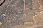
Getting back to the car we drove some distance to a low sandstone outcrop right by the track, with several slabs of engravings scattered around the foot of the hill, of the same style as those at Twyfelfontein. We walked some distance to the far side of the hill, where among a cluster of huge boulders we saw a strange panel of engraved lines and circles.

Around midday we returned towards the central part of the Mikberg, where in another valley we visited one of the larger concentrations of engravings, again in a setting very similar to Twyfelfontein. The engravings skirt both sides of the valley at the base of the sandstone cliff, usually on horizontal surfaces of fallen blocks. While there were many engraved slabs, the panels were not very rich, in all fairness the landscape was more spectacular than the engravings.
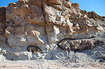
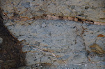
Driving towards the western side of the Mikberg in the afternoon, we passed a very strange geological section adjacent to the track along the side of a riverbed. The lower part of the section consisted of a consolidated silty sediment but with large embedded sandstone fragments and quartz pebbles, capped conformably by a layer of solid sandstone. We spent some time wondering how it could have formed, never seen anything like this..
By the late afternoon we reached the 4x4 track leading south along the western side of the Mikberg (all the way to the West Brandberg Mine). We continued some distance towards the south before turning in to a side valley to make camp close to the starting point of our trek planned for the next day. It was a lovely secluded spot, a perfect place for a sundowner and a quiet evening.
Day 11. - Mikberg area
In the morning we set out to explore a valley leading towards the centre of the Mikberg, with a number of engravings reported along its length. At the point where the valley reaches the exposed sandstone layers it narrows into a canyon, with a rather difficult way up. At one point there is a good two metre high rock step, earlier visitors piled some rocks at its bottom and hammered some rough hand and footholds into the rock so the climb was barely possible, but it was a tough way. However it was worth it, just above this first difficult step we found a very fine panel of engravings with animals and footprints.
The valley was indeed rich in engravings, we came upon a panel every few hundred metres till the very end.
We reached the car mid-morning, after driving some kilometres we started out on another longer walk towards the Mikberg sping, with the biggest concentration of engravings in the entire Mikberg area. Peter Breunig spent a long time documenting the dozens of panels, one can only hope that there will be a publication forthcoming at some point. The spring is at the foot of a high dry waterfall, and engravings are scattered all about on large boulders, with a richness comparable to that of Twyfelfontein.
The spring itself was a tiny little puddle of water in the middle of a wet patch of sand in the riverbed, given away by the chirping of dozens of Lark-like Buntings (Emberiza impetuani) surrounding it, waiting for their turn to get at the water.
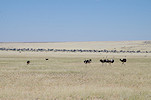
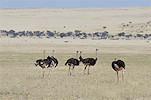
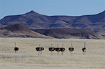
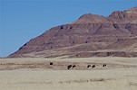
Throughout our stay at the Mikberg one thing was very noticeable - the almost complete lack of game. We have seen a single springbok the previous afternoon, and as we drove back towards the north we encountered two flocks of ostrich, but that was it. Unfortunately despite being a communal conservancy in name, there is very little enforcement done against poaching, the result is sadly visible. (We noticed the same disappearance of game around the Brandberg too in recent years.)
We had one remaining site to check out on our list, a complex of a fine panting and some engravings in a side branch of one of the valleys leading towards the North. In the late afternoon we entered the valley, driving to the end of the motorable track, and made camp there to start the trek to the site at first light in the morning.
Day 12. - Mikberg area - Eremutua
The morning trek turned out to be a bit of a fiasco. Having had a good firsthand description of the location of the paintings but no firm coordinates, I thought I have correctly identified the location on Google Earth, and at first light we set out towards it, first in the man valley, then up a rocky tributary. On reaching the spotted rocks, quite high up on a slope, we found nothing at the likely spots, and a thorough search yielded nothing. Thinking that we must have taken the wrong valley, we scrambled along the contour to the next one, but that too proved to be empty. It was a nice walk with a splendid view over the Mikberg, but now I know that we have taken a turn from the main valley about two kilometres too early...
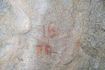
It was 11am by the time we returned to the car, with out time up we retraced our tracks towards De Riet, the continued along the pistes and roads to Khorixas, where we made a brief fuel stop before moving on towards Eremutua, where we were expected mid-afternoon. Our way went past the well known landmark of "Vingerklip", a finger like mesa somewhat removed from a tall escarpment of which it was once a part. The rock is now on the property of an upmarket lodge, which charges a hefty entry fee to day-visitors, we decided to be content with just a view across the fence.
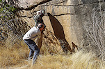
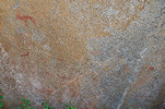
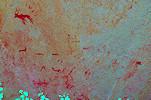
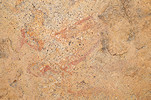
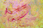
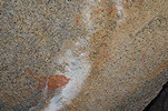
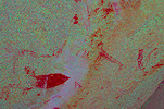
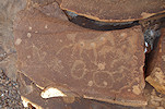
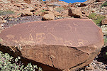
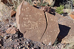
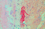
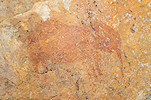
We continued along the D2351 through a series of hills, and at one point we noticed from the road a rock with a shelter in its side that screamed rock art. We stopped to investigate, and indeed we did find the rock to be covered with faint but fine paintings. Having had the Scherz book with us we consulted it to identify the site, but the descriptions were ambiguous, we could not even identify the farm, thought to be Moselle (19) or Harmonie (20). It only became clear after I carefully looked at every figure with dStretch back home that we found Aspro site 24/A, totally by accident. This serendipitious find greatly helped in orienting the relative position of other sites in the area, which hopefully we can visit sometime in the coming years.
The shadows were already becoming long, so we hurried along the remaining 80 kilometres to Eremutua farm, reaching it shortly before sunset, with Herr Nietsche and Jens, the farm manager expecting us with a delicious braai.
Day 13. - Eremutua
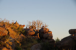
When we made the brief visit with Gábor last June, Herr Nietsche showed us the principal sites recorded by Scherz on the granite outcrop adjacent to the farmhouse, but a number of lesser sites remained. This time we planned a three night stay to have plenty of time to search for all missing sites, and also to visit the adjacent farms. We were up at dawn to make a quick visit to site 106/P, one of the finest, parts of which are almost always on the sun as it is oriented almost perfectly towards the north. We caught the panels before sunrise, then spent some time marveling at the superb vie from the site as the sun slowly illuminated first the rocks, then the surrounding plain.
We returned to the farmhouse to have breakfast with Fried and Jens, making a brief stop at site 106/L, another large site which is mostly out on the sun from the late morning till sunset.
After breakfast we returned to the hill to continue our visit, starting at the principal site, 106/A at the south western corner. Once we finished taking the photos, we started searching for site C, on a smaller block somewhere just below. It took some time to find it, a large shrub has completely overgrown the site, obscuring the faint but very fine panel of human figures.
We continued anticlockwise around the base of the hill along the row of known sites 106/D-E-F, at the latter finding a panel which we did not see the last time, probably it was on the sun.
Last time we could not find sites G, H & I at the north eastern corner of the hill. Scherz's description and map is rather vague, we once again spent some time looking for them, finally on one rock we spotted some paintings, it turned out to be 106/G.
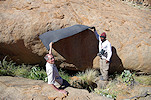
Now we found our bearings, and searched all the rocks along the foot of the hill among the huge star-chestnut trees looking for site 106/I, which was supposedly within 50 metres of G. We found nothing, until further north we reached a large boulder with some paintings hidden behind some shrubs, which we could identify to be site 106/H. There was a clear need for some gardening work to free the panel, as it was already close to lunchtime we returned to the farmhouse to come back with the proper tools in the afternoon.
After lunch we returned, not with the hoped-for axe, but with Jens accompanied by a farm worker, who insisted that we were guests on the farm and any required work is theirs. In retrospect perhaps it was a good idea as the bush proved to be a rather tough one, it was a good half an hours' struggle to free the panel.
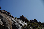
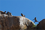
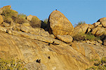
The cleared site 10/H was fully out on the afternoon sun, so we continued past it to see others which were in a better orientation, plus there were still a number to be found. As we moved on, we were shadowed by the resident band of baboons, occupying the top of the hill and making nervous cries as we approached a little closer, but they were clearly not afraid of humans. Fortunately they were not aggressive either, they just observed our movement without really bothering us.
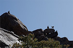
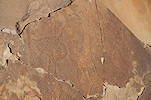
Under the watchful gaze of the baboon sentinel perched on the highest rock we climbed up to the centre of the hill, past an ancient looking stone structure, to find site 106/R, another one not seen before. This was rather easy to find, on a prominent rock just about where Scherz placed it on his map. It contained a number of fine black and red figures, quite different from the other sites here at Eremutua.
We moved to the western part of the hill to search for sites N and S, both high on the north western spur. Scherz's description was not very telling, but after some searching we did find the huge south facing block of site 106/N, with some barely recognisable traces of paintings on it, which later with dStretch turned out to be a very nice composition. We continued searching for site S, but despite checking out almost every likely rock, we found nothing.
There was another major site, 106/T somewhere in the valley leading in towards the centre of the hill. With Gábor we searched for it briefly last year, but being short on time we did not do a thorough job. Now with no time pressure we could do a better search, and we did find the panel, quite high up above the valley, again partially obscured by a large shrub, fortunately we could remove it without the need for heavy equipment. The row of human figures is arguably the finest scene at Eremutua.
There was one more site, 106/M somewhere at the northern end of the spur. We spent the remaining daylight trying to find it, but aside a small panel which did not fit the description and a curious family of hyraxes, we again failed to find the sought main site.
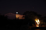
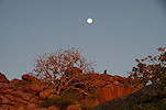
With daylight fading, we retreated to the farmhouse to be treated to a sublime braai prepared by Jens, with a rising full moon to complete the perfect evening.
Day 14. - Eremutua Nordost - Kapelle
In the morning before sunrise we went out to visit the sites we found and cleared the previous day, 106/G & H, both of which are exposed to the sun for most of the day.
We just managed to finish taking the photos at site H when the sun came up, obliterating the paintings in an instant and turning the rocks and the chestnut trees into gold for a few minutes.
When the magical few minutes were over, we moved to the western side of the hill, to visit sites K, and the nearby U which strangely was not recorded by Sherz. Both of them are among the more important ones at Eremutua, and are in good shade in the morning.
After breakfast we drove to the neighboring farm of Eremutua-Nordost, where we were welcomed by Silke von Gössler, with whom we immediately set out to see the main paintings on the property, site 105 of Scherz named the "Wohngrotte" (homestead cave). This is the largest site of the Eremutua area, unfortunately the rock outcrop has long been the home of a large band of baboons, and their excrement has flown over and damaged much of the paintings. In its heyday this must have been a magnificent site, with dStretch it is possible to restore some of the scenes. It did not help that the site was fully exposed towards the mid-morning sun, we plan to return sometime in the future for better photos in the late afternoon.
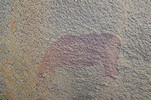
On our return we were shown a lesser site (Scherz's 104) near the road towards Eremutua, which shows a rather interesting scene of an elephant being hunted with a bow (one wonders if it worked... ?)
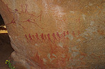
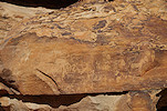
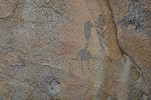
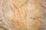
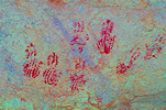
One of the reasons for staying three nights at Eremutua was to have an opportunity to visit the "Kapelle" sites of Scherz, a cluster of paintings on a granite hill lying about a dozen kilometres to the south-west of Eremutua on the neighboring property. Herr Nietsche has already spoken to the owner of the neighboring farm, with Jens we set out after lunch and after collecting a farmhand to accompany us and help clear the way, we went out towards the hill. Leaving the car at the closest track we set out towards one of the principal sites, 107/H, a large shelter somewhere along the side of a granite ridge. The way was not easy, densely overgrown with thorny shrubs, but in the end we did find the site close to the most likely spot. It was completely overgrown, clearly nobody has visited since Scherz recorded it some 70 years ago. In the shelter we found several interesting paintings, including a unique set of painted handprints, the likes of which I have never seen elsewhere.
Two sites, 107/K and 107/L were relatively easy to find, on two sides of a rocky ridge at the northernmost tip of the hill, just beside the track as we returned towards the main road. Both were minor sites, with just a few but quite nice paintings.
As we were busy photographing the elephant at site 107/K, our local companion spoke out and pointed up the thorny tree just above us. Intriguingly he used the word "nyoka" a Bantu word not normally spoken in Namibia but I instantly recognised it from my childhood readings, in Swahili and other related languages it means snake, a warning to be heeded to anywhere in the African bush. At first we saw nothing, but as it moved we could see a long thin snake almost like a branch, with a distinct bulge in the middle indicating a recent meal. It looked like a species of harmless sand snake, it was only back home much later that I identified it as a Twig Snake (Thelotornis capensis), one of the very few rear-fanged snakes that actually have a deadly venom. Fortunately they are very docile, this one too looked at us patiently without much concern while we snapped away.
We took another longer walk in the bush in the direction of where we expected to find site 107/D, but despite a fairly extensive search and many scratches from the thorns, we found nothing except a splendid view, with the Brandberg clearly visible in the distance on the western horizon. Returning to the track we passed another low knoll where we did find site 107/I, one of the minor sites.
With sunset approaching, we had to start making our return. As we passed Kapelle hill in the distance, the name became clear: from the side it does resemble a small church with a spire. There are many more sites here, this afternoon was just an initial reconnaissance to get to know the terrain and a few anchor sites from which the positions of others may be deducted. Hopefully we can return on the following trip to continue the search for the remaining sites.
Day 15. - Eremutua - Windhoek
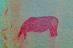
This was our last day, with Uwe leaving with the evening Eurowings flight we needed to leave for Windhoek mid-morning, but we still had a short time to spend at Eremutua to tick off some more sites. We were out again at dawn, first visiting the lovely elephant at site 106/F1, another panel that is out on the sun practically all day. The baboons were once again showing in full force, but keeping their distance.

The fact that we could not find site I was pestering us, we decided to give it another try before leaving. We walked up to site H and started checking every rock systematically in the direction of site G. Perhaps it was the different light, but this time right next to site H we found the very faint paintings on a rock which I'm sure we have already checked two or three times previously.
Scherz reported a single elephant at site 106/B, on a rock facing the main panel of site A. We have searched repeatedly for this panel too without finding it, we still had time so we decided to have another go, and site A was a good place to finish our trip in any case. This time we cleared some overgrowth, and eventually did find the single figure on a low block, indeed where Scherz said it should be. However the figure looks nothing like an elephant, more like a headless antilope.
We lingered a bit at the site, taking photos and just enjoying the superb view over the farm and the plains beyond, with Kapelle clearly visible to the west in the sharp morning light.
Our time was up, we said good bye to Fried and Jens in the hope of meeting again a year later, then set out towards Windhoek, dropping off the car in the afternoon at Mark's garage, then driving to the airport to see Uwe off, while I stayed at the Etango Ranch for the night to take my flight home via Jo'burg the next morning.
For June 2023 we are planning a 16 day circuit to see a wide selection of the Rock Art sites of Namibia plus some of the natural wonders of the country, staying at lodges and guest farms along the way. Please visit the News page for any updates (or "follow" the FJ Expeditions FaceBook page).