
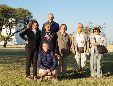
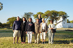
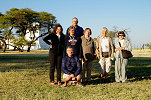
 Click on image for list of participants |
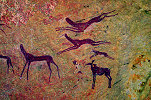
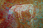
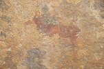
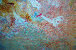
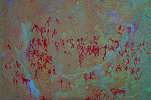
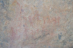
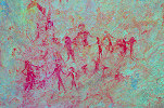
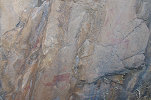
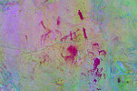
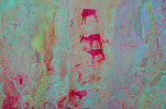
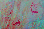
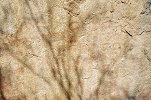
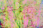
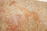
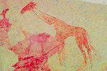
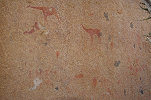
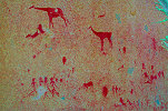
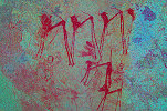
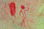
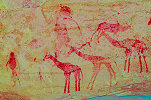
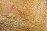
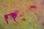
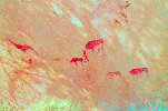
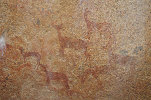
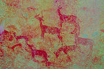
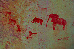
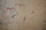
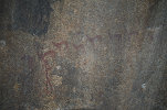
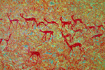
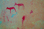
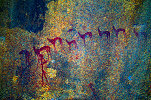
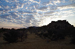
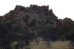
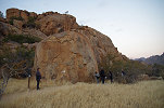
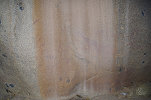
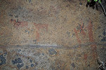
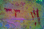
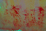
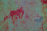
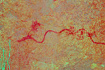
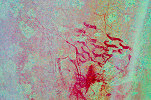
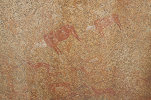
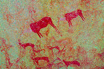
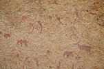
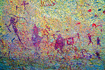
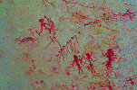
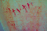
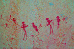
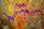
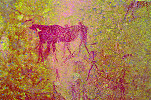
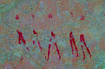
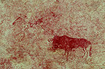
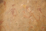
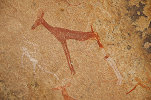
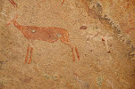
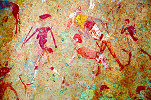
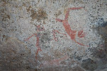
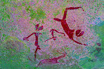
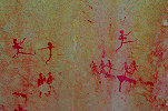
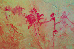
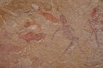
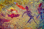
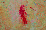
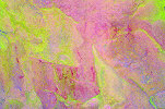
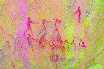
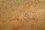
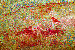
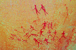
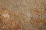
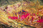
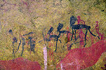
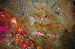
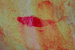
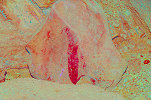
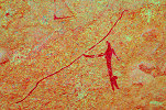
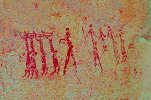
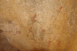
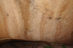
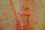
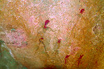
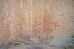
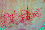
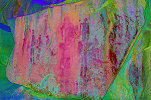
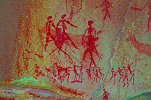
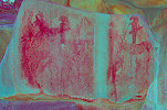
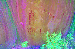
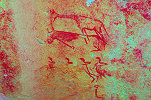
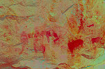
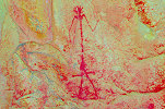
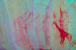
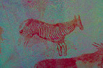
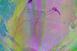
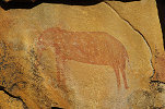
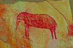
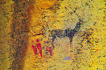
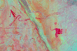
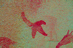
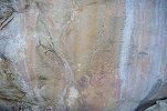
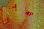
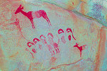
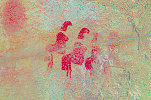
Rock Art of Namibia 12th June - 6thJuly, 2021 Site references based on numbering system of Harald Pager (Upper Brandberg) and Ernst-Rudolf Scherz False colour images processed with dStretch, a freely available software developed by Jon Harman |
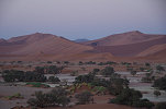
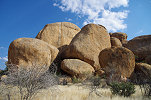
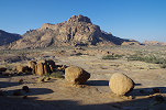
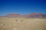
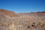
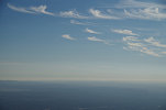
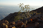
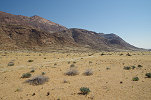
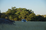
Day 1. - Windhoek - Sesriem - Sossusvlei
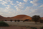
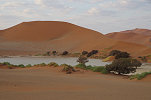
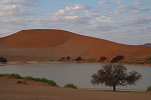
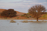
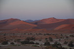
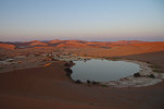
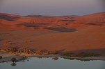
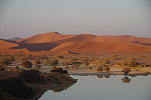
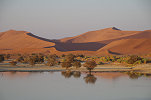
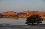
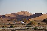
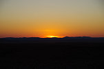
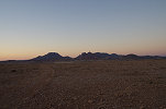
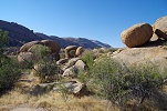
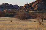
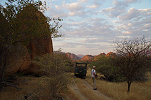
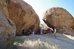
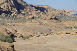
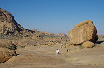
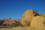
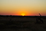
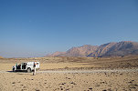
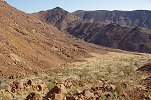
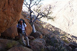
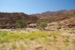
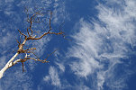
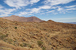
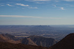
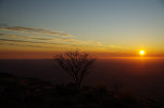
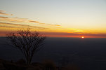
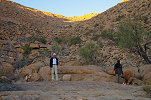
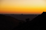
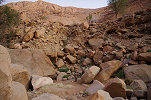
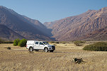
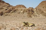
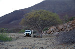
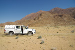
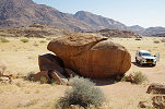
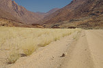
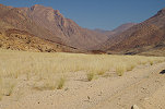
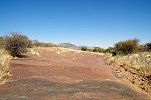
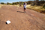
With Magdi we flew in a day earlier to make all preparations, arrange our NHC permits, and to be a bit more rested after the long overnight flight for the long drive to Sossusvlei. In 2020 Air Namibia ceased operations, but in the spring of 2021 Lufthansa re-launched the direct Frankfurt to Windhoek service, so getting to Namibia was much easier than on some earlier trips. On arrival there was no fuss whatsoever, only a glance was taken at our PCR tests and we were allowed to pass. The others arrived with the same flight (with the exception of poor Isabelle, who together with several other passengers missed her connecting Lufthansa flight in Paris due to an uncommunicated last-minute terminal change due to the Covid chaos, and could only join us three days later) the next morring, and with two 4wd pickups we immediately set out towards Sossusvlei. Due to the very few tourists, we could book rooms in the Sossus Dune Lodge (usually booked out years in advance), the only non-camping accommodation inside the Sesriem gates, allowing a sunset/sunrise visit to Sossusvlei. We readhed the lodge mid-afternoon, and after a quick check-in we drove straight to Sossusvlei for the sunset views. Two years ago I remarked that the "Four-wheel drive only" sign at the start of the track from the parking lot is a bit of an exaggeration, I could have easily driven the 2wd low clearance Quantum in without any issues. This time it was not the case (fortunately I had the forewarning from Mark Held who visited some weeks earlier), the recent big rains have completely re-arranged the valley, depisiting a thick layer of soft sand over the old track. It was proper 4wd terrain all the way, we did pass an abandoned tourist vehicle stuck to the axles in sand. Reaching the end of the track, we found the playa t be filed with water, something we have not seen since visiting with Raymond in May 2012. Unfortunately the spectacular sunset failed to materialise, there was a low cloud cover, but it was nevertheless amazing to have the entire place to ourselves, there was not another vehicle in sight. We strolled around the lake till sunset, and had our well-earned first proper African sundowner before driving back to the lodge for dinner.
Day 2. - Sossusvlei - Sesriem - Rostock Ritz
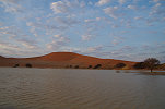
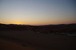
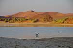
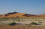
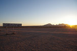
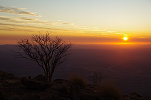
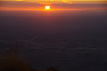
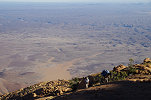
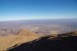
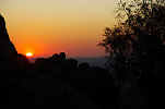
The whole point of staying at the Sussus Dune Lodge was to be able to make it to Sossusvlei by sunrise. As the distance is over 60 kilometres, we had to start in the dark, reaching the dunes in twilight, just being able to make it to the top of the big dune by sunrise.
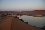
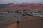
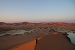
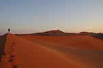
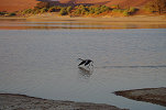
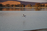
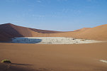
Once the sun rose higher, we descended from the dune to the lakeshore. Our sole companion was the young grey Greater flamingo which we already noted the day before, apparently nobody else in the lodge decided to forfeit breakfast for this spectacle.
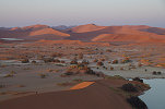
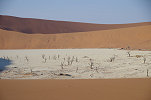
By this time, an hour after sunrise, a trickle of visitors started arriving. We were no longer alone when we made the one kilometre walk to the "deadvlei", an old branch of the watercourse that once was inundated regularly enabling trees to grow, but it was cut off by dunes at some point, leavong only dead stumps sticking out from the white silt-covered playa.
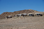
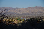
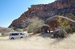
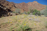
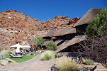
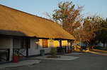
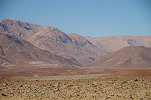
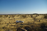
Returning to Sesriem we checked out from the lodge, and drove about a hundred and fifty kilometres north to the Rostock Ritz, a lovely lodge situated on Farm Rostock about half-way between Sossusvlei and Windhoek at the edge of the Namib Desert.
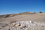
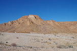
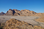
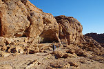
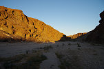
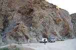
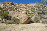
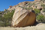
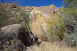
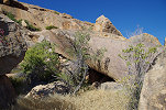
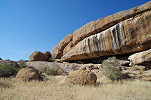
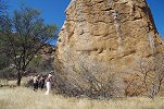
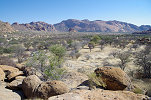
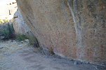
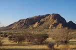
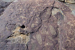
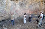
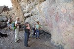
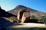
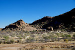
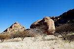
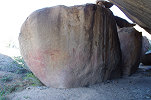
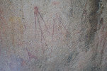
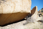
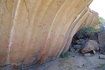
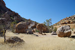
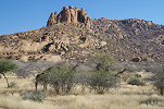
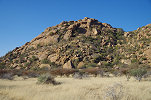
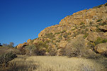
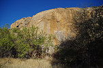
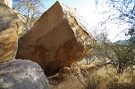
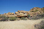
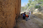
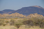
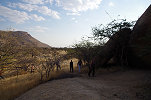
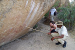
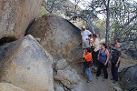
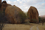
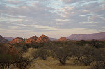
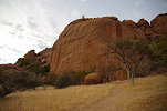
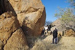
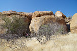
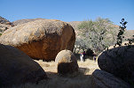
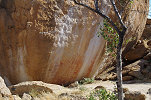
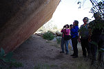
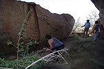
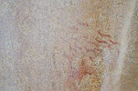
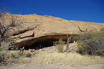
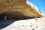
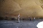
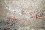
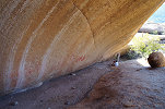
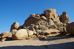
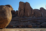
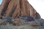
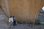
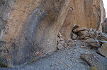
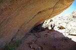
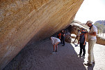
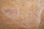
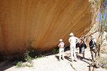
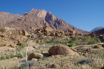
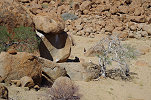
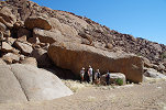
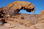
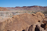
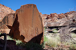
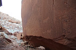
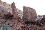
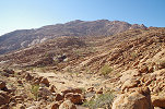
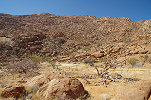
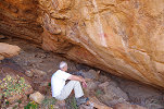
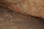
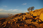
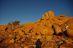
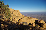
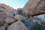
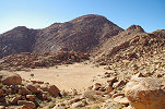
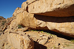
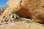
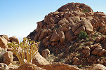
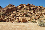
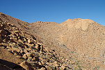
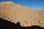
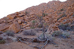
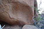
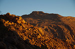
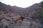
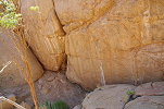
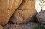
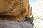
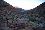
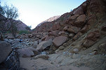
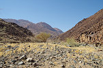
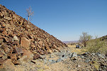
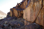
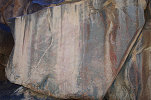
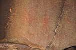
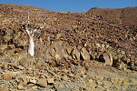
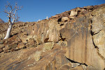
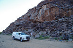
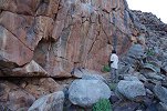
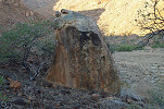
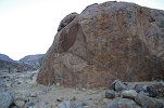
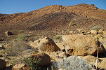
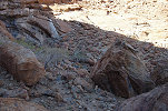
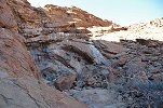
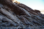
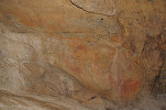
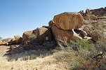
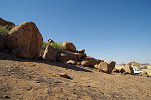
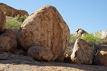
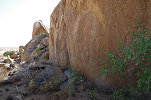
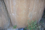
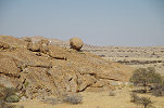
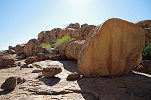
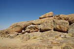
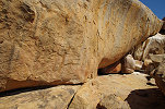
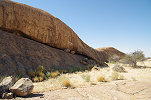
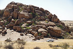
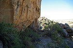
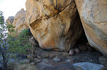
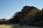
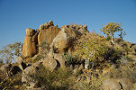
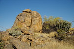
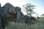
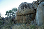
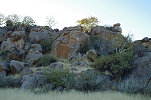
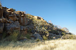
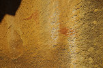
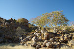
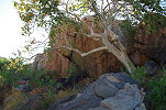
Rostock is actually a corruption of the name of the nearby Rotstockberg ("Red-rock mountain") rather than originating from the name of the German town. The mountain was the reason we came here, as the far side of it is hiding one of the finest painted shelters south of the Erongo region, Oase Grotte (named after Oase Farm, to the north of the mountain from where it is accessible, though it is just inside Rostock Farm). The big deep shelter was recoreded by Scherz (Fundstelle 173), and it contains a series of very well preserved panels which are very rarely visited due to the remote location.

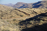
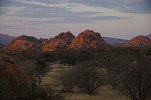
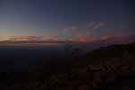
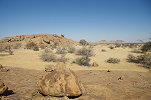
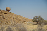
There is an even rougher track leading from the shelter back towards the Rostock Ritz, offering some spectacular views, and a perfect opportunity for a sundowner on a hill near the lodge.
Day 3. - Rostock Ritz - Windhoek - Omandumba West
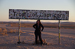
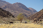
With an early breakfast, we could depart at sunrise back towards Windhoek, as we had a long drive ahed of us. We made a brief stop at the famed Tropic of Caprocorn sign that is just past the entrance to the Rostock Ritz, and another quick stop at the Gaub River canyon.
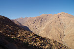
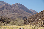
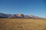
We took the C26 via the Gamsberg pass back to Windhoek, a long but rather uneventful drive, the greatest excitement caused by the flocks of guinea fowl on the road
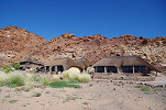
By the time we reached Windhoek Isabelle also arrived from the airport. With our group now united, we swithced the two pickups for the Quantum minibus (from Dornbusch Car Hire like on all other trips) and we set out towards the Erongo. With a lunch stop at Okahandja, we reached the Bushcamp at Omandumba West by mid-afternoon, welcoming a little opportunity to relax a bit and just do nothing for the rest of the afternoon after the long travels.
Day 4. - Omandumba West
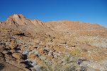
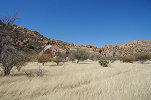
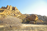
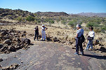
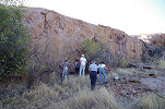
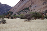
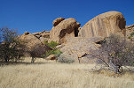
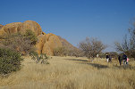
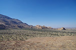
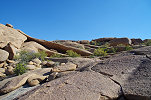
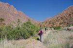
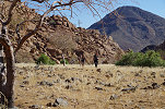
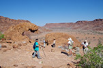
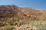
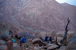
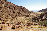
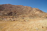
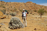
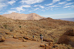
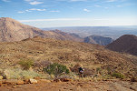
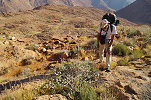
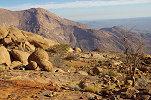
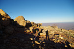
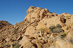
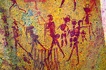
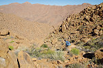
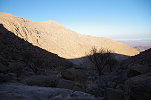
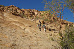
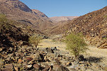
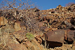
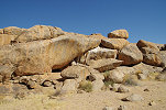
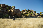
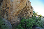
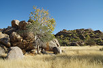
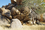
The plan of the day was to visit a selection of the finest among the dozens of rock art sites scattered about the vast farm at the foot of the Erongo, and also to find a few which evaded us on previous trips. We started out in the southern valley (Scherz Fundstelle 131), as the most important sites there are only visible in the early morning, are out in the sun for the rest of the day.
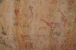
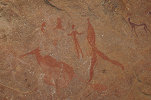
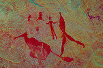
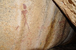
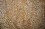
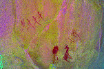
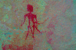
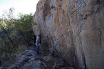
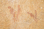
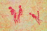
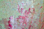
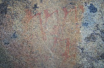
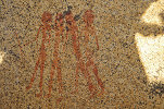
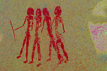
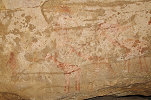
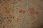
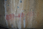
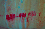
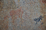
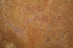
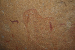
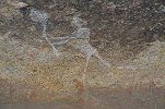
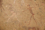
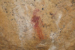
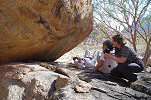
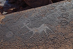
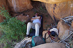
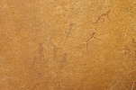
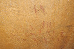
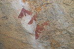
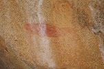
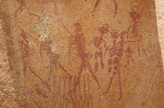
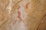
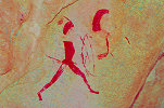
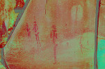
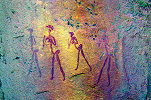
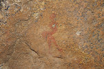
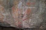
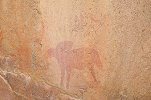
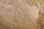
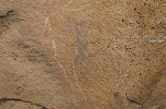
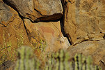
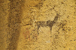
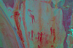
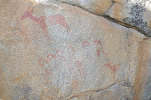
At the Strys cave (Scherz 131/Q) with the novice's eye Madeleine spotted some faint paintings on the slanted ceiling which I have never noticed before. They turned out to be a group of faint but well discernible human figures, one appearing to hold a spear.
We continued to the south-eastern valley, where the track was much improved by Harald since our last visit, we could easily tackle it even with the low Quantum. We were just in time as the sun was already about to obliterate the paintings at some sites.
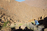
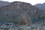
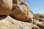
The main site of the southern valley, 131/N only moves into the shade around midday. We were a bit early, so we had some time to search for two of Scherz's sites a few hundred metres to the south, 131/B and 131/B1. We did find 131/B1 on a huge rock about five hundred metres to the south, but the other one, Breuil's "Caesar rock" proved elusive.
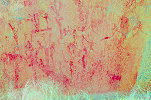
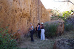
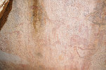
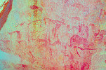
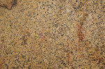
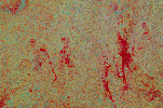
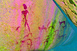
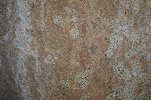
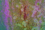
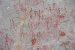
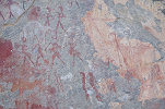
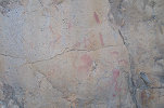
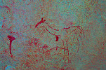
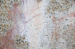
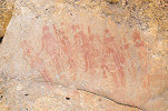
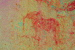
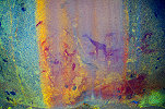
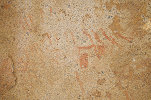
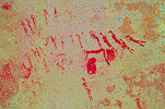
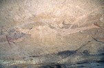
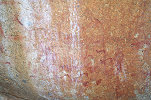
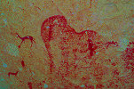
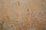
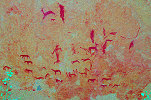
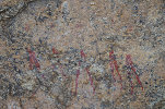
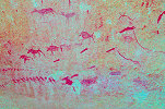
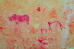
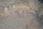
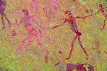
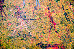
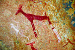
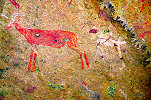
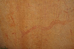
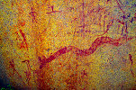
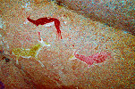
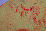
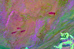
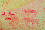
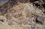
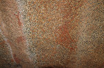
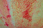
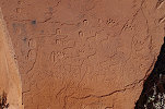
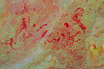
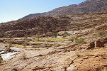
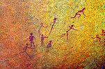
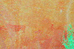
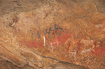
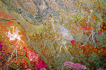
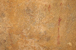
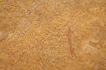
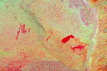
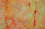
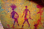
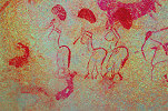
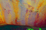
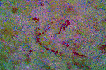
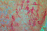
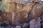
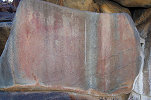
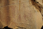
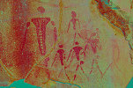
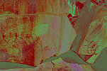
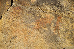
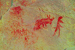
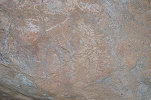
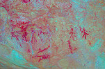
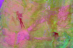
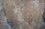
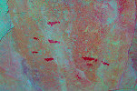
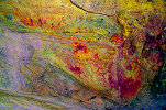
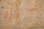
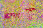
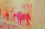
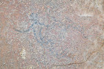
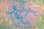
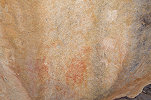
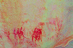
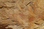
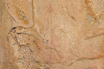
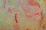
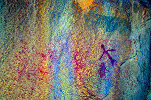
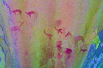
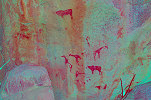
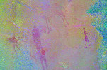
At noon we returned to 131/N, which was now completely in the shade, revealing its full splendor. This site provides a very good exercise in dStretch, as due to the wide range of colours used, different filters reveal completely different details of the paintings.
After lunch we drove to the north eastern part of the farm to see the highlights of the area (Scherz Fundstelle 129), moving slowly back towards the farmhouse (Fundstelle 128).

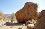
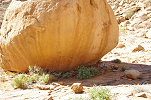
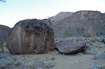
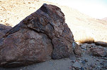
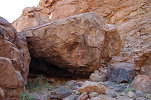
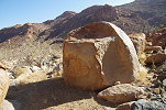
We still had a little time left before sunset, we used it to make a search for a cluster of paintings reported by Scherz near the north western border of Omandumba (Fundstelle 126), near the track leading to the Bushcamp. We found the esternmost site, 126/D straight away, on three separate sides of a huge prominent boulder that was clearly visible from afar as a likely location.
The other three sites proved more difficult, we searched the area without finding anything despite plenty of likely-looking boulders at the foot of the hill. With the approaching sunset, we left the remaining sites for a next visit.
Day 5. - Ekuta Farm
Retaining Omandumba as our base, on this day we made a day-trip to Ekuta farm in the interior of the Erongo. We started out at the panel of engravings near the hunting lodge, this time guided by Peter Hinterholzer who rund the lodhe and the hunting operations on the farm.
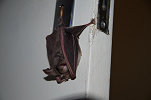
After the visit to the engravings we were treated by Peter to an excellent lunch in the lodge. A bit of an unexpected surprise came in the gent's loo, where I found a small sorseshoe bat hanging by the keyhole on the inner side of the door.
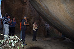
After lunch we moved to the Ekuta farmhouse, the home of Peter's father, Karl Hinterholzer, ho took ous on his grand tour of the amazing Ekuta cave, which he discovered at the age of eight some seventy years before.
It is not on the regular visitors' trail, but from Scehrz I was aware that there is another site with paintings at Ekuta Farm, not too far from the farmhouse. I asked Karl and he was more than happy to show it to us, it turned out to be a splendid site along a low ridge, while not on par with the amazing Ekuta cave, it still offered many fine and interesting details.
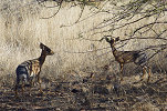

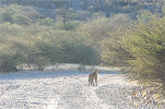
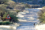
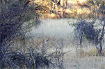
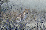
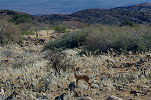
As we were driving back towards Omandumba, Madeleine spotted something dark and cat-like moving parallel to us in the bush. I stopped, and in the flashes between the vegatation we could glimpse a leopard! Amazingly it did not disappear in the bush on our sight, but continued forward, eventually coming out onto the road in front of us. We followed it slowly, even a few photos were possible before it disappeared. As we continued, it suddenly re-apeared sitting barely 20 metres from the road, intently watching us with curiosity rather than fear. It remained put for a good two minutes, before it stood up, turned around and slowly walked away. It was an incredibly rare daylight encounter with a young male, as I later found out. Amazingly just at lunch we discussed with Peter the chances of seeing a leopart on the property (there are about a dozen living there) - he sees one every couple of years...
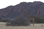
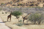
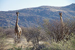
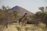
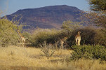
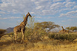
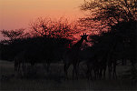
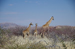
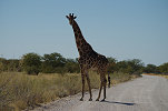
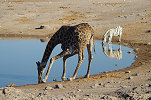
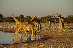
As we approached Omandumba, we saw a pair of Bat-eared foxes in the tall grass, and to finish off this amazing day there was a large herd of giraffe grazing just next to the Bushcamp.
Day 6. - Tubusis - Springbokfontein
We were up at dawn for another day-trip, this time to the western edge of the Erongo just over the ridge to the west of Omandumba.
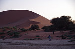
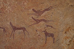
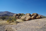
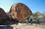
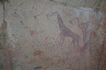
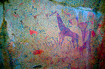
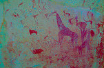
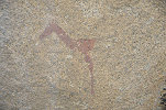
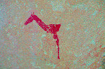
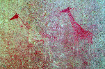
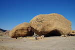
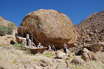
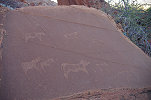
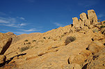
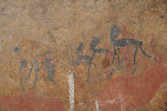
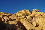
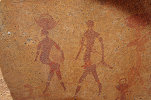
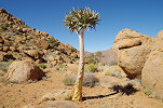
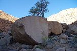
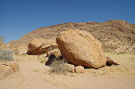
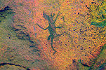
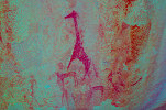
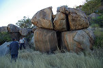
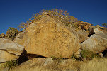
We started at the two splendid sites to the north of the village of Tubusis that was shown to our good friend Jeff La Fave some 20 years earlier by the father of Harald, Herr Rust. They are not difficult to get to, but with the tall grass completely covering the faint tracks, it was a bit tricky to make it to the end of the trail with the Quantum, but we did so without any mishaps. From there it is a less than one kilometre walk to the big boulder with the amazing giraffe-headed therianthrope on the southern side. There are some splendid paintings on the other side of the bouldr too, unfortunately we were just a few minutes too late, by the time we reached the boulder the sun was already up above the hills.
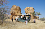
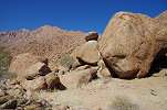
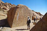
The other "Big Boulder" site is just 300 metres away on the other side of the valley. It is an immense site with 11 distinct panels on the main boulder and on adjacent smaler ones.
There are numerous splendid scenes all around the boulder, but probably the most interesting one is the huge panel with a number of the strange "Sphinx" like figures well known from the Spitzkoppe and some other Erongo sites.
Visiting the two sites took up most of the morning, by the time we returned to the Tubusis track and turned towards Springbokfontein it was well past noon, We went straight to site 98/O for lunch, the only one in the area offering both easy access with the car and good shade. After lunch we spent some time exploring the area further upstream in the valley, but apparently here Scherz was thorough, we found no unreported sites.
After lunch we continued to Breuil's "Nursery boulder" (98/E) and "Battle boulder" (98/F), the two finest sites in the Springbokfontein area.
After the long morning most of the party felt a bit exhausted, we decided that the remaining sites were not worth the long walks (I did not dare risk getting stuck with the Quantum, with the tall grass hiding the terrain), so mid-afternoon we turned back towards Omandumba. On the way, we stopped at the big boulder north of the road which we found with Uwe the previous year. It is in Scherz's Fundstelle 94 area, but does not match any of his described sites.
Reaching Omandumba, we found the herd of giraffe encountered the previous evening right beside the track leading to the Bushcamp.
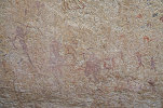
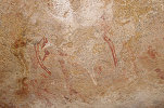
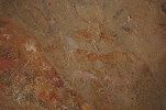
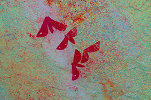
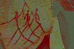
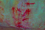
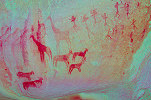
We still had a couple of hours to sunset, while the others decided to have a rest in camp I set out to find two still missing sites. The firts one was 131/N1, located on the south side of the same rocky hillock as 131/N, the major site of southern Omandumba. Whil the location was fairly obvious from the description of Scherz, it took a bit of an effort to fight through the dense bush that surrounded the site, clearly it has not been visited for a very long time. There is a faded but very interesting scene of a group of "Sphinxes", accompanied by a group of ghost-like human figures.
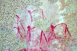
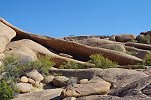
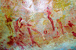
The other missing site was "Caesar rock", I continued past 131/B1 which we found two days earlier till the point last searched, and checked out all the rocks along the edge of the granite hill. Again there was dense thorny bush, it ws a fairly slow affair until I reached a vertical rock wall with paintings. The "Caesar" figure was readily visible, as well as some fairly large unclear shapes.
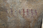
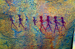
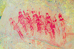
There are two more fine scenes to the left and to the right of the main panel. At the extreme left of the huge wall there is a fine group of four human figures, while under a separate rock to the right there is a whole procession of eight figures.
I waited for the sun to set behind the western hill to be able to photograph all the panels, then started back towards the car, making a straight line for the track running parallel to the hillside rather than struggling back in the bush. As I walked along the track, I spotted the unmistakable tracks of a large leopard over out tire tracks of two days ago, with an even fresher looking tracks of a hyena beside it. Though they were probably one or two nights old, I glanced around and increased my pace back to the car...
Day 7. - Omandumba East - Anibib
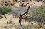
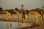
In the morning we packed up to make our move to the neighboring farm, Anibib, to spend the nigth at the Ai Aiba lodge, viditing the best of the innumerable sites on that property. In a very considerate fashion the giraffe were once again lined up by the road to give us farewell.
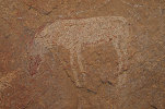
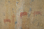
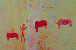
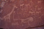
Before driving to Anibib we made a little detour towards the east to visit Omandumba East, the property managed by Harald's brother Didi. Omandumba East is not as rich in rock art as the wetern part of the Omandumba valley, but still there is a major site along a low granite ridge, the Glockengrotte (Scherz's site 132/E) with some splendid panels depicting giraffe and other animals. We also took time to visit the nearby site 132/F, where Scherz reported three adjacent rocks with paintings. In June 2018 we only found one, now we had more time to search the adjacent rocks, but strangely we found absolutely nothing aside the already known single giraffe.
Continuing to Ai Aiba we settled in to the lovely lodge, relaxing a bit till lunchtime. Immediately after lunch we set out with Immanuel Vatileni (who was with us when we made the 'grand tour' of the Anibib sites with Marin Steppe in June 2018), now the assistant manager of the lodge, to see the highlights on the western side of the property. We started out at Breuil's "Deserted place", then slowly trickled back along the row of sites, this time also stopping at the "Drinking trough" site (124/G) which we did not see on previous visits.
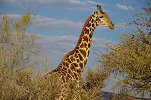
Rounding the granite massif we came to the "Kudu wall" (124/B) site, one of the finest at Anibib. As we continued, we encountered yet another herd of giraffe, this time very close to the road and not at all concerned about our presence.
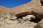
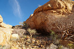
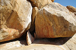
We skipped Breuil's "Mourning boulder" now fully out in the sun, going to the south western valley next to the fence with Omandumba. The tracks in the area have been improved recently, rather than the previous long walk through the bush, now we could drive right up to the big boulder with the "Red elephant" shelter (128/C).
Sunset was approaching, we had time for one last site, the "Springbok boulder" (128/D) which we skipped the last time (obviously Martin was not very impresed with the very faint, hardly visible paintings). This time with the track leadng right next to it we could approach easily, and found a number of lovely panels on this overlooked site which, while indeed very faint, become perfectly visible with dStretch. The site took its name from the large panel of tiny springboks on the side of a huge boulder, but there are more nice scenes on the other side of the boulder, and under the overhang of the adjacent rock.
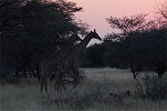
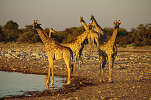
With the sun now very low, we started back towards the lodge. Passing the riverbed, we once again spotted the herd of giraffe, this time almost perfectly silhouetted against the setting sun, the obligatory photo in any self-respecting african safari brochure.
Day 8. - Anibib - Ameib
In the morning before sunrise and breakfast we set out to see the cluster of three sites recorded by Breuil just behing the lodge, within comfortable walking dstance. The most important is the "Raincloud boulder" (125/A2), with a large strange shape that may indeed be interpreted as rainclouds. Most of the panels in this cluster are oriented in a way that they are out on the sun all day.
After breakfast we set out again with Immanuel to se the sites on the eastern side of Ameib. These were not recorded by Breuil or Scherz, the majority were discovered by Martin Steppe during a meticulous survey of the farm while he was the manager of the Ai Aiba lodge for more than a decade. Before visiting these, we went back to the east to see Breuil's "Mourning boulder" (124/A) which is out on the sun for the rest of the day. Then we continued north, starting at the site with the huge human figure which we were shown by Martin in June 2018, but at the time we were a tad too late, with the figure already half out on the sun. Now we could photograph it in perfect light.

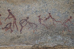
We continued cherry-picking the finest sites of eastern Anibib, like the delightful little scene with the two hunters being chased by an elephant. We moved a bit haphazardly among the sites, to make sure we visited each in the best possible light.
By noon we reached the biggest site of eastern Anibib (125/J1), a huge rock on an elevated terrace that commands all the area towards the north west, with panels of paintings on practically all sides of the boulder and the adjacent low slab.
We fininhed or rounds of Anibib at the specatcular cluster of boulders with the faint large elephant and a number of other scenes (125/H). As we returned to the lodge for lunch, we once again passed the herd of giraffe, who by now hardly took notice of us.
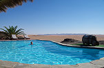
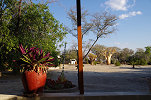
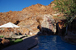
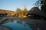
After lunch we packed up, to make the relatively short 80 kilmetre drive to Ameib, which now after years of legal wrangling was once again fully open to visitors. We settled in to the comfortable cabins adjacent to the farmhouse, and had a lazy afternoon by the poolside till the evening dinner.

Day 9. - Ameib
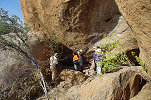
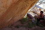
The morning was spent with a visit to the Philipp cave, we started early to mke the best of the cool of the morning as we made the roughly one kilometre walk and climb from the car park.
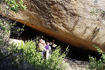
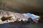
The real treat of the day was in the afternnon. We received special permission to visit the Jatow Grotte, another huge shelter located at the extreme north east of the Ameib property, and normally off-limits to visitors. The site is actually not one, but two shelters located one above the other at the side of a granite ridge, with a rather difficult access route that unfortunately not everyone in our party was able to tackle. The lower shelter is the larger one with a deep underhang (though not as deep as the Philipp cave) with the whole rear wall densely covered with paintings.

The upper shelter was not straight forward to reach, it needed some scrambling over two high rock ledges. It is more of a slanting wall, with much fewer depictions, but those are among the best preserved panels at this amazing site.

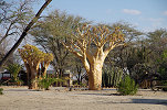
We spent the rest of the afternoon at the classic Ameib sites near the Klein Ameib spring, starting at the giant bouulders of site 147/A under the hill referred to as "Elephant's head".

With enough time on our hands, we climbed up the the triangular shelter in the side of "Elephant's head" (site 147/B), which has has several panel of paintings on the vertical walls.
Starting our climb down, we passed the wall to the left of the shelter, and much to my surprise we found a panel of human figures which I have not seen previously.
We finished the day at Scherz's Fundstelle 150, a cluster of boulders a little removed from the other sites. We started at the small but lovely site of 150/B with the perfect depiction of a wildebeest and a hartebeest side-by-side. From here we continued to the main "Gheisterkampf" (ghost fight, 150/A) site, making a perfect timing, the sun just dipped below the main mass of the Erongo a minute after we reached the paintings.
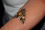
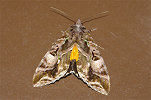
As we were having dinner, we were visited by a huge moth which I have never seen before, much larger than the usual night creatures whirling around the lamps. It was later identified as a fruit-piercing moth, Eudocima divitiosa.
Day 10. - Ameib - Spitzkoppe - Uis
After breakfast we left Ameib, and after a quick fueling stop at Usakos we continued to the Grosse Spitzkoppe, where we spent the morning visiting the two principal sites, "Bushman's Paradise" (Scherz's 92/E) and "Sphinx shelter" (92/C).
After lunch at one of the Spitzkoppe campsites we drove west along the D1918 towards Klein Spitzkoppe to visit the other two main sites, the "White ghost shelter" (89/A) and the nearby site (89/C) with the beautiful pair of giraffe and other paintings.
It was mid-afternoon when we finished at the sites, we drove back towards Grosse Spitzkoppe and took the direct D1930 road to Uis, staying at our regular haunt, the White Lady B&B.
Day 11. - Brandberg, Tsisab Gorge
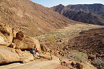
Using Uis as the base, we made the day-trip to the lower Tsisab Gorge along the eastern side of the Brandberg, starting at the obligatory "White Lady" site. The valley was full of fresh vegetation, clearly there were good rains at least on this side of the mountain, a good sign for our planned trek with Gábor.
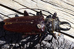
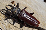
There was water at the foot of the white cliff near the "White Lady", and on a tree trunk I found a huge longhorn beetle (Anthracocentrus capensis which I have never encountered before, dead but the cuticle still mostly intact.
We climbed up to the series of Tsisab Island sites, starting at the Tiara cave (T2) and continuing to the Jochmann shelter (T3).
While the others were photographing the Jochmann shelter, I took the opportunity to sneak off for a quick search along the northern edge of the island for the Acrobat shelter (T6), which I have not yet seen and none of the quides knew its precise location. It took some scrambling among the big boulders, but eventually I found it very close to the expected spot, a mere 100 metres from the Jochmann shelter terrace.
Leaving most of our gear behind at the specious cave next to the Jochmann shelter, we continued upstream to visit the Pyramid (T5) and Skeleton (t8) shelters before returning to the Jochmann shelter for lunch.
Starting our return towards the car park, we visited the lovely T3 shelter, and passed again by T2, where it was again Madeleine who spotted some very faint ttaces of paint high on the southern part of the rock, a panel which I have never noted on all the previous visits.

Again leaving our packs behind, this time at T10, we climbed up to the superb "Girls' school" (T11) site. On our return, passing T10 I found another panel at the rear of the rock, which I have not seen before.
While the rest of the party slowly started back towards the car, I took the opportunity to search for three still missing sites along the northern bank of the Tsisab, a little downstream of the T10 site. I could not locate T25 (Breuil's "rainmaking boulder"), but I did find Scherz's T13 and T12, both fairly small sites on boulders along the riverbed. Dashing after the others, I just caught up with them as they approached the car park.
Day 12. - Lower Numas Gorge
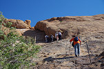
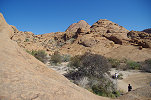
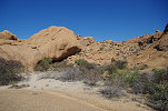
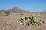
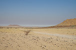
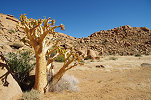
This time we made a day-trip to the opposite side of the Brandberg, to the Numas gorge on the western side. On the way we passed the field of welwitschias which all showed the signs of drought, there was not a single flowering one. Clearly thee was no rain on the west side of the mountain.
Leaving the Quantum at the campsite at the valley entrance, we continued on foot upstream towards the well known sites recorded by Scherz. We went straight to the sites near the Zebrawater spring, to make the best of the early morning shade at the most important panels.

During the rest of the morning we slowly trickled back along the row of sites towards the car, finishing at the spectacular breccia outcrop near the campsite, where the molten granite pushed its way into the cracks of the older Karoo strata, leaving huge blocks of black basalt embedded in the granite dyke.
After lunch at the campsite we visited the single remaining site (Scherz's site 77/A) at the entrance of the valley, then we started our return to Uis along the dusty track.
Day 13. - Uis - Twyfelfontein
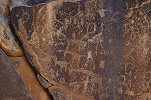
After the lovely three nights at the White Lady B&B we packed up, and after breakfast set out towards the north, to visit the engravings of Twyfelfonten, about two hours' drive from Uis. We drove straight to the parking lot, and were happy to note that the usual crowds were absent, we practically had all of the main panels (Scherz clusters C-H) to ourselves for most of the morning.
Around noon we drove to the upmarket Twyfelfontein Country Lodge (which sports its own rock art site on a cluster of huge boulders at the entrance, Scherz's cluster P, "Ceremonial place") to pamper ourselves a bit for the afternoon and the evening.
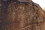
In the afternoon we made a visit to the nearby "Siebenplatte" site (Scherz's cluster O), a cluster of rocks with seven vertical panels full of engravings, some of which are on par with (or even better) than the carefully groomed tourist site. In all fairness, I much prefer this one...
Day 14. - Twyfelfontein - Okakuejo (Etosha)
Having completed our rock art itinerary, we still had two days left for another Namibia highlight, the Etosha park. After a lazy morning at the Twyfelfontein Country Lodge we packed up and started towards the park entrance north of Outjo. We stopped for lunch before the park entrance at the very pleasant Toshari Lodge before continuing to Okakuejo, the main camp within Etosha. Having been mostly isolated from the rest of the world, it was quite strange to return to the reality of Covid rules. Apparently while we were in blissful ignorance, the virus raged in the main cities of Namibia, and just a few days earlier the entire Windhoek/Okahandja district went into a lockdown, with nobody allowed in or out of the region. Fortunately after some frantic asking about it emerged that tourists going to/from the airport were exempt. However the impact of the situation was very visible, there were hardly any tourists in residence, we received a row of premium chalets right opposite the waterhole, something unimaginable in normal times when they are booked out years in advance. We also learned from the check-in staff that Germany added Namibia to the red category, meaning that transfer at Frankfurt was no longer permited to anyone not having a German passport (obviously the virus respects German passports, and will not infect its holder...). Fortunately the Lufthansa call center was efficient as usual, soon all of us were re-booked on Swiss via Johannesburg.
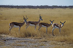
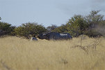
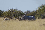
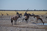
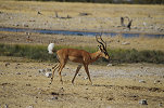
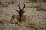
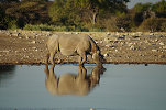
With all this sorted out, we set out on our first game drive around the waterholes surrounding Okakuejo. Contrary to expectations game was conspiciously scarce, apparently with the good rains there were still many watering places all about the park, and they did not need to resort to the artificial springs. While a few of the usual suspects were around, none in any great numbers. The only excitement was when we spotted a female rhinoceros with its young in the distance, half covered by the unusually tall grass.
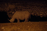
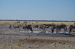
We returned to the Okakuejo waterhole for sunset, but found it deserted on both sides of the retaining wall. The absence of the normal crowds was a bliss, but it was strange to have no animals around at sunset. We had our dinner, and taking advantage of the superb location of the Chalets returned to the floodlit waterhole after dinner, and finally we did have a proper show put on by three rhinoceros who stayed on for most of the evening.


Day 15. - Okekuejo - Namutoni (Etosha)
In the morning before breakfast we went out for another game drive to the waterholes surrounding Okakuejo as soon as the gate opened. There was a bit more activity, but still far less than the usual morning jostling at the waterholes. We had a few nice close encounters, but only the common species.
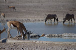
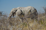
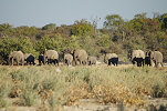
After breakfast we checked out, and started slowly rolling towards Namutoni, about 120 kilometres to the east of the far side of the park. We made some detours to a number of waterholes along the way, with mostly the same result: scarce common game, some of which were already lying down for their midday rest. Finally near Salvadora we saw a small herd of elephants.
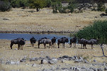
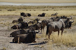


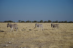
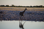
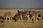
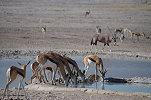
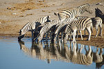
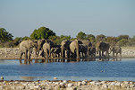
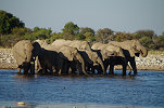
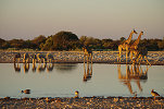
After a quick lunch at the half-way picnic spot we continued to Namutoni, checking in to the comfortable chalets and taking some rest before heading out to the surrounding waterholes. At Chudop there was a little more action, with many drinking zebra and giraffe, but no lions or other large game were in sight.
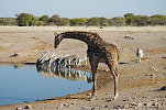

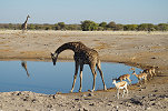
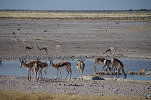
After lingering for an hour we continued to Klein Namutoni, where finally we had our luck. After a short time a large heard of elephants came to drink, followed by a lone rhinoceros, then a sizeable group of giraffe in perfect light.
With the gates about to close we returned for sunset and a sundowner at the deserted Namutoni waterhole.
Day 16. - Namutoni - Windhoek
The only part of the remaining core programme was to return to Windhoek, and take the flights home. We took our obligatory group photo in the gardens by the Namutoni fort, then packed up and set out towards Windhoek.
There was a slight complicating factor. All being vaccinated, there would have been no need for anyone to take a PCR test taking Lufthansa home, however now there was the extra leg to Johannesburg, where a PCR test was required even for transfers. Fortunately a test booth was installed recently at the B2 police checkpoint, with quaranteed results by the next morning if the test was taken before 5pm. This was easily manageable, even with a planned lunch at the Okahandja Country Hotel, However we found the latter closed due to the Covid lockdown, and just beyond there was a fairly strict checkpoint where all our passports and flight tickets were checked (though failing to notice that mine and Gábor's flights were fot ten days later...). The testing went smoothly even though we arrived a good two hours before the booked time, and we were at the Pension Moni in Windhoek for our last sundowner together on the terrace. It was a challenge to find an open restaurant, but after some searching the Riverside Restaurant in Klein Windhoek agreed to serve us (in principle they could only serve for take-away or residents, but we promisded to behave as hotel guests if needed...).
Day 17. - Windhoek - Uis
Much to our surprise all the test results were received by eleven in the previous evening, barring one, Magdi's. However after a quick call in the morning, the missing test too arrived, all negative. After breakfast I drove the leaving party to the airport, making sure the check-in was completed before saying good-byes and returning to Windhoek. We took the time till flight departure (just in case...) to do our shopping with Gábor, and once we saw the Airlink fight to depart we left the Pension Moni towards Uis. At the Okahandja checkpoint a bored looking policeman waived us through without checking anything on hearing that we were tourists, and on the superb freshly graded roads we reached the White Lady B&B at Uis in record time, well before sunset.
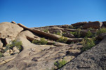
Our plan was to spend five days at the Brandberg, starting with a trek up to the Raiders 1 site from the end of Naib Gorge, something I wished to do since a long time. The rerurn was planned via Porters and Dassie Valley, reaching the Naib again at site I15. This looked doable in three days, for the remaining two we left options open, including a possible climb up to the Western Amis and Dom Gorge sites on the little terrace behind the Dom peak.
Day 18. - Uis - Naib Gorge
In the morning we drove to the ticket office at the Tsisab Gorge to collect our NHC guide, Seth Gaseb. We have met Seth a week earlier and discussed all plans, so he was ready and prepared by the time we arrived. Without much further ado we departed, taking the near track around the Brandberg rather than returning along the muckh longer road via Uis. Time wise probably the two routes are the same, but this one was certainly more scenic passing close to the mountain. As we passed Orabes Gorge, we could still see the remnants of the morning coastal fog on the horizon.
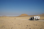
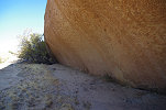
We reached the entrance of Naib Gorge by midday, from this vantage point we could take a good look at the steep climbing route at the left side of the lower Naib where we intended to get up to Raiders Gorge. While our original plan was to start the climb in the cool of dawn the next day, the eat was not too bad so we decided to start the our climb already in the afternoon, gaining as much altitude as we could till the evening. We still had plenty of time for lunch and a siesta till the midday head started to dissipate, I took the opportunity to pay a visit to the nearby site of 77/A, a site recorded by Scherz where on previous visits I have missed one of the faint panels.
We started climbing mid-afternoon. Our plan was to follow the course of a steep ravine that descended just opposite from where we parked the car, at an altitude of 575m above sea level. Our first objective was a broad flat terrace at mid-level in Raiders Gorge at 1300m, the ravine was leading directly up towards it. We carried five bottles of water (calculated to last at least thre and a half days), sleeping gear and very little else. We soon found that the going was a bit better on the slope to the left of the ravine, but it was steep and difficult everywhere, with huge boulders necessitating large steps and frequent detours.
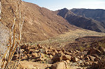
As we reached ever higher, the going became increasingly difficult. We stopped taking photos, and just trudged along in the felt direction that at times seemed near vertical (in reality the slope was roughly 40 degrees, a litte less than 1:1). By the time sunset was approaching, we reached a roughly 1000m elevation, a good 400 metres above the car.

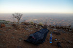
We searched for some flat ground to make a bivouac, but it was extreely difficult to find any among the boulders. Finally we came upon a flat rock and a nearby patch of flattish ground where two could sleep, and I found a small terrace just enough for one a little higher up among the rocks.
Day 19. - Raiders Gorge
Unsurprisingly we had a rather uncomfortable night, were up at first light and after a quick breakfast and packing-up we continued uphill. The car was clearly visible under us as a bright white speck.
We continued upslope among the boulders for a good three hours until finally the going started becoming a bit better, the terrain flattening out and shortly we were within sight of the col between the Naib and Raiders Gorges. Soon we could look into the flat plain only a couple of dozen metres below us, and in another few minutes we dropped our packs at the foot of a big boulder at the plain edge to have a good rest.
This lower Raiders plain appears to be a very pleasant living space, however strangely there are no rock art sites anywhere on the surrounding rocks. The first sites in Raiders gorge are on a high terrace a good 200 metres above the lower plain, towards the main mass of the mountain. Fortunately the going here became much easier, after our rest we started climbing on a series of smooth granite plates leading up to a small terrace about 50 metres amove the main plain, whic was full of fresh vegetation, raising our hopes that we might find water somewhere.
Unfortunately it soon became clear that the hope for any water was unwarranted. After an hour we reached an intermediary plain which was completely dry, probably there was only some small localised rain event at the lower terrace.
At the eastern end of the middle terrace we found a prominent shelter offering shade for several persons. We left out packs there, and Gábor decided to stay behind for a rest after the long and difficult climb, while with Seth we continued up to the high terrace another 50 metres higher.
Already from satellite imagery it was possible to identify site R4, a prominent boulder in the middle of the terrace at an altitude of 1525m, perched on the edge of the sheer drop leading down into the Naib, only separated from the later by a low lip. Our timing was perfect, all of the fine paintings on the south western side of the boulder were in the shade.
Site R3 was amout 150 metres to the north, at the foot of the steep slope leading up towards R1. It took a while to find even with Pager's site plan, as it was a plain boulder looking like all others. Finally we found the panel, more for completeness than anything else as they are not particularly exciting. There was another site, R2 somewhere up the slope, but with only a few damaged figures, not worth the effort of getting up (and down again) among the huge boulders.
We returned to Gábor and the packs for lunch before contining. Our resting place was chosen intentionally below the high terrace, as the easiest looking route up towards R1 was from the middle terrace, bypassing the area with big boulders and some vertical cliffs. Indeed the going proved to be much better, and the weather too cooperated, with some high altitude clouds moving in and blocking the sun.
It took about an hour and a half to make the 300 metre ascent, arount 1750 metres we reached a little terrace overlooking the country below the Brandberg to the west, and just beyond we found the narrow ravine with the vertical cliff along the western side, with the shelter of R1 at the base. The site (and the whole valley) is named after the group of dark "raiders" in the middle of the main panel, but there is also an exceptional scene with three hunters imitating ostriches.
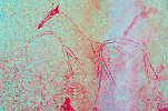
A little removed from the other panels there is an absoltely unique depicton of several moths, a subject not known from any other sites on the Brandberg (or elsewhere in Namibia), accompanied by a large red animal.
There is a nother unique panel at this site, not because of the subject (a very weathered springbok), but because of the medium. It was painted on a small portable slab, which was found by Pager set against the rear wall of the shelter. I was rather pleased to see it still in the same position as on Pager's site drawings.
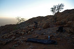
Strangely there was practically no level ground in the vicinity of the shelter, so we returned to the little terrace we passed earlier to make our camp.
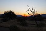
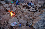
The terrace had an unobstructed view towards the western horizon, we had the rare spectacle of an unobstrcted sunset on the Brandberg while the water for the freeze-dried meals was warming on the little fire.
Day 20. - Raiders Gorge - Porters Gorge - Dassie Valley
We were prepared for a cold night at our exposed location, but it stayed surprisingly warm despite the altitude. We got out of our sleeping bags at first light, and by the time we had a cup of warm coffee and were ready to leave, the sun was already up.
Porters' plain was just over half a kilometre away and only 100 metres higher, according to Tilman Lensen-Erz's description of the Raiders 1 site, an easy 30 minute route. The problem was we did not now which way... At first we tried rounding the ridge between R1 and Porters' gorge, but soon we found the granite plates to be too steep for comfort, it would have been impossible to go that way without descending first into the bouldery and overgrown ravine below. We returned to the small valley of R1, and indeed we did find an easy looking way up along a granite ridge, which however soon ended in a series of inscalable rock legdes. Finally we found that the smooth granite plates on the top of the ridge did offer a good way up, but we already spent nearly an hour searching the way. This time there were no dead ends, we soon reached the top of the col, looking into the Porters' plain.
When we visited the Porters' plain in June 2011, Angula only knew the main Porters 1 site, we did not see P2 which is located above the plain on the north side of the ridge separating Porters and Raiders gorges. With a spell of luck the trail we followed reached the col just a few dozen metres from site P2, we were on the same level so there was no need to climp up and down again. P2 is a long low shelter with only a few faintings, but among them some unique interesting elongated human figures not seen elsewhere.
We continued down the plain to the huge prominent pair of boulders forming a sheler between them, the rocks of site P1. While the site was extensively photographed (in better light) ten years earlier, it was still nice to spend some time with the spectacular scenes all around the boulders.
While with Gábor we spent time at P1, Seth went to check for any water in the basins at the edge of the plain. Based on the dry vegetation we did not expect any, and he soon returned confirming this. We were down to three bottles each, with some conservation just enough for two days. After a short council we decided that going down Dassie Valley can be no worse that the way we came up, and we had enough water left to make it down the longer route, so we decided to stick to our original plan. To make it to Dassie Valley (the northern tributary of the Naib) we neded to ascend to the col above Porters' plain, at an altitude of 1968 metres the highest point of our trek.
On the col we found a pleasant little flat terrace, with a row of huge boulders along its southern side, site Naib 2 (the watershed being in the middle of the terrace). This is another site we missed in 2011, while the scenes are not exceptional, it was still nice to have the opportunity for a visit at this very remote spot. The site itself is spread out over four boulders, strangely none of them offering any good shade or shelter. There was however a large shelter a the rear of the largest boulder, with no paintings but a perfect spot for lunch and a midday rest.

Being in water conserving mode, we waited in the shade till the worst of the miday heat passed, before starting the descent into Dassie valley. The way was steep, and badly overgrown with the unpleasant Euphorbia mauritanica vines with the constant threat of trippig over one of them, but the going was not too bad among a slope of smaller rocks. About half-way down the shade caught up with us, and the little plain in the mid-section of Dassie valley loomed ever closer.

We just reached the fairly large sandy terrace as it moved completely into the shade. The terrace was surounded by four sites, we planned to spend the night here and spend the remaining daylight to find all the sites. The principal one, site I8 was straight forward, a vertical rock wall bordering the downslope side of the terrace with a large but faint panel of paintings depicting numerous human figures.
While we did not have the precise location of the other three sites, based on Pager's site drawings we could readily identify I7 and I9 at the western and nothern edges of the terrace. I12 took a bit more time to find, we came upon it by accident at the far eastern edge of the terrace.

We found all the sites and still had an hour of daylight left. As the next terrace was clearly visible below us with another two sites (including I10, the major site of the cluster), we decided to move our packs and make our bivouac on the lower terrace. Reaching the eastern edge, we found site I11 on the right of a pair of prominent boulders. I10 required no searching, it was clearly the huge boulder perched prominently in the middle of the plain, with a large panel of paintings on the eastern side.
There were two further panels of paintings on the I10 boulder on the northern and eastern sides, photographing all of them took up most of the remaining daylight.
We found a pleasant little fat area along the southern edge of the terrace, overlooking the lower valley. We settled down to prepare our freeze-dried meals in the last remaining light as the sun set.
Day 21. - Dassie Valley - Naib Gorge
Our bivouac was at 1600 metres, we had a good thousand metres descent till the car at the entrance of the Naib Gorge. The first part untill the lip of Dassie Valley was an unknown quantity. We started out soon after dawn, to cover as much ground as possible while the valley was still in the shade.
We wound the going in Dassie Valley to be surprisingly easy (in stark contrast to the struggle we had to do when crossing the upper part of the valley in June 2011). Rather than the expeced mass of jumbled boulders along the valley bottom, we found a series of step-like terraces with easy descents between them. It took only an hor to reach site I19 in the lower part of the Dassie Valley, the highest point reached with Magdi in June 2017.
After a little pause at site I19 we continued down towards the bottom of the Naib. At the lip of Dassie Valley the cliff drops vertically, knowing from our 2017 experience how difficult the upstream way was, we rounded the downstream side of the cliffs, and found a reasonably good way down the rubble slope which at some point was marked by someone with little stones on the top of prominent boulders. After another hour we reached the level of site I15, and made for the shade of the huge promient rock with the lovely hidden fresco underneath.
We were unexpectedly fast, it was still an hour before midday, so we had time to search for a panel at site I16 on the little terrace above I15, which we missed with Uwe in 2019. It was found completely covered by the branches of an adjacent tree, could only be phtographed after some serious gardening work.
We also had time to searc for site I14, loacted somewhere at the bese of the cliff above and a little downstream of I15. We looked for it already on the way down, but the presumed location proved to be completely inaccessible. Leaving the backpacks at I15 made scrambling over the huge blocks a bit easier, and I did fins the site at a rather impossible location, not at the base of the solid cliffs but under a huge detached boulder, with a steep slope ascending almost to the rock with just a tiny patch of level ground at its base.
From here the way back to the car was well nown, we have made it several times under three hours even in the opposite direction, so we took a midday rest at I15 waiting for the temperatures to cool a bit before starting our descent in the valley fully exposed to the afternoon sun. We made a brief stop at site I13 before continuing down the steep, barely passable granite plates towards the bottom of the Naib valley.
The valley bottom turned out to be an oven. Up till now we could not complain about the weather, for most of our climb and subsequent descent there was some breeze and even a few clouds, making the temperatures bearable all day. However in the Naib there was absolutely no wing, and with the direct afternoon sun heating the huge boulders in the valley, it must have been close to forty. All of us still had nearly a full bottle left, so we decided to find a spot of shade, and make the last leg of the descent along the marked trail in the cool and shade of the early morning. The heat persisted for a good two hours until finally the sun set on the horizon, and we could have a more pleasant evening in a small sandy patch among the boulders.
Day 22. - Naib Gorge - Dom Gorge - Amis Gorge
We were up at first light, and just in an hour we reached the car at the bottom of the valley in the cool of the morning, well before the sun rose above the ridges of the Brandberg.

Already the previous day we were discussing our options for the remaining two days at the Brandberg. The very exhausting climb up the side of the Naib to Raiders has greatly reduced our enthusiasm for the planned two-day climb to the Dom saddle, and whatever little was left was firmly erased by the heat experienced in the Naib. We decided to take it easy, and visit the lower Dom and lower Amis gorges, both of which have plenty to offer. After the luxury of drining as much as we liked from the nice cool water left in the car, we loaded into the vehicle to slowly drive back towards Dom gorge.

Along the way we stopped at several places to see the contorted exposures of precambrian schists and marbles which form the basement under the much younger Brandberg granites and the surounding black Karoo basalts.

With the slow pace we reached the end of the drivable section of the Grosse Domschluht by midday. We parked the car in the shade of the single meager tree, and took a midday rest while waiting for the western side of the gorge to slowly get into the shade. The majority of the paintings are on the west side, when we visited with Liz and Jon in June 2015 we were here in the morning, now we had the opportnity to see the sites in a better afternoon light.
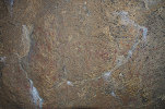
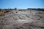
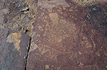
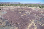
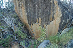
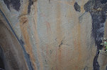
The rock art in the Grosse Domschucht is very unusual for the Brandberg, and is the procuct of the peculiar geography and geology. Here the watercourse cut across the Karoo basalts surroundng the granite mass of the Brandberg, creating a narrow canyon with low vertical walls on both sides. These vertical surfaces provided a vary good surface to paint on, and even though there is a complete absence of shelters, rocks on both sides of the gorge are covered with panels of paintings. Most of them are very faint and weathered, with white encrustations covering the paintings, but dStretch restores them almost perfectly.
Due to the softer rock, there are engravings accompanying the paintings in about equal proportion. The relationship between the paintings and engravings is not straight forward, there are some motifs like wild fauna that appear to be contemporary, while others could be widely separated in time.

We followed the row of engravings and paintings along the now shaded western bank for a good 500 metres, where the basalt outcrops cease together with the rock art. There is a water hole at this point in the riverbed, no doubt formed at the junctinon of the basalts and some more permeable rocks.

We crossed over to the eastern side of the valley, returning towards the car. The rocks here were fully out on the sun, good for photographing engravings, but less so for paintings. Fortunately the light was near perpendicular, so the sunlight had nearly the same effect as using a flash.
Visiting the Grosse Domschlucht sites took most of the afternoon. It was rather late when we drove out of the valley towards the mouth of Amis Gorge, the next one towards the east, where we intended to spend the night.
The entrance of the Amis Gorge is also a narrow canyon bordered by the black Karoo basalts, but much shorter with taller cliffs. There is a single shelter along the western side, where Scherz recorded a small site with a few human figures (Site 75/A).
Erosion shaped a broad three-fingered valley between the Brandberg granites and the encircling basalts. We made camp under a large acacia along the western side of the middle "finger". By the time we arrived it was almost sunset, we only had time for a brief search of the area. On a conspicious rock not far from camp there was a single painted female figure, matching the description of Scherz's site 75/L, which I presumed to be somewhere in the western branch based on Scherz's rather inaccurate sketch map.
Day 23. - Amis Gorge - Uis
We have only been to the lower Amis before once in June 2015. Our objective was to see the sites reported by Scherz, but the weather turned very uncooperative. By the tie we reached Amis it was sweltering hot and we only fond a few of the sites in the eastern branch before giving up on scrambling over the sizzling rocks. Now with the camp in the valley and hindsight, we had a good opportunity to find the remaning sites. Scherz marked two boulders along the eastern side of the middle branch where we camped. Already from camp we could see two conspicious boulders, and we were not mistaken. These were the two sites 75/O and 75/N, no more than 50 metres apart, both with some weathered paintings on the side of the rocks.
There was another site, 75/M somewhere in the narrowing ravine leading up towards the upper Amis and the Lufthöhle. We searched for a good hour among the rocks but could not find it, so giving up we returned to camp, packed up and drove toll the huge rock of site 75/B, from where we continued on foot. Gábor wandered off to seek rocks and crystals, while with Seth we approached the eastern cluster of sites. At 75/Q (a new find in 2015) we immediately found a panel which was missed previously, depictink a larger and many small human figures, plus a bizarre four-horned beast.
We continued to the cluster of rocks that is site 75/F, on the trail towards the waterhole at the eastern end of the valley. Here too, we found a previously unseen panel aside the known ones.
This was the point where we turned around the last time. Now continuing east, in just 30 metres we came upon a rock with a low shelter underneath, site 75/E. After some search we also found 75/I only a dozen metres away. Both of these sites appeared much farther (and I to the north) on Scherz's map.
With these two sites known, we finally got our bearings on Scherz's map, and finding site 75/D was straight forward, in a shallow cave under a dry waterfall at the eastern end of the valley, near the spring which still had a little water. Task completed, we walked back towards the car, and came upon another panel at the 75/F cluster.
It was only mid-morning, but it was already becoming hot on the sun, and after the tough four days on the mountain our enthusiasm for climbing among rocks was much reduced. We left the remaining three sites somewhere in the northern part of the eastern branch for the next time, and we started on the drive back towards the Tsisab ticket office to drop off Seth before returning to Uis. The drive was rather uneventful save for an encounter with a few distant ostriches.
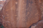
Not far from the entrance of Tsisab Seth pointed out a cluster of rocks, asking if we know the paintings there. It was all news, driving to them we found a very nice panel with a prominent elephant and several human figures. Checking later, this turned out to be Scherz's site 69 ("Ostfuss").
As we reached the road, we were in for another surprise. There were some rains along the eastern part of the Brandberg, and the edge of the road was lined with dozens of Desert shaggy mane mushrooms (Podaxis pistillaris), all dried up but still whole.
After dropping of Seth we returned by the main road to Uis, to have a lazy relaxed afternoon by the pool at the White Lady B&B.
Day 24. - Uis - Kaukausib - Eremutua
While the Erongo, Spitzkoppe and the Brandberg are the richest rock areas of Namibia, Scherz recorded hundreds of other sites around the country, mostly on private farms. In many cases the names of the farms have changed, and it is rather difficult to find out exactly where these sites are (and even more difficult to gain access), however prior to our trip, after several failed attempts elsewhere I have managed to make contact with the family who own the Eremutua farm, where Scherz recorded a particularly rich concentration of paintings about sixty kilometres to the north of Omaruru. We agreed that we will visit on the afternoon of our last day before needing to return to Windhoek. As the distance from Uis was not much, we also had time to visit another cluster of sites recorded by Scherz at Kaukausib, a cluster of low granite knolls a few kilometres to the south of the Uis - Omaruru road. With some prior searching on Google Earth I have managed to identify both the rocks and the likely location of sites, as there was a track leading there from the main road access was fairly straight forward. Reching the knolls, we parked right in front of a large boulder which indeed turned out to be Scherz's site 81/D.
Scherz's map and description at this locality was fairly good, it was rather straight forward to find sites 81/C with some unusual black figures not far behind, and 81/E a little further up the side of the northern knoll.
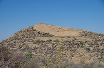
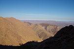
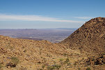
Kaukausib is located in the Tsiseb conservancy, communal land with very little population outside the few villages. Clearly this location fell from memory, there were no signs of any recent visitors, and some intense gardening was needed at some of the sites. From the north knoll there was a superb view of the surrounding mostly flat country, with the Brandberg 40 kilometres away on the western horizon.
Reading Scherz's description, it became clear that site 81/C consisted of three distinct panels, we only saw the first one. It took some search to find the other two, all on boulders within sight of each other, but faint and hard to see.
The largest site of the cluster is site 81/B, located on the southern knoll near a natural cistern (which was now dry). Unfortunately its orientation means that it is out on the sun for most of the day until late afternoon, save for a few panels in the underhanging parts of the rock.
There was one site left, 81/A somewhere along the southern side of the south knoll. The place was obvious, but it took quite some time to find the extremely faint but exceptional figure of a rhino headed therianthrope. With all sites now ticked off, we returned to the car for a quick lunch before setting out towards Eremutua.
We reached Eremutua mid afternoon, welcomed by Herr Nitsche who vaguely recalled the visit of Scherz in his childhood. As the remaining daylight was short, we immediately set out to the low granite hill adjacent to the farmhouse. Herr Nitsche led us to the finest of the sites (106/A) located on the southern side of the hill, about 20 metres above the level of the surrounding plain. The path leading up to it was completely overgrown, according to Herr Nitsche we were the first visitors interested in rock art in perhaps a decade. The site itself is splendid, well worth the scramble among the rocks and vegetation that matched or surpassed the Brandberg at its worst.

Herr Nitsche showed us two more sites at the foot of the hill along the southern side (106/D and 106/E), both on prominent boulders,
Eremutua is only 70 kilometres to the north of the Erongo, but the vegetation was completely different. The little hill was covered with a dense growth of trees, with deep grass on the surrounding plains, vegetation that we only encountered at the higher elevations of the Brandberg.
Near the eastern end of the hill, requiring some walking from the car but no climbing, there is a prominent rock with a single large elephant painted on it (site 106/F1).
We had time for two more sites before sunset along the nothern edge of the hill, sites 106/O and 106/P. With these we made an almost complete circle around the hill. Herr Nitsche did not remember all the sites, but now we had enough understanding of the topography to match it to Scherz's site plan when we intended to return for the remainder in the morning. At 106/O there is a fine kudu which is exceptional in its preservation. The paint is gone, replaced by a growth of dark lichen on the rock, perfectly matching the outlines (including the horns) of the original painting. I know of one single analogy, site I53 on the Engelhard Plain (Naib Gorge, Brandberg).
We planned to camp at some suitable spot, but Herr Nitsche very kindly invited us for dinner and to stay in the guest rooms at the servce building. After the excellent dinner we had a long discussion around the fire on the farmhouse terrace, much of it about plans to re-visit Eremutua and possibly the sites on the surrounding other farms.
Day 25. - Eremutua - Otjihaenamaparero - Windhoek
The previous afternoon we only saw six of the over 20 sites scattered about the hill. At sunrise we set out with Gábor, armed with Scherz's map, to find the rest. We started at the western end of the hill, closest to the farmhouse, where Herr Nitsche pointed out a small site the previous evening. We expected it to be 106/K based on the location, but the scenes did not match, apparently it is not one of those recorded by Scherz.
Site K had to be somewhere in the vicinity, on the side of the hill facing the farmhouse. There were a number of likely boulders on the hillside, we started at the first, but found nothing. Vegetation made it all but impossible to continue on the hillside, so descending to the grassy plain we scouted the next target, and this inseed contained a large panel of paintings, but strangely again not matching any of Scherz's sites. The motif of a bird in flight is particularly interesting, I'm not aware of any other such depiction.
Getting back to the plain we spotted yet another rock a little further to the north, where again we found paintings, this time finally matching the description of 106/K.
We returned to the car to continue clockwise around the hill. Scherz marked two sites near the north western promontory, 106/L and 106/M1, both were fairly easy to find on prominent rocks some way up the slope. We also returned to site 106/P which we already visited the previous afternoon, to photograph the finest panel at Eremutua, which was out on the sun the day before.
We moved to the eastern promontory of the hill, with a number of large wild fig trees. This is the most commanding position on the hill, with a superb view over the savana towards the north and the east.

Not surprisingly, there is a site (106/Q) on the smal terrace on the top of the promontory, and a nother site along the side of the ridge leading towards the interior of the hill.
We could have spent much more time at the Eremutua hill, but we still had to get back to Uis, and we also had some other plans left for the day. We passed by one last site, 106/F on a little removed hillock along the southern side of the hill, before returning to the farmhouse to say good bye to our very kind host.
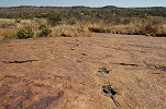
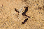
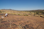
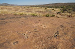
Our last target was the famed dinosaur tracks at Otjihaenamaparero, at the foot of Mount Etjo. It was nice to re-visit, I have not seen these tracks since our family visit in June 2005. We started out at the small tracks near the campsite which we did not see the last time, they were apparently discovered sometime in the elapsed 16 years.
Continuing towards the main tracks, we encountered a friendly ground agama, and also noted that the small stream was still trickling over the exposed sandstones.

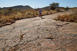
The main theropod trackways were just as I remembered them, with one marked improvement. The rather unsightly white painted circles around some of the tracks were now almost completely weathered away, returning the landscape and the tracks to their undisturbed natural state.
It was close to noon, we had to start our 300 km drive back to Windhoek. By 3pm we reached the testing center at the B2 checkpont to have our PCR tests taken, and drove to the Pension Moni for or last night before taking the flight home via Johannesburg and Zurich the next day.
Covid situation permitting, for June 2022 we are planning a 16 day circuit to see a wide selection of the Rock Art sites of Namibia plus some of the natural wonders of the country, staying at lodges and guest farms along the way. Please visit the News page for any updates (or "follow" the FJ Expeditions FaceBook page).