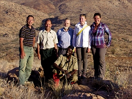
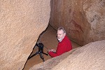
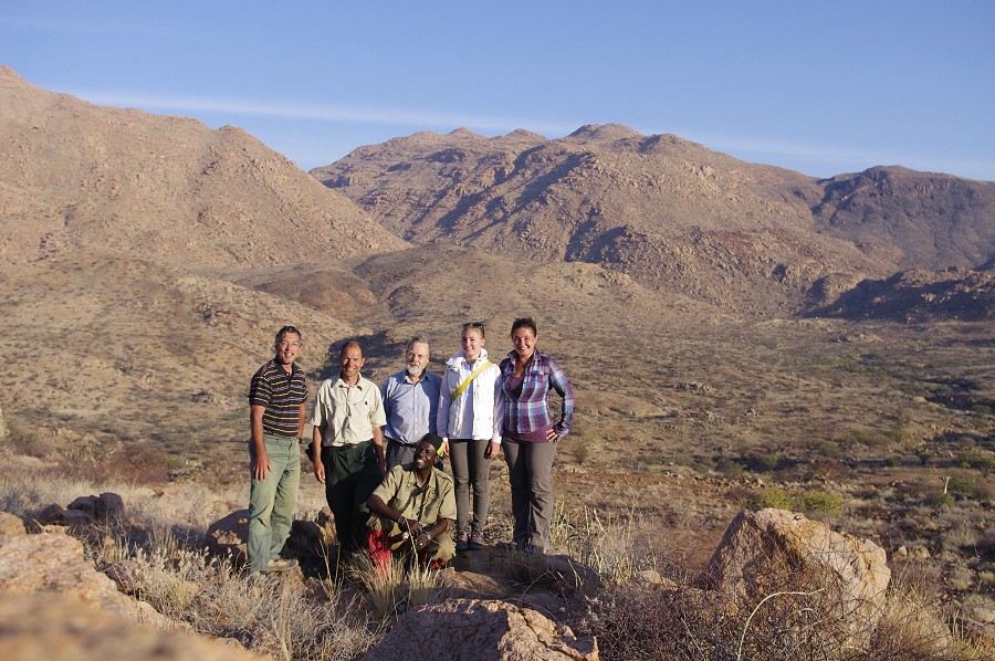
 Click on image for list of participants |
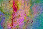
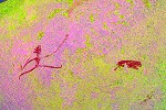
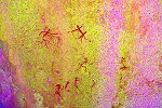
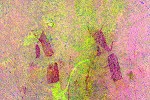
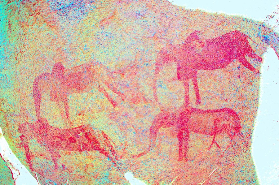
Upper Brandberg, Namibia 20th - 30ndJune, 2013 All site references based on Harald Pager's numbering system False colour images precessed with dStretch, a freely available software developed by Jon Harman |
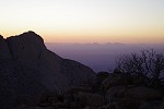
Day 1. - Windhoek - Uis
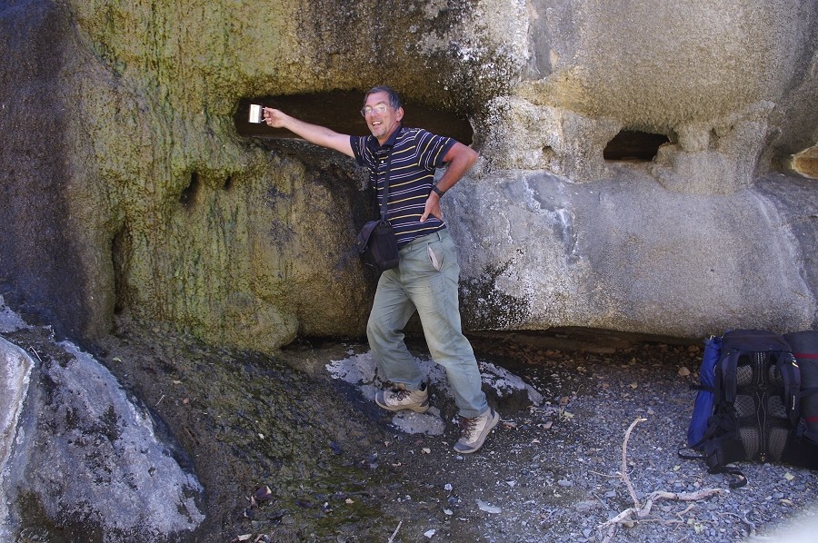
Jon, Magdi and Dóra all arrived to Windhoek the previous day (Viki opting to take the summer school-trip this year), I have done most of our shopping the previous evening, as there was noone to pick-up at the arport we could make an early start. After a brief lunch stop in Omaruru we reached Uis by the mid-afternoon, leaving plenty of time to pack our boxes and discuss next day's plans with Stefan. Uwe was waiting for us at the White Lady B&B, having successfully descended the Ga'aseb Gorge with Alfons the prevous day.
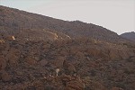
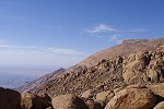
Day 2. - Upper Karoab Gorge
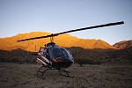
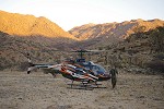
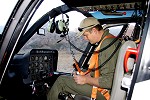
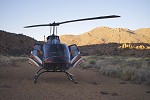
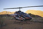
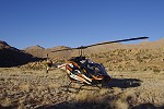
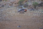
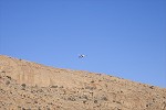
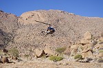
At first light we loaded up the helicopter close to the maximum weight with all the supplies for our trek (except the first camp), and Mark left with the rest of our party for the pick-up point beside the road leading to the Tsisab / White Lady, while with Stefan we took off towards the Brandberg to make our supply dumps. The dumps were planned so that we always had a depot with food and water at the end of a day's march, never needing to carry more than the day's water in our packpacks on any day.
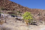
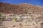
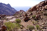
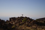
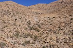
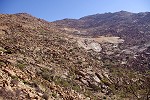
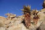
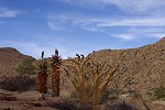
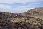
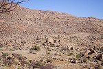
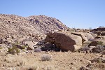
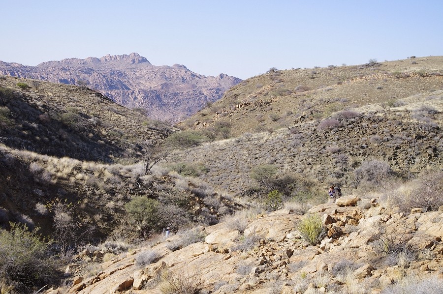
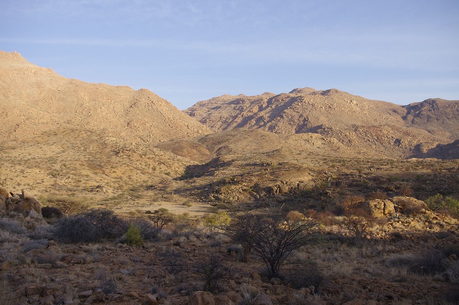
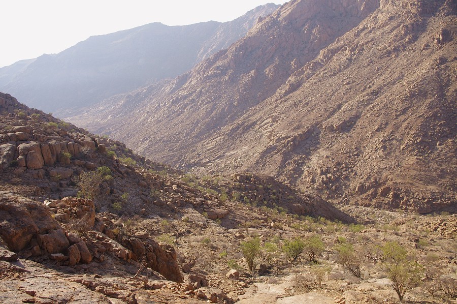
Our first target was the Buschmantal, a large basin in the north-western part of the Tsisab at an elevaton of about 1300 metres, offering an easy route down from the Nuwuarib gorge. After making a broad circle above the basin we spotted an attractive obstacle-free plain near the outlet of the basin, where we landed to make our last supply cache under a large acacia.
We next landed at the usual campsite in the Nuwuarib riverbed, and found the cache of three 5l water bottles left there last year to be intact. The bottle with water from the pool had a healthy growth of algae in it (amazingly still green and alive after a year spent in semi-darkness), but the two sealed bottles looked perfect, a very welcome addition to our carefully calculated rations.
The next cache was made in the Umuab Gorge, not on the large plain, but on a smaller one near the outlet of the main plain, located much closer to the sites we intended to visit.
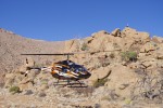
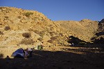
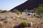
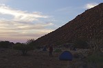
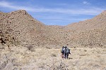
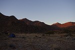
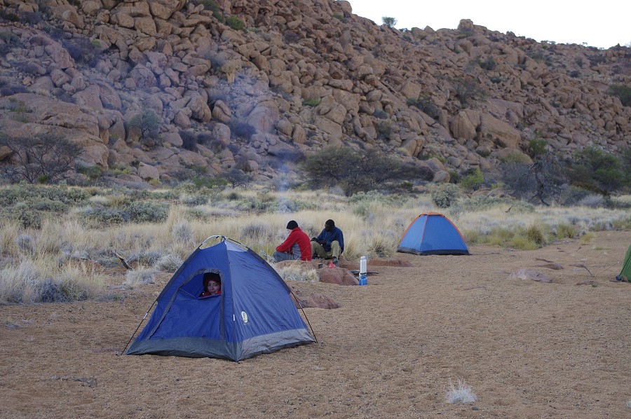
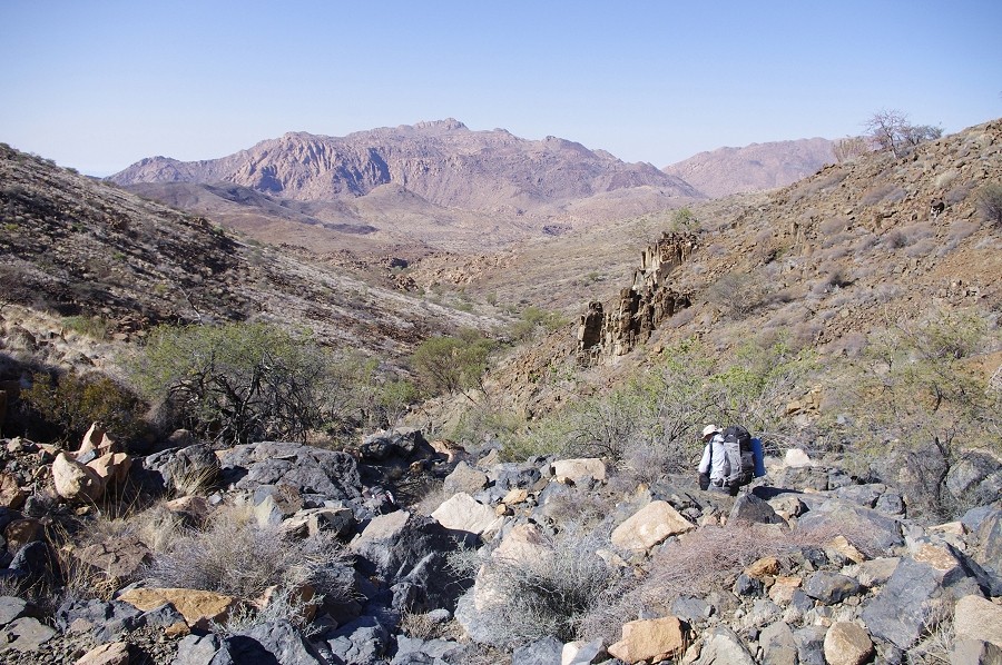
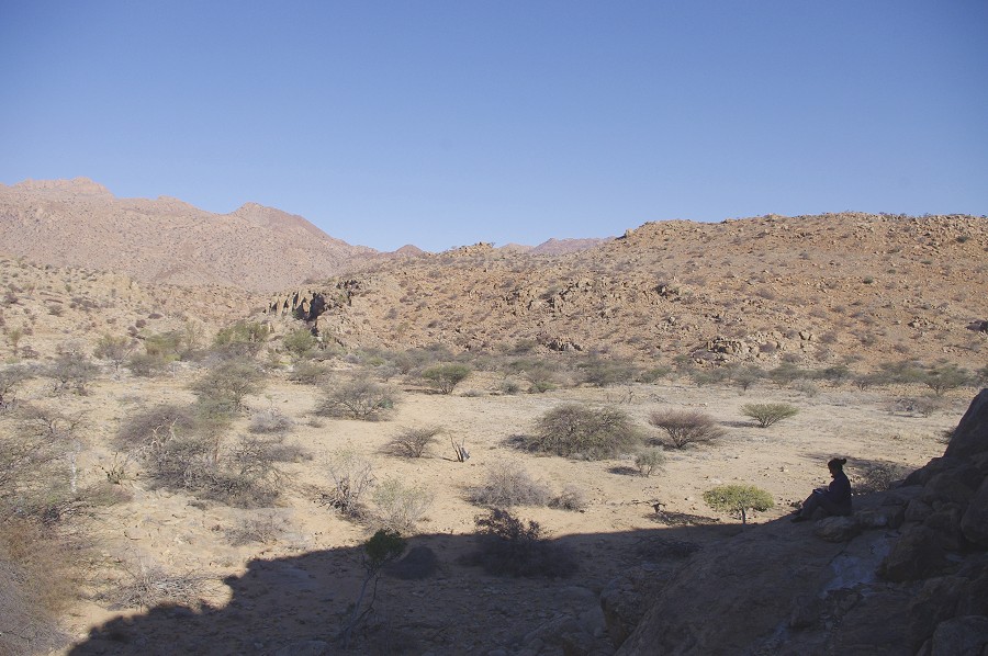
With all our dumps placed, Stefan dropped me off with the remaining water at the small plain selected for our campsite in the Karoab Gorge, already checked out from the air as a suitable landing spot the previous week, and returned to the rendez-vous point to collect the others.
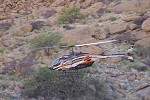
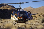
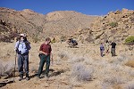
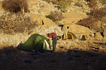
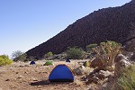
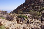
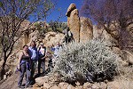
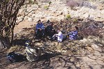
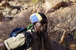
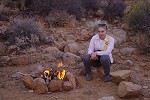
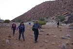
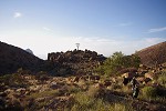
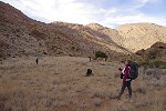
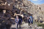
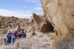
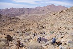
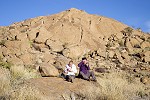
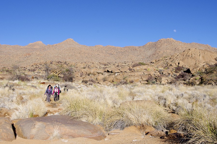
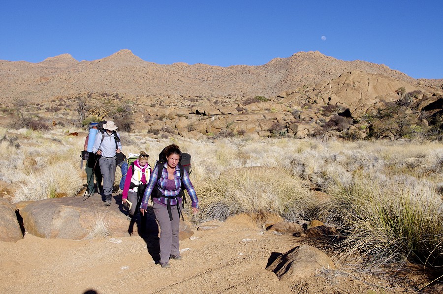
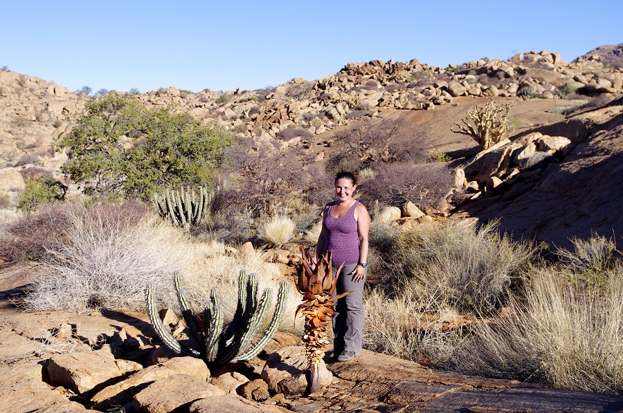
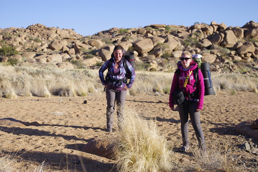
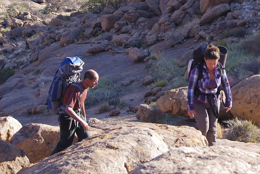
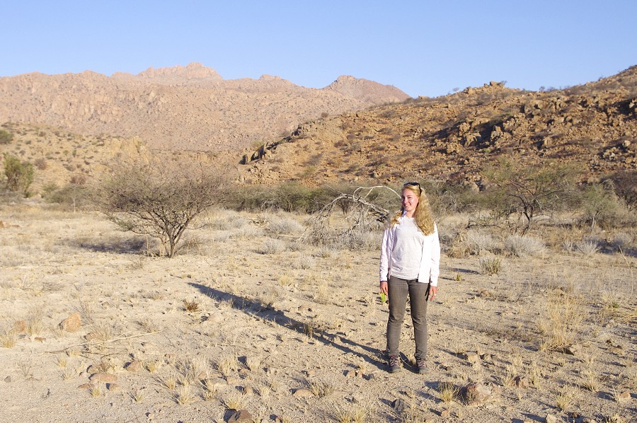
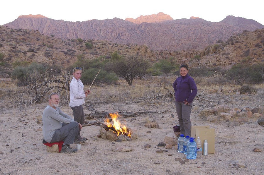
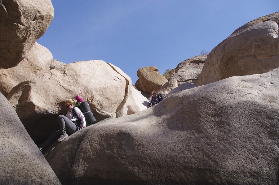
The first flight brought up Dóra, Magdi and Uwe with their gear, with Alfons and Jon and all our remaining suplies on the second, this time Dóra playng the role of windsock on the top of the rocky hill adjacent to our landing spot. Stefan secured the helicopter, to stay with us till lunchtime, definitely not willing to be left out of the fun. Leaving making camp for the evening, we immediately set out to explore the surroundings.
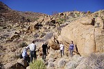
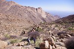
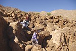
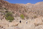
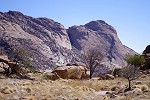
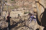
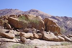
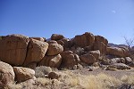
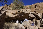
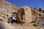
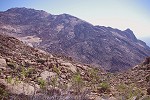
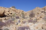
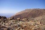
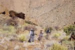
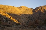
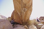
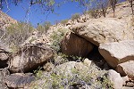
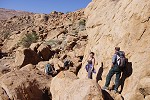
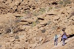
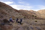
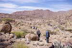
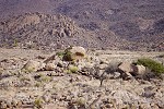
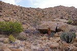
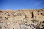
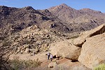
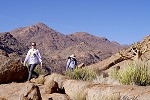
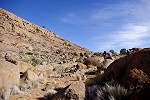
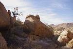
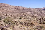
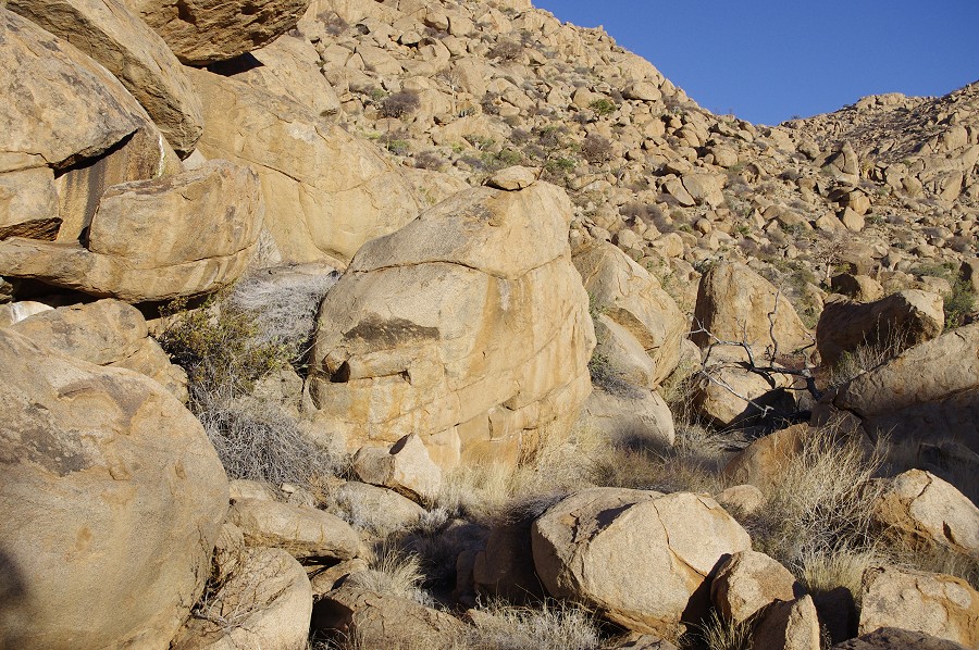
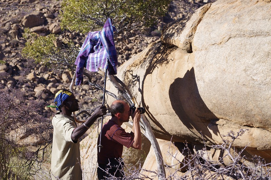
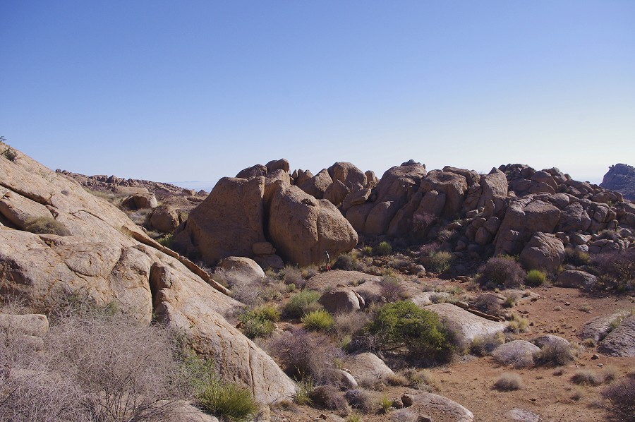
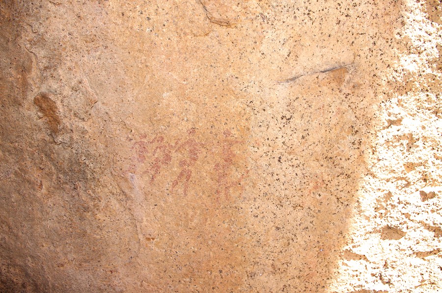
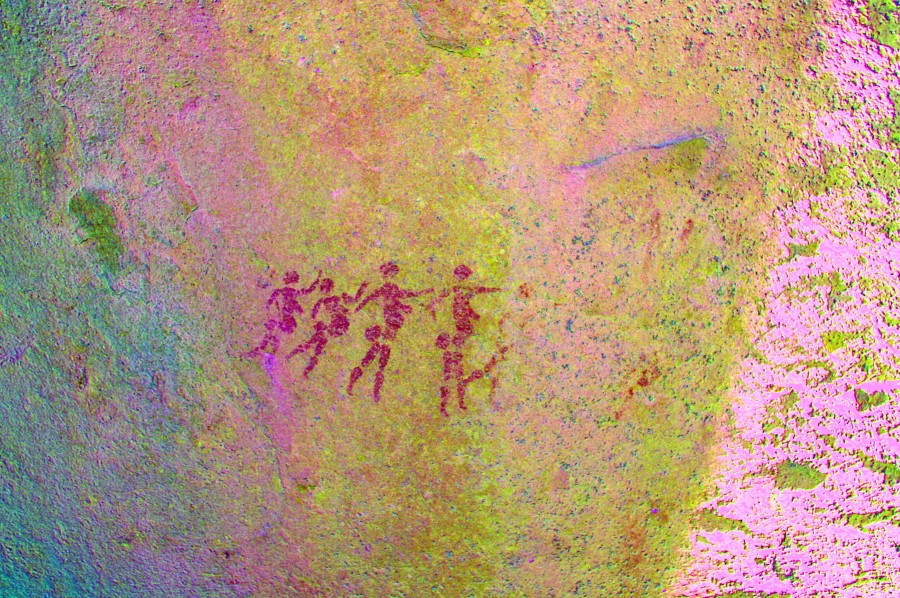
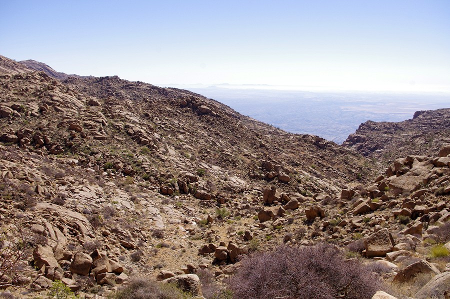
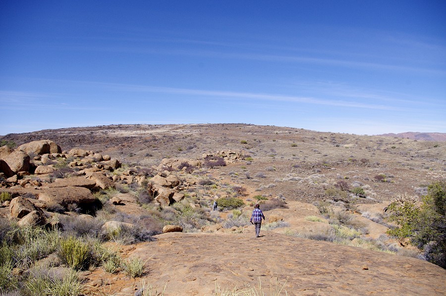
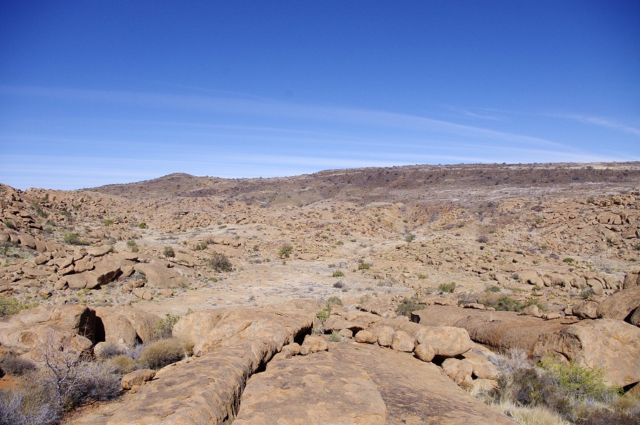
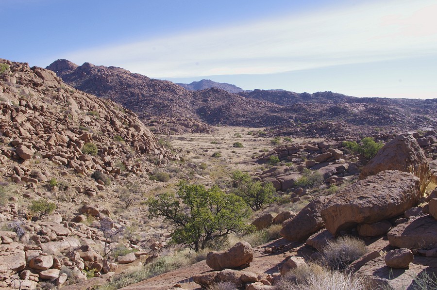
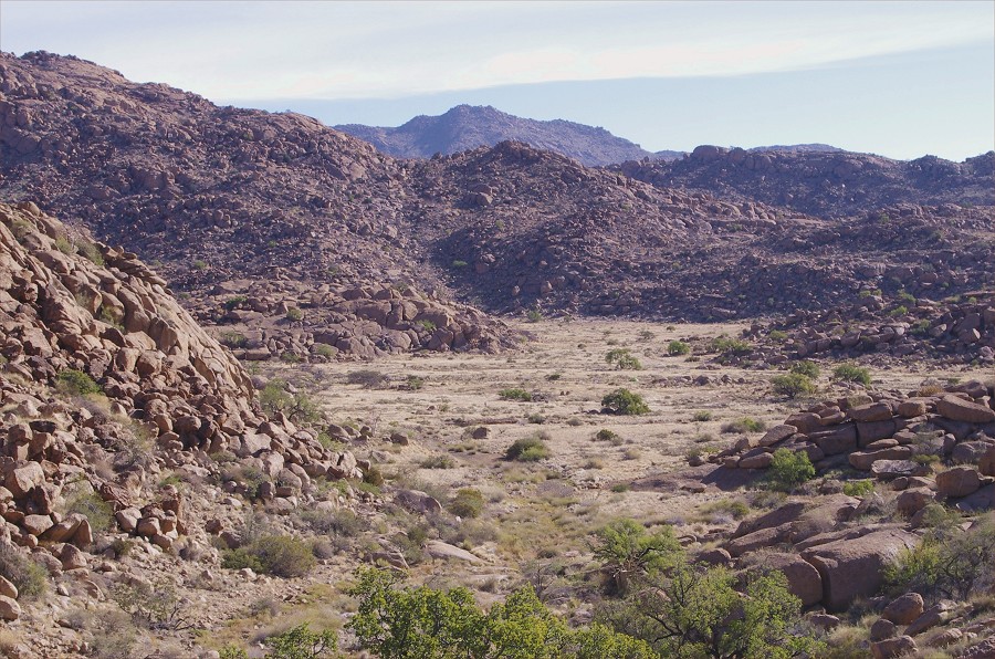
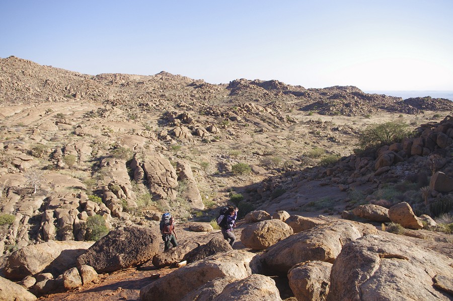
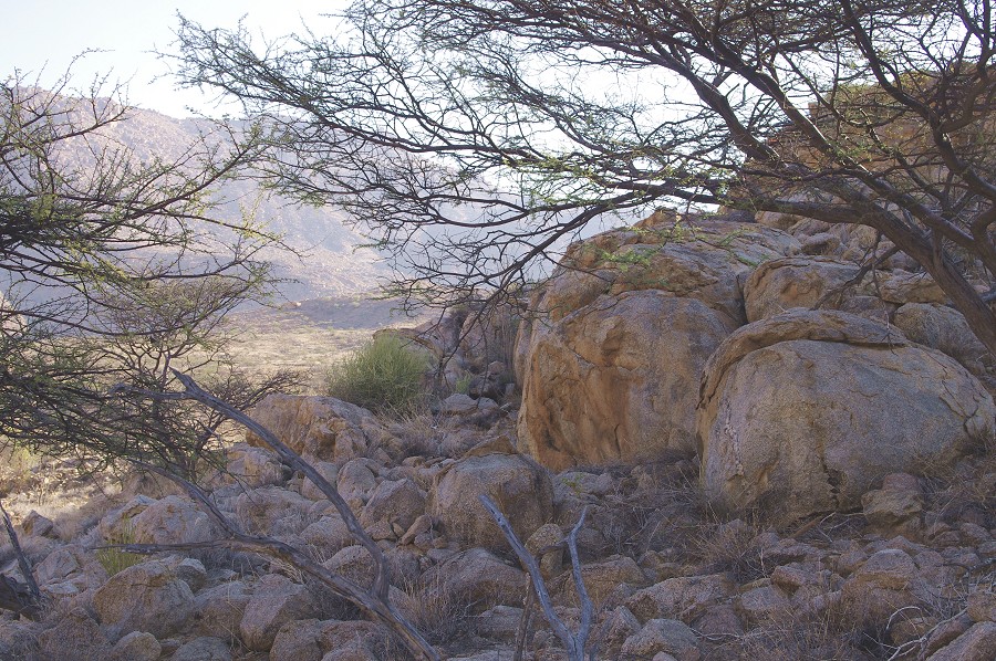
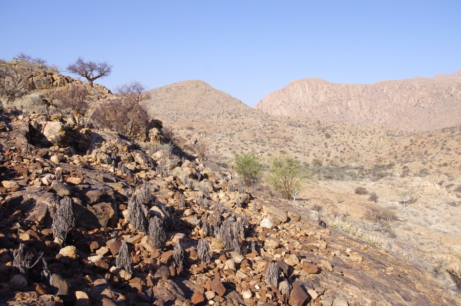
Our campsite was selected to be within easy walking distance from the main cluster of sites in the western basin of the Karoab, and also to offer a relatively easy trek accross the rocky ridge into the Umuab Gorge.The important site of K39 was right at the end of the plain, with the cluster of K40-K44 in the little basin lust below the plain to the south. Within an hour we located all these sites (except the minor K44), however found them all to be fully exposed on the sun. It was clear that these sites are best left to the following morning to be photographed before the sun rises over the ridge to the east.
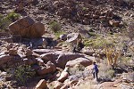
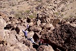
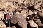
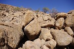
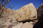
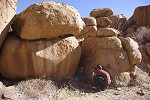
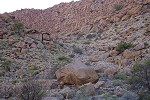
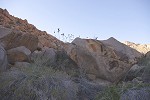
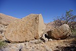
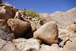
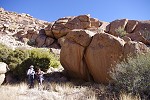
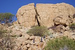
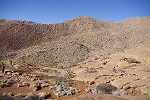
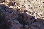
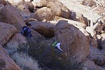
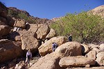
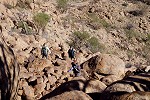
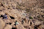
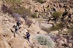
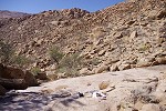
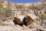
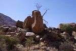
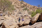
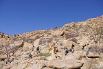
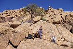
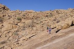
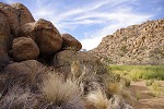
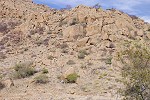
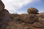
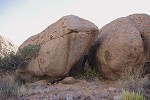
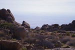
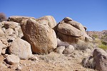
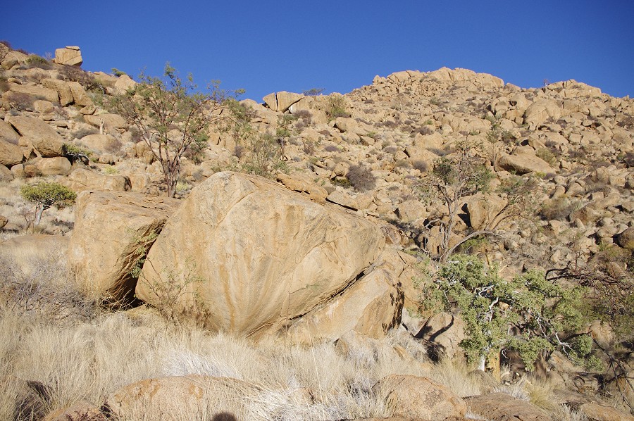
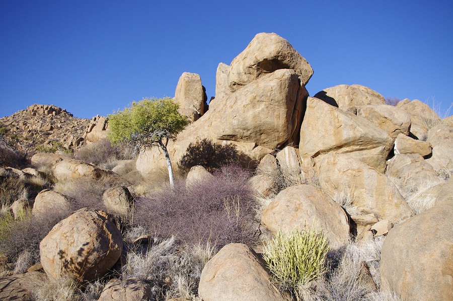
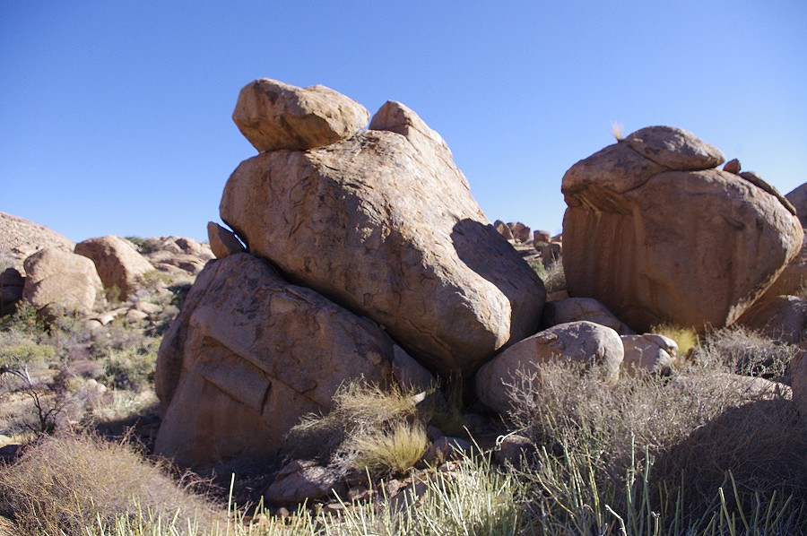
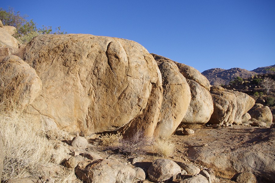
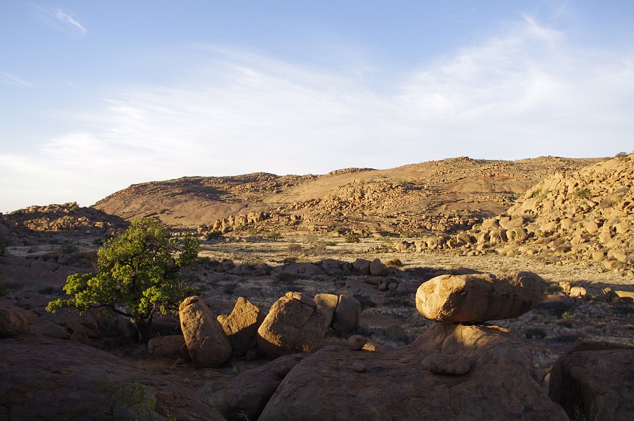
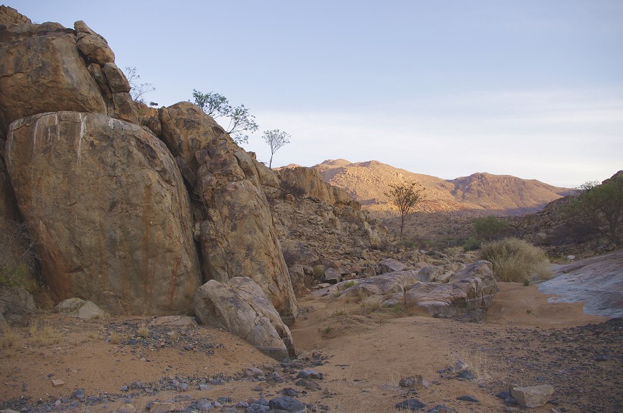
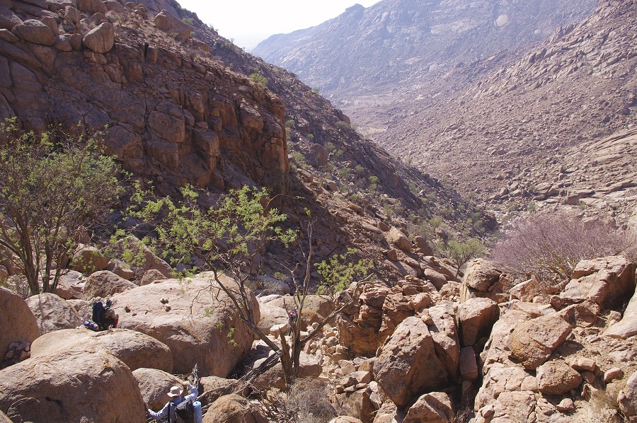
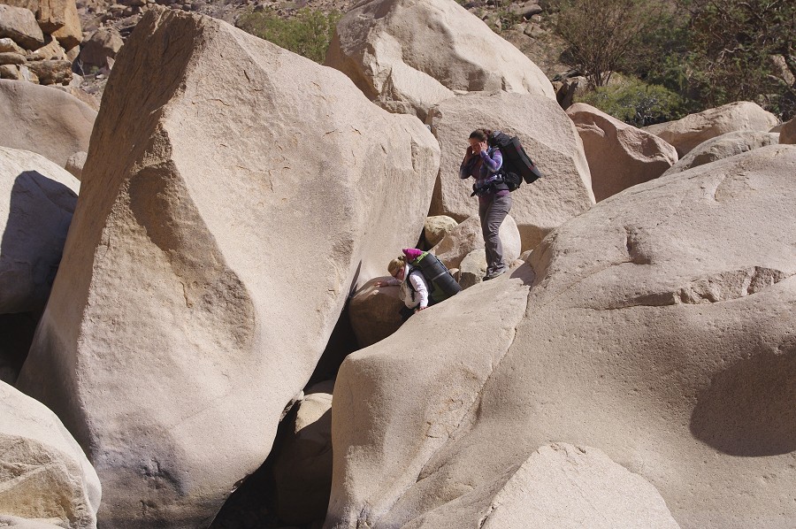
We returned to the camp plain, to mage a descent on the far side to "White Rock Plain" about 200 metres below us less than a kilometre away. What looked like a fairly straightforward easy way down a continuous slope turned in true Brandberg fashion into a boulder field with car sized rocks strewn haphazardly over each other. It was a fairly difficult one hour scramble down the granite rubble to the plain that was looming seemingly within hand's reach below us.
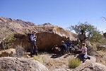
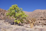
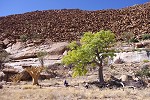
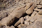
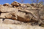
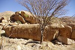
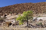
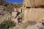
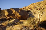
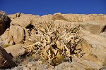
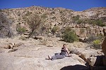
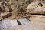
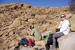
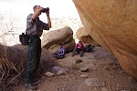
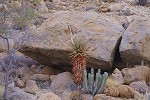
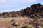
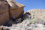
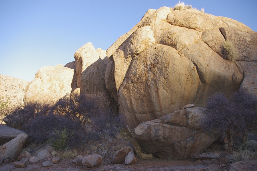
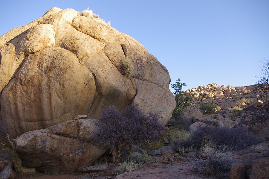
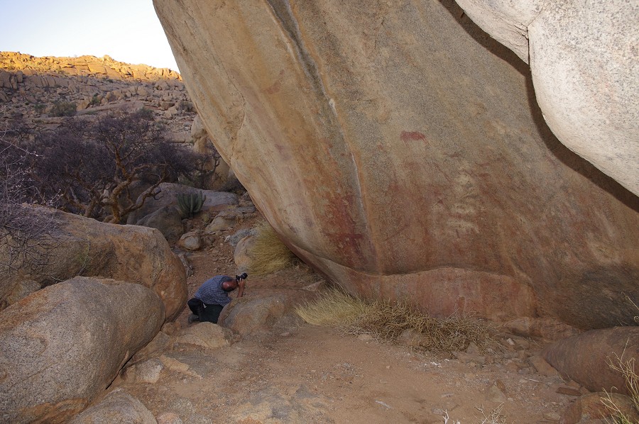
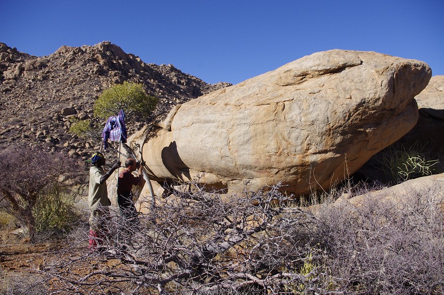
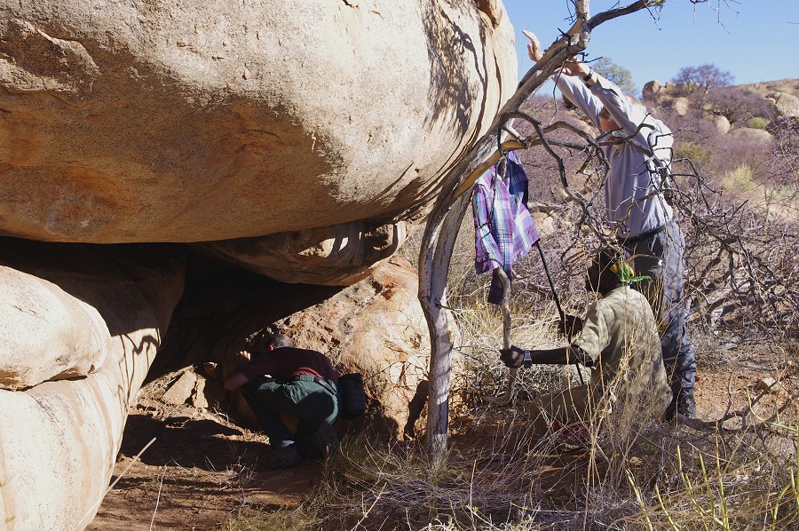
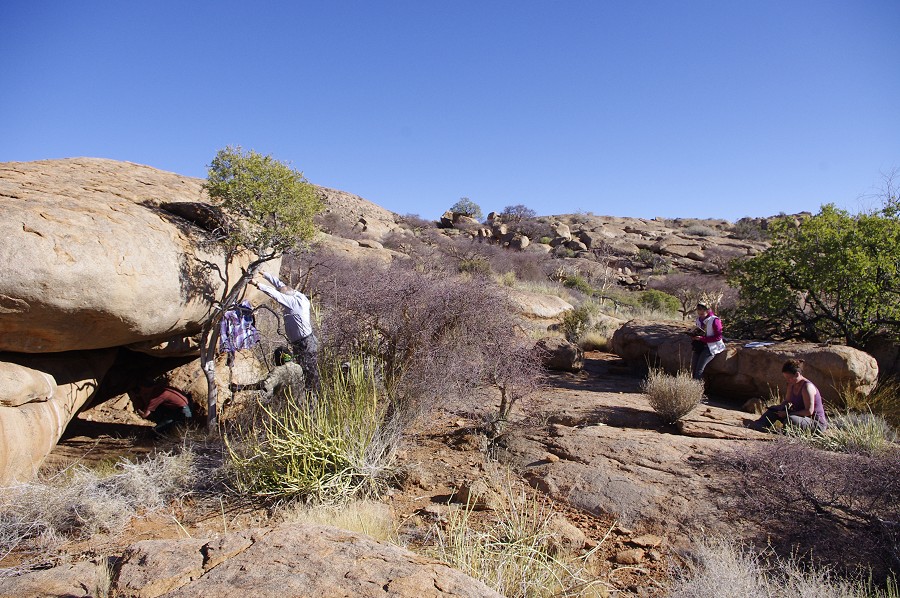
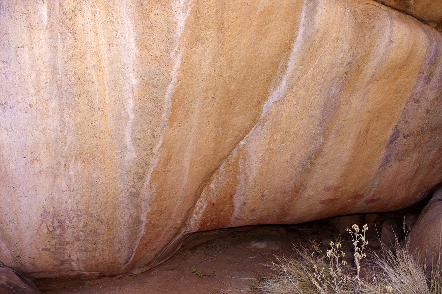
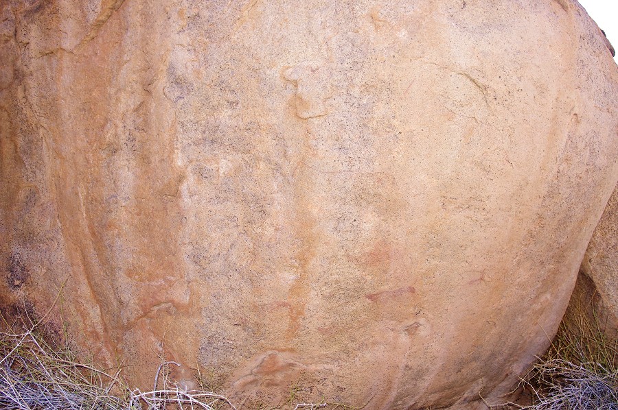
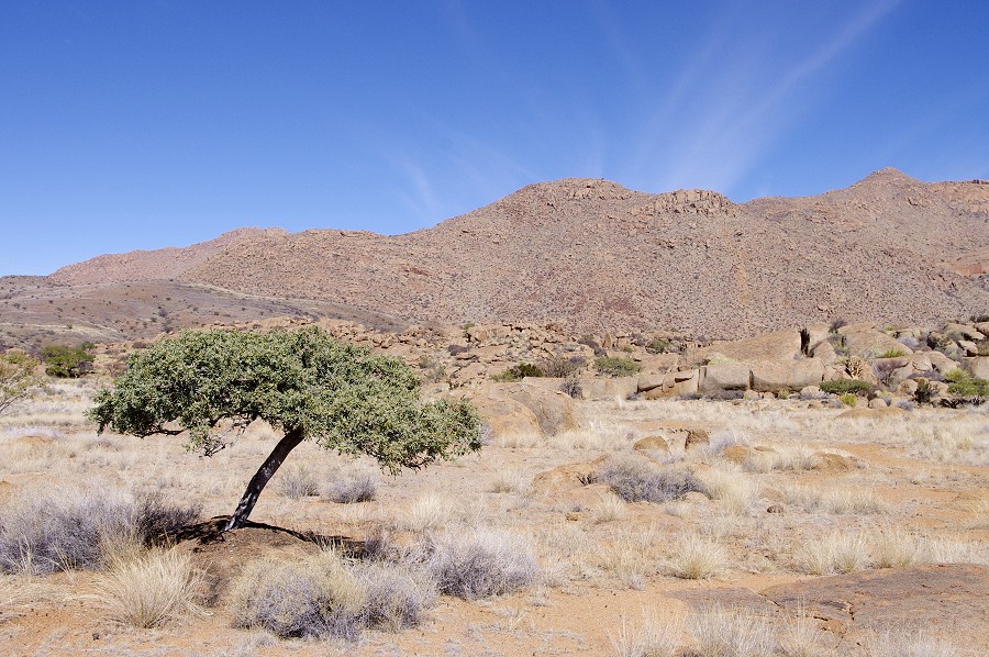
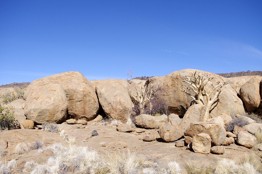
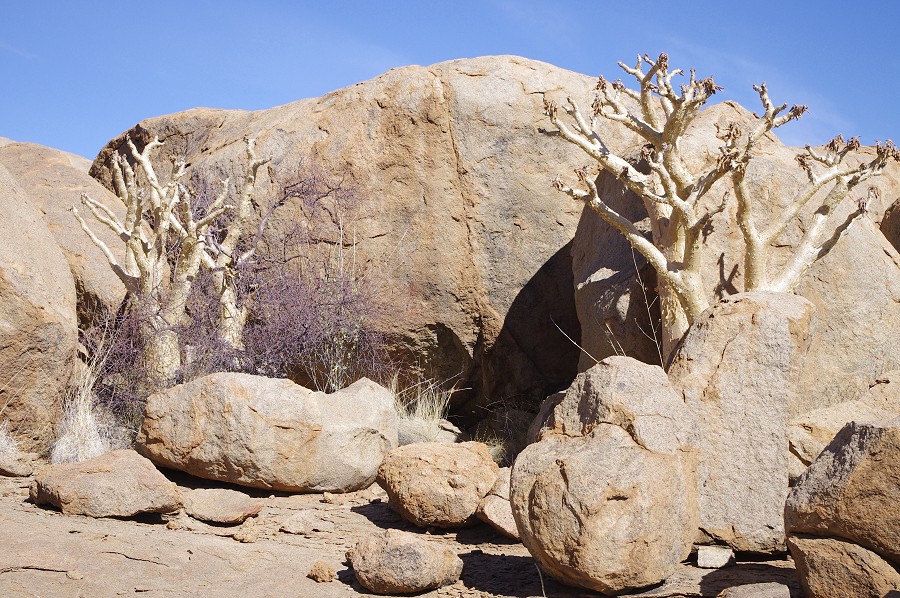
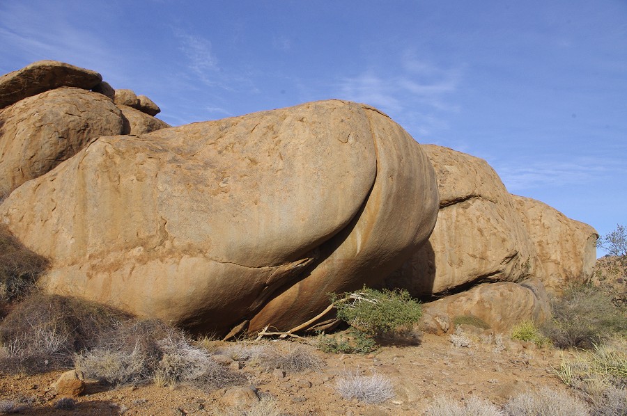
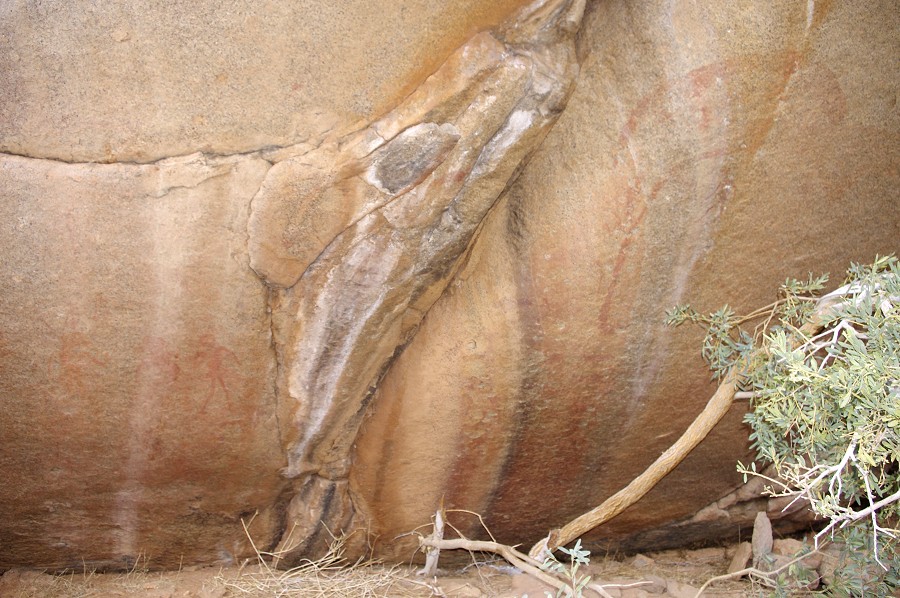
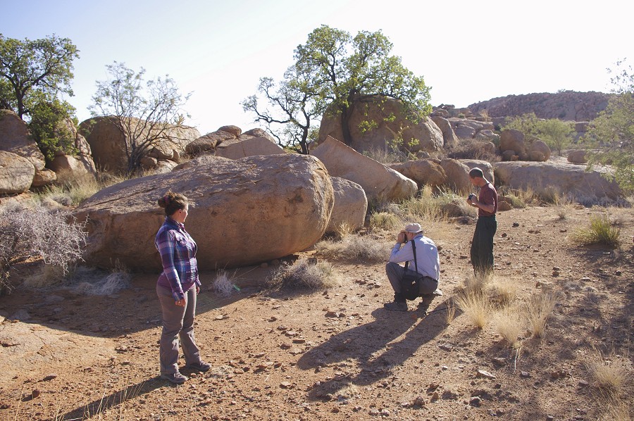
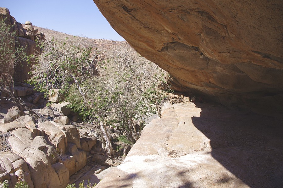
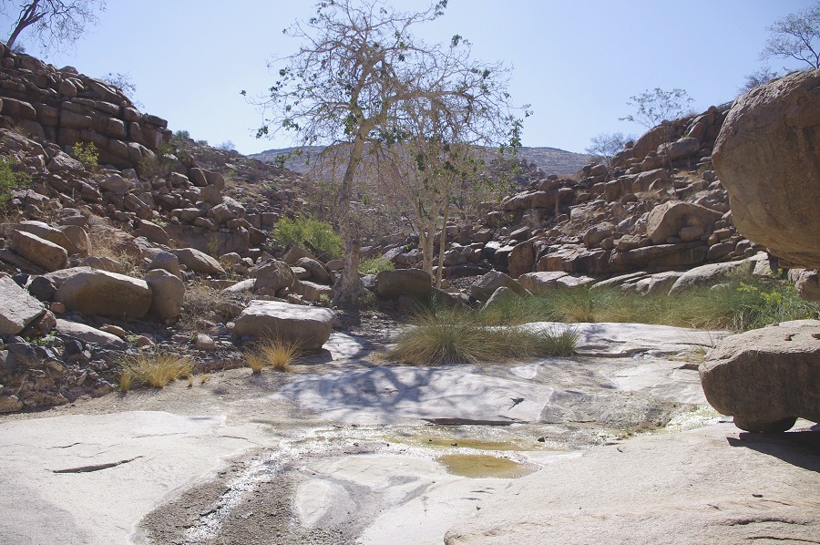
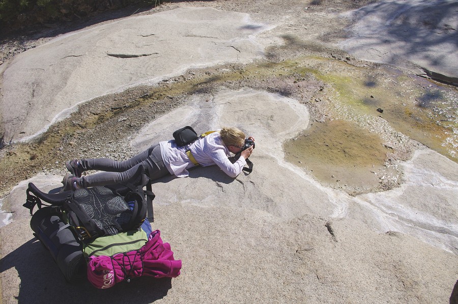
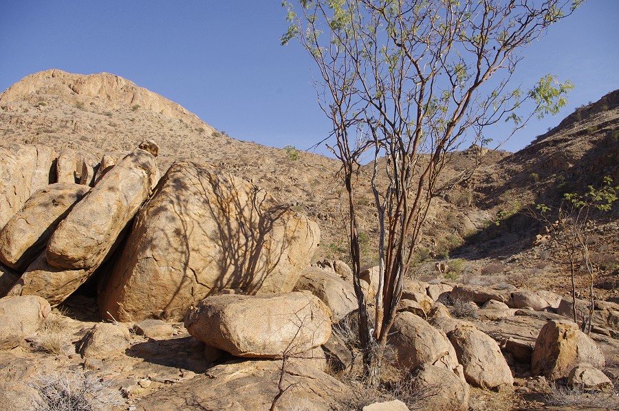
"White Rock Plain" is so named after a large sloping granite plate bordering the upslope side of the plain, that has seeping water flowing over it almost continuously, leaving a thick white crust on the rock. Even now with the very drt conditions there were a few streaks of flowing water, and while here was no standing water at the base of the rock, I'm sure it could have been obtained by digging among the thick growth of reeds in a crevasse above. We placed our packs at the fot of a bright green tree in the centre of the plain, then set out to explore the sites around the perimeter of the flat area.
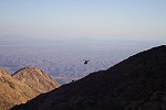
We found all of the sites after a little searching, most of them having been identified beforehand on Google Earth. Except for the minor site of K32 at the northern end of the plain, all the other principal paintings were partially or fully exposed to the sun, as all the sites are along the western edge of the plain, facing east. However we were prepared for this, we had the whole afternoon to spend photographing the various panels as they moved out of the sun, so we returned to the tree for a lunch and a little rest. After lunch Stefan said farewell and climbed up the rubble slope like a mountain goat, in little over 20 minutes we heard the sound of the helicopter engine as it took off, making a wide turn above us back to Uis then on to the base in Swakopmund, while we scattered about to see and photograph the sites.
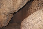
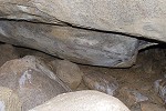
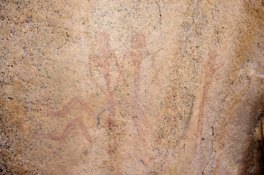
K37 at the southern end of the plain is a very curious location. The paintings are located on the underside of a rock wedged in to a narrow passage that does not lead anywhere, with just about enough space for one person to squeeze in, in a rather uncomfortable folded posture.
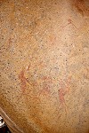
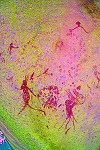
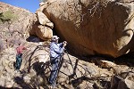
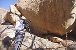
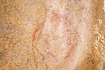
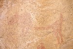
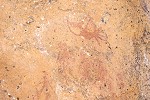
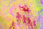
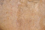
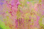
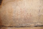
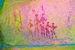
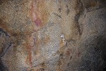
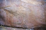
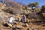
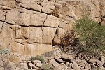
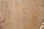
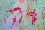
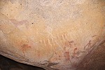
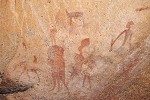
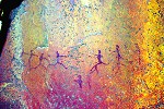
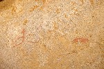
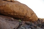
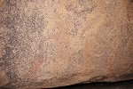
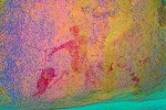
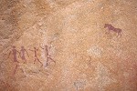
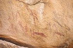
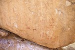
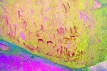
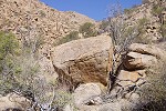
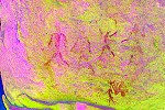
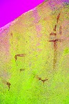
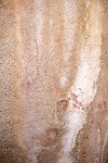
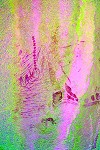
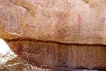
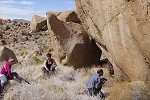
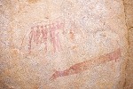
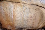
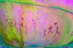
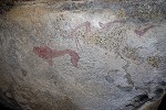
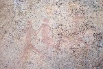
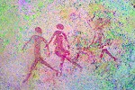
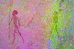
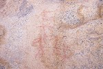
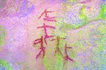
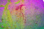
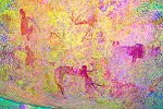
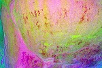
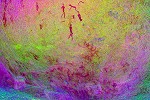
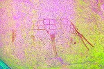
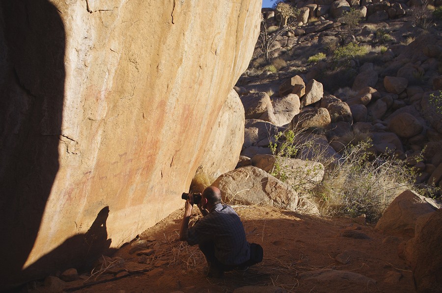
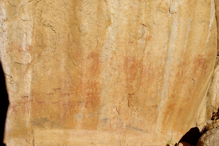
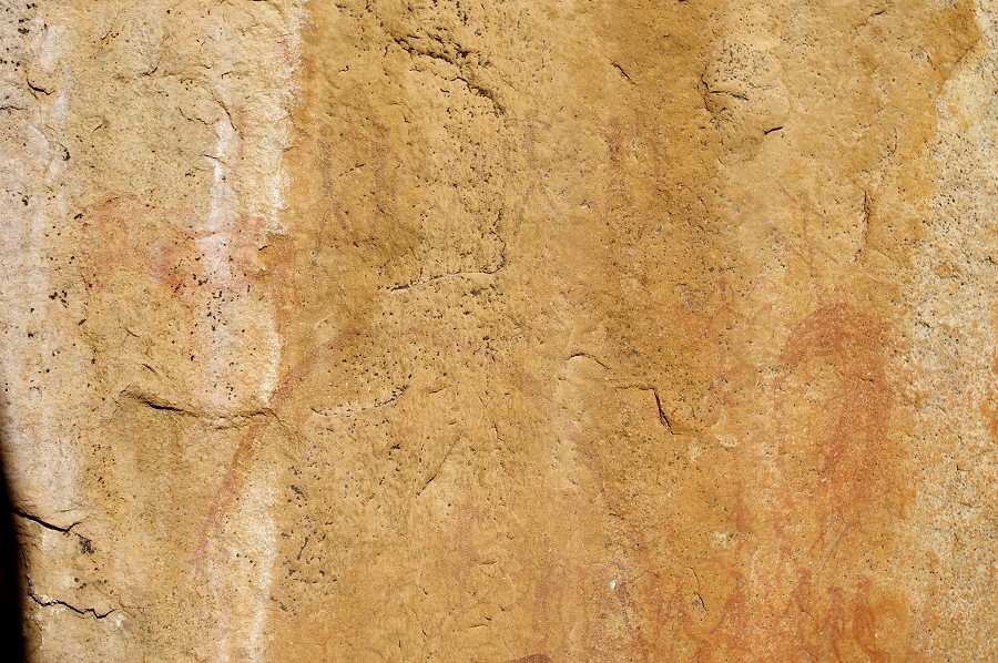
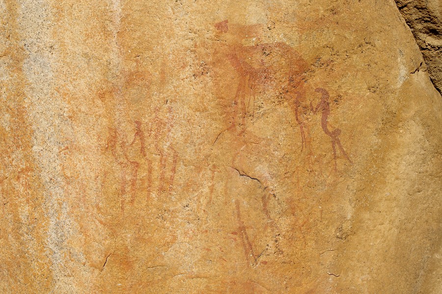
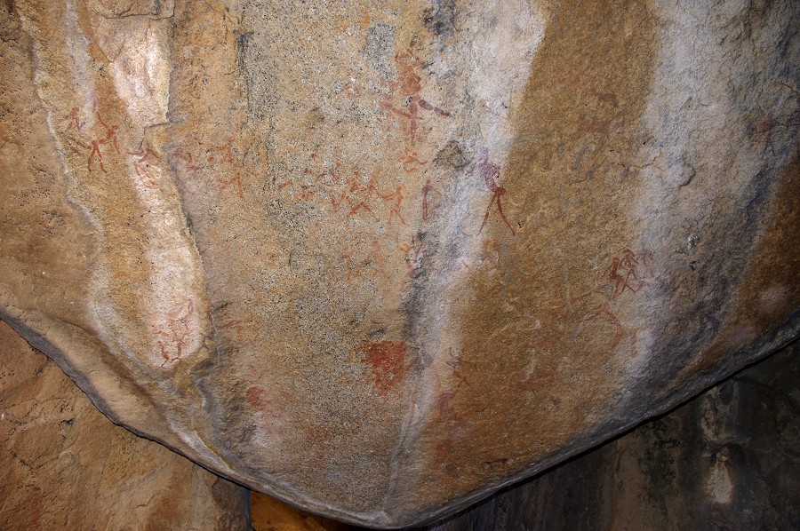
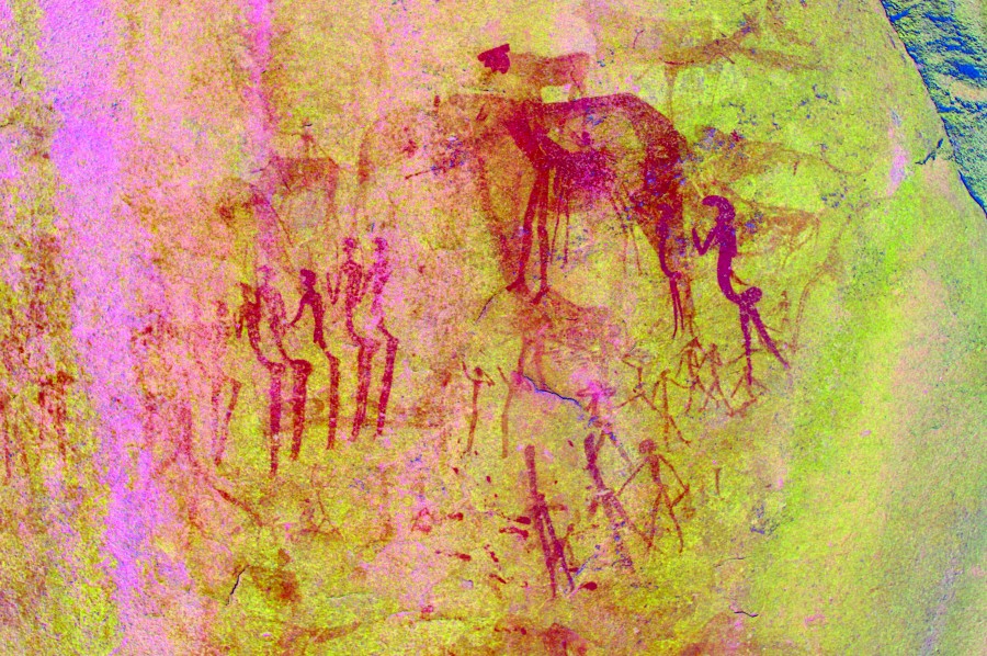
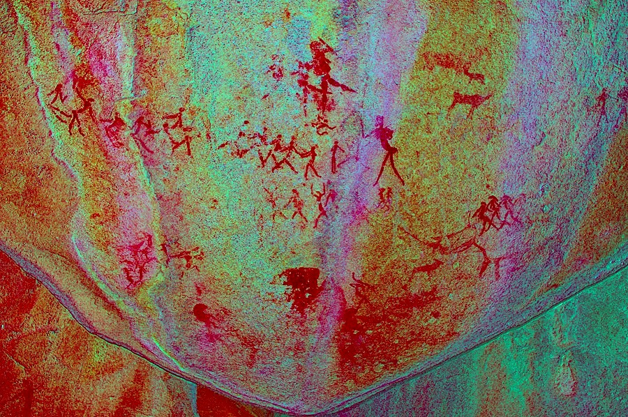
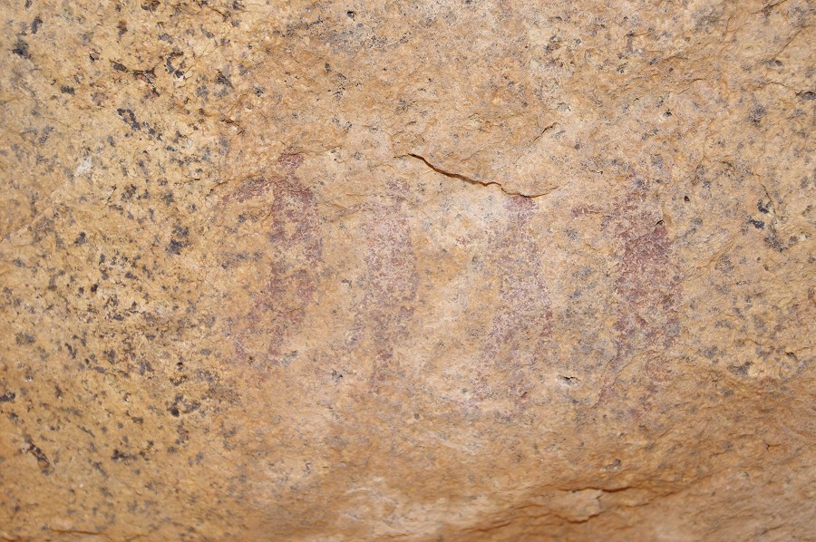
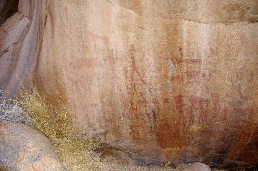
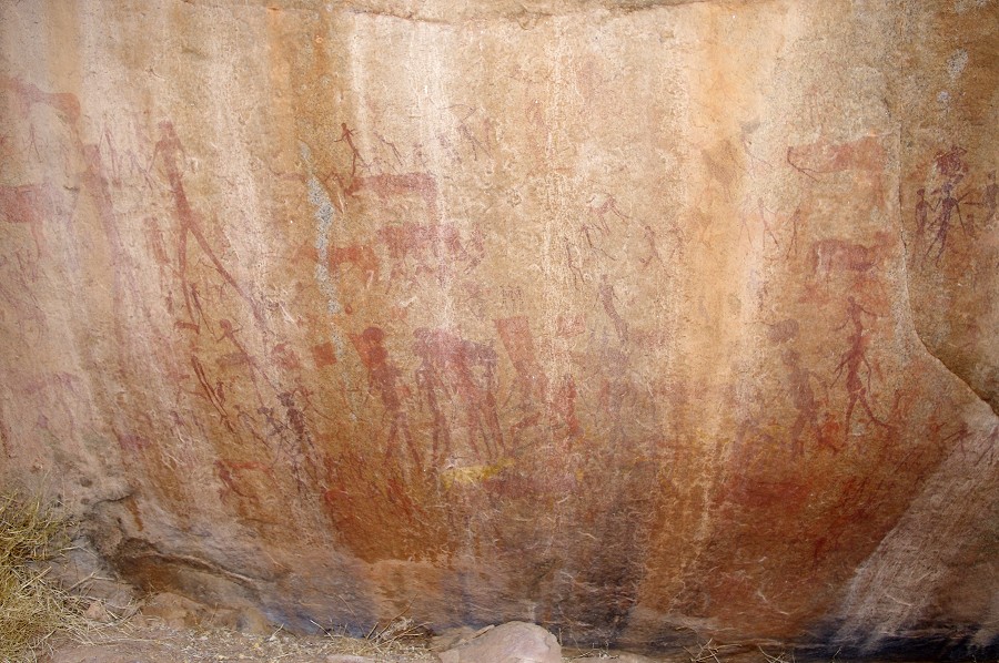
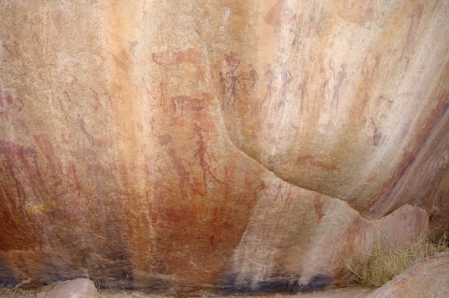
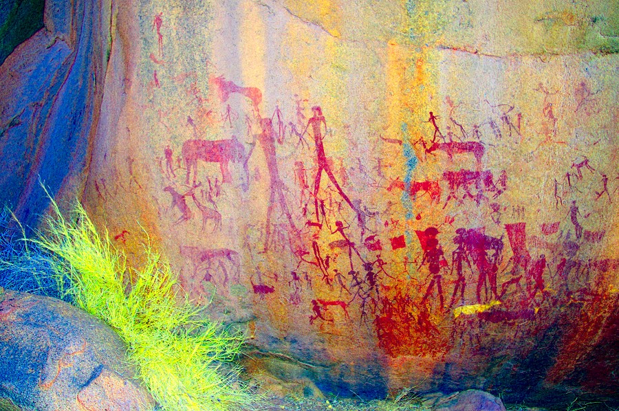
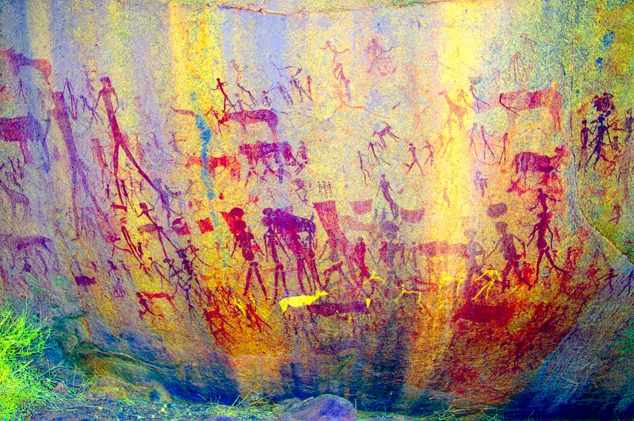
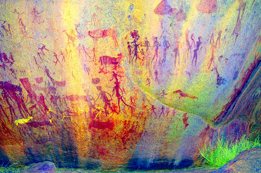
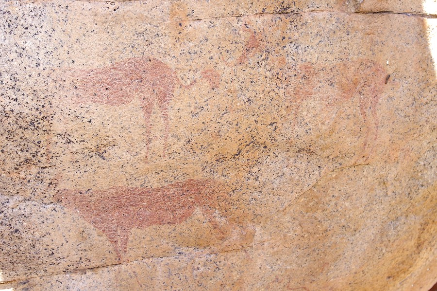
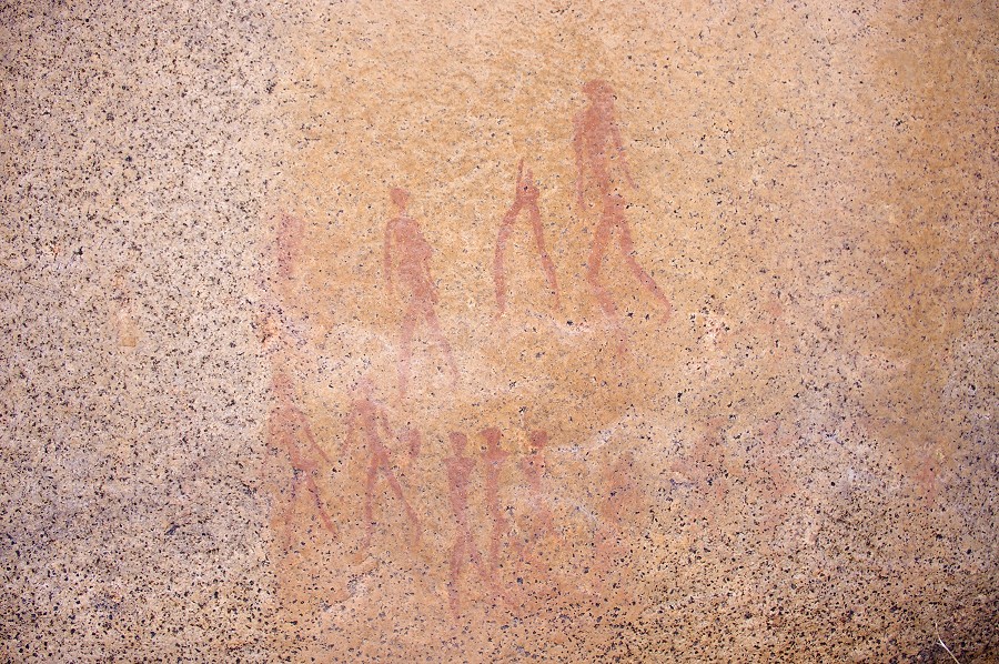
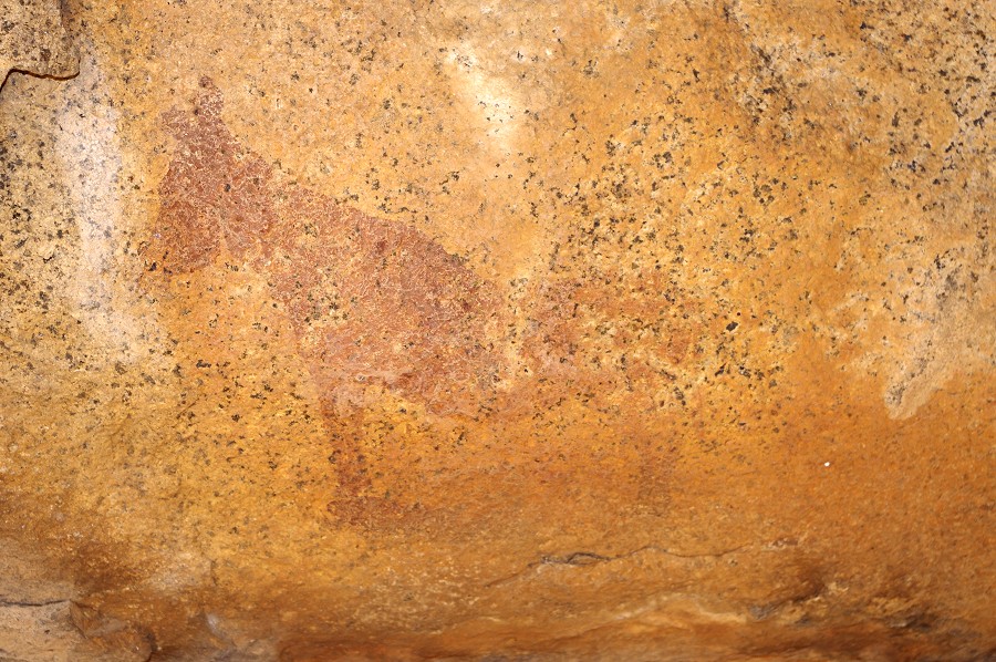
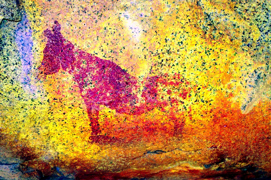
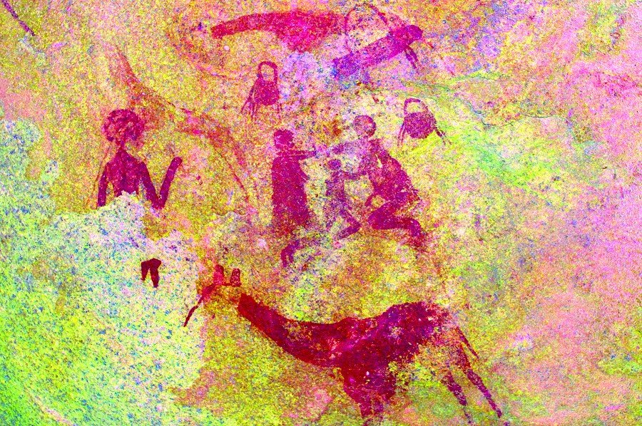
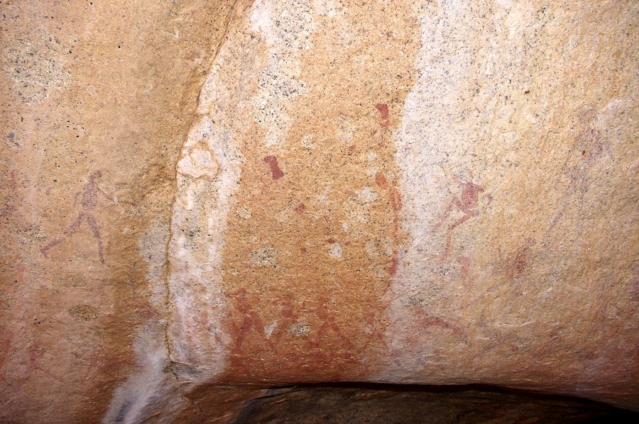
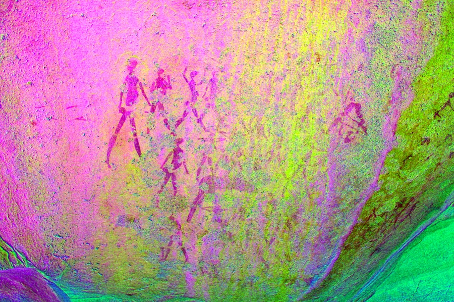
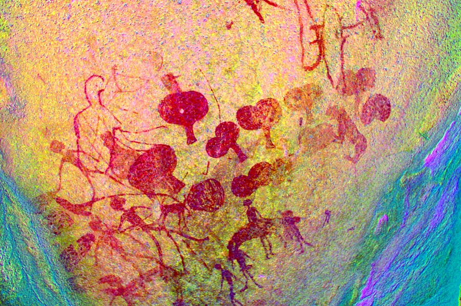
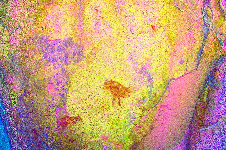
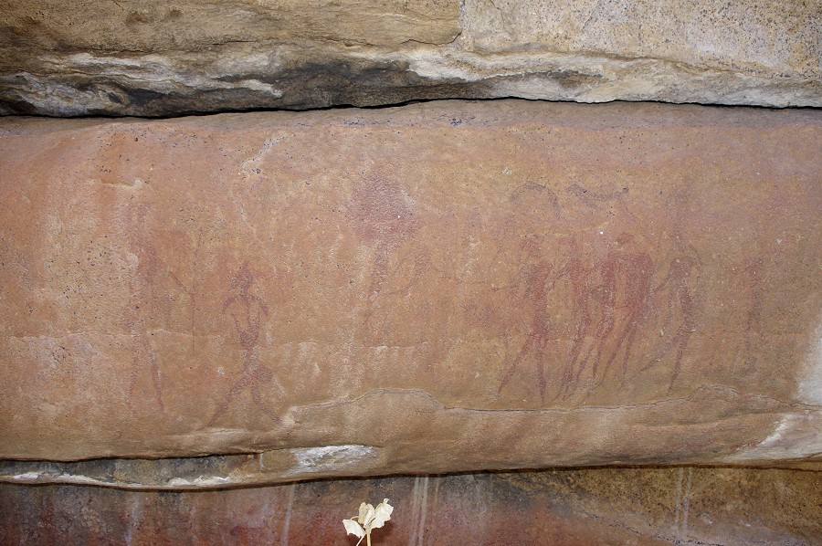
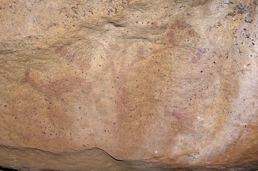
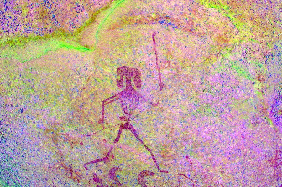
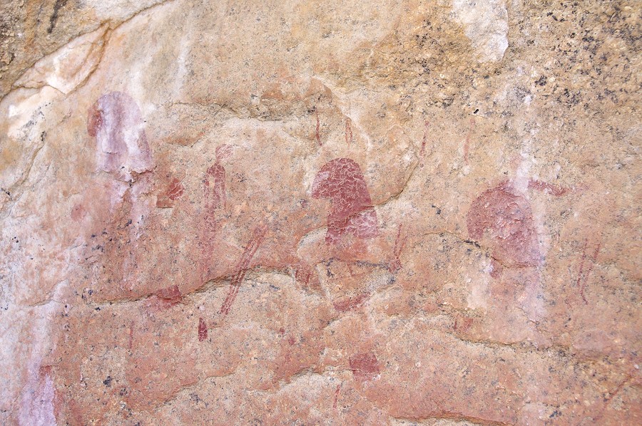
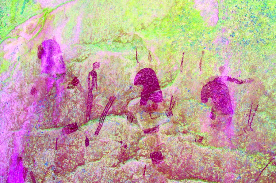
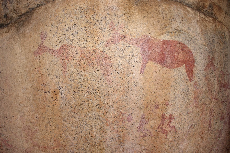
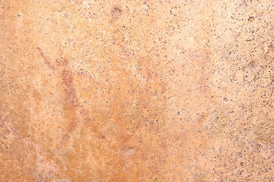
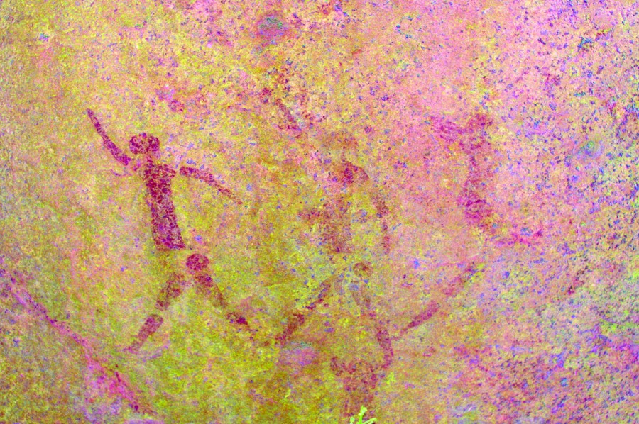
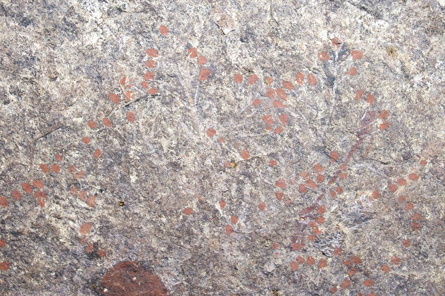
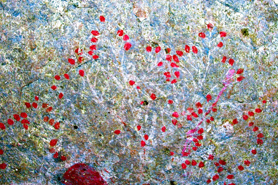
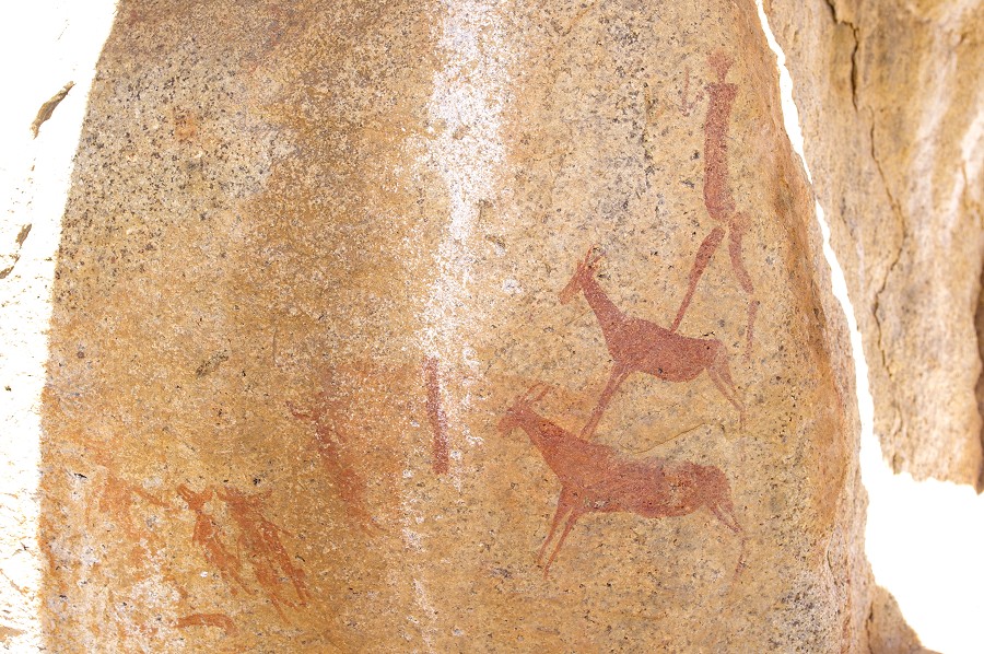
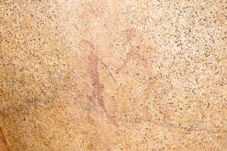
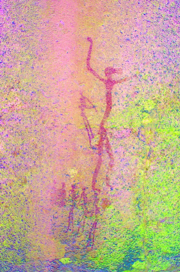
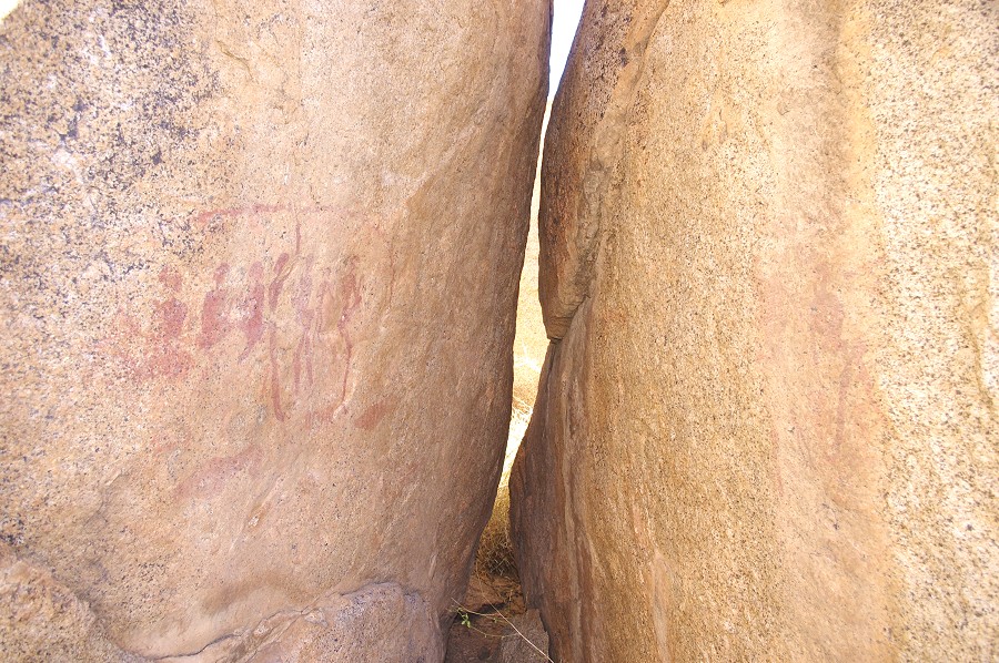
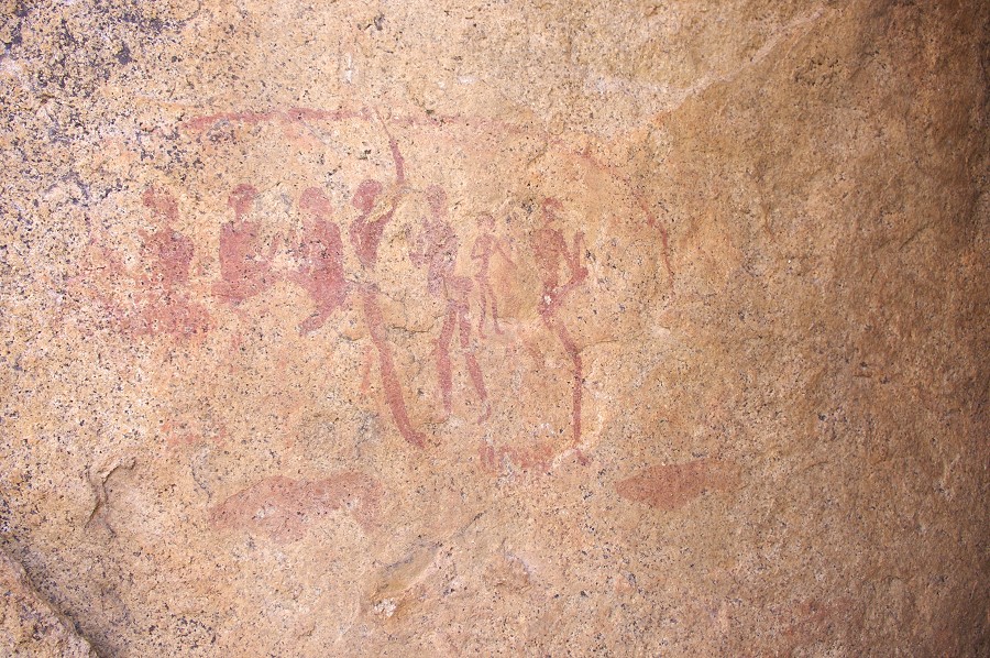
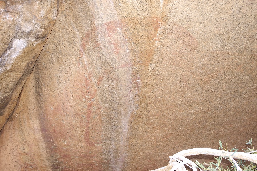
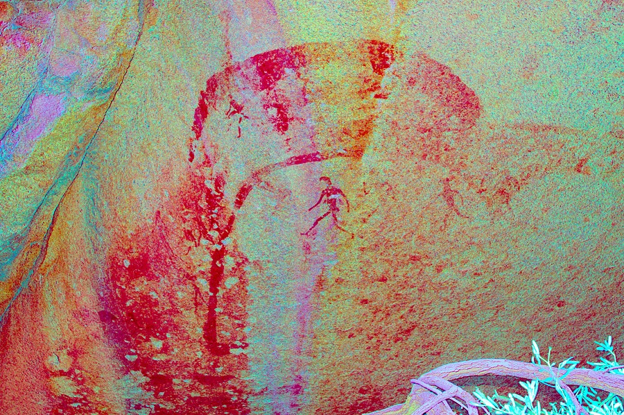
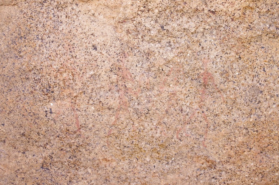
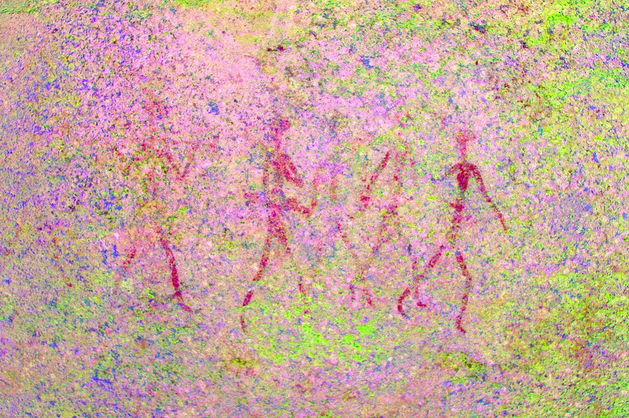
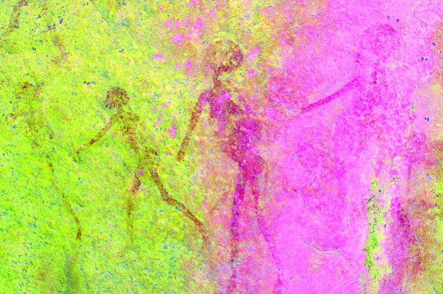
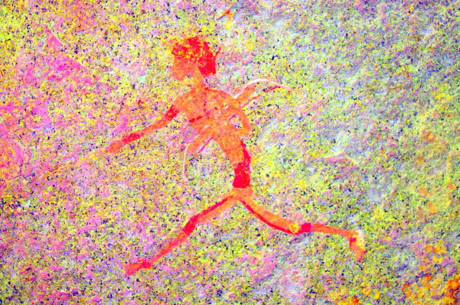
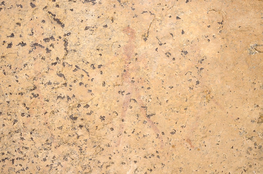
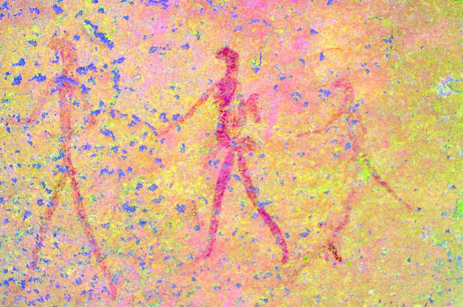
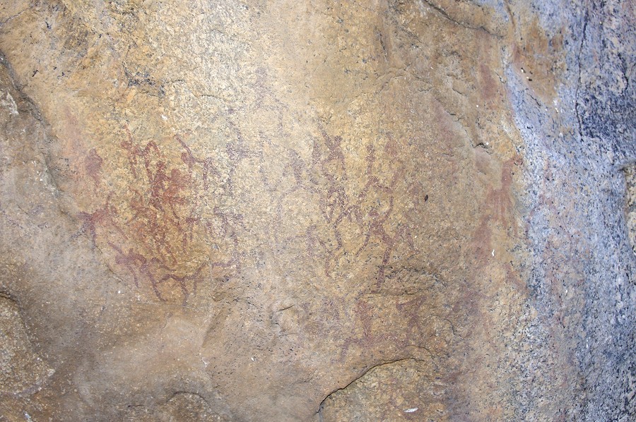
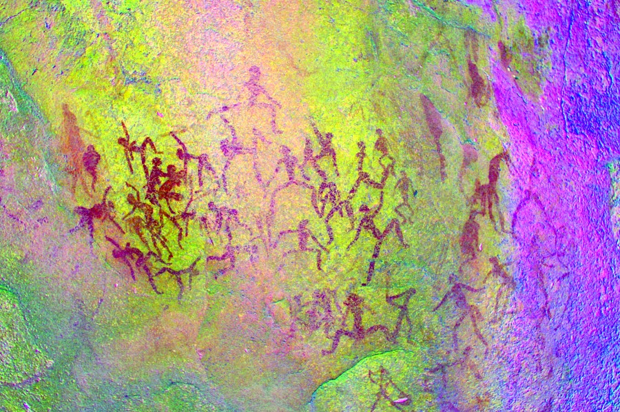
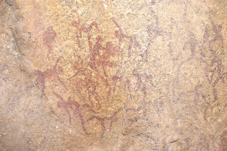
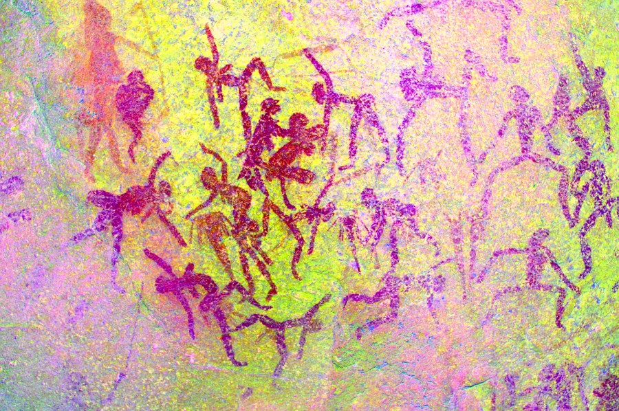
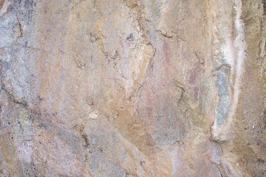
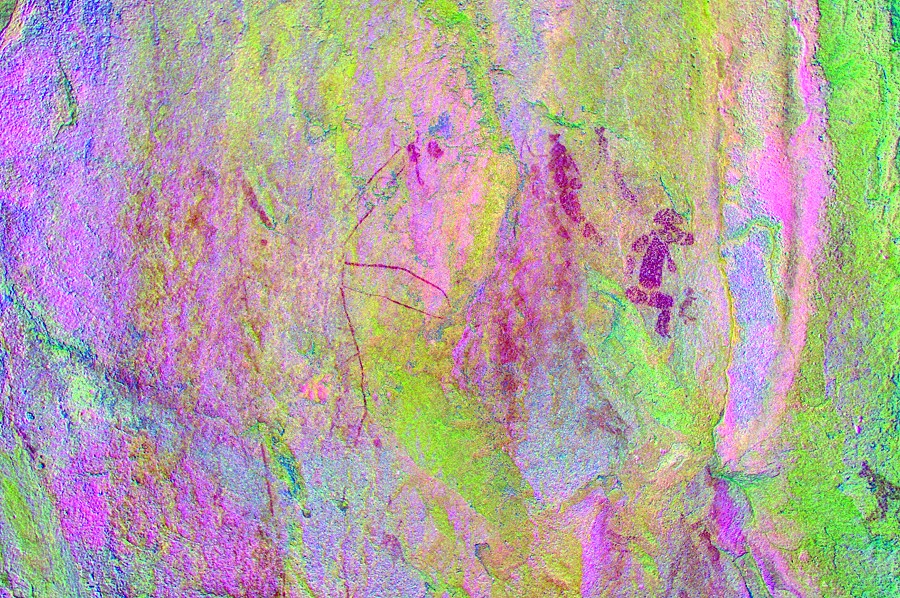
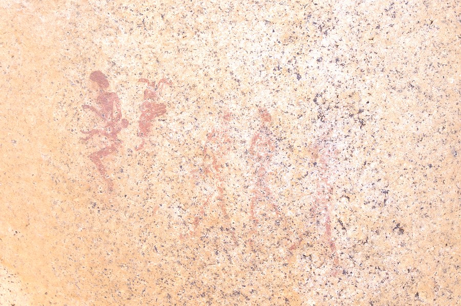
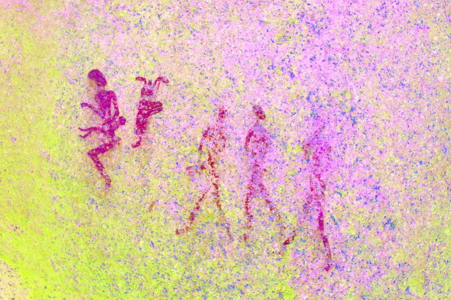
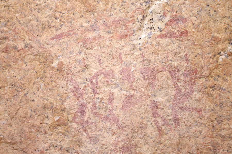
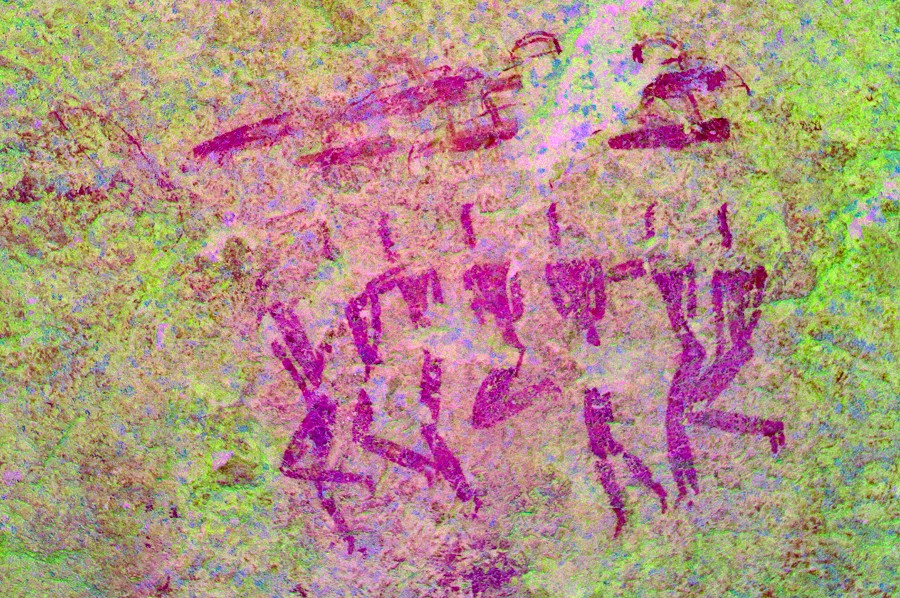
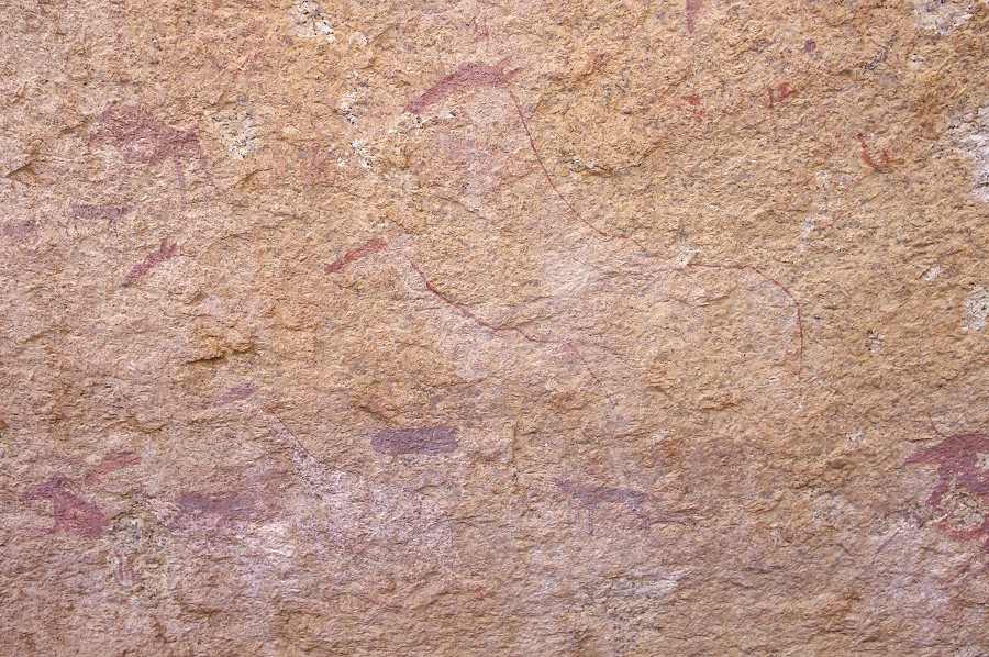
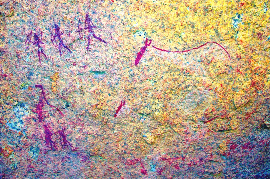
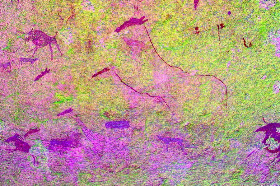
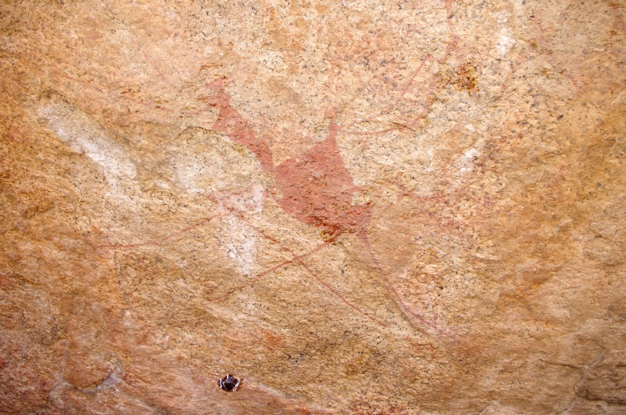
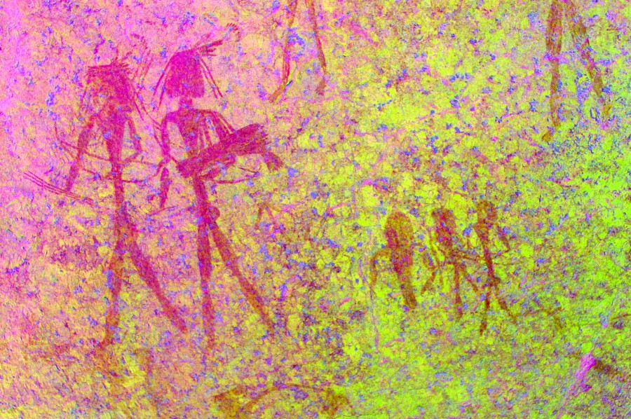
K38 is one of the principal sites of White Rock Plain, on the side of a prominent rock wall clearly visible from the tree in the centre. It has several panels with interesting paintings, the main panel being the largest group of figures at this locality. The paintings are quite faint due to the exposed location, but all details come out clearly using dStretch.
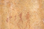
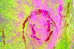
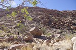
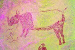
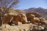
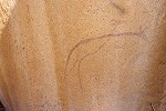
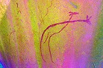
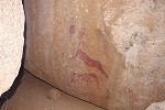
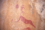
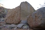
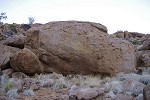
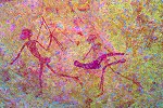
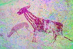
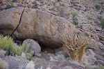
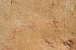
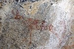
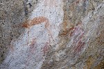
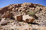
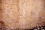
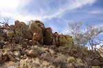
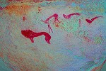
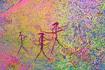
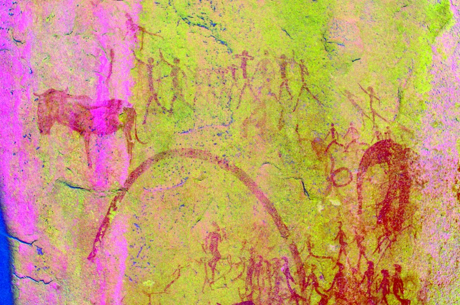
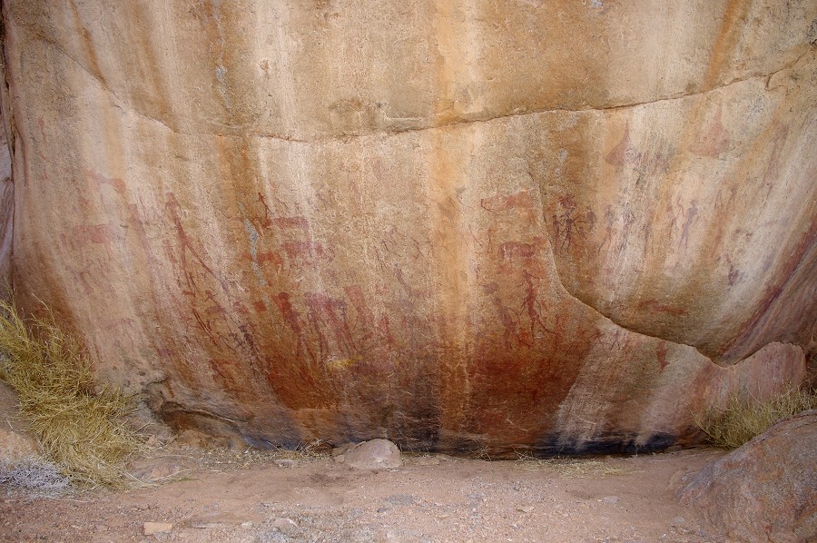
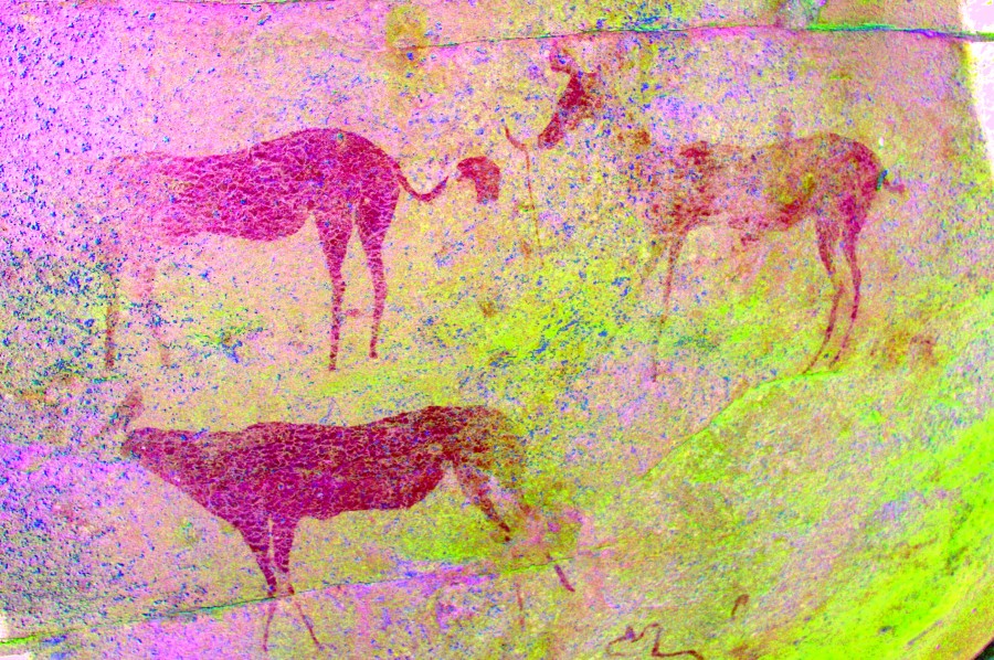
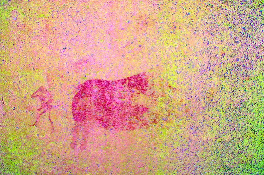
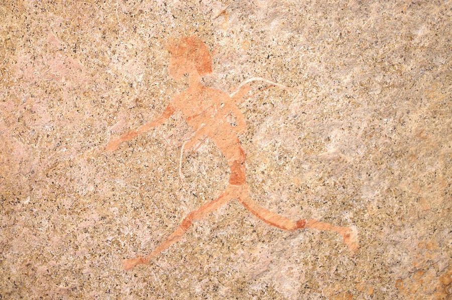
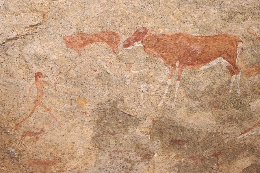
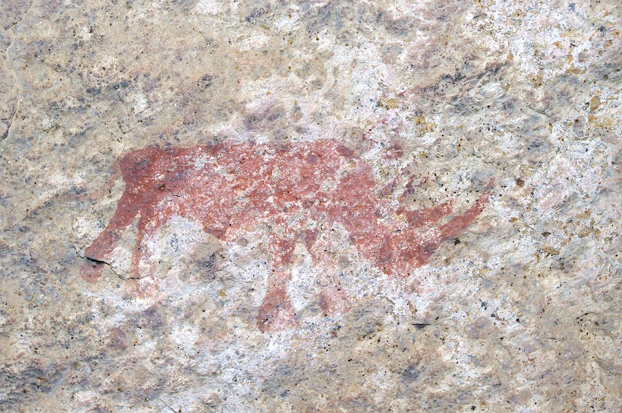
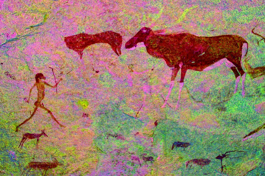
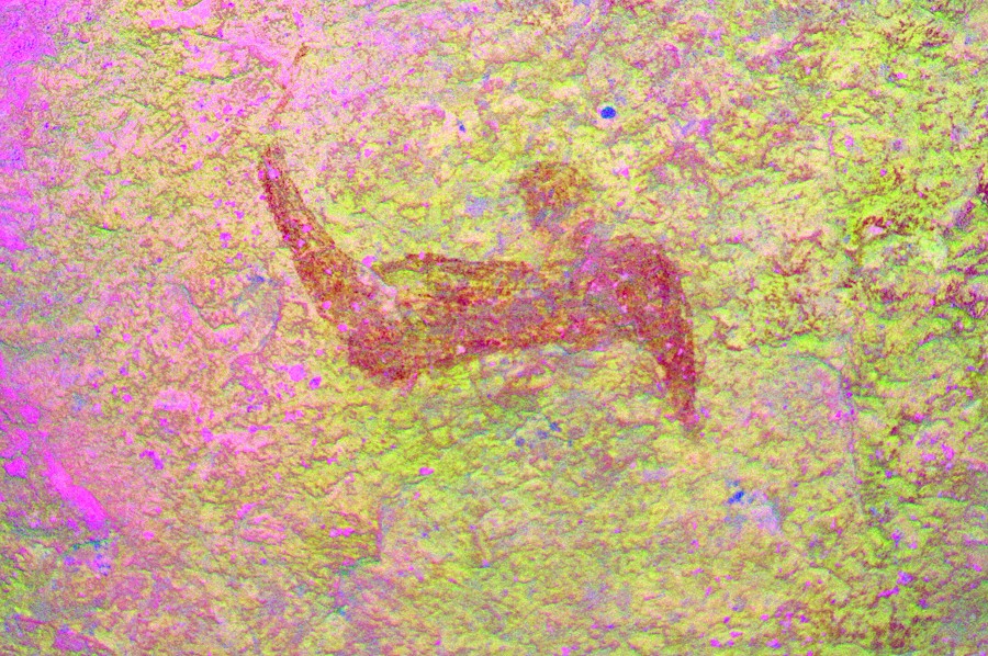
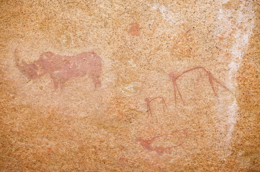
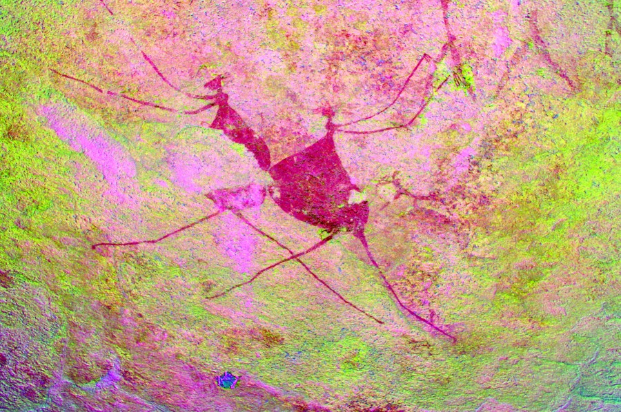
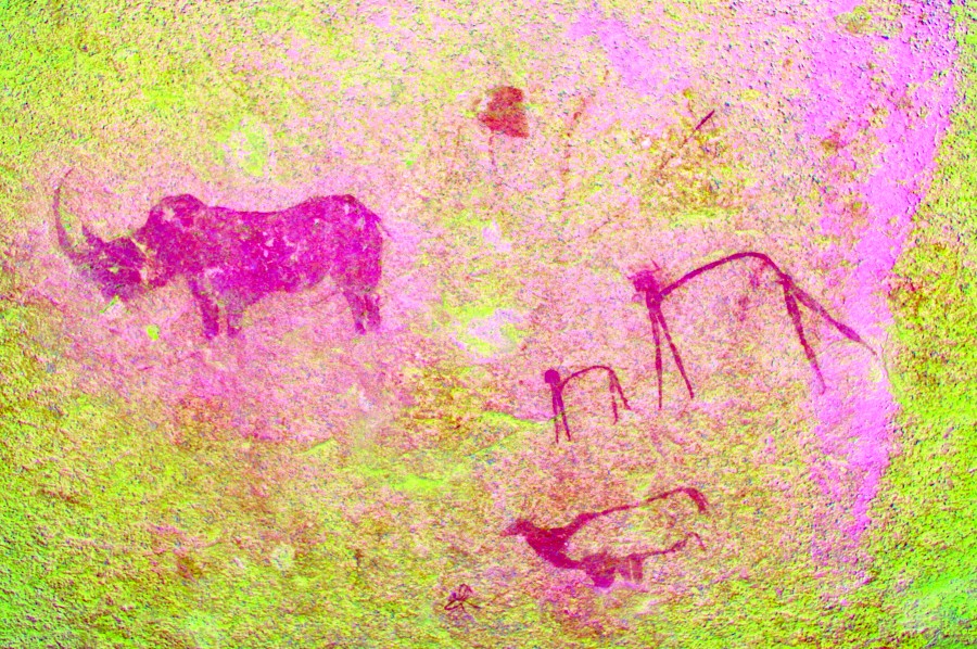
K36 is a very prominent site, among a group of huge rocks on the ridge bordering the plain to the west. On an outlying rock there is a nice rhinoceros, and there are some well preserved human figures on the main panel, including a pair of headless female figures, curiously echoing the "femmes sans tete" figures prevalent in late paleolithic European and Levantine rock art.
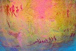
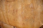
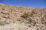
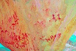
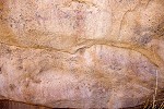
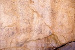
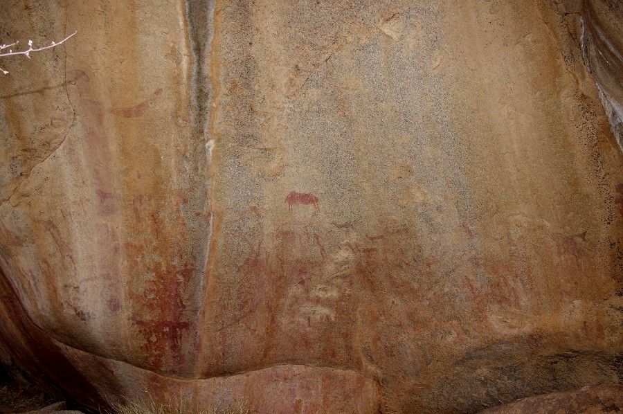
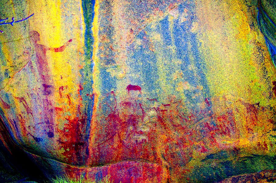
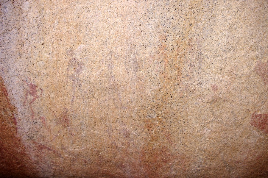
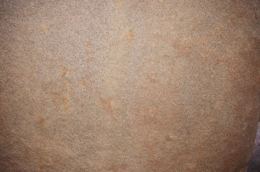
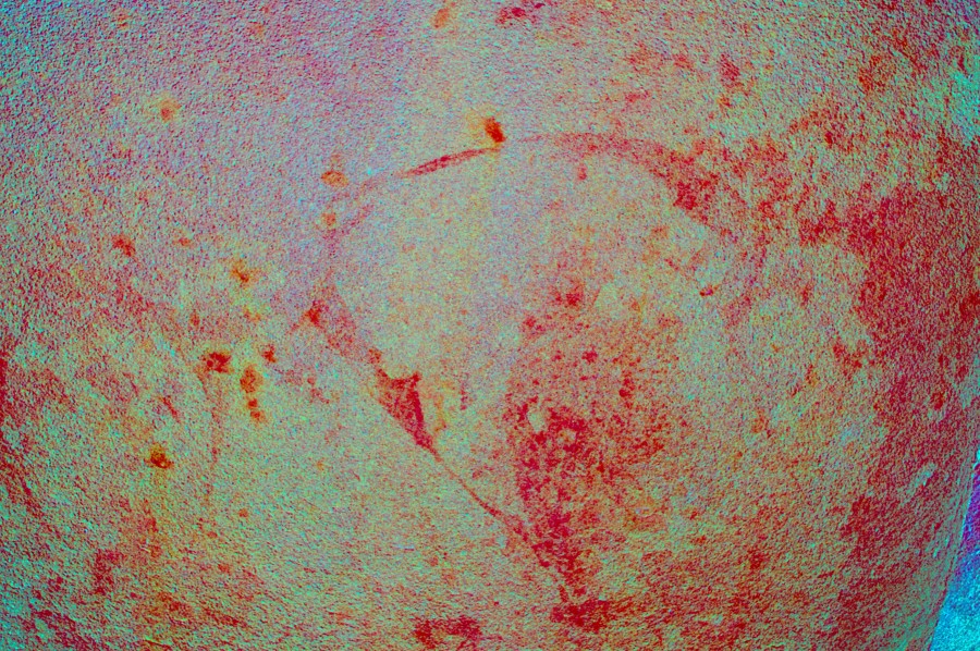
K35 is just a short distance away at the outlet of the plain. It is a long but not very prminent granite ridge, with numerous panels of paintings along the side facing the plain. By the number of figures this is clearly the main site of the area, unfortunately all panels are very faint and damaged due to their exposed location.
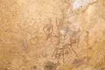
Two smaller sites are located on the northern half of the plain, which is more cluttered with boulders and ridges. K33 is within sight of K35 (K34 being out of sequence, a large site in the lower section of the Karoab), it has two panels, one of which is an interesting scene of two eared serpents. The other is K32 further up among the boulders, which we already saw in the morning.
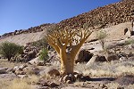
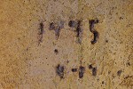
We finished with all the sites about an hour and half before sunset, and we went back to the big tree to collect our gear. Interestingly there is a carved date of 17th April 1995 in the bottle tree next to it, probably dating from the time when Tilman and Marie-Therese Lenssen Erz visited the plain during their survey for the Pager volumes. We started back towards the camp, this time taking the route in the main watercourse rather than up the bouldery slope.
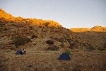
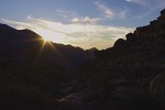
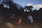
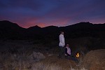
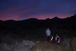
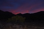
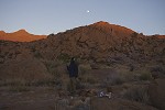
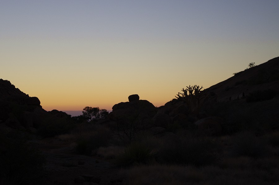
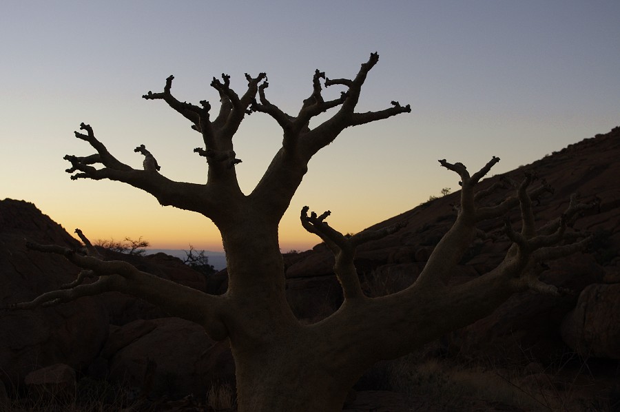
The alternate route proved to be a bit easier, we comfortably reached camp in an hour with enough time left to pitch the tents in sunlight, then just sit on the rocks with a sundowner to see the sun set and the nearly full moon rise simultaneously on the opposite horizons.
Day 3. - Upper Karoab Gorge
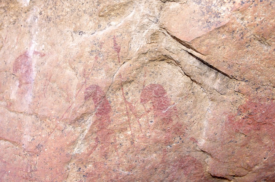
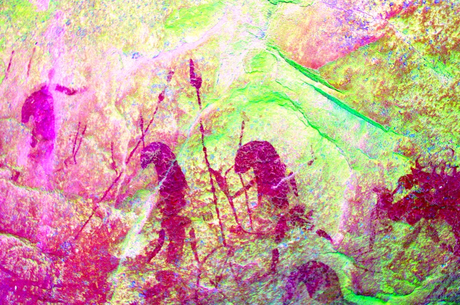
The plan of the day was to see the sites scattered on the prominent ridge separating the eastern basin from the main valley of the Karoab, and also to recconnoiter the route till the half-way point in preparation for the trek to the main valley the day after. At first light, before starting out in ernest, we went to photograph the sites that were out in the sun by late morning the previous day. We started with K39 at the far end of the plain, with a small but magnificent panel of a pair of elements and human figures.
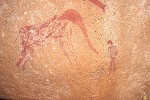
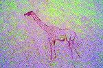
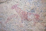
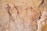
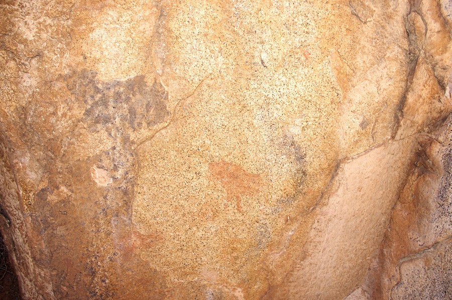
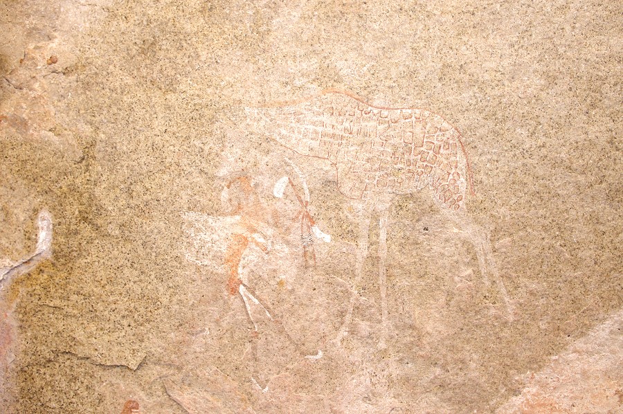
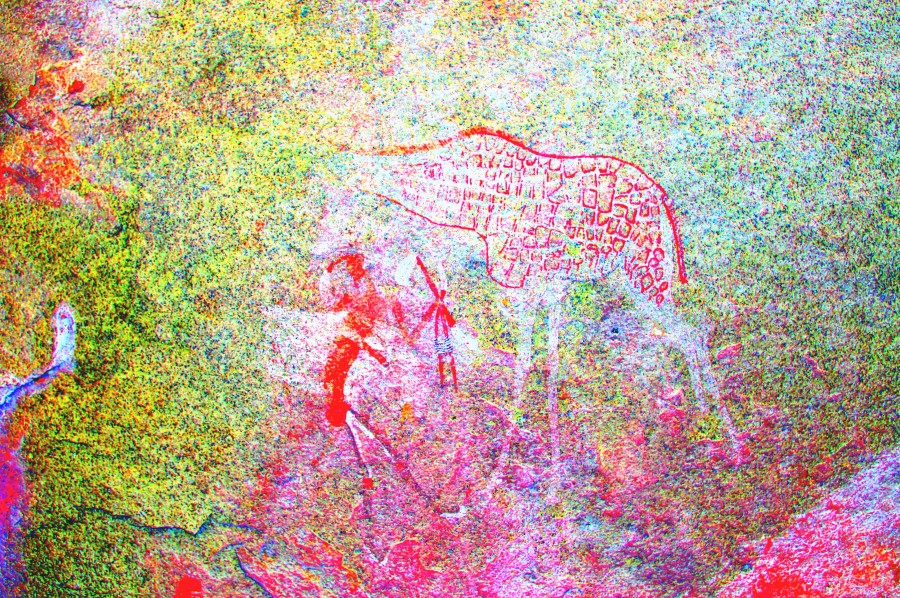
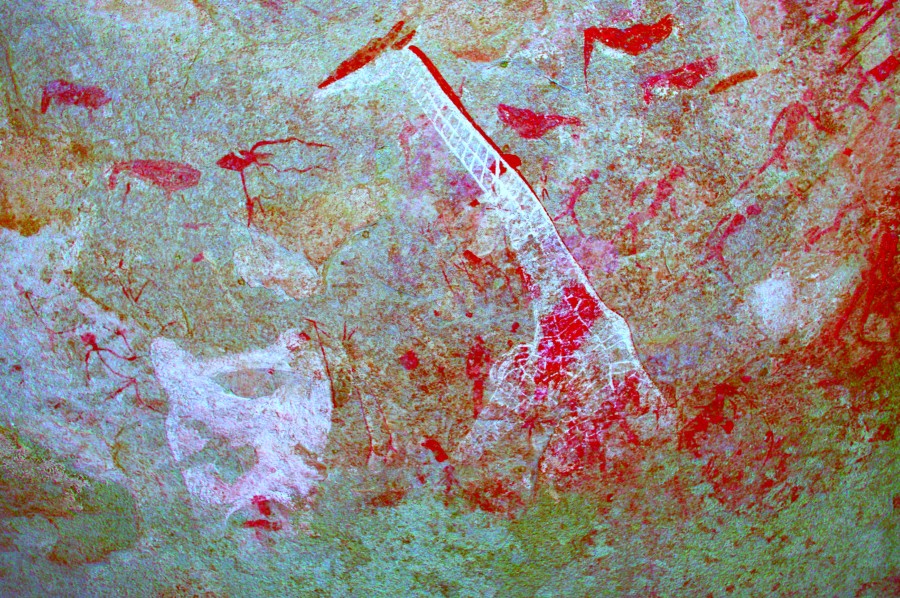
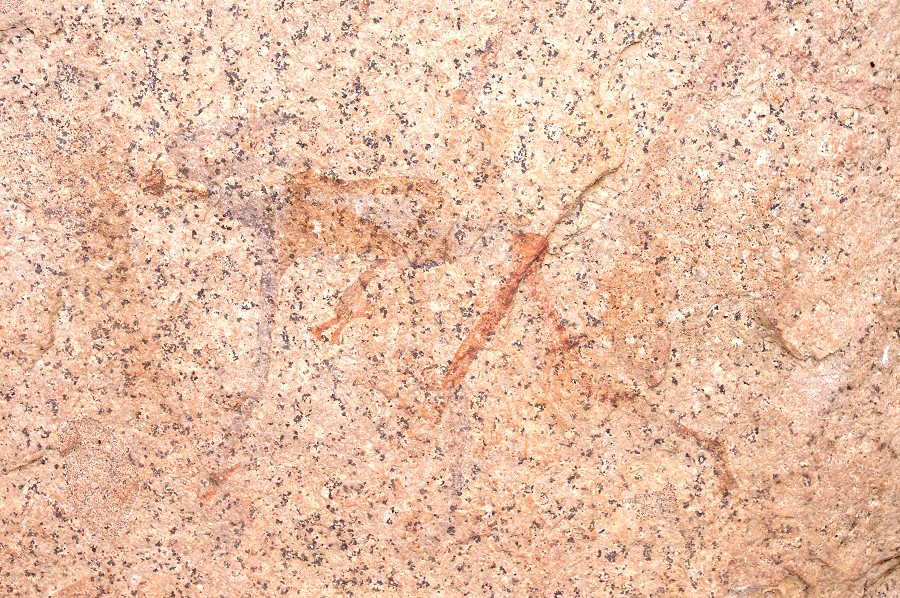
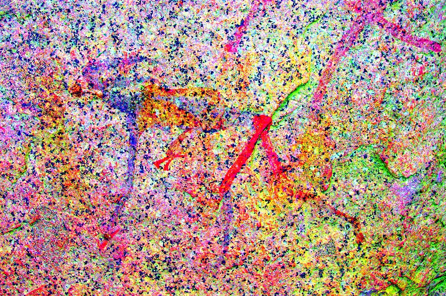
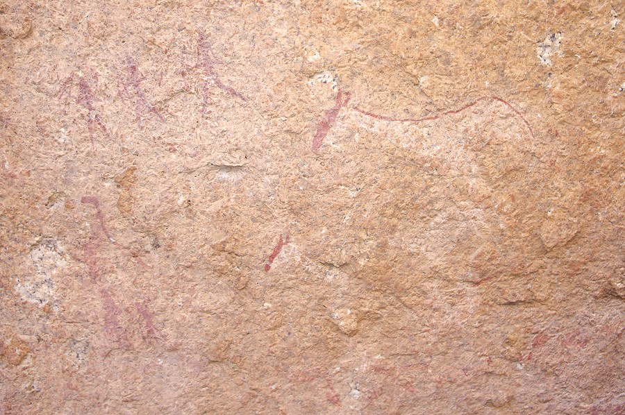
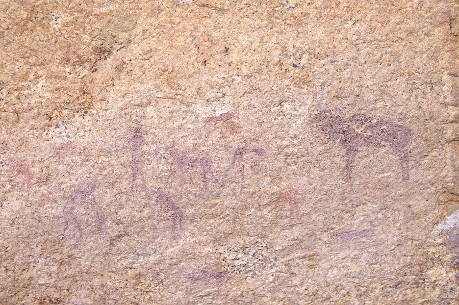
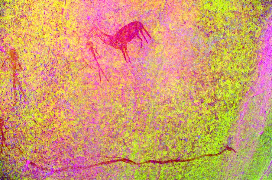
Site K40 is a huge boulder and some surrounding smaller rocks at the bottom of a short descent from K39. There are numerous panels all about, but all are very faint and damaged. While clearly this was the principal site of the area, this des not show on the remaining paintings. On the rear of the main boulder there is a fine giraffe and a number of better preserved human figures. The best panel is to be found on an adjacent smaller boulder.
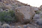
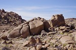
Site K43 is a cluster of large boulders clearly visible from K40 a short distance upstream. There are three large panels of paintings on various sides of the rocks, but all are mostly faint and damaged.
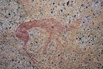
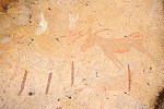
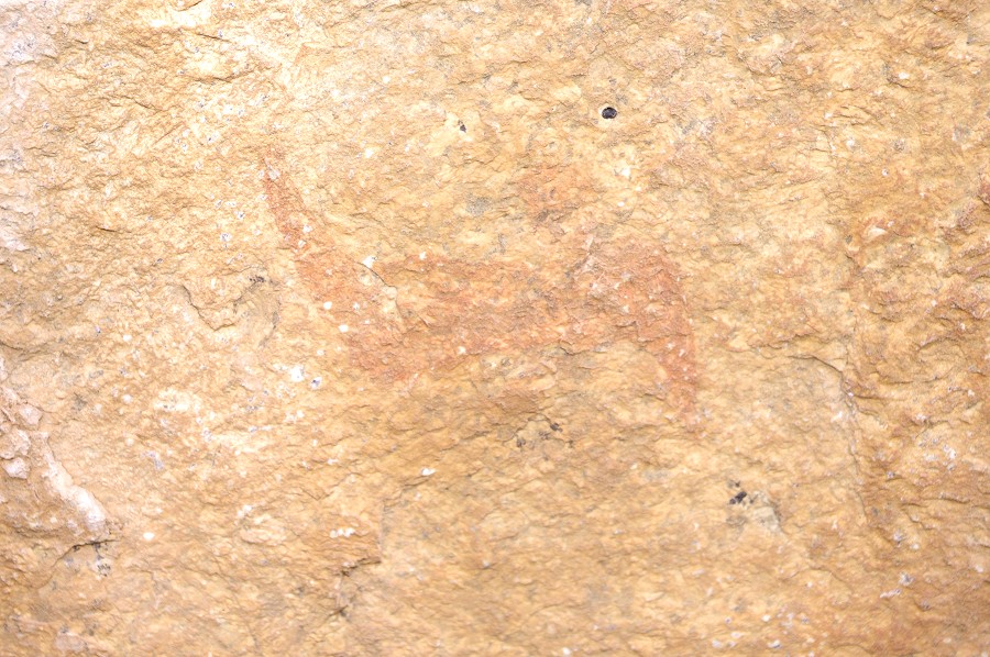
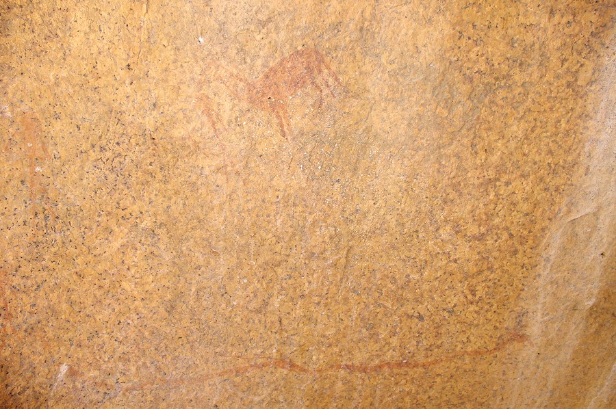
At a similar distance on the far side of the basin, there is a large rock with a panel of fine but very faint paintings on the side, K42. K44 must be close-by up the slope somewhere, but Alfons could not locate it while we were taking the photos. At site K42 there are a couple of very fine gazelle or antelopes among many other faint figures.
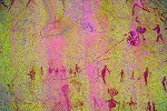
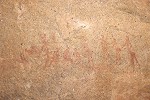
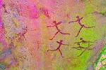
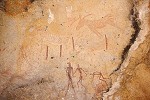
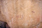
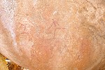
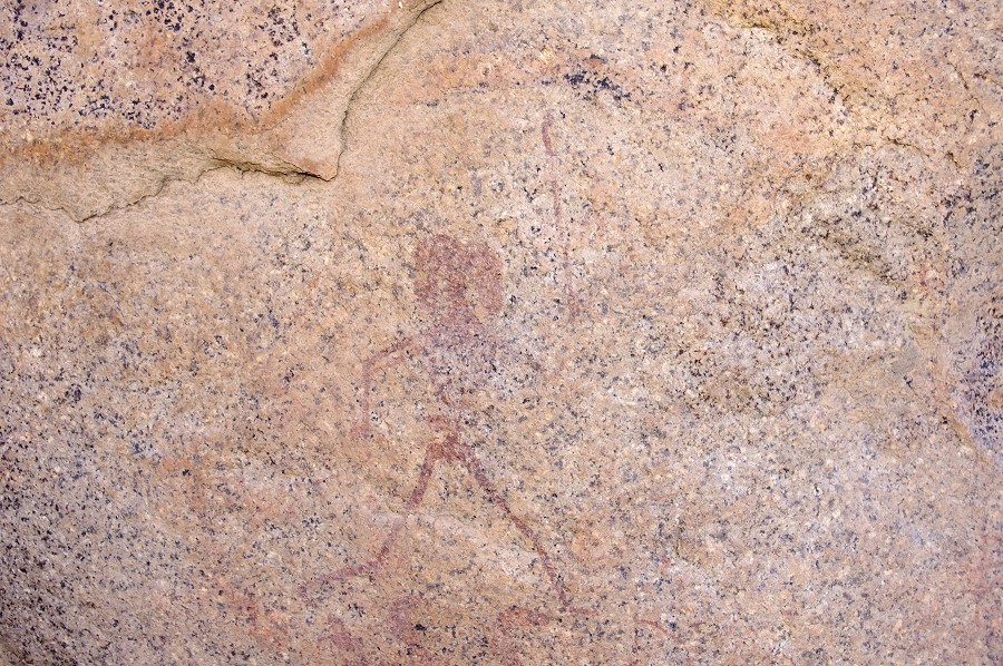
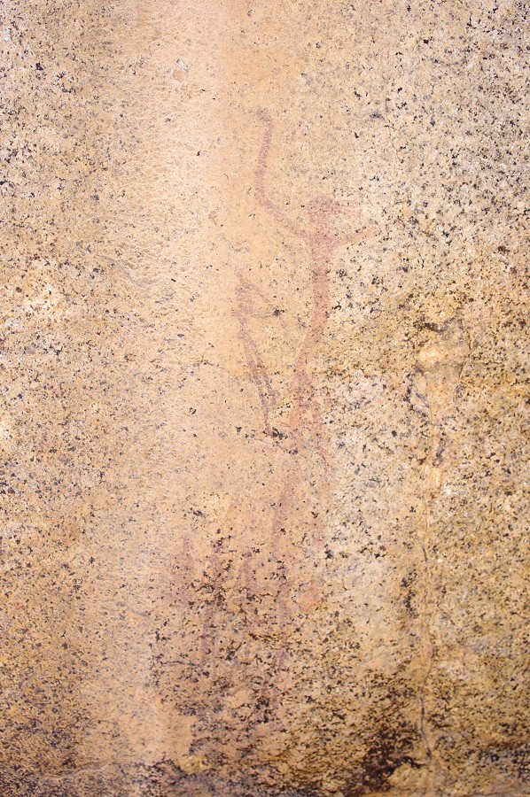
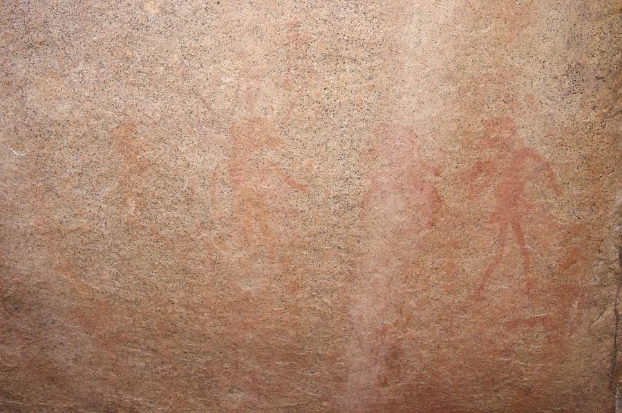
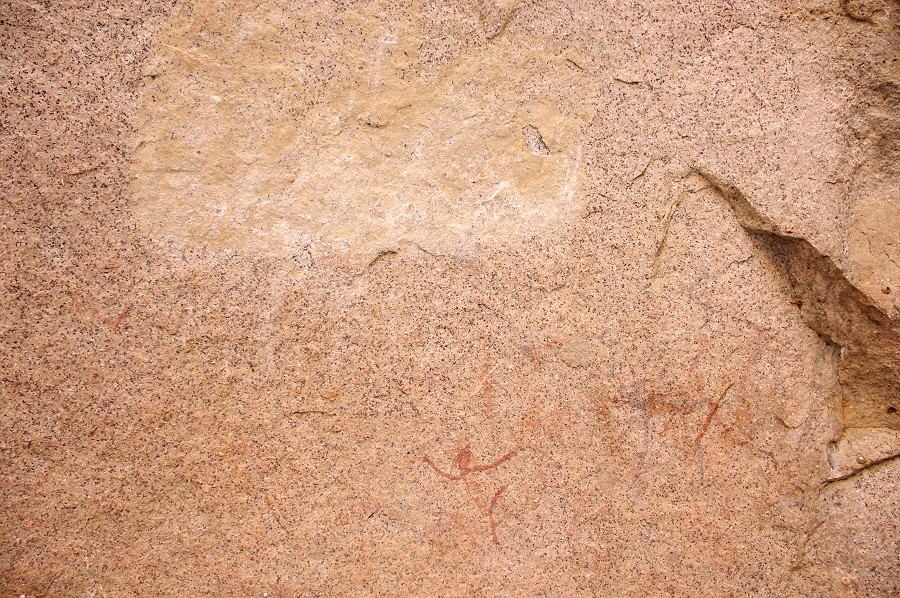
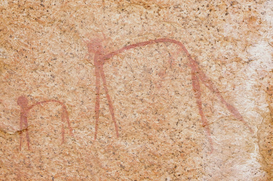
The last site of this group, K41 is a little further downstream, near the principal water hole of the area, which was now completely dry. The site itself is does not appear very exciting, with only a few smudges of on the side of a medium-sized boulder. However dStretch reveals a fine group of human figures.
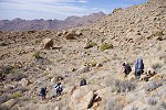
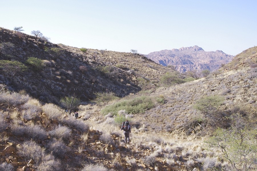
Having finished photographing these sites, we one-by one returned to camp for breakfast and to take our packs for the day. We returned the same way, this time with all the sites already on the sun. We continued past K41 down the valley towards a group of sites right below us where the steep watercourse flattens for a stretch before continuing towards White Rock Plain.
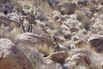
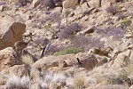
Site K29 was clearly visible from afar as we descended along the side of the ravine, placed prominently at the foot of a huge vertical wall of granite. The paintings were surprisingly well preserved, despite the very exposed location. The vegetation around the site was infested with the large ticks that feed on the klipspringers, concentrated around their resting places. Fortunately so far we always spotted them climbing up our trousers before they bit anyone (another reason aside the thorny vegetation why shorts are not a good idea on the Brandberg...).

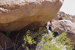
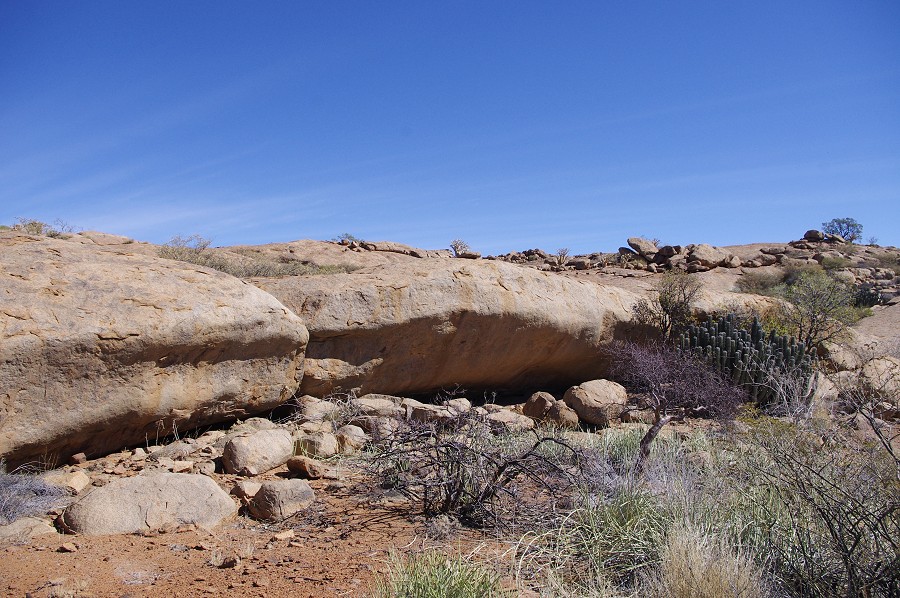
K30 is located just a short distance downstream, under a huge flat overhanging boulder with a spacious shelter underneath. If there is rain, the stream flows right in front of the shelter. This is one of the principal sites of the Eastern Karoab basin. There are panels of paintings both on the celing (including a rare hyaena, unfortunately all damaged by water flowing over them during heavier rains), on the boulders inside the shelter, and on the vertical rck face to the left of the shelter.

We crossed the ridge behind the site, past one of the largest "elephant foot" (Adenia pechuelii) plants that I have seen on the Brandberg. Going upstream in the valley beyond, we turned towards the hillside, reaching a valley above about level with our campside on the far side of the basin.
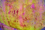
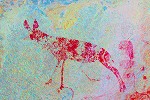
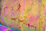
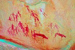
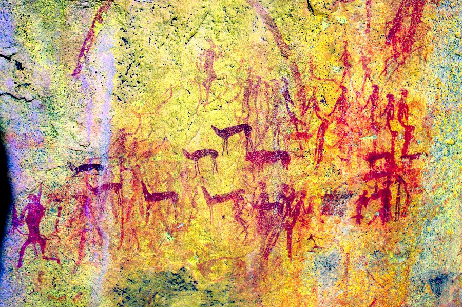
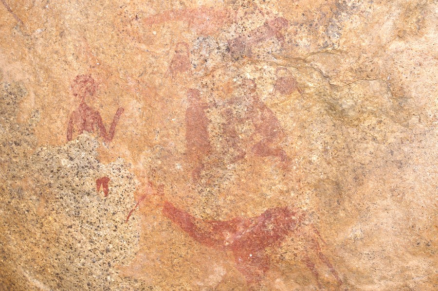
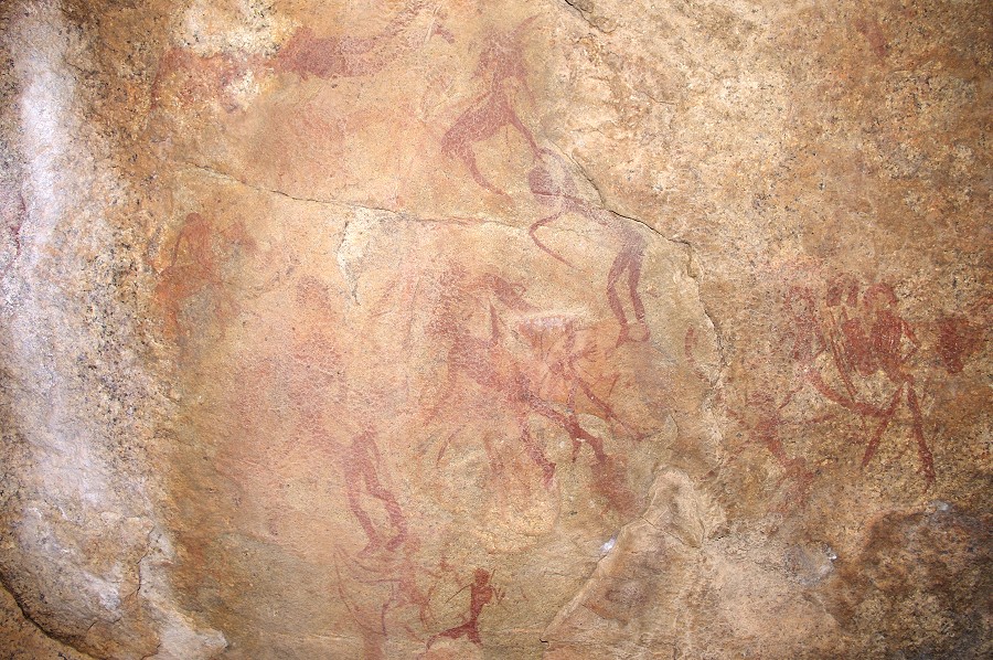
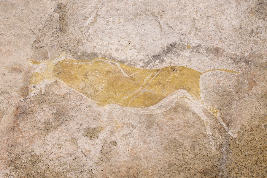
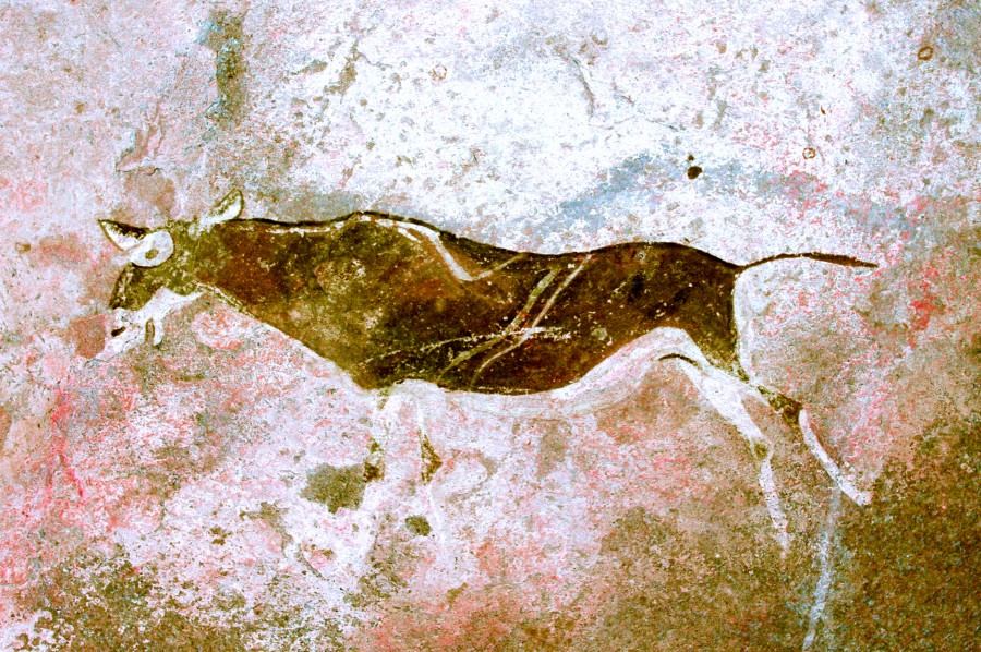
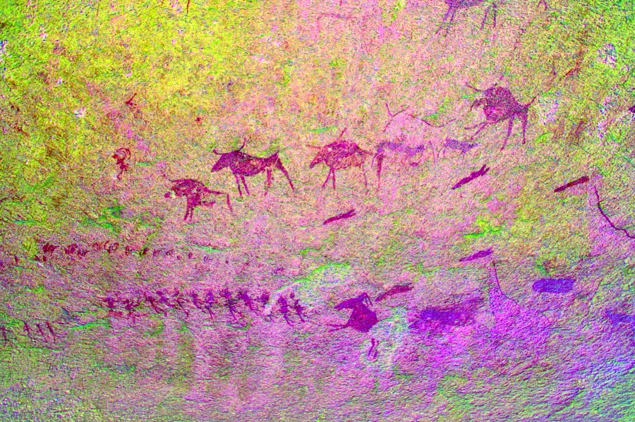
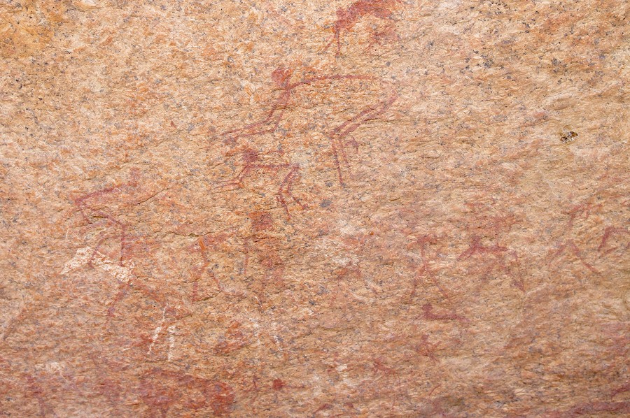
This valley contains only two sites, but one of them, K24 is one of the Brandberg highlights. It contains several panels of paintings, the main one being in a relatively small but comfortable shelter under a large boulder, with a multitude of exquisite paintings including a group of polychrome zebras that are among the finest on the mountain. It was not difficult to find, and we settled down for some serious photography at one of the main objectves for this day.
The other site, K25 was more af a challenge to find, although it was marked as being just over a hundred metres downstream. After some search it was found in a rather unexpected spot, among a cluster of unconspicius boulders right in the riverbed, with the main panel inside a dim, narrow but deep cave formed by the boulders above it. It is a very curious location for paintings, the cave is too low and tight to have been of any use as a shelter, and at times of rain the floor must be flooded with water.
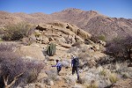
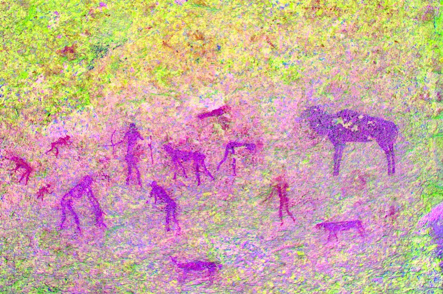
The route to the main valley of Karoab led up in a shallow valley just behind K24. It proved to be a good and easy route, within thirty minutes we were up on the watershed looking down onto a small terrace with a cluster of split boulders, our objective. The terrace was right on the edge of the main descent, looking down into the basin below it was cear that we will not have an easy time the following day. We had a quick lunch in the shelter of a cluster of acacias, and had a look at the cluster of rocks which was site K28. There were a number of panels but all of them with few and faint figures, the most interesting was one with a fuzzy haired hunter chasing an unidentified pig-like animal.
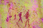
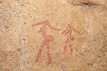
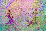
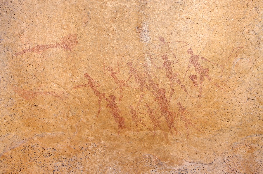
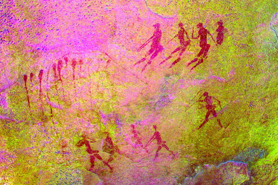
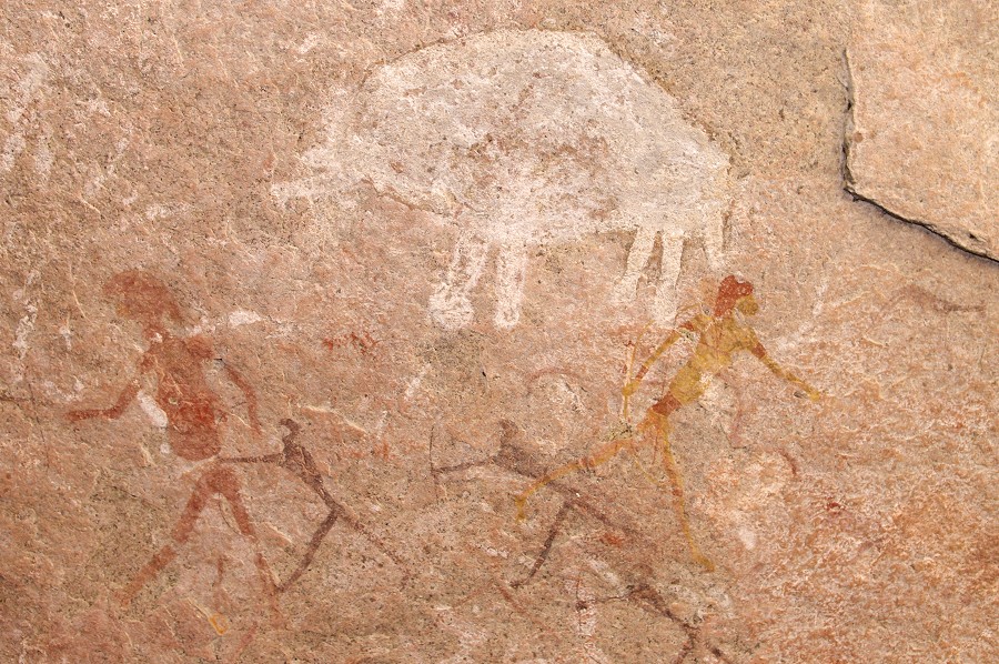
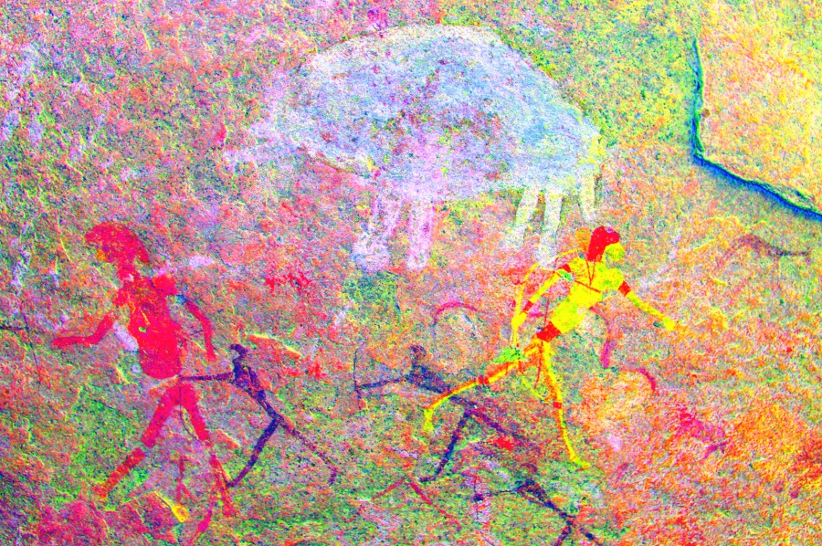
Leaving our packs in the shade of the boulders, we went up the southern side valley to site K27, a couple of hundred metres away in a small basin some fifty metres higher. The well preserved paintings were on the side of an immense boulder, depcting a group of opposing archers with arrows flying in the air, painted over some indistinct earlier figures.
Going back to our packs, we started going back towards K24 and our camp. Near the watershed we made a detour to site K26, a huge shelter in the side of a granite ridge, completely void of any paintings in the shelter itself. The very faint and unimpressibe paintings are on two panels below the shelter, the site was more worthwhile for the breahtaking view from the edge of the terrace in front of it, giving us a perfect view of the route we will have to take in two days when crossing over the hillside ahead into the Umuab Gorge.
We mage a quick descent down the valey to K24, where we still had a panel to photograph that was out on the sun during the morning. By the time we reached it the sun was just about disappearing behind the ridge to the west. We still had plenty of time, we lingered about for another hour capturing the details from the various panels.
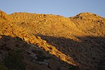
We crossed the valley and climbed back towards our camp on the far side, reaching it just at the magical time when the setting sun turns the top of the hills to a fiery golden colour.
Day 4. - Upper Karoab Gorge
The next morning we started out at first light after a very quick breakfast, heading straight for K24 along the now well tried route. We reached it just before the sun rose above the top of the ridge to the East. Jon was planning to stay here the whole day to photograph the principal panel in full detail, while the rest of us contnued without delay towards K28. In little over an hour after leaving camp, we were at the small terrace, taking a short rest and leaving a cache of water for the return journey. Distance wise we were a little over the half-way point, but it was clear from the terrain ahead that the other half will be accomplished in a much longer time.
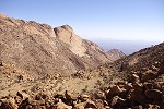
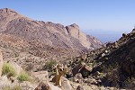
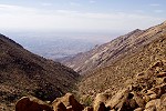
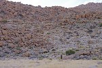
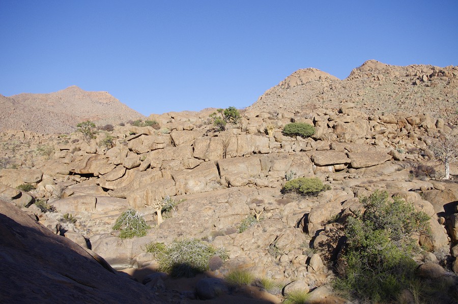
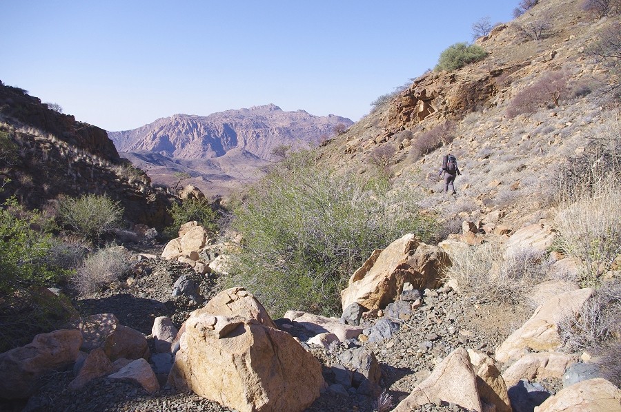
As anticipated, the descent was slow and difficult down a slope composed of huge granite boulders, it was constant scrambling and climbing over rocks without any flat ground where one could actually walk. It took us a good two and a half hours to make the descent into the main valley of the Karoab, with the huge granite plates far above us a good 400 metres higher, topped by the huge rocks hiding site K2 which we visited in 2011 on our way to Porters Gorge. Our aiming point was a conspicious white flat rock near the confluence of two branches of the main valley, with site K13, the principal site of the middle Karoab next to it.
The flat rock adjacent to K13 is white from water flowing over it after rain, and there were still two streaks of water at the base, collecting in a shallow puddle. Interestingly as we dug further into the gravel in the basin which must be a major water hole after rains, it was completely dry. We took a short rest on the plates before starting to explore the site.
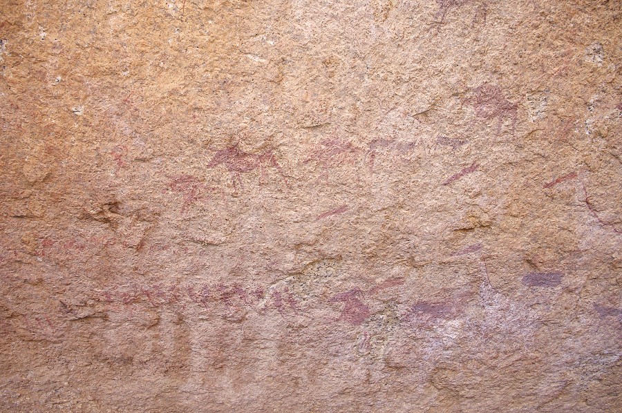
K13 consists of a huge towering rock with a multitude of paintings on both sides, plus a number of smaller panels on surrounding rocks and boulders bordering the streambed that flows in front of the main rock. It is was clearly the principal site of the upper-middle section of the valley, with a lage basin terrace in front of it, one of the very few such areas in the generally very steep Karoab valley. When we arrived, the east side of the rock was still exposed to the sun, but the western side with the finest paintings was in perfect light.
While waiting for the sun to come around to bring the eastern side of the rock into shade, we had a look at the suroundng smaller rocks. They typically contained only a few damaged paintngs, the only exception was a largish rock on the far side of the watercourse with two panels of better preserved, but still very faint paintings.
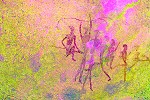
Less than 50 metres further towards the foot of the steep slope bordering the rear of the plain, there is a cluster of rocks, technically a separate site (K12), but really a part of this large cluster. There are several panels under a large flat rock on the left, including a strange long shape on the side of the rock. The most intriguing paintings are in the shallow shelter to the right, with a series of large amorphous forms that seem to make little sense.
While we located and photographed all the outliers and had a quick lunch, the eastern side of the principal rock moved into the shade. This side is fully covered with a multitude of paintings, but the state of preservation is much worse than on the other side, most of the finer details may only be appreciated when enhancing the faint paintings with dStretch.
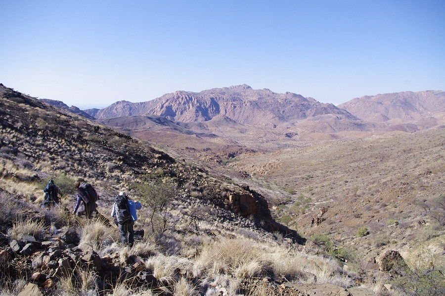
Originally our plans for the day included a visit to sites K17-K19, lying in a small basin in the main valley, a mere 600 metres away but nearly 200m higher. With the prospect of the long and difficult climb back to camp, and the time needed to photograph all the panels at K13, we clearly had to give these sites a miss. We agreed with Jon to be back at K24 latest by 5pm, planning the same time for the return journey we needed to set out at 2:30. Instead of going via the very difficult bouldery slope in the ravine we used for the descent, we turned straight up the slope facing K13 to the East, planning to climb up to the top of the ridge in one go, then continue more or less horizontally to the basin at K28, from where the going would be easy.
The ascent itself was not much better, but once we got to the other side of the ridge there were a series of continuous granite plates which allowed for a much faster going. Still, it took nearly two hours till we reached the little plain at K28 with our water cache.
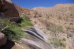
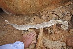
From here it was an easy route back along the now well trodden trail. As we descended towards K24 we passed a large moulted snake skin, which Alphons identified as a fairly small African rock python (Python sebae natalensis), a species that can grow up to 5 metres (though the population on the Brandberg probably remains smaller due to the marginal environment).
We reached Jon at K24 just at the agreed 5pm, and we immediately continued together towards camp to make it back before sunset.
Day 5. - Karoab - Umuab Gorge
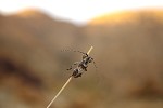
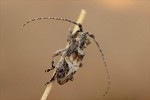
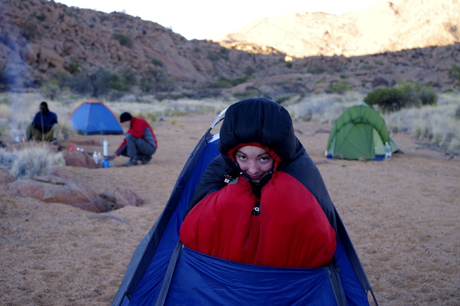
At daybreak as we packed our camp in preparation to move to Umuab Gorge, I found a small longhorn beetle (a Cerambycidae species) under the tent, one of the rare insects we encountered on the upper Brandberg (this scarcity is probably due to all our trips being mid-winter, in summer I expect there would be many more).
We started early, hoping to make most of the climb ahead of us to the top of the ridge before the sun rises. We had to gain an altitude of about 330 metres before we could make a similar descent down to the Umiab plain. The first step was a larger attractive plain about 100 metres above our camp, with a number of large rocks with good shelters around its perimeter, but strangely completely void of any rock art.
From the terrace it was an uninterrupted climb up to the col along a relatively easy route. We have made it from camp to the top in about two hours, just barely having been beaten by the sun.

On the col there was mobile reception, we spent some time making calls and sending messages before continuing. There was just a short descent on the far side into the valley through which we have tried (unsuccessfully) to reach the Karoab sites in 2010. From here it was an easy descent to the shallow basin with the prominent site U1 in the middle on the side of a huge boulder.
From U1 we continued down the relatively shallow slope towards the Umuab plain ahead of us. At the foot of the slope we reached the cluster of rocks hiding site U3, one of the finest sites on the plain with a prominent eared serpent, which we already saw and phtographed in 2010.
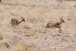
After a short stop to permit Uwe to photograph the panels, we continued now on the plain itself towards the narrow outlet. As we rounded a corner, we became aware of a rattling noise, and soon spotted a pair of dueling male klipspringers. They were so preoccupied with each other that they did not notice us for several minutes, allowing me to quietly open the camera bag and change to the telephoto lens. Finally one spotted us and both bolted in total confusion, first coming almost straight towards us before hopping away over the rocks.
While everything was very dry, we saw a cluster of bright green reeds at the middle of the outlet, indicating the presence of water. We had no shortage, but curiosity made us dig into the sand in the watercourse next to the reeds, however we did not find any wet sand up till a depth of about 40 cms. Our campsite and supply dump was just a few hundred metres beyond, at the edge of a smaller plain adjacent to the main watercourse.

After the long walks of the morning and the prevous day we planned a lazy afternoon, visiting the sites scattered about the Umuab plain. We started with the cluster of sites U9 - U14 at the outlet of the plain, surrounding the dense patch of green reeds. We unknowingly walked past these sites in 2010, now properly prepared with Pager's site plans it was not difficut to find them all among boulders on both banks of the riverbed.
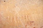
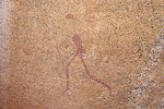
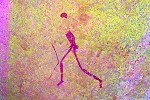
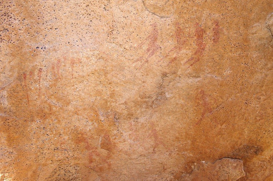
The paintings themselves were not very exciting, most of the panels only showed very faint and barely recognisable scenes with a few figures. At Site U13 there is a fine walking figure (and the traces of a second) but so faint that they are only visible with dStretch, hardly anything may be seen on the spot. At U11 there is a row of tiny figures a mere two centimetres high, an uncommonly small scale for Brandberg paintings. Only the legs are discernible, this is one of the few scenes which even Pager could not copy correctly, mistaking the blobs of paint at the waists as the heads.
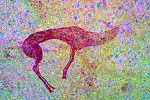
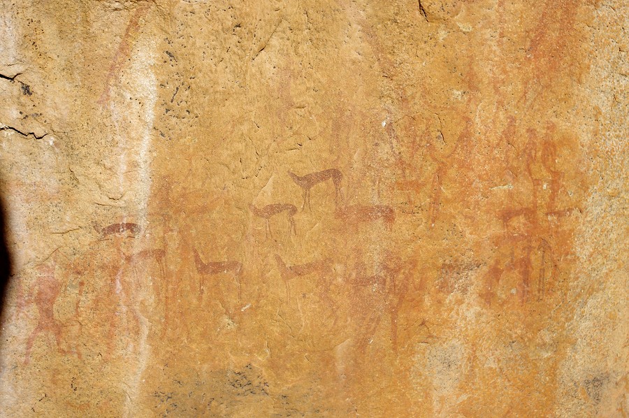
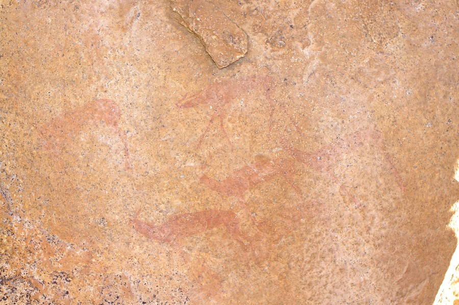
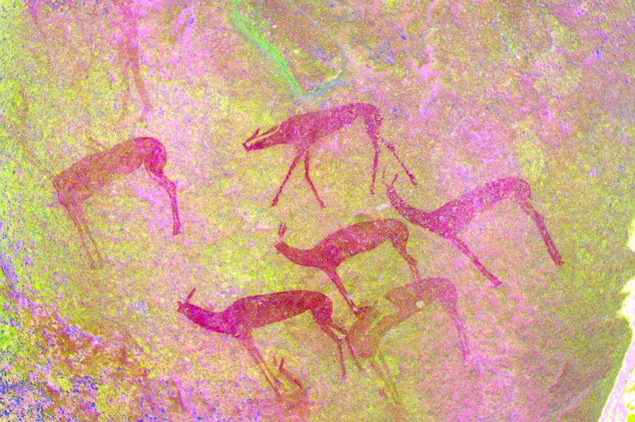
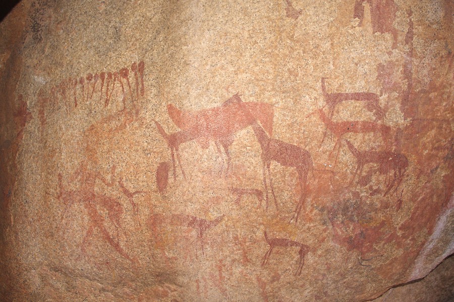
The best paintings in this cluster are at U9, a large flat rock right at the entrance of the plain with a panel of paintings, including a well preserved group of gazelle or antelopes.
Another interesting site, U8 is a little removed from ths cluster, situated on a terrace some metres above the plain at its Eastern edge. The site is a deep shelter among some boulders, and only contains four figures, of which two are remarkable, executed in poychrome red and yellow. It is very hard to make out whether they are human or therianthropes, in this case Pager's tracings are of no help as apparently he too did not see the finer details that are only revealed by dStretch.
We continued accross the Umuab plain to the cluster of sites (U51-U57) at the Southern end where we had our camp in 2010. After the steep topography of the Karoab it felt strange to be walking on flat terrain. With a diameter of around one kilometre the Umuab plain is the biggest patch of level ground on the Brandberg (more than twice the size of Engelhard plain).

We first went to site U51, which formed the backdrop of our camp kitchen three years earlier, and we failed to notice the paintings till the very last day. We also left a cache of water and gas cannisters here, we were curious to see their condition. However on reaching the site we only found a pile of recent rubbish (which we burned before leaving), the water and gas was gone. The explanation was close by - a deep hole in the granite was excavated by crystal hunters sometime in the elapsed three years. Fortunately the paintings showed no sign of damage, probably the miners never even noticed them.
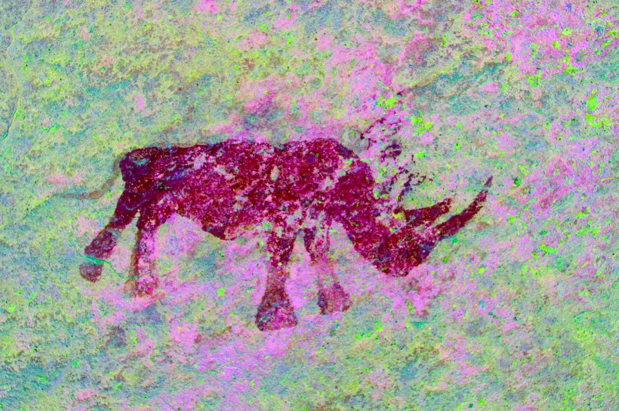
We moved on to U53, where on our last visit we looked in vain for a supposedly fine rhinoceros on a panel of vertical rock. Having the site plan with us this time, we did find something that was definitely painted, but impossible to make out on the spot. Only dStretch revealed back home that it was the rhinoceros we were looking for.
While the others went to see U55, the finest site in this southern part of the plain, I went to the end of the valley to find U56, the one site we failed to see previously. It is a huge flat rock a short distance up the slope at the western end of the plain, with a panel of paintngs deep inside the low shelter underneath. The location is very strange, the pantings are barely above ground level, and one needs to lie down on the ground in order to properly see them.
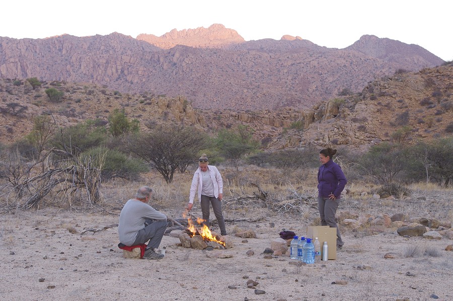
By the time we finished with all the sites the sun was disappearing, we rapidly made it back accross the plain to camp to pitch the tents and light the fire before darkness falls. It only registered with the evening colours that it was mostly a cloudy day, something rather unusual for the Brandberg at this time of the year.
Day 6. - Upper Umuab Gorge
It was a cold morming the next day, with no great distances to cover it was good to just sit around the fire then soak up the sun before setting out for the day. Our plan was to visit the known sites between the Umuab plain and the steep part of the valley. In 2010 we only saw the main sites U21 and U23, but there are another two dozen or so sites in the area. Our camp spot was chosen so that except for one cluster of four sites, all others were within a one kilometre radius, we could visit them comfortably in a day with plenty of time at each.
Four sites were in the upper part of the side valey, the first two within sight of our camp. U15 only consisted of a single boulder with a fine human figure on it, while U16 was a major site with numerous panels of paintings among a cluster of large boulders - unfortunately most of the paintings were so faint that hardly anything dould be discerned on the spot. We have searched for this site in 2010 on our way back from U21, we have been looking for it among the big rocks of the ridge immediately above, a mere 60-70 metres away...
The next site was U17, a cluster of smaller rocks in the middle of the valley with two panels of paintings, one of which is a group of human figures in an interesting and uncommon crude style.
U18 a little further downstream is next to the principal water hole of the area (found to be dry), and based on Pager's tracings we expected a major site. However unfortunately the paintings are very faint and damaged, to most of our party more excitement was caused by the availability of a mobile signal on the rock ledge overlooking the descent into the basin below leadng to U21.
We were planning to cross the basin later that day towards U21, but first we planned to visit an outlying cluster of sites to the west, some 1.5 kilomtres away. There was a nice smooth series of granite plates and flat basins leading from U18 to these sites, an uncommonly easy going by Brandberg standards (in the past we have encountered terrain where the coverng of such a horizontal distance took over half a day). There was the isolated site of U19 about haf way, on a big boulder at the edge of one of the flat terraces, with several faint but interesting scenes.
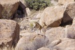
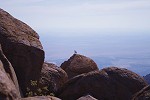
From U19 it was a similarly easy path accross a series of joining granite plates to the basin with the cluster of sites, with the huge rock of U36 in the middle of the basin visible from afar. As we passed near the edge of the steep drop down to the foot of the mountain, we were watched by a klipspringer perched motionless on the top of a huge boulder. It stayed perfectly still for nearly 5 minutes, while I approached it for a closer photo scrambling over the rocks and boulders accross a good 150 metres to the edge of the drop.
Site U36 dominates this basin, with a several continuous panels of paintings along the Western side. We had to hurry as the sun was coming around, with only a narrow strip of shade left along the boulder. We first had to start with some serious gardening work, the principal panel was almost completely obscured by a large bush that sprang up since Tilman and Marie-Therese made their survey in preparation of the Pager Karaoab and Umuab volume (published in 1998, number IV. in the series) in the mid-nineties.
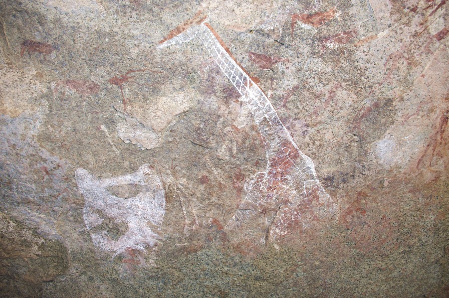
While we were taking turns to photograph the finer details of the main panel in the confined space, the others fanned out to find the other three nearby sites. U34 and 35 were both easily located on boulders within a distance of a couple of hundred metres, both with few very faint and unexciting paintings. U37 took some more time to find, as the site description could fit any of several dozen medium sized boulders on a low rise opposite U36. Finally we found the single painting of a very fine giraffe on an unimpressive small boulder immediately opposite the main panel of U36, much closer than we were initially looking.
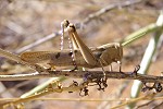
We left the basin around noon, retracing our route back to the basin below U18, then contunuing along a generally flat contour to the huge rock of U21, clearly visible from afar. The most exciting event along the way was catching a large locust among the undergrowth (identified as a garden locust, Acanthacris ruficornis, common throughout sub-saharan Africa).
When we reached U21 most of the prncipal panels were still exposed to the sun. We found a small shady spot to have our lunch and to wait until at least some of the panels become photographable. Near the rock we have come upon the remnants of Harald Pager's dinner from more than 30 years ago.
With the main panel out on the sun till late in the afternoon, we descended into the valley below leaving our packs behind to see the cluster of sites U23-U26, all along a 200 metre stretch along the bottom of the main watercourse, within sight of the rock of U21. U24 is located on boulders in the riverbed immediately under U21, with several panels of human figures, some surprisingly well preserved given their location.

Site U23, the principal site of the lower riverbed is just a few dozen metres upstream, in a spacious shelter among some huge rocks along the side of the watercourse, and a large adjacent basin which must hold water for a long time after rains. The vertical wall just outside the shelter is covered with a large paner of very fine, and exceptionally wel preserved paintings, even visible when fully exposed to the sun. The ceiling of the shelter is also full of paintings. In 2010 we could only make a hurried visit, now we could take photos at leisure.
Sites U25 and U26 are two boulders about 100 metres upstream from U23, one in the riverbed, the other on a terrace above. Both contain only a single scene of paintings.
By the time we reached back to U21 the sun was close to setting behind the hills to the west, finally making the main panel of the site properly visible. This also meant that it was getting close to sunset. Most of our party left to comfortably reach to camp before dark, while Uwe and I stayed behind to photograph the entire panel in detail. It took a good hour to take all the photos we wanted, only starting on our way back close to true sunset. Despite the camp being less than a kilometre away, we still made the last couple of hundred metres in darkness.
Day 7. - Umuab - Nuwuarib Gorge
In the morning we packed camp to move to the Nuwuarib valley. As the distance to cover was short, we planned it in a way to see a number of the Umuab sites along the way, leaving our packs at the principal sites and exploring the surroundings. We also noted that in part due to the cool and cloudy day when we made the trek over from Karoab, we have used much less water than planned, we left two five-litre bottles behind hidden away among rocks near our campsite. Starting out, we first went to U50, a large lump of rocks next to the main watercourse a short distance from camp, with a fine panel of human figures on the side.

We followed the dry riverbed for a half kilometre to the point were it started to make a descent. Here along the rocks bordering the watercourse to the West there are several panels of very faint paintings, site U48, with only a scene of a couple of gazelle and a jackal (?) worth mentioning. We left our packs here to look for anoher four sites located higher up on the ridge above the valley, all within hundred metres of each other.

Site U42 was the closest, a long medium-sized boulder with a large panel of paintings on the upper edge of the rock and some more underneath in a shallow shelter. Both were completely exposed to the sun, it was quite a challenge to create the required shade to be able to photograph the very faint paintings.
The other three sites U39, U40 and U41 were all big boulders scattered about the hillside, with rather small shelters underneath. Only U40 contained meaningful paintings, a fine panel of human figures.
The last site of this cluster was U47 back in the riverbed, a short distance below U48 where we left our packs. It consisted of several boulders in the watercourse itself, with several panes of rather faint paintings, including a large but rather battered zebra.

Staying up above the riverbed, we descended to the huge rock of U44 perched above the Eastern bank 200 metres away, a principal site overlooking this secton of the valley and the scatter of sites below. This site is also adjacent to the path leading over the dividing ridge into the Nuwuarib Gorge, so it was an idea spot to leave our packs while exploring the remaining sites. We have briefly visited this site with Jon back in 2010, however it was at the end of a very tiring day, and the main panel was fully exposed to the sun so we could see few details. At that time we completely missed the fine and much better preserved second panel of paintings, hidden in a low shelter at the left of the rock.
The left panel is at the bottom of a very narrow confined space surronded by boulders, one needs to crawl in to see the paintings on the wall of the shallow shelter. No wonder we did not see them the last time. They were on the sun, but with high boulders all around it was not difficult to create the shade to photograph the well reserved scenes.
This time, the main panel was in good shade, so we could get a much better appreciation of the numerous faint figures literally covering the the lower part of the vertical west-facing side of the huge boulder. Last time with the sun shining on the paintings we could only see the group of antelopes at lower right, the dozens of human figures were completely invisible.
We returned to the riverbed below to find the other sites, all within sight of the big rock of U44. The farthest, U27 was 200 metres downstream, a group of huge boulders straddling a low dry waterfall (and undoubtedly a good water-hole below for an extended period after of rains). We have passed by the paintings on the lower boulder in 2010 on our way back to camp from U23, but did not really appreciate them, a a unique scene of a herd of elephants painted on a large vertical surface. They are very difficult to see and photograph as the paintings are very faint and the panel is fully exposed to the sun for practically all day. There are some more paintings on the rear of the boulder and on the rock at the top of the waterfal, but not nearly as interesting as the elephants.
U28 is a large south-east facing shelter under a huge potato-shaped boulder above the western bank of the watercourse, opposite and in plain sight of U44. This site must have provided good shade and a comfortable living area for most of the day. There are numerous very interesting paintings on the wall of the shelter in varied state of preservation.
The two remaining sites, U43 and U46 were both on rocks in the riverbed right under U44. Compared to the other three sites we have just seen, they are relatively unimportant with just a few figures scattered about on a number of boulders.
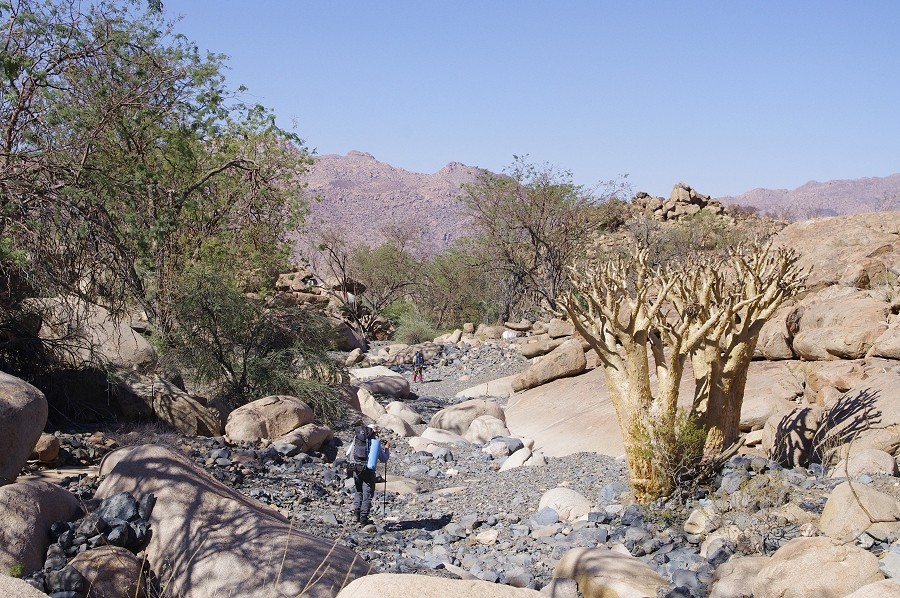
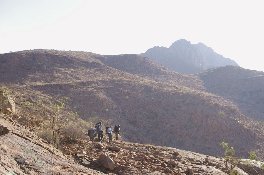
Having successfully located all the Umuab sites we wanted to see, we made it accross the ridge into the Nuwuarib valley. Even with packs and the obligatory phone stop on the top, the trek was well under two hours to the big tree beside the main Nuwuarib watercourse where we have made our supply dump.
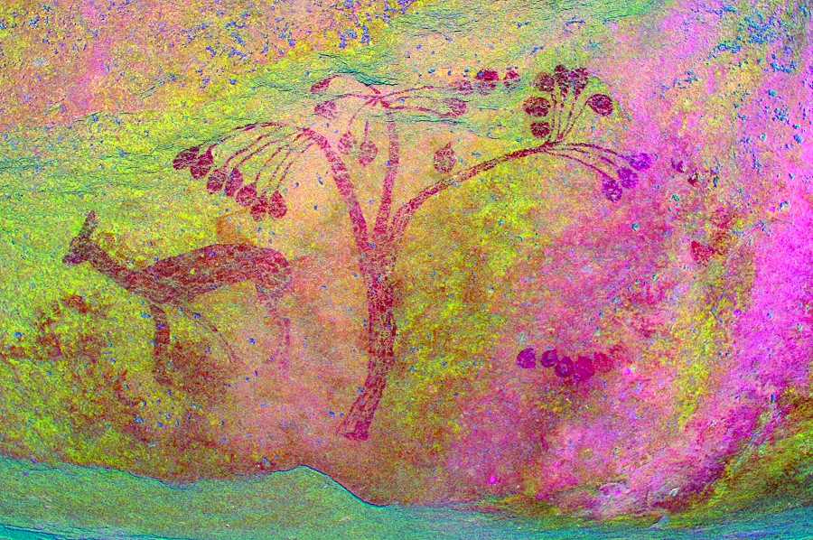
Our campsite was located at the same spot as last year, with all the princpal sites within a half kilometre radius. We could afford a leisurely afternoon, with a good rest in the shade of the tree after lunch before setting out. While the others went to the "Bildergalerie" site and the other nearby sites we have located the previous year, with Magdi we went looking for the remaining sites from Pager's marked aerial photograph which we did not have time to look for last year. We started at W10 where we saw the lovely scene of a fruit tree with a gazelle, but all my site photos turned out overexposed due to a mistaken camera setting. This time with no time pressure I could properly photograph all the scenes.
We continued up the low rocky ridge behind W10 to look for two sites, W4 and W5. By extrapolating Pager's photo to Google Earth I had a fairly good idea of where the paintings were supposed to be in a shallow valley running between the parallel granite ridges. We have quickly come upon W4, a large boulder at the side of the valley with a pair of fine giraffe and some other paintings. We also found a large boulder where W5 was thought to be, but we could not find any trace of paint. As both were fully out in the sun, we decided to return the next morning for the photographs.
W3 was somewhere at the south-eastern end of this small valley (towards the Mason shelter, just a further 150 metres away in the main riverbed), however we could not find it among the many potential boulders. We had more luck as we made our way towards the princilpal water hole, W2 was exactly where we expected it to be, a pair of boulders with paintings on both, the most interesting being a rather curious human (?) figure. The last missing site was W9, somewhere adjacent to the main riverbed towards camp, shortly after the rather meagre site W8 which was located last year. Again it did not take much searching, the panel depicting a fine herd of antelopes was found at the next cluster of rocks.
Having found all the missing sites, We walked past camp towards the sites along the Northern edge of the plain, expecting to find the others at the "Bildergalerie" site which is best photographed in the late afternoon. We passed the site with th curious human figures who hold lances with what appear to be metal points, something unique in the rock art of the Brandberg. The new close-up photos seem to support this conclusion.
The others were indeed at the "Bildergalerie", the main site of the lower Nuwuarib plain, we spent a lovely relaxed late afternoon snapping away at the paintings or just watching the sunset, before darkness forced us to retreat to camp.
Day 8. - Upper Nuwuarib Gorge
The plan for the day was to visit the Mason Shelter (W1) after photographing the two sites we located with Magdi the previouus afternoon, then to explore the elevated country to the west of the Nuwuarib, where a number of enclosed flat bottomed valleys and ridges with deep shadows were identified on Google Earth, suggesting possible larger shelters underneath. If there were any previous surveys of this area, they remain unreported.
First we all went to W4, the site found the previous afternoon, to photograph the two very nice giraffes and the other less exciting scenes.
While the others were occupied with the giraffes, with Alfons we walked up to the big rock appearing to be site W5 to check it out again, this time without direct sunlight. I still saw nothing, but Alfons professed to see some traces of paint near the bottom of the rock. I half-heartedly took a photo, and amazingly dStretch did reveal some red figures, including what appears to be an ostrich, a rather rare theme among the Brandberg paintings.
On the way to the Mason shelter Alfons also found W3, a large boulder with a few human figures on the side. With this find we have finished locating all the sites marked by Pager on his aerial photograph in the Nuwuarib valley.
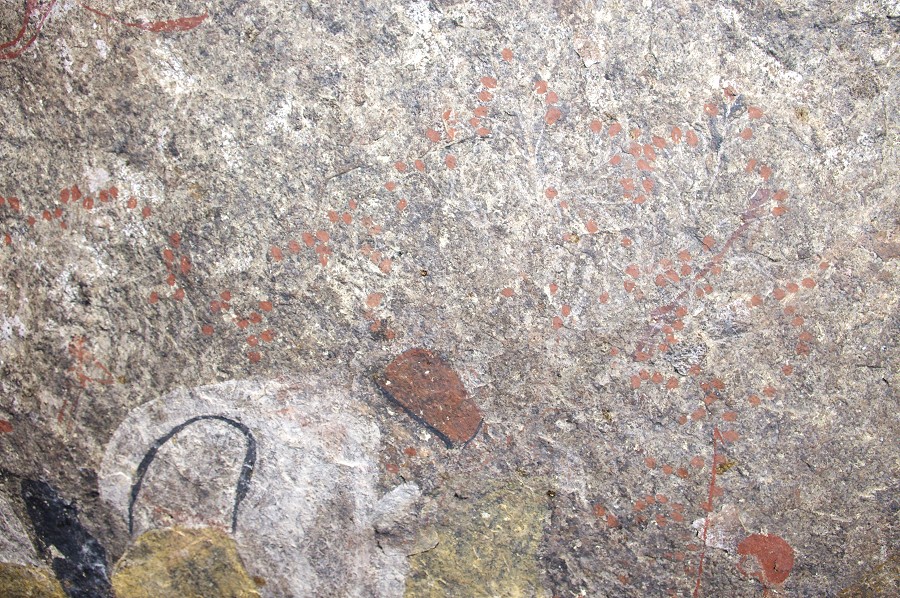
We moved on to the Mason shelter, spending a good hour at the site taking photos and looking at the finer detail. Having taken my detailed photos on previous visits, I could afford the luxury of just staring at some parts of the painting, and I have managed to solve the mystery of the meandering rows of red dots surrounding the "Picasso", the abstract polychrome shape forming the centre of the main composition. Looking close it is possible to identify the remnants of fine white lines joining the red dots - they are in fact all trees, with the trunk and branches in an almost completely vanished white paint, only the well preserved red dots representing leaves or fruit remain clearly visible. This revelation suggests that the amorphous object in the middle may in fact represent a landscape.
At the Mason shelter we have made another find. On all previous visits we were so preoccupied with the main shelter that we failed to notice a very fine panel of paintings on the far side of the rock just in front of the shelter.
It was mid-morning when we embarked towards our proper target for the day, a series of ridges, terraces and basins to the east of the main Nuwuarib watercourse. We climbed up the slope a short distance upstream from the Mason shelter, and soon reached the first of the terraces, the far side of which led towards the route into the Buschmantal, our way down into the Tsisab valley the following day. After a short search Uwe found a small shelter with a couple of painted figures inside, plus some more indistinct paintings on an adjacent large rock. Alfons also found a boulder, now fully on the sun, with some paintings which we left for the following morning since we were to pass this way again.
Following the watercourse crossing the terrace, we came upon a larger plain after a left bend, with some very promising boulders around its perimeter, However hey all turned to be empty, we only found some faint paintings on the vertical rock face of an inconspicious low ridge at the southern edge. The scene turned out to be a rather interesting one, with an apparently bird headed large human with a prominent beak, a unique representation.
We were now in the least known North eastern part of the Brandberg, following the shallow watercourse skirting a large unerded patch of black Karoo lavas capping the unexposed granite in this part of the Brandberg. While it is unlikely that nobody did any surveying in this part of the mountain, no published records remain to the best of my knowledge. We were aiming for a granite ridge that contained a number of promising rocks (as seen on Google Earth). We spread out to explore it, all the rocks identifed on the satellite imagery turned out to be empty but a little further Jon did find a low shelter with some very faint, barely recognisable paintings.
We moved on towards the North, into a small basin in the upper parts of the Eastern branch of the Nuwuarib, which joined the main branch near our camp. A number of long shadows were identified in the area on Google Earth at the edges of the large granite plates, suggesting that some may have large shelters, possibly with paintings. The initial ones investigated turned our empty, we proceeded to have our lunch in the lee of one of the few shady rocks bordering the basin.
After lunch we spread out to survey the broader area. I was aiming for a long conspicious shelter along a granite ridge about half-way up the granite dome bordering the basin to the North. This shelter showed up prominently on satellite imagery, and was also clearly visible as we descended into the basin from the South. It turned out to be over 150 metres long, with a good deep underhang for most of its length, unfortunately all empty. I only found a very small and damaged panel of paintings with a probable rhinoceros on the vertical rock face at a very exposed location, adjacent to the lower end on the shelter.
The other rocks in the area proved to be void of paintings, and as the others tickled back it turned out that my partial rhinoceros was the only find among all the rocks in the surounding hills.
Fortunately we were not to be left without a better find for the day. At the outlet of the basin as we started out towards camp following the watercourse, we came upon an inconspicious cluster of rocks, which contained a very fine, well preserved panel of paintings on a completely exposed vertical rock face. The rock face continued into a crevase between two boulders, and the far side of the crevasse contained another fine panel. It was clear that we were not the first to see these paintings, a broken yellow plastic water bottle was identifed by Alfons as the type Harald Pager used. Most probably he thoroughly surveyed this area at some point, however unfortunately no records of it exist in his diaries.
Having covered all our planned survey area, we descended along the watercourse towards camp, checking out a few rocks and shelters along the way without finding anything. Still, we had a reasonably successful day, locating six sites in the area where none have been previously recorded.
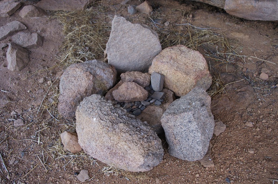
We still had a good two hours left till sunset, some decided to rest in camp while others went to see again the principal sites. I took a walk to the series of grassy plains to the west of the main watercourse, not expecting to find much. However at the end of a largish plain west of the Mason shelter, where a narrow corridor leads out to the main watercourse, I spotted a very large boulder with a conspicious shelter underneath which just cried to be a rock art site. Sure enough, as I approached I notced a number of painted figures and a large indistinct shape looming high up the rock. There was aso a sizeable tree growing in the middle of the shelter, broken but later healed at ground level, indicating that this site was visited, but perhaps decades ago. Ths was also confirmed by a small covered fireplace with a small collection of potsherds and stone implements placed on it.
The left panel showed a number of unusually large human figures (on the scale of about 30cm) and the traces of some smaller ones. On the right (partially covered by the tree, which was too thick to break so I had to keep it down with my weight while taking photos, a somewhat challenging task...) there is a large curved, indistinct shape that was impossible to make sense of on the spot, but even with dStretch it is not much clearer.

Initially I assumed that it must have been Harald Pager who found this site, but after doing some research recently in the library of the Heinrich Barth Institut it became clear that the story goes back to much earlier. The upper Nuwuarib was first visited by Revil Mason, a South African archaeologist in March 1954, when the large shelter (subsequently named after him) and another eight sites with paintings were located. A very sketchy account of the Mason shelter appeared in the Lantern Magazine (June, 1958), but the other sites remained unpublished. In September 1961 and July 1962 H. Jipsen made two visits to explore the area, and having received Mason's notes he found all reported sites, plus a further 16 sites in the Nuwuarib, including most of those marked on Pager's aerial photo, the Bildergalerie and the adjacent two sites wich we saw the previous year, plus this site I have found, which he called "elephant shelter" as he professed to see the partial outline of the head of an elephant in the strange curved shape. Jipsen did not formally publish his finds, but fortunately a typewritten report made for the SWA Scientific Society survives to tell the story.
There are some traces of paint on the right side of the boulder, but so faint that it is impossible to make anything out, except that whatever it is is on an exceptionally large scale, with some visible lines running for over two metres. Lookig at the enhanced photo it appears that the paintings are a group of very large scale giraffe - if so that would be an absolutely unique scene on the Brandberg (Jipsen presumed these to be another elephant).
I only had time left for a quick search of a large group of boulders a little further towards the main watercourse (spotted as a promising locality during our morning climb) which turned out to be empty, before making a hurried dash back to camp to be there before sunset.
Day 9. - Nuwuarib Gorge - Buschmantal
Next morning we packed our camp and started our descent towards the Tsisab Gorge. We were aiming for the last dump made near the outlet of the Buschmantal, a large elevated basin lying to the north of the main Tsisab valley, and offering the natural route to the upper Nuwuarib. When Revil Mason first came up this way, he found the basin and named it the Scherz Basin after Breuil's companion and assistant Dr Ernest Scherz, who later compiled a monumental three volume work on the rock engravings and paintings of South West Africa, including all the then known sites in the lower parts of the Brandberg. At some point the valley was renamed Buschmantal propably on account of the numerous ancient settlement remains found in it, for it is this name that appears on the map of the Brandberg and in all publications after the seventies.
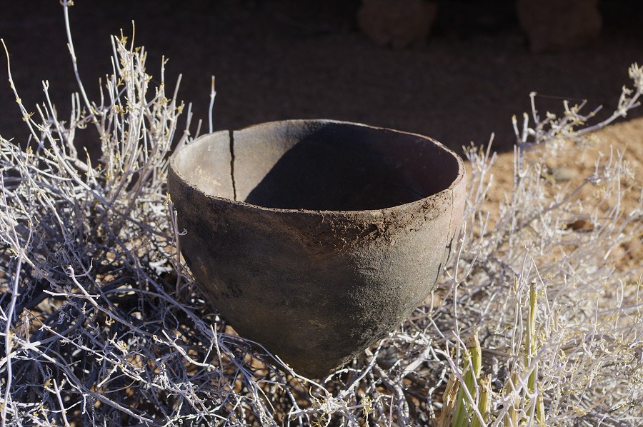
The smooth granite plates above the now dry water hole offer the easiest way up the slopes bordering the Nuwuarib to the East. After a short steep climb we were up at the series of terraces which we explored the day before. We went to the site fund by alfons, a small panel of paintings on a n isolated boulder along the watercourse. Under the rock Alfons also found an intact conical vessel, having no experience with local ceramics I could not tell whether it would be contemporary with the paintings or perhaps more recent.
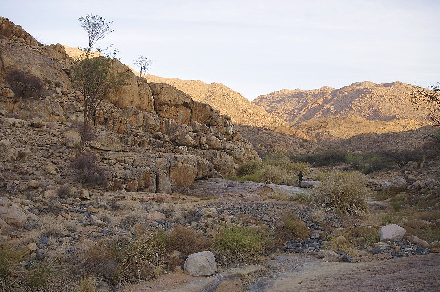
Continuing, we crossed the barely perceptible watershed between the Nuwuarib and the Tsisab accross the dark rubble of the uneroded patch of Karoo lavas which still cover the granites for a large part of the ridge, and most of the northern parts of the Buschmantal. We continued down the meandering watercourse to the piont where it suddenly makes a steep descent into the basin some three hundred metres below.
This black lava presens a very different terrain than the granites. Weathering created steep scree slopes of loose rolling rubble, someting we are all too familiar with from the sandstone country in the Sahara. While technically not challenging, it is a slow and tedious way down such a slope, with smaller rocks constantly rolling under one's feet.
After a steep scramble of about an hour we reached the tamer section of the valley, where the riverbed flattened out, offering easy going in the gravel fill. At a bend we reached the first outcrops of the underlying granite, and immediately we found some very faint paintings in a long low shelter along the riverbank. These were already known to Alfons from previous trips up to Nuwuarib along this route.
As we continued, the river entered a canyon with vertical granite walls on both sides, a very unusual landscape on the Brandberg. The canyon deepened, and at one point we reached a rock face thickly covered with green moss, with water seeping drom a crack and dripping down the moss. Alfons considered this spot one of the most reliable water sources on the mountain, though some patience is required to acquire a cupful of the otherwise excellent water.
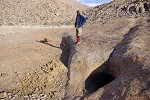
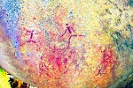
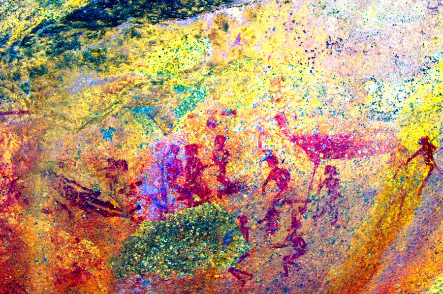
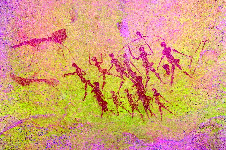
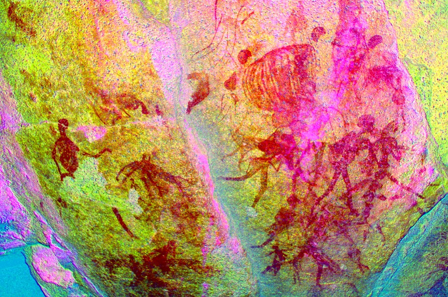
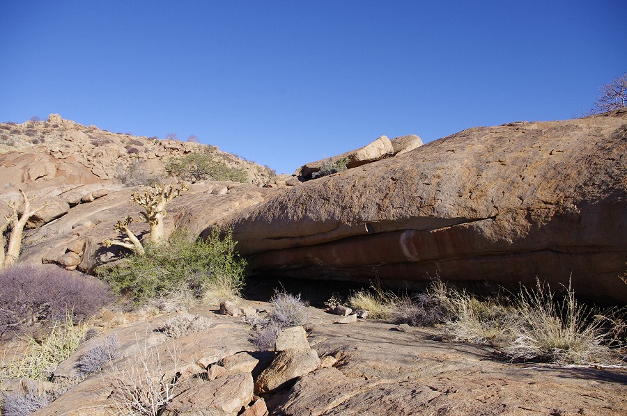
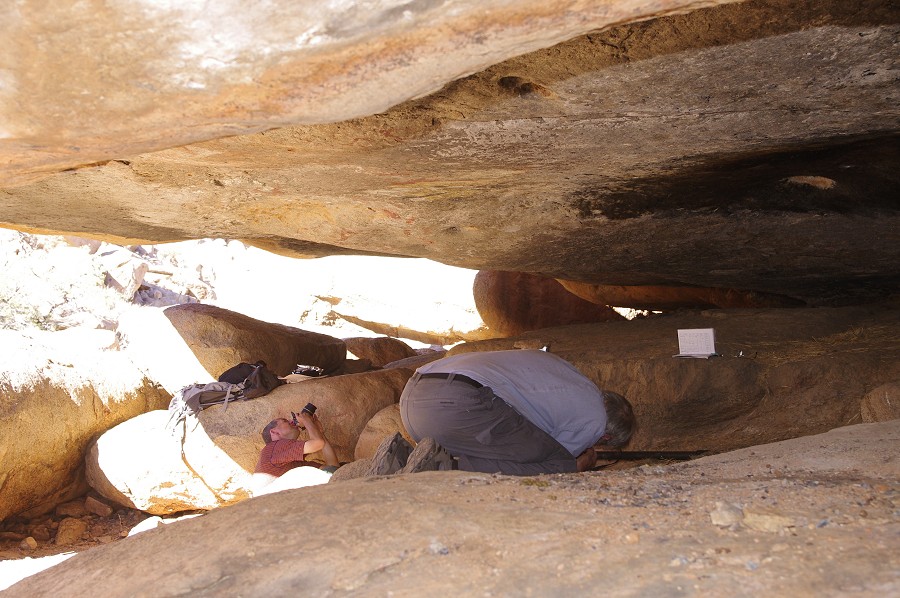
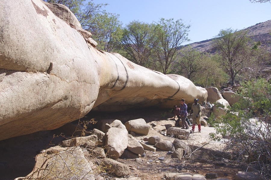
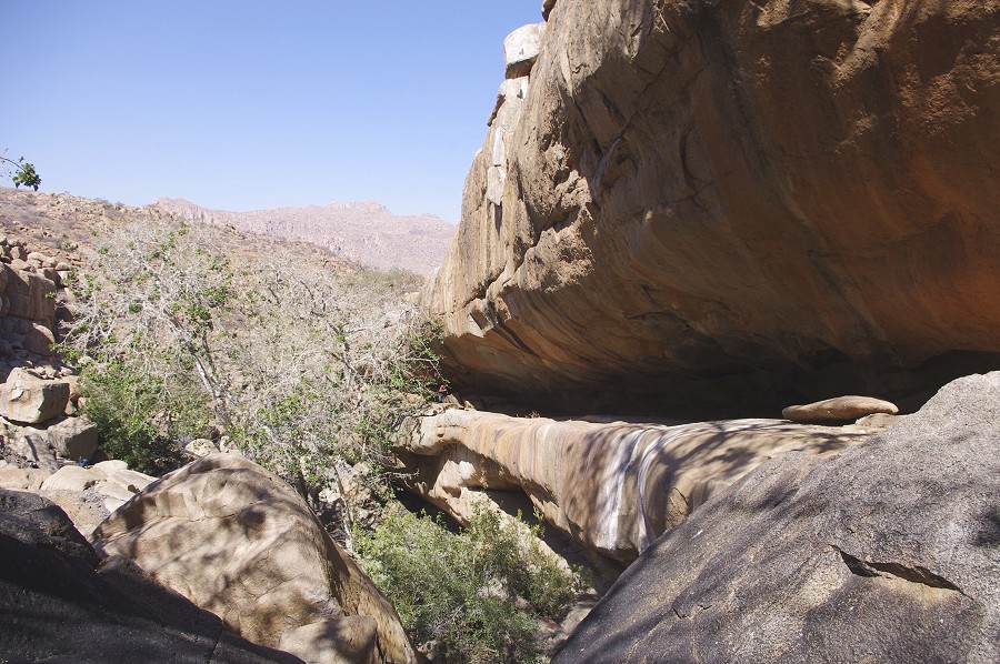
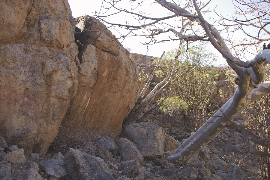
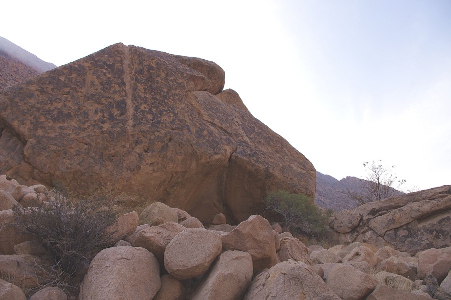
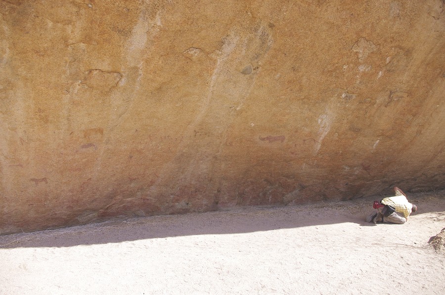
A short distance further the valley deepened again, and after scrambling down a dry waterfall we came upon an enormous shelter running for over 100 metres about half way up the cliffs, apparently formed by water and gravel eroding a softer layer in the rock. The shelter was flanked by a number of huge wild fig trees, no doubt surviving here because of the constant trickle of underground water. There was a rather precarious path leading up to the western edge of the shelter, the only access point. This was "Lange grotte", one of the principal rock art sites of the Brandberg, however as there is nothing published about this site we did not really know what to expect.
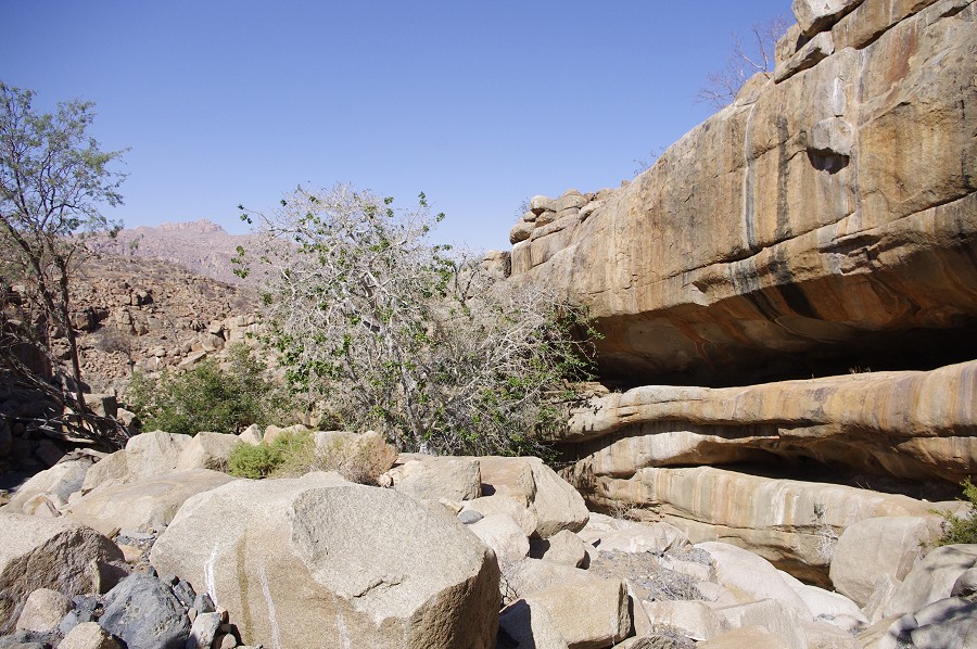
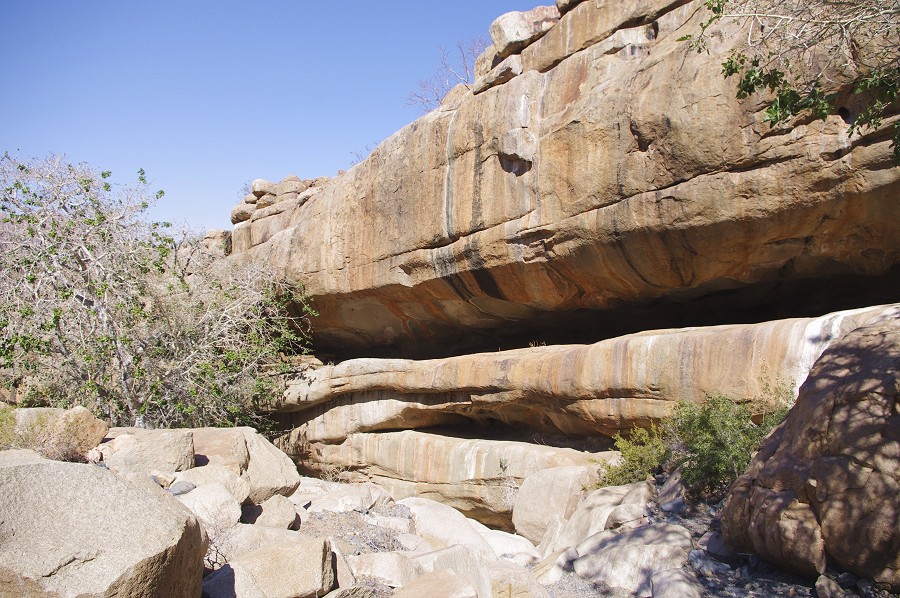
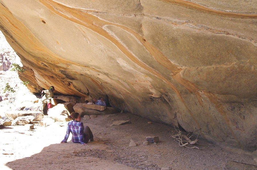
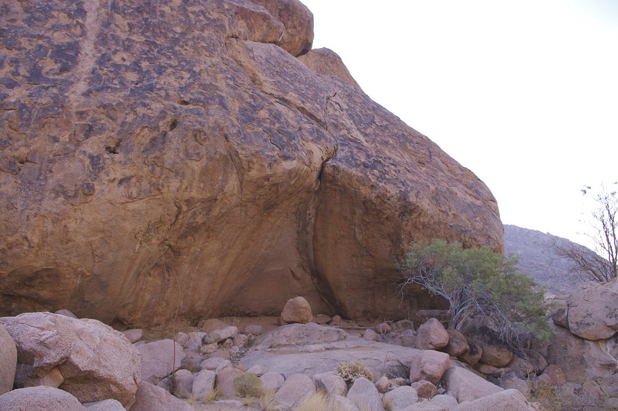
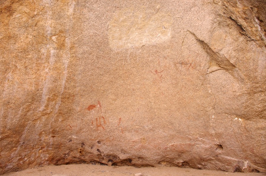
The entire rear wall of the shelter from about half-way its length to within ten metres of its Eastern end is densely covered with paintings, mostly the usual assemblage of human figures and wild fauna, but there are a number of unique and exceptional depictions. The state of preservation varies, some of the scenes are best viewed after the photos have been processed with dStretch.
We spent a good two hours at this site, the somewhat unexpected highlight of our trip. Interestingly Revil Mason bypassed this site in 1951 when he made the climb to the Nuwuarib accross the Scherz basin, even though he did find and study the numerous stone structures of the ancient settlements. Similarly Jipsen seems to have taken a different route up (apparently they found the flat ground adjacent to the top of the gorge easier going than the rocky bottom of the watercourse). The Lange grotte was only found in the mid-seventies by Joe Walter, but the find was never published aside a brief note in the Newsletter of the SWA Scientific Society.
Having photographed all the panels, we continued downstream towards our dump. Not far from "Lange grotte", after a sharp bend in the river we found a shallow open pool of water that must be constantly replenished from some crevasse. There was lush green vegetation with many trees in the valley for several hundred metres downstream. In a small shelter Alfons showed us another rock art site with a few painted human figures.
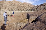
We continued down the now rather flat rivebed crossing the middle of the basin, then accross some low ridges to the small flat terrace where we made our first helicopter dump. We found it undisturbed under a large acacia, and proceeded to have our lunch in the shade of a large towering rock outcrop at the edge of the plain.
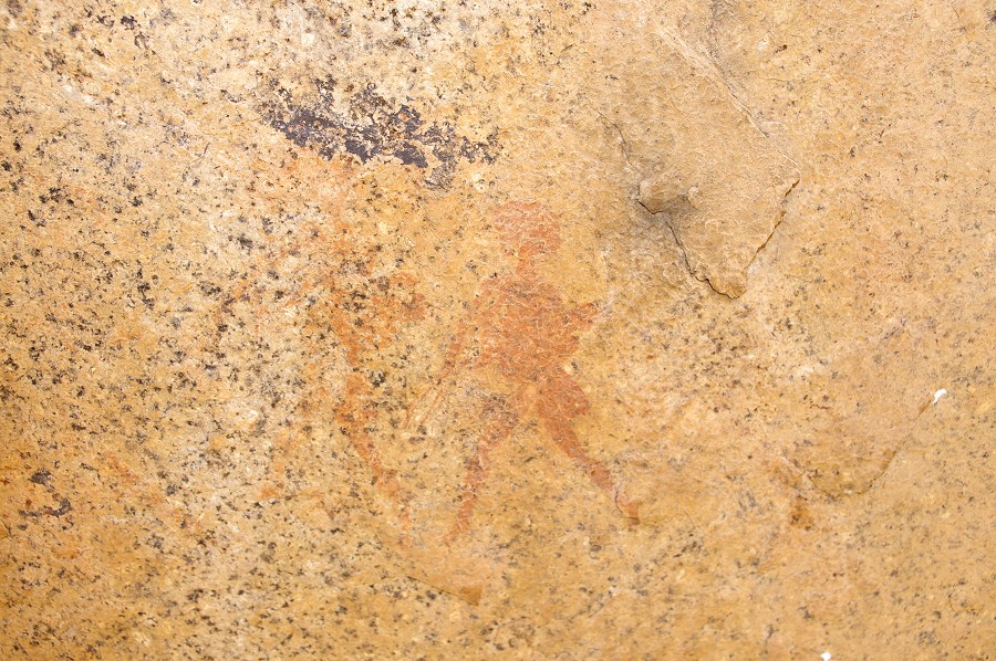
After lunch and a little rest we spead out to explore the immediate area. We were not aware of any reported rock art sites, but soon found two, both very close to our lunch spot. The first just contained some faint indiscernible animals, but the second, on a solitary boulder on the slope above the plain, contained a large panel of numerous exceptional human figures in a style without any ready parallels elsewhere.
While the others decided to take a rest after the long morning walk, with Uwe we set out to explore further. I picked the two valleys to the west of our camp, which both turned out to be empty, my only find worth mentioning were a cluster of stone circles, apparently the remnants of an ancient settlement. Uwe was luckier, he came back from the gorge forming the outlet of the basin with two rock art finds. He also reported that the bottom of the gorge is blocked about half-way by an impassable dry waterfall.
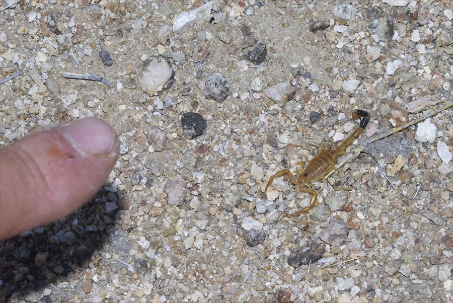
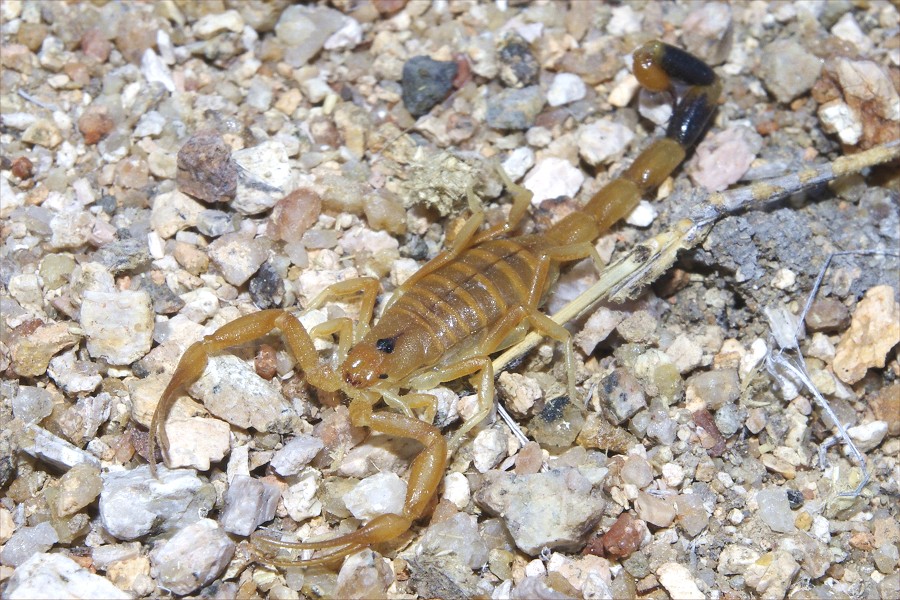
A minor excitement was caused around the campfire, when while arranging the sitting stones Dora spotted a very small and rather harmless looking small scorpion, the first ever we have seen on the Brandberg despite having purposefully looked for them previously. It was a small Uroplectes planimanus, a species supposedly fairly common at all elevations of the Brandberg.
Day 10. - Buschmantal - Lower Tsisab Gorge - Uis
Before starting our descent I quickly dashed down to the outlet gorge with Uwe to see the two sites found the day before, about 500-600 metres from camp.

Our descent was not via the gorge, but first making it out of the basin eastwards, to arrive high up on the slopes of the V shapes Tsisab valley, and to make it down to the very difficult to traverse valley bottom as late as possible. There was a relatively easy route on the top, down a series of rubble slopes down to a small basin and terrace from where we had to make a straight descent.
As we stopped for a rest, Alfons came upon a small rock art site among a group of boulders. As there is no record of any systematic surveys in the upper Tsisab, it is not possible to say whether it as a known site or not.
We made the steep and difficult descent of about 400 metres in a good hour and a half. We reached the bottom of the valley about two kilometres upstream from the tip of the Tsisab island. The first half of that was a very difficult kilometre among the huge waterworn boulders bocking the valley bottom, or where impassable along the steep slopes higher above the valley. We seem to have covered the worst part by around lunchtime, we had a lunch and a short rest in a shaded nook among the big boulders before pressing on.
It was mid-afternoon when we reached the tip of Tsisab Island, with the big and prominent "End of Island" shelter near the tip, with a couple of nice paintings and a large incomprihensible yellowish blob. From here we made a brief tour of the principal island sites for the benefit of Uwe, before moving on to the "White Lady". Here we bumped in to the first visitors, who looked rather suspiciously at us appearing all of a sudden from the wrong direction.
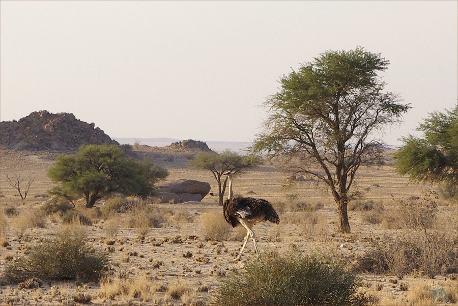
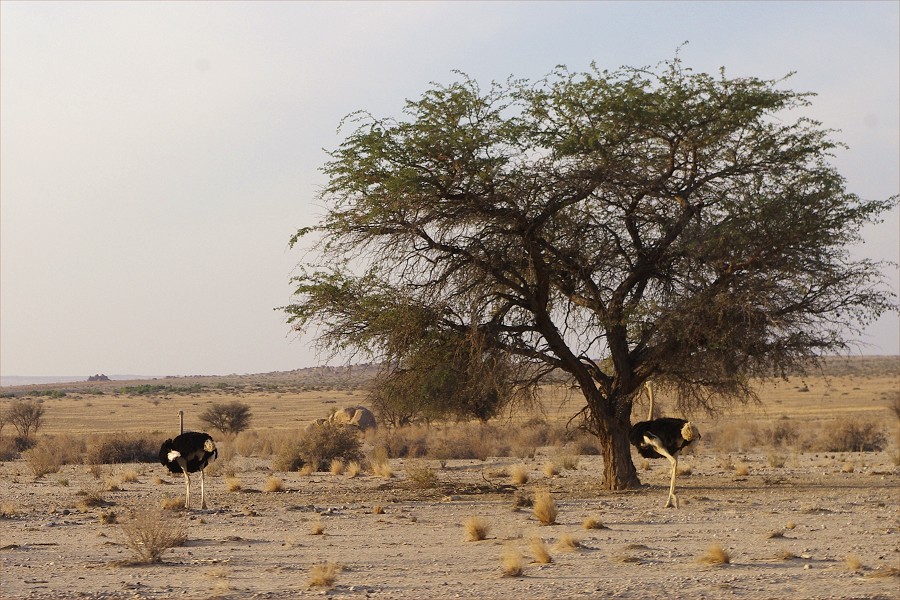
We reached the car park where Michael was waiting with the minibus well after the sun set over the Tsisab. However out on the plain there was still sunlight, we passed through a group of ostriches as we drove away from the Brandberg.
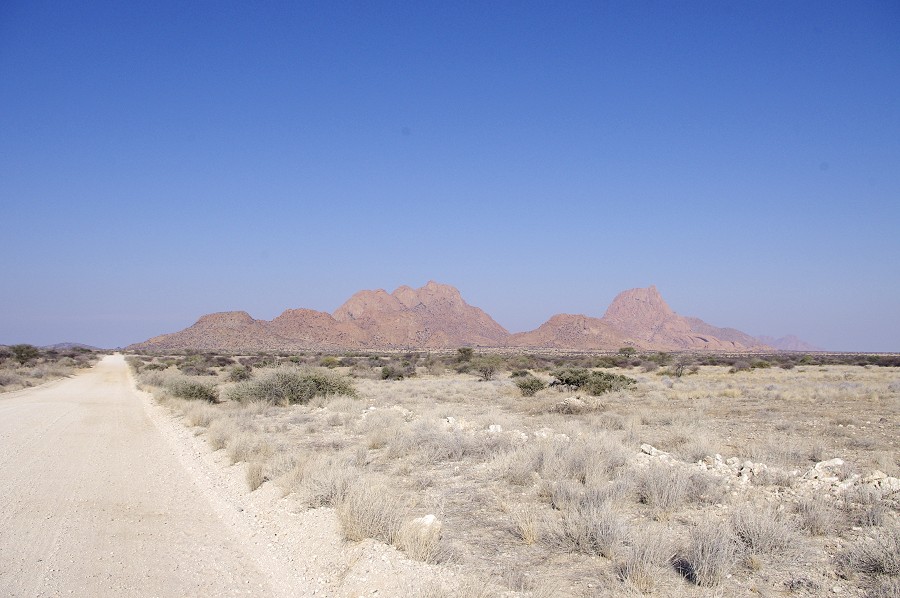
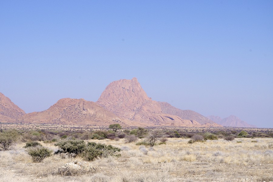
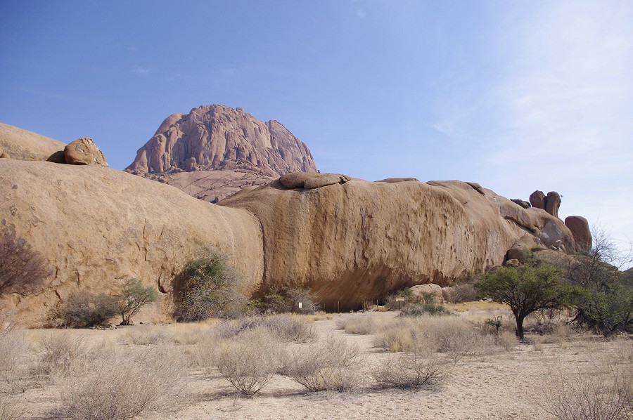
Day 11. - Uis - Spitzkoppe - Windhoek
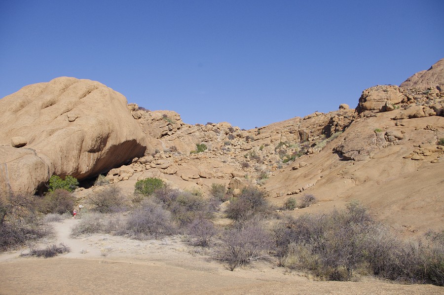
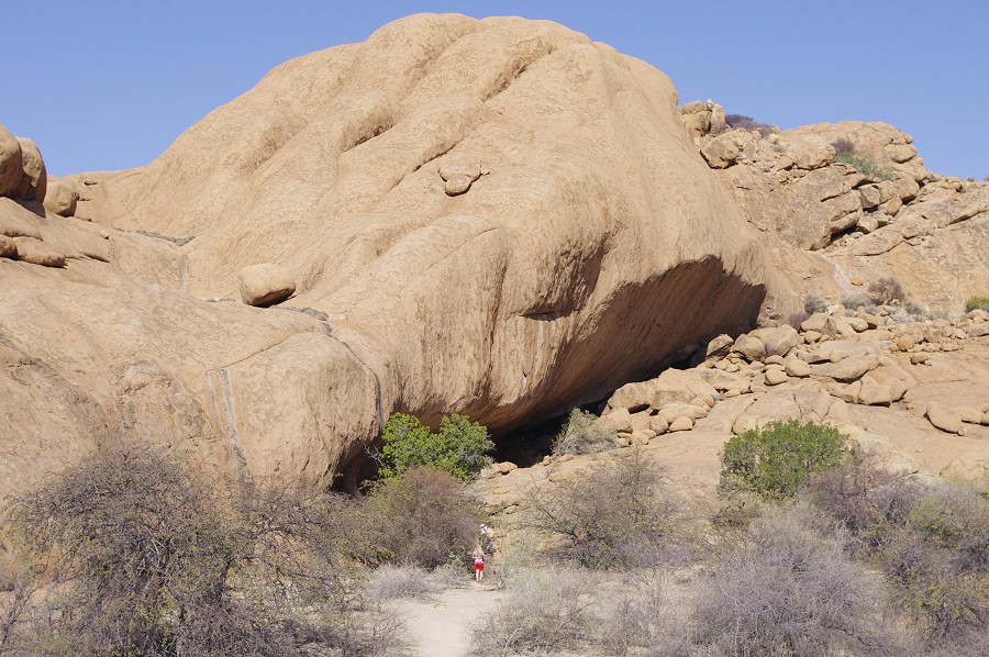
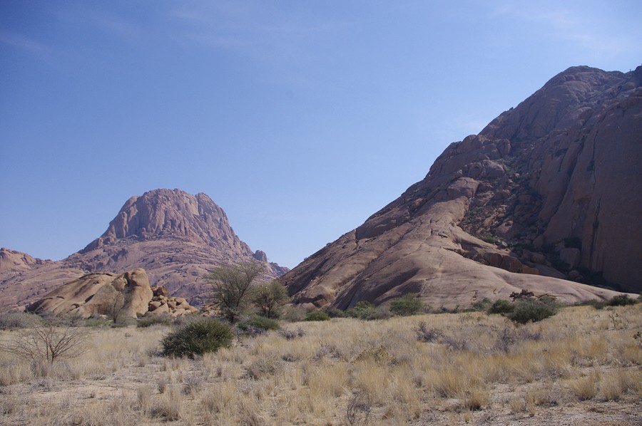
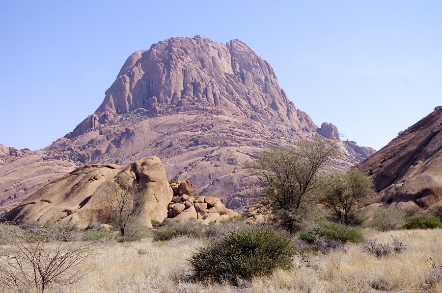
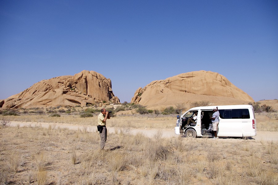
On our way back we planned on passing by the Spitzkoppe, a pair of prominent granite towers rising abruptly from the flat coastal plain about 80 kms south east of the Brandberg, and half as much west of the Erongo. They are very prominently visible in clear weather if one makes a descent through the Ga'aseb Gorge, which just faces them. They also contain a number of rock art sites, including two important ones which were copied and studied by the Abbé Breuil in the late nineteen forties. There is an almost direct route from Uis, we reached the pair of hills in little over an hour.
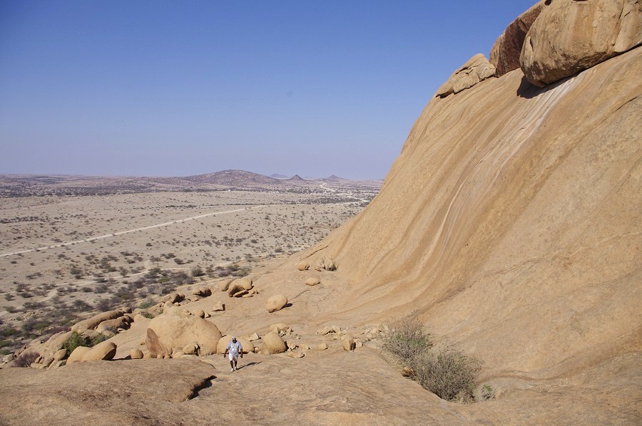
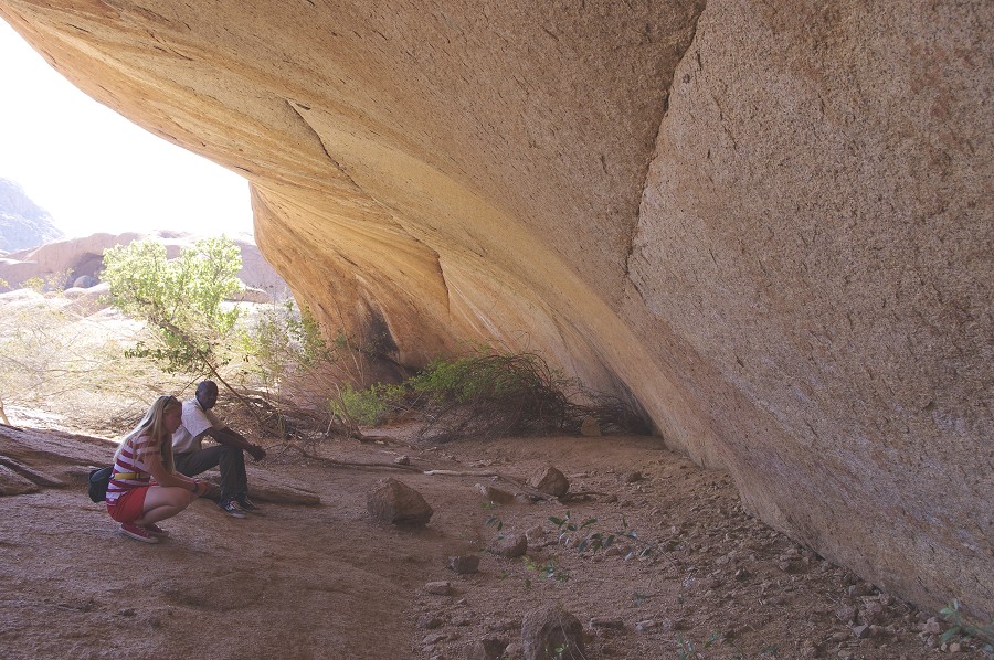
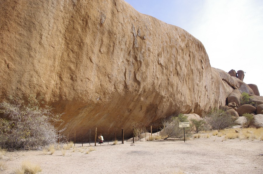
The most important Spitzkoppe site is the "Bushmen's paradise" a large shelter in a secluded little basin near the eastern end of Klein Spizkoppe, the Eastern of the two mountains. The shelter can only be accessed by climbing a rather steep smooth granite slope. Reaching the top one enters a very pleasant large basin with green vegetation, with the shelter along its south side.
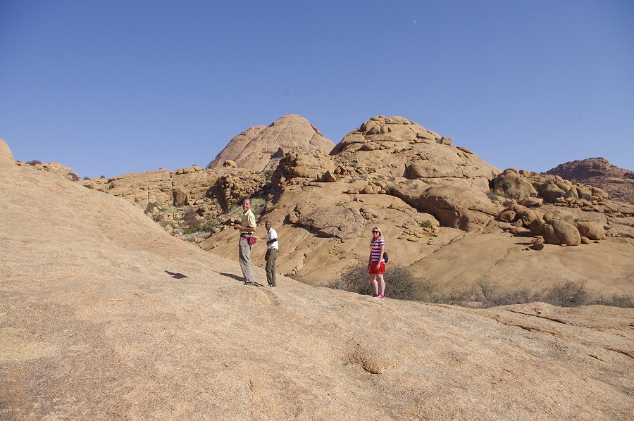
At one point it must have contained some excellent paintings, however they are now all very faint, no doubt to a large part attributable to the practce of wetting faint paintings to make them better visible (a practice "invented" by the Abbé Breuil, and also used extensively by the Lhote mission in the Tassili).
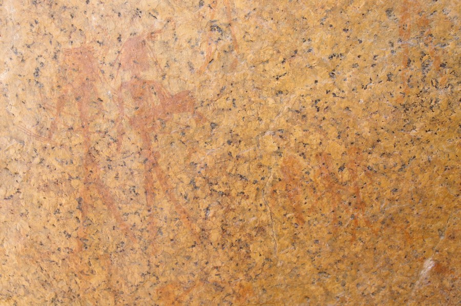
The second site, "Sphinx shelter" is located along the side of a lor granite ridge between the two hills. The name comes from a number of sphinx-like figures, the like of which may also be seen on the Brandberg. It contains a large panel of resonably well preserved paintings, it is certainly the better of the two princpal Spitzkoppe sites.
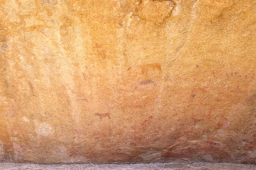
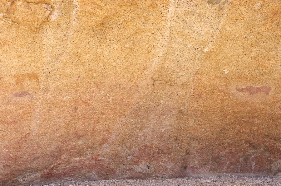
The name comes from a pair of strange sphinx-like figures, the like of which may also be seen on the Brandberg. There are several more unusual figures scattered about this site togeher with the common animal and human depictions.

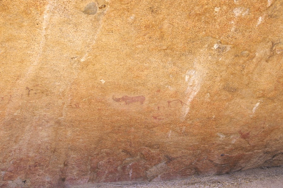
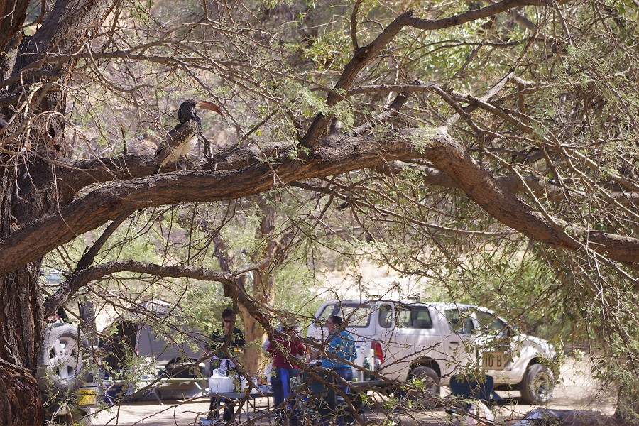
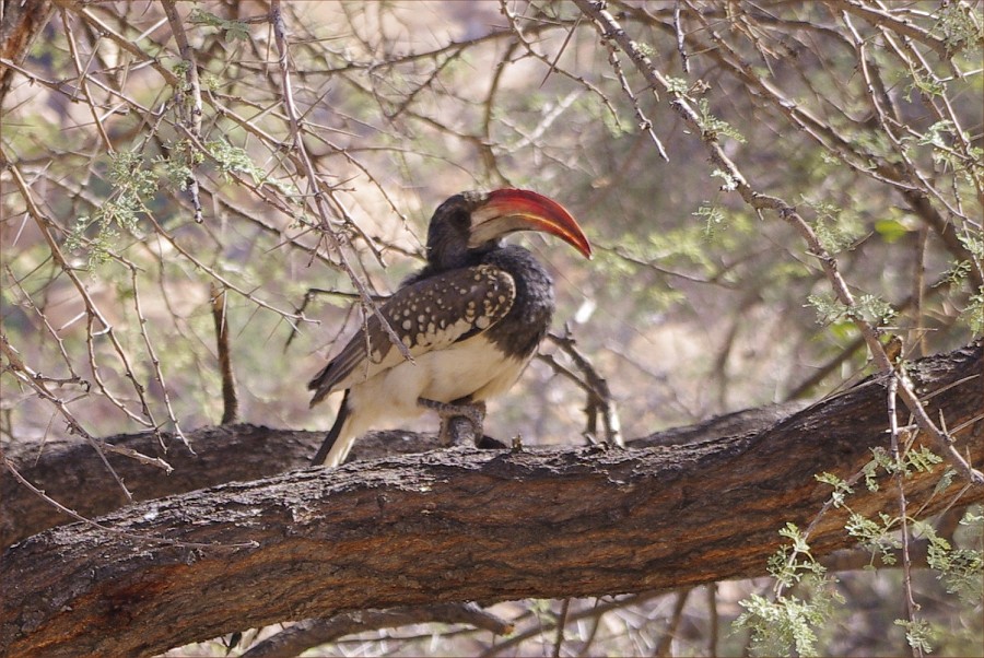
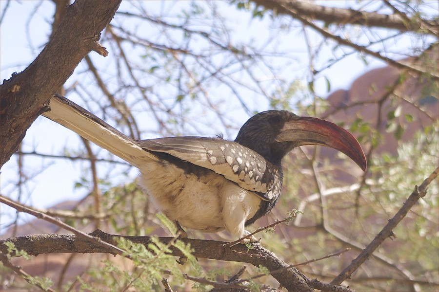
We also saw a third site at the Gros Spitzkoppe which was reccommended by Alfons, containing an eared serpent and several fine human figures, rather difficut to photograph as the whole panel was fully out on the sun. Unlike the other two sites we saw, this was not fenced-in, it was just on the side of a large rock forming the rear of one of the numerous camping places. The adjacent large tree was inhabited by a pair of hornbills who were apparently very experienced in teasing the visiting tourists, patiently waiting on a branch as one walked quietly close and took the time to get them in good focus, then hopping over to an adjacent branch just as one was about to press the shutter release...
Having seen all what we wanted, we started our drive back to Windhoek along the Swakopmund highway that passes close to the Spitzkoppe, to drop off Uwe at the airport for his evening flight back to Germany.
Day 12. - Windhoek
With Jon we stayed a long lazy morning in Windhoek, as our flight back via Johannesburg only departed mid-afternoon, reaching Jo'burg just after sunset.