
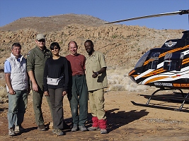
 Click on image for list of participants |
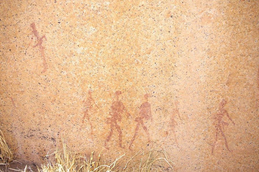
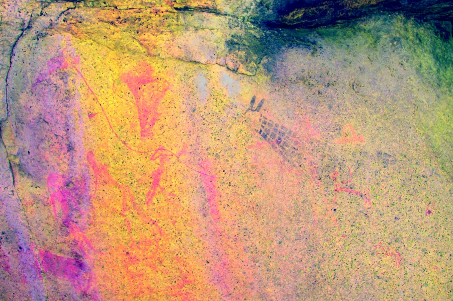
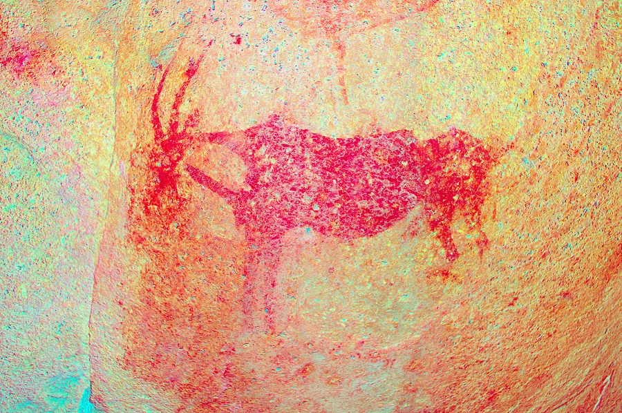
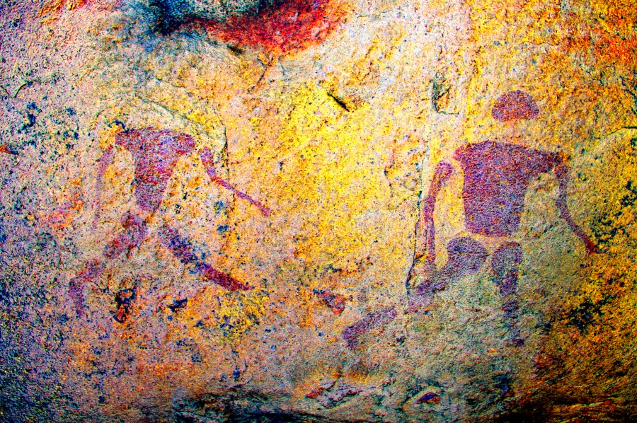
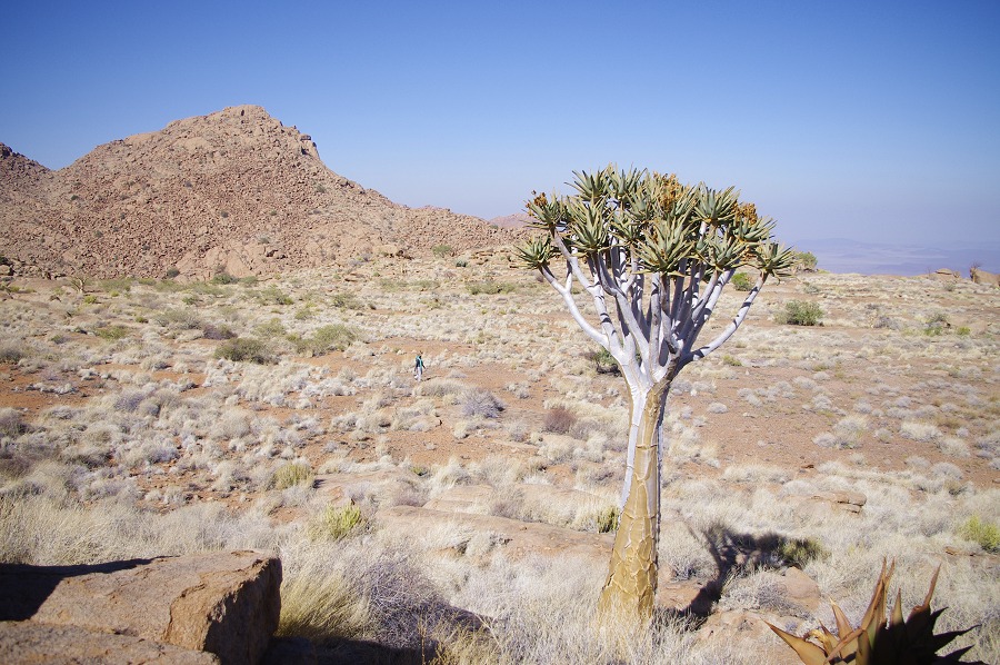
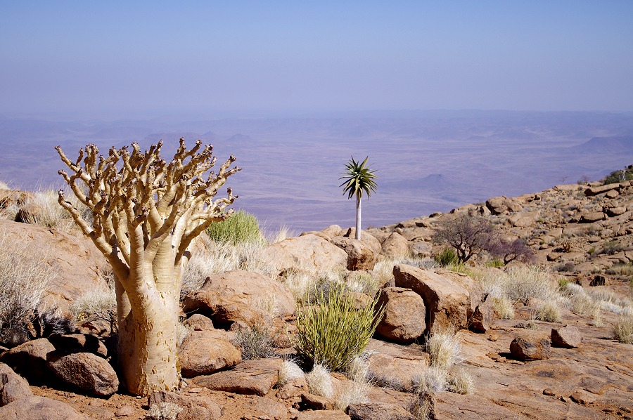
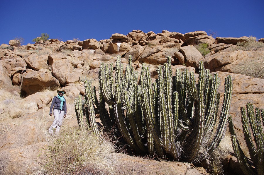
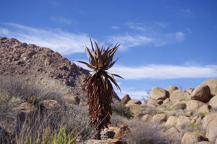
Upper Brandberg, Namibia 10th - 19ndJune, 2013 All site references based on Harald Pager's numbering system False colour images processed with dStretch, a freely available software developed by Jon Harman |
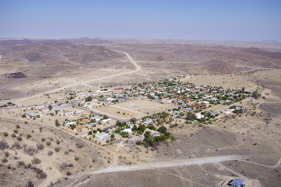
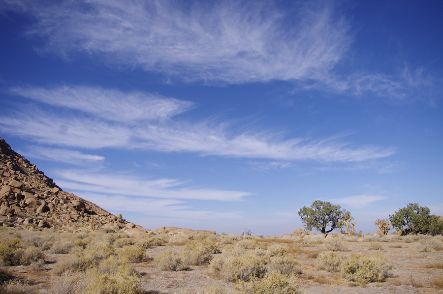
Day 1. - Windhoek - Uis
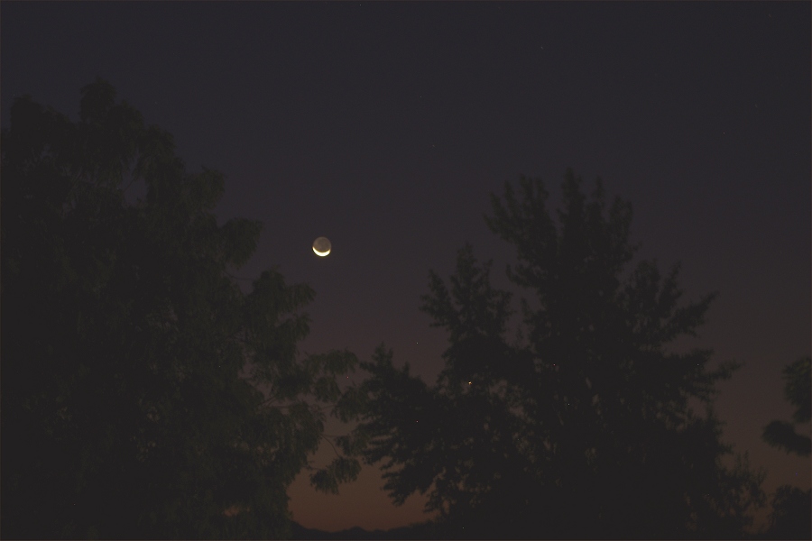
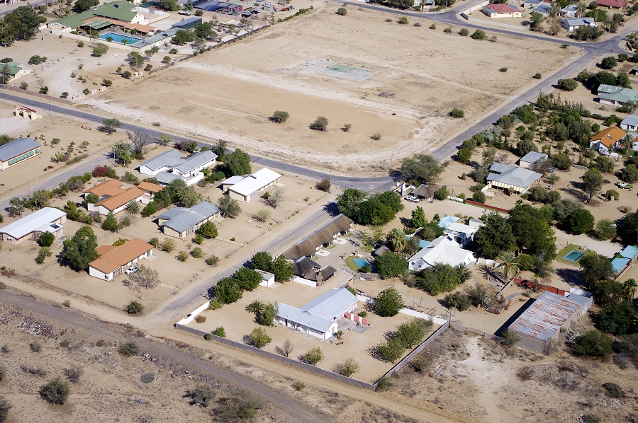
Most of our party reached Windhoek a day or two early, flying in from different continents. Learning from the experience of last year (Air Namibia was again down to one single aircraft, the other being on maintenance) I did not risk the only available direct flight from Europe, but came via Johannesburg, a safer option with multiple daily connections. We met with Nija and Uwe the day before, doing our shoping for the trip. As soon as David was collected from the airport on the morning of departure we set out on our journey, stopping at Okahandja for lunch before moving on to Uis, staying at the White Lady B&B with Annalene and Karl. In the evening there was a lovely new moon in full earthshine, a perfect backdrop for our evening walk to dinner.
Day 2. - Twyfelfontein
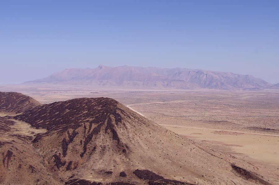
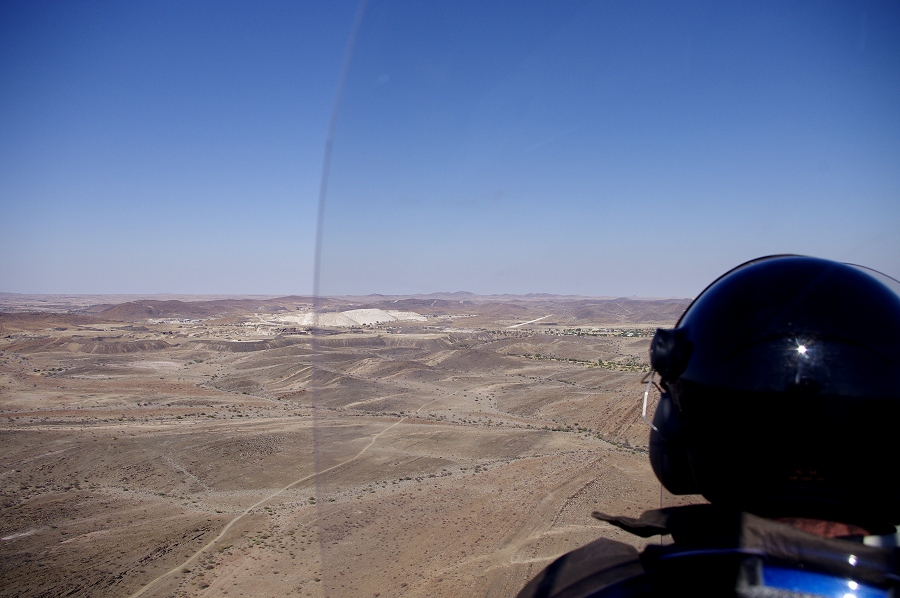
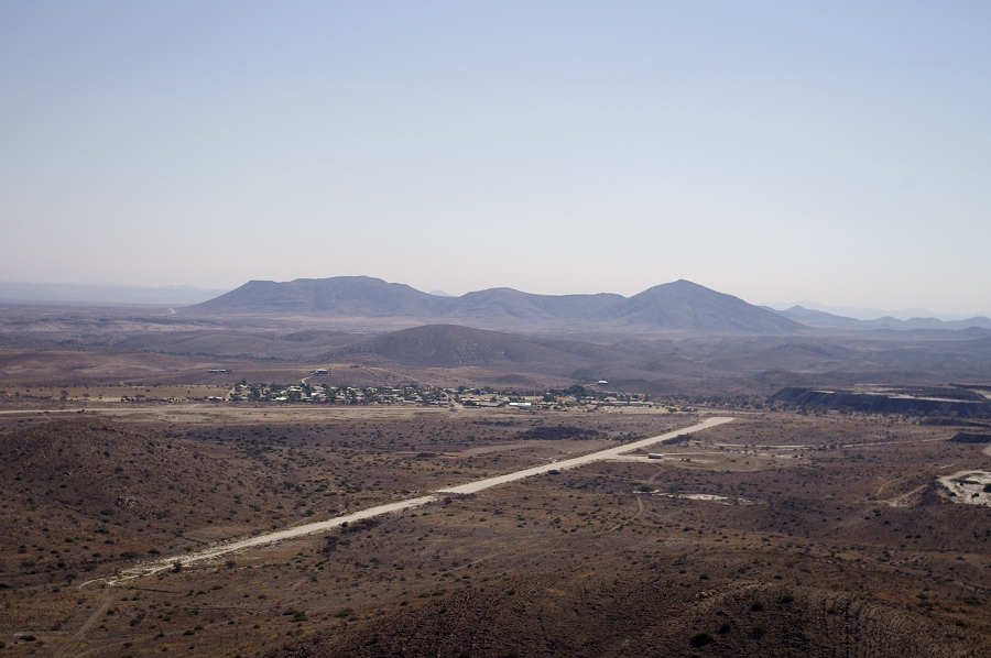
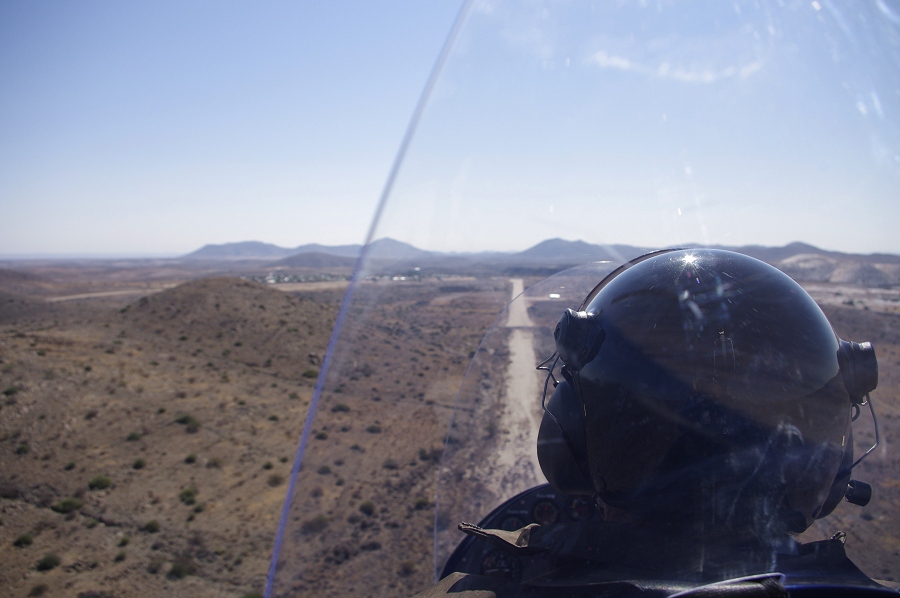
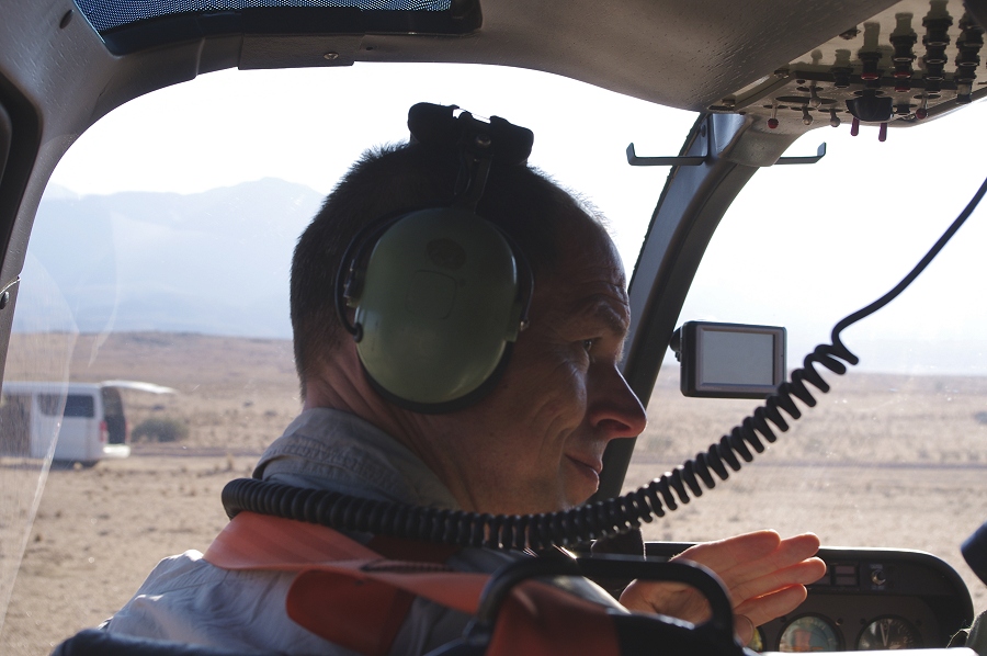
Mark and our party went to visit the engravings of Twyfelfontein some two hours from Uis, whle I stayed behind to pack and label the supply boxes to be uplifted to the mountain. Mid morning Karl tempted me with an offer I could not refuse - to join him for a flight in his gyrocopter for a round of game-spotting. We drove out to the airfield just outside town, and Karl started to prpare the machine for flight. Despite their appearance gyrocopters are more airplanes than helicopters. the rotor is only powered during take-off for a short take-off run, afterwards it is de-coupled from the engine and it is only the rear propeller working, the rotor is turned to produce lift by the airstram.
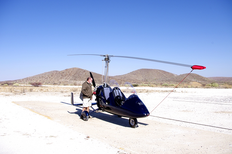
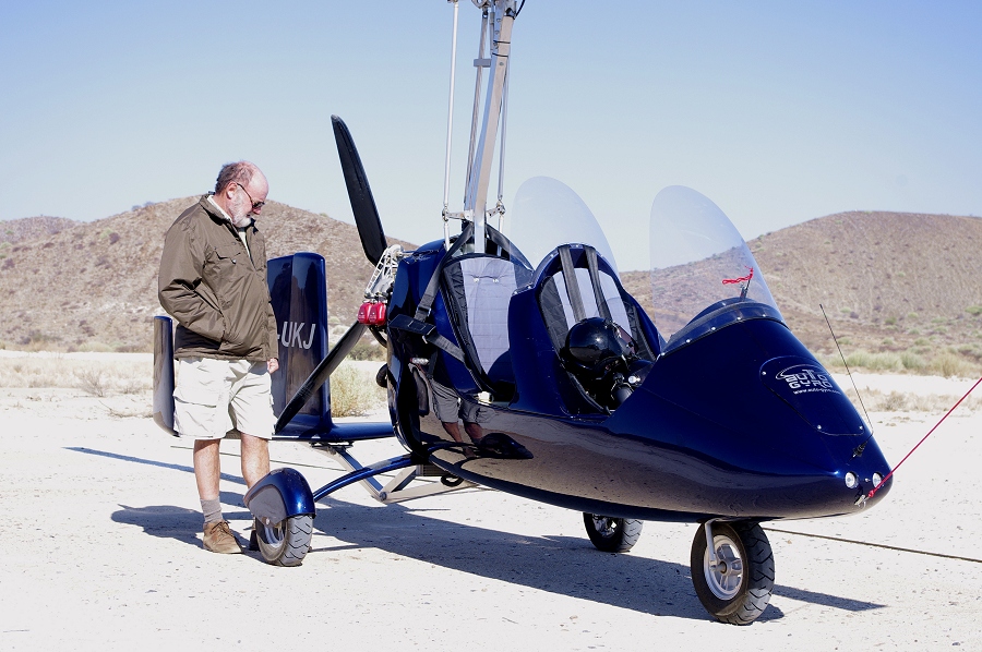
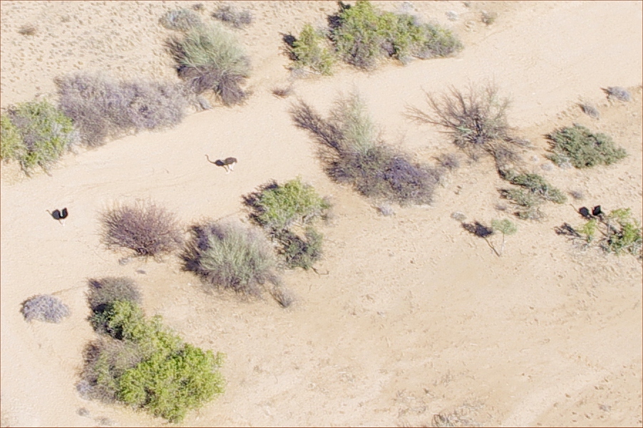
After a short taxi to the runway and an even shorter take-off run we were in the air, flying remarkably smoothly in the rather strong gusty wind. We made a big loop around Uis, first towards the east where Karl saw some oryx the day before. We flew over the vallet where Karl expected the oryxes, but now there was no trace of them, we only saw three ostrich, not particularly bothered by the noisy contraption above them.
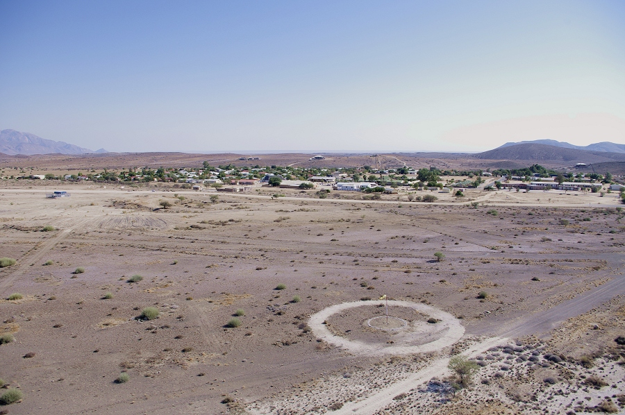
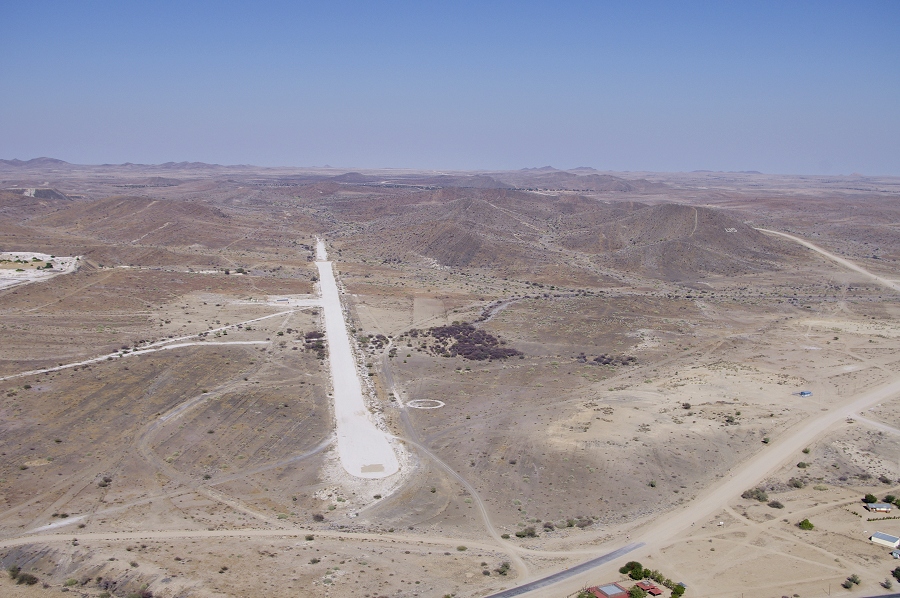
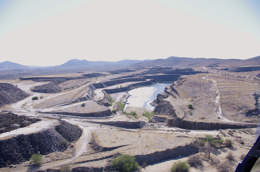
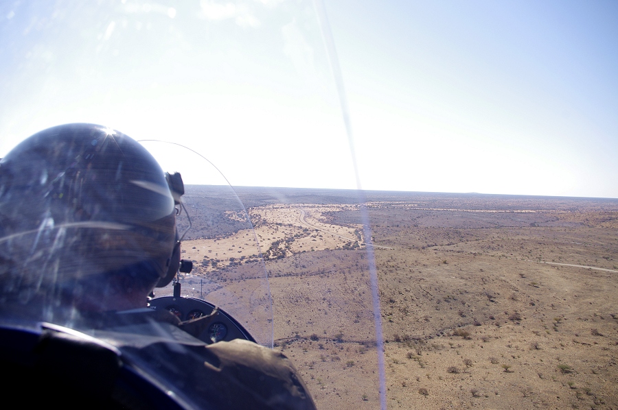
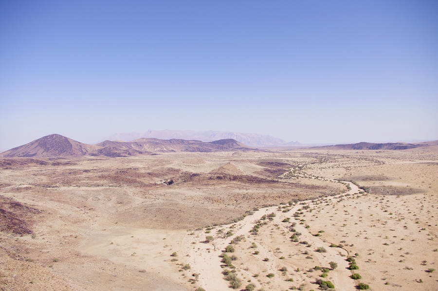
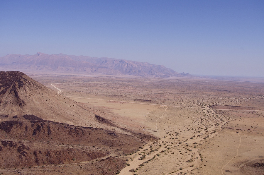
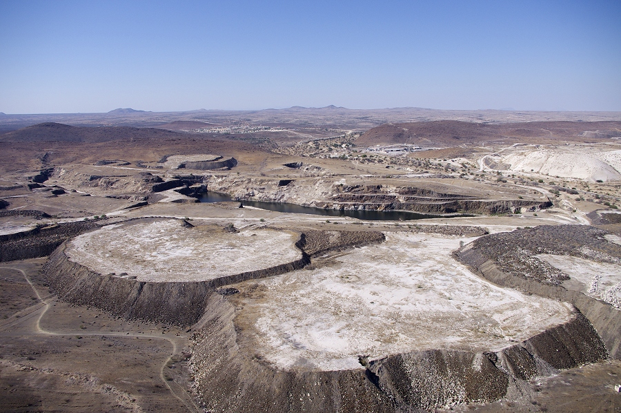
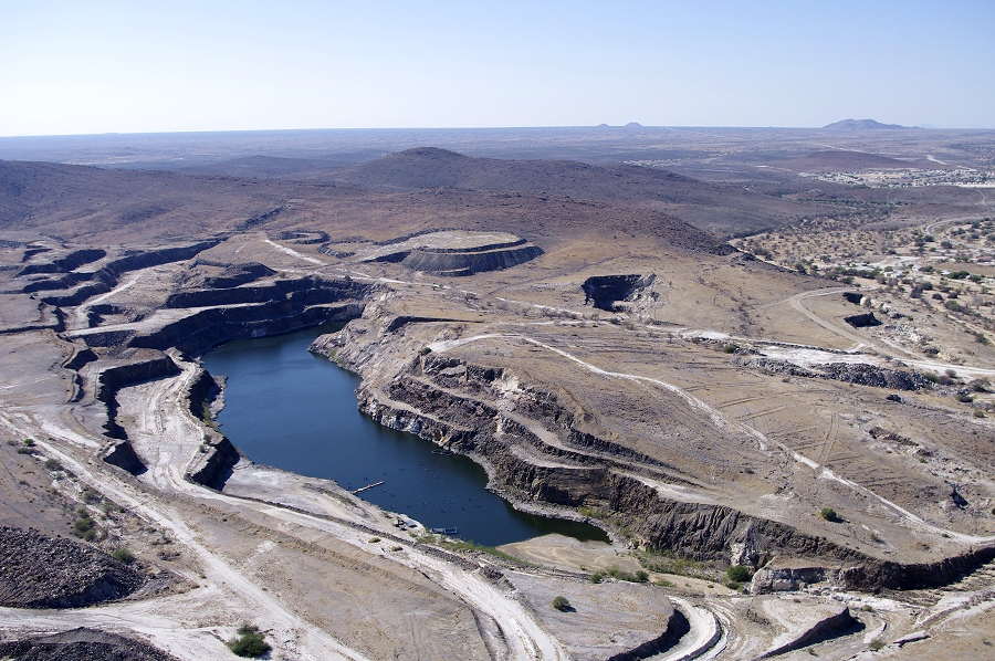
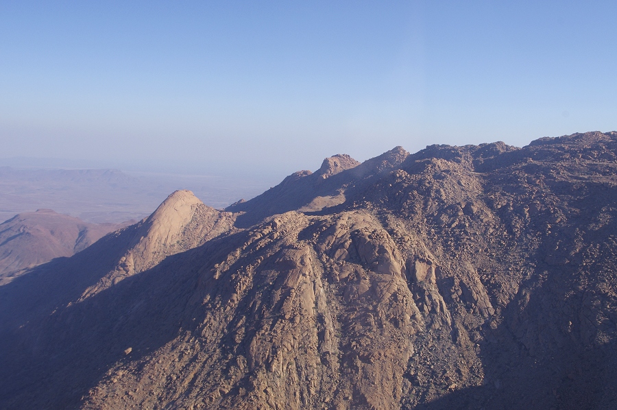
Finding no game, we made a wide turn towards the Brandberg, and then back towards Uis. After circling over the town and the mines we made a low approach to the airfield, slowing to almost a hover in the final flare, the landing run was probably less than twenty metres.
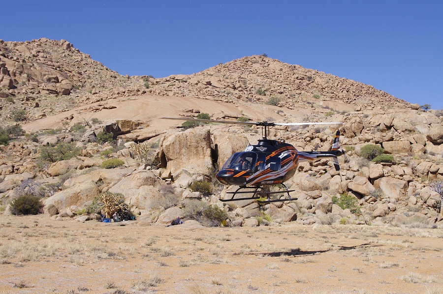
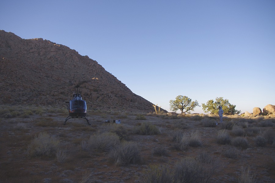
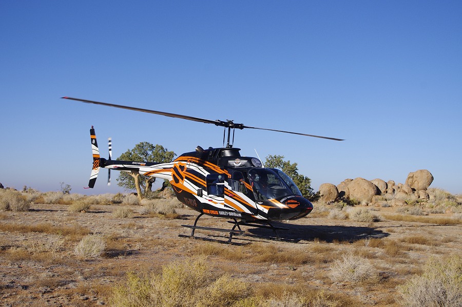
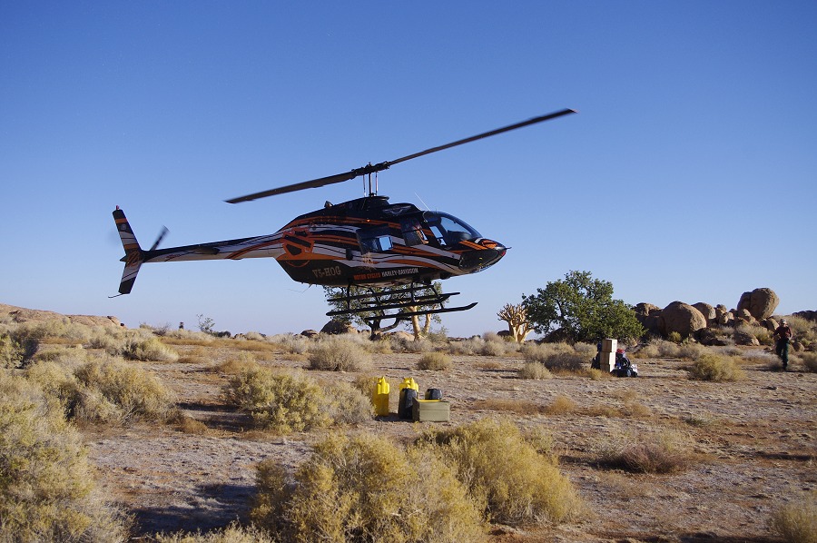
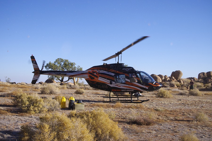
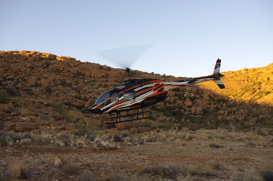
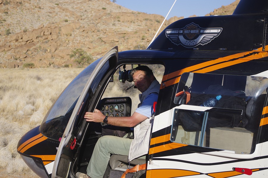
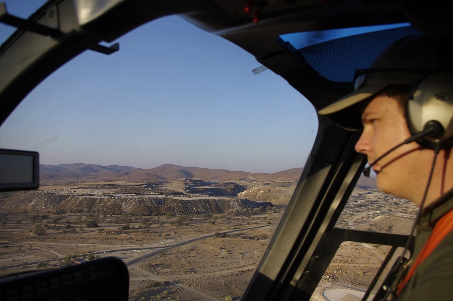
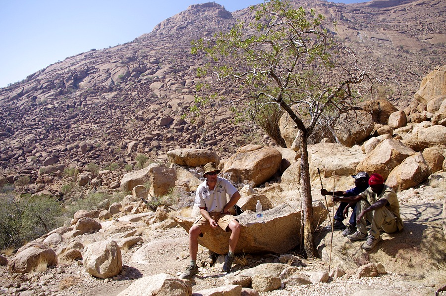
Stefan arrived with the helicopter mid-afternoon, a little before the others returned with Mark. In the evening after dinner we worked out the flight plans and fuel requirements for the various days. All the National Heritage Council permits were in order too, the process was evidently much more oiled than the previous year.
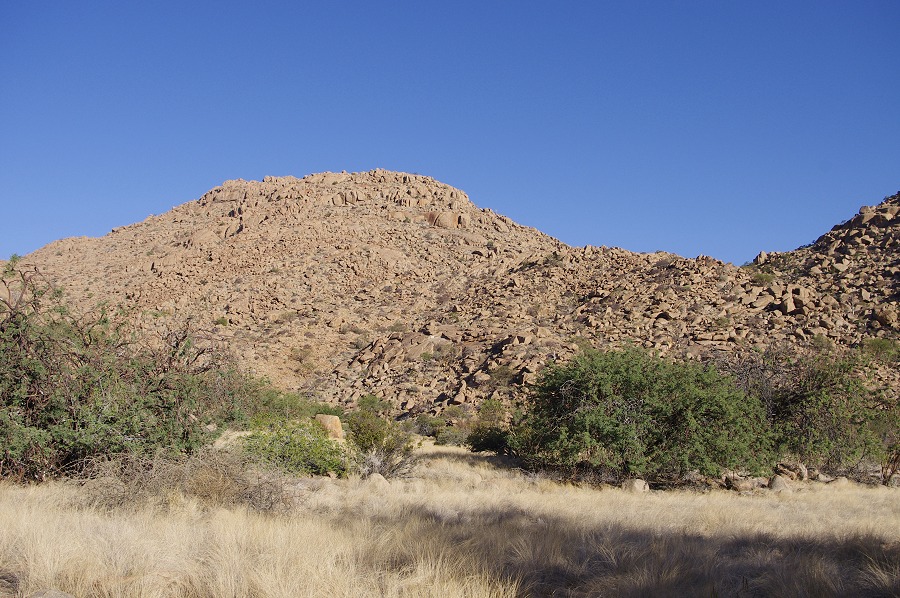
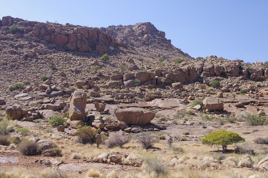
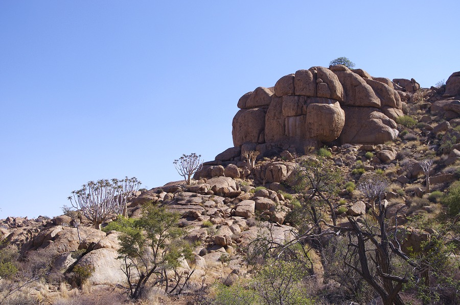
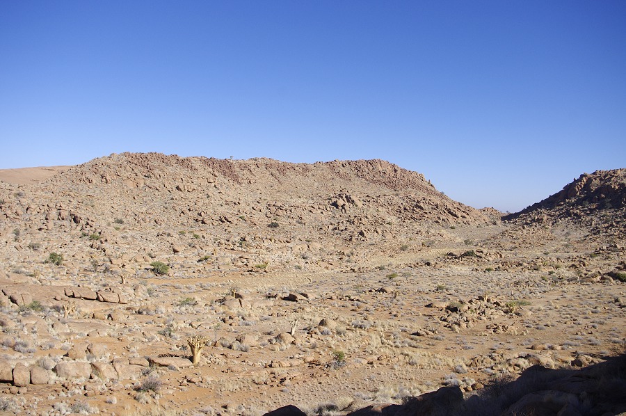
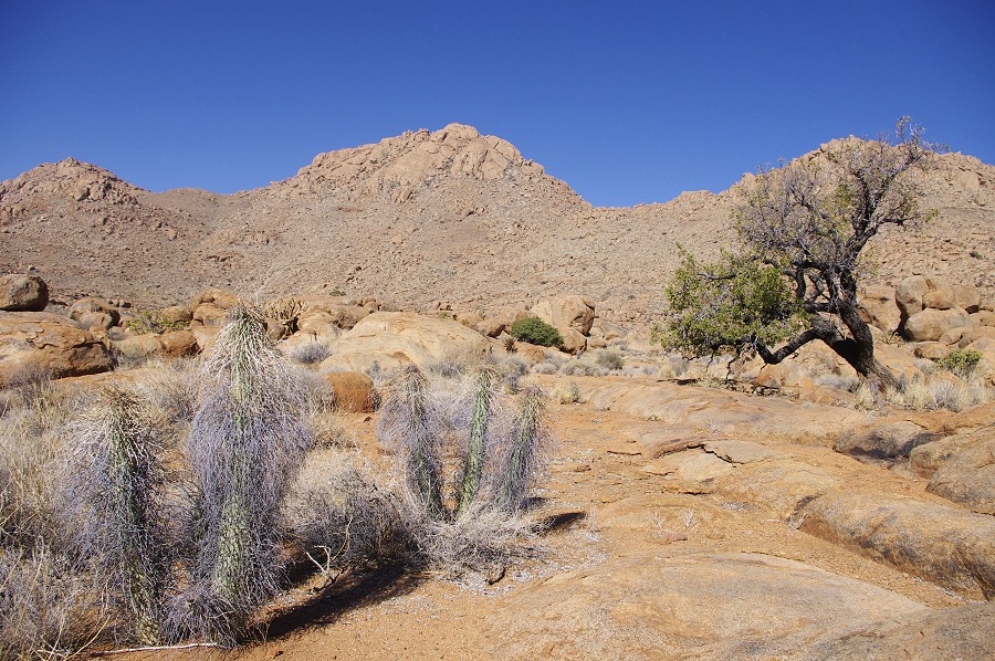
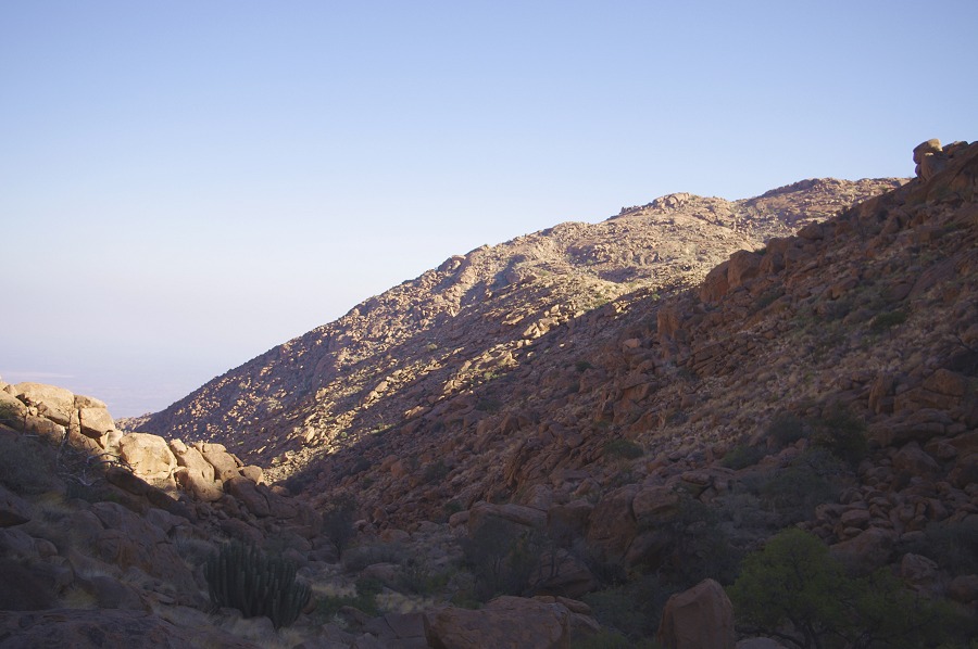
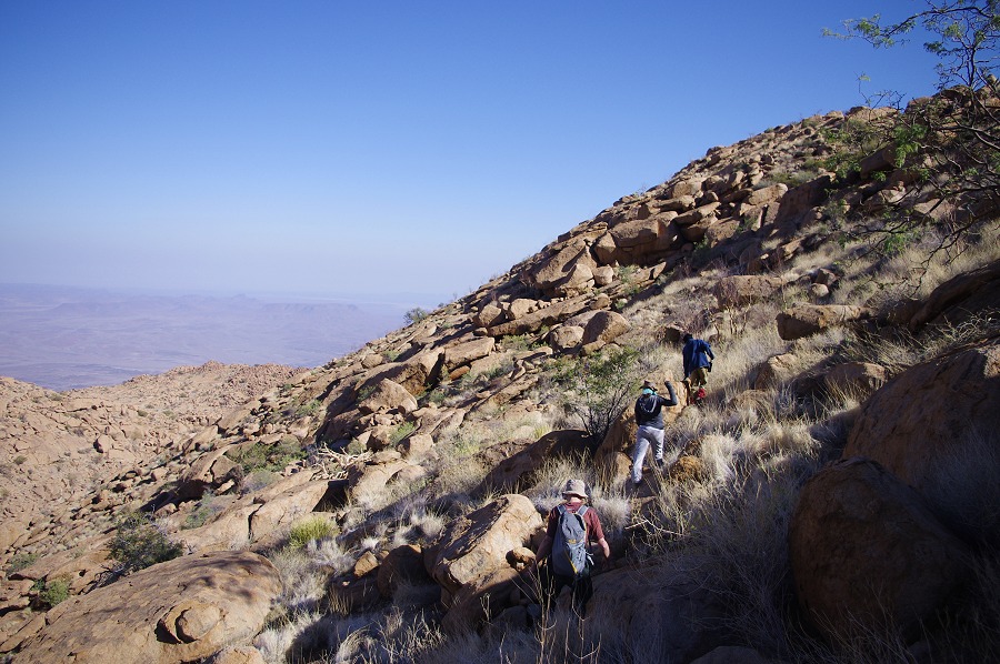
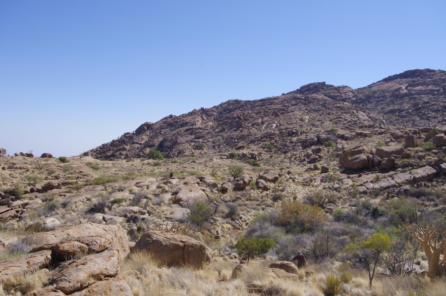
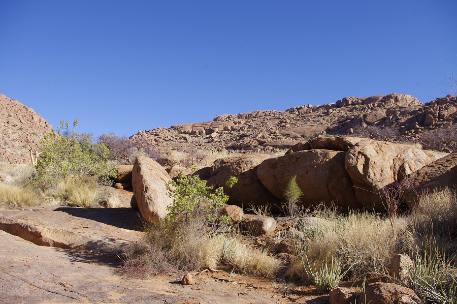
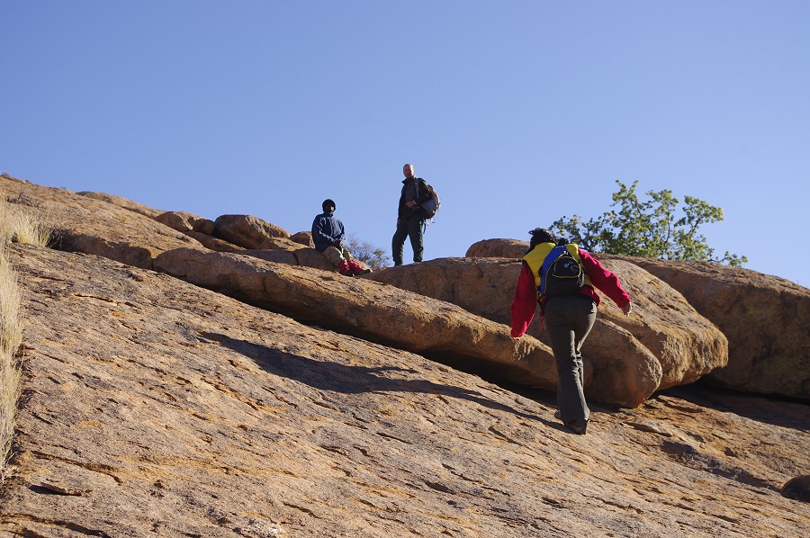
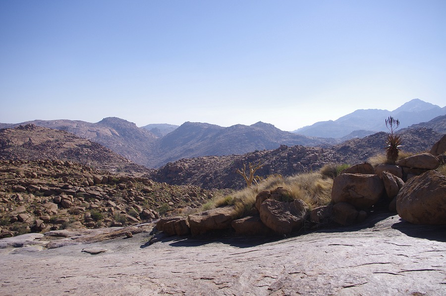
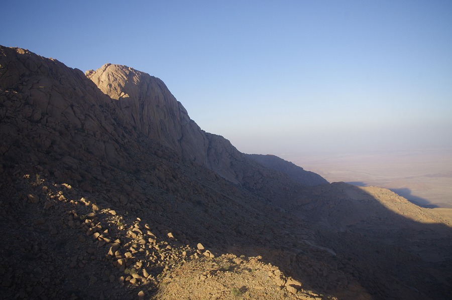
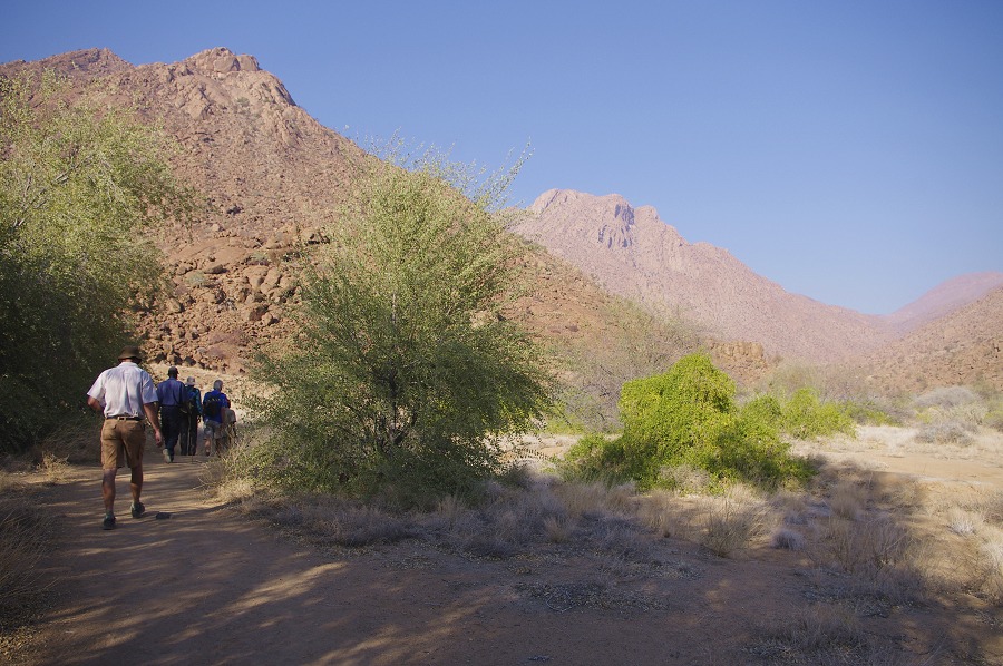
Day 3. - Upper Amis Gorge
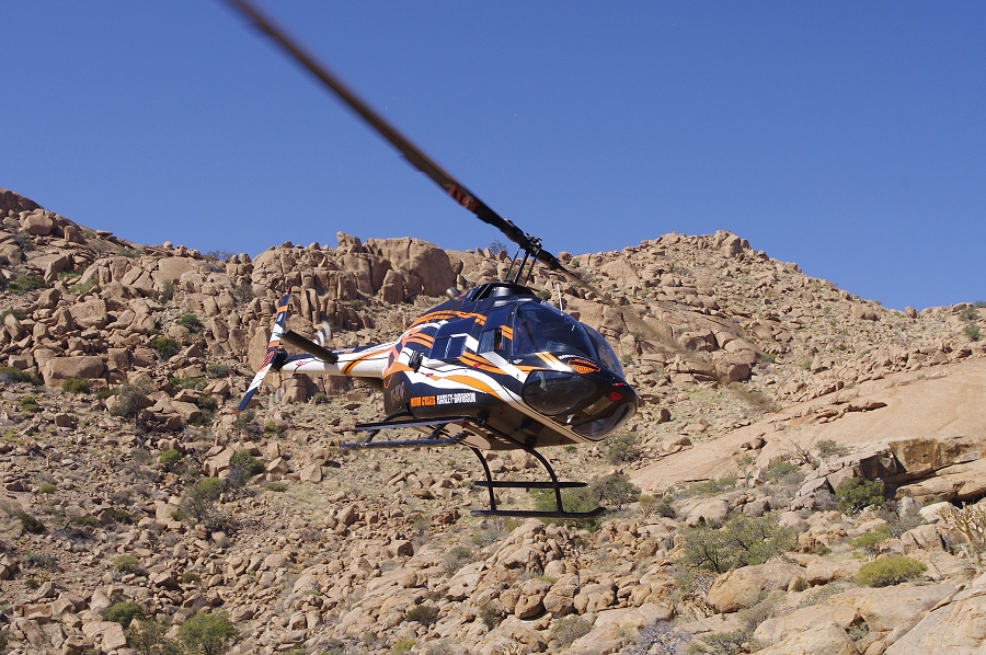
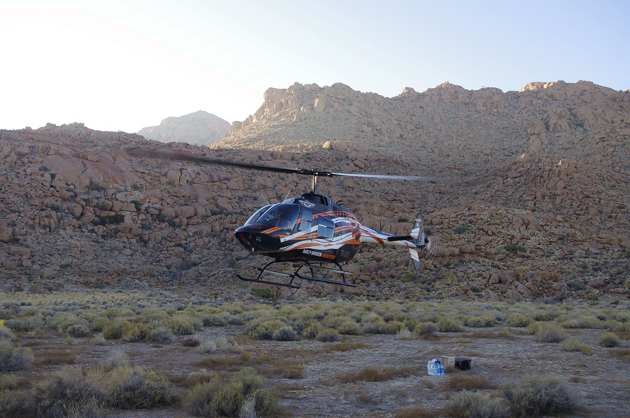
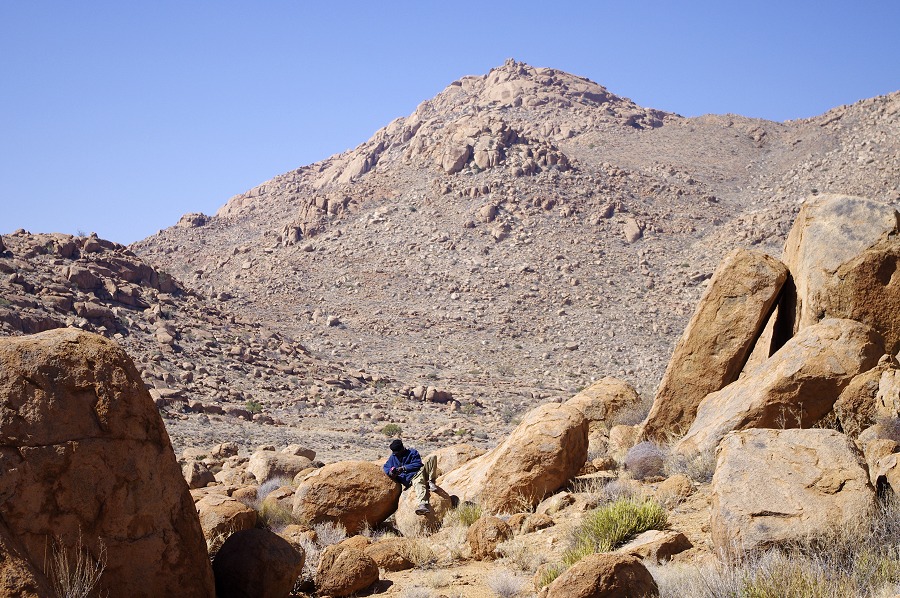
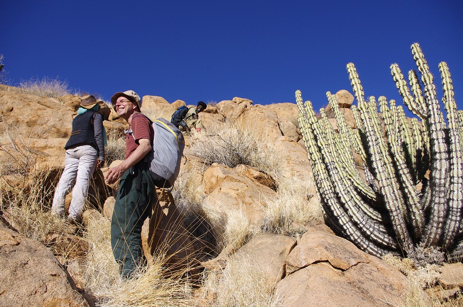
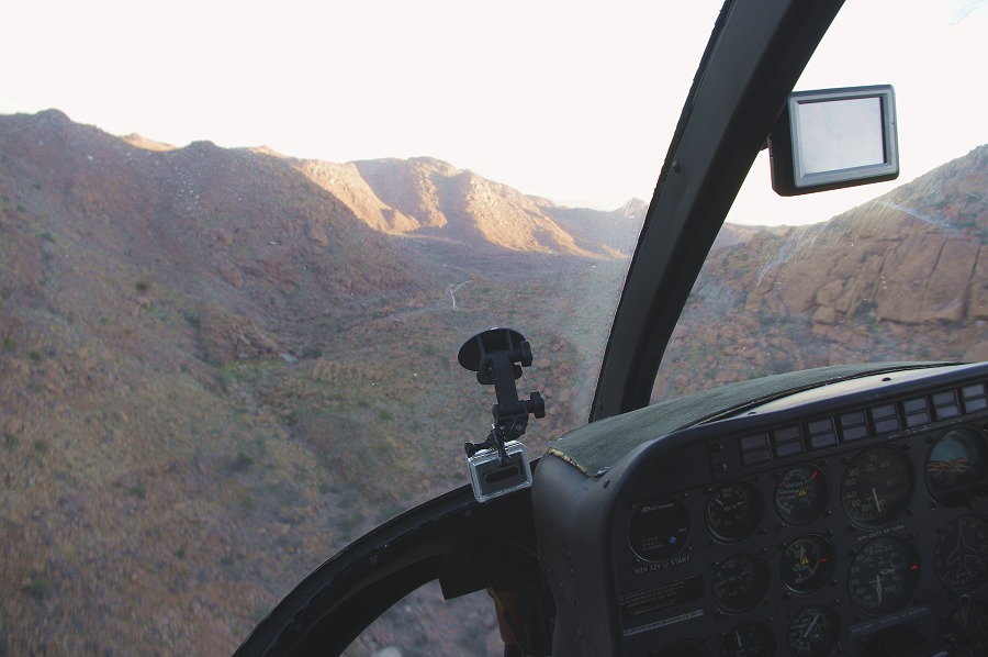
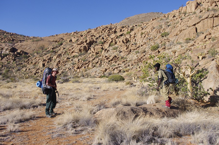
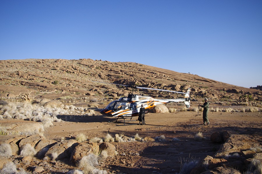
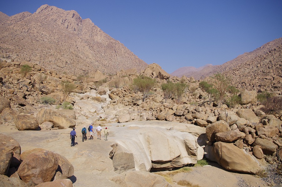
Next morning it was the usual pre-dawn rise, and after a quick breakfast we set out on the West Brandberg road to reach our rendez-vous point by the agreed 7am. There was no fog, Stefan caught up with us a few kilometres before the agreed spot near the Hungorob river, buzzing the minibus before coming down to land. After the briefings Alfons and David immediately went up with most of the supplies to the Amis campsite with the first flight.
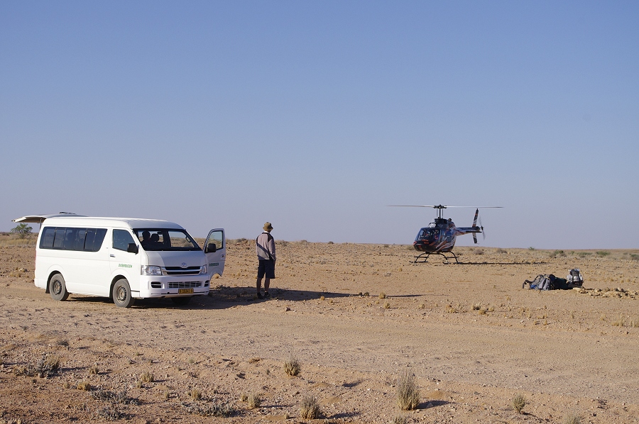
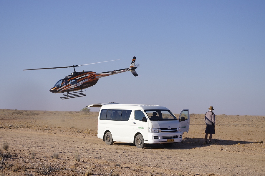
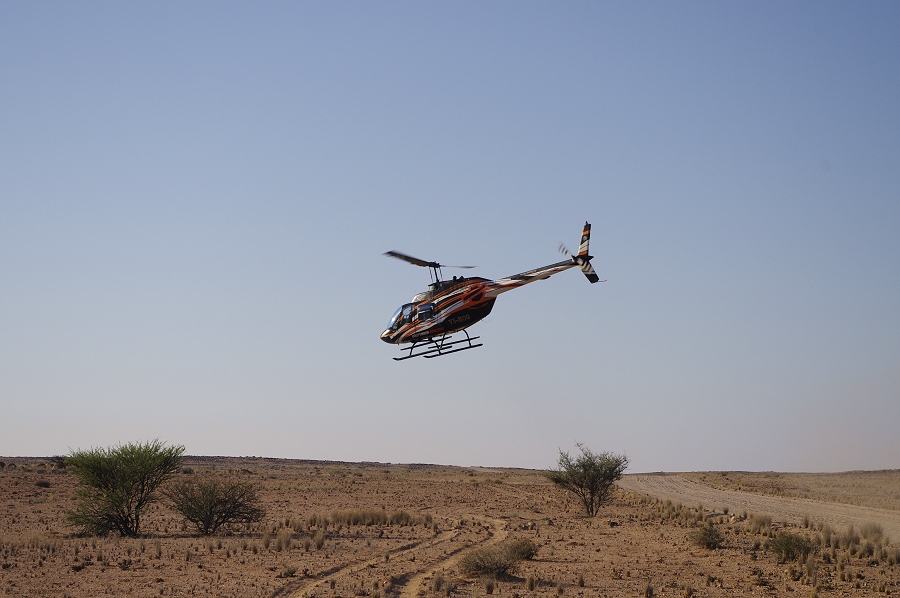
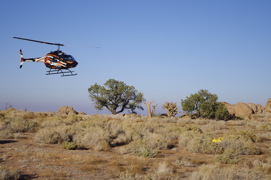
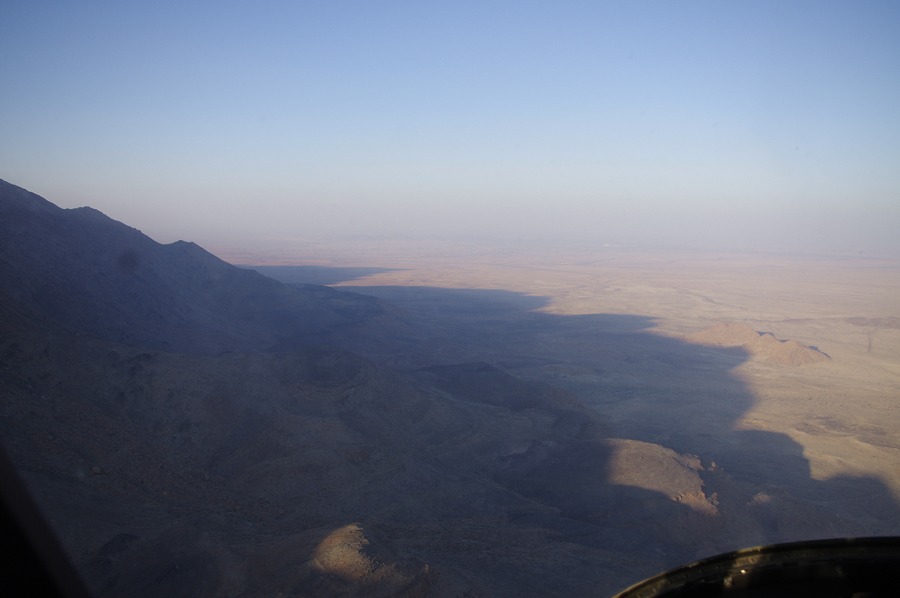
Stefan was back in less than 15 minutes, we quickly fueled and loaded our supplies, then said good bye to Mark and took off for the mountain. From the road it was a quick six-seven minute flight to the Amis campsite, passing by Dom peak, the narrow crack holding the water hole, and the "Wind Shelter" (A6) before landing on the small plain.
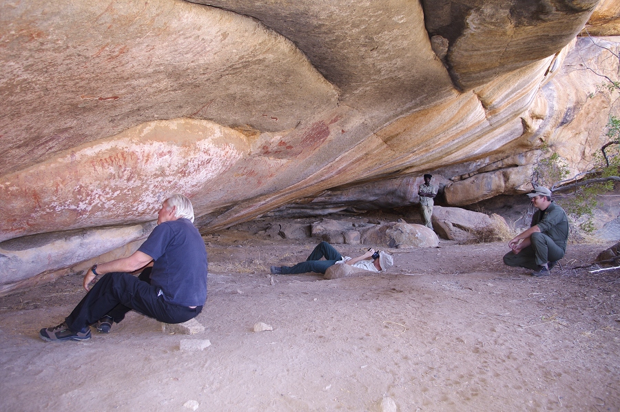
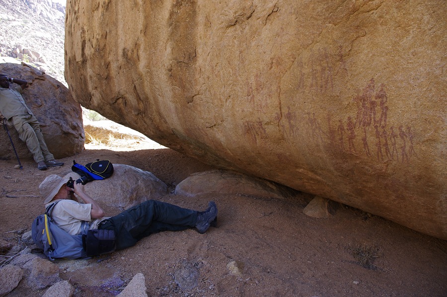
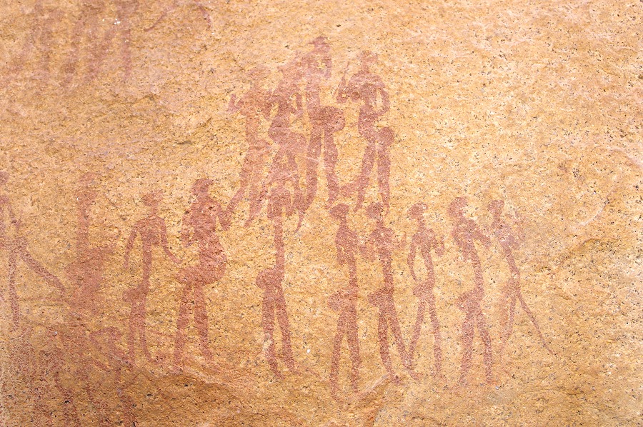
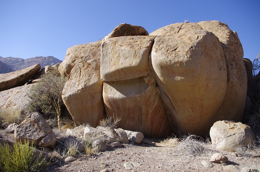
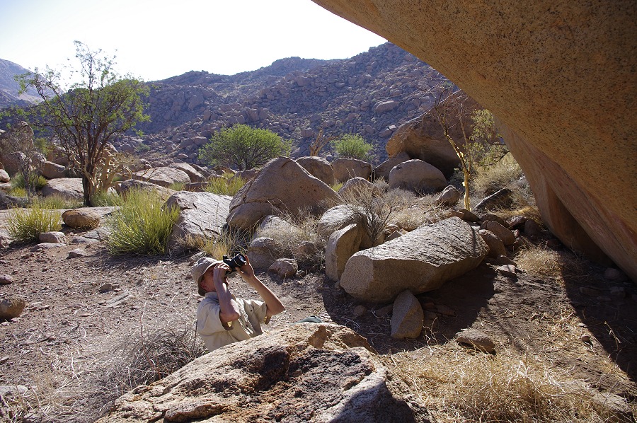
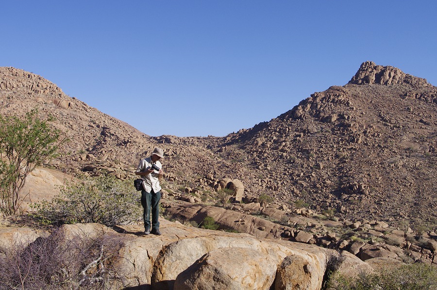
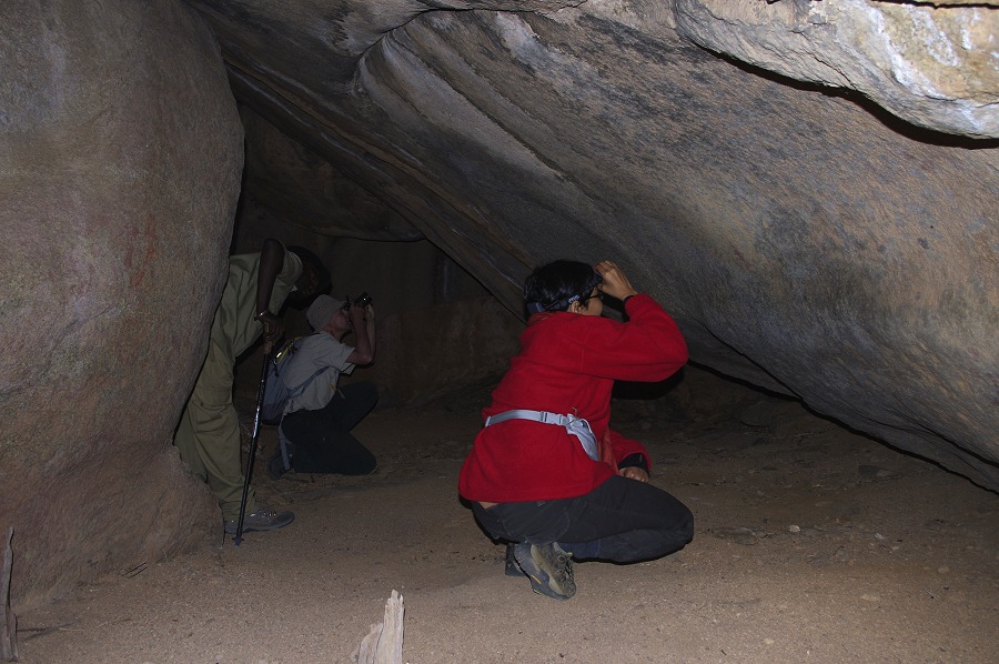
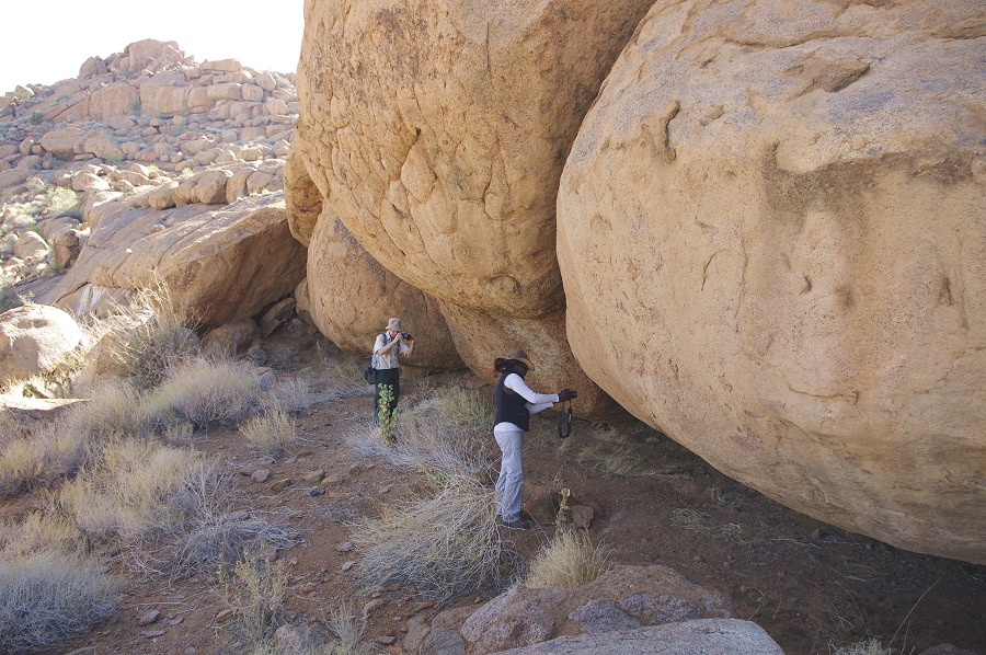
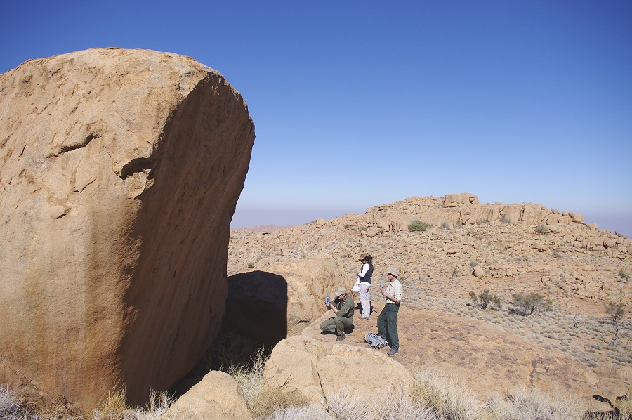
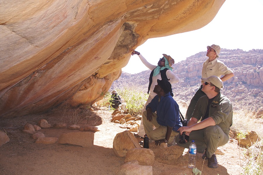
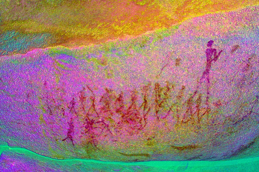
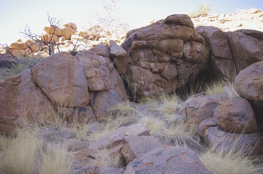
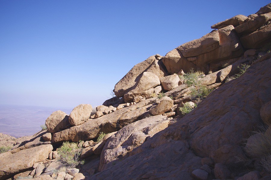
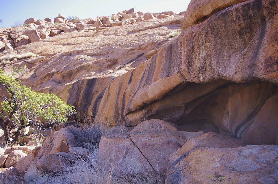
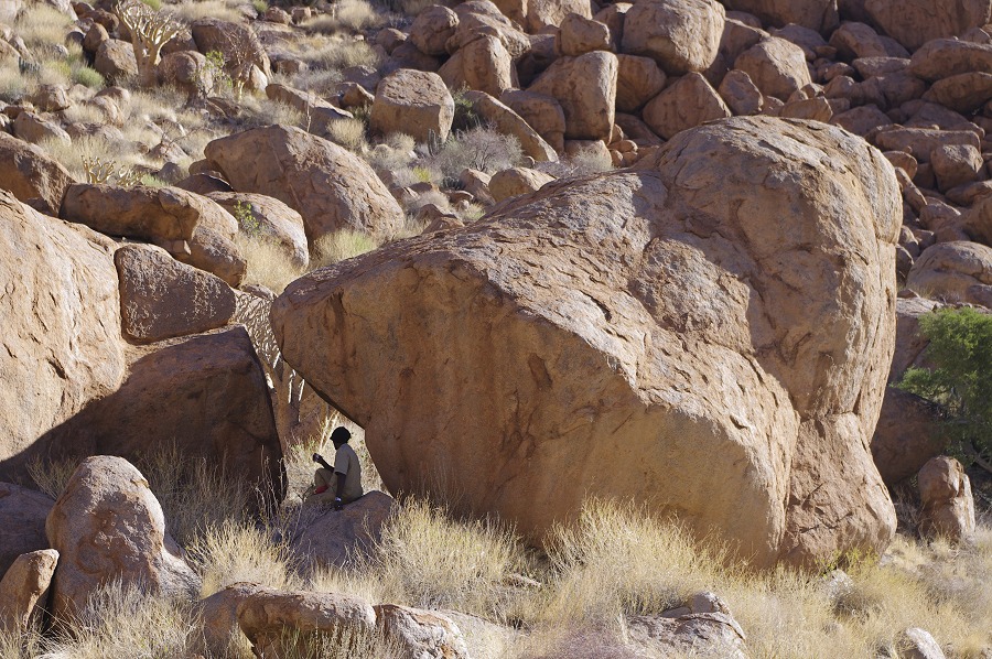
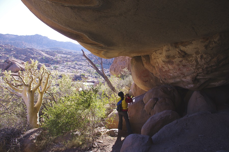
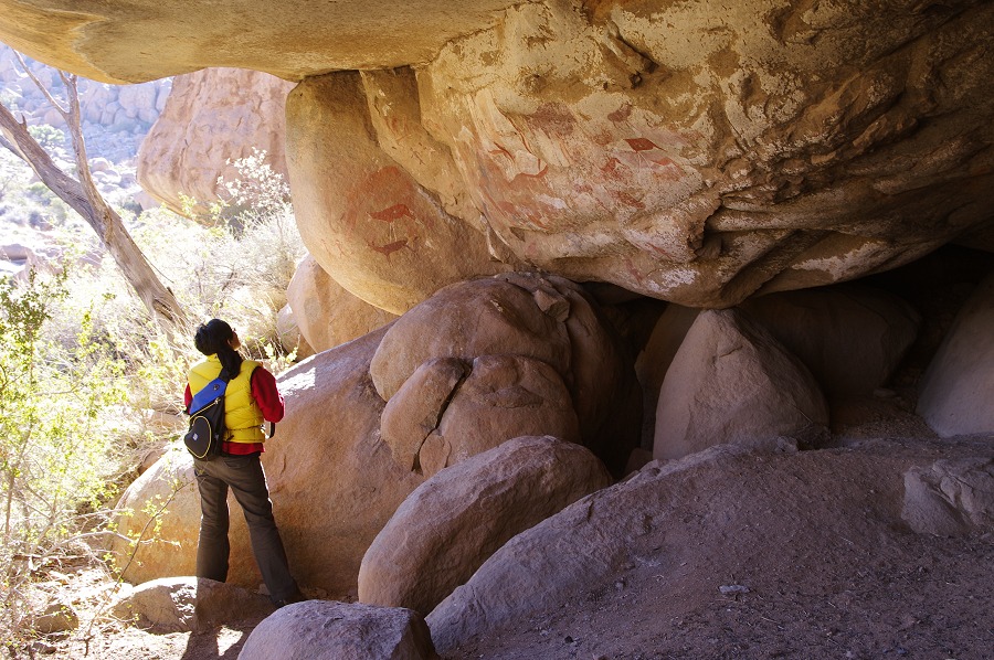
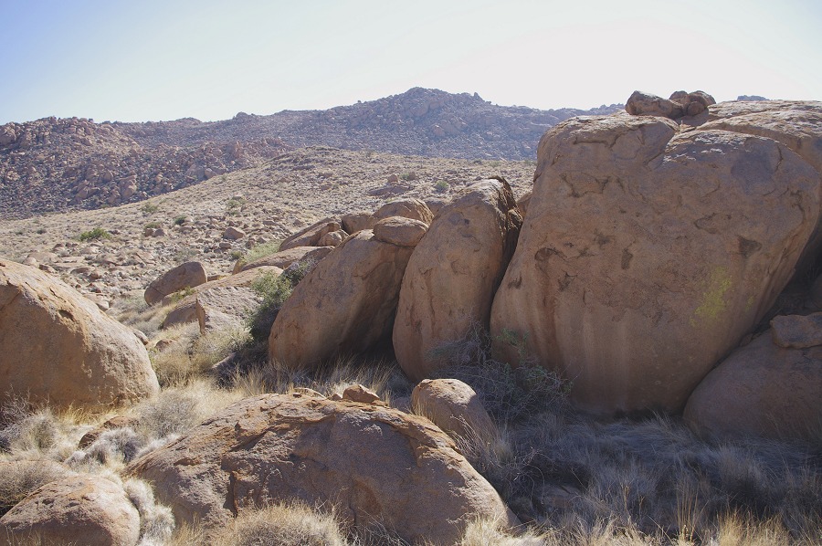
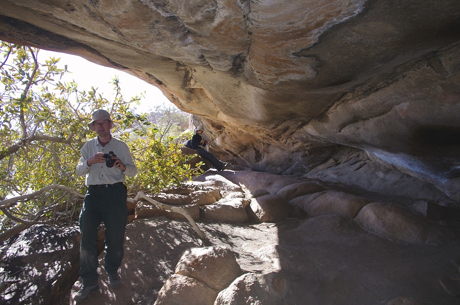
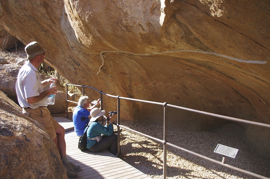
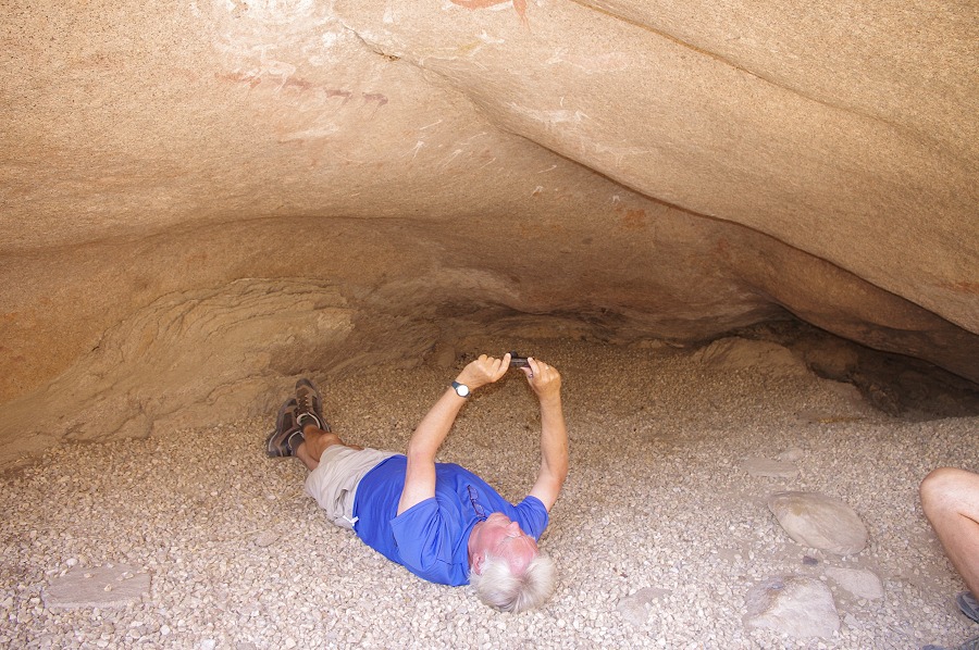
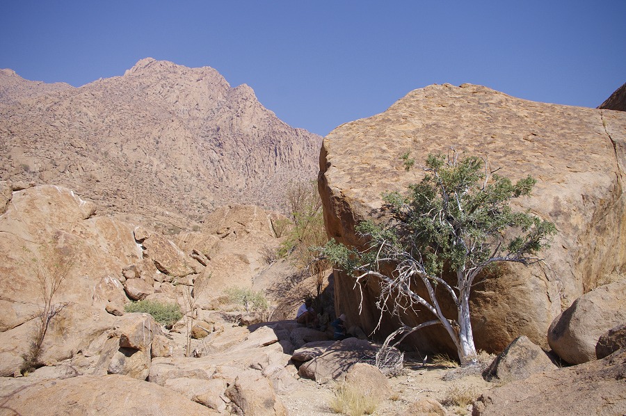
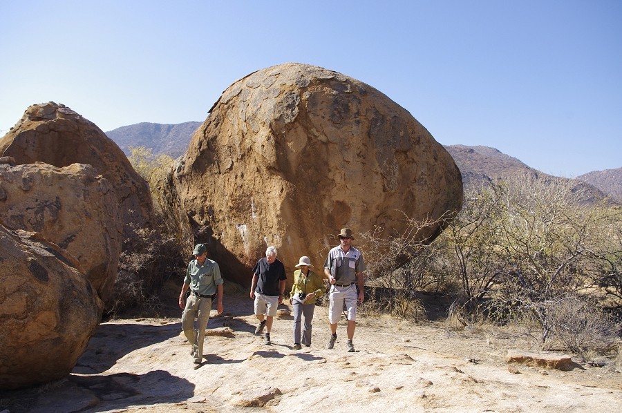
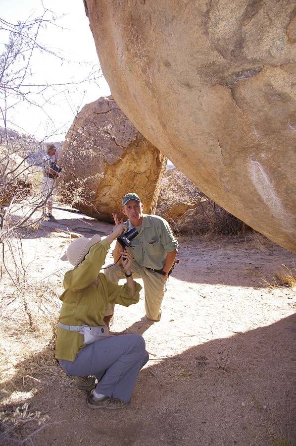
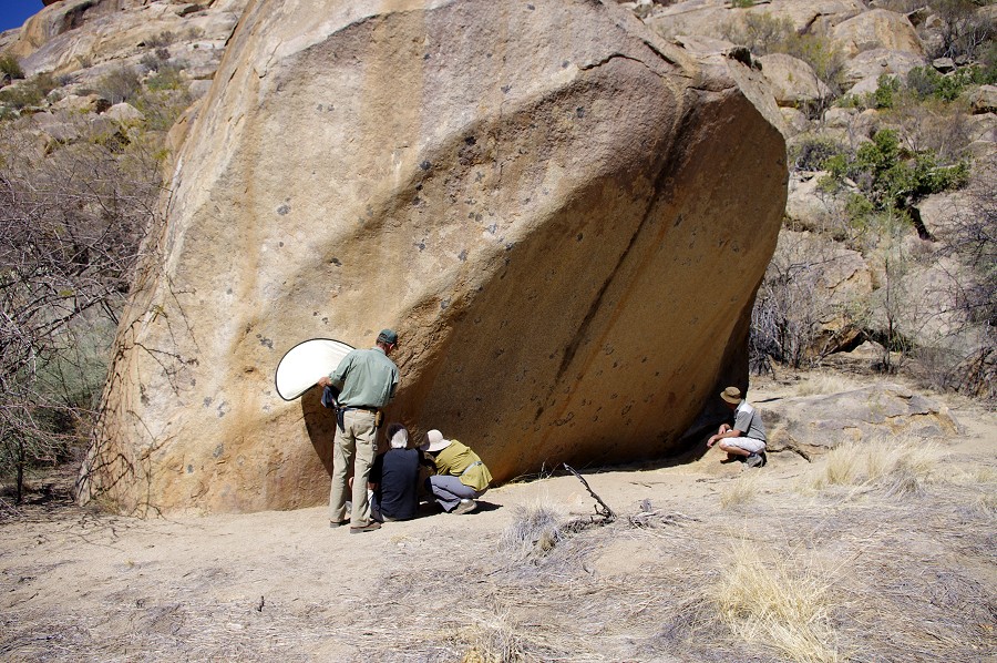
After setting up camp we immediately climbed up to the "Giant's Shelter" right behind our campsite, joined by Stefan. It is always an amazing experience, no matter how many times one sees it. There is an astonishing amount of detail, one always notices new things that were left unnoticed previously.
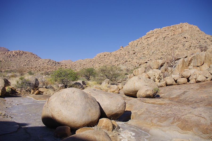
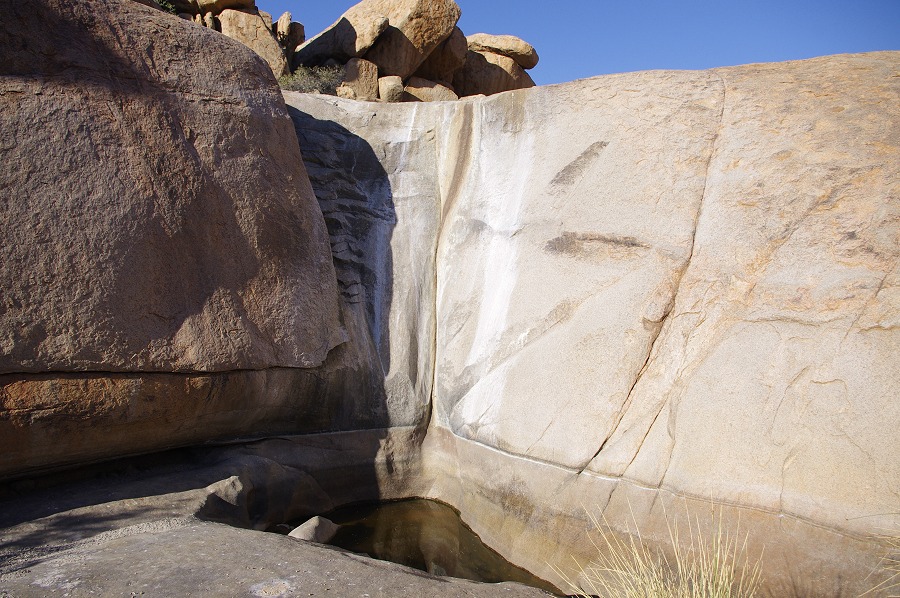
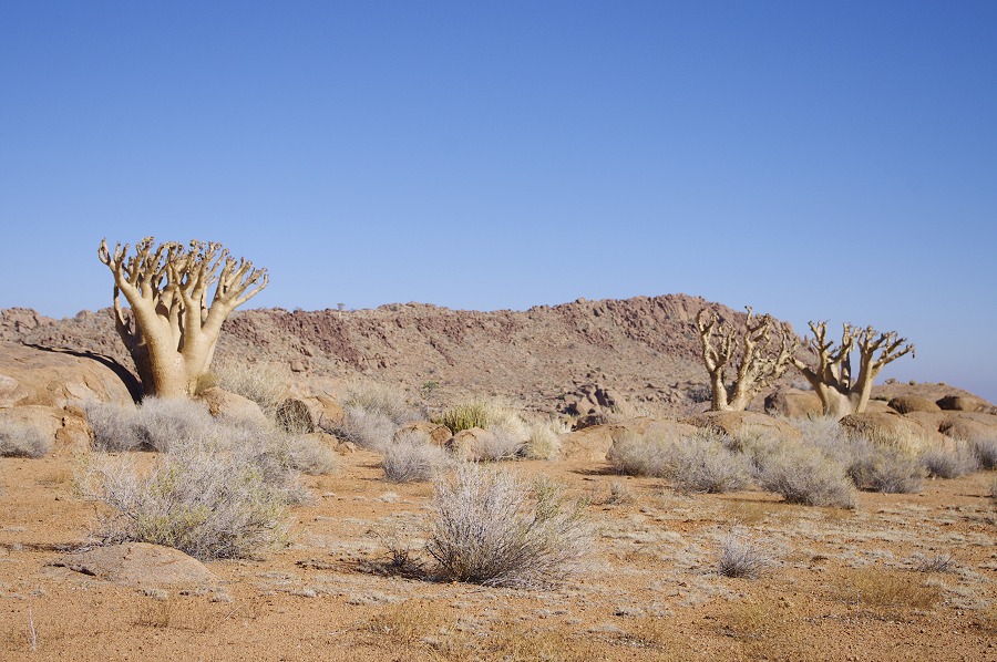
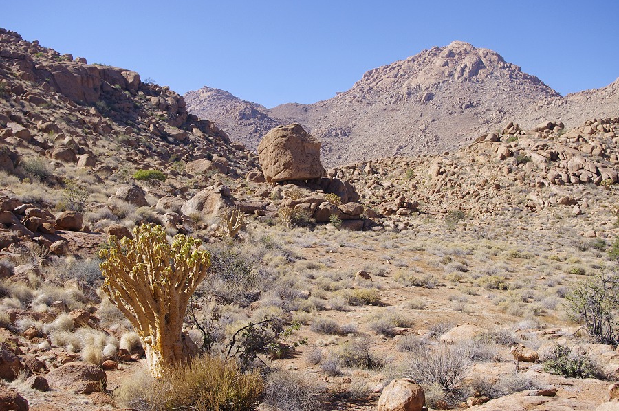
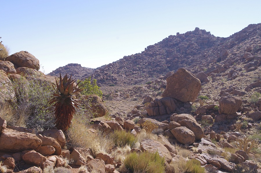
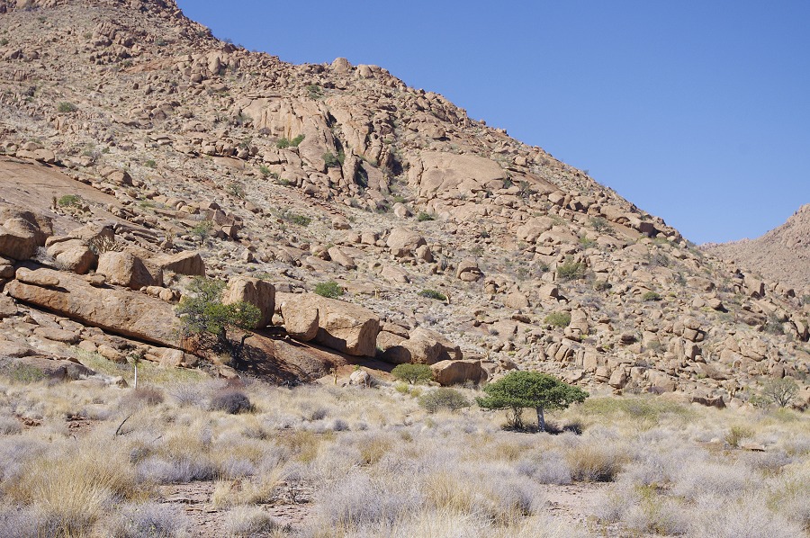
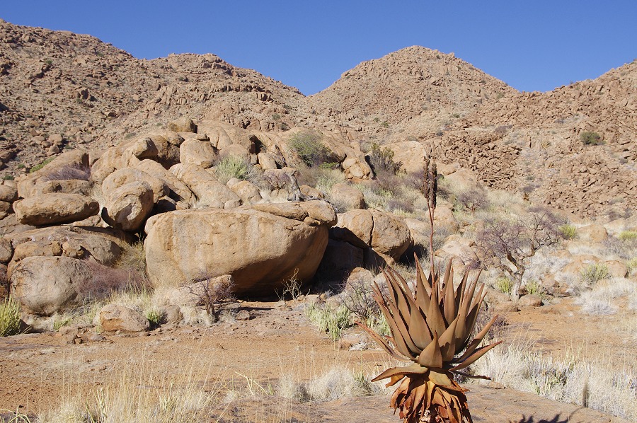
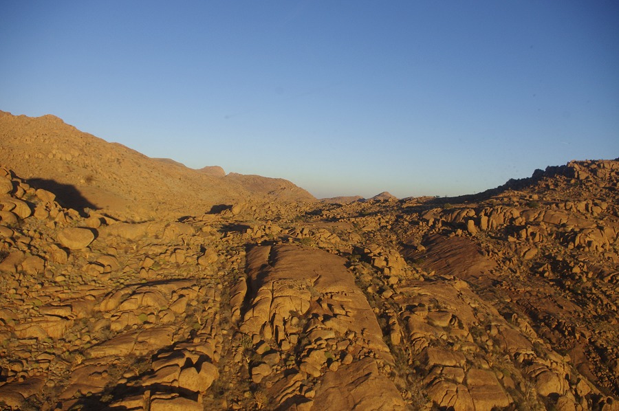
After soaking in the details, Stefan and I decided to make the good half an hour walk down to the water hole to check if there was any water in it. Namibia was experiencing a very severe drought, the Upper Brandberg was also very dry, unlike we have ever seen it. The bottle trees, usually still in full foliage, have already lost their leaves, and there was only dry grass and other weeds, hardly any green vegetation. We did not have high hopes as we approached the waterhole, the bottom of the crack was full of dust, no sign of water. However surprisingly on reaching the rock basin, there was still a good two or three bucketfuls of good clear water at the bottom. While we did not need any water, this was a good sign that we might find some water later on our trekking trip.
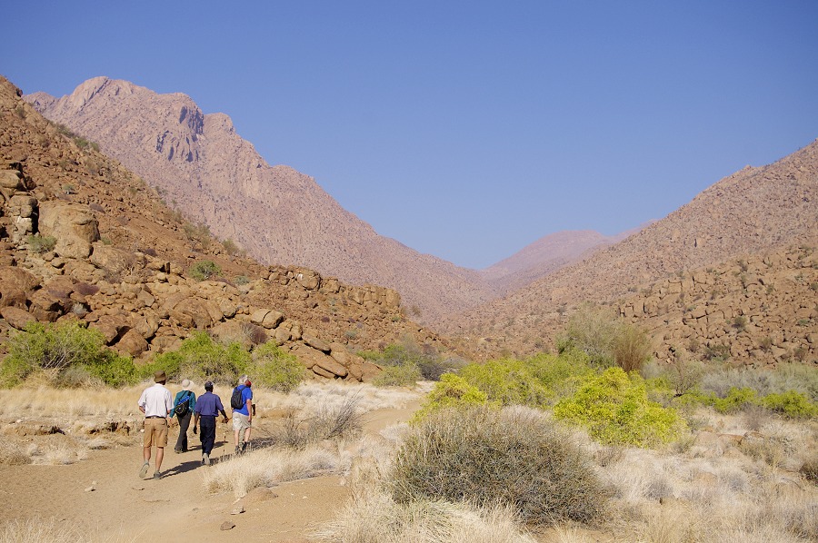
After lunch Stefan departed, and we started out in the valley accross the ridge to the north to make a visit to the nearby Numas sites.
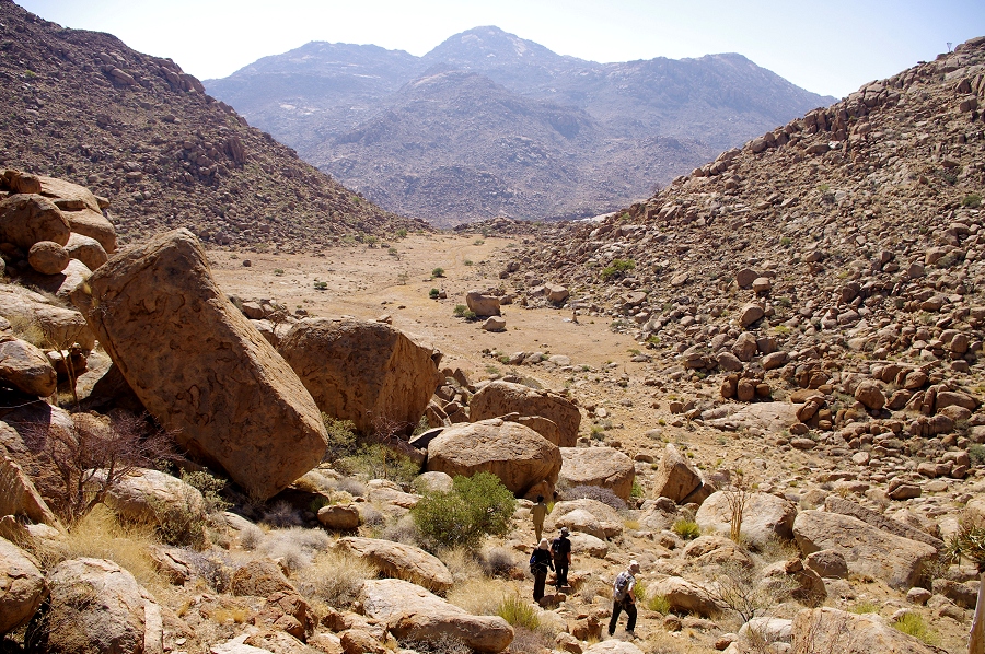
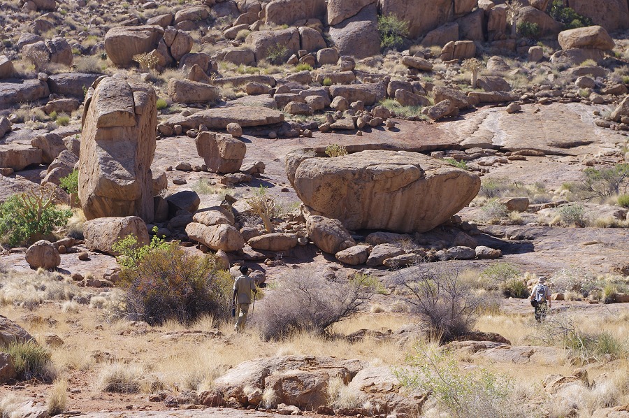
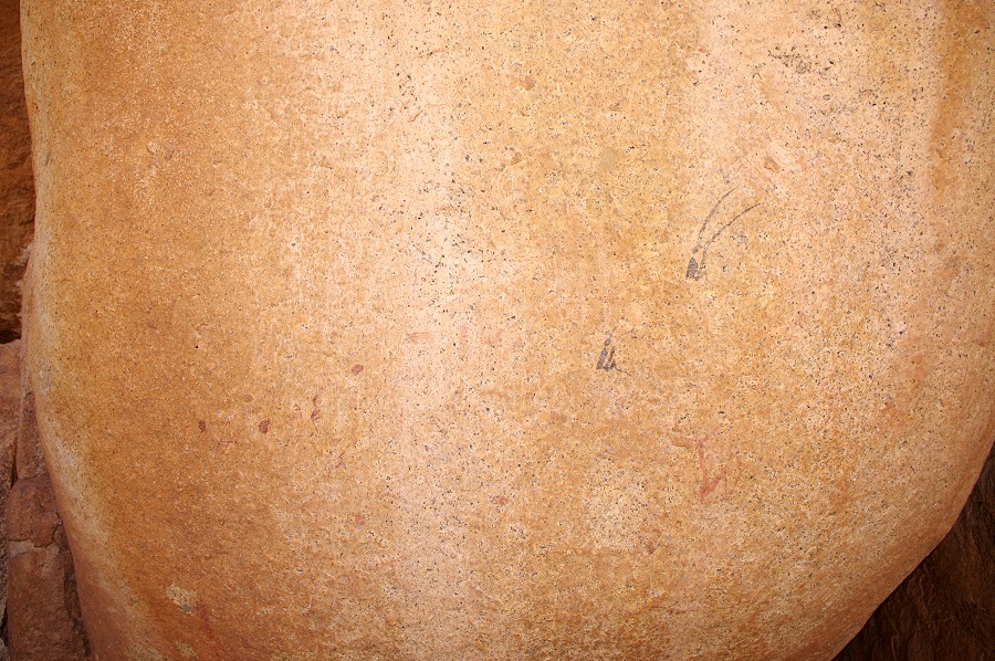
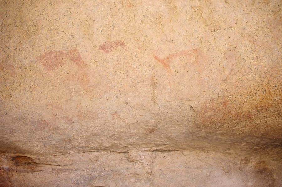
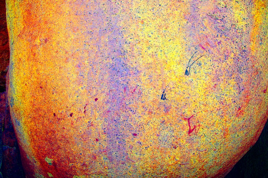
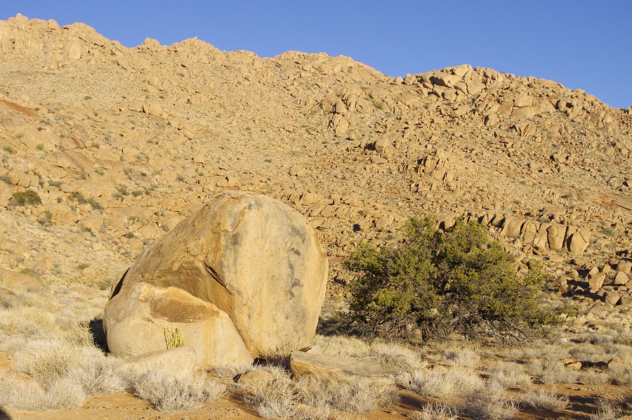
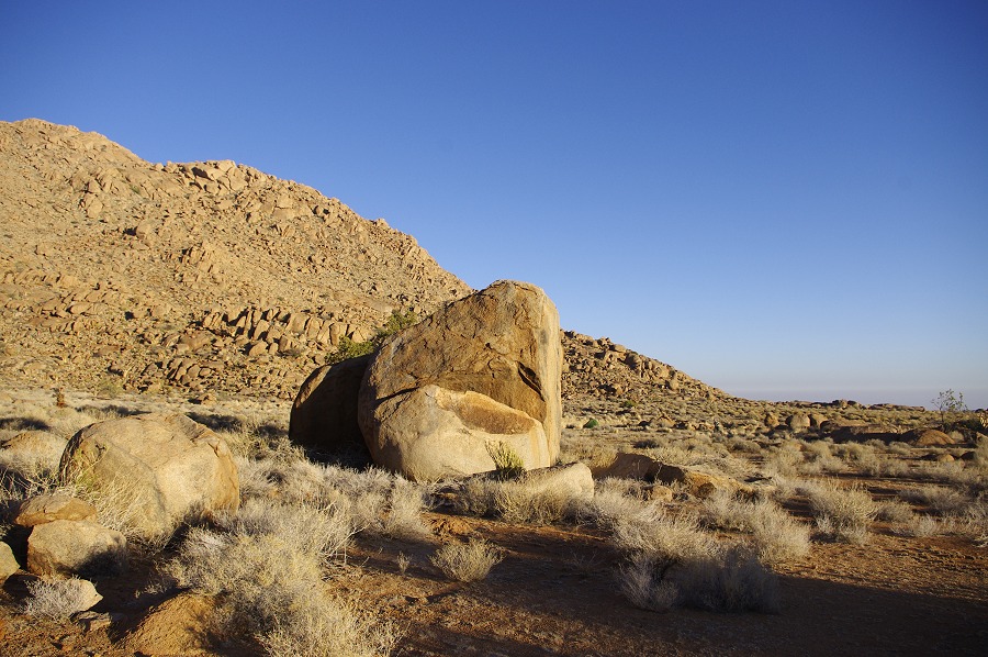
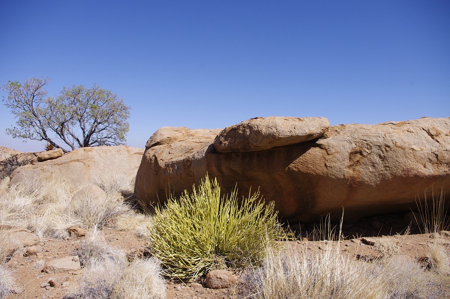
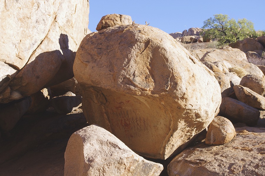
We first passed by site N8, an immense boulder in the middle of the small plain. While this site had been visited several times, a couple of very faint figures were spotted aside the four well preserved ones which were not seen on our previus trips.
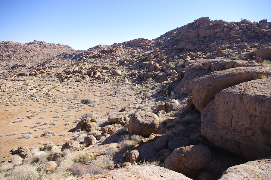
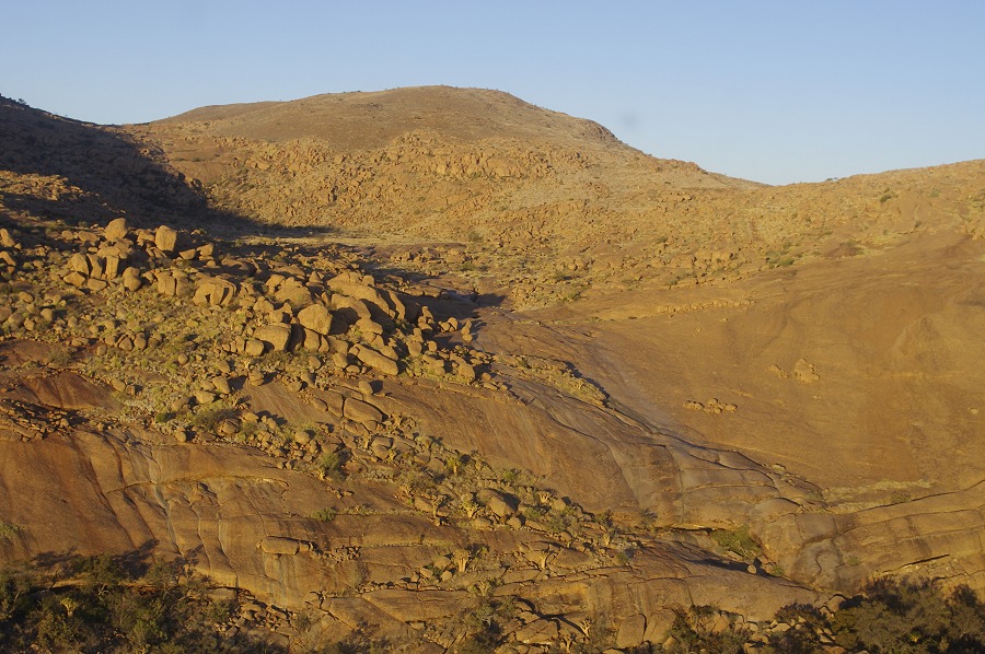
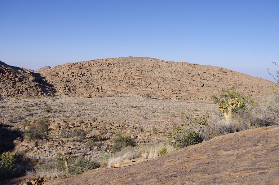
From te edge of the plain we made the half-hour descent into the middle Numas below, to the prominent boulder of the major N21 site near the Eastern edge of the Silberweide valley. While the pleasant grassy Silberweide must have offered a very good living space, surprisingly N21 at a somewhat inconvenient spot is the only rock art site in this part of the Numas valley.
David and Nija decided to return to camp with Alfons, while with Uwe we made a quick sprint accross the Silberweide then up the smooth granite plates to the top of the Middle Cascades, to see the two large sites N23 and N25. The large basin at the foot of the cascades, which we found filled with water in 2011 was now completely dry, with only some green reeds indicating the presence of groundwater below.
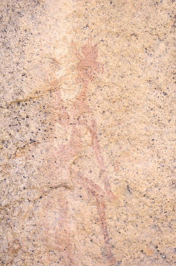
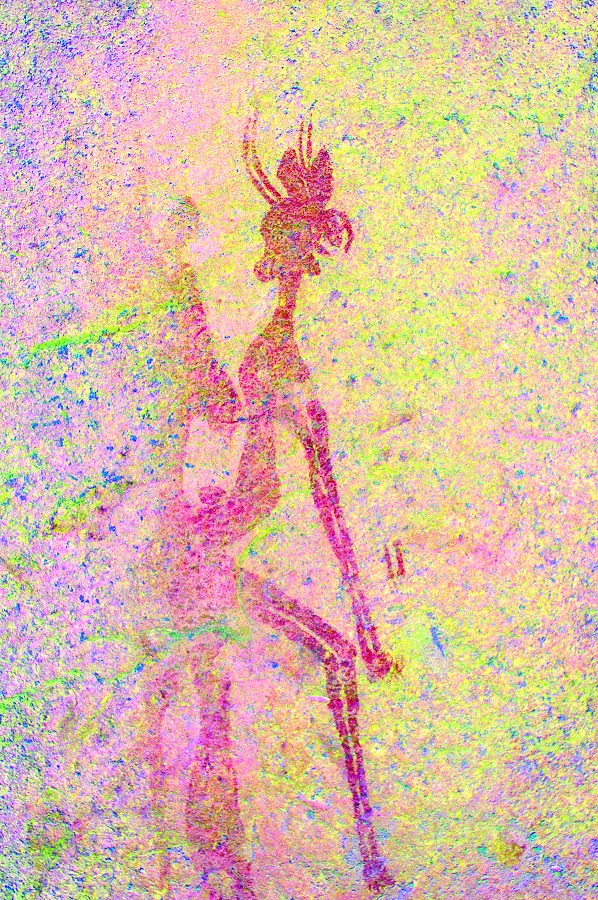
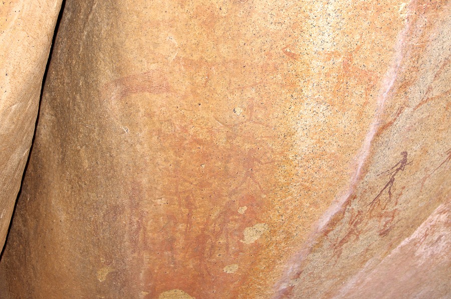
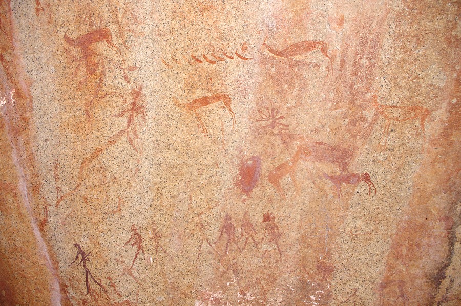
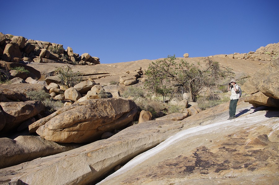
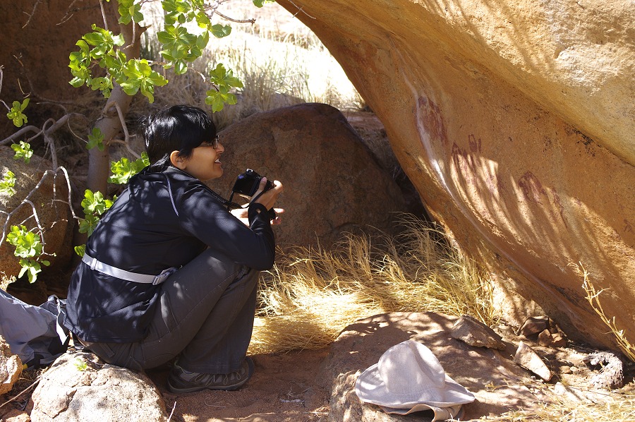
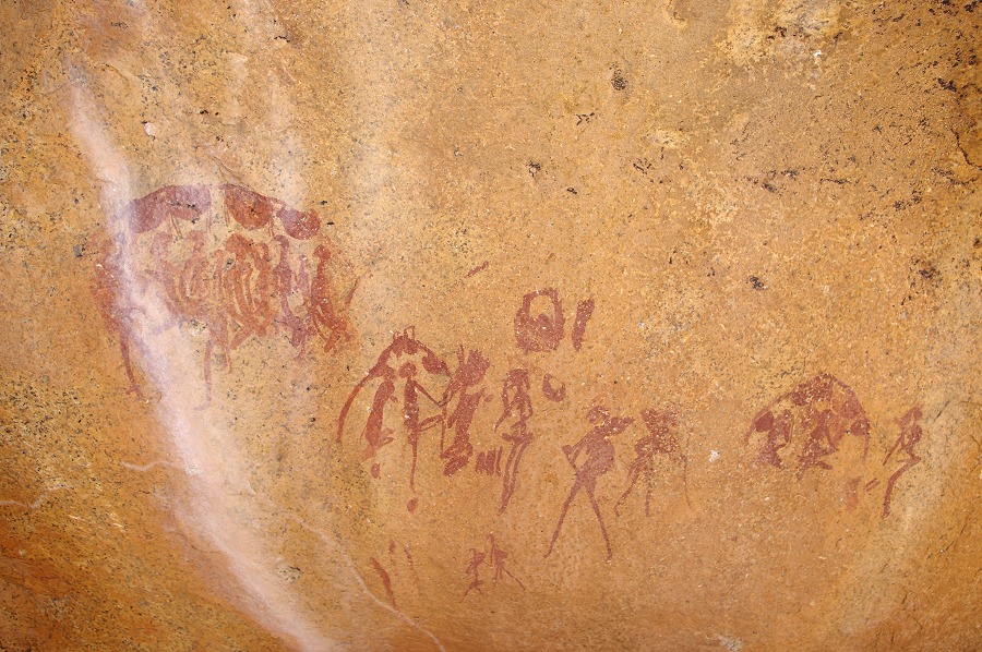
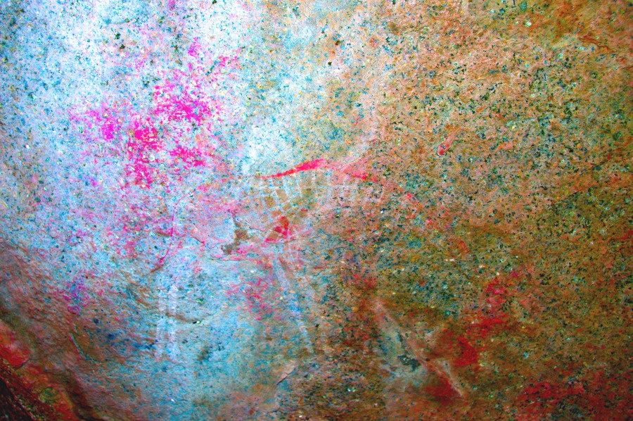
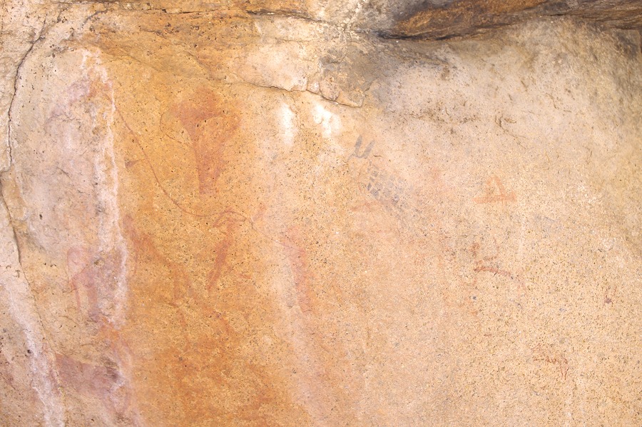
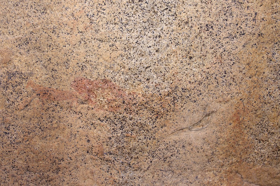
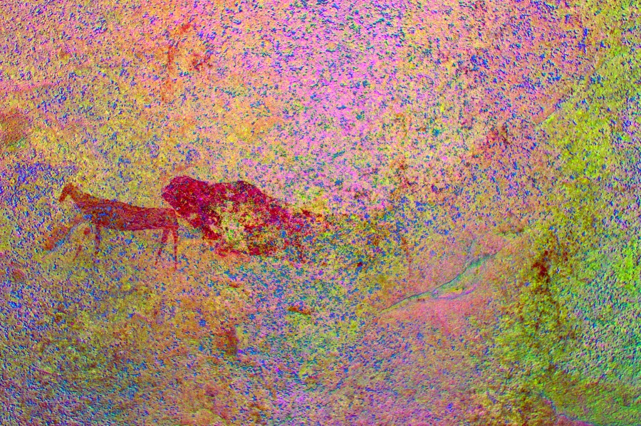
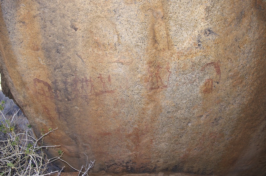
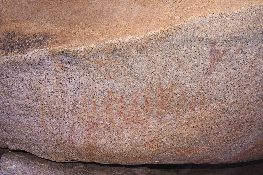
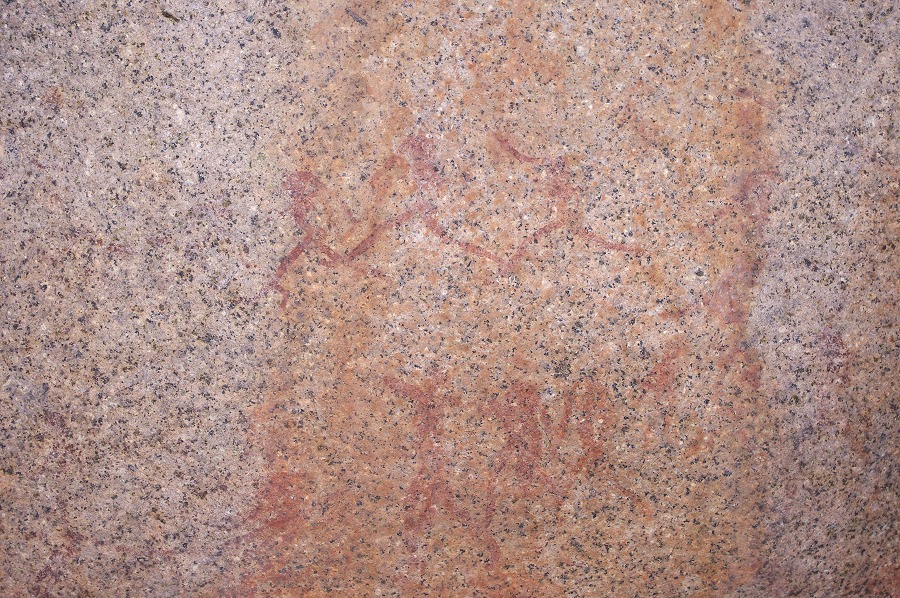
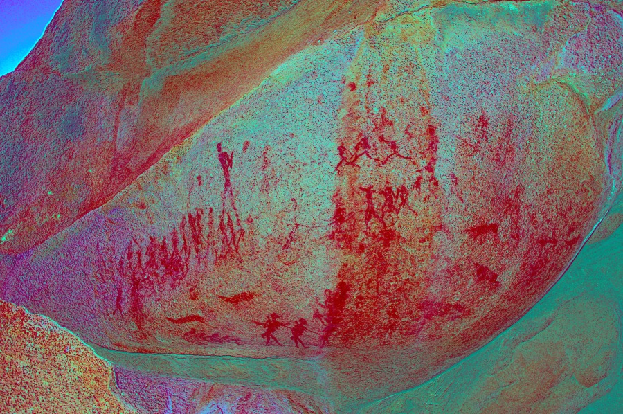
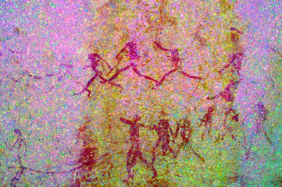
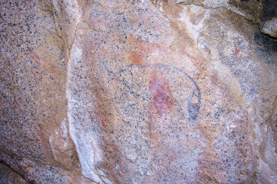
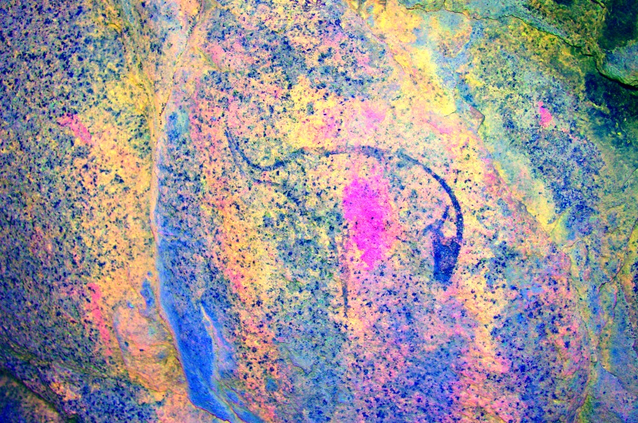
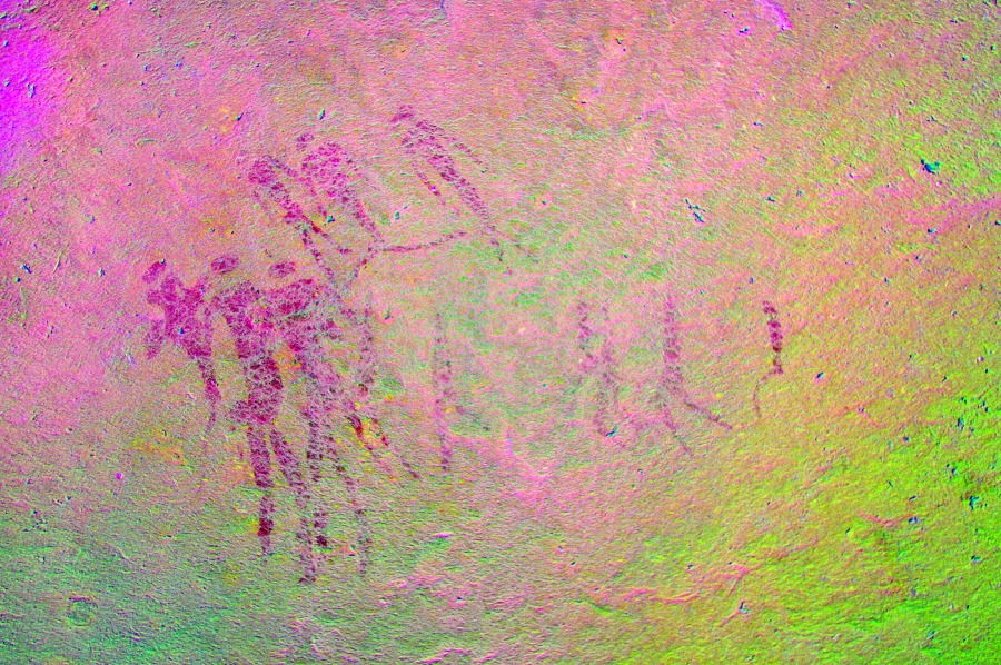
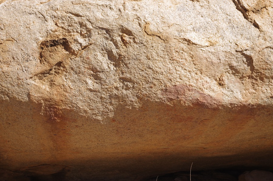
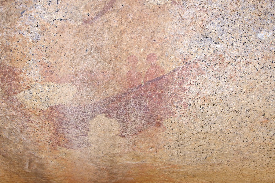
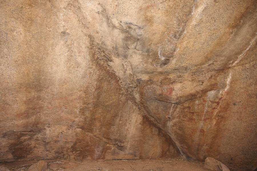
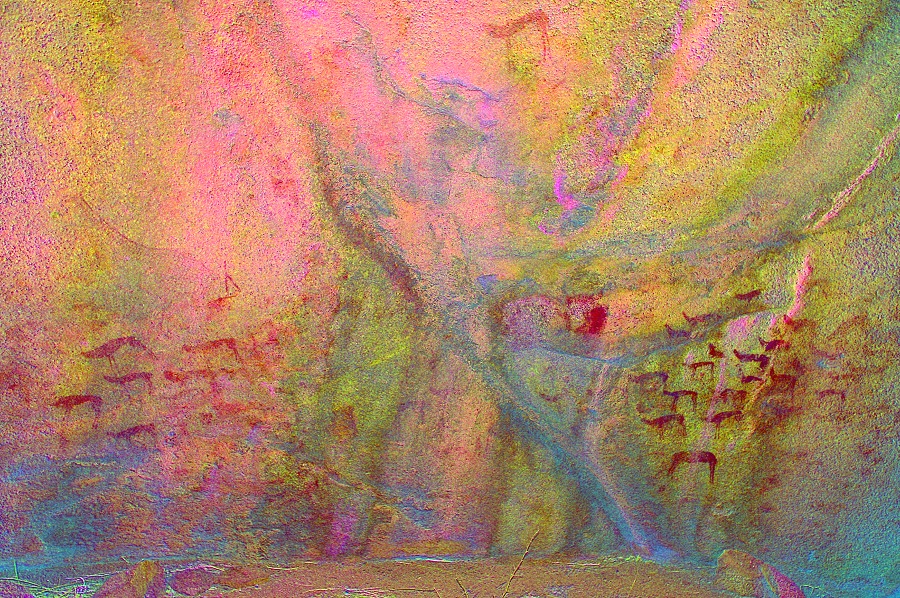
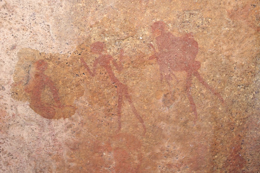
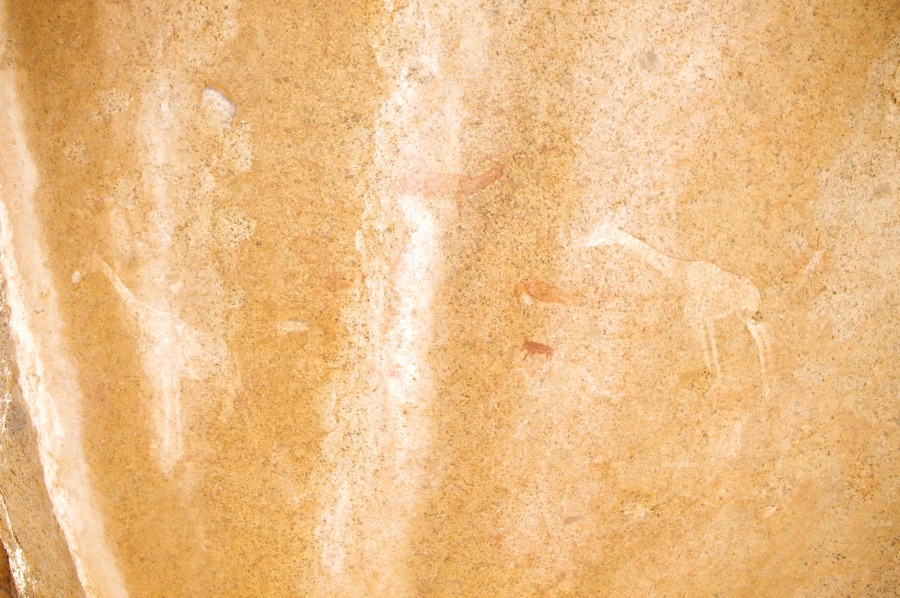
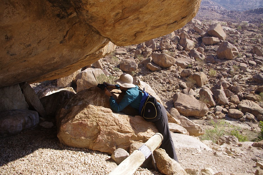
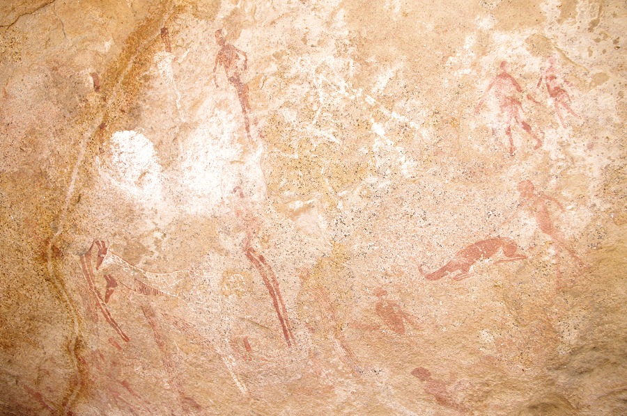
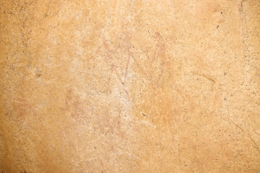
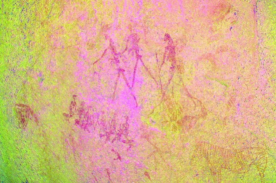
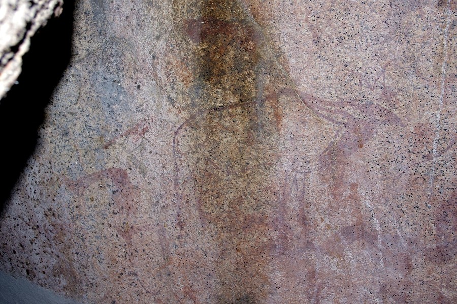
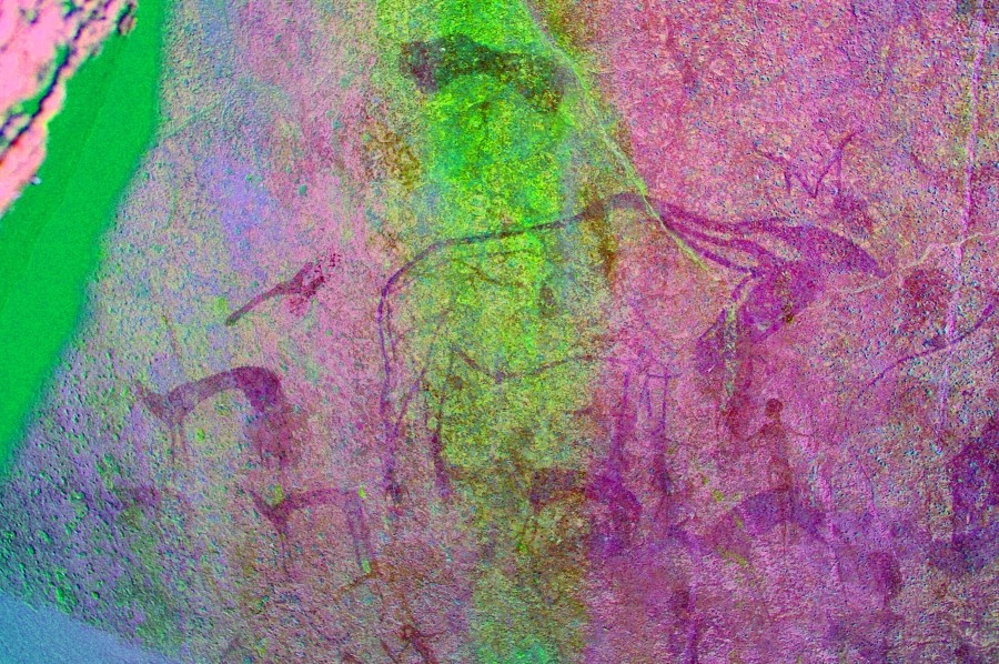
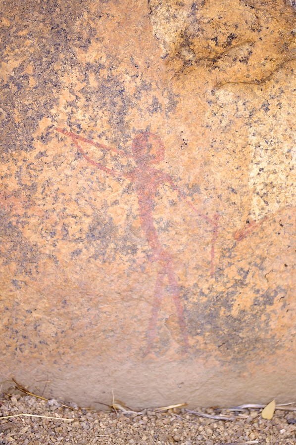
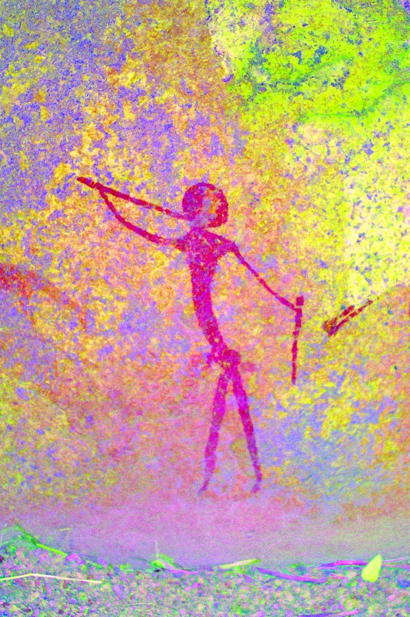
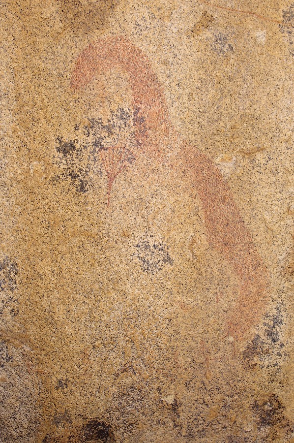
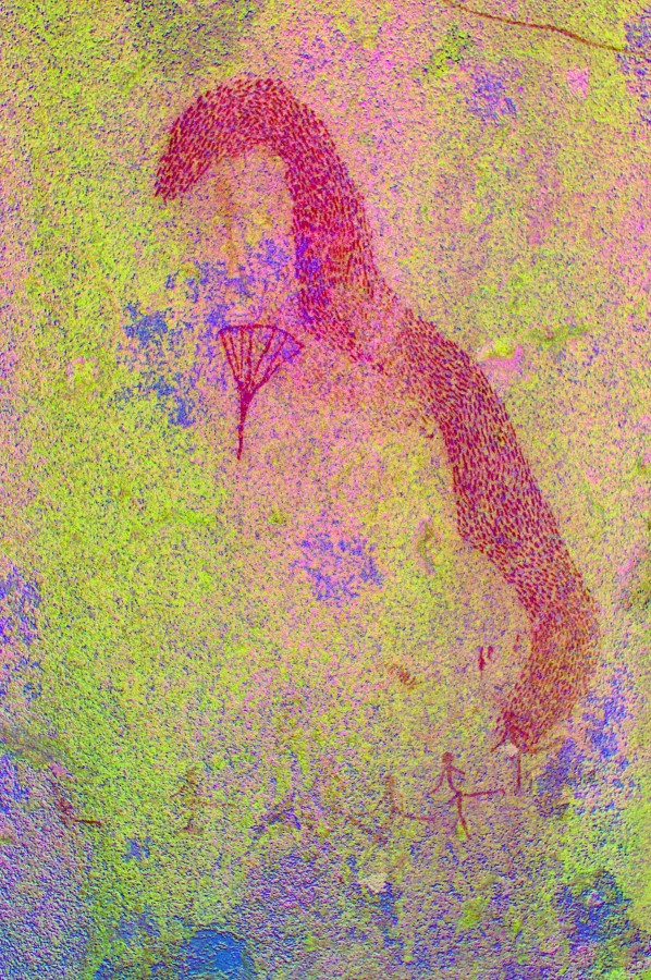
N23 is right on the top of the cascades among a cluster of large boulders, with a number of rather weathered paintings, quite difficult to make out on the spot. This time knowing what to look for, I could take some better photos of the large figures with some very strange hedgear unlike anything else known from other sites. From the photos it is clear that the figures are composites of several superpositions, but the more details one sees, the more difficult it is to make any sense of them...
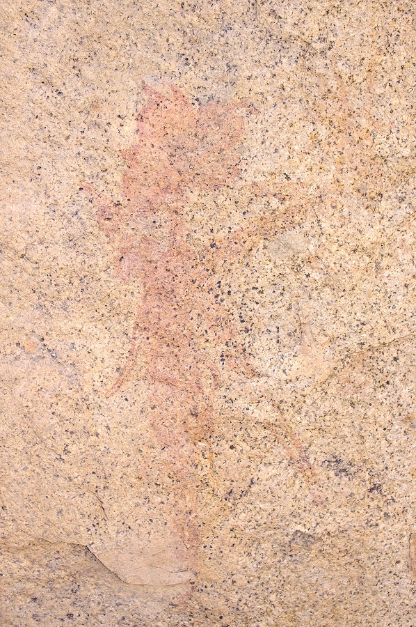
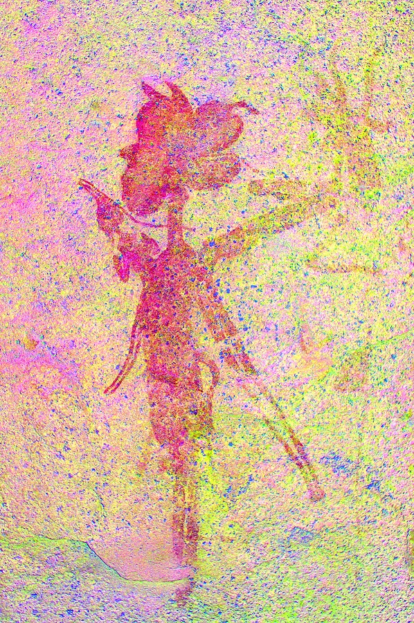
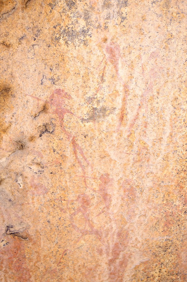
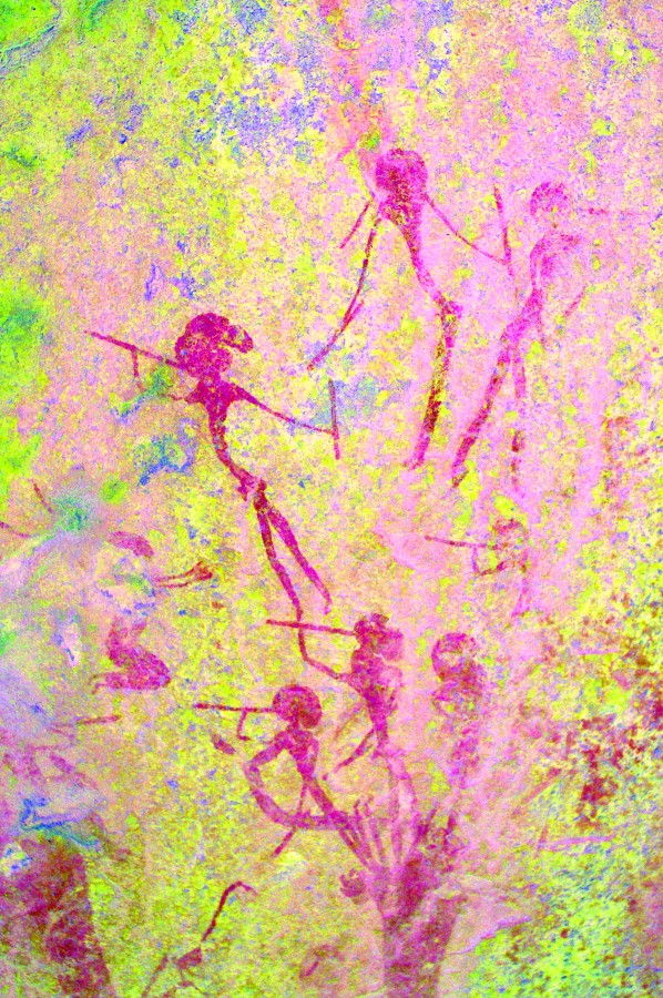
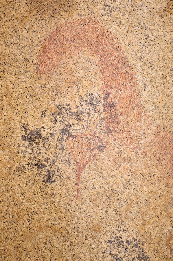
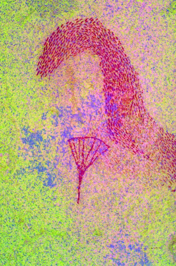
N25 is the principal site of the Middle Numas, in a typical setting on the sides of a large boulder on a terrace a few dozen metres above N23. This time it was in perfect light, we spent a long time photographing all the panels.
With sunset approaching we somewhat reluctantly left the paintings to make our way back down the cascades. Taking a slightly different route down, we unexpectedly came upon a large pool of good water with hundreds of tadpoles, a further sign that there was rain on the mountain after all sometime during the spring, despite the severe drought elsewhere.
Crossing the Silberweide again we climbed back to the valley where we came down, and reached the col above our campsite well before sunset.
Back in camp we were greeted with some rather bad news. David had been violently sick on the way back, and he was feeling very unwell. At first we thought of some kind of food poisoning, but that was rather unlikely given that we all ate the same thing for the past two days. We pitched his tent and hoped that a good nights's rest coupled with some warm tea might make things better...
Day 4. - Upper Amis Gorge
Next morning it became clear that David's condition was not getting any better. He was also becoming short of breath, whether due to anxiety or something else was hard to say. Given the long flight from Australia only a few days before coupled with our high altitude, Uwe (the doctor among us) cold not rule out a potentially life threatening lung embolism, we had no choice but to call Stefan in with the helicopter, who appeared less than 30 minutes after receving our message. As in Uis the only medical facilities are a nurse only able to treat some basic ailments, the plan was to fly David to the Swakopmund hospital after sorting out the insurance formalities during a brief stop in Uis. We could only wish David well and hope that it proves to be a false alarm and he would be able to re-join us up the mountain in a day or two.
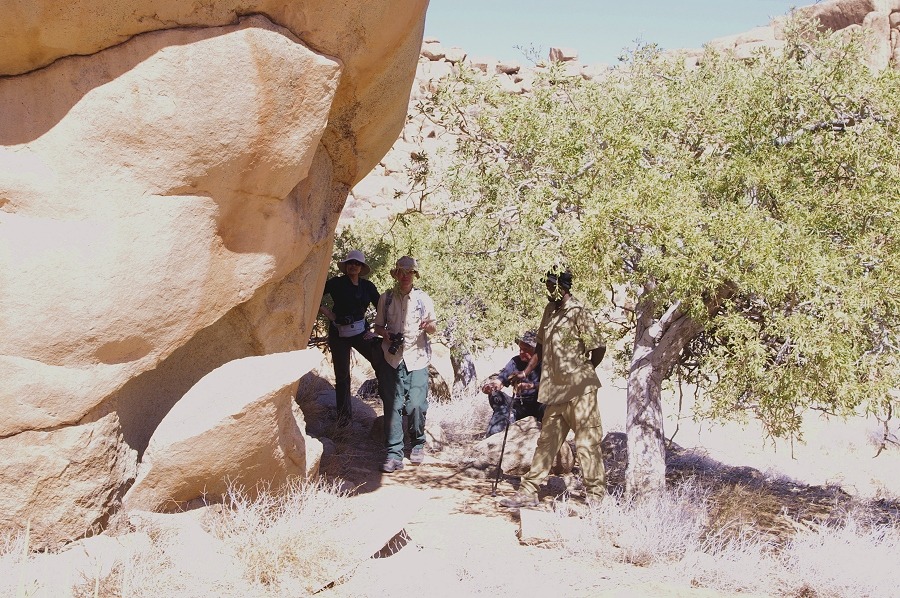
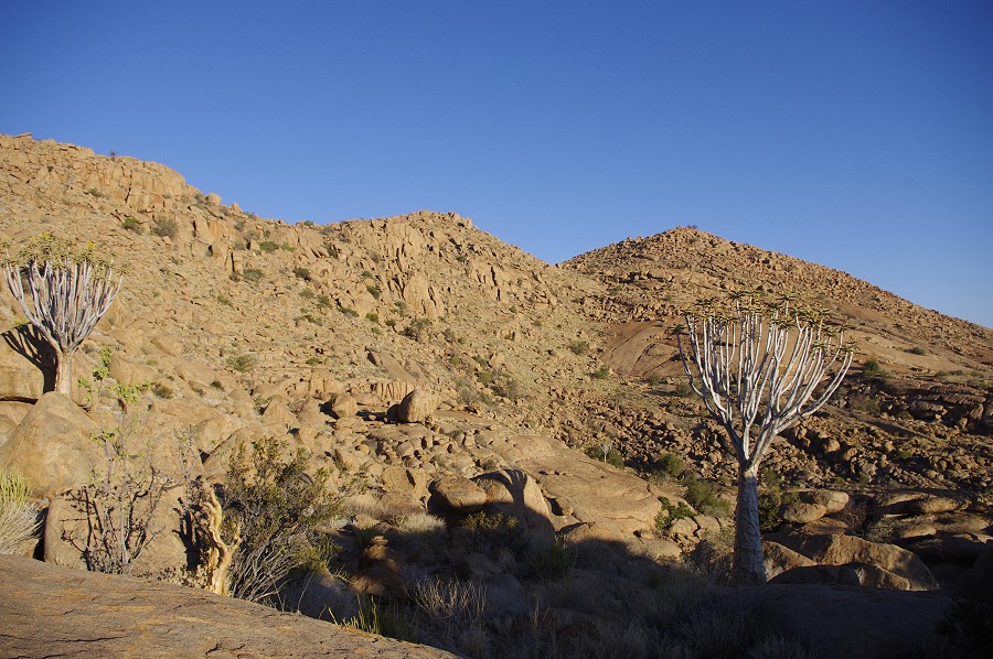
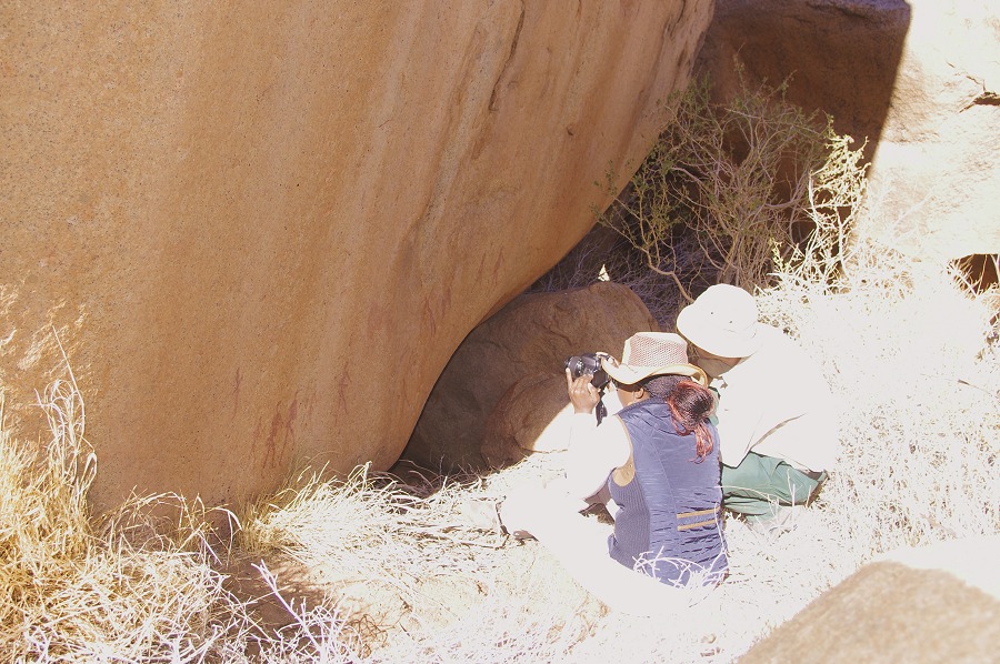
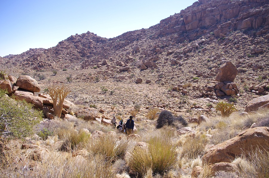
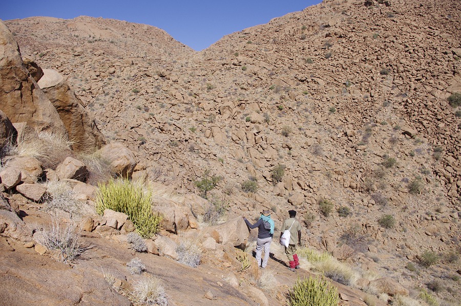
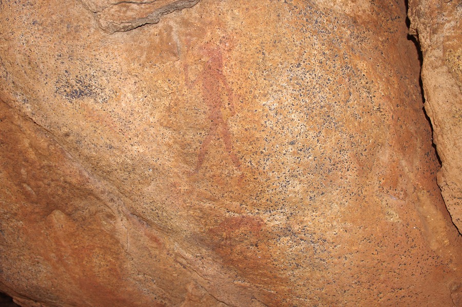
Once Stefan took off with David, we picked up the trail again, setting out to visit the sites to the West of our campsite. Descending the ledge at the edge of our campsite plain we visited A13, a rather inconspicious site on the side of a large boulder wich we already located in 2012. This time, having previously studied Pager's tracings, I was able to spot several figures which we failed to see the previous year.


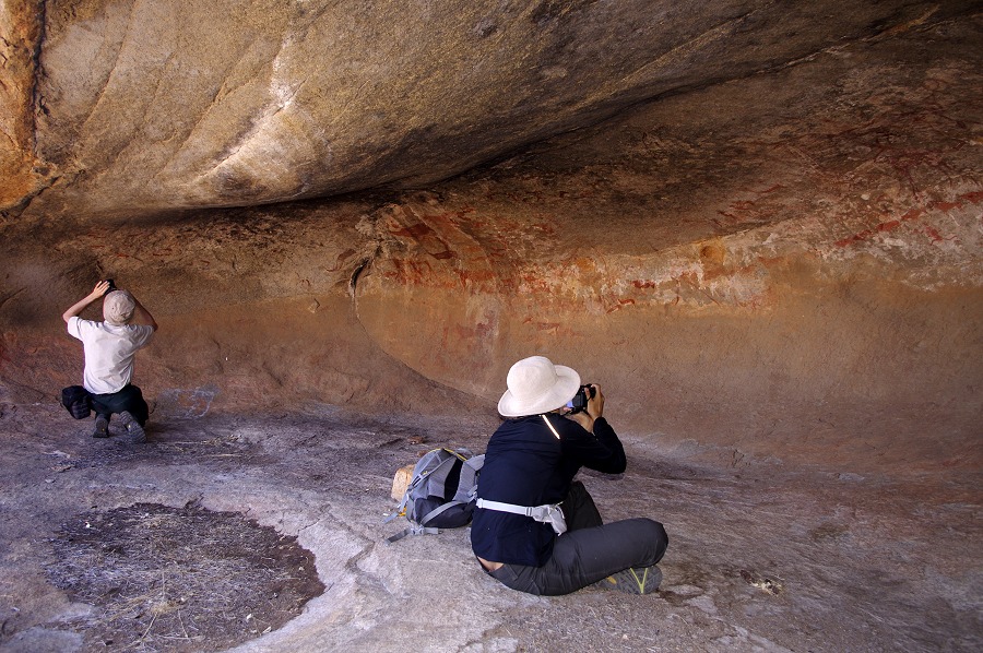
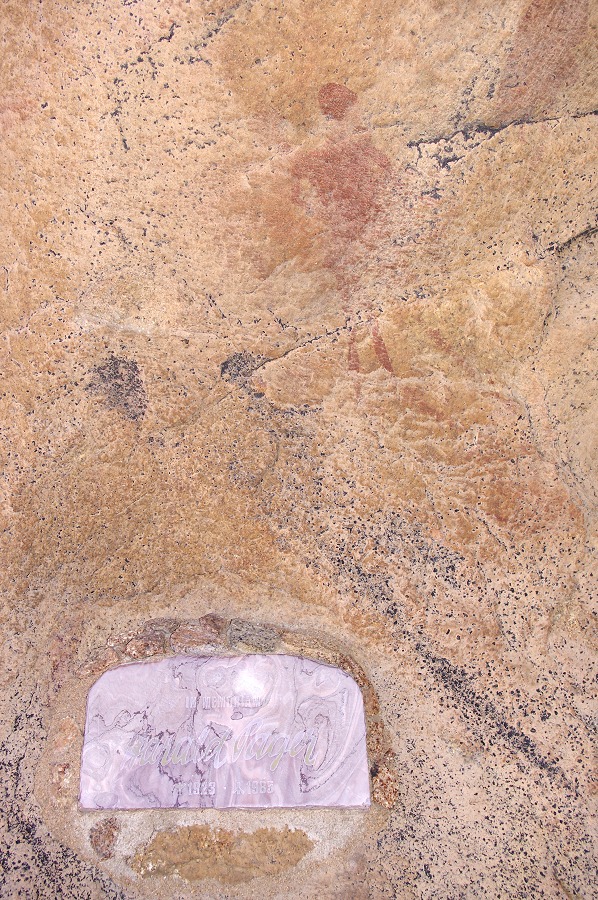
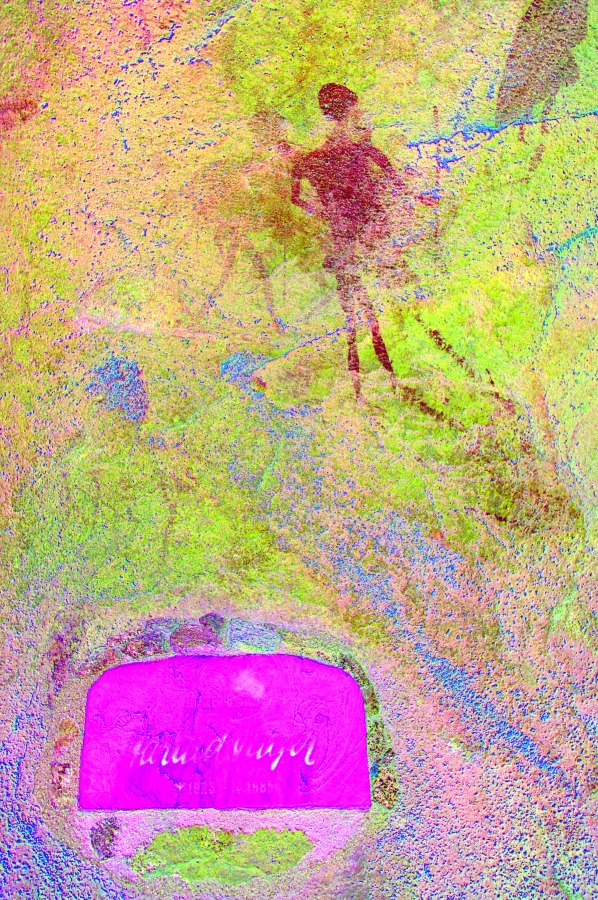
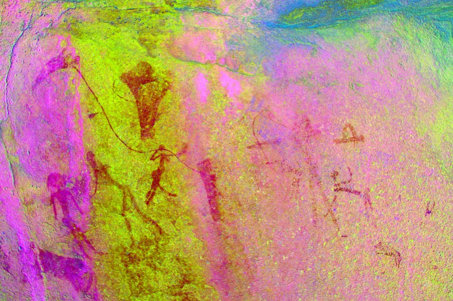
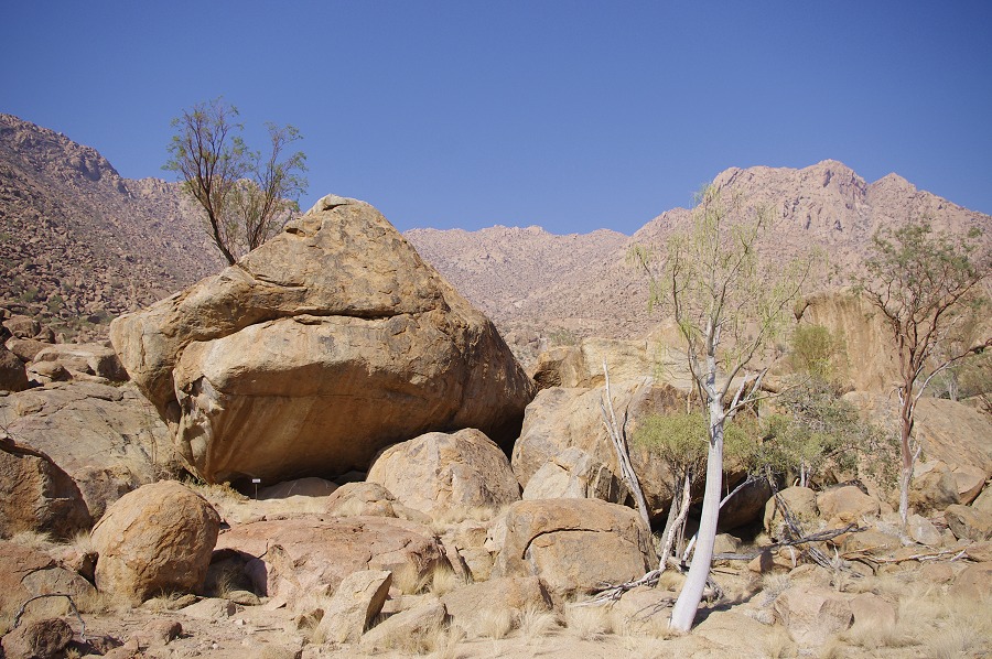
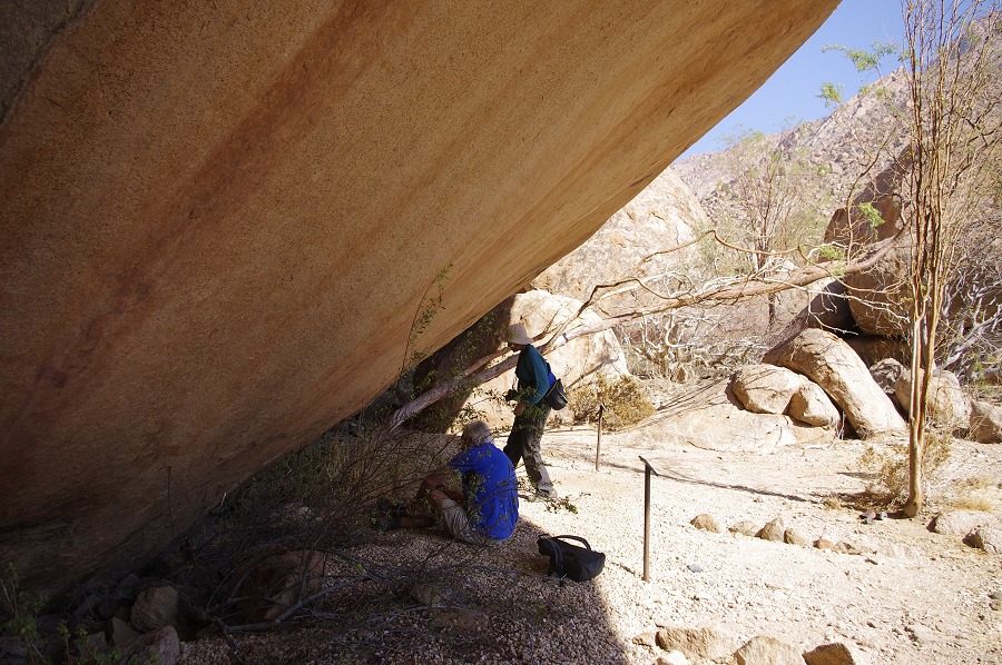
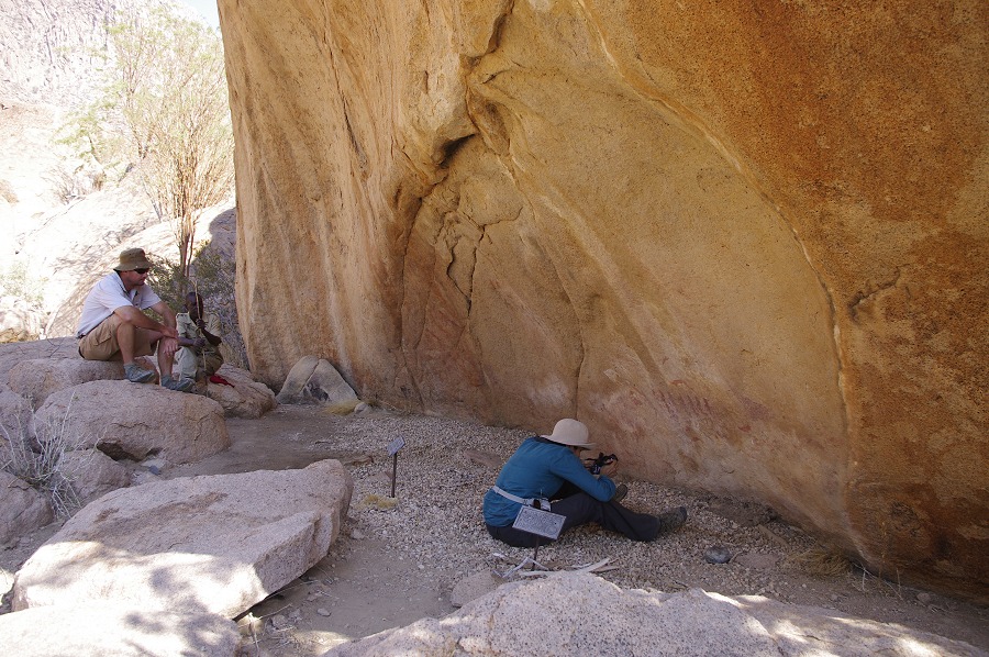
From here we took the trail just behind the site to the "Wind Shelter" (A6), the highlight of every trip. We spent a good two hours at the site looking and hotographing the panels, with me noticing several details and figures I have missed on other visits, including a panel of faint paintings right above the Pager memorial.
After A6 we crossed the granite plates to the large basin West of our campsite plain, going straight to the main site there, A20 on a cluster of large prominent boulders, with the very well preserved shelter scenes in one low overhang.
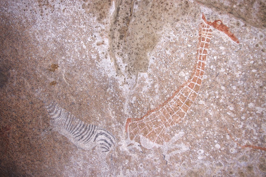
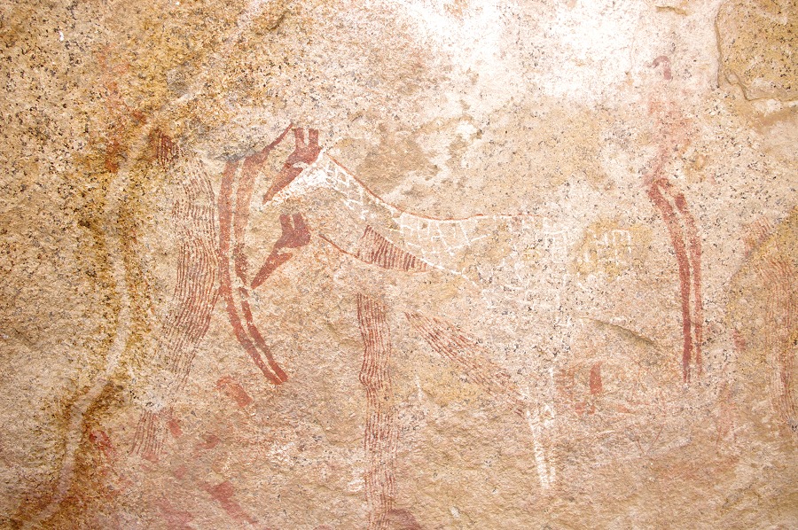
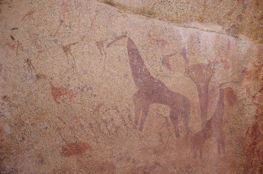
On the far end of the same boulder with the shelter scenes, there is a very faint but extremely curious scene which I have not fully appreciated previously. One can make out a couple of indistinct figures seemingly associated with a horizontal line, but after seeing Pager's tracings it is indeed clear that the strange small figures are in fact climbing up the back and neck of a giraffe, whose head may be seen above to the left.
Before heading back to camp for a late lunch, we explored the rear part of the basin for site A26, the location of which was described quite vaguely in the Pager Amis volume. Again it was a clear demonstration of the futility of attempting to find a site, even with Pager's site plan in hand, if one has no idea of its general location. We spent a good hour looking for it (and A21 on the way back with similar results), checking out all promising rock clusters before deciding to call off the search.
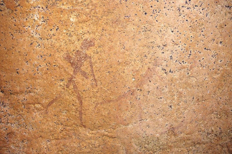
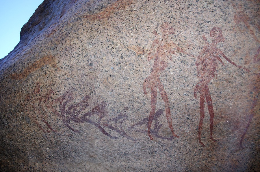
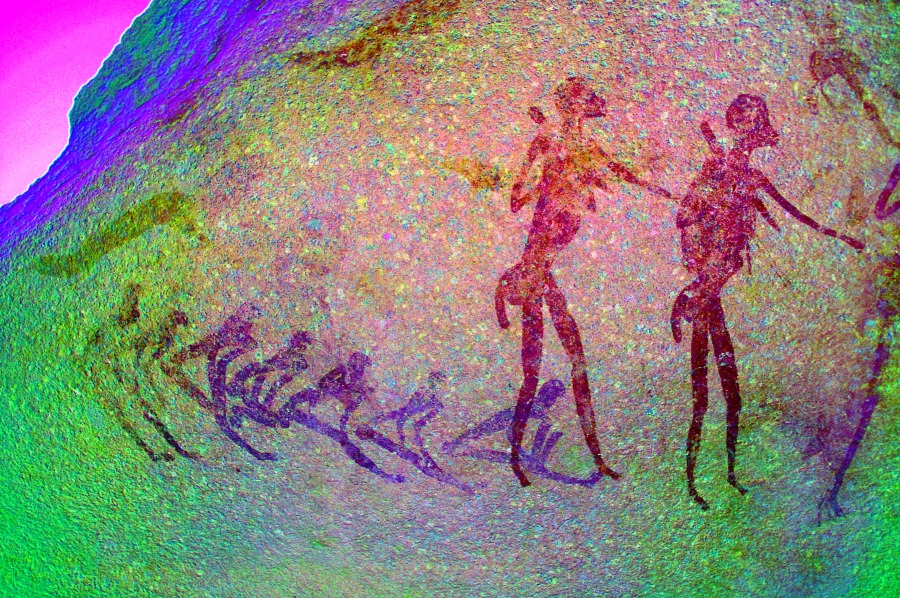
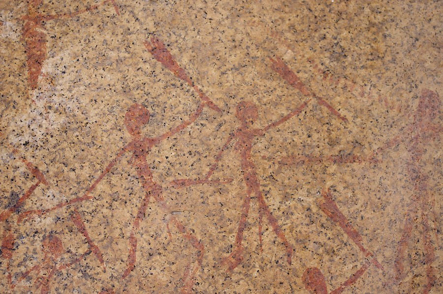
After lunch and a short afternoon rest we set out again, this time to explore unknown country. There were a cluster of known sites on a small flat area below our campsite - Alfons never visitd them, but the site descriptions appeared to be fairly straight forward. We started descending along the banks of the watercourse beyond A13, and after only 15-20 minutes we came upon a large terrace with numerous surrounding large boulders. It did not take long to identify the A14 and A16 among the flanking boulders, while A15 is on a large boulder in the middle of the small plain. Of these sites, A16 has the most impressive paintings, with one panel showing a row of large and relatively well preserved human figures.
Site A17 with a number of interesting panels is shown to be less than a kilometre to the east of these sites somewhere up on the hillside on the aerial photo published in the Pager Amis volume. By the description and the site plan in hand it appeared to be a straight frward exercise, however we soon found out that it could be anywhere on the steep bouldery hillside. After searching around for a good hour we soon came to realise that the site is probably yet on a higher level. We decided that the short time remaining from the daylight would be much better spent at site A12, the major site under our camp plain with the large running figures and a number of other paintings.
Day 5. - Upper Numas Gorge
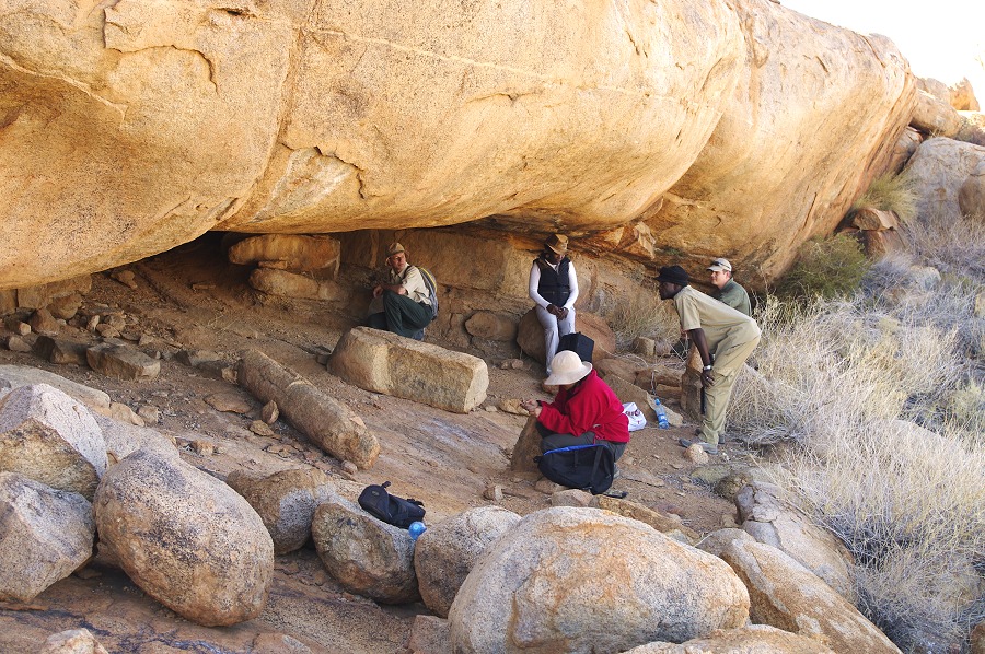
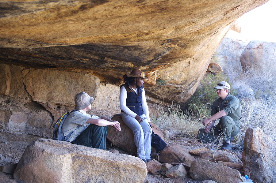
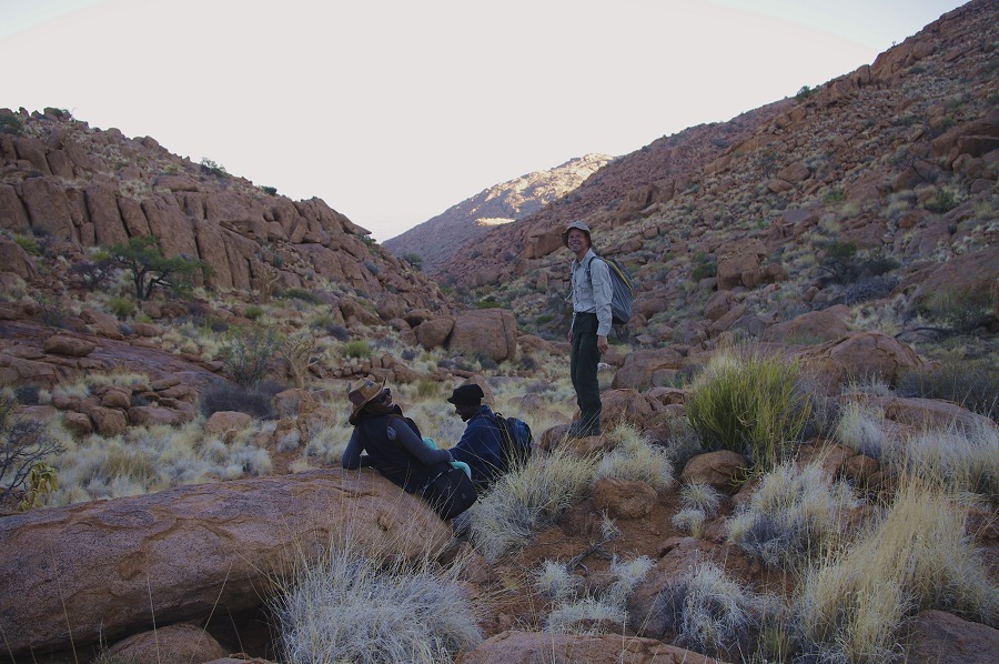
Stefan appeared the next morning soon after sunrise with Alma Nankela, the prehistorian and archaeologist of the National Heritage Council, joining us for two days on the mountain. We eagerly awaited news of David, but Stefan could only tell us that they reached Swakopmund hospital by early afternoon, and had no news since. We immediately started moving to our next campsite, in the upper Numas valley near the "Okapi" shelter (N162), with me, Alma & most of our supplies getting up in the first round, the others joining on the second. Stefan also stayed with us for the day, planning to fly back to Uis in the afternoon.
We started visiting the site farthest from camp, N175 in the side of the plain leading over to Circus Gorge. We have been here with Angula in 2011, but at that time I have only noticed the rather insignificant paintings on the side of a boulder in the shelter. This time after more careful scrutiny of the dark ceiling, we have found several more paintings in this rather large shelter.
Climbing over the ridge above the shelter, we started back East towards the oher sites. This time we have taken a slightly different course than two years ago, and we found a large prominent cluster of rocks at the edge of a very pleasant spacious terrace with some paintings which we did not see previously. Most probably this is site N173 (or N174?), but this still needs to be verified.
We crossed another ridge to the valley (leading to our camp) hiding N172, once a major site but now unfortunately very weathered, and the main panel had been partially covered recently by a termite nest. At the back of the site, on a boulder fully exposed to the sun, Alfons spotted a very fine but almost invisible giraffe.
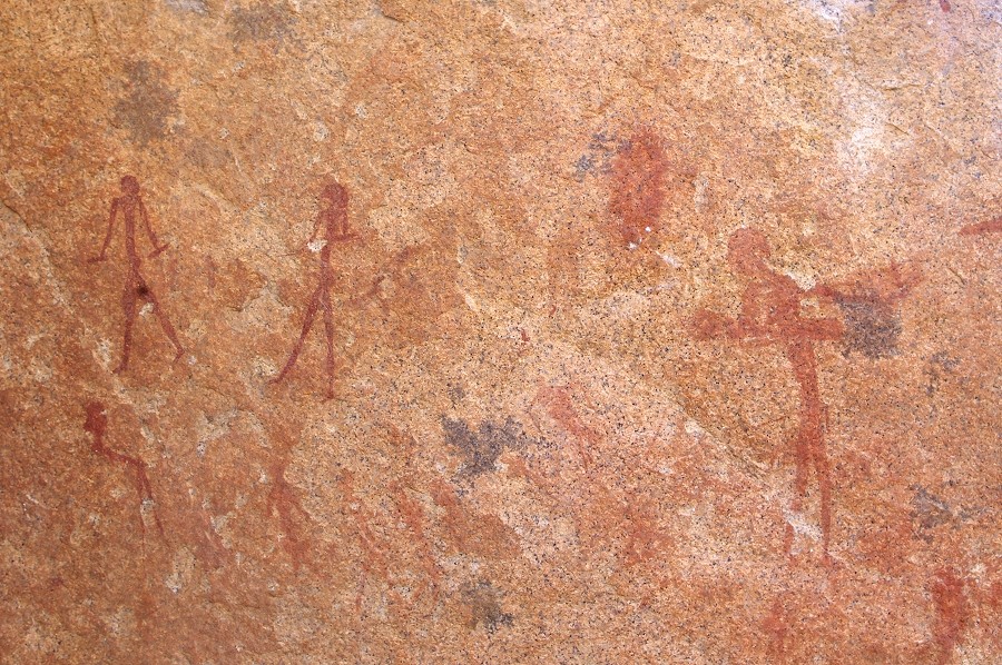
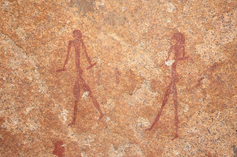
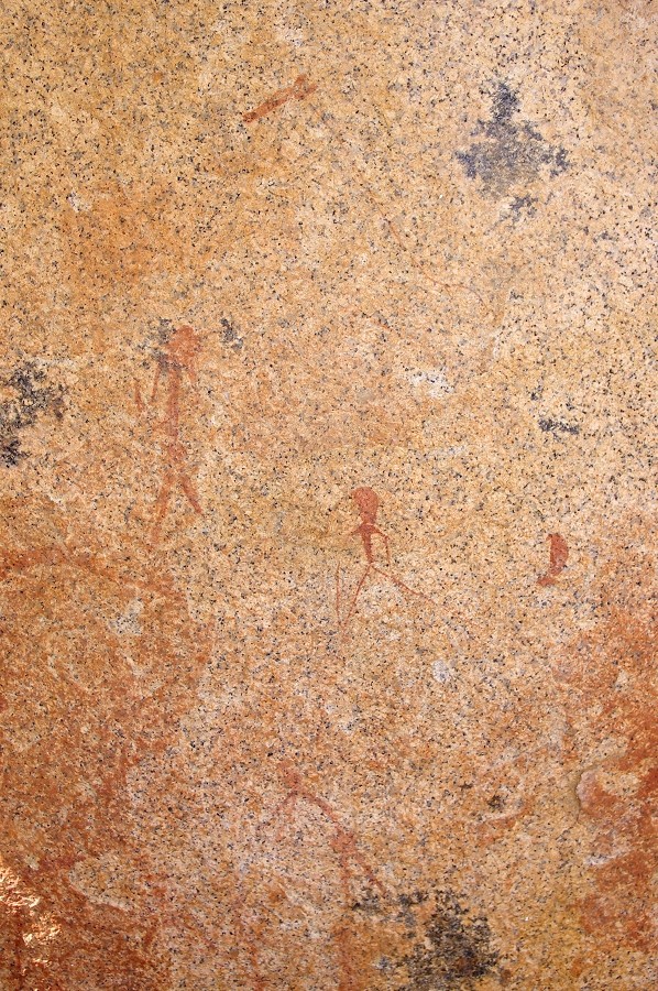
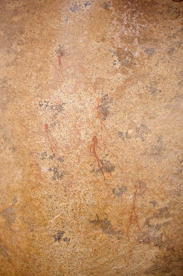
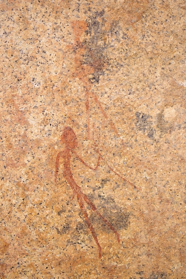
Next in line is site N171, a large boulder at an otherwise quite unattractive location some way up the hillside, with a very fine panel of human figures in a litle hollow at the base of the rock.
We by-passed the huge rock of N168 where all the paintings were on the sunny side, leaving them for later in the afternoon. We climbed up to N164, the largest site in this part of the Naib, with a multitude of complex paintings, unfortunately mostly weathered and quite hard to make out, nebertheless we spent a good hour photographing all the panels.
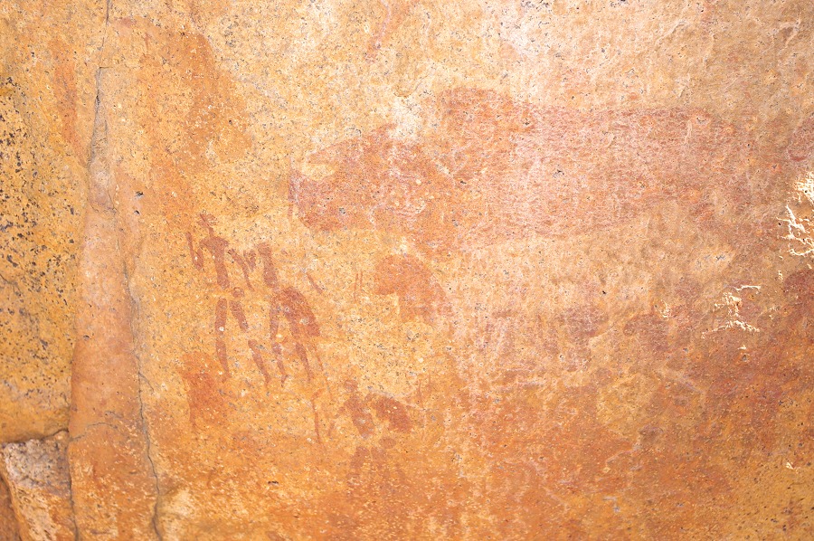
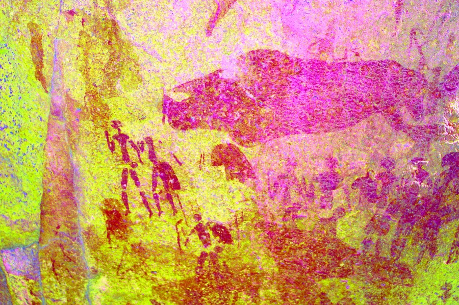
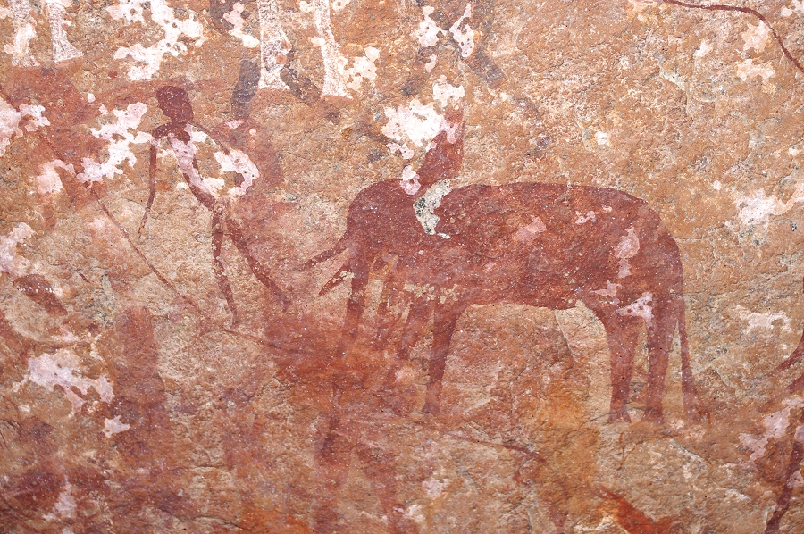
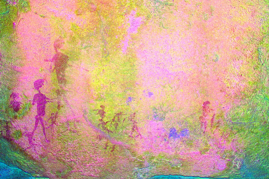
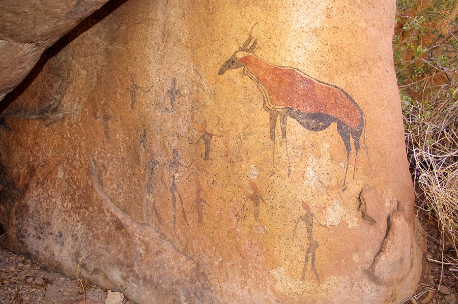
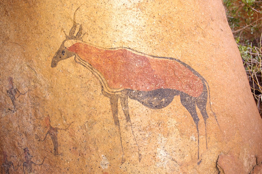
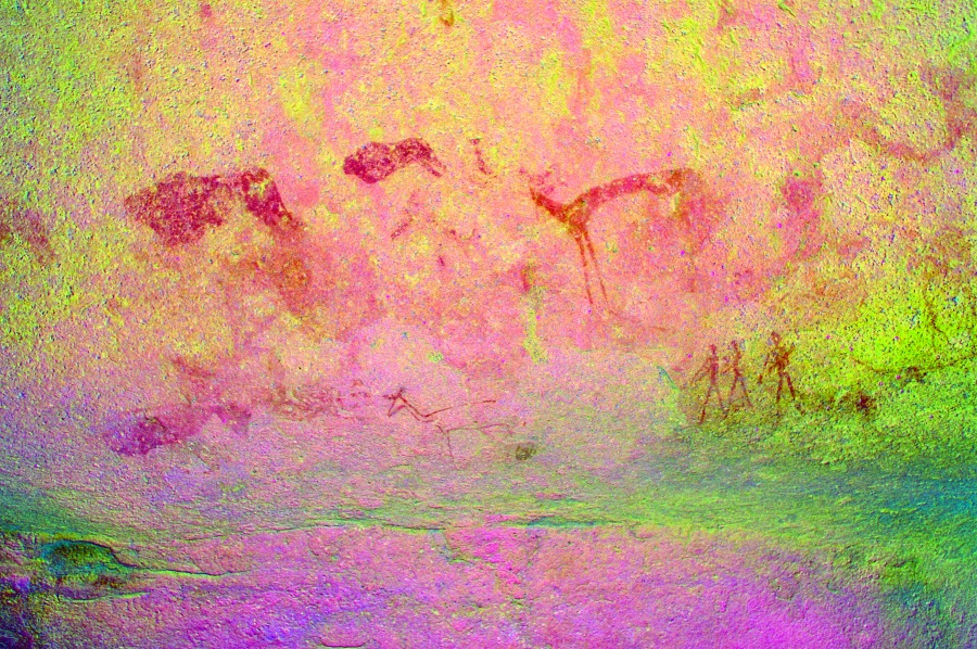
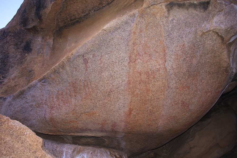
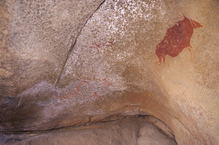
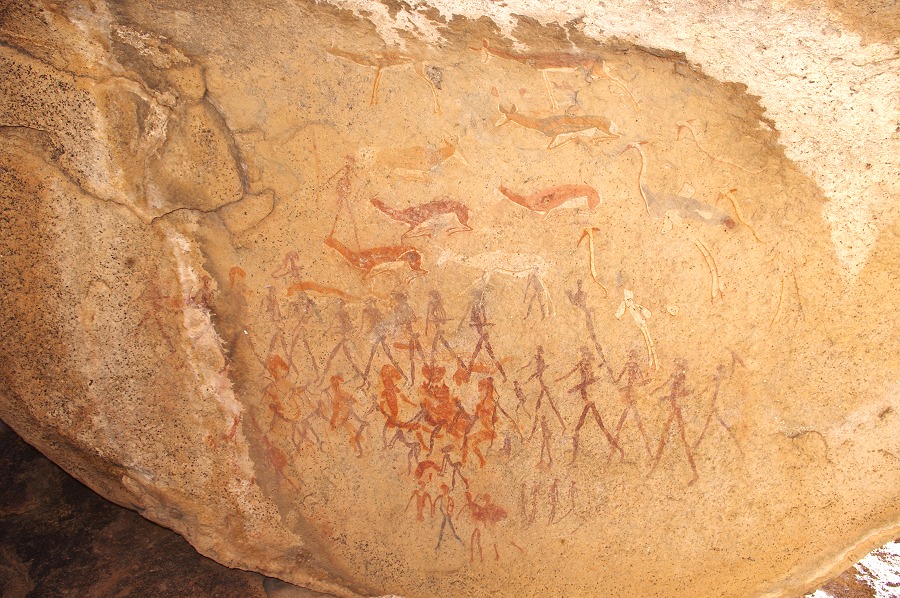
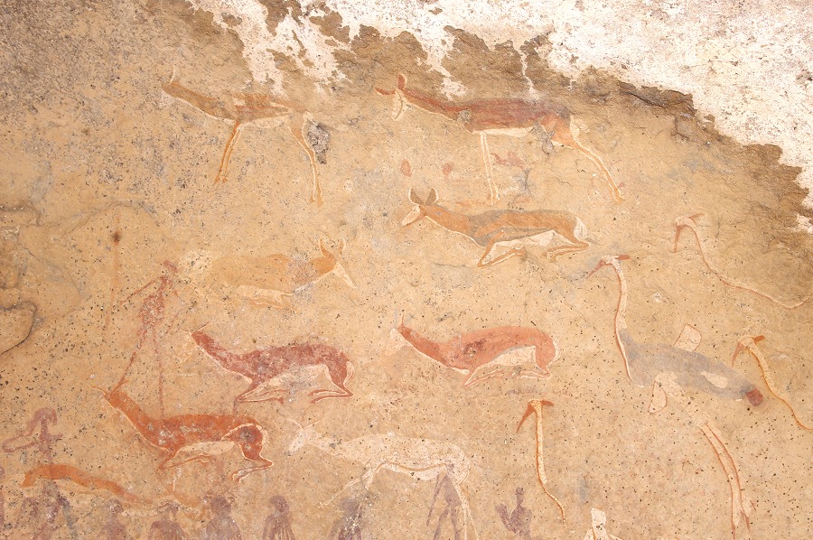
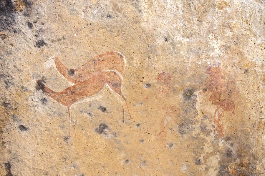
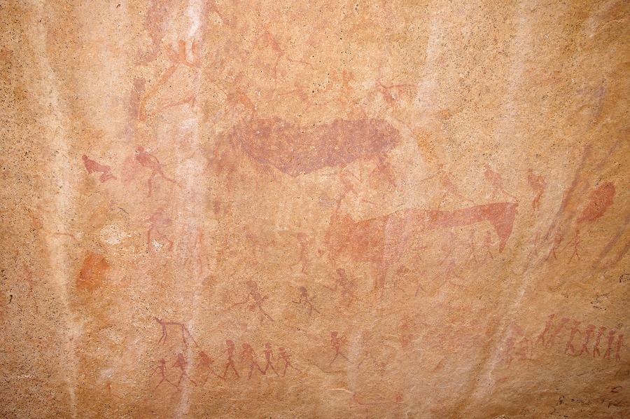
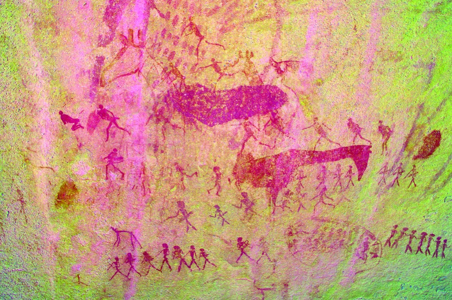
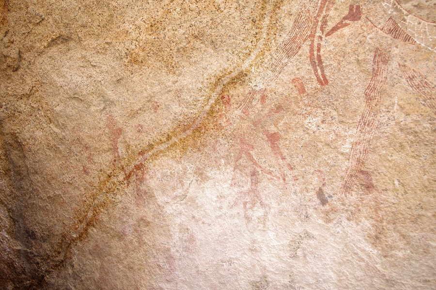
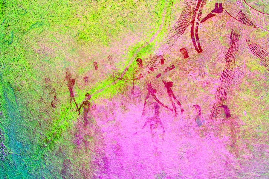
We moved to the highlight of the day, site N162, named the "Okapi shelter" by the discoverers in the nineteen fifties, though the large depicted animal is in fact a hartebeest. The main panel is exceptionally beautiful and well preserved, certainly one of the Brandberg masterpieces
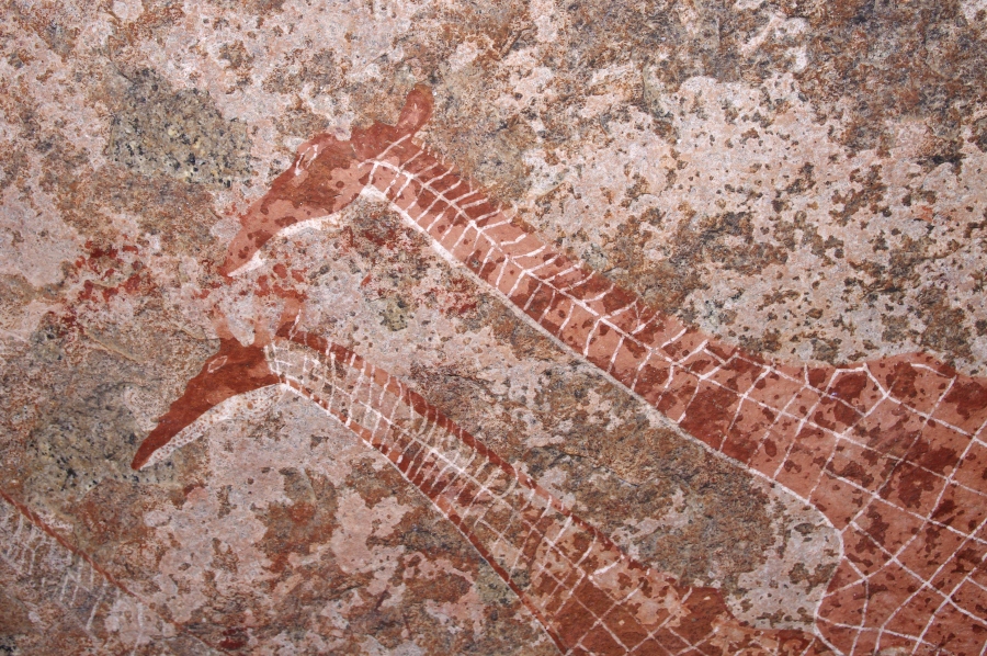
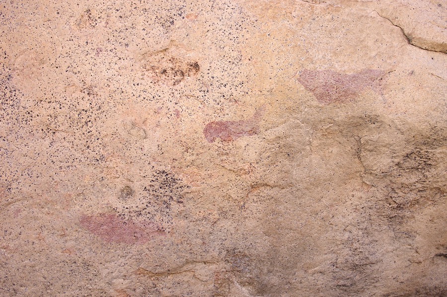
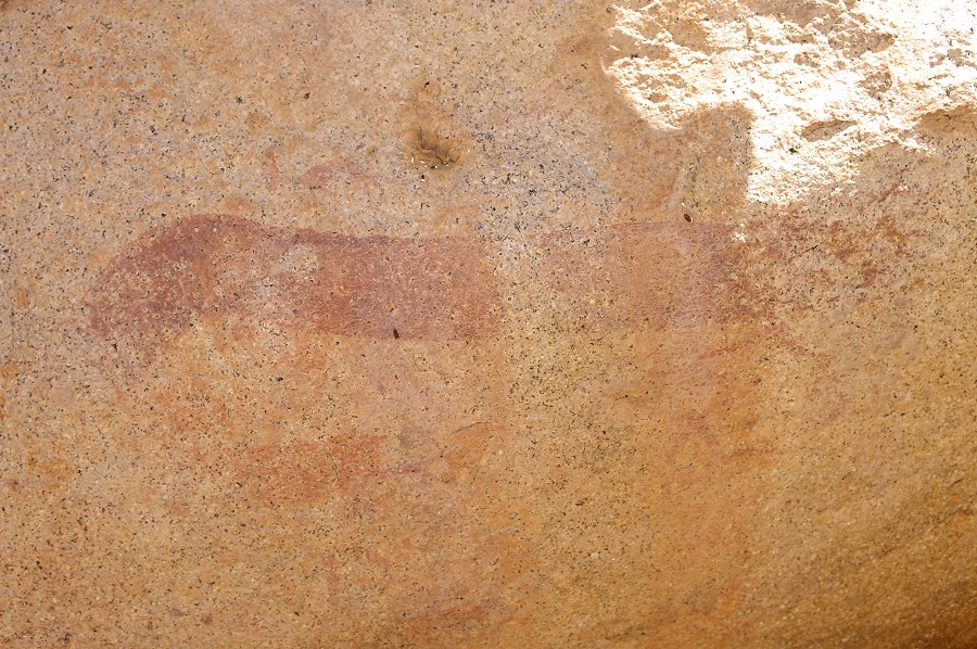
Next to the main panel there is another one with more weathered paintings in black paint, including several fine oryxes and some amorphous shapes with a red dot at the end which makes little sende on first look. It was only the next day at Circus gorge looking at the fine cranes of C10 that we realised we are seeing cranes here too, just the head, neck and legs are gone, and only the body with the red tail is visible.
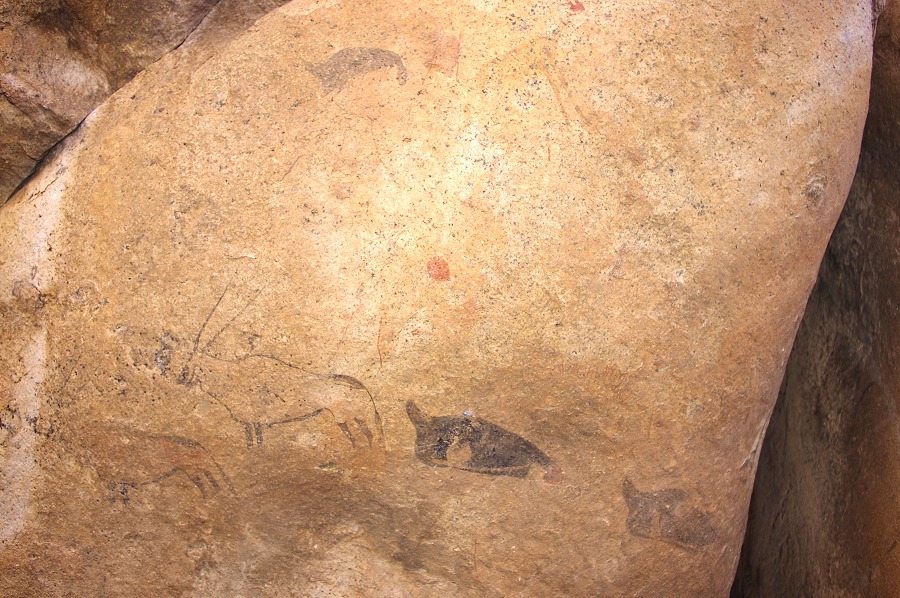
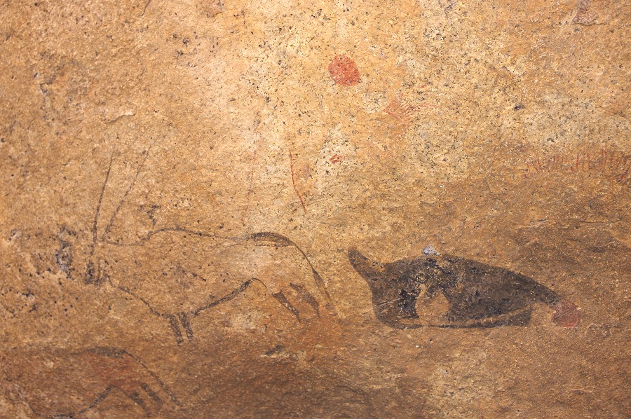
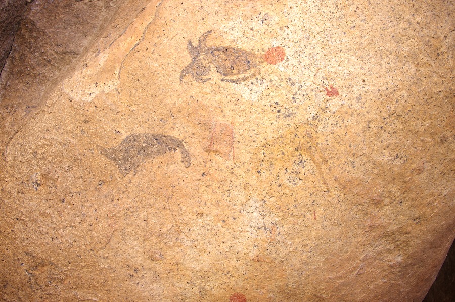
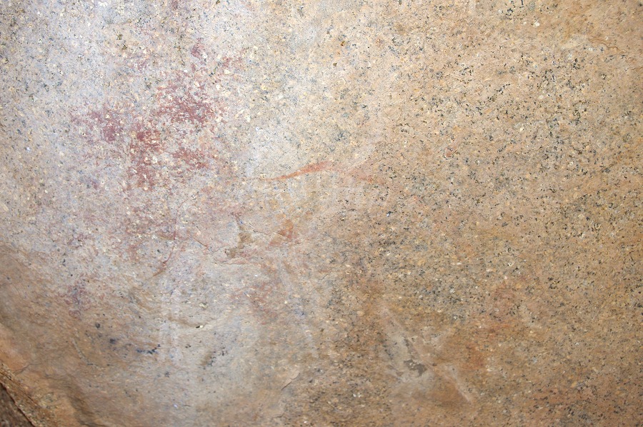
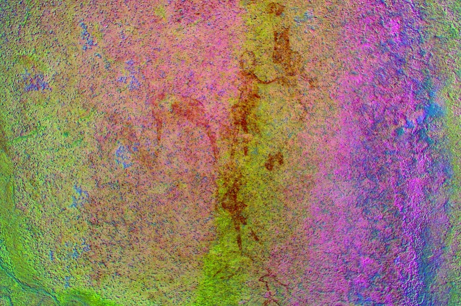
Further left on the vertical rock faces there are several more panels of paintings, of which only some fine but partially weathered oryxes are readily visible, but dStretch reveals many more paintings that are invisible in natural light conditions.
Having finished with all the principal sites, we started to move back towards camp, passing by the big rock of N168. This time in the afternoon shade I have spotted two panels which were completely invisible earlier in the day - we also missed them in 2011.
Nija was nursing a cold picked up on the flight to Namibia which was getting progressively worse, not giving her much sleep over the previous night. She decided not to join the walk to Circus Gorge the next day, and rather than spending a day alone in camp she jumped at the opportunity to go down to Uis with Stefan for a warm bed and shower, coming back in the morning the day after.
Our diminished party spent the remainder of the afternoon in a rather leisurely fashion in the vicinity of the camp. Alfons did find a small site a couple of hundred metres away under a large boulder, probably site N170. We also visited N169, a small but well preservd site right next to our camp on a prominent boulder.
Day 6. - Circus Gorge
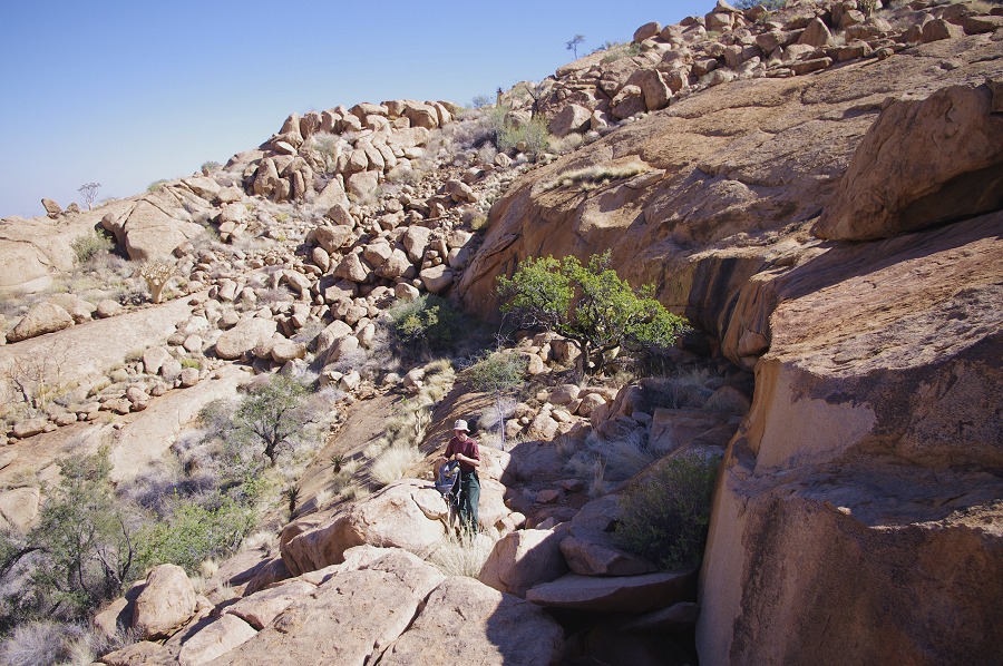
For this day our plan was to visit the principal site of Circus Gorge, C10 plus the adjacent sites. To make the best of the cool of the morning, we started before sunrise, making most of our walk down to the amphiteatre-like basin in the shade. With our small and able group our progress was very fast, it took a little over an hour to reach C10 from our campsite, less than half our estimated time (and what we needed in 2011 along the same route).
There was good reason for our haste, C10 has a large panel of paintngs which face north and remain exposed to the sun for practicaly the whole day, except for the morning before the sun rises over the high ridge separating Circus and Naib gorges. This time we reached the site well before the sun did, we had a good hour to take our photos. While this panel comes nowhere near the perfection of the main panel, it does contain some very interesting scenes, mostly human figures.
It was still just after eight o'clock, Uwe raised a tempting propositon - we had ample time to go further down in Circus, and try to locate C28, a principal site about the same horizontal distance away as the col separating Circus from Numas. Unfortunately we did not have any of Pager's site plans beyond C12, the last site a short distance below C10 which we intended to visit. The small sacle map from the Pager volume we did have provides very little clue other than the general direction. Nevertheless the ridge thought to contain C28 was visible at about the same altitude as C10, and the route there along the contour on the hillside looked feasible. We allotted ourselves till 2pm to return to C10, and set out leaving behind our lunch, reserve water and all unnecessary things.
First we descended past the now dry waterfall and site C11 to site C12, about fifty metres below the waterfall, a cluster of boulders and rock outcrops with some very meagre paintings despite the large number of fixes made by Pager. Most of them only contain some smudges of paint, the best scene was a large crane or other bird on a vertical rock wall.
From here our intended route along the hillside was clearly visible, and did not appear too difficult. We set out trying as much as possible to keep to the contour, but often large boulders forced us to make difficult detours. Nevertheless in a little over an hour we were approaching a cluster of large rocks identified from a distance as the likely location. However reaching them, the otherwise fine shelter was found to be completely empty.
We climbed a bit higher, and soon reached a large pleasant plain, the presence of which came as a surprise as the small scale map did not indicate it, and it was hidden from view as we approached by a low ridge. There were a couple of large rock clusters along the northern perimeter which all looked attractive places for rock art, but we found nothing. Leaving our packs at the westernmost cluster of boulders near the end of the plain, we fanned out on the hillside above in an attempt to locate C28 or any other site which could then help us to position ourselves on the map.
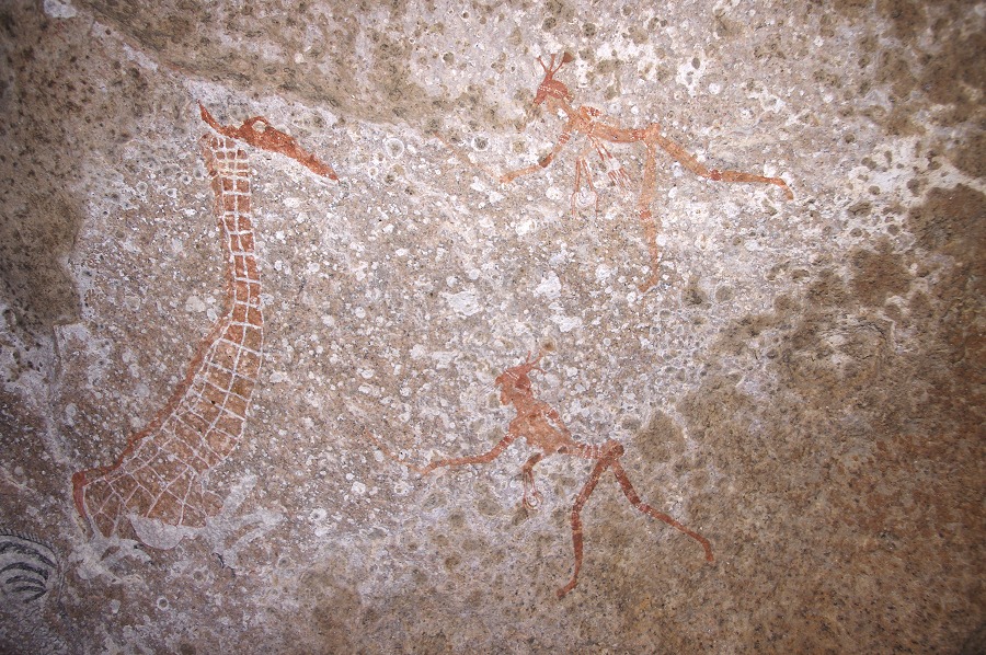
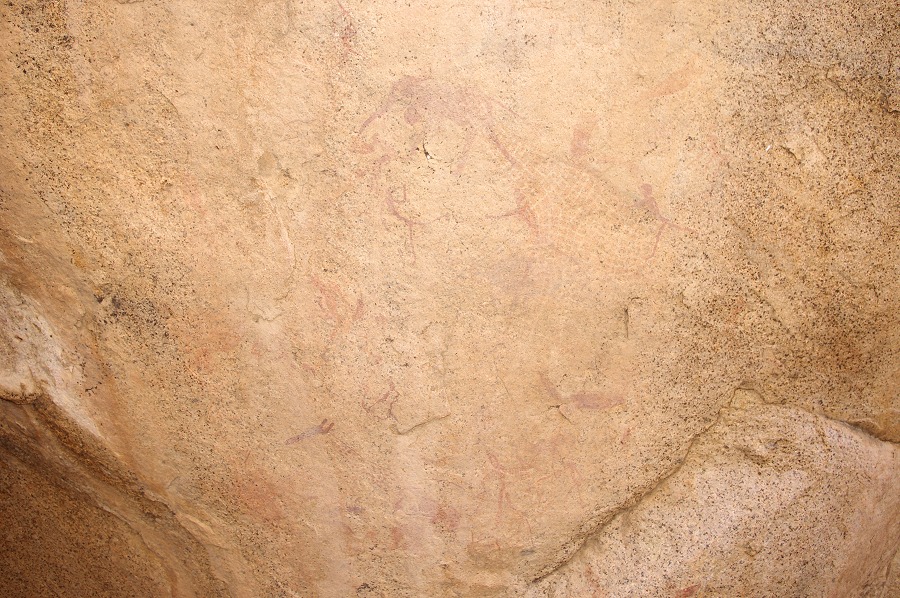
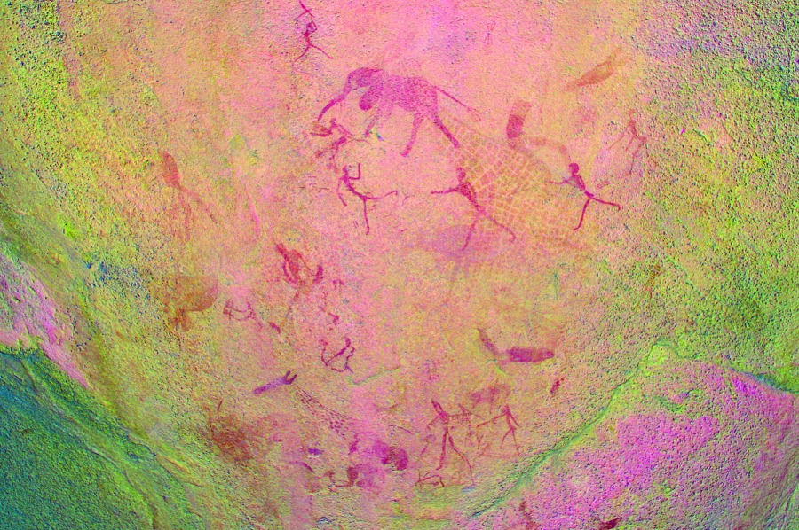
In the end it was pure luck: I climbed a bit higher along the ridge over the plain as the others, and at one point I caught a view into a small valley. At first it appeared uninteresting, but as I walked in to check just in case, a long shadow appeared at the base of the granite plates streaked by flowing water. Approaching the deep comfortable shelter it became clear that water flows over the rear wall for most of its lenth, obliterating any paintings. I was about to turn back when I spotted something reddish at the very end of the shelter - it turned out to be the large antelope, the fine panel with the zebra, giraffe and human figures only becoming visible in a small hollow behind as one approaches the paintings. Both the setting and the paintings themselves were very reminescent of Ga'aseb 7 with the beautiful giraffe and elaborate humans figures.
I went back to call the others, and we spent the next half hour photographing the small but absolutely lovely little scene in the hollow. We all agreed that it may have been a struggle to get here and find it, but this site was definitely worth the effort.
We still had an hour left before needing to start on our way back, with Uwe we made a quick sprint up to several more terraces above on the hillside, up to the watershed with Naib. There were several sites marked in the area, but our quest just proved the futility of attempting to find any sites without Pager's site plans in hand and having a good idea of where they were supposed to be. We spent the hour scrambling over the rocks, and had a beautiful view into the lower Naib, but found absolutely nothing.
Returning to the rocks where we left the packs, Alfons showed a very faint panel of paintings on the underside of one of them - this had to be C29, which meant that C30 had to be at the cluster of rocks at the far end of the plain, which we have also checked out earlier, finding nothing.
Crossing the plain on the way back we apprached the cluster of rocks, and saw a large flat boulder in front of the larger rocks we searched earlier. We did find the panels of paintings on this much smaller rock, including a large eared serpent painted along almost the whole length of the boulder, now much faded and only partially recognisable.
We returned to C10 the way we came, getting back to the welcome shade of the shelter and our lunch packs around two o'clock for a well earned siesta.
We still had time to take a quick look at the sites on the large plain above the basin with C10. We first went to the largest site, C7 with a very large panel of antelopes and other animals.
Returning, we passed by C8, where we found a panel under the rock which we did not spot when locating this site in 2011.
There was another site, C9 on the western edge of this plain, which we failed to find two years ago. This time too we searched in vain, then as luck had it, Alfons stumbled upon it no more than ten metres from the path leading back to C10.
Getting back to C10, the main panel was in perfect lighting, with the sunlight reflecting from the rock in frnt of the panel. We took our time photographing these extremely delicate paintings, among the finest on the Brandberg, before packing our gear and starting on our trek back to camp.
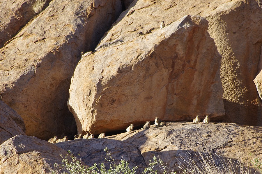
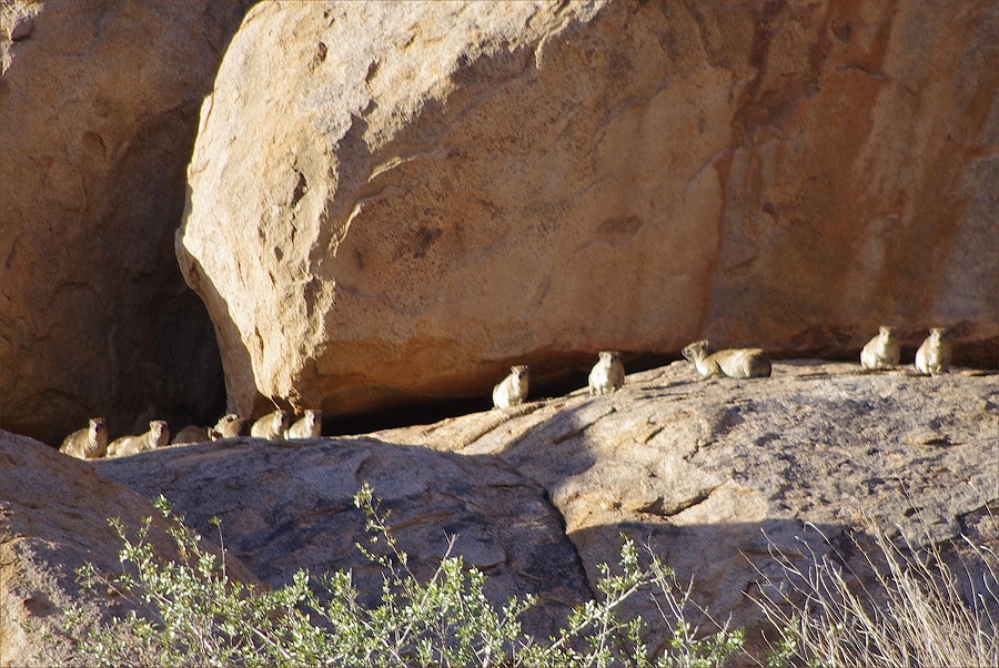
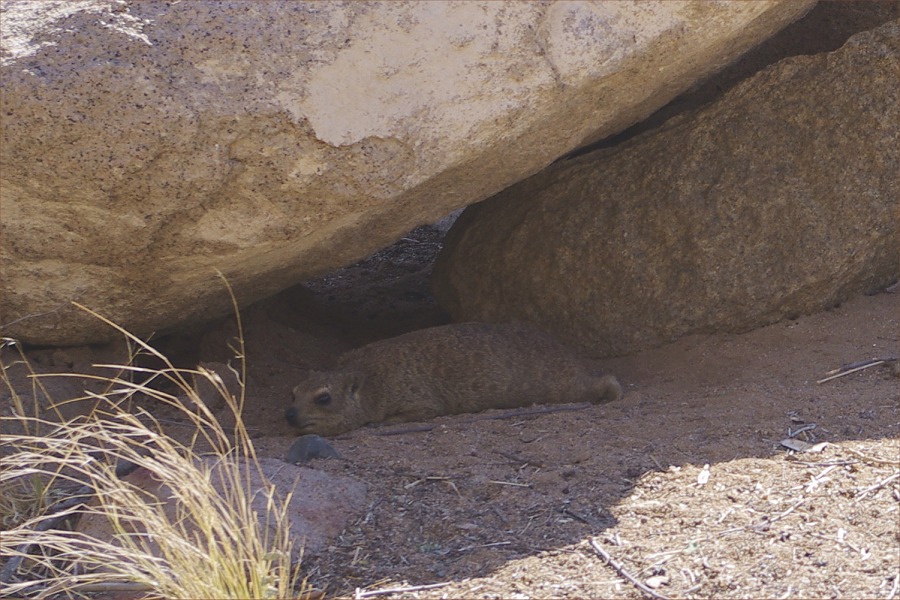
Near the col, far above us we observed a huge family of dassies (rock hyrax, Procavia capensis) warming themselves on the sun. In a rather unusual manner they did not hide on our approach, but sat in a row along the ledge watching us intensely as we passed. Our timing was good, we reached camp shortly before sunset.
Day 7. - Numas - Upper Hungorob Gorge
We awoke to a freezing cold, in a fery literal sense. Condensation turned to frost on the inside of the tents, and there was a thin layer of ice in the water bottles left outside. We packed ourcamp with rather numb hands, putting on everything warm while waiting for Stefan to arrive, hopefully not only with Nija but David too. However even as the sun rose, Stefan did not arrive, and after an hour it became apparent that something must have happened. Despite the cold the wind did not appear strong, so weather was unlikely to be the problem. It took us some time to be able to make contact, finally a message arrived that he had to go on a medical evacuation flight and will be arriving early afternoon.
Having seen pretty much all the sites in the surrounding area, there was little left to do but wait. We took a little walk to the edge of the next valley, where there were a few known sites, but looking down none of us felt the urge to descend the rather nasty looking slope for the sake of a few meagre sites, the whereabouts of which were rather ambiguous. The weather remained cold, and slowly some high altitude clouds drifted in from the direction of the coast, the first I ever saw over the Brandberg.
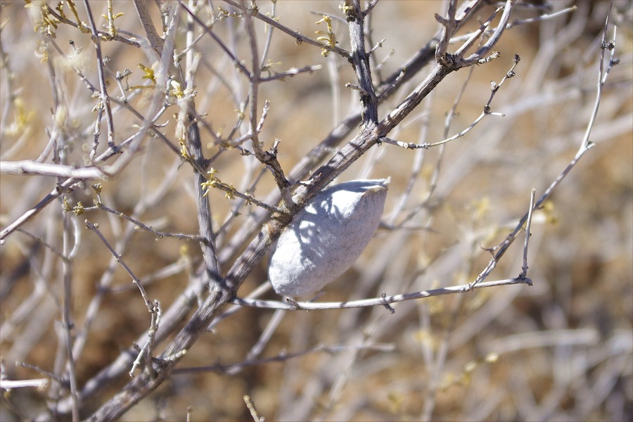
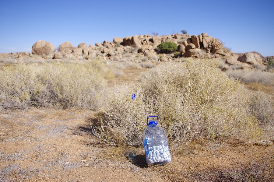
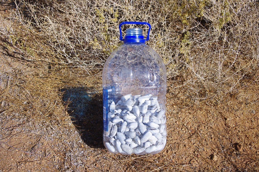
The evening before Alfons spotted some dry empty coccoons of a species of moth endemic to the Brandberg clinging on to the branches of the shrubs littering the small plain where we had our campsite. They were particularly numerous around the large tree in the middle of the plain. We were told that a local medicine man living some 50 kilometres North of Uis is paying one goat for every fifty of these coccoons, apparently a very valuable ingredient in traditional healing that can only be obtained with an arduous trek up the mountain. To pass time we all spread out looking for them, and by lunchtime we could sit down with a promise of a serious braai (barbecue) the following year. One can only hope that the sudden oversupply did not crash the market...
It was well into the afternoon that Stefan finally arrived, with a very smiling Nija, clearly much better after the good rest. The same could not be said of poor stefan, as the story slowly emerged. The previous afternoon he was called to evacuate the badly injured driver of a vehicle that overturned in the coastal dunes South of Walvis Bay. After picking up a medic in Swakopmund they searched for the accident location, but apparently the given coordinates were incorrect, and after finding a suitable landing spot among the dunes just minutes before twilight, they spent a very cold night in the cockpit of the helicopter, with just one sleeping bag between the two of them... In the morning after sunrise they finally managed to locate the vehicle and evacuate the injured (who must have had an even worse night) to the same hospital which was still keeping David for observaton.
After a quick fueling from the reserves we still had on the mountain Stefan took Alfons, Alma and Nija to our next camp on Waterfall plain, while we stayed with Uwe to pack up and load our supplies and remaining gear on the next flight.
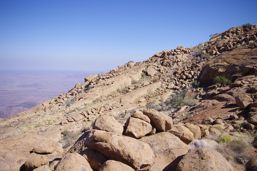
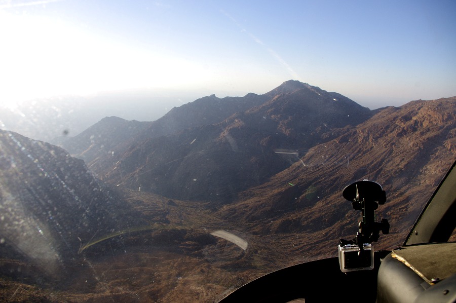
On the second flight with Uwe we took a loop to the three Northern valleys we intended to visit on our forthcoming trekking expedition, to check out the known water holes and landing sites. Flying over the Naib basin we descended into the Karoab, where White Rock plain looked completely dry, however the little terrace spotted on Google Earth above, our intended campsite did appear to be an ideal landing spot. Continuing to Umuab the only large water hole near our planned campsite was also completely dry, as was the large guelta near the Mason shelter in the Nuwuarib, which contained water on all our prevous visits there. It was clear that we had to be completely self-reliant on water. We turned south towards the Waterfall Plain, making an approach right over the Falls Rock shelter (H28) in a perfect low afternoon light.
After a qick unloading and good-byes Stefan left with Alma (who still needed to get back to Windhoek that evening), leaving us to set up camp in the last light of the day.
Day 8. - Waterfall Plain (Hungorob) -Uis
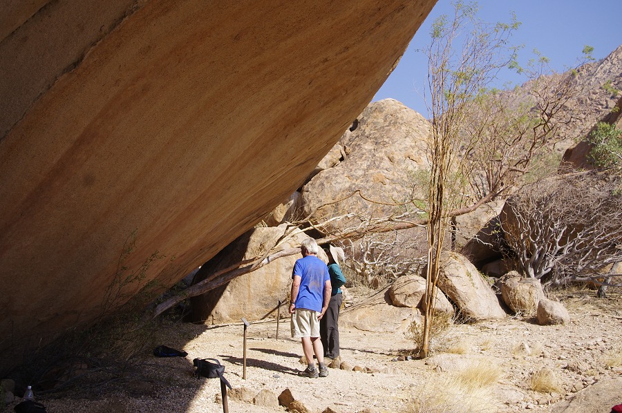
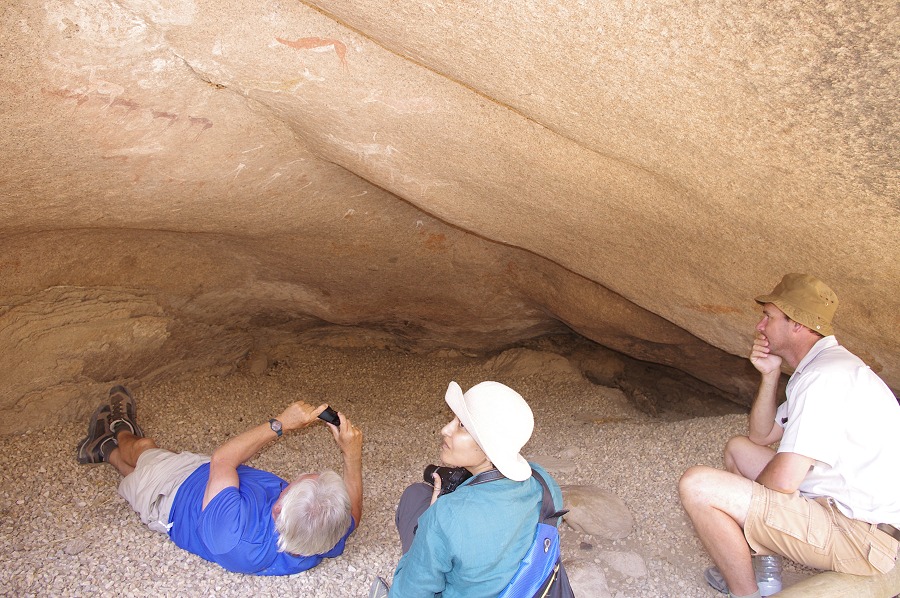
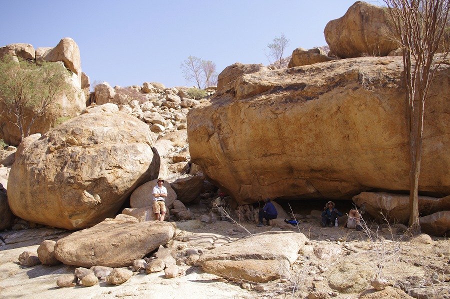
Wth the delay in gettng over to Waterfall Plain the previous day, we had to cut short our planned programe, but we still managed to cover most of the sites we intended to see. After packing up our tents and gear which have been somewhat ruffled by a rather strong overninght wind (which fortunately died down in the morning) we started out on the short climb ut to Snake Rock (H43), the principal site of the area and one of the most important ones on the entire Brandberg.
Whie Nija stayd with Alfons to photograph the site in detail, with Uwe we made a quick sprint to the area to the North, with a series of flat terraces and about a dozen sites of lesser importance. The first site to see was a short distance below H43, site H47, a large boulder which we have already identified the previous year but could not find any paintings. This time armed with Pager's site plan it was an easier job, but it was necessary to do some serious gardening work before enough of the encroaching dense bush could be cleared to see the rather unspectacular paintings. Moving on we climbed up some rather difficoult boulders to an upper level, where we soon found site H48, a large triangular boulder with some fine large human figures on its side.
Finding the remaining eight sites proved to be much more difficult. I have found out repeatedly that the area overview shetches in the Pager Hungorob (and Amis) volumes are neither to scale, nor are they in an uniform perspective, which makes them very confusing. With Uwe we stumbled among the rocks for quite some time, looking at several empty boulderw which we suspected of being sites, until by accident we found H51, quite far from where we assumed it to be. Getting our bearings, we soon found another three, then further two higher up, but despite having a good description of the ir environs we searched in vain for H55 and H56. Most of the seen sites had some very insignificant paintings, only the row of figures at H52 (with a typical "porter") and at H51 (with some curiously executed in outline) are worth mentioning, plus the enormous ancient bottle tree adjacent to the otherwise rather nondescript H53.
After a good hour and half we returned to H43 where Nija was still merrily snapping away at the innumerable details. We descended to camp, and after a quick lunch moved on to Falls Rock shelter (H28).
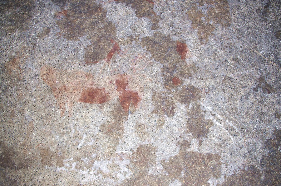
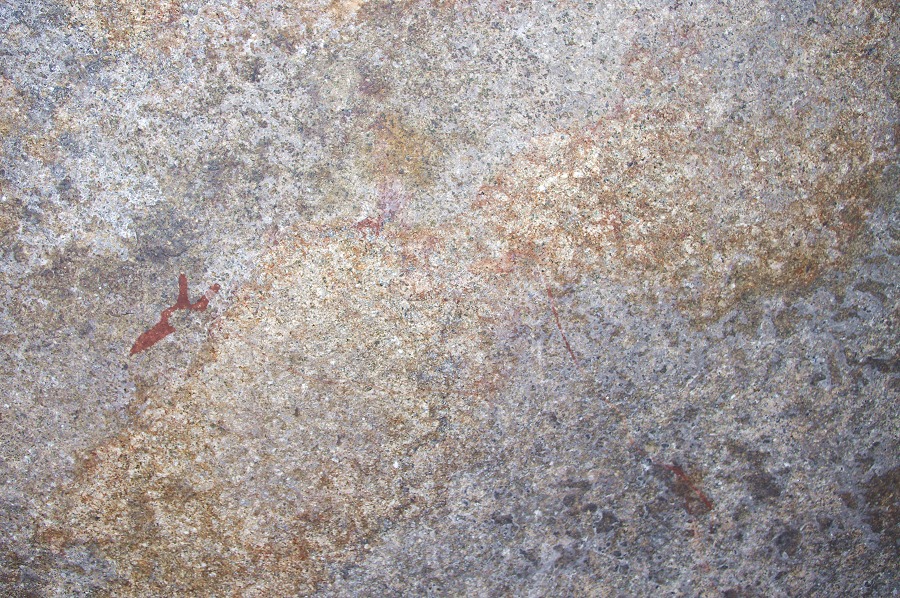
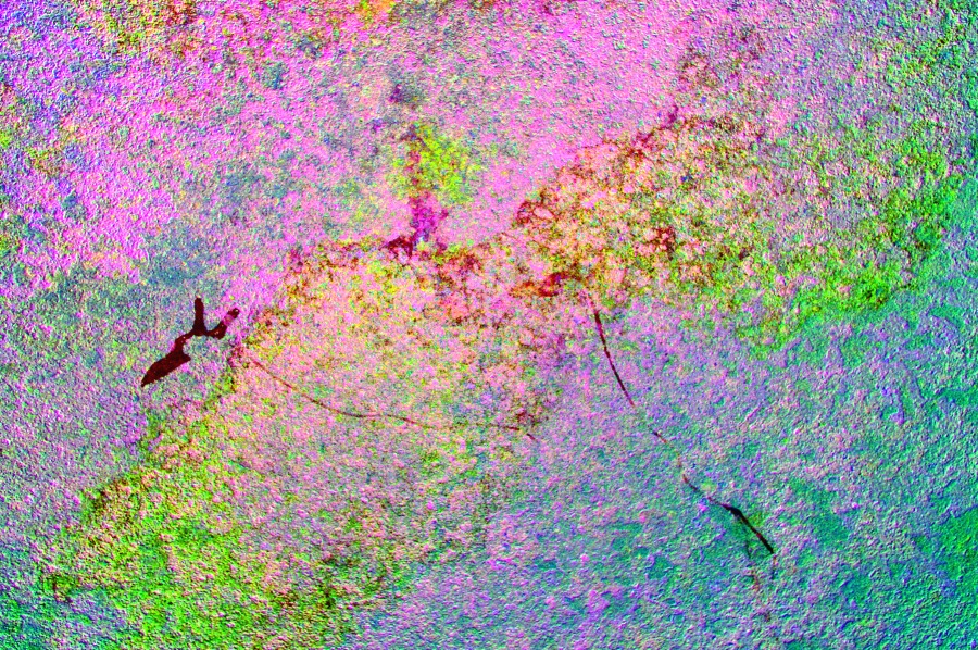
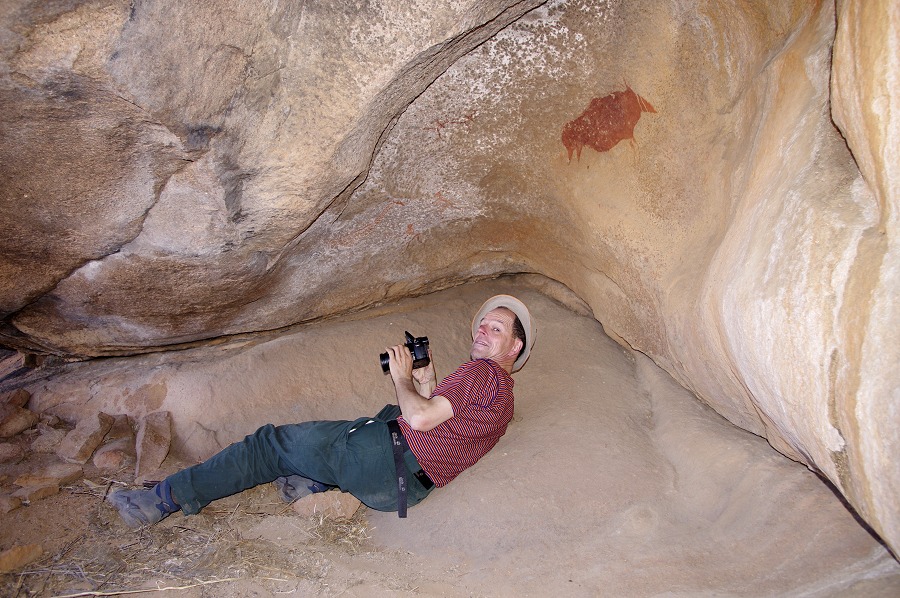
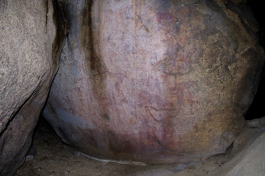
Unfortunately the majority of the paintings here are not so well preserved, but there is a very curious and unique panel which I have only been able to photograph properly now, with Pager's tracings in hand to be able to make out the very indistinct scene. On the brow of the shelter there is a large flat vertical area where two large animals and an indistinct large shape have been painted, uniquely not with any pigment but just mud. Now their colour is practically identical to that of the surrounding stone, however dStretch brings out the subtle tonal differences. The animal on the left is indistinct, however the one in the middle is clearly a large rhinoceros, almost a metre in length. What the amorphous shape to the right might be is anybody's guess. These mud paintings seem to be more ancient than the usual ones in red ochre, as a small running figure is painted over the belly of the indistinct animal on the left of the panel.
We climbed back to Waterfall Plain, to visit the other sites scattered about. We were just at the first site when we heard the sound of the helicopter, Stefan arriving to join us for the rest of the afternoon.
Stefan finally had some news from David, apparently at the hospital they have found nothing conclusive, he felt much better now and was on his way back from Swakopmund to join us at Uis in the evening. While sadle he could not re-join us on the mountain, this was certainly a bit of good news. Unfortunately this also meant that we could not make our traditional group photo of all of us together, as the previous day we agreed that Uwe will descend the mountain via the Ga'aseb gorge with Alfons to see the sites there, while we return to Uis and Windhoek, as he was to join the trekking expedition immediately afterwards. After the photo session they both took their packs, taking our leftover supplies which were just enough for the two of them for the two days, and we set out to visit the sites at the far end of the plain, after which we wished them good luck and they set off to reach the campsite at the Helm pools before sunset.
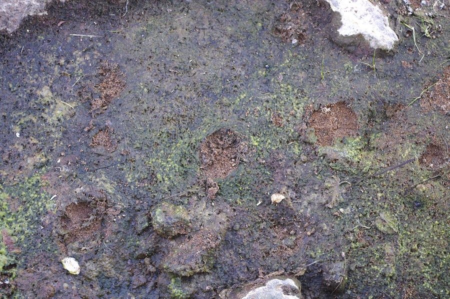
We stil had a couple of hours of daylight left so were in no hurry. We checked out the main water hole of the plain, and were suprrised to see some murky water still remaining at the bottom, with some very fresh looking leopard tracks leading to the waters' edge. We also went to see a few more sites, then when the shadows started to grow we loaded the helicopter with our few remaining things for the flight back to Uis.
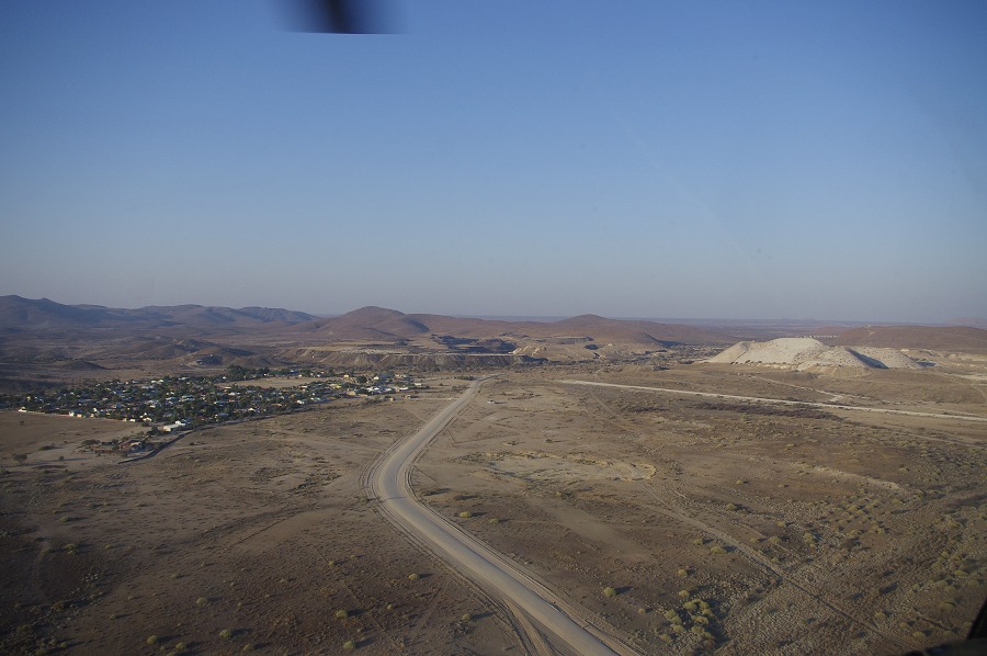
It was a quick ten minute flight back to Uis, passing over the Helm pools (but no sight of Alfons and Uwe) then past the Orabes Kopf and Ga'aseb before taking a straight course for the town, with the light right behind us. As we landed, a tall figure started to walk towards us from the White Lady B&B, it was David in both good shape and spirits. He was released from hospital two days earlier without any definite diagnosis, but was discouraged from going up the mountain again, but after a final check that morning he could rejoin us for the remaining days.
Day 9. - Lower Tsisab Gorge (White Lady)
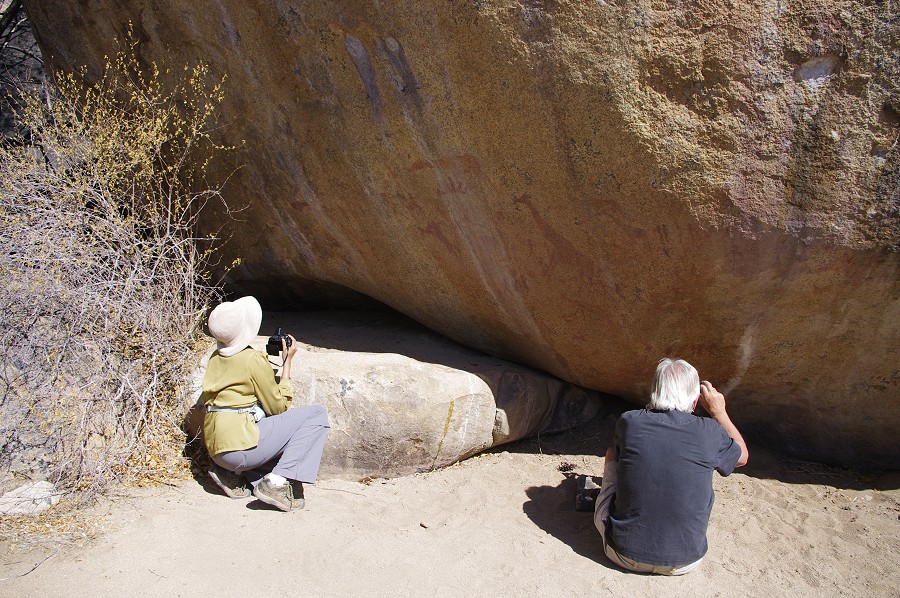
We started out early to make the best of the cool of the morning durng the two and a half kilometre walk to the lower Tsisab sites. With Alfons still somewhere in the Ga'aseb wth Uwe, our guide for the day was Colin, one of the core team of mountain guides working at the Brandberg, who also supported a number of scientific expeditions to the upper reaches of the mountain. We quickly reached the "White Lady" shelter (T1 - The Tsisab site numbers are adapted from E.R.Scherz, Felsbilder in Südwest Afrika III, Köln 1986), well before the trickle of other tourists started to arrive. Inexplicably very few visiors make the extra effort of going just a little further to see the Tsisab island sites recorded by Breuil in the late forties. The built path continues, and there is a cluster of beautiful paintings just a few hundred metres beyond. Colin told us that for every 100 visitors to the White Lady, there is one who requests to extend the tour to the other sites.
We crossed the dry waterfall just behind the "White Lady" and started out with the White Giraffe shelter (T7), one which I did not see since our very first visit in 2005. In my memory it lived as a much smaller site, it is a very large imposing rock with a shallow but roomy shelter underneath with some very fine paintings, including the pair of fine white giraffe for which the shelter is named.
We moved on a short distance to the Jochmann shelter (T4), the first paintings to have been discovered in the area, and certainly the principal site of the lower Tsisab (with many more paintngs than at the more famous White Lady). We spent our time taking photos and just observing the numerous exquisite details.
Moving on, we visited the white ostrich shelter (T3) and the Tiara cave (T2) along the northern edge of the island, both containing very fine panels of paintings. In the latter there is much more than first meets the eye, the readily visible giraffe are just a small part of a fairly large panel with many figures that are very faint, barely visible on the spot.
We climbed down the main watercourse to the Elephant shelter (T10) on the far bank, on first look an insignificant site with a faint elephant and a few more damaged paintings. We stopped here to have lunch in the shade of the shelter, and this gave an opportunity to have a closer more detailed look (usually this shelter is the last one on the itinerary, with everyone already saturated with paintings for the day by the time it is reached). I was quite surprised to find the whole rock densely covered with faint but still recognisable paintings, all of which stand out quite vividly when processing the images with dStretch.
From here a steep path leads up to the Girls' School shelter (T11), the finest panel of paintings in the lower Tsisab. While David felt perfectly fine, he decided not to push it in the midday heat, he stayed down while the rest of us made a brief sprint to the shelter about fifty metres above the valley floor.
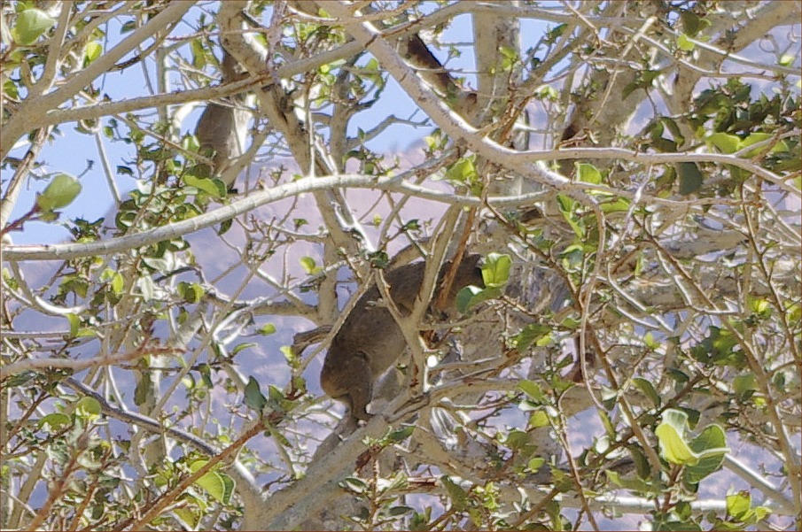
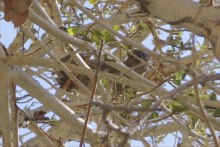
Having completed our round, we started our way slowly back to the car park to drive back to Uis for a lazy afternoon and evening. It was already well into the afternoon, we saw several cases of whole families of dassies (rock hyrax) up on trees feedng on yound shoots, then running down clumsily on our approach. One large wild fig tree was particularly full of them, with all branches shaking and swaying as we approached, with dozens of them running for safety.
Day 10. - Uis - Omandumba - Windhoek
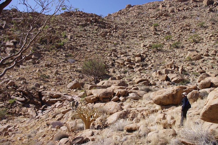
We departed Uis with an early morning start to Omandumba West, the farm of Harald and Deike Rüst at the foot of the Erongo Hills, some 100 kilometres away. There are over a hundred rock art sites scattered about the huge farm, some recorded by the Abbé Breuil hosted by Harald's father, but many remain unpublished.
Harald first took us to Leopard Cave, a dwelling site which was excavated in 2007-2009 by a french team from the MNHN, Paris (Pleurdeau et. al, 2012). The exavations yielded what appears to be the oldest evidence for the presence of domesticated sheep / goats in Southern Africa. The big shelter also contains some very faint paintings on the rear wall, only appreciable after enhancing with dStretch.
Next Harald showed us two sites which he only recently discovered, both with some very fine paintings. A systematic survey would almost certainly reveal dozens of more sites among the huge boulders scattered everywhere at the foot of the hills.
We continued to a large deep shelter at a more remote corner of the farm, which I did not see on previous visits. It has an interesting large panel of paintings on the rear wall, unfortunately rather damaged by flowing water ant the urine of the hyrax whch live in the cave.
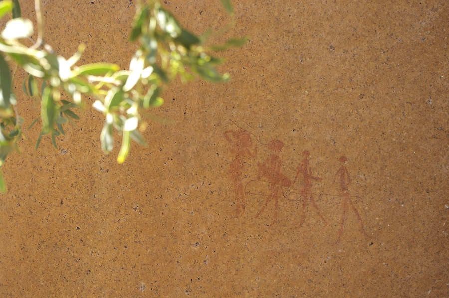
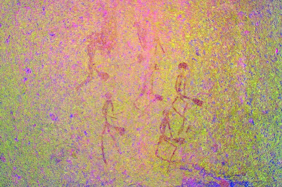
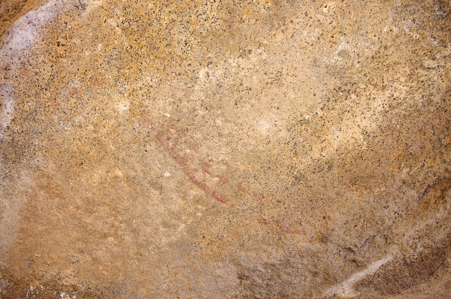
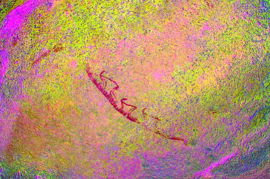
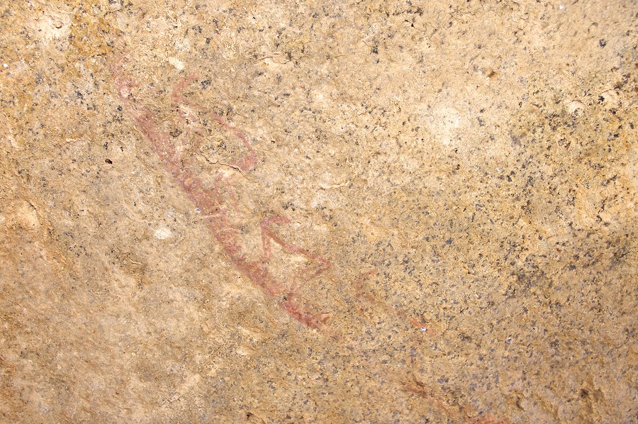
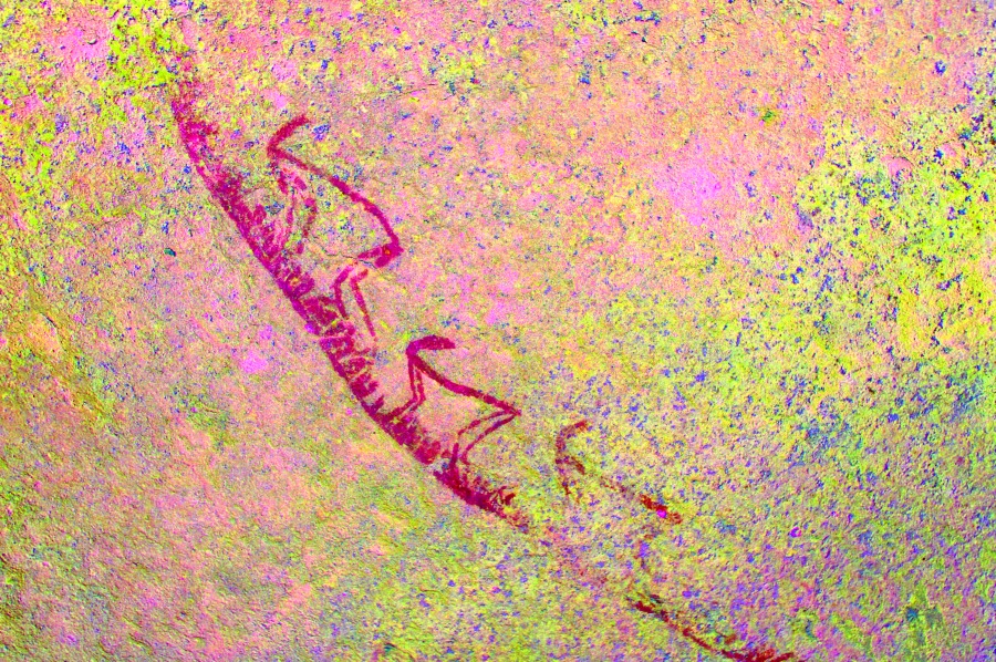
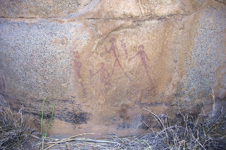
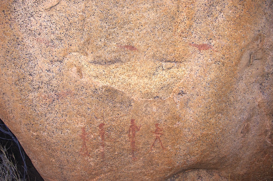
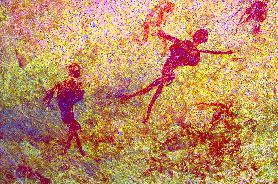
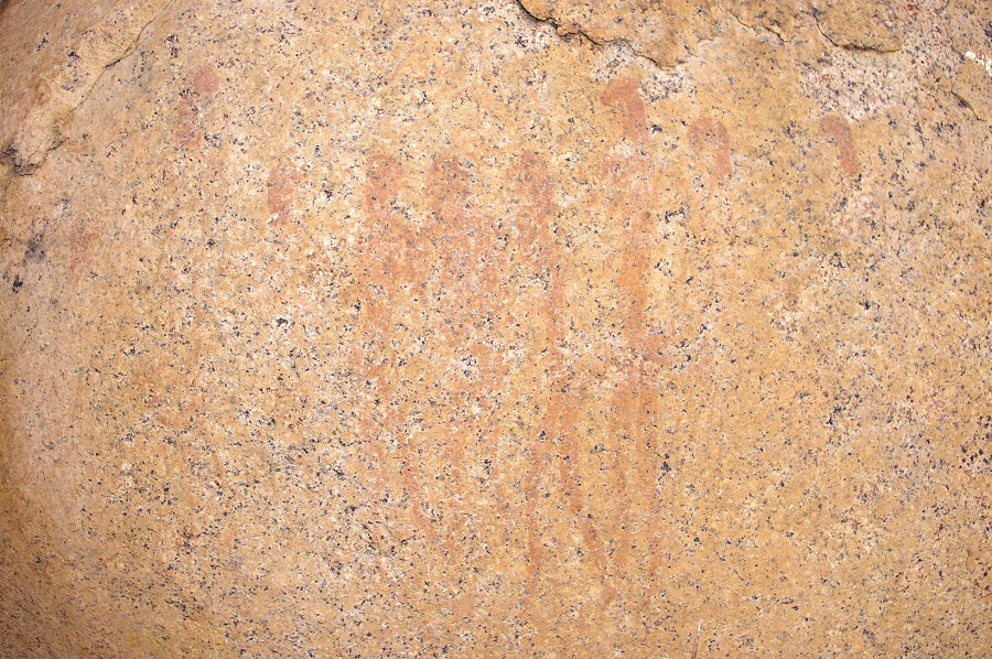
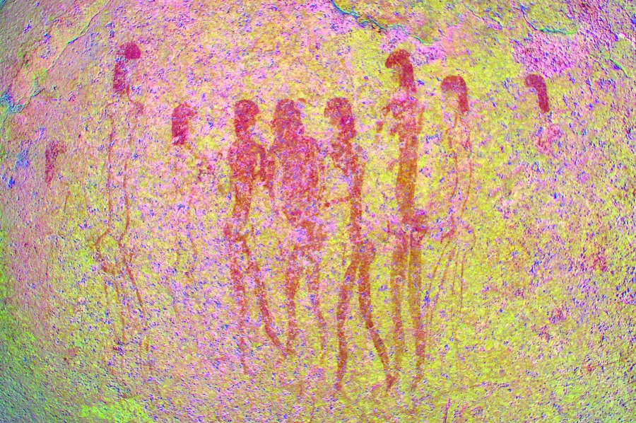
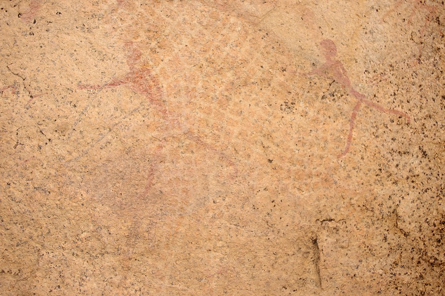
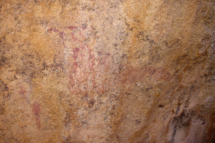
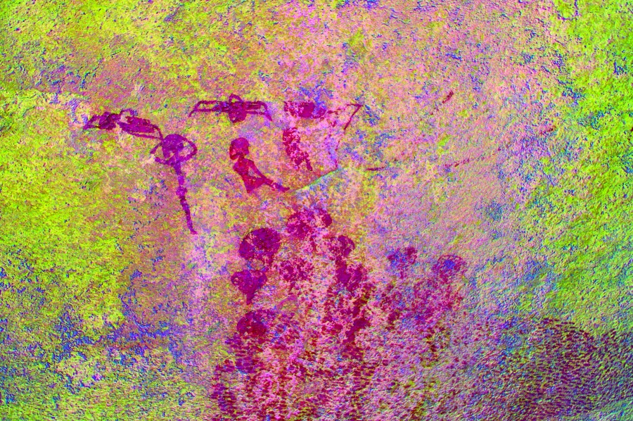
As we started moving back towards the farm house we reached more familiar ground, passing by the "crown shelter" and the group of curious human figures who appear to hold a long object to their mouths. Even with dStretch it is hard to make any sende of them, it is unlikely that they are musical instruments (as suggested by Breuil), but an alternate hypothesis of blow-darts is equally unlikely, as there is no evidence of any such implements in use in the ethnographic record of Southern Africa.
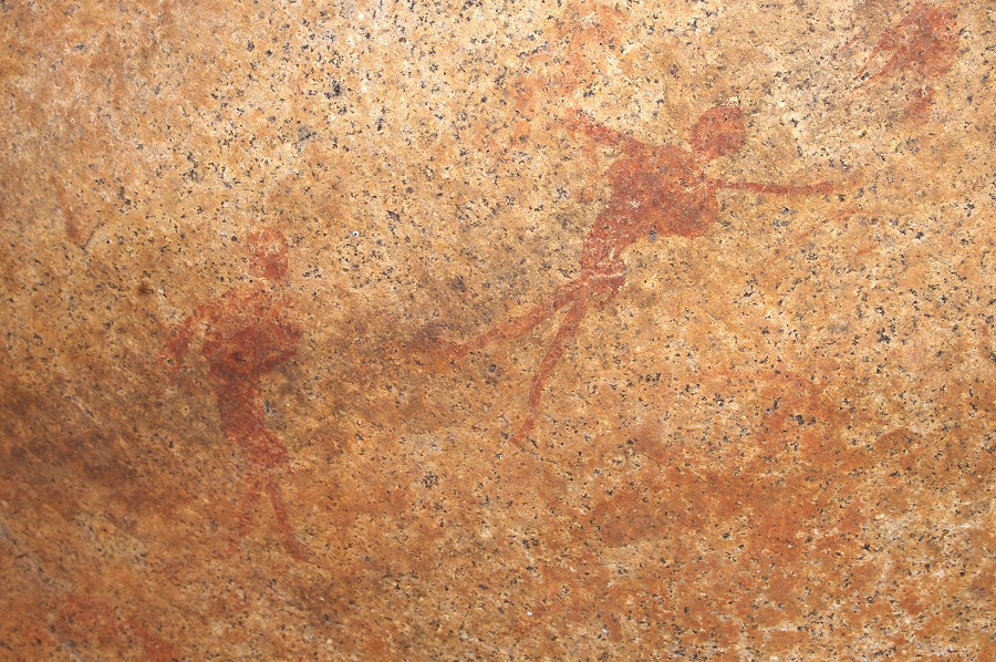
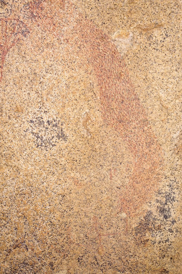
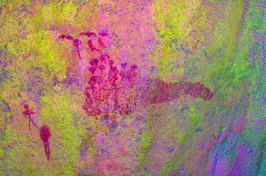
The famous scene generally interpreted as a swarm of bees chasing a group of hunters is on the rear side of the huge boulder forming "crown shelter".
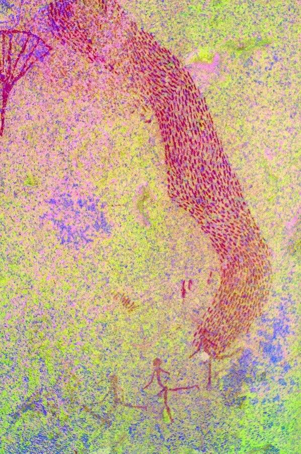
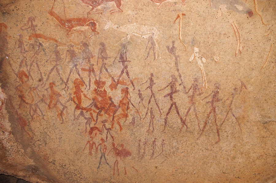
This time taking a better look I saw another adjacent panel with apparently similar topic, casting some doubt on the interpretation of the other better preserved and well known scene. There is also a group of human figures (including several typical "porters") to the far right which I spotted only after Harald pointing them out.
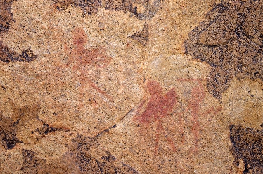
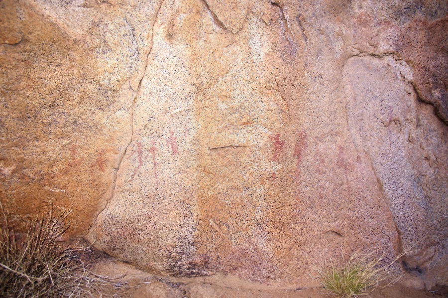
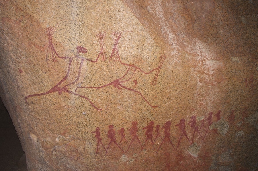
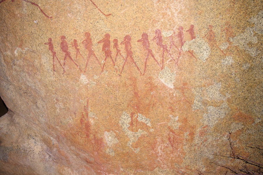
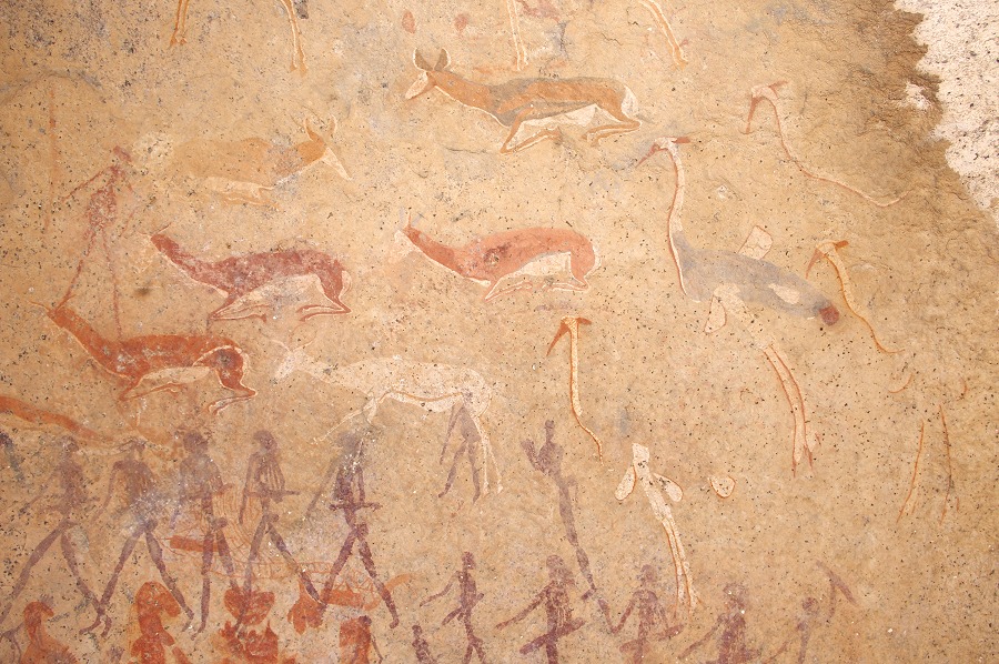
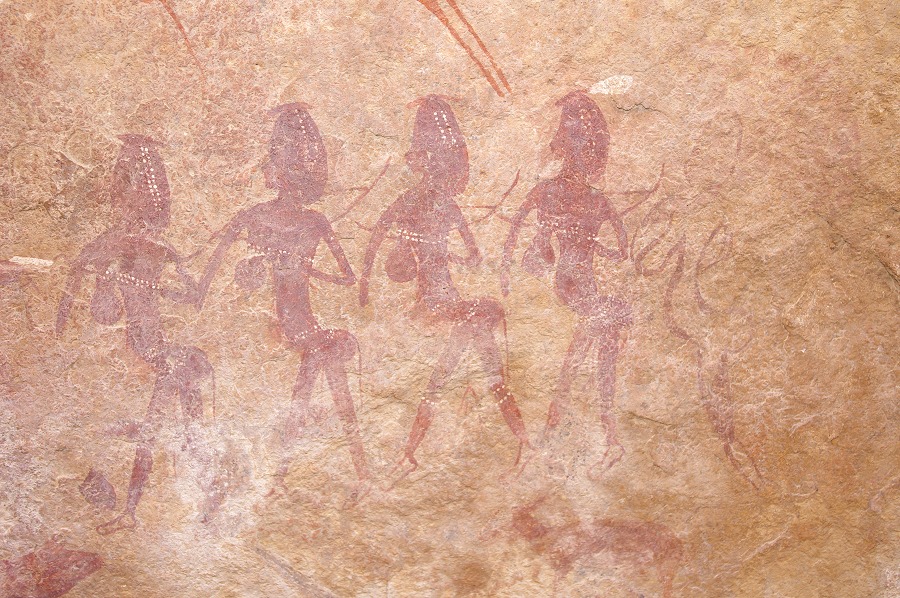
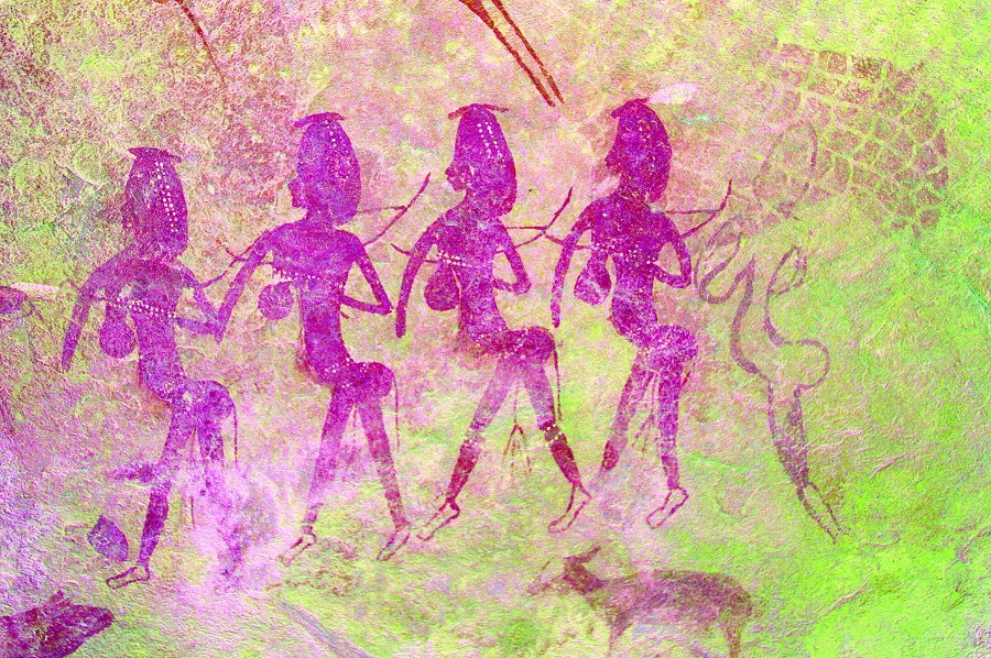
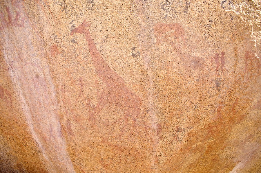
As customary we finished off our tour with the largest and most important shelter on the farm, the "torchbearer's shelter", so named after a group of apparently dancing women holding what are most likely lit torches (there are ethnographic analogies for such night dances).
After the usual superb lunch we said good-bye to our hosts, and also to Nija who left us here for a few day's tour of the Skeleton Coast. We reached Windhoek by late afternoon, starting preparations immediately for the follow-on trekking expedition.