
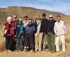
 Click on image for list of participants |
Gilf Kebir Expedition, Egypt 20th February - 1st March, 2008 |
Day 1. - Kharga - Bir Terfawi
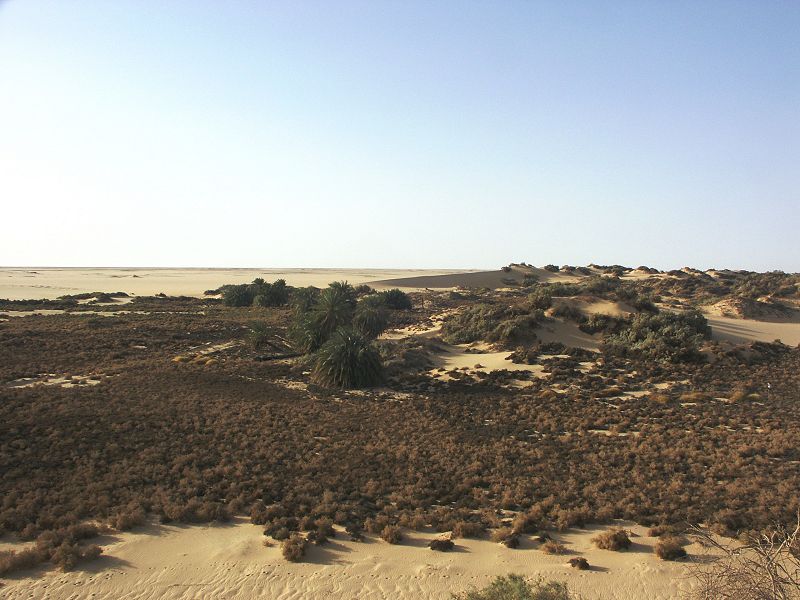
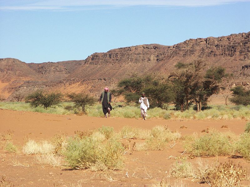
We met Michael and the group in Kharga the evening before, where they spent some days wisiting the Oasis and its monuments. We were set to start at 6am, but our allocated officer failed to turn up till 9am, resulting in a frustrating wait outside the army barracks. When he did turn up, the he turned out to be a thoroughly unpleasant young lad, quite a contrast to the almost invariably nice and cheerful fellows we had in the past. With the late start and the long drive along the road south through the Oasis, then along the old route of the Darb el Arbain, it was late afternoon when we reached the small Oasis of Bir Terfawi to make camp.
Day 2. - Bir Terfawi - southern Gilf Kebir - camp near Peter & Paul
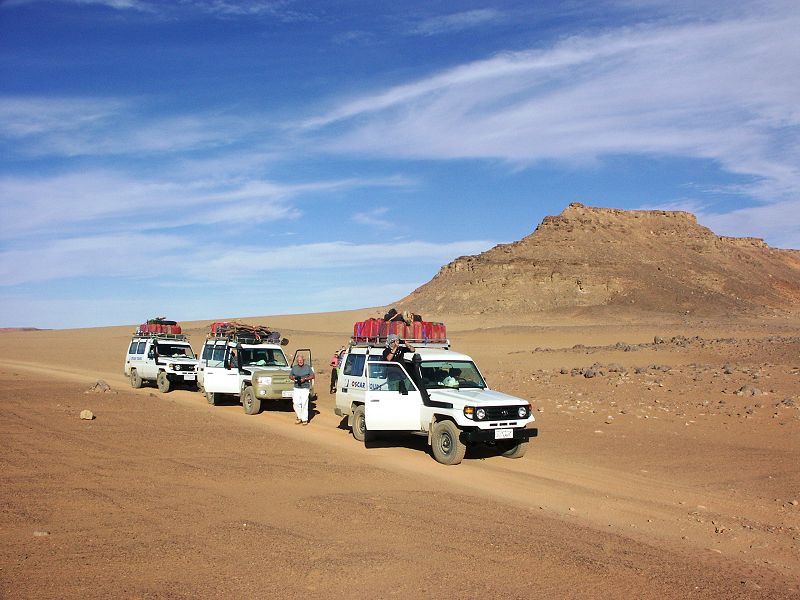
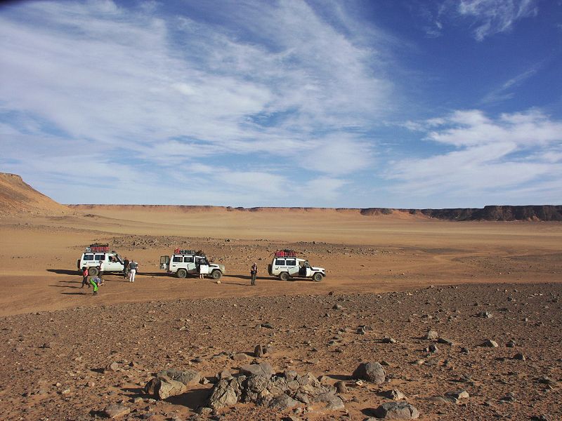
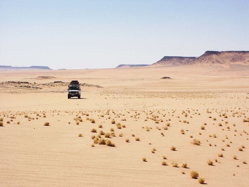
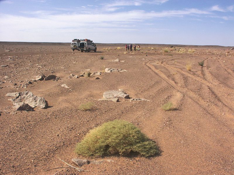
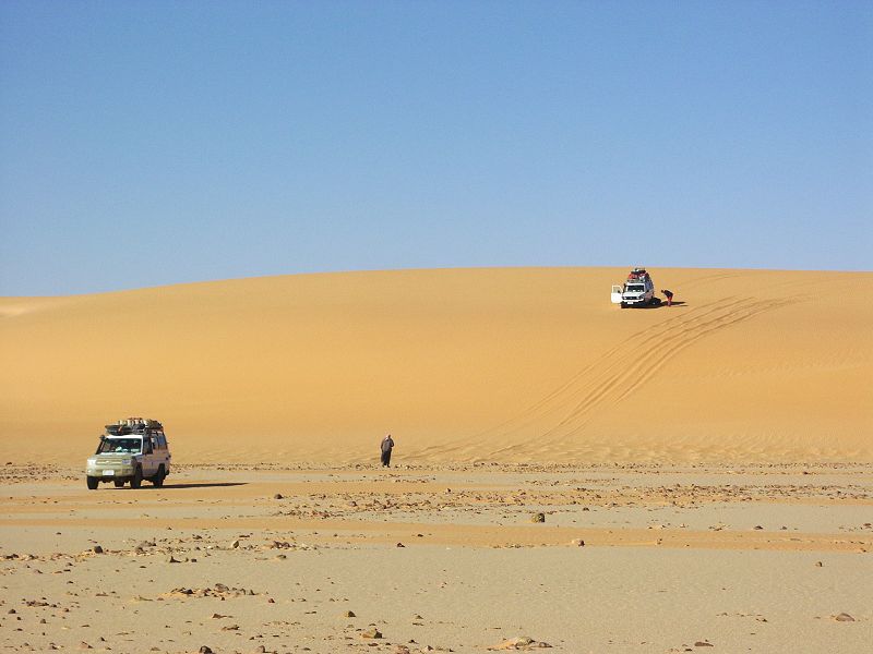
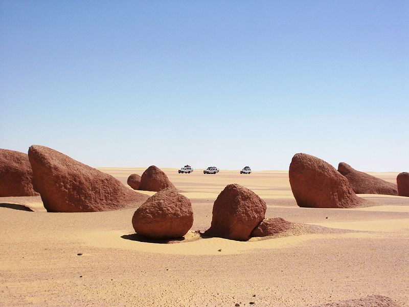
After an early start to make up for time lost the previous day, we drove accross the Selima Sand Sheet to "Eight Bells" aerodrome, then on to Shaw's Cave on the col between Wadi Firaq and Wadi Wassa.
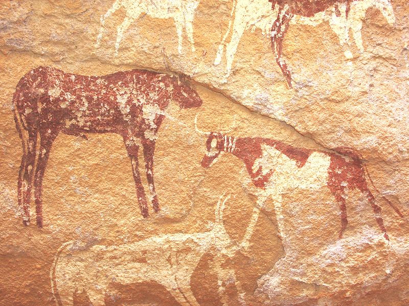
After the customary photo frenzy associated with the first rock-art encounter, we continued westwards in Wadi Wassa, to exit on the plain to the west of the Gilf. This route was off limits due to the mines at the western entrance of Wadi Wassa (laid, like all others in the area, during the 1977 Egypt - Libya conflict), however recently a safe route around the mined areas was marked out, and is now in heavy use as attested by the numerous fresh tracks.
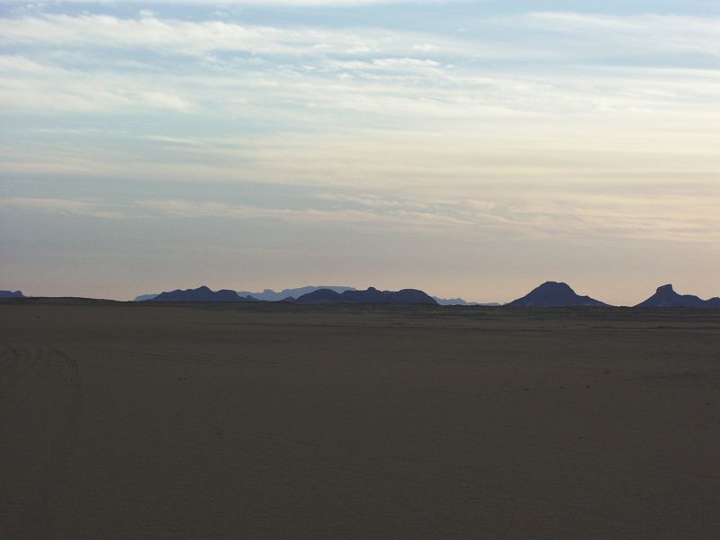
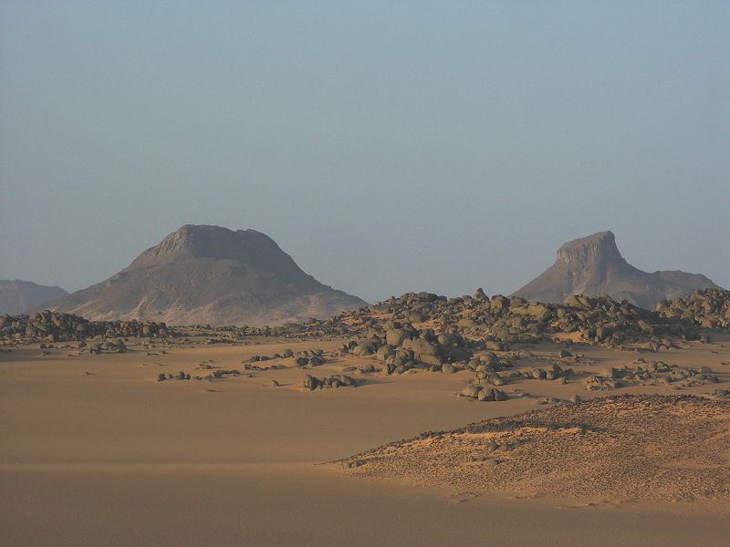
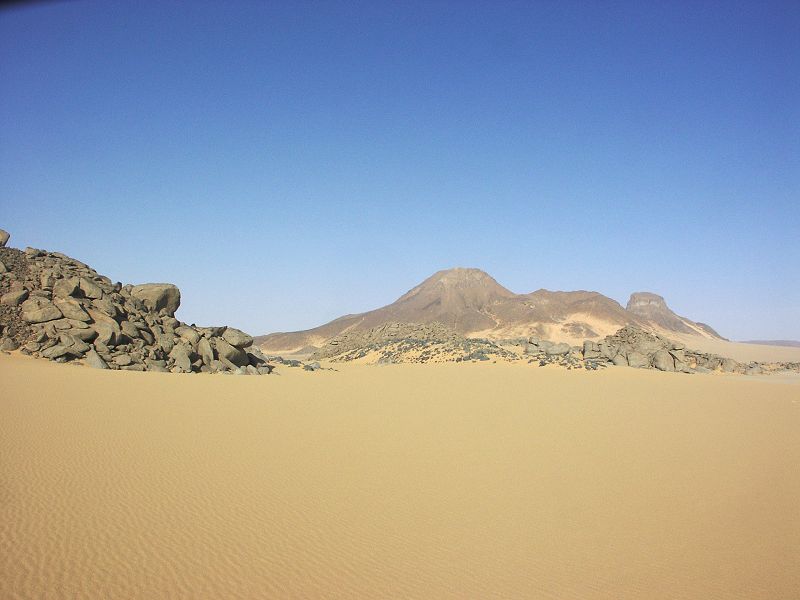
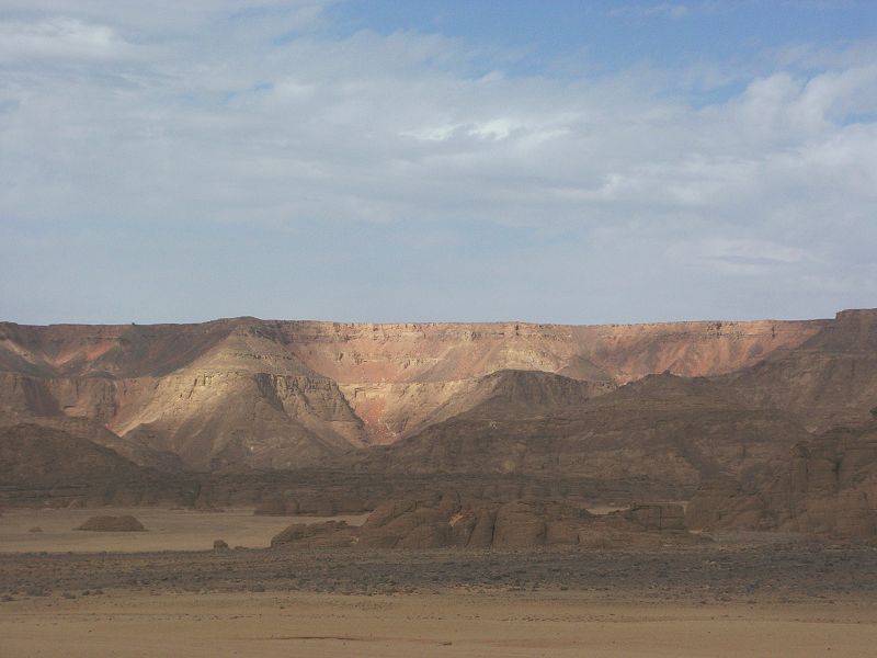
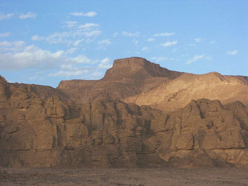
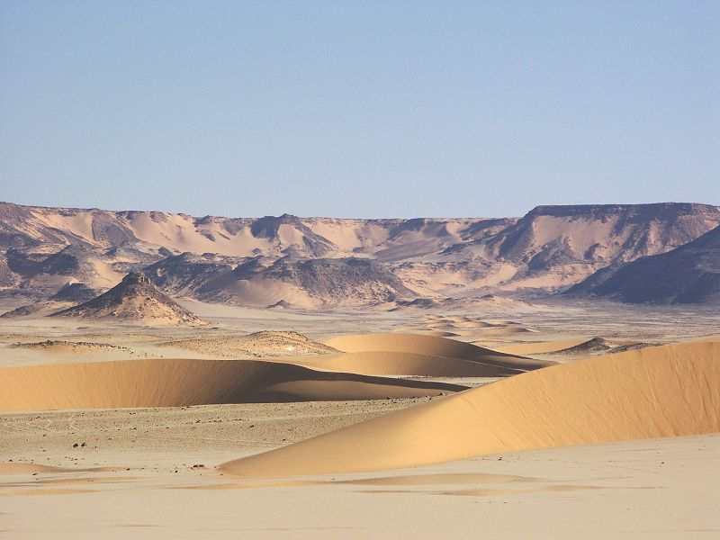
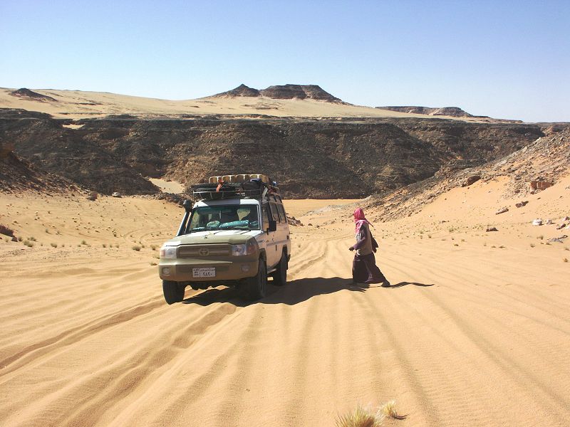
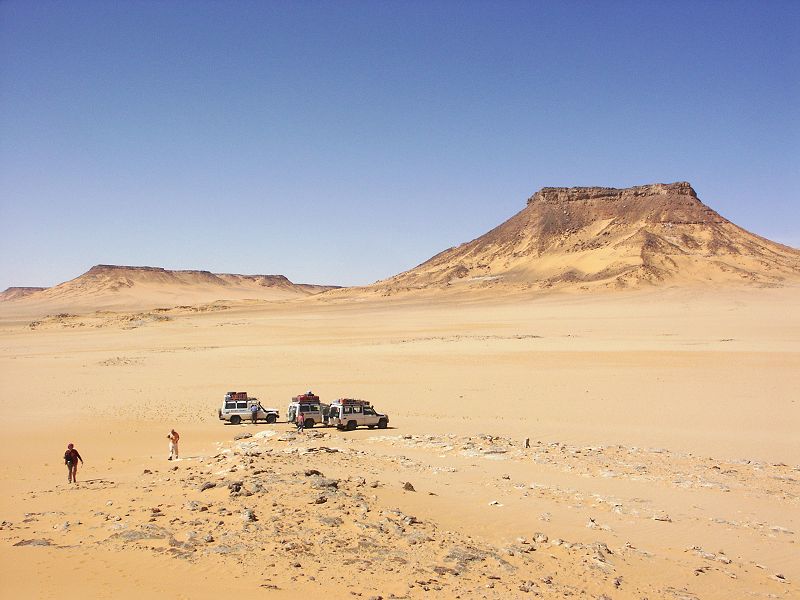
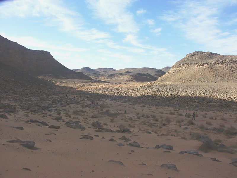
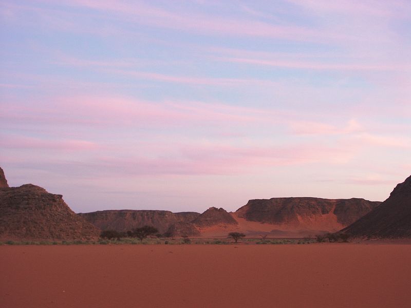
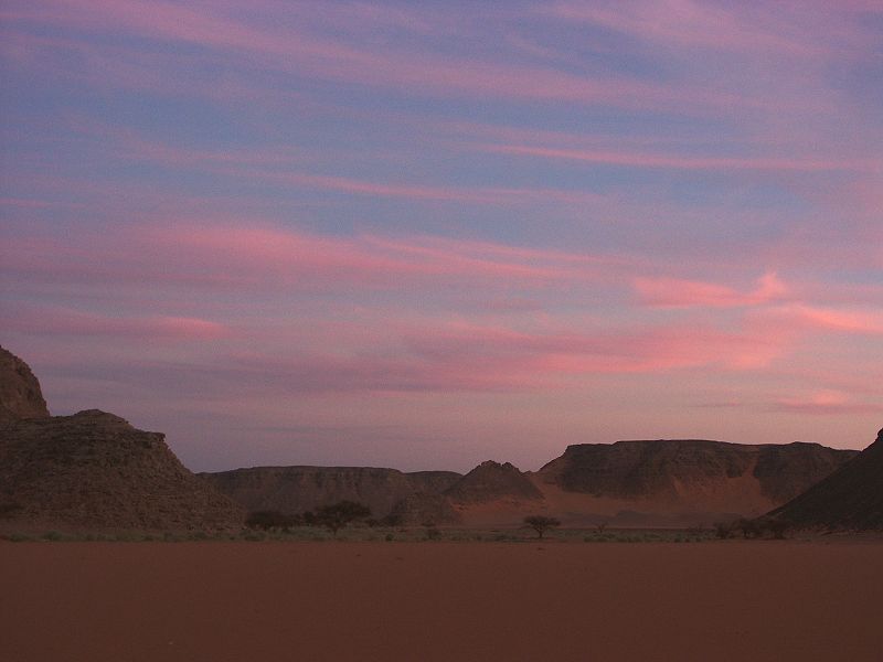
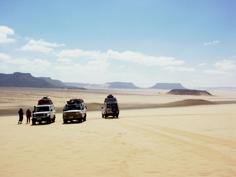
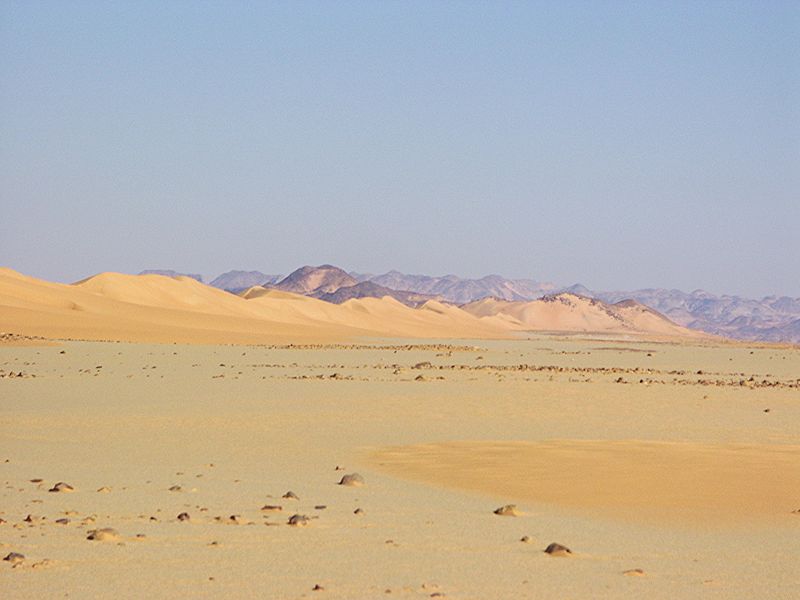
As we were approaching our campsite among the low granite hills north of the two prominent volcanic hills Peter & Paul, we had an amazing view as we reached the top of the rise where the hills & Jebel Uweinat beyond first come to view. It was a perfect crystal clear evening, the hills and Uweinat stood out as dark silhouettes in a way I have never seen before. At this point, Jebel Uweinat is still about 80 kilometres away, usually just barely visible in the ever-present haze of the desert.
Day 3. Clayton's Craters area - Wadi Sora
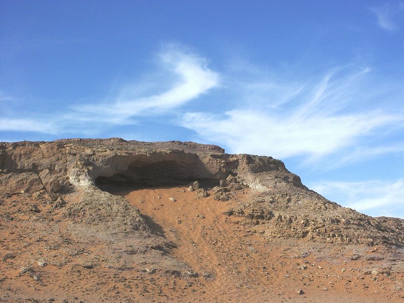
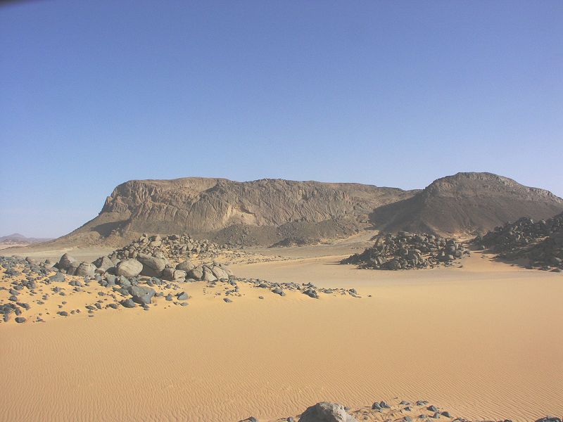
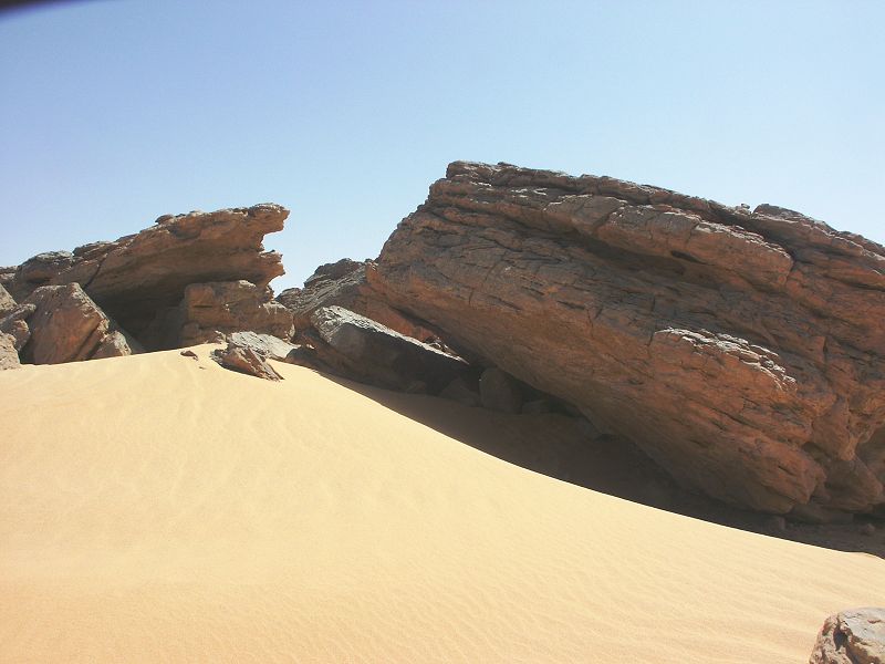
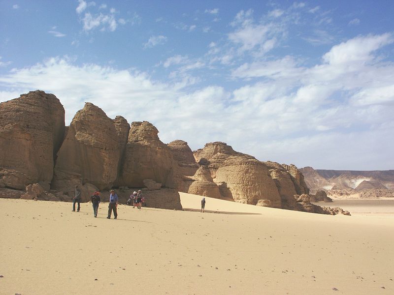
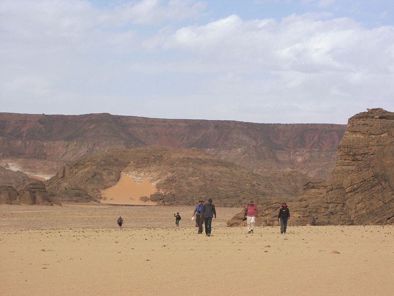
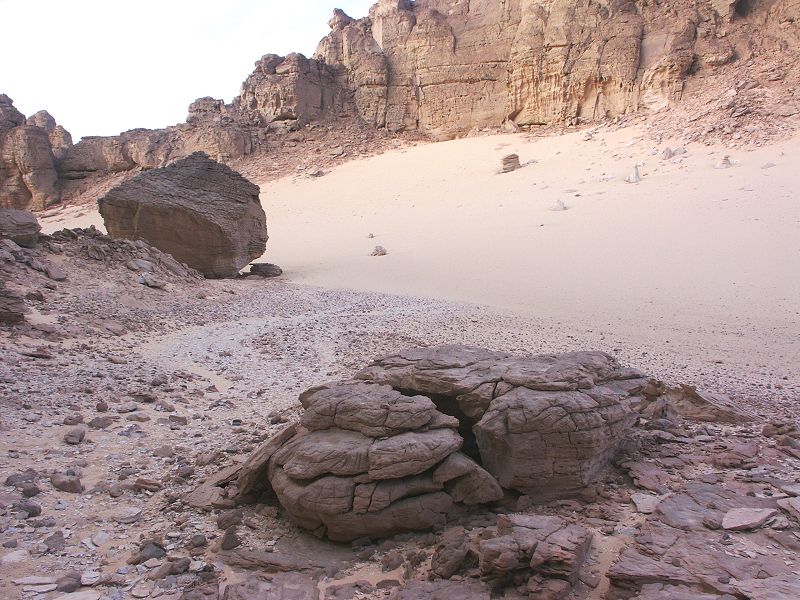
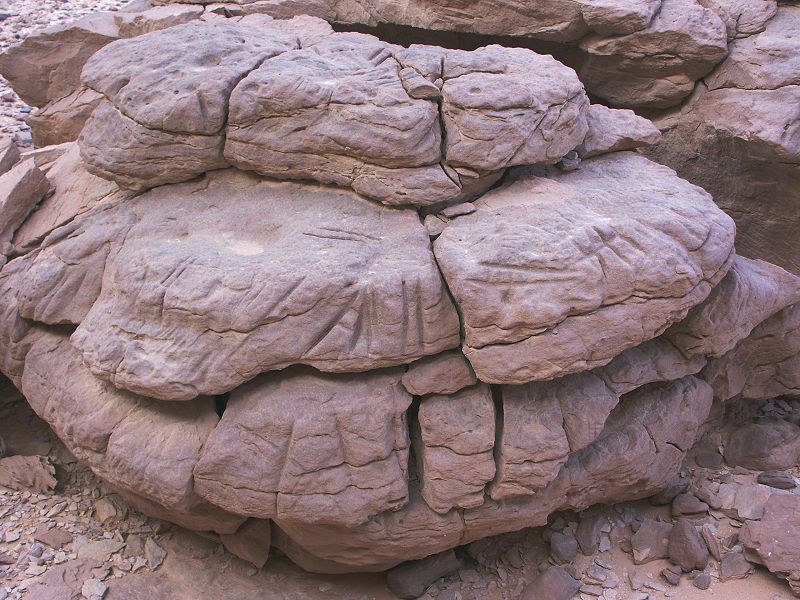
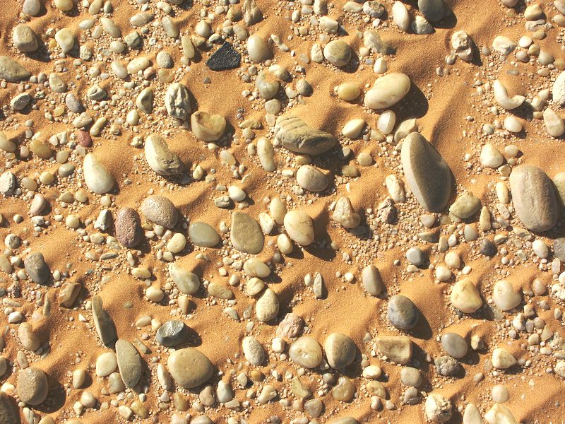
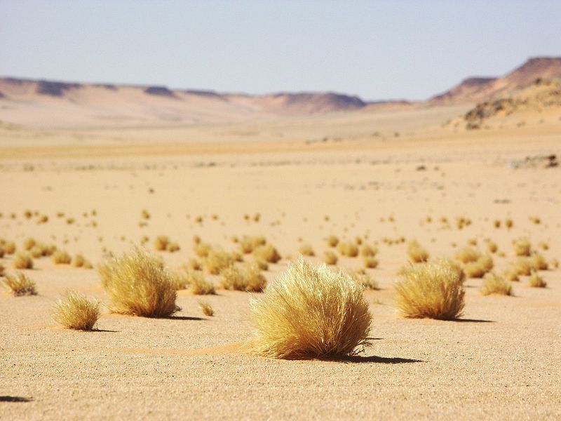
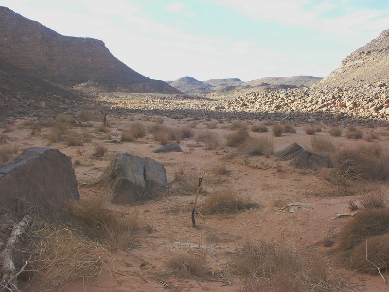
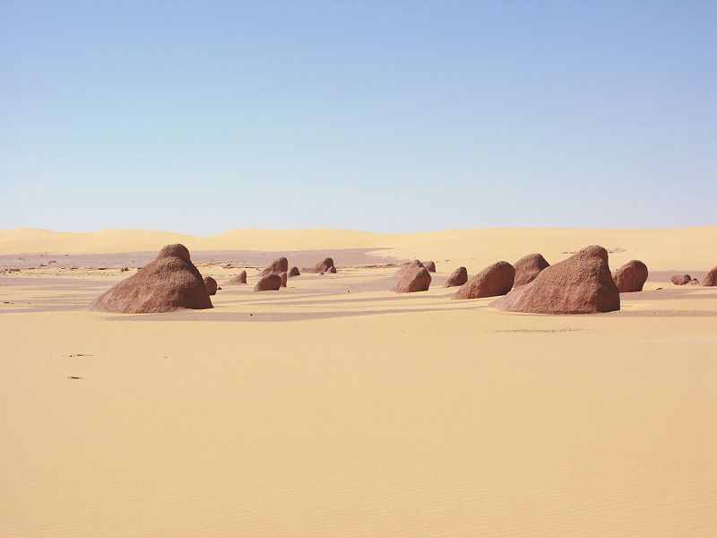
Our campsite was at the foot of a low granite outcrop made up of huge rounded boulders. There are many such igneous outcrops in the area, which combined with the golden sand make a strikingly beautiful landscape in the morning light.
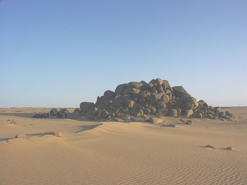
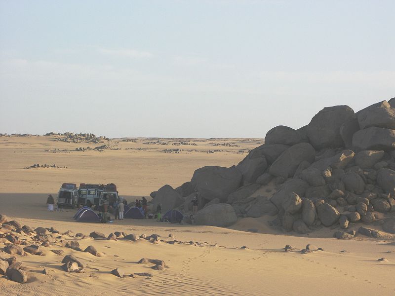
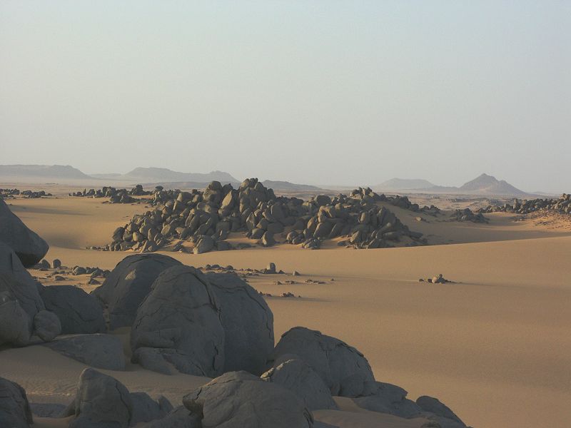
We noted some similar but larger granite outcrops around Peter & Paul, an area we have never thoroughly explored previously. As shelters formed under large granite boulders are the usual setting for rock art sites at western Uweinat, this region merits a closer systematic look some other time.
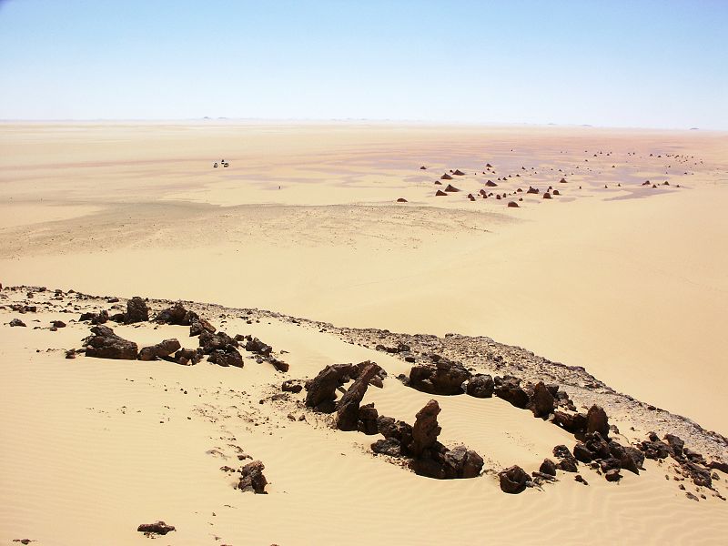
The objective of the day was to visit some of the scatter of rock art sites that were discovered by my good friend (and travel companion on the October 2005 expedition) Mark Borda during three separate trips in 2007-2009 among the scattered low hills to the south-east of Clayton's Craters. Hitherto this region between the uplands of Uweinat and the Gilf Kebir was considered void of rock art, Marks discoveries came as a total surprise, and will require a complete re-thinking of our understanding of the prehistoric land use and settlement patterns of the area.
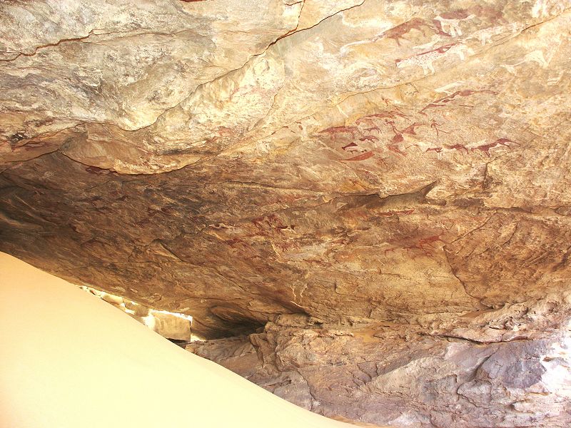
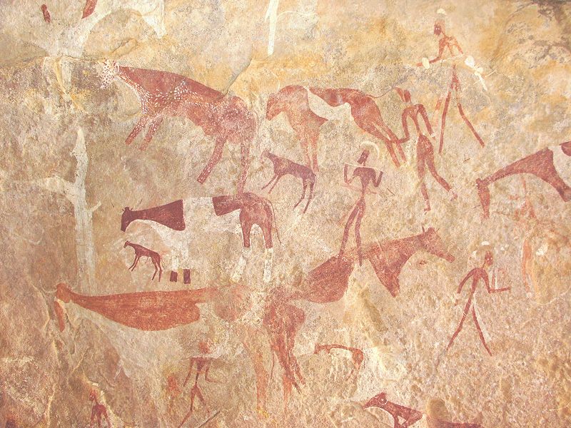
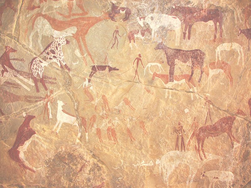
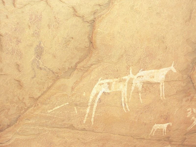
The most important find of Mark (made together with Mahmoud Marei in 2008) is a large shelter with it's ceiling completely covered with beautifully preserved paintings in the classic Uweinat cattle pastoralist style, now designated site CC (Clayton's Craters) 21. This new site is among the most important rock art sites of the region, a brief article by Mark announcing the find appeared in Sahara 19.
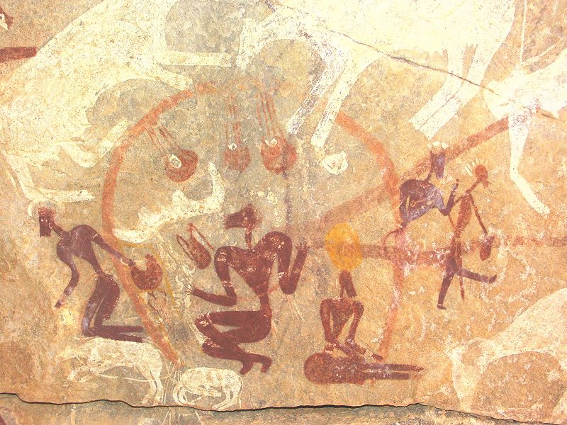
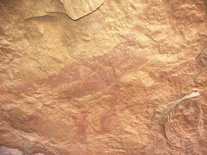
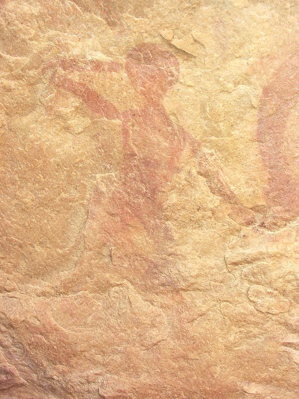
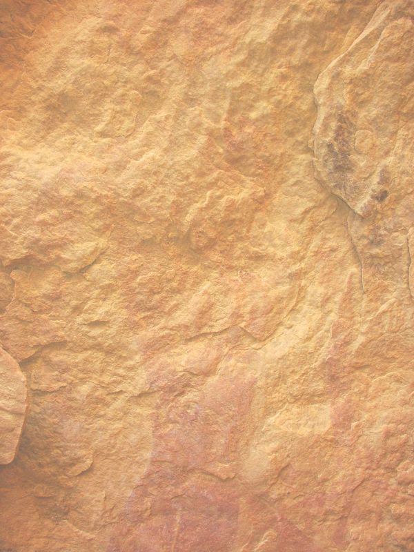
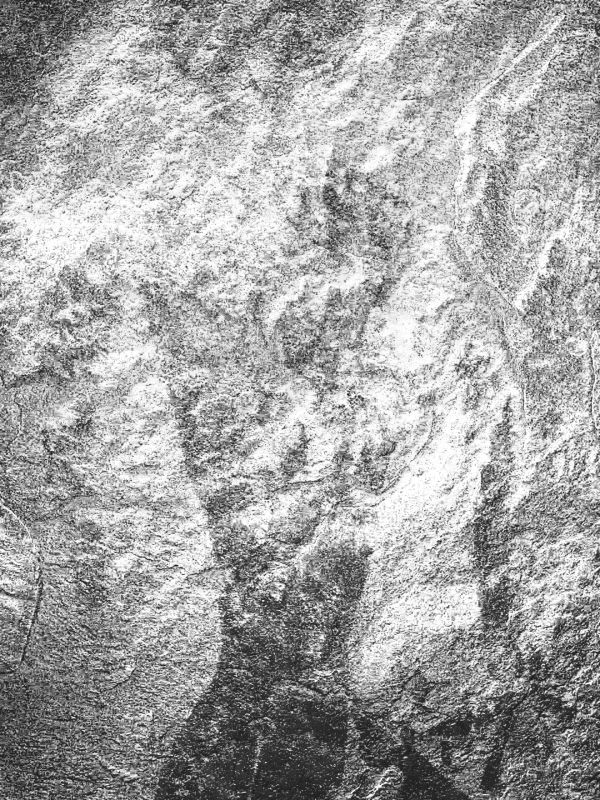
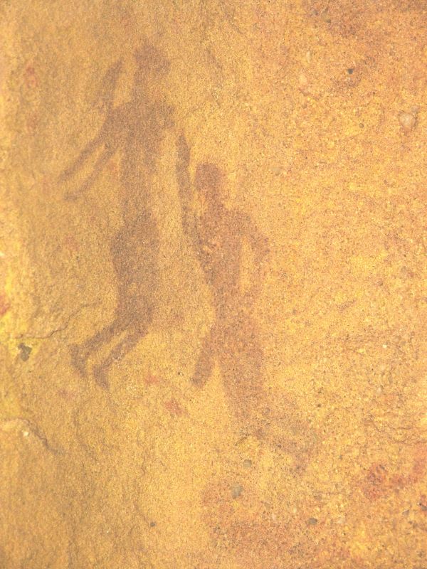
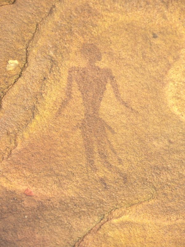
In October 2008 and early February 2009 Mark made over a dozen new discoveries of engravings and paintings in the vicinity (published in Sahara 20). While we did not have time to visit all, we did manage to see six of them, including two of the most important ones. While they are not as spectacular as CC 21, are scientifically much more interesting, having some unique aspects not observed elsewhere. One is a shelter with very faint paintings of human figures in the "Uweinat roundhead" style. This style is the earliest of all the paintings in the central Libyan Desert, possibly as much as 8000-9000 years old. A remarkable feature of the shelter is a large "roundhead" figure that is more than 1 metre in height, having no analogies anywhere. This shelter significantly extends the known range of this style that was hitherto known from the valleys of Uweinat, and a single example at Jebel Arkenu. (last photo of the large figure enhanced with dStretch, an image processing software specially designed for making faint rock art sites more visible).
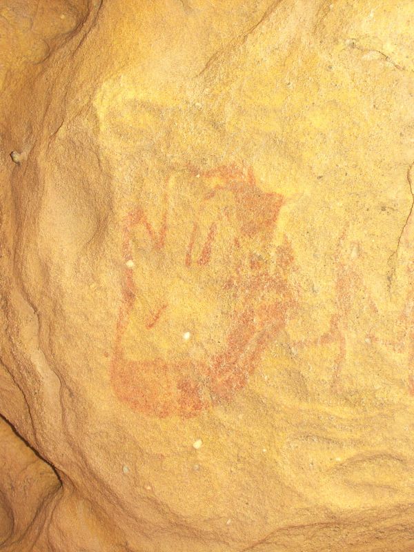
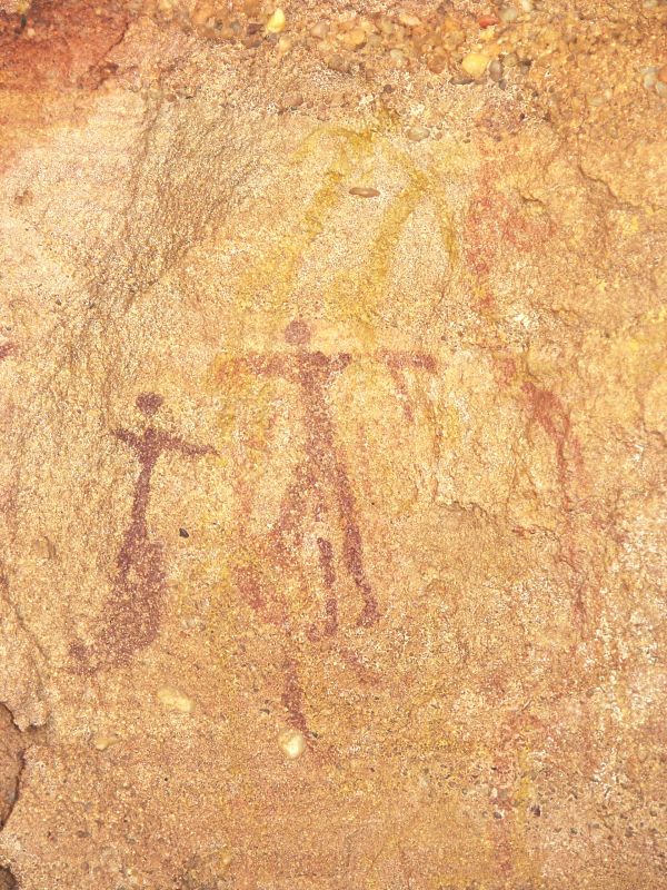
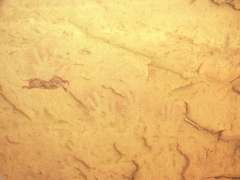
Another site of Mark's contains both negative and positive handprints, and figures that are very reminescent of the paintings we have found in Wadi Wahesh, previously only observed in a very small area along the southhern side of Jebel Uweinat.
In the late afternoon we made our way north to our campsite at Wadi Sora.
Day 4. - Wadi Sora area
In morning we visited the main shelters of Wadi Sora and the amazing WG 21 shelter in the north (this site had been excavated by Rudolph Kuber and the HBI team in April 2009, no published results yet, but eagerly awaiting the first reports).
In the afternoon we took a walk along the arc of sites to the north of Wadi Sora. While no new sites were found, a couple of new observations were made at known sites. In the shelter with the "headless beast" discovered by Giancarlo Negro & Yves Gauthier in 1999 (WG 45/A), in the different light of the mid-afternoon we have observed several more negative handprints, and a couple of small Wadi Sora style figures, which were too faint to be observed before.
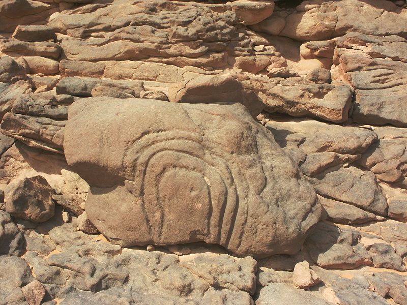
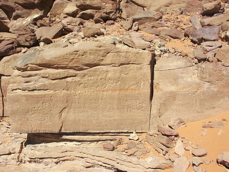
In front of site WG 41/A we have noted a large rock with curious linear engravings, that we missed on previous occasions.
Day 5. - Wadi Sora - Wadi Abd el Melik
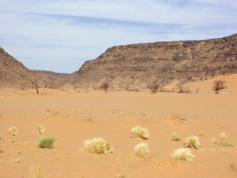
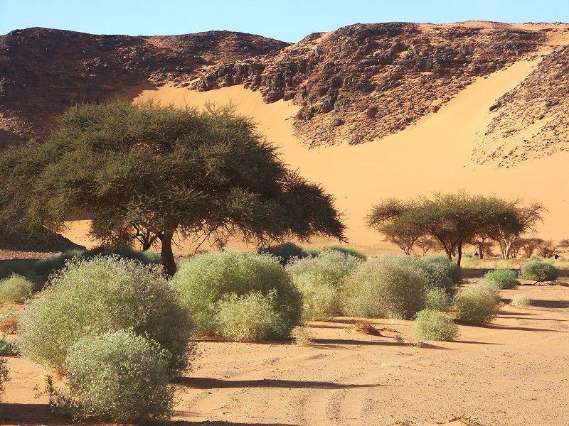
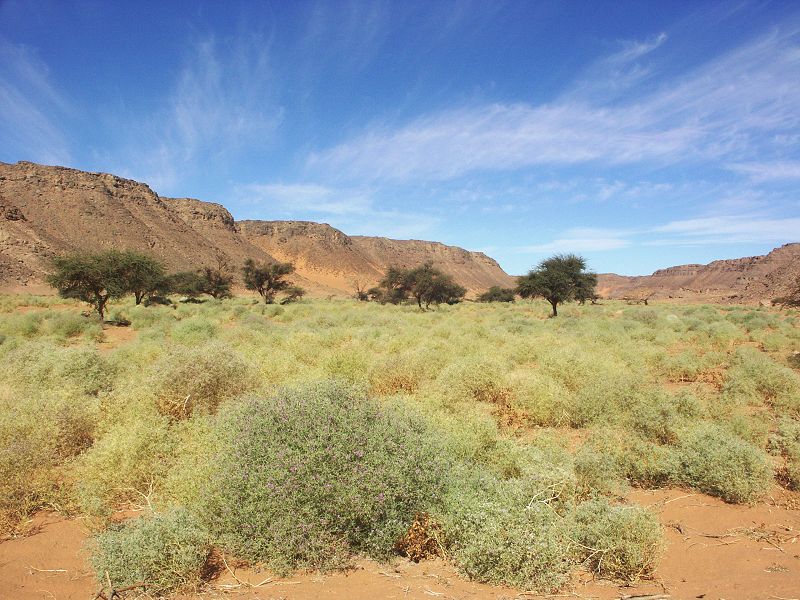
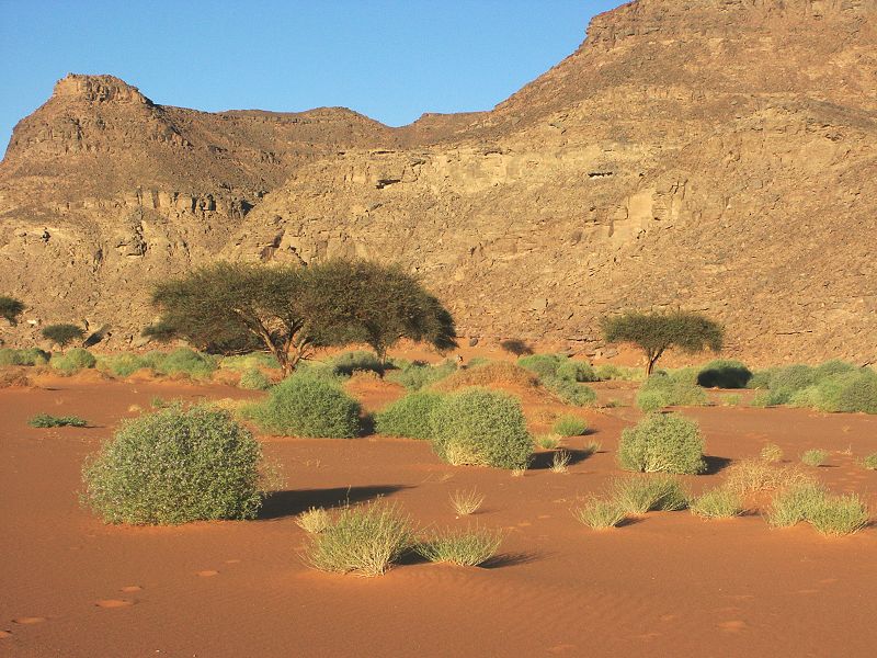
In the morning we left Wadi Sora to backtrack till the Aqaba pass, then ascend the top of the Gilf on our way to Wadi Abd el Melik. When we entered the lower course of the Aqaba wadi, we were astonished to see a wealth of recent, and in some cases still green vegetation, undoubtedly the result of the rainfall we observed in March 2008.
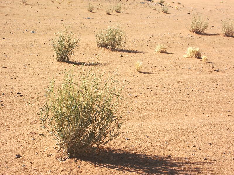
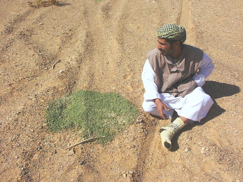
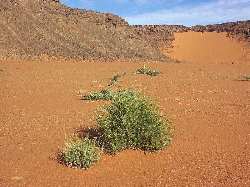
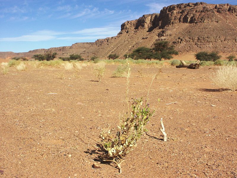
The vegetation that made parts of the "Gap" appear like green fields was now all shrivelled and dry (apparently the rainfall was just enough for the seeds to germinate, but not enough for full plant growth), however in lower-lying spots there were still a few large green plants.
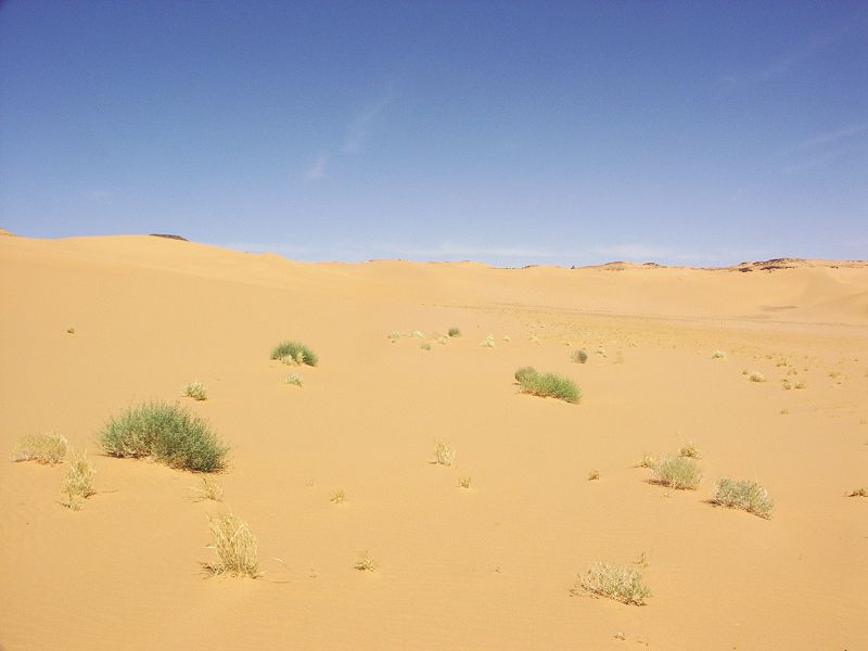
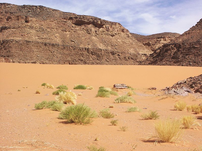
When we crossed the shallow upper stretch of the eastern branch of Wadi Abd el Melik (into which we descended some 80 kilometres further north), we found it to be full of vegetation appearing to be one year old, clearly raised by the same rains which made Wadfi Hamra green in March 2008. This gave hope that perhaps Wadi Abd el Melik may be green as well in the lower courses. We have noted a couple of plants that were not observed before, awaiting identification.
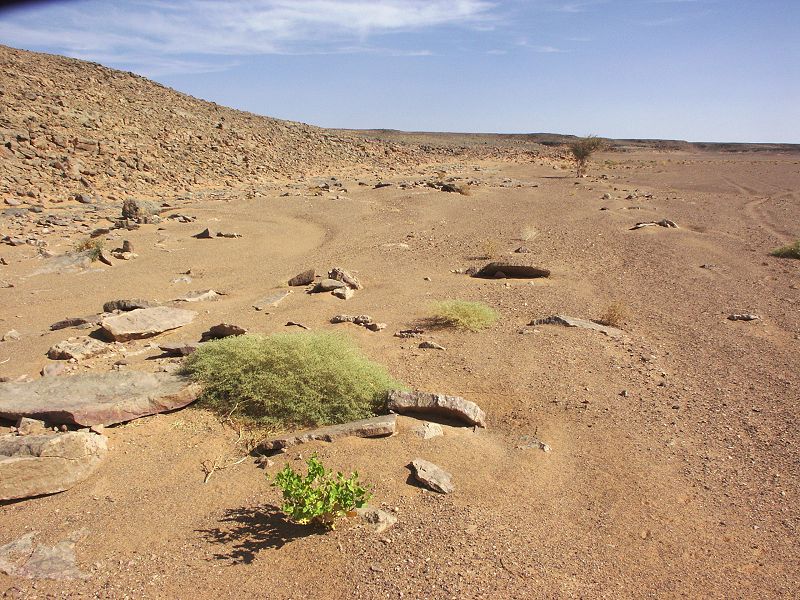
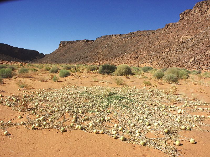
Continuing north, we passed the shallow basin full of dried Roses of Jericho (Anastatica hierochuntica) hoping to see fresh growth fed by the past years rain, but were disappointed, apparently there was no rainfall there. We continued to the Lama Pass, the narrow sandy wadi that provides the only vehicle passage into (and with a huge struggle, out of) Wadi Abd el Melik, making camp near the end of the driveable section of the eastern branch. Unfortunately the valley proved to be completely dry, like on previous visits. Apparently the rain runoff that brought the upper stretches of the wadi to life was insufficient to reach the lower lying areas.
Day 6. - Wadi Abd el Melik - Wadi Hamra
In the morning we set out to look for the well that Abd el Melik el Zueia spoke of to Almásy. Almásy's text (Published in "Recentes Explorations..." and "In Air...on Sand") appears to be quite clear and unambigous:
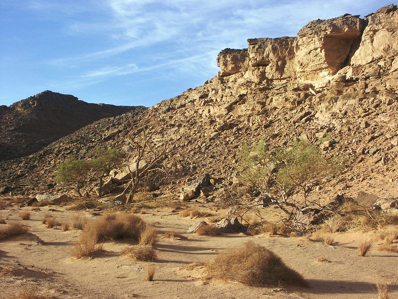
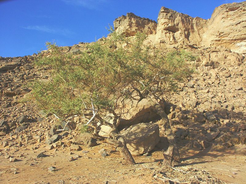
"The following morning we rode up this valley right to its end. There were many Talh and Selim trees and we also passed two white trees trees (heglig olive, Balanites aegyptiaca) on our right while the ground of the valley was covered with beautiful tall green grass. [...] At last the wadi ended and there on the left hand side going up towards the end we found at the foot of a wall of rocks a spring with plenty of good water in it. There was a large plank cut with axes lying over the spring so that people could stand on it when bringing up water."
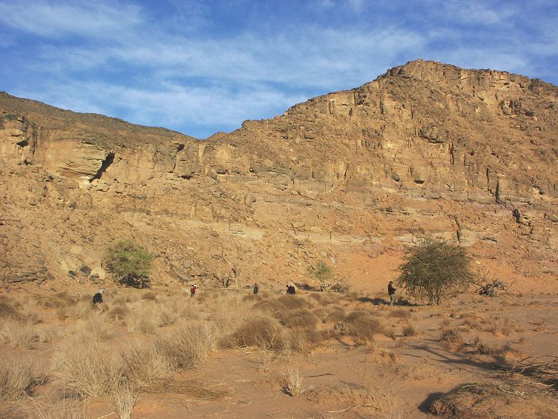
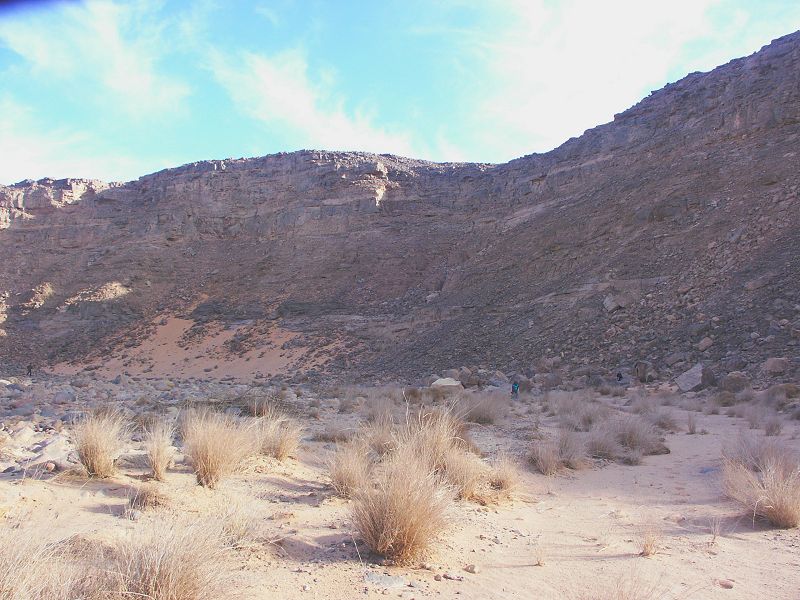
The two Balanites trees still grow there in the valley, there can be no mistake as this species is found only in this one place in the entire Gilf Kebir. A few hundred metres beyond the trees, the side of the valley does rise to a high almost vertical cliff. While the valley does not quite end but continues further in a narrow gorge, the broad flat valley floor with vegetation does end here, beyond this location it is only a rocky ravine. We thoroughly searched this one kilometre stretch upstream from the Balanites trees, but found absolutely no trace of any former well. More curiously, we found absolutely no trace of any former human presence, as would have been expected if indeed there was a well there at some point. We did find one shallow sandy depression in the otherwise mostly rocky valey floor, where possibly one could have dug for water for a few weeks or perhaps even months after a major rainfall would have saturated the valley floor. We had to conclude, that probably the "spring" was no more than a water hole dug into the sandy floor of the valley after a larger rainfall (also suggested by the "tall green grass", in stark contrast to the dry state of the valley today).
Following our lack of luck with the well, we visited the rock art sites in the middle section of the wadi, then started north towards the confluence of the two branches. Near the spot where we had our snake encounter four years ago, we noticed a small tributare with fresh green vegetation. It appears that the rains of last year were localised events only affecting small areas.
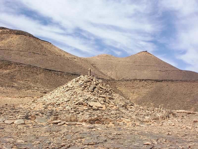
We continued north to Wadi Talh, a major western tributary of Wadi Abd el Melik, some 50 kilometres north of where the two branches meet. Our target was the unique tumulus of an unknown age and a nearby rock art site with engravings, both found by Khaled Khalifa some years ago.
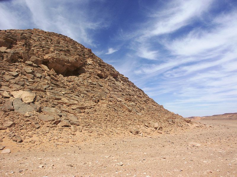
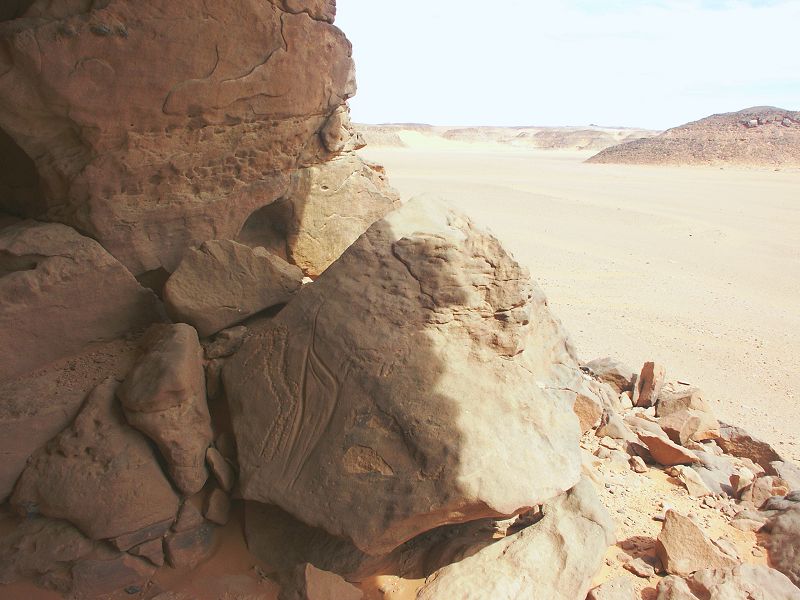
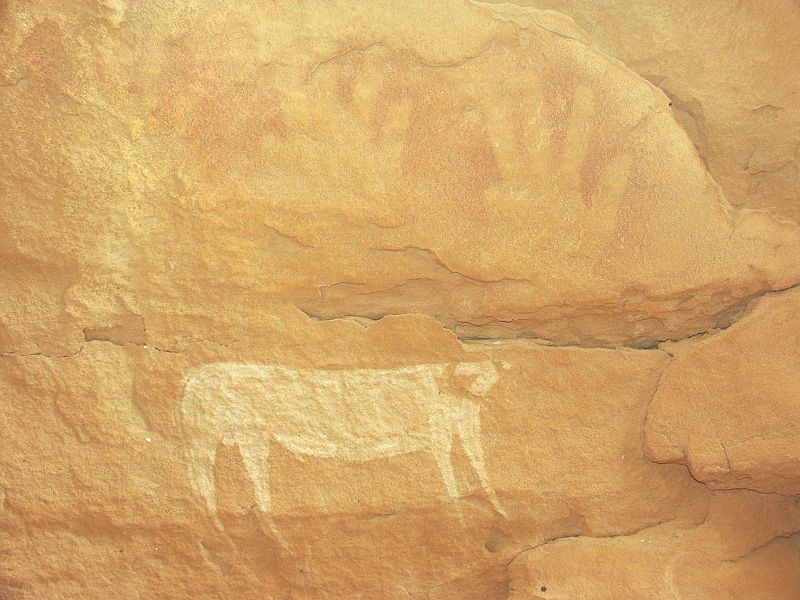
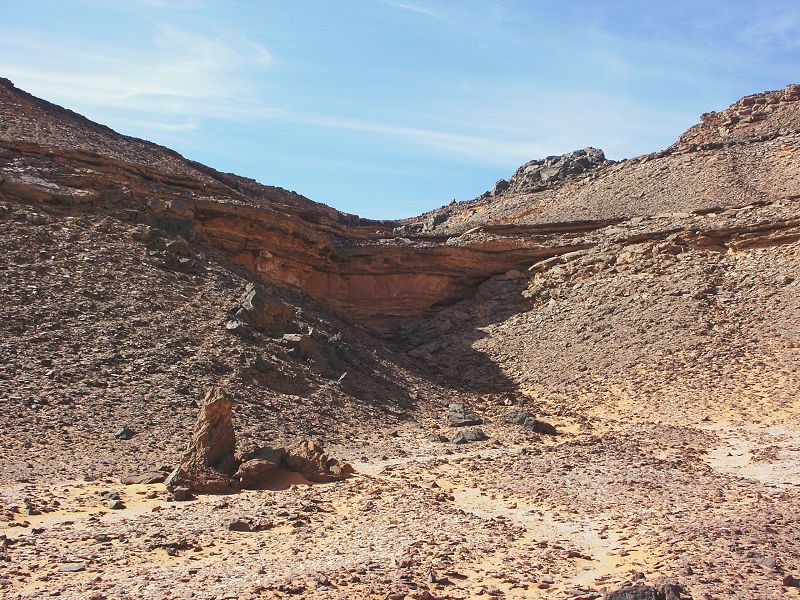
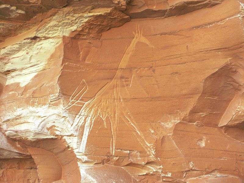
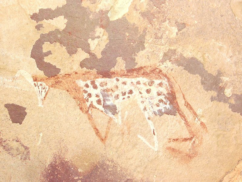
Continuing towards Wadi Hamra, in an eastern tributary of Wadi Abd el Melik to the north of the mouth of Wadi Talh, we came upon a large dry waterfall in a small side wadi, with a conspicious overhang and a vertical rock face below. The setting was very reminescent of the rock art site reported by Giancarlo Negro in a wadi north of Wadi Hamra (Sahara 7.), and sure enough when we climbed up to have a close look, the whole rock face proved to be full of engravings of cattle and giraffe. The most exciting bit however was the discovery of a single painted cattle on the ceiling of the partially collapsed overhang. It is in the classic Uweinat cattle pastoralist style, the northernmost locality of this culture prevalent in both the Gilf Kebir and at Uweinat and the surrounding massifs.
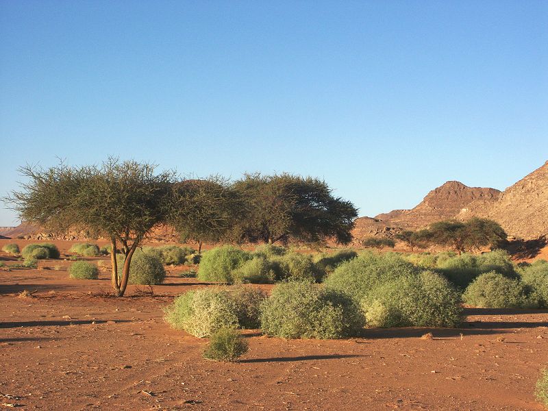
Following this fine discovery, we ascended the Gilf plateau for a short distance at a suitable spot spotted on satellite imagery, and entered a valley leading out to the east, a splendid shortcut from Wadi Abd el Melik to Wadi Hamra saving a drive of about 150 kilometres compared to the previously known via Wadi Gubba. The upper section of Wadi Hamra proved to be an amazing sight, full of large green plants that grew out of the tiny shoots observed a year ago. By sunset we camped at our regular spot in Wadi Hamra.
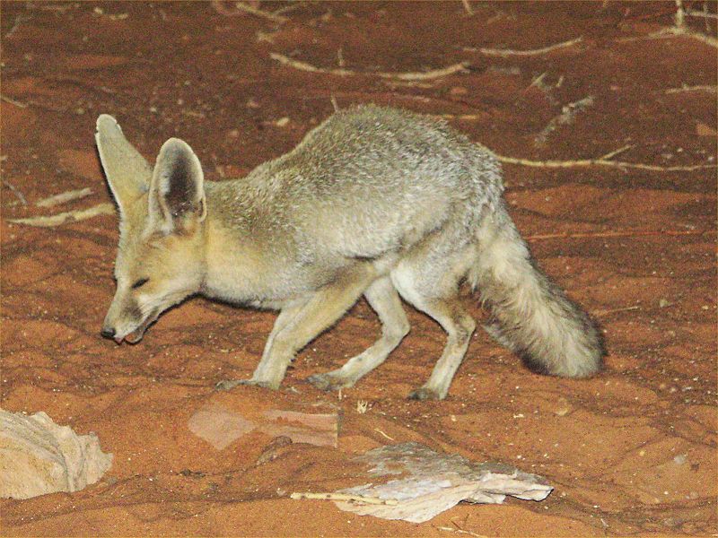
After dinner, when camp fell quiet as everyone retired to their tents, we had a desert fox (Vulpes rueppeli) visiting, rummaging through our empty pots with a huge rattle.
Day 7. - Wadi Hamra
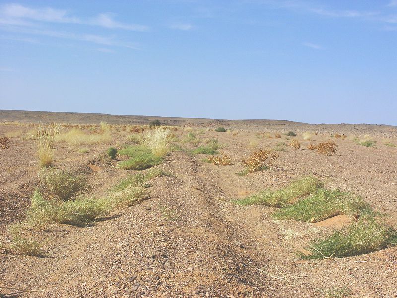
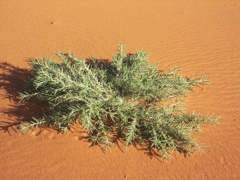
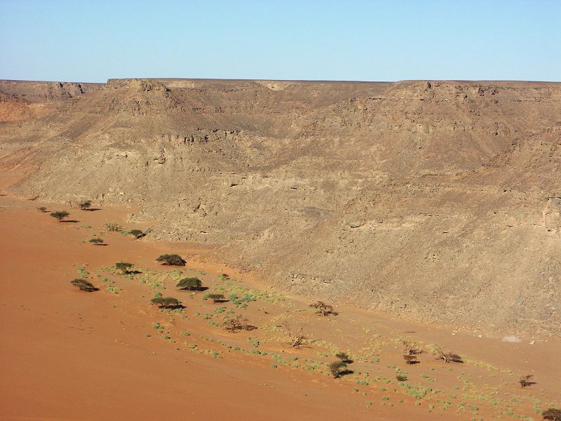
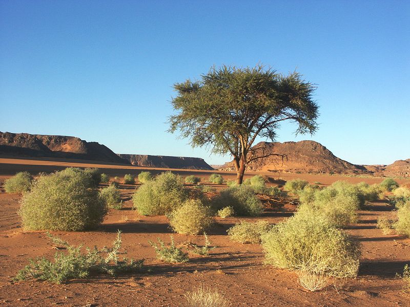
We spent two nights at Wadi Hamra, spending the day visiting the rock art sites, and taking long strolls in the amazing greenery. The tiny shoots of the previous year have grown into large mature plants, that densely covered the bed of the watercourse for the upper five kilometres of the Wadi. The majority were huge Zilla Spinosa over a metre in diameter, which were just a few centimetres high when first observed last year.
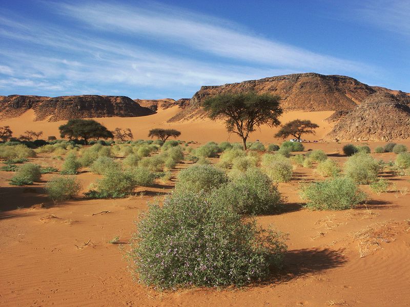
While Zilla Spinosa was dominant, there were many other species as well in lesser numbers, though much reduced from the species noted a year before. In due course I will complete a page in the flora & fauna section of this website on the Gilf rains of 2008, describing the species observed in more detail, as well as the development of the plant life over the year.
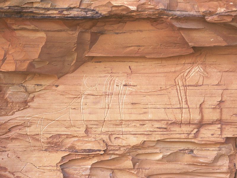
Wisiting the rock art sites in the middle of the valley, we had a chance to observe the panel of engravings discovered by Giancarlo Negro & party (Sahara 7.) in a morning light (usually we reach this site late afternoon). Having had a good look at the "possible rhinoceros" in direct sunlight, I have to conclude that the identification is very unlikely. What appears to be the "horn" may well be just a natural feature of the rock.
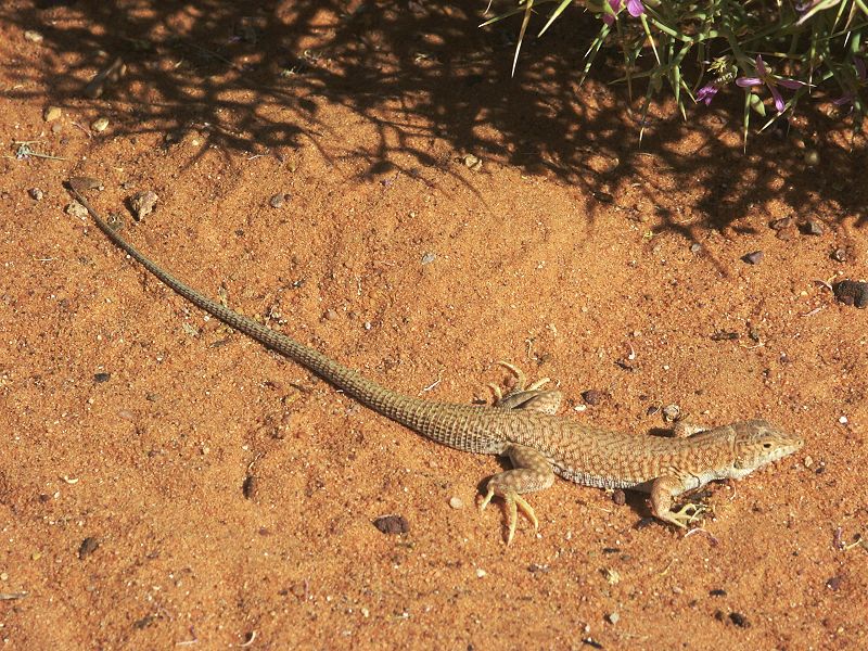
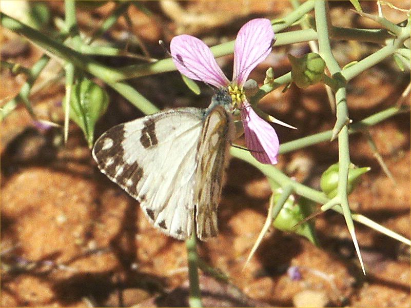
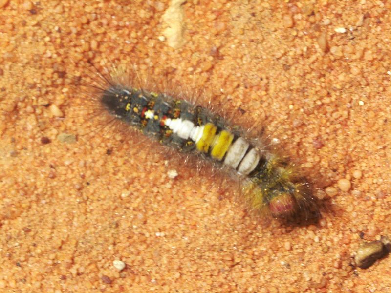
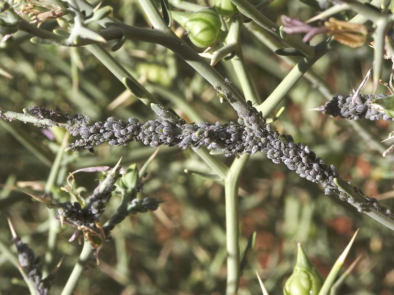
Despite the abundant greenery, there was surprisingly little animal life. Apart of the fox seen the night before, no other mammals were observed, and no fresh tracks of any were seen. There were a few lizards under the zilla bushes of the same species noted some years ago, and a few moths and butterflies of several yet unidentified species. One interesting find was a colony of aphids living on a zilla bush.
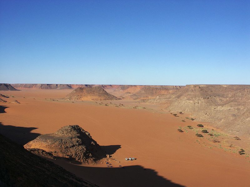
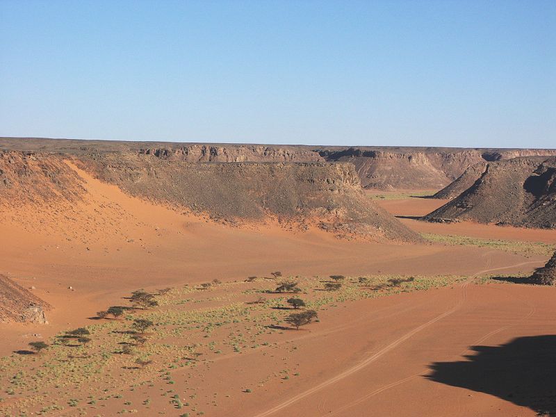
In the late afternoon we climbed to the top of the plateau near our campsite to get a birds-eye view of the valley. From above it is very clear, that any vegetation is restricted to the bed of the watercourse. One metre away the valley floor is as barren and dry as it always been.
Day 8. - Wadi Hamra - Eastern Gilf Kebir
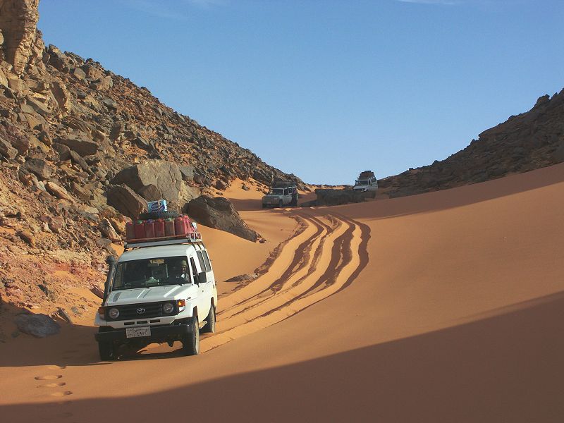
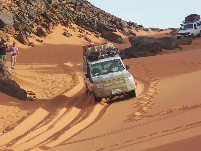
In the morning we started our way back towards Dakhla. The crossing of the dune field in the middle of the "Gap;" was accomplished without any serious difficulty, only one car got stuck at the tricky point but was recovered without much trouble. As we reached the far side of the dunes, a rather stong wind picked up, which soon grew into a full fledged sandstorm.
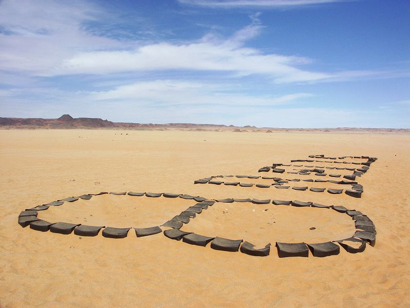
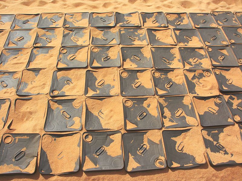
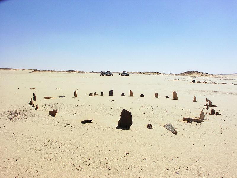
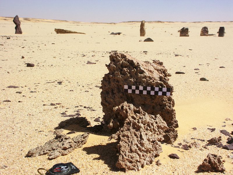
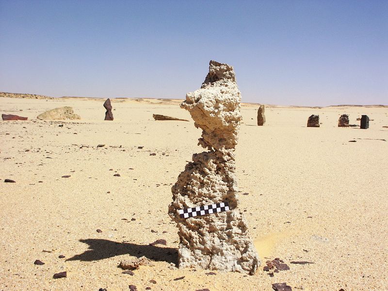
Our objective for the afternoon was to do a proper survey of Bagnold's Stone Circle with measurements and scale photographs, but the weather became very uncooperative. The wind was driving the sand till chest height, kneeling down to take measurements and close-up photos was rather unpleasant, with eyes, mouth and the cameras rapidly filling with sand. While the rest of the group huddled in the cars, with Michael we braved the sand and wind for about an hour to do a basic survey, much less than what we intended. I will prepare an article with the results for the coming issue of Sahara.

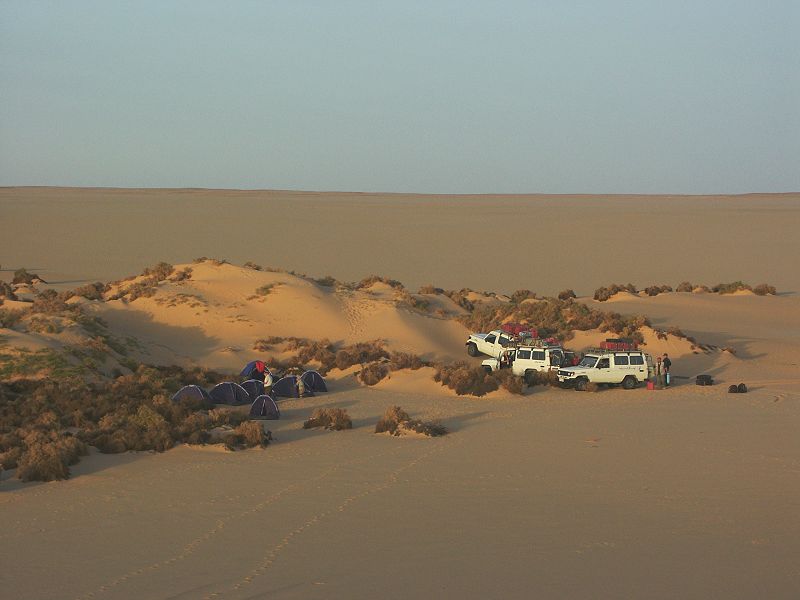
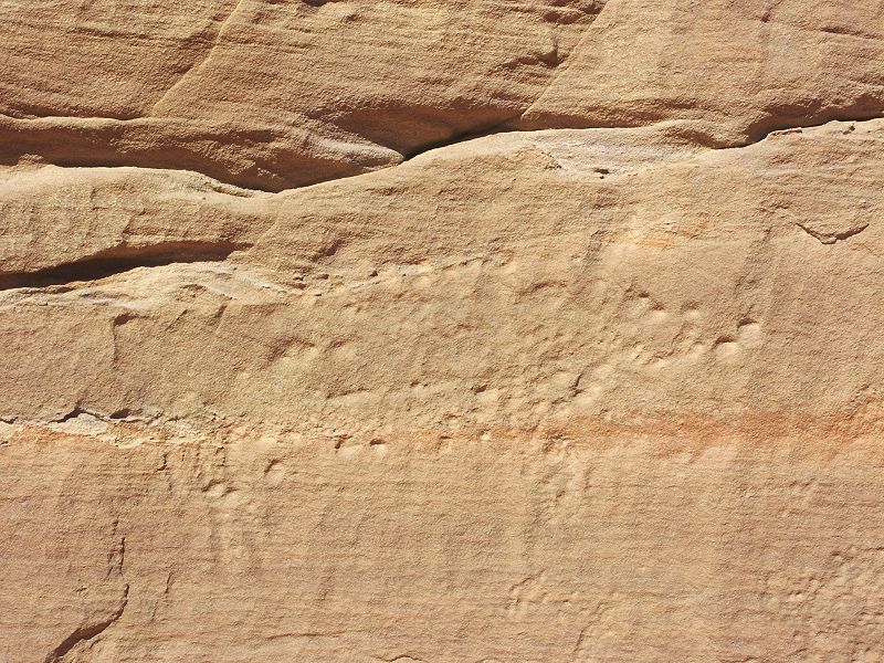
We were planning to camp nearby, and use all of the afternoon for the survey, but the wind drove us back to the hills flanking the north-east corner of the Gilf, where we found a reasonably sheltered spot to camp behind a large sandstone outcrop.
Day 9. NE Gilf - Abu Ballas
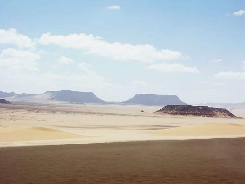
Fortunately by the next morning the wind died, and conditions were back to pleasant as we started our way back towards Abu Ballas.
Along the way we passed by the dry lakebed with the pink yardangs next to "Hill with Stone Circles".
We reached Abu Ballas by late afternoon, and made camp a short distance beyond at the foot of the Abu Ballas scarp.
Day 10. Abu Ballas - Dakhla
We reached the tarmac road by midday, and were in Dakhla by early afternoon, from where Michael & the group returned to Luxor to continue with their trip in the Nile valley.