
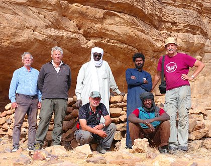
 Click on image for list of participants |
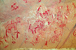
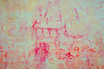
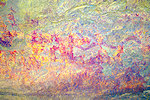
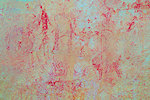
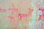
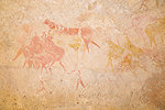
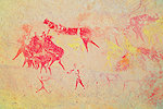
Tibesti Mountains, Chad 10th - 30th January, 2026 False colour images processed with DStretch, a freely available software developed by Jon Harman |
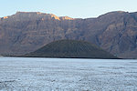
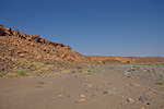
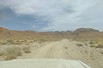
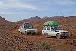
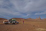
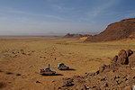
We have not visited the high Tibesti ever since our first trip to Chad in January 2014, it was high time to make a return to this amazing landscape. Starting from N'Djamena we did a 3 week circuit to see the key sights and localities plus a number of previously unvisited places. As on all recent Chad trips, ground logistics was provided by Tchad Evasion.
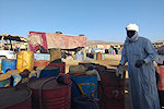
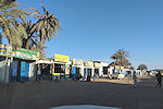
Day 0. N'Djamena
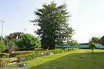
Turkish Airlines made a very agreeable change to their N'Djamena schedule. While the flight still went through Niamey, arrival was at 9am, a much more pleasant experience compared to the previous 3am, even if the night was to be spent on the plane. Most of us took this flight, with Chris arriving with the midday Ethiopian, allowing us a pleasant afternoon and evening in the garden of the Irrisor Hotel and a good night's sleep before the next morning departure.
Day 1. N'Djamena - Camp before Mussoro
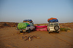
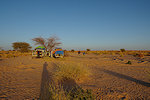
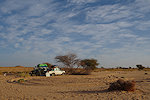
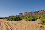
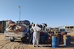
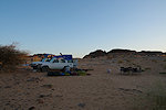
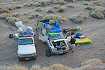
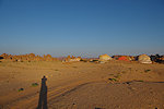
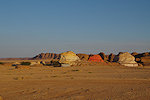
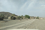
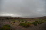
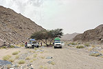
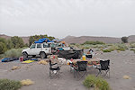
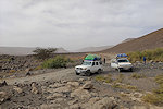
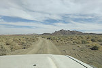
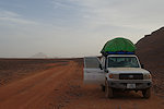
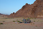
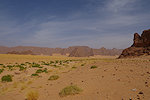
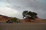
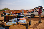
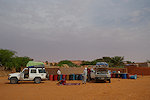
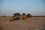
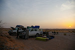
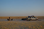
With time to prepare, we could do an early start, leaving the Irrisor with two cars at 8am. Our crew was the same as on the 2024 Ennedi trip, Adoum as our guide and lead driver, Ibrahim the other driver and Hassan the cook. The road till Massaguet was still under construction with deviations, but parts were complete allowing good going, we passed the town and continued on the better road till Masakory. We stopped for lunch and a midday break soon after leaving the asphalt, after which we continued along the dusty Bahr el Ghazal for the rest of the afternoon. We made an early camp before reaching Moussoro to permit everyone to get sorted with the fresh camping equipment still in daylight.
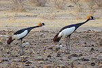
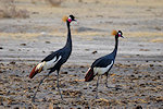
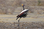
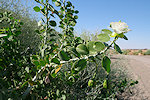
Soon after stopping we noticed a pair of large dark birds near our camp. Approaching we recognised them to be Black Crowned Cranes (Balearica pavonina), the first time we saw these lovely creatures in Chad. They are supposedly common further south, but this pair somehow made it quite far north of their usual range.
Day 2. Massaguet - camp before Kouba Olanga
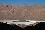
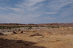
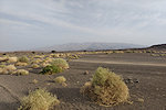
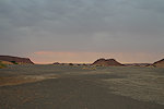
Moussoro was just a short drive from camp, we made a short stop to fuel till Faya, then continued along the dusty Bahr el Ghazal without much to comment on. We stopped for lunch before Salal, and made camp about an hour's drive before Kouba Olanga in a rather bleak spot some distance off the road.
Day 3. Camp before Kouba Olanga - Faya-Largeau
Morning was still pleasant, but as we packed and departed the wind started to pick up, and by the time we reached Kouba Olanga it was a raging sandstorm, with dust reducing visibility to only a few hundred metres. We trudged on, crossing the patches of exposed lakebed almost blind, until we reached the Erg Djourab where we could at least see where we were going. We had a very quick lunch (prepared inside the car) in the mostly symbolic wind shade of a large barchan, then continued non-stop towards Faya, which we reached in the late afternoon. We spent the night at the Tchad Evasion house, which had been taken over by our former guide Djibrine in his retirement, and underwent a remarkable transformation for the better with everything in order and new trees planted.
Day 4. Faya Largeau - camp after Ain Galaka
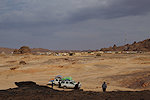
We were hoping for some better weather, but the Sandstorm was still raging, visibility was almost zero with the fine white dust of the dry lakebed completely filling the air as we drove along the small oases and villages of Borkou to the west of Faya. Unsurprisingly we lost the main track several times, it was a rather slow progress, with lunch inside the car again. By the evening we were a little past Ain Galakka, not a particularly impressive achievement, a mere 100 kilometres in a day. Fortunately we found a cluster of low rocks to the north of the track which offered a little protection, and by the evening the wind showed some signs of abating.
Day 5. camp after Ain Galaka - Tugui
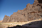
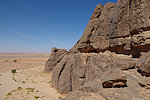
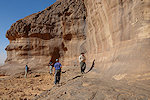
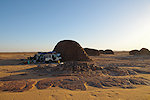
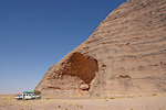
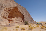
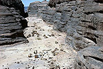
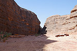
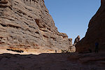
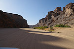
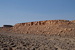
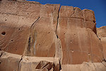
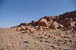
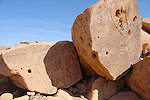
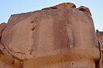
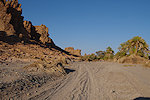
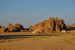
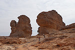
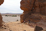
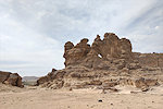
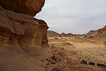
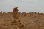
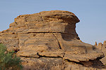
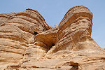
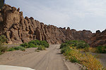
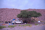
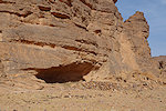
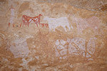
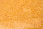
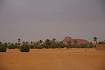
Our original plan was to make a clockwise circuit of the Tibesti, starting at Zouar and making it back via Yebbi Bou and Bini Erde along the Enneri Miski, allowing our last reserve days to be spent among the Miski and Borkou sites. However as Tchad Evasion was arranging the travel permits it emerged that Bini Erde and the Miski is still off limits, and the plan was changed to return via the Kozen Pass, along the Yebbi Bou to Gouro piste. This meant skipping much of the Borkou and Miski sites, but we did have enough time to make a detour to Tugui Tungur and Tugui, the finest cluster of sites at the south western corner of the Tibesti. With the delay of the previous day we arrived at Tugui Tungur by midday. The cliffs offered good protection from the wind, and after four days of sitting in the cars non-stop we were all eager to finally use our legs. While Hassan prepared lunch, we climbed up to the small shelter published by Paul Huard with the vivid late pastoral paintings.
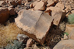
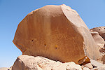
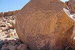
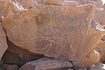
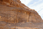
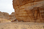
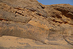
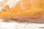
After lunch we proceeded to the rear of the protruding rock outcrop to the other painted shelter, which strangely was not seen by Huard, it was only noted by SVS in the early 2010s when tourism to the Tibesti re-commenced after a decade of rebellion. This site is less well preserved, but more interesting, with a couple of Karnasahi style figures below the more recent late pastoral scenes, the only ones known from the western side of the Tibesti. Nearby there are several panels of crude engravings.
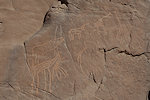
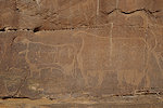
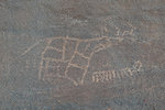
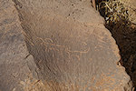
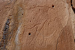
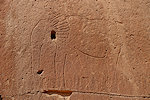
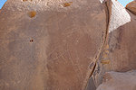
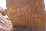
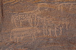
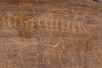
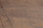
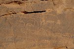
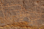
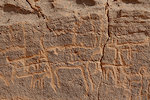
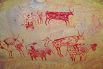
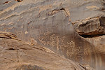
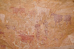
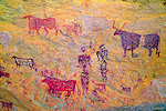
We continued north for a short distance to the spectacular panel of engraved cattle at Tugui. Previously we always visited in the morning, now they were in a completely different (and perfect) afternoon light.
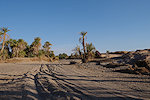
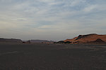
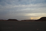
We still had some time left to proceed, we drove till the far side of the broad Enneri Miski valley, where we found protection in the lee of a few low rock outcrops, the last before the country opens up into a flat plain.
Day 6. Camp near Tugui - Ehi Atrun - camp before Zouar
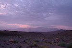
After three days of howling gale the wind finally died that night, and we awoke to a cold but perfectly calm morning. To celebrate, Hassan prepared a fine omlette, after which we packed camp and continued towards the north west.
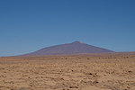
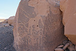
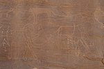
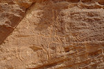
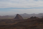
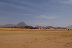
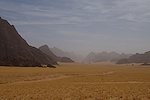
We drove on the monotonous plain without stopping for nearly three hours. After the second hour a dark blob appeared intermittently on the horizon, but it took a good further hour to reach it, the huge monolith of Ehi Atrun, with a huge cavity in its side which contains a number of engravings, including a very large four legged animal executed in low relief, which appears more ancient than the other large cattle depictions. On our last visit it was fully on the sun and hardly visible, now we arrived with a good contour lighting which revealed many more details. I also spotted some smaller animals executed in the same technique (and with similar patination) which were unquestionably cattle, which seems to confirm that the large figure is the same.
We drove for another hour, past the small village of Aoda along the Enneri Geli, stoping for lunch in the shade of some large acacias in the riverbed. From here we followed the old direct track to Zouar, which in 2014 was still mined and unusable. Now it had been cleared, and offered a much faster direct course towards Zouar, enabling us to regain some of the time lost in the dust storm three days earlier. We made camp in a little wadi not far from the track, about 25 kilometres before Zouar.
Day 7. Zouar - Zouarké
The piste to Zouar was more direct, but it crossed the low plateau so it was a slow bumpy ride, it took nearly two hours to cover the remaining distance and finally look into the valley with the town.
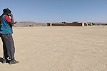
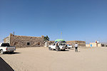
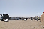
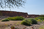
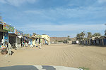
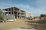
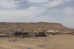
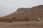
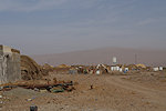
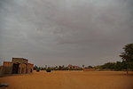
Zouar has much changed since our last visit, and not necessarily for the better. The small sleepy and isolated village turned into a bustling frontier town mostly catering to the gold mining in the area, with a whole market town in the place of the three small shops that made up the souq in 2014. It was not an altogether pleasant and friendly place, our visit was rather brief, presenting our papers at the Sous-préfecture and being denied permission to visit the old fort, which apparently was still being guarded by the military though satellite imagery shows the interior to be completely empty... We took a few clandestine photos with phones, then made a hasty departure.
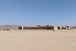
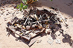
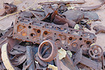
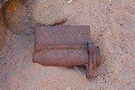
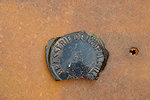
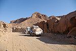
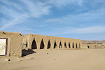
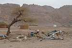
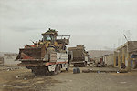
The main reason to re-visit Zouar was the "Garage Leclerc", the WWII era vehicle workshop used by the Colonne Leclerc before starting the Fezzan campaign in 1942 (possibly the same place where the LRDG vehicles were maintained and repaired after the 1941 Murzuq raid). Unfortunately in 2014 I was not even aware of its existence (and neither was Andrea, our SVS guide), I only found photos posted on the internet taken by French Legionaries posted to Zouar in 2016. Having identified the spot based on the photos on Google Earth, we drove out of town to the sandstone massif hiding the narrow, well protected valley. We stopped near the entrance and while Hassan prepared lunch we visited the site. Unfortunately sometime in recent years with the demand from gold mining the locals recognised the scrap value, and much of what remained untouched for 80 years had now been collected into heaps, cut up and removed, with little of the original scattered parts remaining. Still, it was an interesting visit, possibly at the last moment before everything disappears.
Having seen what we wanted we did not linger, after lunch we left Zouar towards the west along the Enneri Zouarké, the route we used in 2014. The track now was much improved, in a half hour we covered the distance from Zouar to the entrance of the canyon.
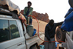
The town of Zouarké did not become any more endearing in the intervening years, it was the same unpleasant and filthy boomtown as we remembered it from 12 years ago. We uploaded enough fuel here to last till Gouro (from Adoum's look I could tell that it was atrociously expensive), Hassan brought some fresh bread, Ibrahim bought a new battery to replace the misbehaving existing one, then we left town towards the main track skirting the Tibesti.
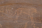
Leaving town we had an amusing experience. On approaching the military checkpoint we could clearly see the puzzled look on the face of the approaching officer. He asked where we were going rather suspiciously, but on hearing Bardaï he broke into a grin and informed us that we were at the Niger frontier. Apparently we took the wrong track from town and ended up at the border post. All was taken in good spirits, we were directed to the proper track and soon rejoined the main piste heading North. We rounded the promontory to the west of Zouarké and made camp in a small hidden valley among rocks (Gábor immediately found an engraved cow nearby).
Day 8. Zouarké - Trou Natron
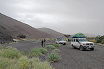
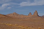
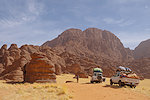
Soon after leaving our camp we turned east, along the track leading up the slopes of the Ehi Tousside volcano towards Bardaï and the interior of the Tibesti. We expected a dismal full day to ascend to the rim of the Trou Natron caldera, but much to our astonishment a veritable road was bulldozed in place of the almost impassable track, which allowed for a very dusty but fast progress. Pic Tousside soon came into full view, and it loomed ever closer as we quickly gained altitude. At a rest-stop we encountered a large caper (Capparis spinosa) bush, our crew immediately set about to harvest its leaves into big sacks, apparently very much valued for its medicinal properties.
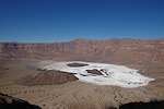
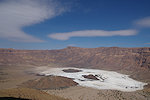
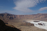
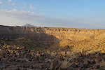
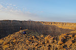
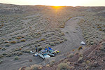
As we were making our way up, the engine of our car seemed to lose some of its power, it was struggling on steeper ascents, and did not accelerate as expected on easier sections. We suspected a clogged air filter, but Ibrahim (who turned out to be a very skilled mechanic) soon stated that one or two cylinders were misfiring, apparently a fuel-feed issue. After some discussion we decided to continue the last few kilometres, and he would fix the issue while we make our way down into the Trou Natron. Despite this setback we reached the caldera rim by midday, after snapping photos we moved to a little more secluded and protected spot to make camp. Originally we planned the descent for the morning after but the new road made us change plans, we quickly packed our gear to make our way down the crater during the afternoon, taking advantage of the shade along the western side.
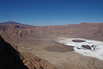
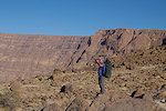
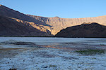
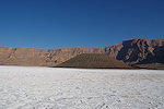
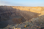
Chris elected to stay up on the rim, so it was the remaining four of us who started the descent shortly after 1pm along the winding donkey trail leading to the bottom of the caldera. The depth of the crater is almost exactly 750m, from memory with Gábor we recalled a not too difficult three hour hike till the bottom. In reality it turned out to be a grueling four and a half hours, the part we have forgotten is that 12 years passed and we did not get any younger...
It was close to sunset when we reached the bottom of the caldera. We were not completely alone, we saw several donkeys and grazing goats and at least one walking human as we were descending, but the area we targeted for a bivouac (a cluster of acacias, the same spot where we camped in 2014) was deserted. After a quick meal it did not take long to fall asleep after the rather exhausting descent.
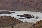
Day 9. Trou Natron
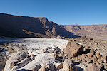
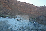
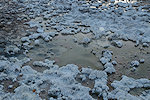
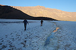
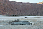
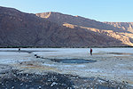
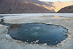
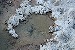
We were up at daybreak, after packing our gear we set about to explore the bottom before making the ascent. I promised Adoum that we will be back by 2pm, as we spent some time on the way down to search for the correct path we needed an estimated four hours to get up, we had time latest till 10am. Our main target was the hot spring at the foot of the eroded small volcano at the caldera bottom, on our way we found another (lukewarm) spring which I'm quite sure was not there on our earlier visit. There was much more water on the crater floor, in many places we needed to make detours to avoid sinking ankle-deep into the mud underlying the white natron crust. The puddles further added to the eerie feeling of walking on melting snow, not entirely inconceivable as before sunrise it was bitterly cold, just 1 degrees Celsius at the lowest spot in the crater.
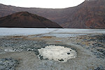
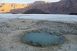
The hot springs at the corner of the small eroded volcano appeared much as we remembered them from the last time, but with much more vigorous gas venting. We rounded the small volcano as the sun rose above the caldera rim, adding to the feeling of walking on a snow field. However it soon started becoming warmer, by the time we returned to the small valley with trees we were no longer shivering.
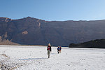
We started our ascent around 9:30am, the way up was not much easier than coming down. In the end our estimate was reasonably good, we reached the crater rim just after 2pm, and made it into camp in another 15 minutes.
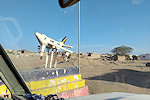
Hassan was awaiting us with a prepared lunch, after some rest we packed camp to move on to the wadi to the south of Doon Kinimi ("Petit Trou"), a smaller but at 1.4km diameter still formidable caldera (or maar ?) to the north east of Trou Natron, near the high point of the old Tarso Tousside shield volcano prior to the formation of Pic Tousside stratovolcano. We made camp in the valley and set out to visit the crater some 700m to the North. The going was not easy among a number of steep-sided gullies carved into the ignimbrite, but after some effort we reached the crater rim. As the walls are not as sudden and vertical as Trou Natron, taking a peek inside is a bit tricky, one needs to walk out along a loose rubble ridge between gullies draining into the crater, and stop just before it starts falling steeply into the void. It was not a very comfortable place, after some quick photos we soon made a retreat to camp, reaching it just as the sun set. Ibrahim was still fiddling with the misbehaving engine, as whatever fix he did the night before did not quite eliminate the problem (though the engine did work much better).
Day 10. Oudingeur - Gonoa - Gira-Gira - Bardaï
In the morning we set out along the road towards Bardaï. Originally our plan for the visit of the three principal rock art sites of the region was for a day and a half, but with this new road we could easily expect to see them in a day, completely recovering the delays we have picked up so far. There was, however, one unpleasant drawback. Under the wheels of passing vehicles the ignimbrite turns to a very fine dust, and in places this loose powder completely inundated the track. With the wind from our rear the dust cloud we created completely blocked all forward vision, sometimes we had to halt for the cloud to clear before we could continue.
Unfortunately some other developments related to the road also hastened our progress. On reaching Oudingeur we found that instead of following the old track, the new road was bulldozed straight through the picturesque canyon with the engravings on both sides, destroying many of them in the process. The remaining ones were covered with the dust, and the threat of passing vehicles made for a rather hasty stop.
We reached Gonoa in less than 30 minutes, a stark contrast to the half-day needed twelve years ago. The minefields have been cleared, the road now followed the old track passing Gonoa just to the south of the engravings. Fortunately here the riverbed is rocky, impassable to vehicles, so the engravings, while close to the road, remain undisturbed. We parked the cars near the road in the shade of a few meager Balanites trees and set out to visit the site, starting at Gonoa I, the nearest to the cars. With much more time on our hands than last time, we found several panels missed on our previous visit.
Last time we did not have the time to visit the side valley with Gonoa V. This time we did make the detour, though in retrospect on our first visit we did not miss much. The only scene worth mentioning is a small barbary sheep attacked by a dog on the side of a boulder.
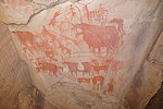
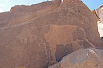
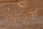
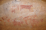
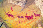
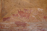
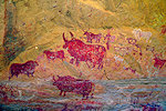
The highlight of the visit was definitely Gonoa III, with the panel of elephants. These were all in the shade last time and hardly visible, now we had a perfect contour lighting which brought out all the fine details. We also found the fine panel of giraffe and some others missed previously.
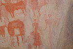
Gonoa II is the main cluster of panels along the eastern bank of the wadi, with a multitude of panels both on the blocks at the foot of the scree slope, and on the vertical walls above (including the famed and unique large human figure). In the late morning the majority were still in the shade, the trade-off for having such a spectacular light on the far bank.
By midday we completed our rounds of Gonoa, we returned to the cars for lunch and a little rest in the shade before moving on. Gira-Gira is really a suburb of Gonoa, on the far side of the ridge separating the Enneri Gonoa from its eastern tributary upstream of their confluence. The main road passes just by them, on our last visit we only made a brief stop, now we had plenty of time to search for all the panels. The site is composed of two clusters, Gira-Gira II is just beside the road as it reaches the wadi after Gonoa.

Gira-Gira I is the larger of the two clusters, a little downstream along the south bank of the wadi, past the now disused old track.
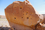
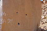
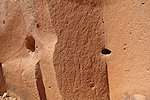
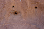
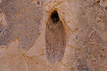
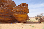
A bizarre feature observable at all these rock art sites engraved into the ignimbrites that inundated the paleo-valleys are the strange holes in the rock. Here at Gira-Gira I there is good evidence that these holes are not ancient features in the rock (e.g. casts of incinerated plants), but post-date the engravings. It is a mystery who/what made them, the most likely culprits are some birds carving their nests into the soft volcanic rock.
Leaving Gira-Gira we drove along the excellent road passing through the exposed basement at the base of the sandstone cliffs. We reached a checkpoint where the road joined the Enneri Zoumeri, this too was a very relaxed affair, the soldiers waving us through once realising we were tourists without checking any papers. From here it was just a short drive along the bed of the broad wadi to reach the outskirts of Bardaï.
We could have camped earlier, the only reason to reach Bardaï was that we were running short on water. We stopped at the pump on the main square to fill our jerrycans, leaving all other chores for next morning.
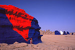
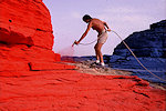
To make camp we drove out of the town towards the South, to the area where the Belgian artist Jean Verame created a gigantic painted landscape in 1989. It is highly debatable whether the end result may be called art or vandalism, fortunately the desert is slowly reclaiming its own. The vibrant colours have faded after only 35 years, the blue turned white, hopefully in another couple of decades only the coffee table book will remain as a memento (photos of Jean Verame at work from the now defunct jeanverame.com website).
Day 11. Bardaï - Enneri Zoumeri
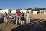
In the morning we returned to town, making a brief stop at the abandoned old Bardaï Research Station before heading to the market for Hassan to top up our supplies of bread and vegetables. There was an enormous change compared to our last visit, in 2014 practically nothing was available, now the market was full of excellent fresh vegetables, freshly baked baguette, things unheard of previously. There were a number of several storey concrete buildings, a far cry from the few miserable mudbrick huts. Overall the town had a surprisingly pleasant orderly appearance (unlike Zouar), though one thing was conspicuously absent: we could not find any diesel anywhere.
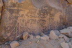
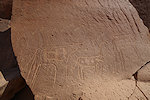
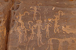
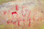
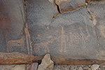
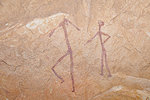
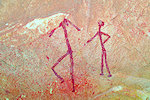
Bardaï is also the home of a very interesting panel of engravings, with large groups of human figures holding curved sticks (much resembling some figures from Jebel Uweinat). In 2014 Andrea had no clue about their location, and was in no mood to search for them it at the time very unwelcoming town. Now the situation was far more relaxed, at the Sous-préfecture we asked if anyone knows about them, and while the scene was not recognised we were directed to a cluster of rocks nearby where there were definitely some engravings.
After a brief search we immediately found several panels of the usual crude cattle associated with Human figures. Eventually the main panel was found on the far side, overlooking the riverbed just below.
Having found everything we wanted (much faster than anticipated), we drove out of town eastwards along the Enneri Zoumeri, which still had flowing water in places, there must have been some heaver rains in the not too distant past. As we progressed it became increasingly overcast with dark grey clouds, but there was only some wind, no rain.
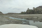
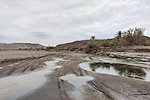
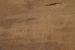
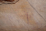
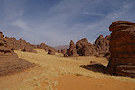
Our target was the dissected sandstone country bordering the Enneri Zoumeri about 25 kilometres east of Bardaï, where in 2014 we discovered a shelter with fine pastoralist paintings, the only ones known from the central Tibesti. At the time we did not have time to explore further, now we have allotted a day and a half to make a thorough survey to see if there is more. There was a car track leading into the western border of the area, we made camp there and after lunch we set out on foot to explore. It did not take long to find a few scattered engravings, but the area seemed to lack any suitable shelters for paintings.
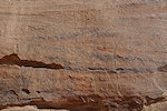
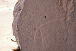
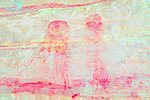
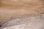
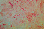
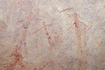
Finally on a rock wall that did not appear particularly favorable for paintings, Bruno found some very faint and curious traces of paint.
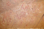
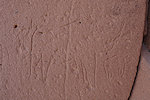
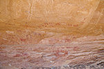
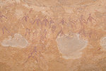
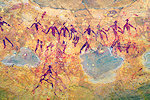
Even with DStretch the scenes are very difficult to make out, but there are clearly human figure, spirals and several negative handprints. While the few discernible animals do look like cattle, the other paintings have a definite archaic "feel".

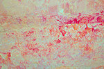
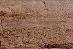
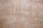
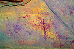
We continued our search in the very broken sandstone terrain, and after some time came upon another shelter formed where a volcanic dyke fractured the sandstone. There were mostly only some traces of water-smeared pigment on the rock face, with DStretch it was possible to make out a few humans and animal figures that were not cattle, with the same archaic feel as the paintings in the previous site.
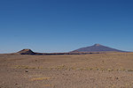
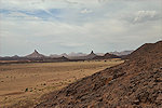
While we were busy photographing the paintings Chris wandered off till a far col, from where he could overlook an amazing landscape littered with volcanic plugs along the horizon. By this time it was getting late, exacerbated by the dark clouds, it was time to make a hasty retreat to camp.
It was a rather warm evening after the cold nights of the high Tibesti, sleeping with an open sleeping bag I soon found out that we had plenty of uninvited dinner guests - and I was on the menu. There was a particularly vicious swarm of mosquitoes, probably hatching from the numerous stagnant pools in the nearby Enneri Zoumeri. I climbed out of the sleeping bag and for the first night on the trip I put up a tent for protection, which turned out to be very fortunate as just a couple of hours later rain started falling in big drops, soon strengthening into a proper shower that repeated several times overnight.
Day 12. - Enneri Zoumeri - Zoumeri Village - camp near Tarso Toon
The overnight rain was not really enough to penetrate the ground, by the morning everything was dry (our crew covered everything sensitive to moisture with the big trapaulins used for luggage on the cars). With the eastern fringes of the area covered, we decided to move to where we found the paintings in 2014 to thoroughly search the vicinity. As we were driving upstream Hassan spotted from the car window a nice panel of previously unreported engravings along the southern bank of the Enneri Zoumeri.
We parked the cars in the shade of some trees near the towering rocks behind which we found the 2014 site, and started exploring on foot. In the northern reaches of the rocks we found a few meager engravings, but no more shelters or paintings.
We almost completed going around the rock outcrops, re-visiting the 2014 site, new to the majority of our party. I was hoping that the better resolution camera might reveal new details, but saw nothing we have not noticed before.
All we had left was a small unexplored section facing the riverbed. Not far from the known site we came upon a slanting fallen boulder which created a small shelter. On the ceiling we found some very faint traces of paint that turned out to be a group of (archaic?) human figures. Unfortunately on my photos the scene is cut, I never noticed the upper figures on the spot.
Our finest find was awaiting at the tip of the rock outcrop directly facing the river. In an elevated shelter (which I cannot fathom how we did not see the last time) we found some well preserved late pastoralist paintings, while on the rock wall just below there was a large panel of engravings.
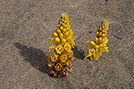
We have completely covered our intended survey area, we moved the cars to the shade of a sandstone tower for lunch before continuing. On our way we made a brief stop at the first cluster of engravings seen in 2014, which were known to our guide Senoussi at the time. The riverbed was full of bright yellow parasitic Cistanche phelypaea just like the last time we passed here.
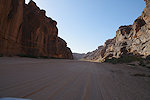
We continued east along the Enneri Zoumeri, which soon narrowed to a picturesque canyon, with sandtone walls on both sides, but no promising shelters so this time we did not stop to investigate.
We reached the village of Zoumeri bu mid-afternoon. This too changed beyond recognition, with a number of brick and concrete houses having replaced the traditional huts. We went to the village well to take on some water before driving further upstream along the valley, with the Tarso Ton volcano looming on the horizon ahead. We made camp in a valley along the northern flanks of the volcano.
Day 13. - Tarso Toon - camp in the Enneri Yebbigué
We awoke to a pleasant warm morning with lilac skies as the sun illuminated the high clouds, but it soon turned a gloomy grey with thick clouds moving in, and rain was seen coming in the distance. We only received a sprinkling, but packed camp in a rather hurried manner.
We continued on the track towards Yebbi Bou, again much better than I remembered. We followed a valley that at first was flanked by dark volcanic rocks, but soon we reached the area of basement outcrops which make up most of the northern part of the Tibesti. About this time the rain started, at first only in large drops, but soon it became strong enough to make the ground wet, with even small puddles appearing. At least it solved the dust problem for a while... We also started passing large excavations, on both sides of the road, gold mines everywhere in the basement region.
I could not avoid noticing that we were consistently driving north instead of east, our intended direction. However we seemed to have been on the main track with no obvious junctions, and since many of the roadways changed at first it did not concern me. However after continuing for 20 kilometres, I asked Adoum, who appeared fairly confident that we were on the right track, expecting that soon we would join a large wadi with the track turning towards Yebbi Bou. Looking at the satellite imagery this looked plausible, and after another 20 kilometres we indeed reached the lower course of the Enneri Yebbigué, with a well-used track leading south. After 10 kilometres we did our good deed of the week, encountering a pickup laden with water and a single driver that was badly stuck, our joint efforts certainly made his day.
In retrospect I cannot understand how we forgot to ask the man where he was coming from and where the track leads to, but in the general rejoycement of getting the pickup out of the sand nobody thought about it. We continued for another 10 kilometres along the now increasingly less traveled track, crossing several sections of flowing water and some rough rocky patches. Eventually we reached a rock ledge that completely barred the way, clearly the track was not leading along the valley till Yebbi Bou. Adoum was adamant that we took the wrong turn at the last tributary and that is the one to be followed, so we returned to the junction and followed the track, but that too was a rather dismal one, clearly not the main road we were seeking. As I did not have any high resolution satellite imagery, we called lunch break, and set up Starlink to download them to assess our situation and find a way out.
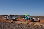
Starlink saved the day, but what we saw on the downloaded imagery did not look very promising. It did appear that we indeed missed a turn just after our camp, and instead of taking the Yebbi Bou track we turned north along one of the number of tracks serving the gold mines. There appeared no way towards our intended direction south, in the end we agreed that the best course of action is to bite the bullet and go back the way we came to the correct junction. We already passed the spot where we helped the pickup when much to our luck we encountered a group of gold miners. Our drives engaged in a heated discussion, and from the body language it appeared that there indeed was a track leading south among the hills bordering the valley to the west, just we missed it on our way upstream. Turning around we drove to the described point, and we did find the rather hidden entrance of the track, which led us among innumerable goldmines along a valley steadily south, eventually joining after about 25 kilometres the east-west track which we were supposed to take in the first place. In the end we have covered about 100 kilometres till the junction instead of 35, but it was not entirely wasted effort, the drive through the gold mining country was definitely interesting, and the terrain was very different from anything we have seen so far in the Tibesti. Once on the right track, we continued towards the Enneri Yebbigué again, reaching it well upstream of the blockage. We passed the military checkpoint at the junction, and made camp in the broad valley among some Salvadora shrubs.
Day 14. - Enneri Yebbigué - Yebbi Bou - Kozen Pass
In the morning we continued towards Yebbi Bou, making a brief rest stop before reaching the town. Despite the considerable detour the previous day we were not much delayed, we arrived at the Sous-Préfecture to present our papers by 10:30am. Adoum was back on known territory, he was confident we'll make it to the bottom of the Kozen pass by the evening on schedule. Yebbi Bou changed less than the other places we passed, it still mostly consisted of the traditional houses, though there was considerably more rubbish about.
Once we left the town we found that the track towards Kozen and Gouro was indeed far better than anticipated, we could keep a good steady pace. As there were no trees or shady spots, we stopped for lunch at a small volcanic outcrop near the track. Fortunately we were high and there was a cool wind with cloud cover, there was no real need for shade.
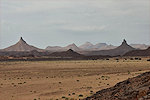
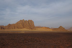
After driving for another half an hour we reached the crest of the eastern Tibesti (at around 1900m asl), and after a turn we had a superb view down towards the Kozen pass.
From here on we started to descend rapidly among spectacular volcanic plugs. Sometimes the track crossed broad lava fields, which was difficult going, but by and large it was a fast journey compared to earlier Tibesti memories. Adoum was right, by 4:30pm we reached the bottom of the pass and entered the Kozen valley.
.
Our target for the night was the vicinity of the Kozen Michidin shelter, somewhere near the pass entrance but the publications were not very clear. Adoum made it very clear that he is not going off the track anywhere near the pass entrance which was (and probably aside the immediate track is) heavily mined during the rebellion. Fortunately Hassan vaguely recalled seeing some paintings in a shelter a few kilometres away, so we drove there to check, it was indeed the shelter we were looking for. As it was close to sunset we left the visit for the following morning, and made camp in a small protected cove nearby.
Day 15. - Kozen Michidin - Enneri Drosso
Having dropped down considerably in altitude it was a pleasant warm morning, and G. already made the first rock art discovery of the day when going out for a toilet, finding a small shelter near camp with a couple of painted white goats and a strange enclosure which could represent a hut.
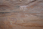
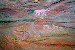
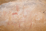
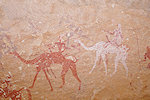
Already from camp we could see a large shelter in the distance which looked promising, before proceeding to the main site we decided to check it out. Climbing up we did find a number of faint human figures on several panels, while not resembling any of the known styles they did have a distinct archaic look and were not associated with any domesticates. While we were taking photos Adoum waved from below, he spotted a large panel of late pastoralist cattle in a smaller shelter a little to the right of the main one. It was certainly a very nice find to start the day.
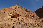
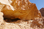
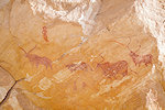
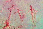
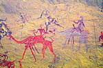
We moved on to the nearby main shelter, which was originally found by d'Alverny in 1936 (JSAFR 20/2, 1950), and also published in Arte Rupestre nel Chad (1996) by Adriana Ravenna. Confusingly both publications claim that the shelter is oriented towards the North, while in reality it faces almost directly East, hence the difficulty I had in locating its likely spot on Google Earth. Initially one sees the late pastoral paintings of cattle, speared warriors, and also some fine camel riders resembling those at Enneri Korossom (KN04). On close look one notices a faint earlier layer of classic Karnasahi style paintings, including a very fine large group of human figures. Both the paintings and the surrounding landscape link these paintings with the other Ouri plain sites, rather than the central Tibesti ones we saw earlier.
From our earlier finds it was clear that the area was far from being thoroughly explored (probably nobody visited since Sergio and Adriana in the 1990s). We had some spare time on our hands to check out both sides of the Kozen valley (though a complete survey would have taken several days), starting at a smaller shelter which we already spotted the previous evening while looking for the main site. Here too we found a weathered panel of late pastoralist paintings, and also some traces of Karnasahi style figures. Certainly the area warrants a more thorough survey at some point.
We continued east along the Kozen valley, checking all rock outcrops as we passed (though from the car and at a distance, it was definitely not an exhaustive survey). There appeared to be a clear scarcity of suitable shelters, we saw some lovely landforms much resembling the Ouri plain, but few promising sites.
In the end we found just one more minor site about 20 kilometres downstream, with some very faint white cattle barely worth mentioning along the side of practically the only likely shelter we saw.
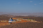
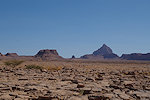
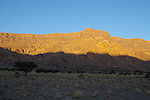
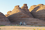
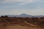
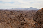
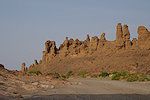
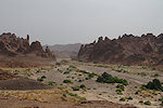
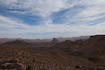
The landscape was spectacular, however. As we descended down the valley (quite steeply, despite the deceptive plain-like appearance) the bordering hills rose to jagged peaks, with eroded rock towers and golden sand filling the space between them. There was also much vegetation, probably the remnants from the 2024 rains, after which we saw the lower section of the valley completely covered with green.
By midday we approached the eastern end of the valley without finding any more sites. We chose a shady spot for lunch before exiting this wonderful area.
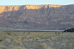
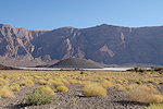
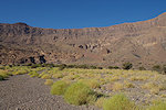
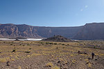
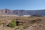
After lunch we entered the narrow winding outlet of the Kozen valley. We were now 600 metres lower than at our camp at Kozen Michidin, though all the time it appeared that we were driving on a level plain. Interestingly we could still see in places the lava flow from the 70km distant Tarso Kozen which filled the valley at some point. After a further 20 kilometres and another 100 metres of altitude lost we finally emerged to the broken country to the east, soon hitting the north-south track which we have taken to and from the Ouri plain in 2022 and 2024. We continued south along the track all afternoon, past the well and village of Bini Erde, finally making camp in the Enneri Drosso near the abandoned village of Bini Drosso about 50 kilometres before Gouro.
Day 16. - Enneri Drosso - Gouro - camp east of Bembechi
In the morning we awoke to raindrops and leaden skies, with large rain showers visible in the distance, luckily they all missed us, just. We took a rather hasty breakfast and quickly packed camp just in case, but as we departed the clouds began to break up and patches of sun appeared.
We quickly covered the short remaining distance to Gouro, where we made a longer stop to fuel the cars, get some bread, and allow Adoum (who was from the village) to make the obligatory social calls. We found Gouro still to be the neatest and most pleasant of all the Tibesti settlements.
Well ahead of schedule, we left Gouro mid-morning and drove for about an hour along the track south. We were astonished to find a newly built road leading out of town, offering a fast smooth ride unlike the winding bumpy track of old. We stopped for lunch at a solitary hill with a few rocks offering shade, then continued south along the fine new road, before leaving it to follow the northern edge of the Borkou escarpment towards the east. We finally made camp in the lee of a couple of Tamarisks about 25 kilometres due east fro the small oasis of Bembechi.
Day 17. - Camp east of Bembechi - Bembechi - Faya-Largeau
We still had a spare reserve day, we planned to use it to visit the "Faya crater", a circular feature visible on satellite imagery about 50 kilometres to the north east among the eastern Borkou hills. There is another larger circular feature, the Aorounga crater about 100km to the north that was identified as an ancient impact crater, the two could possibly be related. To our knowledge this "Faya crater" had never been visited before (it was only identified on Google Earth less than 10 years ago), taking advantage of having a trained geologist amongst us (Chris) we were curious to see what we find.
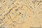
This area is characterised by parallel sandstone ridges separated by sand filled valleys, aligned with the prevailing wind direction. We already tried in January 2024 to gain access from the west, but it was impossible to cross the sandstone ridges, we concluded that the only feasible way is to drive east along the northern edge of the plateau till reaching the lanes leading directly south west towards the crater. We still had another 10 kilometres to do eastwards from our camp along a fairly difficult terrain, not made any easier by a sandstorm that suddenly sprung up in the morning after a perfectly quiet night. On reaching the lanes we turned south, but instead of the expected sandy lanes we found the valley bottom to be filled with exposed rocky terrain, a very difficult going. Where patches of sand appeared, they were all covered by tufts of grass with small trailing dunes, almost as bad and bumpy as the rocks. In two hours we covered about ten kilometres towards the south. With another forty remaining and near zero visibility in the now howling gale, it was time to admit defeat. We re-traced our own tracks the best we could, and retreated to Bembechi where we could at least have lunch in the lee of a large cluster of Doum palms. After lunch we departed for Faya, crossing to the west before hitting the built road, which allowed us to reach town and the relative protection of Djebrine's garden & house in a mere two hours.
Day 18. - Faya-Largeau - Erg Djourab
We spent the morning holed up in Faya, licking wounds and hoping for the wind to calm a bit before departure. As our departing flight was at 7pm on our last day, we planned to depart after lunch weather permitting, to be able to reach N'Djamena by midday allowing time for showers and packing. The cars were fueled, Hassan bought some supplies, and around midday the weather appeared to calm down a bit. We decided to have a quick lunch then leave.
The optimism turned out to be somewhat unwarranted, as soon as we climbed out of the Faya depression the gale returned, and stayed with us throughout the afternoon. We reached the edge of the Erg Djourab, and made camp in the very meager wind shelter of a large barchan dune. After a very quick dinner take inside the cars everyone retreated into the tents to somehow weather the night.
Day 19. - Erg Djourab - camp before Salal
The sandstorm continued thrughout the night and morning, we quickly packed camp the best we could and continued along the track through the Erg Djourab. While in the sand it was relatively fine, but once we reached the far side the white dust of the lakebed reduced visibility to almost zero. We were driving almost blind, all the time struggling to keep the two cars within sight. We had a brief stop for lunch (inside the cars), then continued, passing Kouba Olanga. After a while with vegetation anchoring the sand and soil visibility improved, and we could make better progress, making camp about 50 kilometres before Salal.
Day 20. - camp before Salal - camp after Moussoro
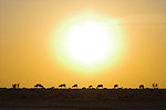
Finally overnight the storm subsided, and we awoke to a perfectly calm morning, with grazing cattle passing us as the sun came up, presenting a perfect study of the different horn types depicted on the ancient pastoralist paintings.
The rest of the day was an uneventful drive along the length of the Bahr el Ghazal, with a lunch stop before Mussoro. We had enough fuel, so we only did some quick shopping for dinner before continuing, making our last camp about 50 kilometres before Massakory and the asphalt road.
Day 21. - Camp after Moussoro - N'Djamena
After two hour's driving we reached Massaguet, where we said good-bye to Chris who went off for another five day excursion to the Zakouma National Park with a separate car that was awaiting us by the roadside. The rest of us continued to N'Djamena, arriving to the Irrisor soon after midday, allowing for plenty of time to tidy up (and have a cold beer in the garden)before leaving to the airport for the evening flight home.

We are planning a return to the Tibesti again in November 2026, this time to the Ouri Plain along the fast route via Gouro. The trip will start and end in N'Djamena, and will take 21 days using cars, with some shorter treks to and around the sites. Please visit the News page for any updates (or "like" the FJ Expeditions FaceBook page).