
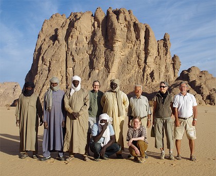
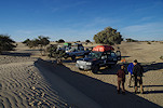
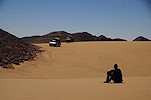
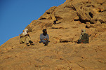
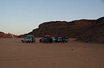
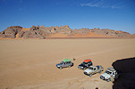
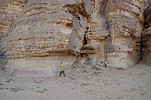
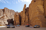
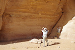
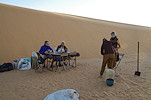
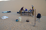
 Click on image for list of participants |
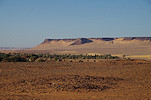
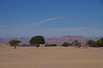
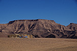
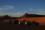
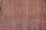
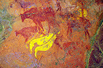
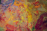
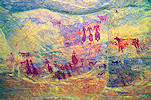
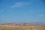
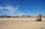
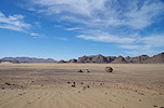
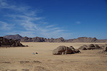
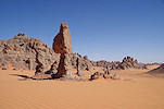
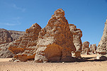
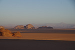
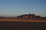
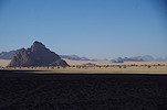
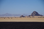
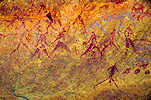
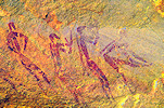
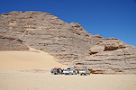
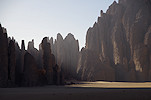
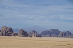
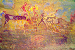
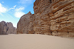
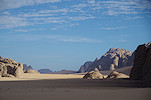
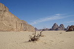
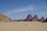
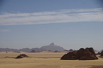
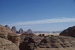
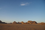
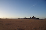
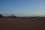
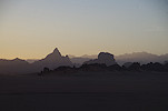
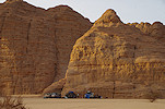
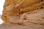
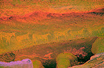
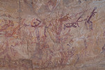
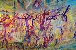
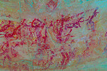
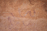
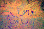
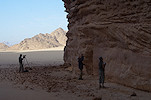
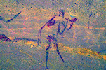
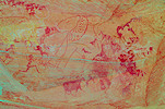
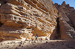
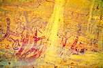
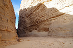
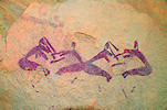
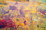
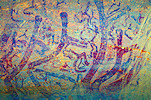
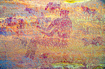
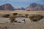
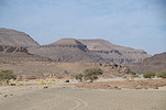
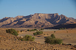
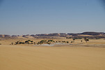
Ouri plain, eastern Tibesti, Chad 18th November - 8th December, 2022 Site references based on numbering system of Adriana and Sergio Scarpa-Falce, Aldo and Donatella Boccazzi False colour images processed with DStretch, a freely available software developed by Jon Harman |
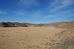
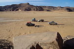
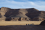
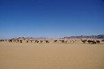
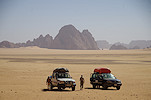
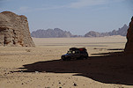
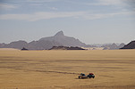
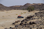
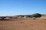
Following our last expedition to the amazing rock art sites of the Ouri plain in January 2017, the resurgence of the Tibesti rebellion followed by Covid prevented any return despite several plans and attempts. This time the conditions were again right, calm has returned to the area and we had the benefit of an all local crew who could arrange safe passsage. This time we took the faster eastern approach via Gouro circumventing the mine fields, saving three days' journey each way which could be spent at the plain, enabling the visit of the northern areas which were not reached on the past expeditions. Like on the past two Ennedi expeditons, ground logistics were provided by Tchad Evasion.
Day 1. N'Djamena - Camp after Moussoro
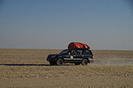
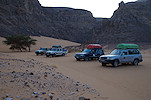
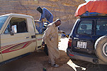
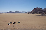
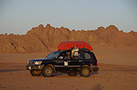
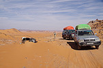
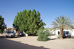
Most of our party reached N'Djamena a day early to have a day's rest in the Irrisor hotel (the former Ibis). The cars and all paperwork were ready by 8am on the day of departure, we quickly loaded our luggage at the hotel and without much ado set out on the long boring drive noth via the Bahr el Ghazal. Like on the previous trips with Tchad Evasion, Djibrine was out guide and lead driver, with Adoum and Moussa the other drivers and Ramadan the cook (whom we knew from the January 2020 Ennedi trip. The day was an eventless drive, first along the asphalt till Massakory, then along the dusty piste in the Bahr el Ghazal towards Moussoro which we reached late afternoon, only stopping for a short lunch break.
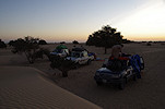
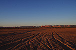
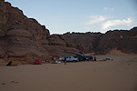
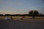
In Moussoro we only stopped to fuel, then continued, making camp at sunset among the vegetation covered dunes bordering the Bahr el Ghazal. there were exceptonally good rains a few months earlier, there were still big pools along the low lying areas, something we never saw on previous trips.
Day 2. Camp after Moussoro - Kouba Olanga
This day was a long and dusty drive up along the Bahr el Ghazal, first in the valley, then a bit better going after reaching Salal, on the flat plain bordering the wide shallow watercourse.
After stopping to fuel in Kouba Olanga, we continued a short distance beyond the town at sunset to make camp among the low dunes where the Bahr el Ghazal ends to give way to the white dry lakebed of the ancient Lake Megachad.
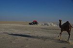
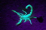
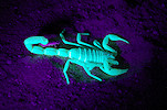
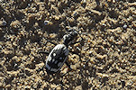
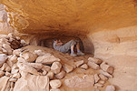
This time we had a UV light with us to find scorpons in the dark, as we set out for a hunt after dinner I was astonished how many there were about. There was a bright blue glow every dozen metres or so, the common African Fattail Scorpions (Androctonus amoreuxi). Most of the time they rapidly disappeared into their burrows as we approached, but we did manage to catch a few out in the open to take photos.
Day 3. Camp after Kouba Olanga - Faya-Largeau
In the morning as we were packing camp, some excitement was caused by a nice white spotted predator beetle (Anthia sexmaculata) that was hiding under one of the tents.
The rest of the day was again an uneventful long drive, cossing the dunes of the Erg Djourab without any mishaps, reaching the Faya depression by mid-afternoon. We spent the night in Faya at a reasonably good tourist camp (not the same as the one we used on our very first Tibesti trip in 2014) near the airport.
Day 4. Faya Largeau - Gouro
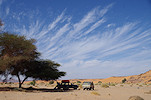
With our early arrival in Faya the day before, Ramadan could do all the shopping needed, the cars were fueled, so early morning we could continue our journey nort towards Gouro. This part of the journey passed through the valleys and dunes of Borkou, a much more pleasant and fast drive on the firm sand than the previous days. By midday we crossed Borkou, and stpped for lunch under the single tree we saw along the entire route.
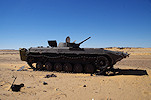
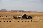
Next to our lunch spot there was another relic of the Libyan wars, a shot-out Soviet-built APC that became the home of a tiny desert agama (Trapelus mutabilis).
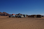
We reached Gouro by sunset, spending the night at the guest house of Djibrine's family.
Day 5. Gouro - camp east of Kozen
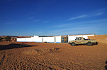
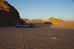
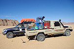
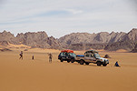
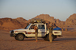
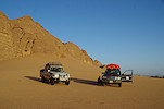
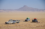
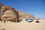
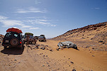
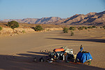
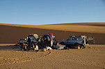
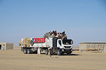
In the morning we met Idriss, a relative of Djibrine who was to be our guide on the way to the Ouri Plain and on the plain itself. He was driving a Landcruiser pickup without any license plates (as we later learned, this facilitates moving freely between Chad and Libya, as no awkward questions arise). This pickup enabled us to carry enough fuel and water to make it there and back from Gouro withot any risk of running short on either. There were already several drums of fuel stored at the guest house.
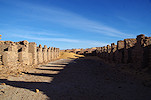
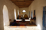
While our crew fueled the vehicles and Ramadan went to the market to top up our supplies, we had some time to visit the old Senussi zawiya (strong house and religious school) which was within walking distance of the guest house. This zawiya in Gouro has the distinction of being the only surviving Senoussi monument, all others in Libyia and Egypt having been destroyed or demolished long ago.
Before leaving Gouro we went to the Sous-préfecture to have our travel permits endorsed. Clearly the Sous-préfect was a good friend of Djibrine, the formalities went very quickly, and he even came outside to greet us and wish us a bon voyage, emphasizing that we were in very good hands with Djibrine and Idriss.
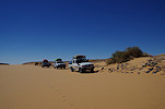
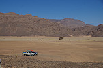
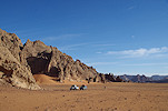
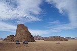
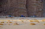
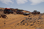
From Gouro a fairly difficult sandy pass leads up to the next level of the plateau toards the north. Idriss with his petrol driven pickup coud tackle it easily, but the fully loaded diesels struggled, it took several attempts and quite a bit of pushing to get all our cars up to the top. Once there, it was relatively easy if bumpy going, by lunchtime we approacked the well and village of Bini Erde (same name as the town and well at the entrance of the Enneri Miski on the far side of the Tibesti). Idriss had his house in Bini Erde, after having lunch in the valley and taking water, we visited the vllage for him to say good bye to the family.
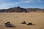
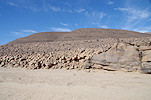
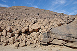
The most dangerous part of the track leading north along the eastern side of the Tibesti started just north of Bini Erde, here a number of minefieds were laid both durng the Lbyan Wars (by the reteating Libyan army), and later by the Tibesti rebels based in Yebbi Bou and Ouri. Fortunately With all the gold-miner traffic this track became much safer, with a number of wrecked cars marking the minefields, and fresh tracks clearly showing the detours arond them.
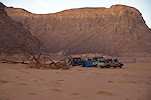
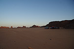
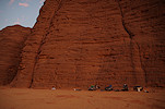
By the evening we reached the Kozen valley (leading towerds Yebbi Bou in the interior of the Tibesti), and made camp in a pleasant sand-filled side wadi.
Day 6. Kozen - Ouri Sao
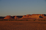
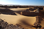
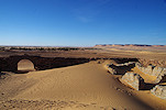
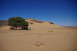
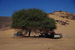
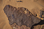
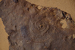
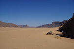
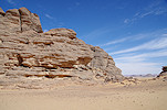
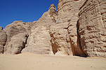
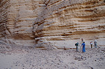
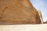
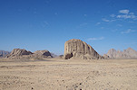
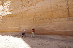
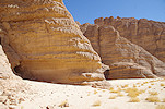
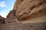
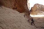
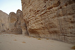
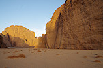
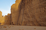
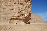
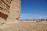
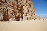
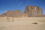
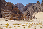
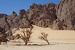
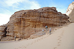
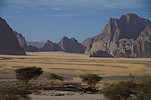
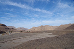
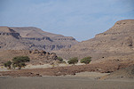
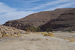
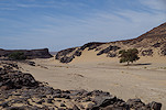
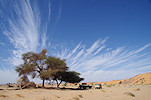
In the morning we packed up and contnued north on the well traveled track (used by gold miners, who cross the northern Tibesti in the Dohone in Libya, conveniently ignoring international borders). By midday we reached the entrance of the Ouri Sao, the main valley draining the Ouri plain, cutting through the plateau of Palaeozoic sandstones to the east of the plain. We stopped for lunch in the shade of a solitary large acacia in a small tributary, and exploring the area I came upon a strange trace fossil which is very similar to the holdfast of Edacaran organisms found in Precambrian rocks. To my knowledge the oldest rocks in the area are Cambrian to Ordovican, but one never knows...
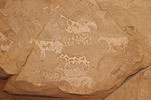
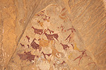
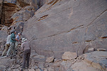
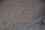
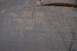
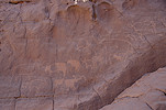
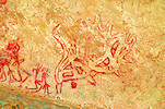
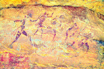
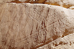
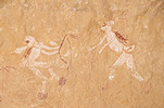
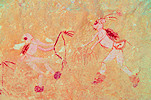
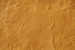
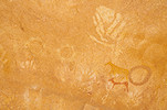
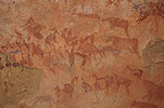
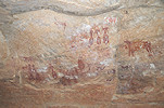
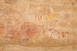
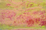
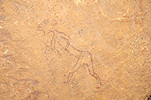
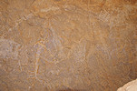
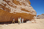
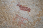
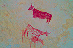
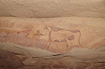
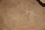
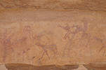
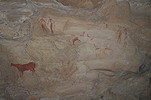
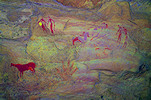
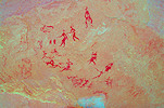
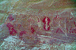
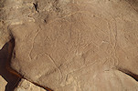
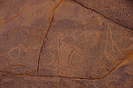
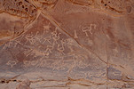
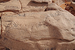
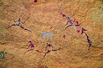
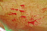
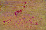
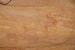
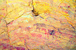
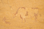
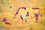
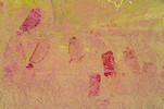
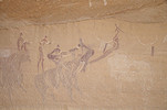
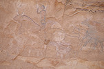
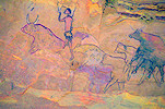
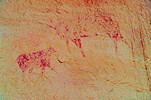
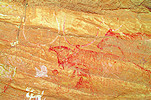
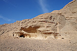
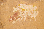
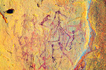
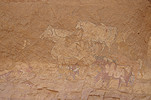
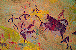
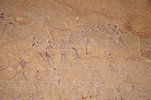
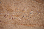
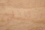
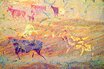
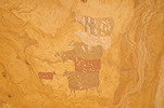
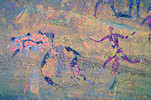
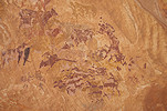
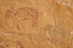
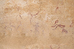
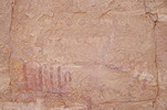
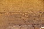
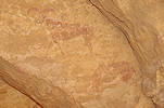
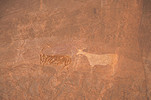
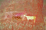
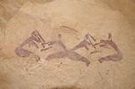
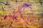
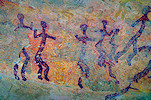
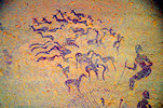
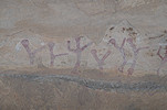
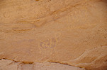
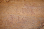
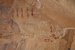
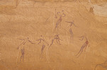
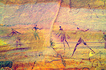
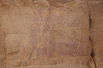
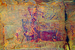
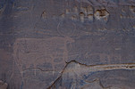
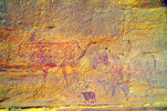
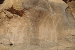
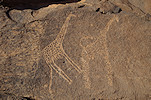
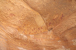
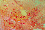
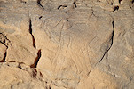
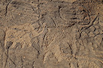
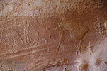
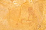
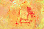
In the 1990 when Aldo & Donatella Boccazzi explored the Ouri Plain, the Ouri Sao was thought to be mined by their guide, and they only explored it till the junction of the Enneri Borou, not further downstream. It was only in 2017 (just a week after our own expedition via Aozou and the Enneri Korossom), pioneering the Eastern route with a guide fom Gouro, that Yves Gauthier and party explored the outer part of the Ouri Sao (which their guide called Enneri Yangara), and found a number of engravings and paintings along its length, beyond what was explored by the Boccazzis. The first of these sies (OS05 using the numbering system of Aldo Boccazzi) are a group of fairly crude engravings depicting both cattle and wild fauna, mostly giraffe.
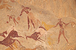
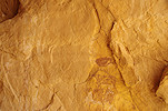
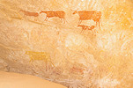
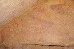
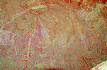
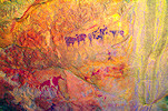
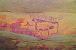
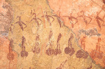
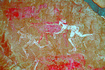
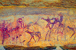
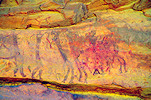
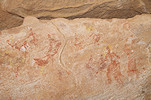
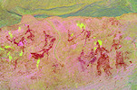
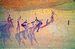
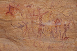
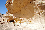
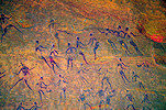
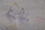
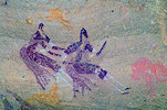
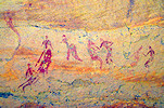
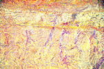
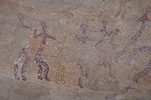
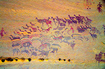
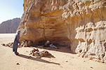
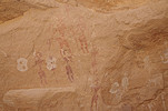
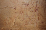
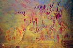
A little further upstream, Yves and party found two shelters high above the valley floor with paintings (OS04 and OS03, called Yangara-1 and Yangara-2 respectively in the publication in Les Cahiers de l'AARS 22), the larger of which contains a spectacular and extremely well preserved panel of Karnasahi style paintings.
Not far from OS03 (Yangara-2) we found a panel of engraved cattle (OS03B) on the same level which was not noted by Yves & party.
As we continued upstream, we saw a number of other panels of engravings noted by Yves, until we reached the first site recorded by the Boccazzis (OS02).
By this time sunset was approaching, we drove into a small lateral wadi to make camp out of sight of the main track.
Day 7. Ouri Sao - Enneri Borou East - Mossei
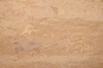
In the morning we continued west along the long Ouri Sao, visiting several more panels of engravings found by Yves and party. It is intriguing and there is no ready explanation why this valley is full of engravings and is relatively poor in paintings, while in the rest of the Ouri plain paintings predominate. Possilby, like at Jebel Uweinat, the engravings represent a late phase of rck art, by which time only the largest valley provided suitable living conditions.
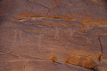
After about ten kilometres from our campsite we reached the confluence of the Ouri Sao and the Enneri Borou. Aldo & Donatella reported several paintings and engravings from the Eastern end of the Enneri Borou, they were more accessible from the Ouri Sao than from the main concentration of the Borou sites inthe mid-section. The first site (BE03) with some strange archaic paintings was about six kilometres upstream from the junction.
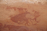
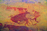
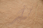
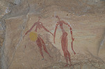
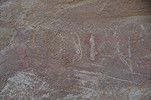
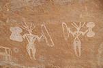
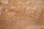
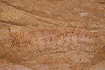
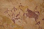
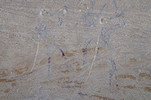
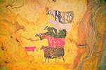
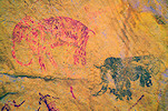
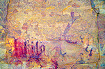
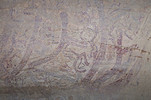
A short distance away there is another site (BE02) with some Karnasahi style paintings and a unique large engraved therianthrope (?) with seemingly animal legs and possibly cattle horns on the head.
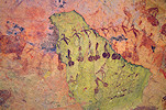
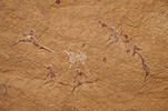
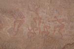
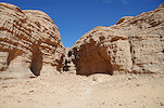
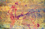
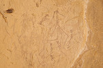
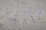
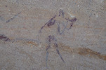
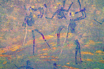
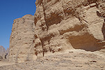
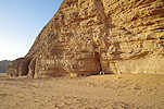
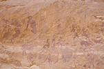
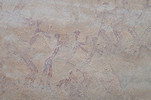
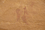
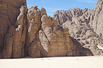
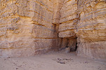
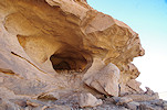
After vsiting a couple of lesser sites we moved deeper into the Enneri Borou, visiting BE01, the most intriguing site of the area. It is a small shelter quite high up at the base of a cliff, with a series of strange white human figures with no clear stylistic affinity.
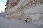
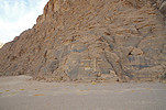
For lunch we returned the Ouri Sao, where the vertical walls of site OS01 along the southern bank provided some good shade. Aside the engravings we found some more recent relics, a surveying point from the time in the nineteen seventies when the area was a part of the Aouzou strip, occupied by Libya.
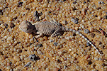
Among the nearby dry shrubs we saw some movement, it was one of the common fringe-toed lizards (Acanthodactylus scutellatus). Usually they scuttle away on sight, but this one was completely fearless, we could approach it, and after some time it even started catching flies which landed on my leg as I was taking photos.

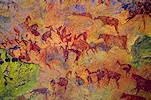
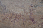
After lunch we crossed over to the broad valley of Siekouba, where two major sites are located. The first one, SK01 is facing west, and the mid-afternoon sun was unfortunately shinng on the very impressive large cattle, making them very ahrd to make out fully. However the same lighting enabled us to find a unique row of engraved cattle heads in the small satellite shelter, which we would probably have missed altogether in the morning.
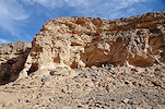
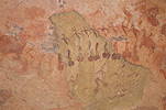
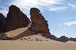
SK02 was a few kilometres to the north. I had some concerns as the location provided by Aldo was in the middle of a featureless sand plain at least a kilometre from any rocks. Fortunately on reaching the given spot a big shelter was visible in the hillside in the distance, and indeed it turned out to be the site we were looking for, with a "wallpaper" of negative handprints and strange circles underlying some later cattle.
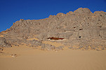
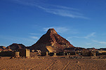
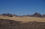
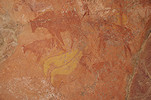
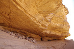
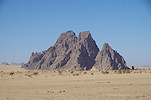
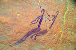
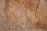
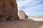
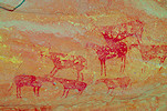
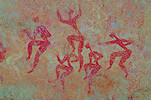
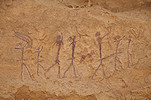
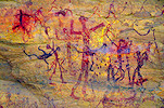
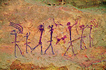
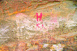
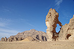
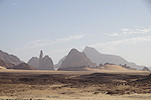
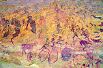
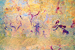
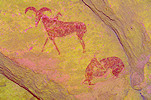
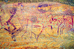
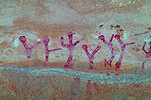
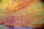
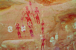
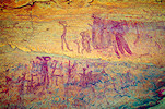
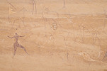
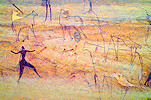
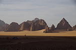
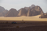
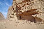
From Siekouba Mossei is a mere 20 m to the North, with a well traveled track lading on to Libya. This area is considered the most dangerous part of the Ouri plain, as here the hills close in, and the narrow gap has been mined at several places. We passed a number of unmarked minefields, all known to Idriss (I would not be surprised if he was invlved in laying them during the last rebellion, as a protection against the regular army), and soon approached the isolated hill with the main site of Mossei, MO00 on its northern side. Reaching this splendid site was one of the key objectives of our trip. It was already found by d'Alverny in the nineteen thirties, the row of Karnasahi style figures is a unique depiction with no real parallels elsewhere on the plain.
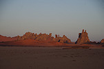
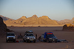
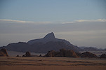
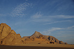
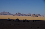
The Mossei main site was just adjacent to the main track, to make camp we moved a few kilometres furter north, to the vicinity of site MO01. We were protected by a small rocky hill, but with good visibility in all directions we had a perfect view of Pic Betté (the highest peak of Libya, just across the border, now corrupted to Bikku Bitta on modern maps).
We still had enough daytime left for a quick visit to the nearby site, MO01, located in a large shelter on ground level, open towards the west. This one contains mainly late pastoral paintings, very similar to what one may find also in the Ennedi.
Day 8. Mossei - Ouri hills
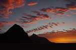
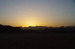
We had a perfect warm and still morning, again with a perfect view of Pic Betté, now illuminated by the rising sun.
While our crew packed up camp, we had tme to re-visit site MO01 and some small surrunding shelters, noting a couple of details that we missed the brevious evening in the dwindling light.
Aldo & Donatella found numerous further sites among the clutter of rock outcrops between our campsite and the main mass of the Tibesti towards the North. The plan for the morning was to visit them all without any time pressure. We started at the most distant cluster, MO08-09-10, of which MO09 is the most impressive with a large panel of Karnasahi style paintings, in varying degrees of preservation.
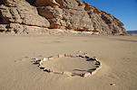
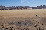
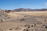
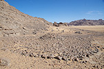
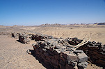
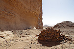
The low terraces on and around the Ouri plain is littered with a peculiar shaped stone monument, called compass graves due to the protrusion that invariably points more-less towards the East (or more precisely, twards local sunrise). On the ground they are inconspicious, made of a thin layer of stones, with only the central tumulus of any height. Near the northern tip of the plain at Mossei two adjacent monuments stood out for being very clear on satellite imagery, and they turned out to be one of the best visible from the ground, located on gently sloping ground with high pints nearby from where one could have a good overview.
There were a number of lesser sites along the row of hills and rock outcrops to the east of the compass graves, mostly the usual Karnasahi style pastoralist paintings, but also a few strange archaic looking figures.
As some of the location information was imprecise we looked in a number of shelters, and did find a few unreported sites, but nothing exceptional.
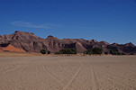
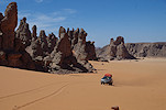
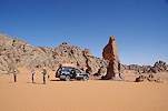
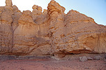
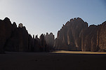
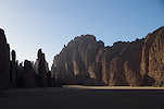
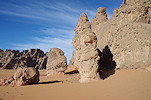
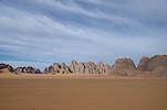
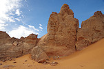
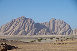
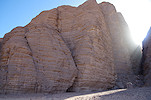
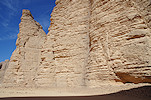
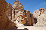
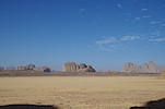
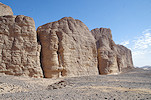
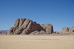
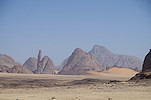
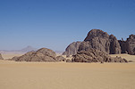
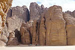
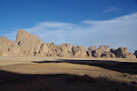
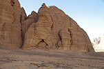
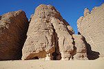
A little east of the clusters of Mossei sites, very close to the Libyan border, there are a series of valleys with bright red sand and towering rock outcrops, one of the most beautiful landscapes of the Ouri plain. Strangely though there are many suitable shelters, there is only a single insignificant rock art site in the area, clearly the ancient inhabitants preferred the open plain.
It was past midday when we finished with all the northern Mossei sites, we returned to our campsite which offered good shade for lunch, and we also took the opprtunity to refuel the cars from the big 200l diesel drums on Idriss' pickup. While we were doing so another pickup approached us from the north, also full with fuel drums, coming from the direction of Libya. They turned out to be two cousins of Idriss, driving back to Ouri after a visit to the gas station at Rebiana, a mere 400 kilometres away.
We only had one unvisited site left, MO07 between our camp and the main Mossei site, a large horseshoe shaped inlet in the side of a cliff with a near-continous shelter at its basewith several panels of pastoralist paintings. A little to the north we found another, apparently unrecorded shelter which too had a fine panel of Karnasahi style paintings.
We made another stop at the main site of Mossei to see and photograph it in a different light, and at a more leisurely pace.
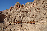
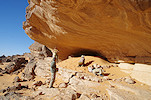
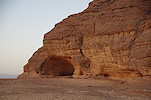
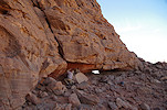
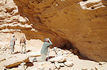
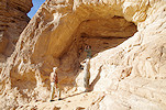
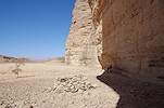
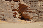
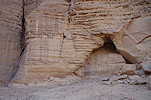
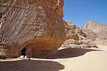
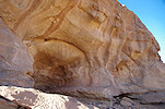
Having finished Mossei, we drove back towards Ouri to see another principal site, referred to as "Riparo del Mani" (shelter of the hands, OU00) at an isolated hill. The prominent shelter was visible from afar, we parked the cars at the foot of the hill and climbed up to find a large panel of rather weathered Karnasahi style paintings, with two fine superimposed white figures. We could not find the handprints after which the shelter was named, but it only registered later(too late to return) that we only found the secondary shelter (OU00B), the main one was somewhere 100 metres to the south on the other side of the hill.
We continued to the row of hills further south, where Yves and party found a small site with some paintings at the entrance of an inlet that offered good camping spot. The site was still on the sun as we arrived, but it moved into the shade very quickly as the sun set behind the hills.
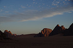
Our campsite was at a very scenic spot, with a clear view towards the north where Pic Betté still dominated the horizon.

Day 9. Ouri - Araské
Sunrise was again a spectacular scene as the light slowly filled the plain, with plenty of time to enjoy while our crew packed camp.
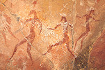
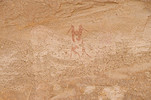
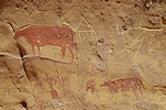
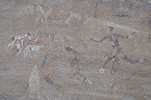
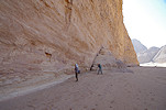
We drove a short distance towards the south to see site OU01, a very unusual site with no real shelter at the bottom of a vertical cliff. A number of archaic human figures were painted on the few available smooth surfaces high above the present-day floor level, which then were superimposed by Karnasahi style cattle and figures on the lower level which mst still have been within reach at the time.
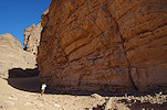
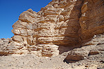
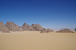
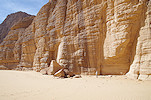
We continued along the row of hills towards the south where they meet the Ouri Sao, and crossed to the other side to a prominent rock outcrop, Ehi Turqui, with a number of sites along the eastern side.
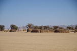
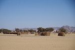
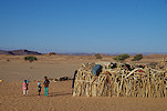
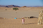
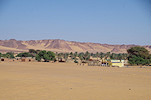
We continued to Ouri village, which was again inhabited by a few families (relatives of Idriss) after having been abandoned for more than two decades. There is not really much to see, we stopped briefly at a house cum store to exchange the obligatory greetings and notify the villagers of our presence and plans.
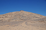
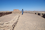
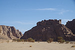
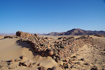
The fort of Ouri is located on a hilltop to the west. Some quides refer to it as Fort Leclerc, but this is almost certainly incorrect, as this fort was neither used during the 1941 Kufra campaign (which was launched from Faya via Ounianga), not the early 1943 Fezzan campagn (which started from Bardai). It is a small mud and stone structure, by all appearance it was likely an Ottoman fort built prior to 1912, when Turkey attempted to assert control over the area (well before the French occupation of the Tibesti by Tilho in 1917).
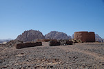
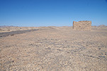
The new French fort is some distance to the south (the location dictated by a large guelta nearby), a low stone structure on a hilltop, hardly visible from a distance, neither Idriss nor Djibrine were aware of it (I have picked it out on Google Earth). There is a large insignia made of pebbles of the Troupes Coloniales in the courtyard, and a sturdy machine-gun emplacement at the southern end overlooking the plain. This fort was established in 1931 in response to some Italian incursions, prior to the never ratified Rome treaty of 1935 when France conceded the Aouzou strip (that included all of the Ouri plain till the Enneri Korossom) to Italy.
From the fort we drove down south to the Enneri Araské, a large tributary of the Ouri Sao with the junction just downstream of Ehi Turqui. We made camp near the principal site (reported by d'Alverny), and since we still had some time till lunch we immediately set out to explore the site. The location was a bit vague, out on the plain adjacent to a huge rock wall with several shelters at the base, naturally we expected one of them to be the main site. We did find a few paintings (including a delightful little hairdressing scene which to my knowledge was not reported), but not the principal shelter.
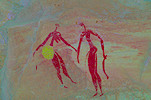
After some searching we realised the main site of d'Alverny is on the far side facing the wall, in a very low and inconspicious shelter. It is a very small but delightful little scene of six very fine Karnasahi style figures.
In the afternoon after lunch and a little rest we set out to visit the western Araské sites. AR04 is the finest, hidden in a crevasse with a very fine couple. Yves and party found another panel of paintings a short distance away (AR04B).
We still had some time left of the afternoon, we ventured in among the jagged hills to an area which to my knowledge was never exlored. It was a spectacular landscape, and we did find one small site at the base of a high cliff.
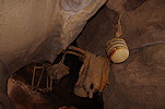
In one shelter we found some left-behind posessions of nomads, hanging from the ceiling just like depictions in ancient paintings.
Day 10. Araské (& Borou North)
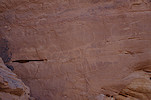
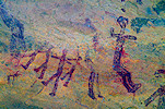
In the morning after breakfast we departed from cam to visit the broad valley to the east, part of which drains into Araské, the other part into the Enneri Borou. The sites reported by the Boccazzis on the Araské side are crude engravings, mostly catte, but include a number of curious "sitting" cattle, sheep and giraffe.
On the Borou side of the valley the Boccazzis only reported a single site far in the south near the main watercourse, but Yves and party explored the outcrops of the sandy plain and found many more, including some strange shapes that resemble the so called "nasses" found in the western part of the Sahara (maybe stylsed catfish ?).
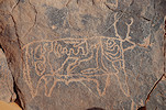
We finished the round of this valley at site BE11 of the Bocazzis, which depicts alongside the usual catte a large weathered, insistinct elephant.
Mid-morning we moved back to the main plain to the south of Enneri Araské. Here there are a number of sites in shelters at the bases of scattered inselbergs, including the small shelter of AR07, which contains some very fine Karnasahi style scenes.
We finished this round at the splendid site of AR06, the most important one on the southern part of the Araské watershed, with numerous Karnasahi style scenes.
After lunch and a little siesta at the campsite, we drove again towards the south, a little farther than where we finished in the morning. Yves and party found a number of lesser sites along the western and southern edges of the plain, we found some but not all. By the late afternoon we have reached the ridge separating the Araské and Borou watersheds, with site BN01, the northernmost site we reached during our 2017 trip.
By the time we finished with all the sites the sun was about to set, it became almost dark as we drove back on the plain to the Arask&eacte; camp.
Day 11. Araské - Enneri Borou
Having seen all the sites in the Araské area, we haded south to the Enneri Borou. In 2017 this was the northernmost point we could visit, as our guide from Aozi did not know the precise location of minefields around Ouri. In the Northern area there were a few sites we missed, we started at one of them (BN09) before racing to the major site BN07 to beat the sun that was already close to rising above the eastern cliff.
We crossed over to the south side of Enneri Borou to visit another small site, BS10, a little removed from the others, with a large but very weathered panel of Karnasahi style paintings.
We drove to the small embayment behing the main site BS06 to make camp, at the same spot as the previous visit. We had enough left of the morning to make the round of the fine sites to the south of our campsite.
We returned to camp for lunch and a midday rest. I took the opportunity to survey the vicinity of camp, as on satellite imagery there were several promising spots among the jagged hills. However I only found some spectacular scenery and a single site on a sun-exposed rock face with some very weathered, practically invisible traces of paintings.
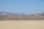
Some of the finest sites of the Ouri plain are concentrated north of the Enneri Borboré at the eastern edge of the plain, which here is at its widest. Due to the topography they were easier to acess from our Borou camp, but still a fairly long drive was needed across the broad sand plain to reach them. Now being in known country, we cherry-picked the finest sites, filling the whole afternoon.
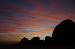
Sunset caught us in the middle of the plain, with an amazing view in all directions. Naturally a lengthy photo session ensued, it was almost dark by the time we got back to camp.
Day 12. - Enneri Borou - Enneri Borboré - Enneri Fofoda
In the morning az our crew packed up camp, we set out on foot to see the nearby BR06 site. I made a little detour to photograph the site found a day earlier with the very faint paintings, not much more visible even when out of the sun.
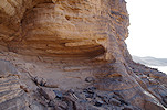
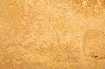
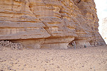
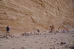
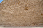
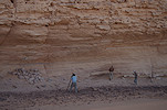
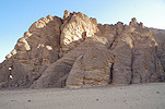
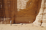
Site BS06 is the largest archaic site on the plain, with numerous strange figures in a style not found elsewhere except th immediate vicinity. It continues for dozens of metres along the base of a huge vertical cliff, with no real shelter. For most of the day it is exposed to the sun, the best time to visit is early morning, while the cliff casts a shadow.
before continuing to the known sites, we planned some exploration in the north western part of the Borboré area. A prominent rocky ridge at the western edge of the plain was neither explored by the Italian parties of the 1990s, not Yves Gauthier more recently, and satellite imagery suggested the presence of some promising shelters at the base of the clifs. It was just a short 30 minute drive from BS06 to reach it, and straight away on the northern side we found a shelter with paintings, though far from spectacular.
We continued around the massif, which did not quite live up to its promising appearance. We found another two minor sites, but most of the best shelters were empty.

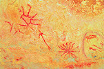
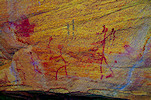
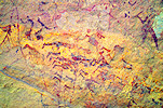
We continued to the south side of the Enneri Borboré, where in 2017 we found the spectacular site with "Korossom Fantastic" paintings, the northernmost occurence of this eculiar achaic style. This shelter also contains some scenes of the Borou style, including the amazing U shaped figures which have no parallel anywhere in the Sahara.

Crossing the watershed we drove to the Fofoda campsite at the base of a huge cliff that provided shade till mid-afternoon. While Ramadan prepared lunch, we made a quick visit to the nearby FN02 site with the huge cattle figures, which would be out in the sun all afternoon.
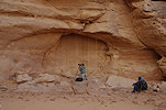
After Idriss assured us that it is safe to do so, in the afternoon we made a fairy long drive into the Enneri Fofoda to the east, to a site reported by the Boccazzis about 15 kilometres fromour camp, already off the plain as the valley cuts through the eastern sandstone plateau. The provided point was in the riverbed, it took some time to locate the site which was in fact quite high up on a terrace, several hundreds of metres from the river. It was a large west facing shelter with numerous paintings, unfortunately due to the orientation already coming out into the sun.
As we returned to the car, we spotted a number of Arthropycus trace fossils from the Ordovican-Silurian, confrming that these sandstones are all Palaeozoic (on some geological maps they are marked as Mesozoic "Nubian sandstone", no doubt inferred without any confirmation in the field).
On our way back we passed a large natural arch and an adjacent shelter about half-way to our camp, on the edge of the plain. On investigating we found a large engraved cattle inside and some painted archaic figures on the left wall.
We finished the day at the magnificent Fofoda site of d'Alverny (FN00), one of the first sites to be discovered in the Ouri Plain, with our camp just a short distance away.
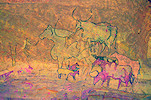
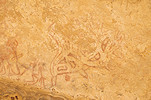
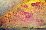
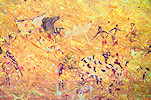
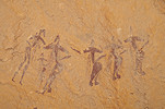
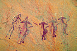
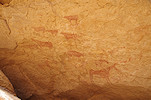
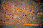
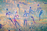
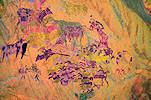
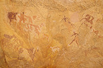
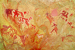
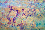
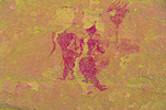
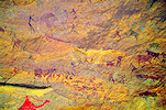
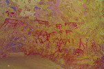
While Ramadan was preparing dinner, we walked from camp to the amazing FN01 site, a huge wall with hundreds of Karnasahi style figures which was found by Aldo & Donatella in the nineties. Arguably this is the finest site of the entire plain, and it is a magical experience to make the first visit in the evening with torchlight.
Day 13. - Enneri Fofoda
After a spectacular sunrise we walked again to site FN01, as this is the best time to photograph all the fine details, before the glare of the sun fades the paintings. One of the most curious are a few figures who appear to blow hons or some other musical nstruments.
There is a cluster of rocky hills at the western edge of the plain just north of the Enneri Fofoda. As one of the main rebel hideouts was in the rivebed near a large semi-prmanent guelta, there are mines blocking any access for vehicles from the river side or the southern bank, while the northern bank is impassable due to several rocky ridges blocking the way. To our knowledge these hills were never explored, our plan was to make the rughly five kilometre walk there and back in the morning, exploring the potential shelters and rock faces. After FN01 we returned to camp for a quick breafast, then Djibrine took us out to the most distant point accessible with car, and we agreed that he will wait for us at the same point from mdday. We needed to cross several ridges and sandy plains to reach the cluster of hills on the near horizon.
We reached the cluster of hills after a good hours' walk, and at first found nothing, all the explored shelters and crevasses were empty. We were close to the time when we needed to start back when finally along the southern side, facing the riverbed, we did find a shelter with some faint Karnasahi style pantings.
A little further we found another high shelter that had some very faint Korossom Fantastic style figures. Our time was up, so we had to rerurn towards the waiting car, re-tracing our onward way. We have managed to exploe less than half of the potential area, so certainly a re-visit will be in order on some future trip.
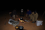
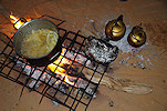
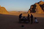
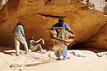
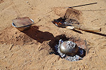
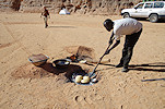
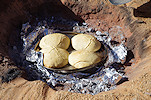
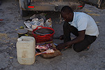
While we were away, Ramadan accomplished a very impressive feat, something I have never witnessed in the desert. Using two steel bowls surrounded with red hot charcoal as an oven, he baked some perfect crispy buns for lunch, of which any French boulanger would have been proud of.
After a pleasant siesta in the shade we set out again in the afternoon to visit the remaining sites of the Fofoda North area at a nice leisurely pace, spending a long time at each to take photos and take in all the fine details.

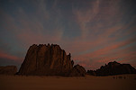
Again it was close to dark as we returned to camp, with the remnants of the setting sun glowing on the western horizon.
Day 14. - Fofoda North - Enneri Daobou - Fofoda South
In the morning after packing camp we quickly drove to the splendid site of FS08 at the eastern edge of the broad plain to the south of the Enneri Fofoda. We visited this site in 2015 on our first visit of the Ouri plain. We found it to be already out in the sun, and with or limited time there was no chance of a re-visit, now we planned an early start to make sure we have plenty of time before the sun obliterates most of the scenes.
We continued to te middle of the plain, to a small hill with ancrevasse in the side with site FS01, which we bypassed on all previous trips. It turned out to be nicer than anticipated from the description, with a large Karnasahi style panel.
Site FS02 is a large vertical rock wall at the base of a small hill near the southern end of the plain, part of the row of hills that separate the Fofoda South area from Lulu Erdenga plain further south. We made a hurried visit in 2015, now we could afford a much more leisurely photo session. The scenes are mostly Korossom Fantastic figures, unfortunately mostly very weatheredand hard to decypher.
There are a number of lesser sites, mostly engravings scattered about along the row of hills, both on the Fofoda and Luli Edrenga side, with a few having been added by Yves Gauthier and party in 2017. We spent the rest of the morning going from one to another, with none having been visited on any of our previous trips, we just drove past to see the more important sites.
The last site of the morning, LE01, was unexpectedly nice, with two fine panels of Karnasahi style paintings, including two splendid barbary sheep, an unusual subject for the pastoral period.
For midday we moved to site FS03, the largest "Korossom Fantastic" site of the plain, where we also intended to camp to allow as much time as possible at the main site in both evening and morning light conditions. While Ramadan prepared lunch, we immediately set out to see the site with the good reflected light, before the lowering sun obliterates the images from early afternoon till sunset.
After lunch we made a visit to the nearby small site which Ryan and Tomoko found in 2015, which I never saw nor photographed. There is a strange long-necked animal with the head turned back that does not appear to be cattle like the rest of the figures in the shelter. A little further we found another shelter with some very faint and weathered paintings of what seem to be sheep and some indistinct human figures.
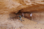
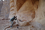
After a little rest we set out to visit some of the Enneri Dabou sites some 15-20 kilometres away. We have mostly seen them hurriedly in 2015 under not too good light conditions, now we had the opportunity for a more leisurely visit of th most important sites. We started at DB01, a lovel site which is rather awkward to photograph, as there is just a very narrow sloping ledge in the shelter (with rather insecure footing) with a slope below too steep to stand on, so either one is too close to capture entire scenes, or too far and below for good details. The shelter itself contains scenes from almost all the key styles, some in good superposition, giving some good clues to the relative chronologies.
We continued to the far side of the Enneri Daobou, to site DB04, an important "Korossom Fantastic" site which was completely out in the sun on our last visit. Now with the sun low, it was well shaded and many more details were visible than in 2015.
With the sun getting rather low, we only had time to visit one more site, the splendid DB03 with the huge wall of Karnasahi style paintings. We stayed until the light started becoming too low to take good photos, returning to camp in the twilight.
Day 15. - Fofoda South - Luli Erdenga - Karnasahi
With our camp purposefully positioned next to the site, in the morning we could afford a nice long photo session at site FS03 and the adjacent satellite sites. The day before the reflected light at midday was more pleasant to look, but with flash the deep sahde of the morning proved better, revaling more details.
With six days needed to get back to N'Djamena, this was our last full day on the Ouri plain. After packing camp we started along the southern edge of Luli Erdenga, where in 2015 we just made a cursory visit to the two principal sites, ommiting a number of others which we could now see.
We continued to the two sites seen in 2015, just catching the fine "Korossom Fantastic" site of LE11 before the sun care around, with just a narrow strip of shade remainng.
We finished our round of Luli Erdenga at the smal site of LE12, with just two late pastoral figures and a strange torch-like object. There were also supposedly some engravings, but those we failed to find.
We reached Karnasahi in the late morning, we still had a couple of hours to make an initial round of the sites before lunch. The main site is out on the sun till mid-afternoon, but site KA10 near our camp was already in the shde, we paid a visit to the unique large seated figure, which is very hard to make out under any light condition. As we returned to camp for lunch, we passed a small shelter where we came upon a very fine undocumented panel of late pastoral paintings, which seems to have missed the attention of both the Boccazzi's and Yves.
After lunch we returned to the main Karnasahi site which was just coming into the shade, some coming for a lengthy photo session, some just to marvel at the amazing fine details.

Mid-afternoon we took the cars to visit site KA06, with the finest "Korossom Fantastic" beasts anywhere. I was a bit concerned that we will be too early, but this site too comes into the shade mid-afternoon, our timing was perfect.
We continued to Tcherughé a few kilometres futher east. The main site was still out on the sun, so we visited the panel of large engraved cattle at the eastern edge of the plain before returnng to the paintings. This time we noticed a well-built path leading up to the centre of the row of painted shelters. It is strange that we did not spot this on either of the past visits, probably we were so preoccupied with the paintings that it did not register.
Fortunately there was a thin but almost solid cloud cover, so we did not need to wait for the sun to set behind the hills, the light was good enough for photography. We spent all the remainng afternoon at these shelters, which we always visited under much worse light conditions.
Day 16. - Karnasahi - Enneri Korossom - Bini Erde
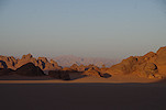
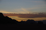
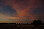
Some of the clouds remained till the morning, and we had an amazing sunrise spectacle, with the sky turning bright pink then orange before the sun appeared and put an end to the show.
With a long day ahead, we packed camp early and set out, making a few last site visits on the Ouri plain along the way. We drove to the Enneri Korossom and made a brief stop at LE07, a big shelter with some remnants two large "Korossom Fantastic" figures, then continued to KE01 with the large engraved elephants, which are almost invisible in the morning light.
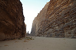
We exited the Oruri plain via the Enneri Krossom (called Eneri Ounga in its lower courses), which was much narrower and more winding than the entrance via the Ouri Sao. The straight line distance from the exit point on the plain to the ar side of the low eastern plateau was about 45 kilometres, but we had to drive about 75 via the winding valley. As we drove along, we soon found the explanation for the narrowness of te valley. The lava flow from the Tarso Aozi volcano which filled the upper courses of the Enneri Korossom continued, reaching nearly 80 kilometres from its source. The water had to carve a new course in the basalt-filled valley.

We reached the open country to the east of the plateau before midday. For a while we continued along the riverbed as there was no exit, then climbed to the low plateau and turned south.
This was a different track than the one we took on the way north, soon we encountered a mined spot marked by a wrecked Landcruiser, just a few metres from the new detour. Idriss casually mentioned that it was his uncle driving the car...
We stopped for lunch in the shade of the only available trees in the lower Enneri Binem. This valley has it's source just south of Karnasahi, and also has rock art in its upper courses, but it is not directly reachable from the Ouri Plain with cars, only on foot.
We continued south, reaching the Kozen valley by mid-afternoon. The place where the track reached the valley was also marked by an extensive minefield, with a wrecked car in the middle.

By the evening we approached the village of Bini Erde. We made camp in the nearby riverbed, while Idriss left us to spend the night at his house with his family.
Day 17. - Bini Erde - Gouro - Borkou
We had a pleasant calm and warm morning, with time to explore the surroundings for which we had no time the previous evning. Along the riverbed there was a curious geolocical featre, a dome-shped eroded rigde of some very old (Precambrian?) metamorphic sedimentary rock unconformably overlain by the later Palaeozoic sandstones on both sides.
Before starting on our journey south we dove to Bini Erde to say good-bye to Idriss, who turned out to be an excellent guide and a very pleasant companion on the trip.
Not being in a terrible hurry, we also had time to visit the old French fort perched on a ridge above the well, overlooking the valley and the present-day village. This too probably dates from the nineteen thirties, and is a part of a chain of such stuctures flanking both sides of the Tibesti.
The rest of the mornng was a rather uneventful bumpy ride back towards Gouo, whiv we reached by early afternoon. We again stayed at the guesthouse of Djibrine's family, and had lunch while our crew went about to fuel, buy supplies and check-in with the authorities.
We did not stay at Gouro for the night, we were ready with all chores by mid-afternoon with a good two hours of daylight left, so we decided to make use of that time to reach the dunes by the edge of Borkou, some 100 kilometres to the south, where we made camp.
Day 18. - Bembechi - Faya-Largeau
After the enclosed Ouri plain this was the first really cold night out in the open, we all shivered in our warmest clothes until the sun came up. Otherwise our camp was a pleasant place among a chain of golden barchan dunes, with the area littered with huge ferric concretions exfoliating like giant onions. These concretions are common everywhere in the Sahara, but I have never seen such big ones.
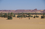
We had one more sight on our itinerary, the small oasis of Bembechi, the easternmost settlement of the Borkou. A panel of engraved elephants were reported from here, while Djibrine did not know the exact location he had a fairly good idea of where it had to be. It was just a short drive over the dunes from our campsite to Bembechi, passing the palmerie we drove to a promnent hill where it did not take long to find some giraffe engravings, and after some searching also the pair of elephants.
We had enough time to walk around the hill to check for some more sites. Not far from the reported engravings we found a small shelter with a large panel of late pastoral paintings, and a little further some more engravings, including elephants and rhinoceros. At the far side of the hill there was yet another shelter with both engravings and paintings on both sides.
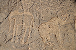
As we continued further around the hill, we only found some spectacular views of the small oasis on the south side. As we came around to the cars, in a small niche we found some paintings, one turned out to be a very fine elephant, an unexpected ending to our tour of rock art sites.
We planned three full days to reach Faya just in case, but with no delays anywhere we were there by early afternoon. As the cars needed some maintenance plus it was an attractive thought to finally have a shower (not to mention the cold beer which Jonathan produced for lunch and dinner), we stayed for the night, having a lazy afternoon in the tourist camp.
Day 19. - Faya-Largeau - Kouba Olanga
We left Faya in the morning, and with a midday break in the Erg Djourab, continued all day till the vicinity of Kouba Olanga, where we made camp close to where we stayed on our onward journey.
Day 20. - Kouba Olanga - camp after Moussoro
We fueled in Kouba Olanga, then contunued along the track towards the Bahr el Ghazal. The only mentionable sight was a large flock of crowned sandgrouse (Pterocles coronatus) in the morning as we left Kouba.
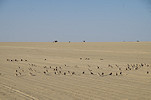
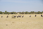
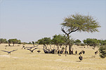
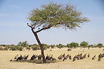
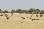
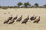
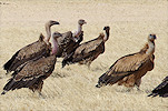
After passing Salal in the Bahr el Ghazal we met with an unexpected sght, a large flock of vultures feeding on a cattle carcass. They did not flee as we approached, only moved away under a nearby tree, and we could observe them from close. Vulture sightings have dropped dramatically in the past ten years, so I was very pleased to see this mixed flock of 33 individuals. The majority were Rüppel's vultures (Gyps rueppelli), with at least a pair each of Eurasian Griffons (Gyps fulvus), White-backed vultures (Gyps africanus) and Lappet-faced vultures (Torgos tracheliotos)
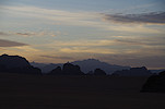
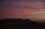
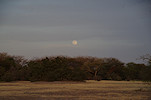
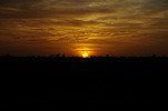
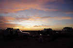
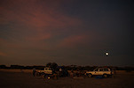
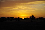
We reached Moussoro by mid-afternoon, after fueling we drove out of town to make camp among the vegetation covered dunes off the road. It was a very pleasant warm and calm evening, with the full moon rising, Ramadan preparing a festive goat for our last night, and the sunset providing a stunning spectacle.
Day 21. - Camp after Moussoro - N'Djamena
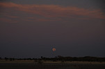
In the morning we were offered a very rare special treat, with both the setting full moon and the rising sun visible on the opposite horizons, amost perfectly aligned.
With our next stop being NDjamena, packing camp took longer than usual, as we already prepared and packed our gear for the onward journey. A few things did not make it, one of the last acts before departure was to burn my shorts in the rubbish fire. It served well on many trips, but by now it was more silk tape than fabric, too torn both in front and rear to be patched again.
We reached N'Djamena by mid-afternoon, in time for everyone to take a shower at the Irrisor hotel after all the dust of the Bahr el Ghazal before we needed to go to the airport to catch our respective flights.

Following this smooth and successful trip, we are planning a return to the Ouri Plain in November 2024 along the same fast route via Gouro. The trip will start and end in N'Djamena, and will take 21 days using cars, with some shorter treks to and around the sites. Please visit the News page for any updates (or "like" the FJ Expeditions FaceBook page).