
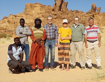
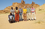
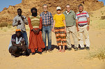
 Click on image for list of participants |
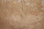
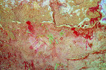
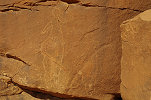
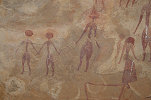
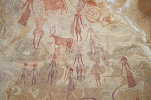
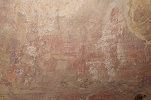
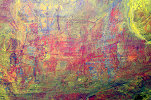
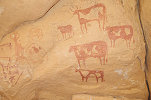
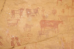
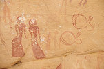
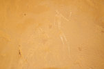
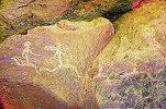
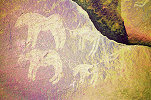
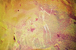
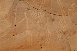
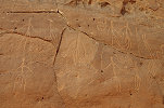
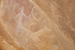
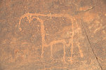
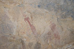
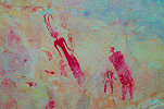
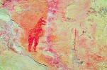
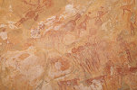
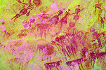
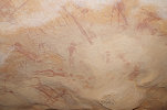
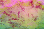
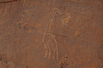
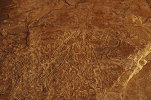
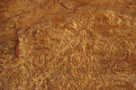
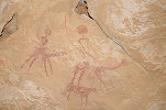
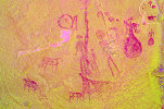
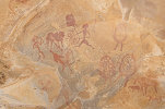
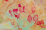
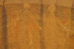
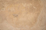
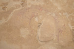
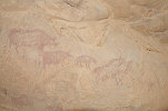
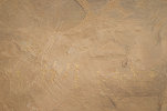
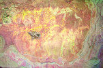
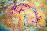
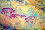
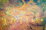
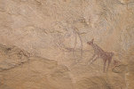
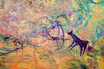
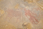
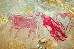
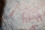
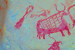
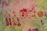
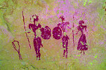
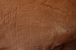
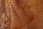
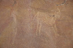
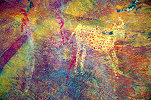
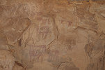
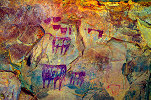
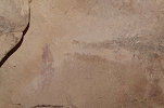
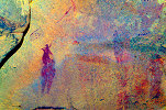
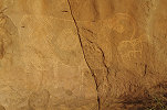
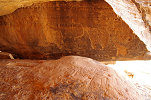
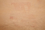
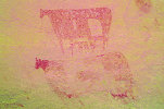
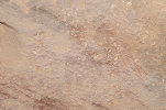
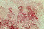
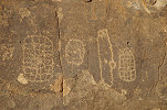
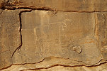
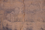
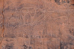
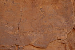
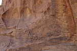
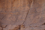
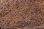
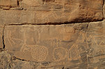
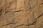
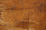
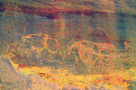
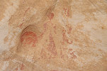
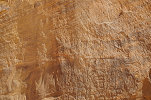
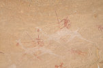
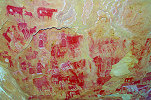
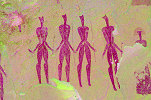
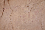
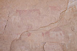
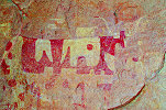
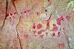
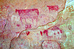
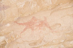
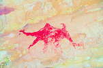
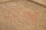
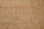
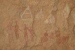
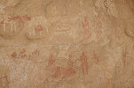
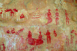
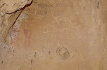
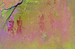
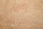
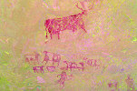
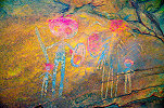
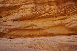
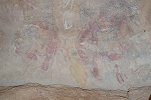
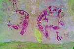
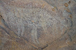
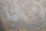
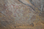
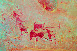
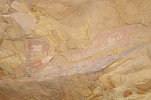
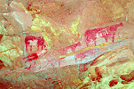
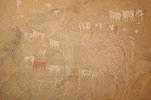
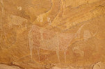
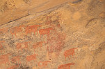
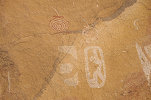
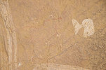
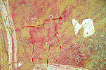
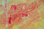
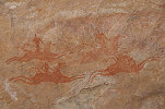
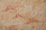
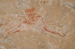
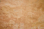
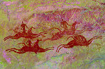
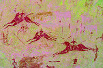
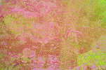
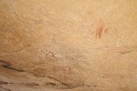
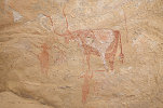
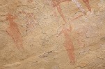
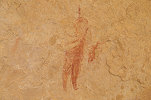
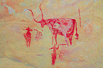
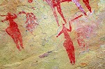
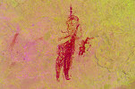
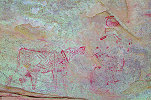
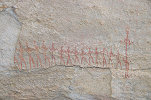
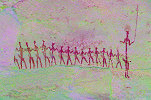
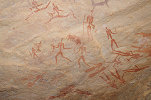
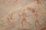
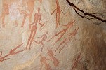
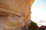
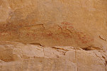
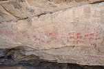
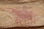
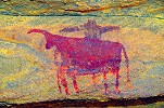
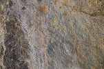
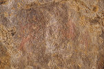
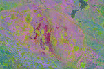
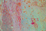
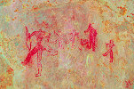
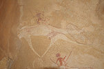
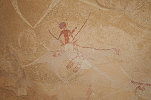
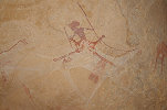
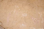
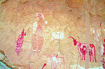
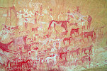
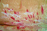
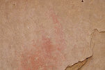
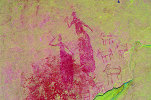
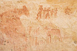
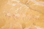
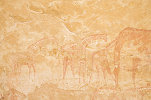
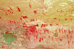
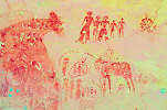
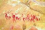
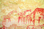
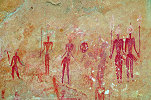
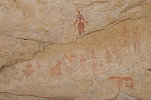
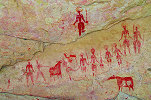
Ennedi Expedition, Chad 3rd - 19th February, 2020 False colour images processed with dStretch, a freely available software developed by Jon Harman |
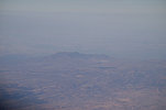
With the very late confirmation of the arrangements and the trip, my choice of flights to NDjamena were rather limited, in the end I decided to take Egyptair with an overnight at the Cairo Airprt Novotel both ways, a more appealing choice than a night flight back with Turkish involving a stop in Kinshasa... In the end it turned out to be a very good choice, all the flights were pleasant and the added bonus was a flyby of the Meidob Hills, El Fasher and the Jebel Marra volcano on the way to N'Djamena (via Douala).
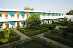
I arrived mid-afternoon, while the rest of our party came with the evening Air France flight. We stayed at the Chinese-run Chez Wou hotel (right across from the old Ibis/Novotel that now changed hands and is no longer an Accor property), which turned out to be a surprisingly nice and comfortable place with a pleasant garden.
Day 1. N'Djamena - Camp before Mongo
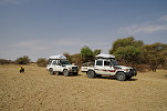
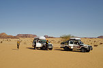
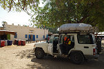
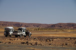
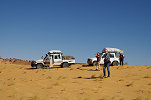
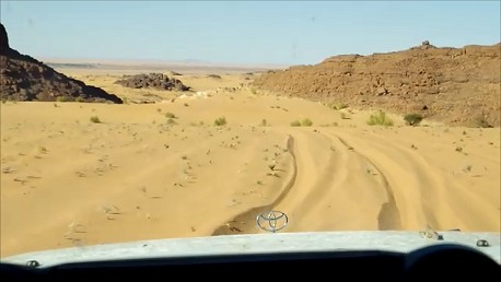
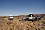
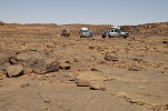
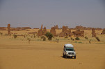
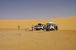
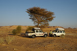
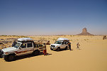
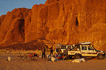
Moussa, the owner of Tchad Evasion arranged all paperwork overnight, and after a quick early breakfast at the hotel we were ready to depart by 8:30am. We had two cars, a double cab Landcruiser pickup driven by our guide Djbrine, and a regular Landcruiser, both appearing to be in good condition. We quickly loaded the cars and without much further ado set out on the road towards Abéche.
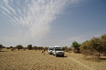
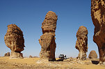
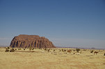
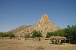
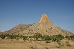
The day was a long and uneventful one, we drove continuously without much interruption, only stopping for a short lunch break and to purchase some firewood near the spectacular granite hills near Bitkine.
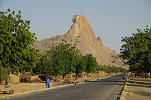
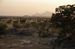
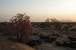
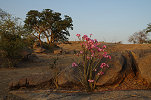
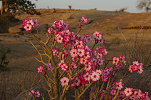
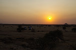
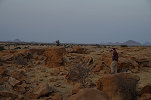
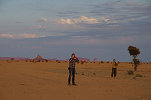
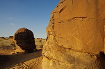
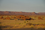
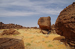
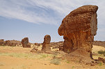
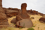
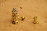
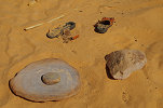
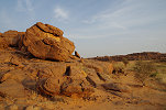
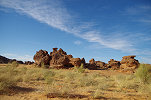
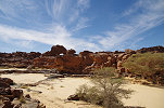
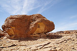
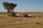
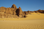
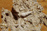
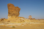
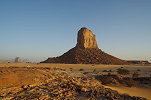
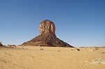
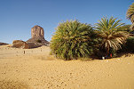
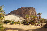
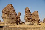
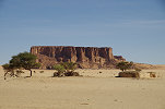
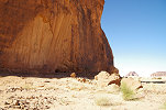
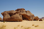
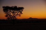
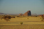
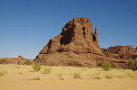
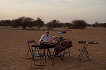
With no delays we made very good progress, making camp just before sunset at an unexpectedly pretty and peaceful spot among a group of low granite knolls full of blooming desert roses (Adenium obesum) only a few dozen kilometres before Mongo.

Day 2. Mongo - Camp before Biltine
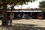
In the morning we made a brief stop at Mongo to fuel, then continued past the neat villages towards Oum Hadjer and Abéche.
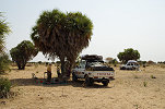
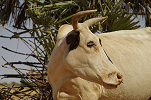
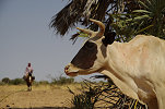
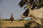
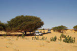
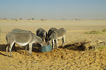
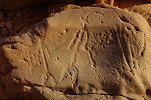
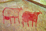
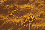
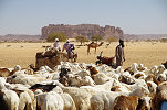
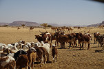
We halted after noon for lunch before Abéche among a cluster of dum palms near some harvested sorghum fields. As we were packing up ready to continue, we were visited by a herd of cattle marched to the market by their owner on horseback, with one cow exhibiting a perfect set of the unusual forward facing horns which appear frequently in the pastoralist rock art of the Ennedi (and elsewhere in the Sahara).
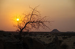
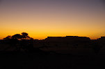
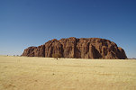
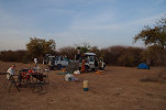
In Abéche we only made another short fueling stop, then left the asphalt road and continued north along the piste towards Biltine. We made camp again just before sunset, behind a low granite hill only twenty something kilometres before Biltine.
Day 3. Biltine - Camp before Ennedi
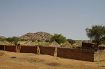
Passing Biltine we continued north towards Kalait, pausing briefly beside the road before entering the town.
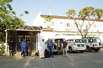
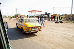
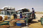
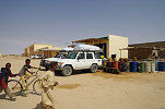
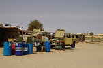
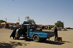
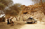
Kalait was still no more endearing than it lived in our memories, but we needed to stop to take on fuel at the "gas station" and purchase some supplies as this was the last place on our journey with any stocked stores. Interestingly the vast majority of the available goods were not from Libya like two years earlier, but from Sudan, clearly indicating the improved situation in the Darfur (and also the closed Libyan border). As the Landcruiser developed some electrical problems the previous afternoon (the only issue we had on the entire trip) that had to be repaired before we could continue to the Ennedi, we used the time to have lunch while the problem was fixed.
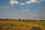
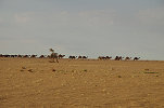
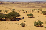
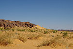
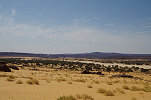
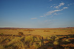
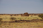
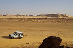
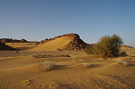
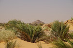
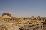
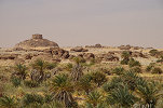
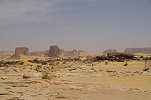
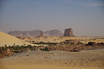
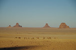
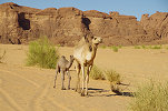
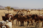
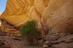
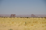
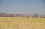
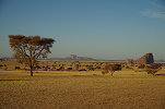
We left Kalait mid afternoon, and as we continued towards the Ennedi the country became noticeably greener, with abundant fresh vegetation in all the wadis, the remnants of some exceptional rains the previous summer. We also passed a number of large camel herds, marching to the Fada market.
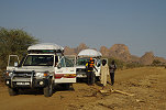
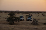
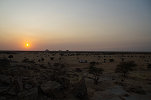
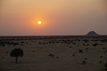
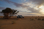
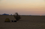
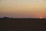
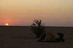
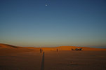
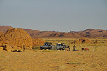
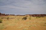
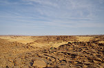
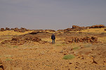
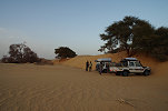
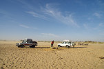
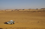
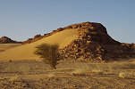
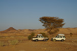
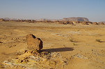
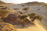
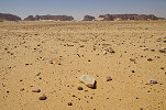
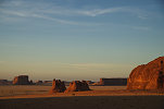
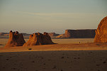
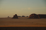
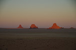
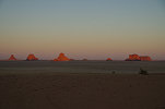
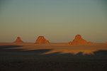
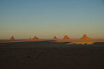
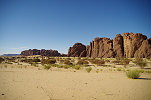
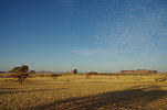
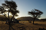
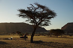
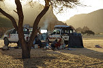
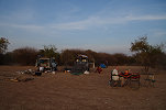
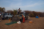
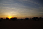
We continued driving till sunset, hoping to reach the first rocks of the Ennedi to camp, but as the sun was approaching the horizon we were still a good forty kilometres away, an hour's drive on that terrain. We made a quick stop to collect firewood, then drove some distance off the piste on the featureless flat terrain and made camp in the open.
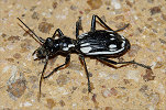
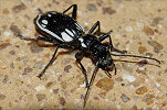
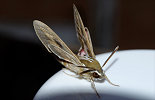
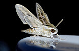
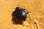
We had a beautiful calm and warm evening with a number of visitors, including a familiar large predator beetle (Anthia sexmaculata) and a sphinx moth (Hyles livornica), no doubt drawn by the irresistible scent of our sundowners.
Day 4. Camp before Ennedi - Fada - Mourdi Depression
By now we have all settled down to the usual desert drill, waking at dawn and starting to pack up at sunrise. After a quick breakfast we set out towards the distant hills.
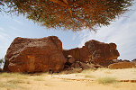
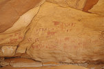
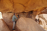
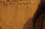
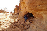
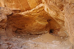
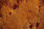
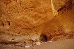
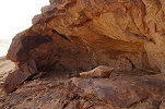
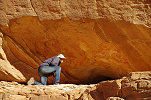
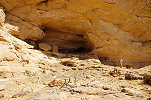
Soon after leaving camp, Djibrine turned off the main piste, taking a direct line towards Fada. Once passing the first inselbergs I realised that we were on the piste leading to the Ovayke well. Being well within schedule, the temptation was too great to resist, and we made a short detour to visit the lovely shelter at Soro Kezenanga which we re-discovered during our January 2018 expedition. In the deep interior of the shelter we even found some faint paintings that were missed on the previous visit.
By mid-morning we reached Fada, where we only needed to uplift some water and present our papers at the Sous-préfecture. We only had to wait about half an hour at the main square, then we were ready to continue northwards.
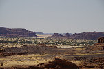
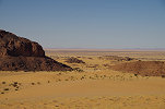
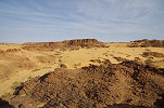
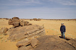
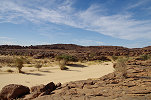
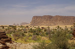
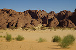
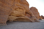
From Fada the piste continues northwards, ascending the plateau in a number of tight turns that have been surfaced to reduce the erosion after the infrequent rains. With the heavy rainfalls of the previous summer there were a number of deep ruts beside the road (and a few across), but the going was still reasonably good, by midday we were on the top of the plateau looking back towards Fada.
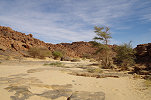
We continued for another half an hour, reaching the sandy basin in the middle of the high plateau, and stopped for lunch in a small acacia grove with a large tree providing good shade.
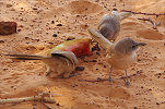
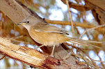
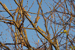
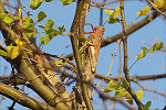
We were not alone. The trees were filled with a flock of rather noisy Fulvous chatterers (Turdoides fulva) , which at first looked at us from a distance, but by the time we finished lunch the temptation of the discarded melon peels was too great, and they descended taking little notice of us, fighting each other furiously for each bit of scrap.
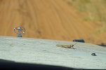
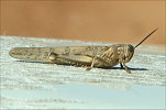
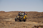
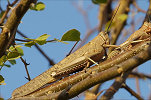
As we continued, an unexpected hitchhiker hopped on our bonnet, and amazingly stayed there for the next hundred kilometres, braving the bumps and the headwind. It appeared to be a desert locust, but subsequently it was identified as a tree locust (Anacridium melanorhodon), a close relative.
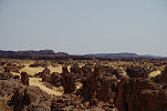
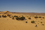
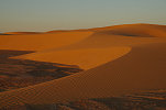
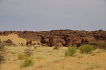
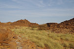
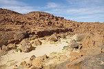
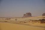
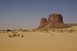
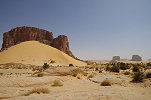
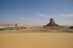
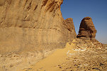
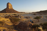
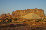
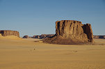
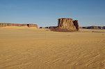
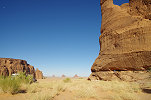
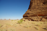
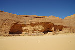
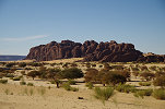
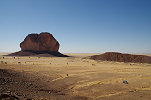
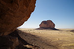
We soon reached the broken northern side of the Ennedi, and drove north along the side filled valley until we were on the top of a huge dune overlooking the descent into the Mourdi Depression.
With our hitchhiking locust still in place, we descended the steep sandy slope and continued along the bumpy piste leading east along the southern edge of the Mourdi.
We reached the Bankey well in the Oued Kordi in the late afternoon, and stopped to gather some firewood in the grove of acacias bordering the large watercourse.
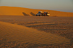
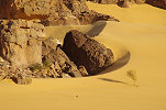
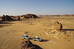
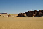
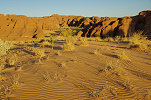
We still had a good half an hour to sunset, so we continued to the belt of dunes about a dozen kilometres further East, making camp in the lee of a larger barchan, our first proper desert campsite.
Day 5. Mourdi depression - Niola Doa
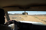
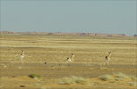
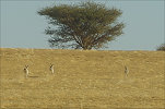
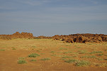
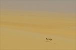
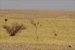
In the morning we set out on the remaining 60 kilometres to Diona, the small town that is the principal settlement of the Mourdi. There was abundant grass everywhere, and we encountered several small groups of dorcas gazelle, all fleeing as soon as they heard the sound of the engines, it was impossible to take any good photos from the distance in the bumping cars.
We reached Diona by mid-morning, where we needed to collect a local guide to continue to Niola Doa. Unlike the lengthy delays experienced on our 2016 January trip, things went extremely fast and smoothly. The prefecture was still deserted so early in the day, but after some searching we found the sous-préfect in the middle of the village, and after a quick negotiation between him and Djibrine it was agreed that we pay the customary fee, but there will be no need for the physical guide if we know our way, a win-win for all. We quickly took on some fresh water at the well and then rolled out of the town, the whole stay lasting less than thirty minutes.
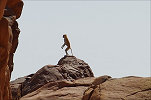
Not far from the village, near the spot where the track leading south left the riverbank and started climbing onto the low plateau, we startled a troop of patas monkeys which quickly disappeared behind a cluster of rocks, but I managed to sneak up on them close enough to take a good snapshot of the lookout, before it spotted me and they all disappeared for good.
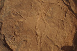
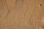
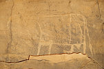
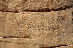
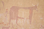
We continued on the dismal track, soon encountering the first (and only) flat tyre of our trip. Murphy was at work, as while we were busy with the tyre probably the only other vehicle within a hundred miles just appeared, naturally at a place where it was nearly impossible to pass the blocked track due to the large rocks. They were gold miners heading for the Tibesti, probably several of them not local but Sudanese, choosing this remote route to avoid the eyes of officialdom. They were in good spirits, hopped off the pickup which scrambled past us empty on the big boulders, then they were on their way again. In the mean time the tyre was fixed, and Ursula found a lonely engraved cattle on a flat rock just a few dozen metres from where we stopped.
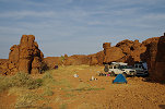
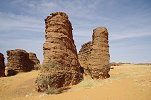
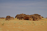
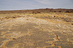
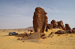
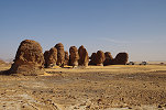
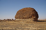
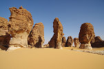
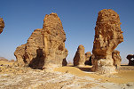
The rest of the drive south was slow but uneventful, by lunchtime we reached a cluster of rock towers about five kilometres before the turn-off to Niola Doa. Already in 2016 I was eyeing this group of rocks as a very likely place for some rock art, but we did not have any free time to explore. Now, being a good half a day in advance of our planned schedule, we could afford to stop here for lunch and make a thorough search of the area. Surprisingly, though there were many potsherds and tools scattered about between the rocks indicating ancient habitation, we did not find any engravings, apparently this neighborhood had less artistic talent than the one next door.
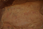
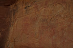
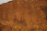
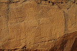
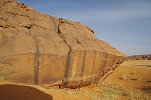
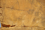
With the worst of the track behind us, we quickly covered the remaining distance to the Niola Doa plain, by mid afternoon we were at the Italian panel in the best possible light conditions.
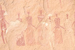
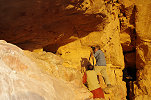
We were at our destination much earlier than planned (our best estimate was a weak maybe for making Niola Doa by the evening), so we could make good use of the late afternoon light. We first visited the "Abri de la colonne", a large shelter with fine paintings in a cluster of rock towers a kilometre or so further north. This shelter is facing South east, so there is a strong glare almost all day, this late afternoon time was perfect to see and photograph the paintings.
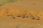
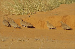
Near the shelter we encountered a large flock of crowned sandgrouse (Pterocles coronatus), apparently a common species here as we also saw them on our previous visit.
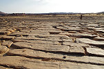
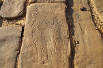
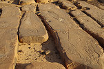
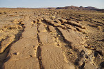
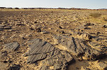
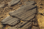
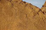
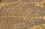
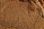
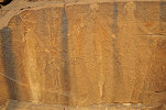
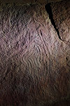
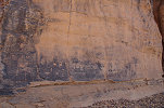
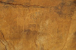
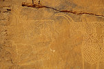
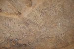
As the sun sunk lower we moved to the horizontal slabs with innumerable engravings along the eastern edge of the Niola Doa plain, including a number of fine Niola Doa type figures. We also took the opportunity to visit some of the finest glacial striation marks I know in the Sahara, a remnant of the Ordovican glaciation when much of the central Sahara was under the south polar icecap.
With the day nearly done, we returned to the Italian panel, which has the best side lighting as the sun sets, however we found that the stronger afternoon light provides more contrast, overall the photographs were no better than the earlier ones.
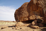
For camp we moved to the rocks adjacent to the French panel. There still was a good half an hour left till sunset, so made a quick dash to a small painted shelter a few hundred metres away ("Abri de l'animal gravé") which has a number of engraved cattle which are covered with some later paintings, providing some clues to the relative chronology of the rock art of the region.
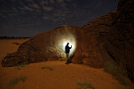
In the evening the wind picked up, and it turned rather unpleasantly cold. Nevertheless with Michael we braved the elements and went to the French panel just behind our camp to try to make night shots with the milkyway in the background. Unfortunately there were moving clouds and a fairly strong moonlight, so our results were nothing like the stunning photograph made by our friend Takayuki Hanafusa (Tak) two years earier.
Day 6. Niola Doa
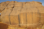
We were up at dawn to make the best use of the strong contour lighting on the French panel at sunrise, but the strong winds also brought in thin layer of high altitude clouds which made the light rather dull. Fortunately a little later the clouds dissipated, so we could still make good photos of the panel while camp was packed and the cars loaded.
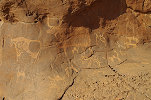
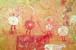
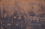
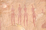
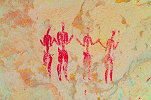
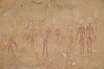
We moved on to the Fuchs panel at the northern edge of the main Niola Doa plain, which is also oriented in a way that it gets the best light in the morning. The site is in fact two adjacent rocks, the left with a fine scene of cattle accompanied by a single Nola Doa type figure, while the second one to the right displays a group of four large (and partially unfinished) figures. We also visited the panel of large cattle a short distance to the North of the Fuchs panel, on the top of a low plateau bordering the plain.

From the Fuchs panel we also made the short walk to the "Abri au bidon", a solitary rock with a low shelter underneath containing some rather damaged paintings, plus some engravings on the exterior of the rock (including a small crude Niola Doa type figure).
During our 2016 visit we did not have time to search for two sites which were situated somewhere to the north west of the Fuchs panel. At the time the resolution of the Niola Doa area on Google Earth was rather poor, and with no definite clues in the Choppy volume we did not go looking for the "Abri de la Danseuse". In the mean time Pier-Paolo Rossi managed to re-locate both this site, and a nearby other site with some white running figures and other paintings. Ursula visited these sites two years earlier, so we did not need to search but could go straight to them.
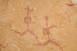
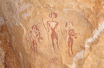
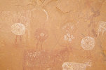
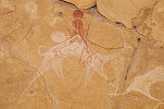
Both sites are located on a smaller plain to the North of the main Niola Doa plain, the two separated by a rocky ridge, with a narrow watercourse leading from the latter to the former on a lower level. The "Abri de la Danseuse" (ND 13) was located on the far side of the plain, but no more than thirty minutes from where we have left the cars. The paintings in the shelter were unexpectedly well preserved, and there are two curious objects which don't have any analogies elsewhere.
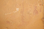
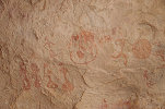
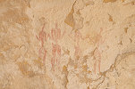
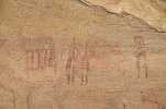
The shelter with the white paintings (ND 12) is on the nearer side of the plain, a few hundred metres away, under a large rock outcrop. There are a number of faint scenes, all executed in white paint, and are very unlike any other paintings in the Niola Doa area. Their affinity is unclear, while they appear to show some similarity with archaic figures of the south western Ennedi, there is a scene which appears to show a herd of cattle.
Not far from the shelter there is a large rock tower (ND 11), with some very fine engravings on the Northern face of the rock. Two years earlier Ursula also found some unreported engravings on the southern side.
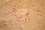
While the rest of us were busy photographing both sites, Ursula wondered off in another direction, and soon we heard the yell signaling yet another find. This time it was a fine small panel executed in white paint, depicting several archers and a dog (?), apparently from the same style/period as the nearby larger shelter. There was also a fine cattle with forward curving horns (usually associated with the Niola Doa style) at the base of the rock with the small shelter.

Ursula and Michael decided to head back slowly towards the cars, while with Hans we made a quick and rather superficial survey of the western part of the enclosed plain. A few hundred metres to the west of the known sites, at the base of an isolated rock pillar, we did find a small shelter with a few faint but fine painted figures.
Not far to the north there was a conspicuous shaded rock wall, which did contain some rather curious rock art. A number of painted cattle once adored the wall, which have been partially erased by engraved cattle and human figures, all appearing to be in the same style as the painted ones.
We made a round of the rocks further north and west, but found nothing more, so we too returned to the cars for lunch.
Our cars were parked not far from the little double shelter (ND 14) with the strange plumed figure and the fine Hohou style figure, before lunch we made a quick visit. On the flat rocks leading up to the shelter we noted numerous camel period engravings which we missed previously.
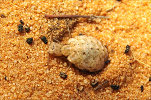
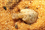
While we were having lunch, a small movement in the sand caught my eye. It turned out to be a rather large (about 1cm) ant lion, which was not lying in wait in its usual funnel shaped burrow, but was actively hunting, the first I have seen with this behaviour during daytime. There were also many of the large black darkling beetles prowling about, happily dashing for the discarded kitchen scraps.
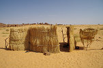
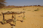
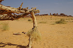
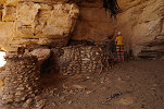
Nearby there was a little abandoned unroofed grass shelter with some food storage structures. The little table-like construction was particularly interesting, with downward facing thorny twigs tied to the supporting poles, apparently to thwart rodents from getting to whatever was stored on the top, something I have not seen before elsewhere.
After lunch we moved to the western part of the Nola Doa plain, first visiting the very fine paintings at the low shelter of site ND 10.
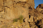
In 2018 when Ursula was at Niola Doa with Yves Gauthier and party, they have found a low shelter in the unexplored north western part of the plain with some faint pastoralist paintings. One member of the party spotted some engravings on the rock beneath the shelter (designated ND 31) which turned out to be a large Niola Doa type figure, complete with a stick across the shoulder.
The large engraved figure was in a rather bad light, there was some hope that there might be direct sunlight on it just before sunset. We continued further up a narrow side valley to find a suitable sheltered campsite (the wind was still blowing strong), then set out on foot to explore the north western corner of the plain. While the landscape was spectacular with many rock towers, we only found a single crude panel of engravings (designated site ND 40) with some giraffe a few hundred metres from site ND 31.
Late afternoon we returned to site ND 31 to see if the light improved. The figure was still mostly in the shade, but through a narrow slot among the rocks a sunbeam slowly mover across the figure from bottom to top about half an hour before sunset. While the entire figure was never illuminated, at least it will be possible to create a perfect composite image of the various illuminated segments.
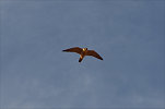
As sunset was approaching, we slowly returned to camp as a Barbary falcon (Falco peregrinus ssp. pelegrinoides) circled overhead. Along the way I spotted a small movement, and was rather surprised to find a pretty velvet ant (despite the name it is actually a wingless wasp, Pseudophotopsis sp.), creatures familiar from Namibia, but my first ever encounter in the Sahara. Another surprise came at the campsite, as I was preparing my sleeping place. On a vertical face of a low rock ledge there was a crudely engraved but clearly recognisable small Niola Doa type figure (designated site ND 39).
Day 7. Niola Doa
On a trip early in 2017 Yves Gauthier and party were informed by a party of nomads of the existence of a yet unknown panel of engravings with large Niola Doa type figures (provisionally referred to as Nila Doa II in the article in Cahiers 19 announcing the find). Ursula saw the panel with Yves later in 2018, and one of our objectives on this trip was to make a visit to this remote site, located to the North of the main plain, and only accessible on foot.
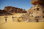
Our campsite was located at the start of the easiest route to the new site, but still it was a trek of several kilometres each way on rough rocky terrain, with the need to cross several deep valleys along the way. Ursula and Michael elected to explore the environs of the campsite, while with Hans we set out in the early morning towards the sites. Despite the rough terrain we managed to cover the roughly four kilometres relatively fast, in little over an hour and a half we could see the characteristic rock with the engravings in the middle of a small plain.
At the edge of the plain we passed by a rock with a shelter containing a panel of paintings, visited but not published by Yves. De scenes show late pastoralist figures, the best being a pair of camel riders, directly facing the large rock with the engravings out on the plain.
Niola Doa II is situated on an isolated rock with a large vertical face, a setting very reminiscent of the other known panels. There are two typical large figures with all the attributes of the style, and are accompanied by three cattle with one slightly overlapping the foot of the right figure, suggesting a somewhat later date despite the apparently similar degree of patination.
Not far from the main panel, among a cluster of rock towers Ursula found a small figure in 2018 that is also reminiscent of the Niola Doa type figures, though it is small and crudely executed so little more may be said. It proved to be rather challenging to find, even with known GPS coordinates.
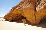
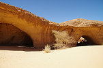
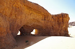
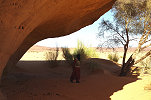
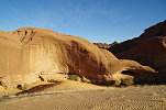
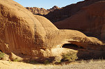
Not far, Yves and party found another small site with paintings, a little natural arch with some pastoralist scenes on the ceiling.
It was still only mid-morning, with the whole day allocated for this area we had plenty of remaining time to search the western part of the plain which was left unexplored by Yves and party on their two previous visits. A few hundred metres west of the small arch with paintings we found a large area with exposed horizontal bedrock that contained a number of engraved cattle.
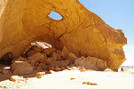
A little further, a long rock outcrop with another natural arch had many surrounding stone structures, and a small niche at its very end contained a few painted late pastoralist figures.
Not far, among another cluster of rocks we found a large low shelter under a boulder which also contained some faint paintings. Unfortunately the floor of the shelter also contained something unexpected, a generous supply of kram-kram (thorny seeds of the grass species Cenchrus biflorus). I spent a good half an hour removing them from my trousers and shirt after taking photos of the scenes on the ceiling.
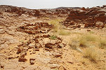
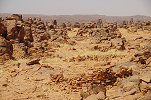
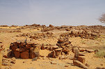
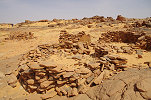
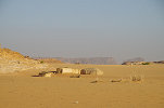
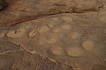
Near the south western edge of the plain satellite imagery showed a large concentration of stone circles. With plenty of time on our hands, we made the slight detour to investigate, and they were very clearly the remnants of a large village, covering an area at least 200 by 200 metres, with possibly a hundred or more such circular stone structures, the bases of huts constructed of branches and palm-leaf matting which are removed when the community moves to another location. Intriguingly we found very little evidence for the age of the village, apparently everything of value was taken when the settlement was abandoned. The few crude camel engravings on the surrounding rocks suggest a relatively young age, but the few sherds of prehistoric pottery inside one of the huts could indicate a much older date (though the sherds could also pre-date the settlement).
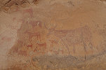
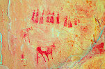
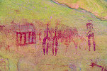
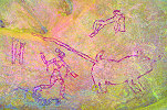
As we started our return back towards camp, we passed a low and inconspicuous rock, which nevertheless contained some intriguing paintings in a low shelter that passed all the way under the rock. A scene shows a group of human figures with spears and large shields (and one with bow), some apparently attacking a beast that has no visible head, but could possibly be a lion or some other large feline.
We crossed the same sand filled valley as on our onward trek and re-traced our route to camp, reaching it in the early afternoon, well before our estimated return time.
Our original plans called for spending the night at the same spot, but our early return enabled a change of plans, to make the move to the "Lost panel" where we originally planned the subsequent night. On the way we passed a very fine panel of cattle adjacent to a spectacular group f rock towers that was found by Els Vandecruys in 2016 when we spent an afternoon exploring the western edge of the main Niola Doa plain.
We continued to the campsite adjacent to the "Lost panel" (ND 03, so named as its true location was lost between the first reporting by sergeant Bousso in 1964 and its re-discovery by Alec Cambbell, David Coulson and Pier-Paolo Rossi in 1996), and spent a nice late afternoon visiting the panel and surrounding other sites in the perfect afternoon light.
At the large nearby rock tower with more Niola Doa type engravings (ND 04) Yves and party found a previously unreported crude figure just to the right of the main figures, very hard to make out except when the light is just right in the late afternoon. The rock also contains a number of paintings, and on one side Ursula found in 2018 another small engraved Niola Doa type figure, barely visible in diffused light, and partially covered by paintings.
The approaching sunset provided perfect side lighting on the nearby panel of cattle (ND 05) and illuminated a part of the "Lost panel" in an orange glow before everything faded in the dusk.
After dinner we returned to ND 04 to photograph the small Niola Doa style figure with side held torchlight, finally being able to discern the entire engraving.
Day 8. Niola Doa - Camp in Mourdi Depression
At this point we were a full day ahead of our schedule, having accomplished everything on our to-do list at Niola Doa in the past two days. Already in the evening there was a strong wind that did not subside much overnight, but by the morning it strengthened to a full blown gale as we packed camp. Departing, we passed a flock of sandgrouse which looked a bit different, and indeed they turned out to be Lichtenstein's Sandgrouse (Pterocles lichtensteinii), not the more common Crowned sandgrouse seen many times in both Chad and Algeria.
Before leaving the Niola Doa plain we made a brief visit to the two small shelters with paintings a few hundred metres to the south west of the "Lost panel" among the innumerable rock towers.
We had one remaining task on our list in the Niola Doa area. In 1996 Dominique Fradin saw a shelter with very fine paintings somewhere adjacent to the Enneri Ourchigué, the valley draining both the Niola Doa plain and the broad area to the south and the east, named "Abri de Procession" on account of the very interesting procession of large white figures. While it was published by both Choppy & Scarpa Falce (1996) and Simonis et al. (2017), the exact location of the site has faded from memory, nobody visited it ever since. Based on the description given in Choppy, we could pinpoint the location to within a kilometre stretch of the valley. As the track leading to Niola Doa passed nearby, we stopped the cars to spend a few hours to search for the site along the banks of the sand filled valley.
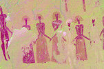
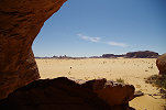
We spent a good two hours searching at all potential locations along a good two kilometre stretch the dry riverbed, way beyond the estimated position, without finding anything. Somewhat disappointed, we returned towards the cars. With Ursula we stayed behind a bit, and just a few hundred metres from the track we came upon a low natural arch high above the riverbank, at a location that seemed to match the described location next to a tributary joining the main valley. Climbing up, we were delighted to find faint paintings both at the rear of the arch, and in a small shelter facing the valley, including a procession of white figures. We were convinced to have found the site, it only sank in back home, once we had the chance to compare the found scenes with the tracings of the real "Procession", that we came upon a completely unknown site.
Not far upstream there was another rock, with some further paintings, but all very weathered.
Thinking that we found our target, we did not linger but continued along the track towards Diona. It was past midday, but as there was no shelter anywhere along the way, we continued till reaching the Enneri Diona, where along the banks the row of trees and a low cliff provided some shelter against the howling gale. At our lunch spot there was a small shelter high up in the side of the cliff, and on the off-chance I explored it just in case there was anything to be found. Much to my surprise the ceiling was full of paintings, again it was later that the site was identified as the one published by Choppy and Scarpa Falce in the vicinity of Diona.
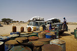
We entered Diona to fill our fuel tanks and canisters (here too the 'gas station' consisted of drums of diesel, apparently from Sudan as the borders with Libya are now sealed). In the afternoon we continued westwards in the Mourdi in full sandstorm conditions, making camp in the only relatively sheltered spot along the high banks of the Oued Kordi just north of the Bankey well (the same spot where we camped four years earlier).
Day 9. Mourdi Depression - Korta Lula
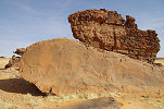
Our objective for the day was to complete the east-west crossing of the Mourdi depression, and reach the very fine panel of engraved cattle at Korta Lula at a straight line distance of 100 kilometres, near the north western corner of the Ennedi. The night turned out to be reasonably calm, and in the morning as we packed camp and moved to the Bankey well to fetch water, the blue sky made the outlook for the day a bit more promising.
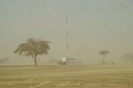
However soon after leaving the well the wind picked up again, and by the time we reached the small village of Tébi (which incredulously now sports a mobile tower, just like Diona) it was once again a full blown sandstorm. In the village we paid a visit to a cousin of Djibrine, and Ramadan took the opportunity to acquire a young goat to have fresh meat for the next couple of days.
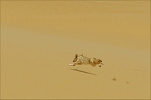
The rest of the drive towards the west turned out to be rather unpleasant. In the sandstorm we soon lost the track leading towards Ounianga, and had to make way over the endless belt of low dunes filling the centre of the Mourdi Depression. In good weather this would have been fun, but in the sandstorm with hardly any contrast it was very difficult to judge the dips and rises and the surface of the sand, the lead pickup invariably got bogged down every 10-15 minutes, and with the heavy fuel load it invariably required the sand channels from the other vehicle. The only excitement along this slow going was when we stirred up a fennec (Vulpes zerda) that ran for quite some time abeam the car.
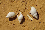
For lunch we stopped in the lee of the largest dune we could find, Ramadan tried his best to keep the sand out of the salad but it was a rather crunchy meal. However the stop provided a good opportunity to see the true nature of the Mourdi Depression, the central part of which was once a shallow lake which is now filled with the dunes. In the lee of the big dune the lakebed was swept clean, and we found several mollusc shells and hippopotamus teeth fragments indicating a very different environment in the early Holocene.
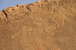
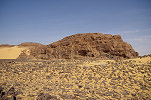
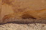
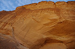
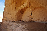
Djibrine knew of a site with paintings a few kilometres to the west of the cattle engravings at an isolated rocky hill, one of the northernmost prominent outcrops of the western Ennedi. A large shelter along the southern side of the rock contains a number of strange large scale engravings on the ceiling, and some fine panels of typical Ennedi late pastoralist paintings at the rear walls of the deepest part. Reviewing publications after the trip it emerged that the site was not entirely unpublished, a photograph in Simonis et. al (2016) attributed to Spazzi d'Aventura and misidentified to be at Anoa (AN 03) depicts the group of three painted human figures in the main shelter.
A few dozen metres further west there is a smaller second shelter with a number of cattle engravings inside.
Further west there is a third long and shallow shelter with several scenes of paintings, including a number of red spotted cattle (?) at the extreme left, and a fine panel of faint Hohou style cattle and human figures, substantially extending the known range of this early pastoralist style.
On the scree slope below the shelters we found several engravings of human figures with an "antenna" (feather?) on their heads. This unexpected cluster of sites was a thrilling experience, especially the finding of the Hohou style figures which Djibrine was not aware of, and appear to be a new find.
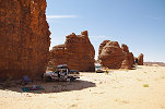
The site with the engraved cattle is just adjacent to the track leading south towards Mogoro, which explains its better known status. We drove to the general area to camp but found no suitable shelter from the strong northern wind, in the end we made camp in the very meager protection of a small tree and a few shrubs about a kilometre from the engraved panel.
Day 10. Korta Lula - Mogoro - Anoa
The wind stayed strong all night, and it became a howling gale by the morning, with only the lee of the cars providing a little protection.
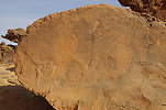
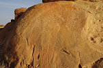
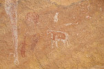
We quickly packed camp and braving the gale and the flying sand we visited the very fine engravings nearby, depicting cattle with forward facing horns in a style similar to the cattle at the Fuchs panel at Niola Doa.
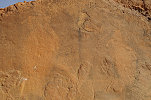
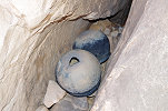
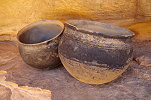
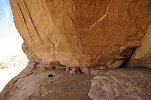
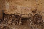
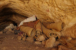
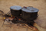
A short distance away, along the rear wall of a shallow shelter there are some more crude cattle engravings. In a narrow niche adjacent to the shelter there were two large (and very heavy) pots stashed away, waiting for their owner to return. The degree to which the windblown sand has eroded away their originally soot covered bottom despite their protected position suggests that they could date back to prehistoric times.
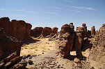
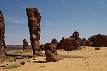
While there are a few more known sites around the fine engraved cattle, with the wind and blowing sand we were in no mood to make any further explorations, but continued along the track leading south, where hopefully the bulk of the Ennedi would provide some shelter from the wind. After an hour we reached the isolated rock 7 kilometres east of Mogoro where Choppy and Scarpa Falce reported some engravings, easy to find at the base of a large prominent shelter.
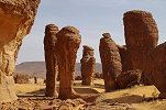
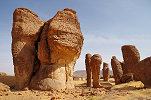
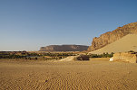
Continuing along the track we soon reached a wide sand-filled pass leading down towards the oasis of Mogoro, marked by a number of huge towering rocks. The wind was still blowing strong, but the plateau behind us did provide some protection as the sky started showing a distinct bluish shade, a rather welcome change after the two days of sandstorm.
We found the oasis to be deserted, apparently it is only inhabited during the date harvest, at other times people move back to the larger settlements of Anoa and Oum el Adam. At the foot of the escarpment the weather was indeed much more pleasant, while our crew proceeded to fill the empty water containers from the well we explored the central part of the oasis. As none of us visited before, and Djibrine was not aware of the location of the engravings mentioned by Choppy, we just checked out the likeliest spots in the vicinity of the well, however all we found was a very pretty scenery.
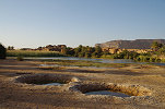
The most interesting find was a small patch of eroded lakebed silt, quite high (~10 metres) above the present low point of the oasis basin, with a multitude of embedded gastropods matching the present-day mollusc fauna of the Ounianga lakes.
We moved to a cluster of rocks and dunes adjacent to the main palmerie of the oasis, but again we only found a nice view, none of the reported engravings. However there were several rock outcrops visible from our vantage point which looked promising.
One particular cluster of rocks on a low plateau with some visible low shelters looked particularly promising, and with some difficulty we navigated the cars to the spot, both to investigate and to have lunch in the shade of the rocks. The hunch proved correct, as we did find several panel of engravings all about the rocks, and one of the shelters contained a weathered panel of paintings, mostly cattle but also a faint group of intriguing, archaic-looking human figures on the rear wall.
At the time we expected to have found one of the sites reported by Choppy and Scarpa Falce, however checking the publication against the taken photographs seems to indicate that we have stumbled upon a previously unreported site. The terrace behind the cluster of rocks also contained a large field of tumuli, the strategic position overlooking the entire basin must have been a perfect settlement site.
There was a prominent stepped rock visible in the near distance which we already spotted as a likely location earlier in the day. By this time it became rather hot but it was still windy, the others elected to encourage me from the comfort of the shade, so I alone set out to investigate. Near the foot of the hill I did find some meager engravings, but on the top one could only enjoy the view and the amazing wind-eroded rock formations, there was not a single piece of rock art despite the commanding location.
At the foot of the hill, on a low wind-eroded rock ridge I did find a couple of engraved cattle, which again did not match any of the scenes published by Choppy & Scarpa Falce.
By now we have covered all the readily visible areas worth searching around the oasis basin. While there were innumerable rock outcrops to the south, and any of them could have contained the engraved panels reported by Choppy, rather than a possibly futile search it appeared to be a better use of our time to continue to the neighboring Anoa oasis just eight kilometres away, where we had a fairly good idea of the location of the more interesting sites. The terrain was rough, but after an hour of bumping we reached the top of the dune overlooking the very picturesque oasis.
The known engravings of the oasis were all reported from a cluster of rock towers and outcrops about 3 kilometres to the south west of the oasis. In the winter of 1966/67 Jean Courtin found a wonderful panel with large Niola Doa type figures, while later Choppy & Scarpa Falce reported further engravings in the same area. Finally in 2016 Stefan Kröpelin published a large panel of engravings with humans associated with strange oval objects (nets or shields?), also somewhere in the same general area. Our good friend Alessandro Menardi-Noguera explored a part of the area the previous year and located the sites of Courtin and Choppy, however the site reported by Stefan Kröpelin was not found. With plenty of time on our hands we set out to explore the very picturesque area, hoping to be able to re-locate all the known panels. We started out at the position provided by Stefan, and indeed we did find a small panel (including some of the oval shapes), but it was not "the" panel we were looking for. Continuing among the maze of rocks (Anoa 2), we found all the sites recorded by Alessandro, but no trace of Stefan's big panel.
Finally from a more distant group of rocks we heard the shriek of Ursula, she found the big panel completely in the shade, very hard to discern from any distance, and appearing completely different from the known photographs.
On the subsequent rocks we found two more panels of engravings, including another one with the strange oval objects, both of which were recorded by Alessandro on his visit.
After thoroughly exploring all the rock outcrops and having satisfied ourselves that no exposed surface was missed, we walked across the few hundred metres distance to Anoa 1 with the superb Niola Doa style panel, now in a perfect late afternoon light.
With the day nearly done, we turned towards Anoa, aiming for the huge isolated rock pillar marking the location. As one approached from the south, there is absolutely no sign of the oasis, which is hidden in a deep depression at the foot of the dune flanked mountain.
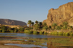
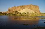
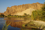
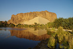
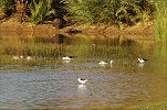
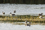
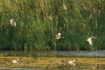
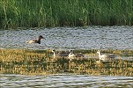
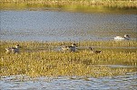
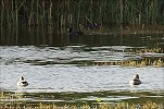
Once passing the rock pillar, the green depression suddenly comes to view, with a bright blue little lake at the lowest point of the depression. Because of the mosquitoes the settlement is not near the lake, but on the top of a high whaleback dune behind the rock tower.
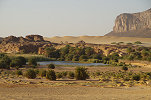
Before heading to our campsite we visited the lake, spending some time at this lovely spot that comes as close as I have ever experienced to a classic picture-book oasis, with the huge trailing dune reflected in the blue waters. Even though out in the plain it was still windy, in the depression shielded by the mountain there was only a gentle breeze ruffling the water.
To our amazement the lake was full of waterbirds, we could recognise a black and white wader and at least two different species of ducks. Once the photographs were looked through in detail, a total of six waterbird species were noted. Many thanks to Joost Brouwer of the West African Birds DataBase for helping with the identifications (provided in the photo captions).
With the approaching sunset we too moved out of the depression (and away from the mosquitoes), making camp in a small secluded valley.
Day 11. Anoa - Oum el Adam - Bichagara
In the morning we drove back to the village to pay our dues to the village headman for the campsite and water, then went to the well that is a little distance from the lake to fill our water canisters.
Once our chores were done, we returned to the rock art sites, starting at Anoa 2, hoping to catch Stephan's panel in the sun, but we were either already too late, or the sun only strikes it later in the year, not mid-winter. Nevertheless our visit was worthwhile, further exploring the rock columns to the east I found another panel of engravings, also displaying the strange oval shapes, beyond the sites found by Alessandro.
After a thorough search of all the rock outcrops between Anoa 2 and Anoa 1 we converged on the main panel of Anoa 1, waiting for it to come out into the sun. I was hoping for a good side lighting enhancing the reliefs, but instead only the irregularities of the rock were enhanced, clearly the best time to visit this panel is the late afternoon, like we did the day before.
Djibrine offered to take us to a site he knew about ten kilometres to the east of Anoa. We started out along an impressive row of rock towers, and in the side of the last one we saw a large shelter which looked worth investigating. On the vertical rocks below the shelter we immediately found a very fine panel of engravings, showing some "sitting" cattle, an apparent oryx and some fine and exceptionally large cattle. Djibrine was not aware of this site, and looking through the available publications it appears to be an unreported locality.
The impressive shelter above only contained a few weathered paintings, but more interestingly there were a number of stone constructions which could have been storage areas or perhaps pens for small goats or other animals.
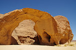
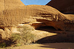
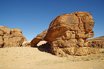
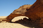
We continued east, and soon came upon a towering rock outcrop with a large trailing dune, and a very impressive natural arch beyond (usually referred to as the Anoa arch). The rock tower had a large shelter in its side, but access was very difficult, in the end only I attempted the climb while the others moved to a cluster of trees about a kilometre away, which provided some meager shade for our lunch break. The shelter turned out to be empty, but here was a very fine panel of large cattle engravings at the southern tip of the rock, facing a large terrace with a vertical drop all around, a well defendable position. Later I checked and this panel was published in Simonis et al. as the locality of Kurta.
There was an excellent view from the terrace overlooking the Anoa arch, but alas no way down. I searched for a while but it soon became clear that the only way down was where I got up, so it was a rather lengthy detour rounding the terrace, then crossing the plain littered with prehistoric artifacts until I could re-join the others beside the small cluster of trees.
In the afternoon we continued towards Oum el Adam, which I imagined to be a tiny village like Anoa. However it turned out to be a proper settlement with built houses, and we could even purchase some fresh tomatoes from the local vegetable gardens.
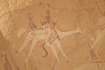
After Oum el Adam we soon reached the picturesque rock towers of the Bichagara region, where we planned to spend the night. Before our campsite Djibrine took us to a small shelter with some fine paintings of camel riders in the characteristic dynamic Ennedi style. This site is not published by Simonis et al., for a while I thought we saw an unreported site, however back home I realised that this was one of the sites published by Mahmoud Marai and Hardy Böckli in Las Cahiers de l'AARS No. 19.
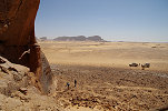
We moved to the southern part of Bichagara, making camp on a sandy terrace at the foot of a row of impressive cliffs, overlooking the plain dotted with the rock towers, one of the finest landscape settings in the Ennedi.
The small but fine site of BG 01, the principal paintings in the Bichagara area were just a short walking distance from our camp, with a fine panel of pastoralist figures on the ceiling of a surprisingly little shelter.
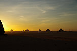
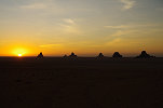
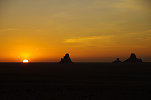
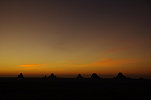
From our campsite we were treated to a superb sunset spectacle, with an open horizon and the sun disappearing among the rock towers cluttering the plain.
Day 12. Bichagara - Gaora Hallagana - Ga Kowrou
Sunrise at Bichagara was equally spectacular, with the rocks on the plain turning pink then orange as the sun rose above the cliffs. By this point we were a full two days ahead of our planned schedule, as based on the experience of previous Ennedi trips we expected a much slower progress. The previous evening we discussed our options and decided to spend these unexpectedly gained two days in part re-visiting some of the classic sites, and also to see some more remote ones along the main route, finishing off our trip at Archeï.
After packing camp we briefly re-visited the small site of BG 01 in the side of the rocky cliff, now in a better morning light.
Our next target was the large cave of Delebo, the northernmost of the sites published by Bailloud. However Djibrine said he knew of another site with paintings not far from the direct route, so we first made a detour towards the cliffs of the high plateau among a number of spectacular inselbergs, coming to stop at the tip of a huge rock spur, with a very shallow shelter at its base.
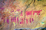
This was the site of Totor, a place that was visited by Bailloud without making any copies or photographs, the site remained unpublished save for a brief mention in his diary. It proved to be unexpectedly rich, with several large panels of Fada style figures covering all suitable surfaces. One panel was particularly fine, with a large group of men and women accompanying four cattle with abstract coats, one of the finest examples of this characteristic Ennedi style.
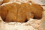
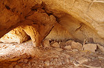
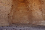
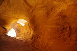
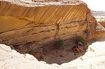
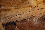
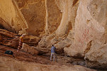
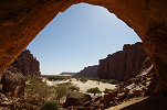
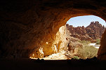
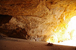
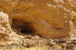
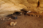
Delebo was just seven kilometres further, along good going on the firm sandy plain at the foot of the cliffs. According to Djibrine the term Delebo actually referred only to the prominent isolated rock far out on the plain, but apparently Bailloud (or his guide) applied it also to the group of rocks closer to the main cliffs of the plateau. One of these rocks has its base almost completely hollowed out, with an enormous pillared cave occupying the interior.
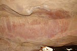
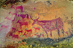
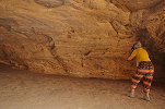
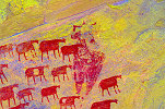
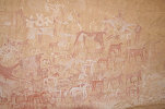
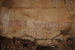
In the deepest part of the shelter there is an almost perfectly semi-circular hall, about 15-20 metres across, with a frieze of enormous cattle (and some smaller figures) painted all around. Standing in the middle of the hall, one really feels like standing in the middle of a herd, almost expecting the cattle to walk off the walls.
We spent a long time at the big Delebo shelter, also checking out a few of the surrounding smaller rocks and shelters but finding nothing more. As we departed, of the south side of the same rocky massif we saw a promising shelter, but on approach we only found a single painted camel. The location, overlooking the track from Wadi Doum to Fada, was clearly used as a artillery position during the Libyan Wars with a number of discarded shell casings and a few unused or dud RPG's littering the slope below the shelter.
Around midday we moved towards the rocks of Gaora Hallagana, searching along the way for the sites of Kele Eguené and Herté Saouni, both marked on the map of Bailloud and mentioned in his diary as having some paintings, but without any illustrations. We searched the likely spots but found nothing, so we continued to Gaora Hallagana for lunch and a nice leisurely visit of all the principal sites. Even after repeated visits there were some panels new to me, like the fine pair of cattle and the procession of women in the shelter adjacent to the well known GH VII site.
We continued to wander about the sites and the amazing rock formations, eventually converging on the large shelter of GH IV with the lovely Fada style scenes adjacent to which Ramadan was preparing our lunch along the shady side of the rock.


After lunch, as our crew were packing up, we explored the amazing eroded system of caves (site GH 09) along the south side of the south-eastern rock of the group, adjacent to the prominent natural arch. There were a few insignificant paintings inside, but also I found a fine panel of figures in a shelter to the east of the arch (GH 14) which I was not aware of previously.
In the afternoon we continued towards Ga Kowrou, where we intended to camp, somewhere in the vicinity of the Rhinoceros shelter, to be visited the following morning. Soon after Gaora Hallagana we passed a picturesque rocky area named Tami, which hides one of the earliest published rock art localities of the Ennedi (Passemard, 1935). Bailloud also mentioned in passing several sites in the area with paintings in his diary, but again provided no illustrations. Without knowing exactly where to look, we just picked some shelters randomly along our general direction and checked them out. Many were completely empty, but a few contained some rather faint and not exactly spectacular paintings, none of which however matched the figures published by Passemard.
After leaving Tami we drove into the spectacular Béchiké valley, one of the finest landscapes of the Ennedi. We made a small detour to a well in a narrow side canyon to replenish our water supplies, then continued towards the south east.

As we emerged from the Béchiké region to the sandy plain to the south of the Ga Kowrou massif, Djibrine took us to a small cluster of rocks at the southern edge of the plain. At this apparently unnamed and unrecorded location (Djibrine knew of no name, and I could find no references to this site) a low shelter contained a panel of rather weathered pastoralist paintings.
From here we turned North, rounding the Ga Kowrou massif and entering the broad valley along its northern side. Finding a camping spot proved to be a challenging exercise, as the recent rains flooded the valley, and all flat areas were full of kram-kram. Finally we found a reasonably clean spot in a little rock enclave, and we all wandered off merrily to enjoy the scenery in the low late afternoon light.
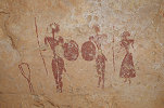
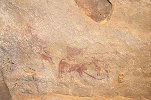
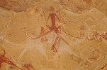
The difficulty of finding a campsite had a serendipitous outcome. Normally I would not have considered the dusty little corner as a suitable spot, but with all nice sandy patches infested with kram-kram this was the last resort. However in a small rocky gorge I stumbled upon a low shelter marked by a number of grinding basins, with a few red paintings on the rear wall. The big surprise came when, looking more closely, in the corner of the shelter I found a small but delightful little scene of a group of warriors holding shields and some weapons, one of them looking exactly like the aliens of cheap science fiction movies. We would never have found this site, if not for the kram-kram.
Day 13. Ga Kowrou Archeï
The new find was made after sunset, in the morning we all made a visit to see it under better light conditions. This time I spotted a series of faint paint traces on a rather hard to see horizontal stretch of the ceiling, which turned out to be two miniature shelter scenes, something without ready analogies in the region.
While our crew were packing camp, we crossed the ridge and dune separating us from the Rhinoceros shelter (GA 01). This magnificent site was reported by Choppy and Scarpa Falce in 1998, but as it was found in pre-GPS days its precise location was lost. We have found it in 2018 after spending a half a day searching, I was really pleased to have been able to unexpectedly re-visit these exceptional archaic paintings.
By the time we finished taking photographs our cars were loaded and ready to pick us up, we drove to the entrance of the valley to see two more sites there. One of them, GA 02 is a relatively minor site in a large shelter at the base of an isolated rock tower, we by-passed it in 2018, now we had the time to make a brief halt.

The other site is GA 07 under a large natural arch, wth a magnificent panel of paintings that includes several rare painted Niola Doa type figures, one of which (the isolated head between the legs of the large cattle at right) I missed on our 2018 visit.
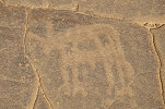
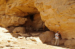
Leaving Ga Kowrou we drove to the southern side of the Deli massif, a huge inselberg marking the edge of the Ennedi with high cliffs facing the open plains (and a smaller outlying rock tower). At the base of the cliffs where it meets the scree slope, there is a huge flat floored opening, one of the largest shelters known in the Ennedi (DL 01). As it is not on the direct route towards Archeï we have by-passed it on both previous trips, now we had the opportunity to make the short detour for a visit.
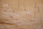
The shelter is best known for some of the finest depictions of horses with riders in flying gallop, a theme that appears to be concentrated in the Archeï-Terkey region. However on the vertical wall at the outside of the shelter, adjacent to a group of faint Fada style figures, I noted some faint white lines which turned out to be a painting of a large, possibly archaic elephant which was not recorded before to my knowledge.

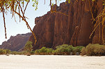
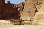
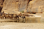
There are several more sites along the Deli cliff further east, however our time was limited and they are not as spectacular as the ones we intended to see, so they were left for a next visit. We continued to the Chigéou well to pick up some water, which was crowded with large herds of camels, sheep, goats, and much to my surprise cattle, all waiting for their turn to have a drink.
After the stop at the well we made a detour to the south, to the massif of Barakatra immediately to the north of Terkey, the two separated by a broad flat bottomed valley. At Barakatra Bailloud reported a large shelter with some fine Fada style paintings (Terkey-Barakatra I), but the more exciting find was made by Suzanne Lachaud in 1996 in a small shelter high above the main site. The paintings, published in Cahiers de l'AARS 20 do not appear spectacular on first look, but there are five clearly recognisable Niola Doa type figures on the panel, adding to the ones known from Ga Kowrou (GA 07) and Grande Riparo at Archeï.
The huge rising shelter of Terkey-Barakatra I is practically full of paintings along its entire length, from the level of the valley floor to at least 25 metres above. During a 2018 visit near the highest level of paintings Ursula found a very faint and damaged scene that shows another Niola Doa type figure, accompanied by a cattle in the same style. Not far, there is a very fine row of tiny little human figures led by a larger one wielding a spear.
The very fine panel of Fada style figures published by Bailloud are on the ceiling of a small niche, near the mid-section of the shelter. The space is so low that it is impossible to photograph the entire scene, but probably the protected location greatly contributed to their perfect state of preservation.
There is one section of the shelter, covered with a fine large panel of cattle and human figures, which now is completely inaccessible. There most have been a precarious ledge leading from mid-level to the shallow niche, but at present it is too eroded for anyone in their right state of mind to make an attempt.
There are many more panels and scenes all along the shelter, including a few - like the Hohou style cattle overapping an archaic figure - which were photographed by Bailloud (he did not make any copies here). The paintings become progressively more weathered as one descends to ground level, at the very entrance of the shelter only bare traces remain.
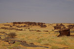
Around midday we set out to cover the remaining 25 kilometres to Archeï. As we drove along, the entire valley had a distinct greenish hue, it was covered with thick growth of not quite dry grass that emerged following the rains of the past summer, a good illustration of how the desert can transform into a dry savanna in a matter of weeks if there is sufficient water.
We reached Archeï early afternoon, and had a quick lunch in the shade of the trees bordering the canyon walls adjacent to the shelter of Archeï 01. After lunch we scattered, some visiting the famed guelta, while I set out to the far side of the valley to the huge cave of Archeï 02.
The paintings along the right wall of the Archeï 02 shelter were already published by Passemard in 1935, however Alessandro Menardi Noguera found several years ago some very faint, almost indiscernible archaic paintings on the ceiling a few years ago. While I already saw and photographed them on our two previous visits, I was not fully satisfied with the results (due to the poor lighting and visibility focusing is very difficult, and it is also very easy to crop parts of figures), so I took the opportunity to spend plenty of time re-taking the photos, this time with reasonably good results.
In the deep dark interior, where a number of large bat guano stalagmites emerge from the dust of the cave floor, the walls are thickly covered with mud wasp nests. However there is a reasonably clear patch along the right wall, here Alessandro found some more paintings recently which I could now see for the first time. They too appear to be archaic though slightly different than the ones on the outer ceiling, at least eleven human figures may be discerned but it is very difficult to make any sense out of the scene.
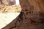
Mid afternoon we moved west to re-visit the lovely site of Manda Guili (Archeï 04), which was very high on Michael's wish list (it was here that his camera failed on the 2018 trip). Unlike last time when we came prepared with a ladder, this time we had no ready means to get up the nearly inscaleable 5 metre high rock face to the shelter (in ancient times there must have been access along a now collapsed ledge from the adjacent cave). However Djibrine and Djido came to the help, with amazing skills they climbed up to the shelter along a crevasse where I had to give up after the first metre, and easily pulled me up with a pair of ropes. This proved to be too challenging for Michael, but Djibrine did not give up, he managed to park the pickup under the shelter. From the roof it was only a two metre climb, something Michael could manage, and we could take perfect close-up shots of the magnificent camel riders, the main attraction of the shelter.

Last time in my excitement at having made it up, I have completely missed the fainter ancillary panels at the left of the shelter (quite possibly they were on the sun and were practically invisible), now I made up for it. There are several more fine camel riders both on the left wall adjacent to the main shelter, and in a small overhang at the extreme left of the narrow ledge.
We kept ourselves busy taking photos till the approaching sunset, when we reluctantly descended via the roof of the pickup, and made it back to camp which was set up among some acacias a few hundred metres from the shelter, on kram-kram free ground.
Day 14. Archeï - camp beyond Kalait
With our last day in the Ennedi, we took a long lazy breakfast to enjoy the amazing view from our campsite over the Oued Archeï. While we needed to start on our return journey, we still had time to visit a couple of sites before turning towards Kalait.
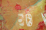
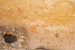
We crossed the broad valley to visit one of the absolute Ennedi highlights, the "Grande Riparo" (Archeï 07). We spent a lengthy time photographing the main panels with the pair of Niola Doa style figures at the extreme left, and the multitude of others from practically all the principal painting styles of the Ennedi.

On the high main wall of the shelter there are just a few paintings, including the solitary head of a Niola Doa type figure and a few smudges, which are revealed with dStretch to be female Niola Doa type figures. This time I noticed another faint smudge which I have not recorded before to the right of the known ones, after processing the images they turned out to be the pair of Niola Doa style women, this time accompanied by a herd of goats (it is unclear, if the goats represent the same period, or are a later addition, but all are very weathered) which were published by Alessandro Menardi Noguera in 2017.

Once we were done with the paintings, at the foot of the shelter we took our obligatory group photos, with the camera perched on the bonnet of the pickup.
Our last target was the shelter of Dibirké, on an isolated rock between the massifs of Terkey and Tokou. It was first reported by Marie-Anne Civrac on the 2013 AARS meeting (and published in Cahiers 17). Djibrine used the name Aski for the locality, but according to Civrac and the 1:500,000 hydrogeological map of the Ennedi this latter refers to the large isolated mountain a bit further north.
The shelter contains paintings on two levels. The majority are on a lower level at the right side, some of them have been obscured by a recent stone and mud storage silo. The paintings here extend for several metres, and display the usual human figures and cattle, but exceptionally there is also a herd of giraffe depicted.
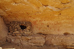
The large upper shelter also contains several mud and stone constructions, and it seems to be in present-day use by the local nomads, as attested by the numerous stored personal belongings that have clearly been moved and partially changed when comparing to Civrac's seven year old photos. At the left there is a fine frieze of large cattle, unfortunately damaged by the droppings of birds which seem to nest above them at times. Further to the right there are several more, better preserved panels of paintings.
With Dibirké we finished the meaningful part of our itinerary, from here we set course for Kalait across the grass covered plains.
The rest of the day was in return mood, only stopping for quick lunch in the shade of some trees along one of the larger wadis, then continuing to Kalait to uplift fuel, water and some supplies for the return journey. We managed to leave town a good hour before sunset, and covered another thirty kilometres before making camp beside another wadi some distance from the piste.
Day 15. Kalait - camp after Abéche
With all attractions behind us, we settled down for the monotonous long drive back to N'Djamena. Not much worth mentioning happened during the day. We made a brief halt at the Biltine market, and reached Abéche by mid-afternoon where we made a longer stop at the market to allow our crew to stock up on cheap supplies coming from Sudan. We stopped to make camp off the road at sunset a litte more than half-way along the Abéche - Oum Hadjer stretch.
Day 16. Oum Hadjer - camp before Bokoro
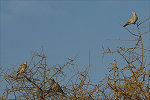
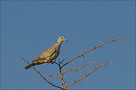
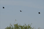
In the morning some excitement was caused by several largish birds perched on an acacia a few dozen metres from the camp, but the taken photos showed that they were just the common African Collared Doves (Streptopelia roseogrisea).
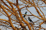
The rest of the day was a monotonous drive, only interrupted by a few rest stops and lunch in a mango garden in Mongo. By mid-afternoon we passed the spectacular granite mountains, the biggest event was catching sight of a flock of metallic blue Greater Blue-eared Starlings (Lamprotornis chalybaeus) during one of our rest stops.
Camp was again made before sunset, this time at a spot off the road at the foot of some low hills about 25 kilometres before the town of Bokoro.
Day 17. Camp before Bokoro - N'Djamena
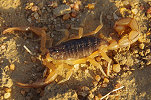
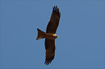
This being our last camp, we spent more time than usual packing everything, as everyone except me were leaving with Air France that evening. Ursula found a yellow scorpion (probably Hottentotta minax) under her tent, the first we saw on the trip, and a pair of Black Kites (Milvus migrans) arrived to investigate, but were soon chased away by the ravens waiting patiently for the leftover scraps after we left. Waiting for the cars to be loaded I wondered off a bit, and was stopped in the tracks by a rustling sound from one of the shrubs. Going close, I found the tree to be full of large brown locusts, their stirring in the morning sunlight was making the noise. They were not desert locusts, but the closely related Sahelian Tree Locusts (Anacridium melanorhodon, the same species as our Ennedi hitchhiker) which also swarm, but in much lesser numbers.
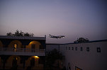
With only had 300 kilometres remaining to N'Djamena, with the evening flight we agreed that it would be a better option to drive straight to town, rather than to spend another hour in a dusty spot by the road for lunch. We reached N'Djamena early afternoon, providing enough time for a good shower and a meal in the Chez Wu Hotel before we said our farewells and the others left for the airport. Air France was on time, landing soon after sunset right over the hotel.
The next day I had an uneventful departure and flight to Cairo, spending the night at the comfortable Airport Novotel before taking the flight home the morning after.
We plan to return to the Ennedi by the way of the Ounianga Lakes (which we never visited before) in November 2020, re-visiting Niola Doa and the many other rock art and natural wonders of the south western Ennedi. We will also spend some time trying to re-locate some of the remaining "lost" sites of Bailloud. Please visit the planned itinerary page for more details (or "like" the FJ Expeditions FaceBook page to receive notices of news and updates).