
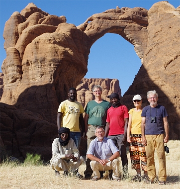
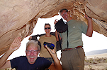
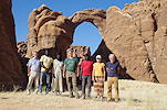
 Click on image for list of participants |
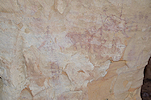
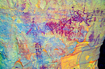
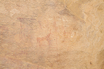
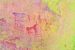
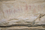
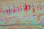
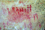
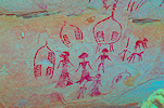
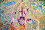
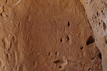
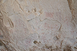
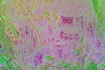
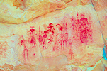
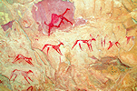
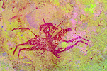
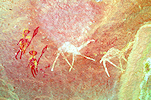
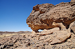
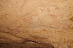
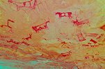
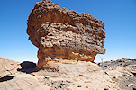
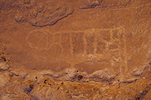
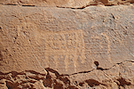
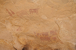
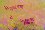
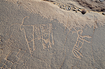
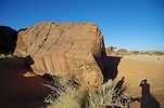
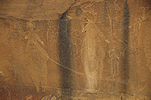
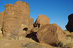
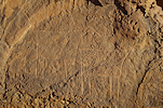
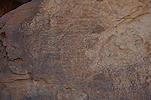
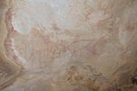
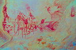
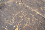
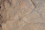
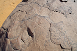
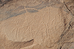
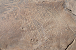
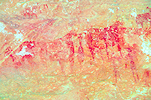
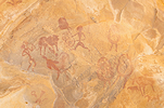
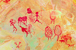
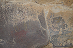
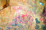
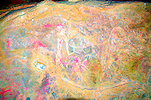
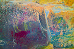
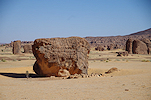
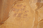
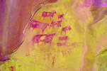
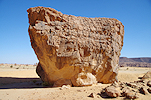
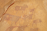
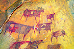
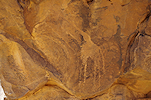
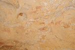
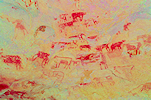
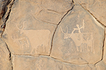
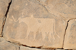
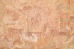
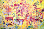
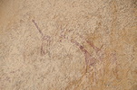
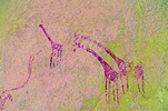
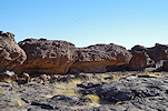
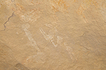
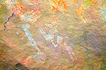
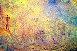
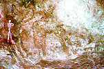
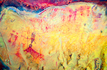
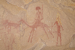
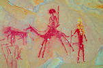
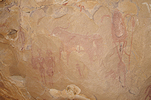
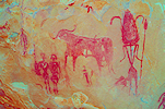
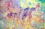
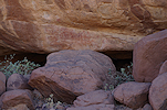
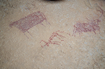
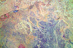
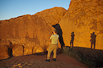
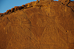
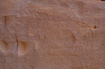
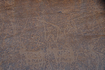
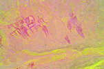
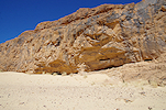
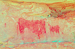
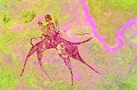
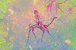
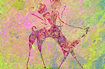
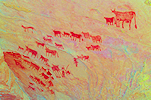
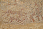
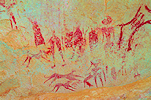
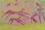
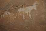
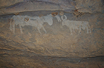
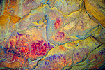
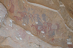
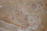
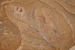
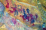
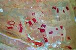
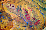
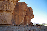
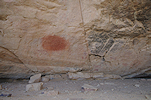
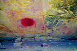
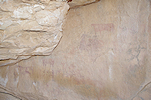
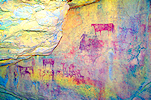
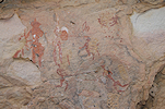
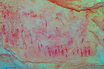
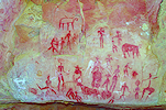
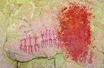
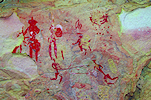
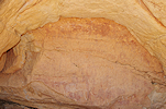
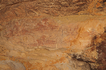
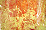
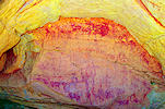
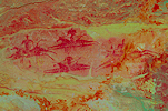
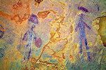
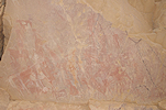
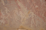
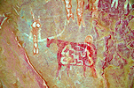
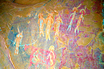
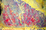
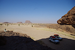
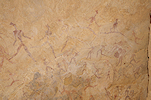
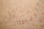
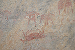
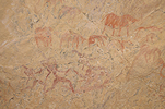
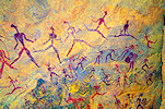
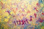
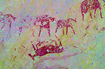
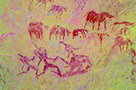
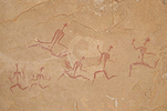
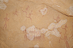
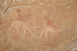
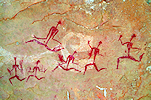
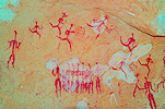
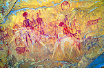
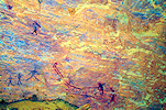
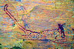
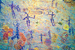
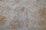
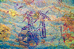
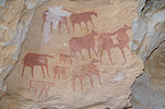
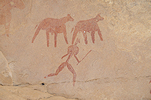
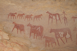
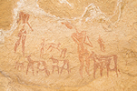
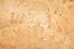
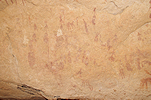
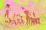
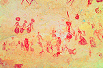
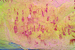
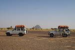
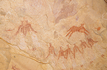
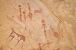
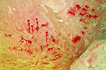
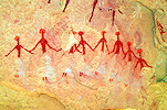
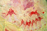
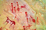
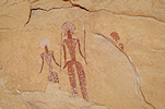
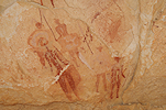
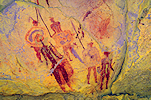
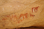
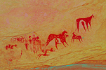
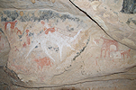
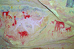
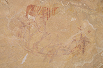
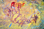
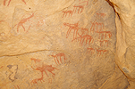
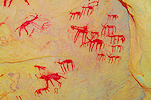
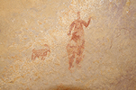
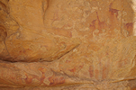
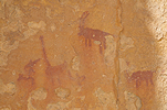
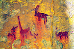
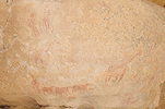
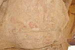
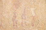
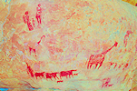
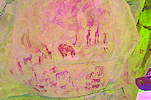
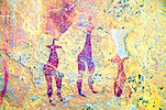
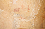
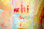
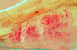
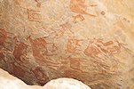
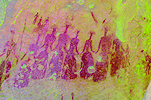
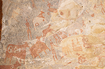
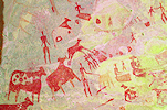
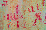
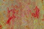
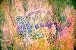
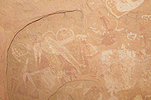
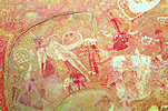
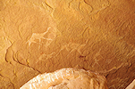
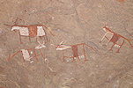
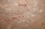
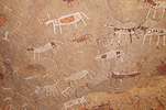
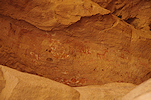
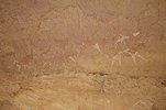
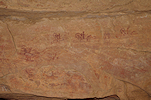
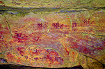
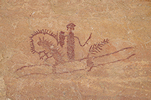
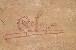
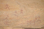
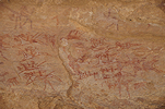
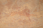
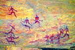
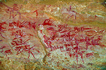
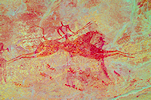
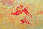
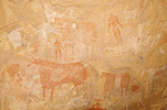
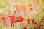
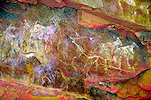
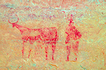
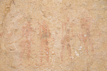
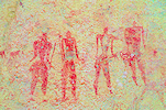
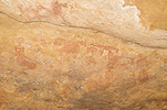
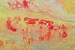
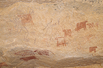
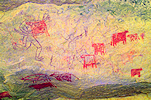
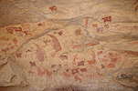
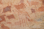
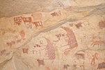
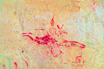
Ennedi Expedition, Chad 19th November - 8th December, 2021 False colour images processed with dStretch, a freely available software developed by Jon Harman |
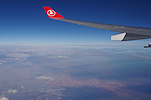
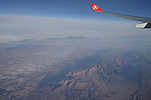
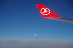
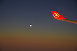
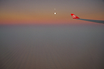
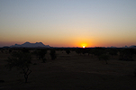
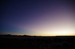
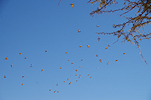
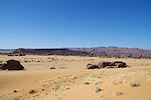
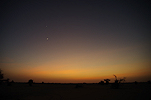
After the anxiety of securing a negative PCR test two days before departure, We all arrived to N'Djamena within a couple of hours of each other in the evening. All others took Air France, I was the only one on Turkish Airlines. With an afternoon flight, we had a splendid view of the Tassili n'Ajjer as we overflew Djanet, with a full moon rising over the Teneré an hour before landing in N'Djamena.
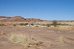
Day 1. N'Djamena - Camp before Mongo
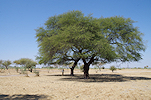
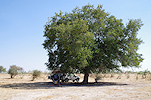
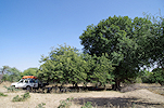
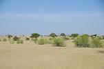
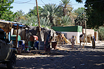
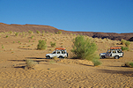
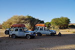
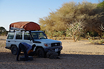
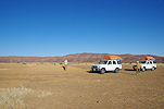
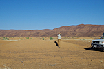
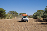
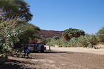
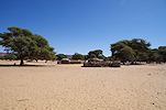
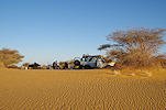
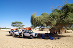
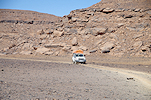
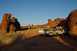
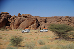
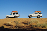
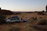
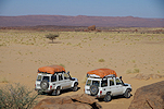
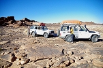
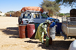
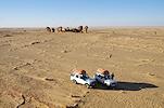
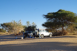
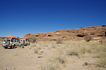
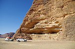
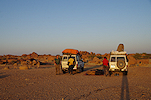
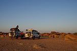
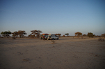
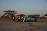
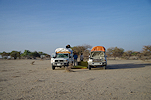
We stayed for the short night at the Irrisor hotel (the former Ibis). Sadly Moussa, the owner of Tchad Evasion passed away the year before, now we were hosted by Faris, his son who took over the business. All paperwork was arranged overnight, and after a quick early breakfast at the hotel we were ready to depart by 8am. We had two Landcruisers, our guide Djbrine, Omar as the second driver, and Pascal, the cook. We set out on the road towards Abéche, driving pretty much non-stop till midday, when we stopped for a short lunch-break under large shady tree near the road.
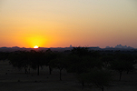
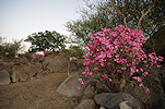
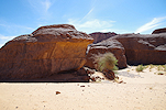
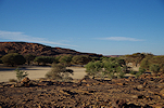
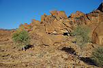
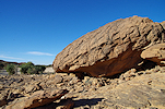
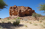
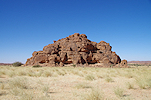
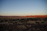
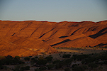
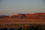
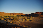
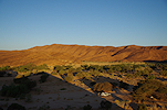
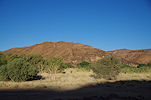
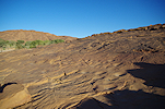
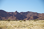
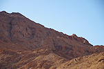
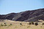
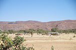
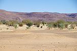
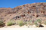
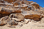
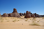
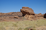
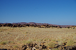
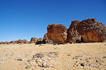
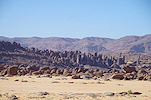
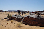
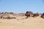
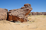
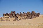
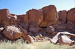
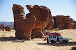
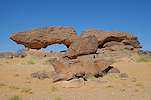
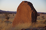
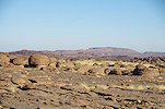
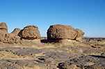
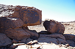
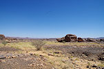
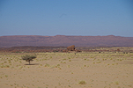
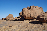
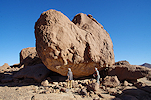
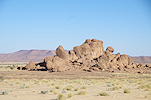
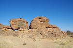
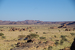
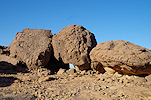
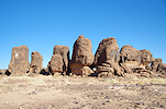
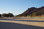
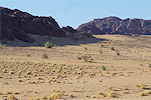
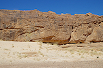
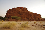
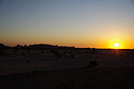
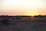
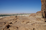
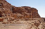
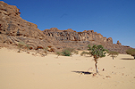
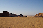
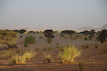
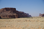
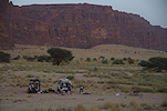
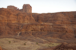
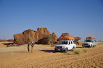
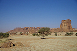
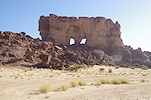
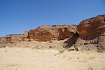
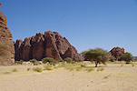
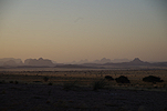
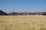
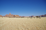
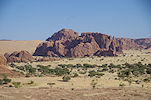
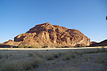
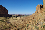
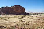
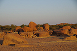
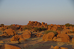
After another long drive in the afternoon, we reached the scenic granite hills before Bitkine in the perfect late afternoon light.
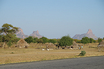
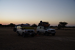
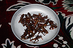
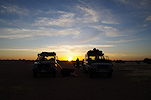
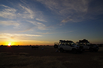
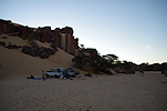
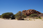
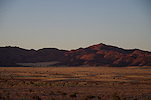
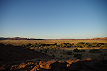
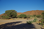
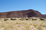
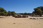
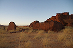
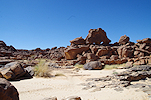
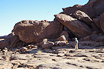
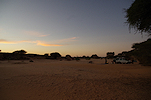
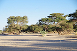
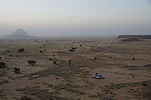
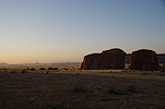
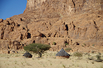
We continued past Bitkine, making camp before sunset at a very pleasant spot among low granite knolls, the same spot where we camped two years earlier. That evening we had some special snacks to go with our first sundowner. With locusts abundant everywhere, fried locusts were on sale at the roadside stalls in every village. Having mentioned in passing to Pascal that I never tried them, he bought a bagful in the village before camp for us. In all fairness, while they were nice spicy, they are quite overrated. The sensation was like eating unpeeled prawns, without any meat inside...
Day 2. Bitkine - Camp before Abéche
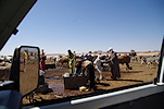
At dawn just as I stirred in my sleeping bag, Djibrine walked up to me and in a very casual tone informed me that overnight the cook died. Overcoming my initial shock I scanned about, and indeed saw poor Passcal lying on the ground a few dozen metres from camp. Based on the traces he must have gone out to toilet sometime during the night, and collapsed right there. The previous evening he prepared a very tasty meal for us, and showed no signs whatsoever of being unwell. We were still in mobile range, Djibrine informed Faris and the police in Bitkine, after covering Pascal's body we patiently waited for the events to unfold. In all fairness things turned out surprisingly efficient given the situation and where we were. Within an hour a géndarme arrived on a motorcycle, had a look at the scene, made some photos with his phone, politely asked a few questions, established the circumstances, and within half an hour produced a report which we were asked to witness. As he was about to leave we asked now what, and he simply said we can do with the body whatever we wish. After a quick consultation with Faris it was agreed that we will drop off the remains of Pascal at the Bitkine hospital morgue, from where it will be arranged to transport it back to N'Djamena to his family for a proper burial. Another cook was already preparing to take the overnight bus to Abéche, where we could meet him the next morning.
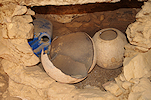
We rolled the remains of Pascal into his sleeping bag then into one of the plastic mats used under the tents and mattresses, and with some effort managed to get him into the back seat of the Landcruiser for his final journey. We drove to Bitkine, and after some discussion with a doctor at the hospital who concluded heart failure as the most likely cause, we were directed to a small isolated building in the middle of a field on the far side of the hospital. After evicting the family of goats who took residence and cleaning out the place with a broom the best we could, we left the body of Pascal on one of the raised concrete benches.
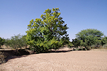
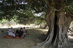
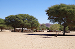
Naturally the mood was subdued as we continued on our journey. We were in no rush, as the replacement cook would only arrive to Abéche the next morning. We drove past Mongo, had the usual lunch break under a group of shady fig trees, then continued towards Abéche, making camp at dusk near the road about half-way between Um Hadjer and Abéche.
Day 3. Abéche - Camp before Kalait
We had a slow start, as the bus was due in Abéche around 10am. We did not realise it in the evening, but we made camp in the middle of a track between two villages, we had a number of curious passing onlookers as we had breakfast and broke camp.
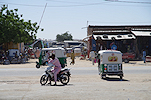
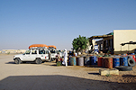
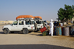
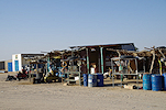
In Abéche we stopped at the gas station near the entrance of town, which incidentally was right opposite the bus station. We needed to wait about an hour for Hassan to arrive, spending the time marveling at the splendidly decorated tuk-tuks coming to the station for fuel.
We had nothing to do in Abéche, as soon as Hassan arrived we continued along the piste towards Kalait and the Ennedi. The only mentionable event was a loose fan-belt that needed fixing in the second car, which was accomplished quickly while we marveled at the tall grass which covered the normally barren landscape after the heavier than usual summer rains.
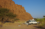
By sunset we were within 40 kilometres of Kalait, we made camp at a pleasant spot near one of the tree-filled riverbeds.
Day 4. Kalait - Gaora Hallagana - Hohou
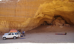
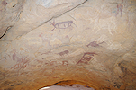
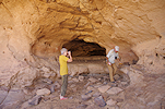
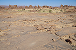
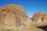
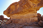
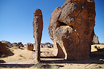
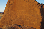
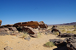
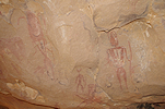
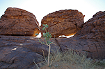
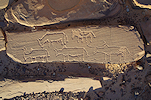
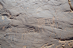
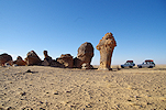
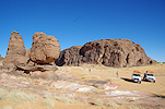
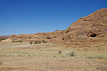
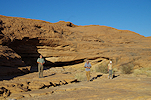
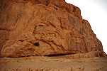
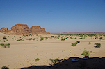
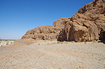
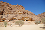
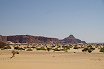
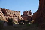
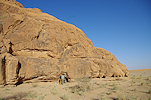
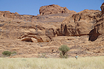
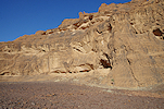
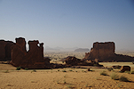
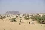
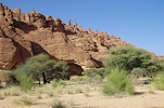
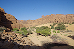
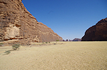
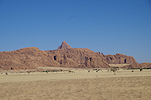
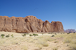
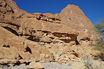
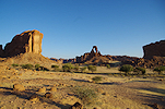
In the morning we drove into Kalait to fuel, and for Hassan to top-up our kitchen supplies before continuing to the Ennedi. It was all rather quick, by mid-morning we were on our way, and by the late morning the Ennedi was in full sight. Our first stop was at the recently discovered archaic paintings at Bogaro, near Gaora Hallagana (Gauthier & Gauthier 2018, Cahiers de l'AARS, 19)
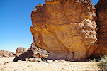
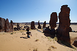
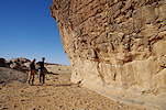
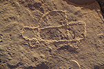
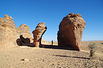
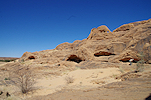
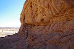
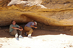
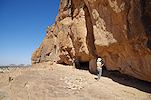
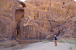
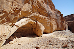
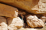
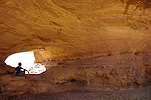
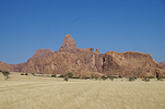
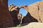
We returned to Gaora Hallagana for a long lunch break, enabling Attila and Koen for whom it was the first visit to the Ennedi to see the principal sites, while I set off to find the "ladder scene" (Yves Gauthier suggests, probably correctly, that it could represent a well) at site GH 08 at the eastern entrance to the amphitheathre surrounded by the spectacular sandstone outcrops.
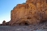
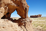
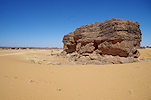
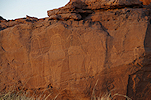
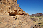
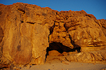
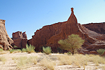
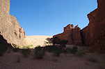
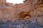
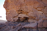
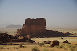
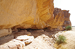
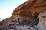
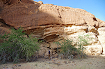
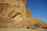
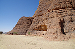
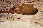
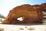
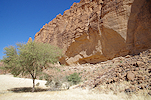
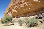
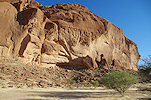
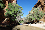
In the afternoon we continued towards the Hohou valley, where we intended to camp and do some exploration for the missing site of Bailloud. Before entering the valley we stopped at the prominent outcrop of Ndou overlooking the broad tree-filled valley. There is a big shelter in the side of the outcrop with several panels of paintings, the most important another one of the "ladder scenes" (well ?) of which there are several more scattered about in the Ennedi.
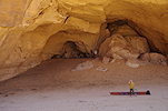
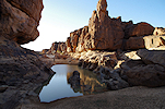
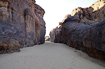
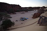
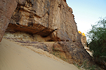
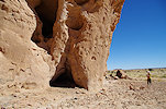
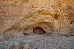
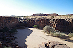
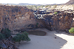
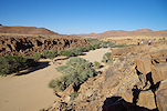
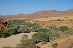
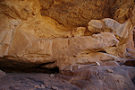
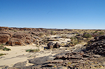
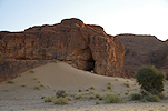
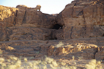
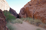
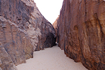
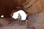
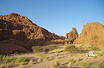
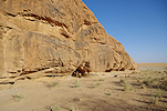
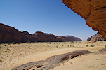
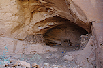
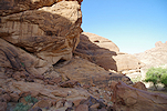
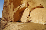
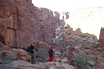
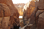
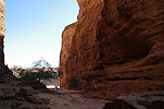
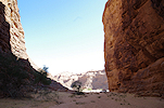
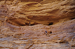
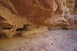
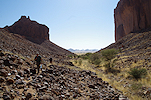
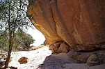
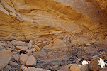
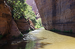
We entered the Hohou valley, which progressively narrows into a steep-sided gorge. We stopped for camp where the soft sand became too deep to continue without getting stuck, and continued on foot to explore the gorge in the remaining daylight. We quickly found site HH 01, a low shelter under a prominent rock, the most important of three recently reported sites (Simonis et. al. 2017) in the valley.
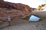
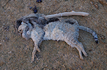
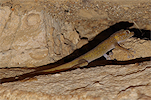
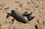
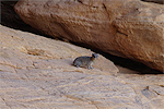
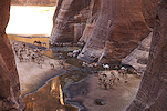
Continuing upstream, we came upon a small guelta, with a foul smell emanating from afar. Near the bank of the pool we found the very decomposed carcass of a large cat, later identified by Koen as an African wildcat (Felis lybica).
We continued further, searching for the small sand filled shelter reported by Bailloud which contains some of the finest examples of the Hohou style figures, named after this particular site. The scenery was spectacular, with more gueltas and a narrowing canyon, but we could not find any traces of the site. Hopefully next time, after gaining a better understanding of the topography and eliminating large areas.
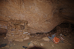
As we returned to camp, we passed a low shelter high up the side of the valley which we already seen on the onward walk. It turned out to contain a small panel of faint but recognisable pastoral paintings, a previously unreported site.
Day 5. Hohou - Fada - Gweni Fada
In the morning we had an early breakfast, and while our crew packed camp, we set out on foot to explore the sides of the valley, still in the hope of finding Bailloud's lost site. There were many potential rocks and shelters, but we found nothing.
After about a half kilometre we reached a low terrace, with the known site of HH 03 in a low shelter at the base of the vertical cliffs bordering the valley.
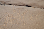
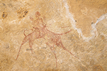
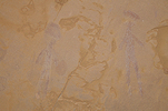
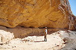
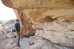
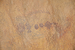
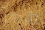
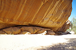
A little further downstream, at the confluence of a small tributary we spotted a large rock with a sizeable shelter underneath. At first we saw nothing, but then slowly some very faint paintings emerged from the dark ceiling - a group of fine camel riders in the classic Ennedi style, another unreported site.
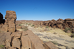
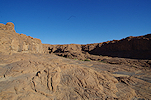
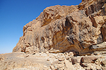
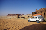
At this point the cars caught up with us, and we continued out of the valley, rounding the Ndou promontory till hitting a track ascending to the plateau above, leading towards Fada. There was a spectacular broken country on top, we stopped at a few places but found nothing except the scenery.
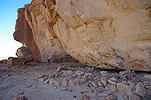
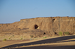
It was not in our plan, but the track unexpectedly took us past the prominent outcrop of Hohou Dahon, with the large painted shelter in the side. It was reported that these paintings were badly damaged by Libyan soldiers using the shelter as an artillery position during the war, but we were pleasantly surprised to find them quite well preserved with only minimal visible damage to the main panels.
In Fada we stopped to uplift water and report to the Préfecture, but we had enough fuel to reach Diona, so after just a short stop we continued along the piste towards the North.
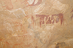
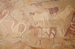
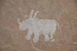
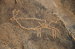
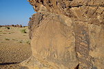
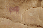
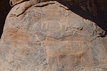
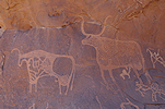
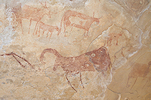
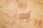
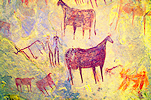
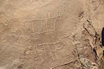
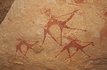
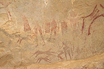
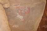
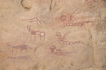
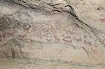
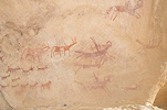
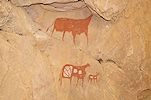
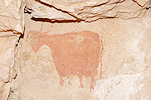
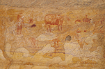
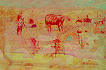
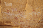
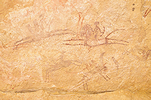
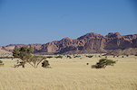
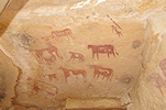
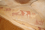
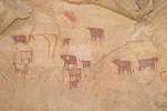
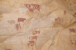
Our midday target was the site of Tenebyela, where Bailloud reported a fine panel of engraved elephants and some paintings. Later Yves Gauthier located a number of other sites in the area. These are located in the upper reaches of the Oued Kika, the large valley flowing North to the west of the Gweni Fada structure. We started at the westernmost of the sites, a prominent rock adjacent to the main watercourse, with a large shelter in its side. The highlight of the paintings is a unique small white rhinoceros, without any clear stylistic affinities (but relatively recent, based on the much more weathered cattle right next to it).
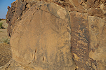
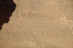
The other sites were among a cluster of low sandstone hills a few kilometres away. The most prominent was a large east facing shelter in the side of one of the inselbergs, with a panel of engravings on the left wall. After the trip, reading the relevant publications, I realised that the site of Kika in Choppy et. al. (1996) is in fact the same site, the two elephants in figures a. and b. on page 43. are not two separate sites as implied, but adjacent to each other on the same panel. We also found some faint paintings on the right wall, which were left unmentioned by both Bailloud and Choppy.
We used our extended lunch-break to explore the surroundings. It turned out that Bailloud's panel of engraved elephants (Tenebyela I) was just outside the shelter to the left, along the southern side of the inselberg, in reality the same site.
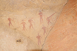
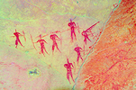
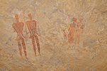
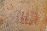
We found Bailloud's Tanabyela II site with the procession of warriors with spears and shields in a small shelter at the side of the adjacent hill.
A larger hill at some distance contained an array of smaller shelters, all bearing some traces of paintings, but none very exciting. The most interesting were a lonely Hohou style figure and a group of red spear-wielding figures.
Mid-afternoon we set out again, following a track leading downstream along the Oued Kika. We soon found out why the track makes a wide detour from the riverbed, not far below Tanabyela there is an impassable huge dry waterfall with a drop of about 30-40 metres, with a large guelta at its base (Djibrine called it the Kika guelta).
Beyond the guelta the track entered a region of soft dunes, then it descended steeply into the riverbed. Downhill it was easy going, but it would be a struggle to get cars up the opposite way.
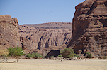
We continued down the Oued Kika to the junction of the Oued Dougouro, the big wadi draining the Gweni Fada crater. As we wanted to reach the crater by sunset, we did not stop anywhere but continued along the increasingly soft track along the riverbed, leaving any exploration for the return. We were almost at the entrance of the crater when a flat tire caused a short halt, but Djibrine and Omar fixed it before we even had a chance to properly stretch our legs.
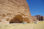
We reached the end of the Oued Dougouro around sunset, we just had enough time to climb the hill next to camp and take a glimpse into the crater before darkness.
Day 6. Gweni Fada - Mourdi depression
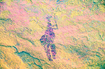
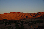
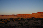
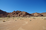
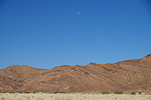
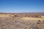
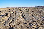
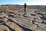
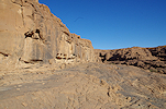
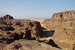
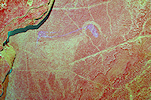
We were up at dawn to climb back to the top of the hill next to camp for sunrise. In the sharp morning light we could better appreciate the huge circular feature, thought to be an impact crater by some (Vincent & Beauvilain 1996, Koeberl et al. 2005), but there are some lingering doubts (Norbert Brügge, pers. comm.) with the possibility open for a non-impact origin. While none of us were specialists, there were very few visits to Gweni Fada with a geologists' eye, our objective was simply to take a good look and observe with an open mind. One curious feature, well visible in the low light of sunrise, is the strange circular inward dip of the otherwise horizontally bedded sandstones around the northern quadrant of the feature, traceable even on satellite imagery.
The "central uplift", a rugged mountainous area filling the lower centre of the crater was too far to observe any details, but we intended to take a close-up look later in the day.
We lingered on the hill top till the sun fully rose above the horizon, then made our way back to camp for a quick breakfast to allow our crew to pack camp while we set out again to explore the wadi sides.
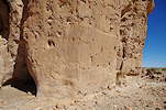
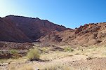
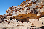
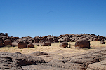
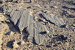
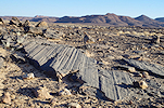
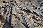
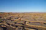
There was a section of the inward sloping rock layers right behind camp. One thing became immediately obvious: the layers were completely undisturbed, the section tilted as one unit, no vertical faults or any shattering was visible. Moving a little downstream, a thick layer of massive (Devonian ?) sandstone became visible, again completely in one block without any breaks or faults. Rounding a corner, I came upon a large eroded shelter under this layer, with some recent stone constructions inside and a few crude paintings on the wall (probably recent to modern) and a number of stone circles just outside.
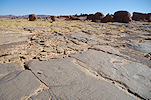
I walked some more upstream, to get a clear view of the western cliffs of the valley where the junctiong of the tilted and horizontal layers was clearly visible. From what one could see, there was an abrupt sharp line between the tilted and horizontal strata, but no misalignment. Apparently some enormous bending force tilted these layers towards the centre of the crater. This observation raises many questions: one would expect an astrobleme forming impact to shatter the rocks, or at least create numerous vertical faults, rather than gently bend them. On the other hand, one cannot readily think of any gradual tectonic process that would result in such a circular dip of the rocks in the direction of the centre of the feature.
I also found ample evidence for ancient inhabitants. One smooth tilted sandstone section adjacent to the riverbed was fill of large grinding basins, similar to what may be observed in many other places in Ennedi and Chad in general.
After the exploratory walk around the mouth of the outlet wadi, we set out with the cars to see the central uplift. As we drove across the wide crescent-like plain surrounding the central hills, we passed a series of low mounds which were clearly eroding lake deposits. At one time in the geological past the crater was filled with water, most likely during the early Holocene pluvial when other Saharan basins also contained lakes.
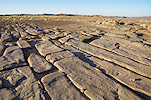
We were aiming for the deep northern valley cutting into the interior of the "central uplift". As we approached, we could see that the layers in the sandstones around the outer side were generally tilting upwards towards the centre of the uplift, but as we entered the valley we could see adjacent mountain-sized blocks with the dip in all directions including vertical, clearly a jumbled mess that was created by some huge upheaval.
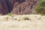
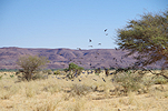
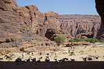
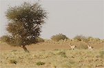
There were many herds of livestock grazing on the plain outside, so we were very pleasantly surprised to startle a large herd of Dorcas gazelle near the end of the valley.
We drove till a large gravel terrace near the upper end of the valley, from there it was only possible to continue on foot. From satellite imagery it looked possible that some of the rocks are not sandstone but possibly igneous, we came to check this out. Up close it became clear that all the "central uplift", at least on the accessible northern side, is composed entirely of sandstones. A thorough search in the riverbed did not reveal the slightest evidence for any igneous rocks in the catchment area. However from this close-up vantage point the structure of the interior was well visible. The highest ridge closing our view to the south (but not the highest peak of the uplift) clearly consisted of a huge single block of vertically upturned sandstone.
Driving out of the valley once again we could observe the diverse tilt of the rocks, the eastern bank tilted upwards, while the opposite western bank had downward tilting strata just a few hundred metres apart. Driving around the perimeter of the uplift, we also passed the upward tilting layers (pointing towards the centre of the uplift) which glittered from a distance earlier in the early morning sun, now it was clear that they were just ordinary sandstones, coated with a reflective desert varnish.
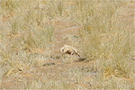
As we approached the rocks around the perimeter, we saw a large cat make its escape. I snapped a quick shot, but could not find the animal anywhere on the photo, however the tracks remained to prove that we were not hallucinating. Koen identified the tracks as African wildcat, the same animal we found dead by the Hohou guelta. Not far from this spot we also saw a huge flock of pigeons roosting on an acacia, then fleeing with a loud noise as we approached.
Our plan was to drive into the large wadi flowing around the "central uplift", draining both the southern part, and the area to the south of the Gweni Fada structure, where a dark linear feature (possibly a volcanic dyke) could be traced on satellite imagery for a length of over 10 kilometres. Roughly where the valley started to turn west around the rear of the uplift, we came upon the first large gravel terrace. This was enough to establish the nature of the rocks upstream. We searched very thoroughly, but found absolutely no trace of any igneous rocks, only sandstones of various grades. The only unusual find was a larger piece of sandstone breccia, with angular lighter coloured fragments embedded in a very similarly textured but darker purplish sandstone. Such a rock could have formed under impact conditions, and if so it could be the first piece of impact breccia documented at Gweni Fada. However it could also have formed due to other geological processes which created this jumbled mass of sandstones in the centre of Gweni Fada. The jury is out...
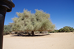
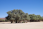
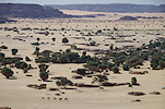
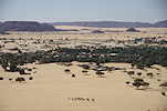
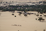
We have seen everything we wanted to during this short foray into Gweni Fada. While the geology was fascinating and puzzling, our main objectives were still the rock art sites, especially Niola Doa, so we slowly started making our way out of the crater. Backtracking in the main wadi we passed some huge ancient acacia groves, some of the largest such trees anywhere in the Ennedi. We also passed several villages, concentrated along the watercourse, and saw more of the lakebed sediments as we cut across the plain towards the mouth of the large wadi draining the Gweni Fada basin.
On our way out we made a brief halt at the perfect section of the junction of the tilted and horizontal beds in the cliff bordering the wadi along the western side. The conclusions were the same as already made in the morning from a distance. There is no vertical displacement, the same beds continue in the downward sloping section after an abrupt bend.
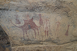
During the inward journey we had no time to search, but now with our survey of Gweni Fada completed faster than planned we could afford to check out shelters along the way out. We stopped at one prominent row of shelters by the western bank, looking inside we found several panels of pastoralist and camel period paintings. To my knowledge, no one reported this site before.
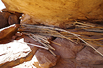
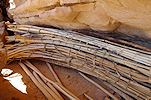
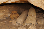
There was a slab with some engraved camels next to the southern shelter, but more intriguingly we also found several bundles of tied-together hut or tent poles, exactly of the same shape and size as what is depicted on paintings in the Tassili n'Ajjer, with cattle carrying such bundles tied to their horns.
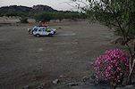
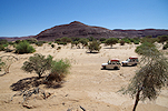
There were no more mentionable finds in the valley. After a quick lunch stop in the lower section, we soon reached the Mourdi depression, joining the track leading towards Diona. We drove all afternoon without stopping, making camp among some low dunes about 50 kilometres short of Diona.
Day 7. Diona Niola Doa
The previous evening was rather windy, with the sand on the move it was the first time there was a need to put up tents. Fortunately we had a nice calm morning to pack camp and continue on our way.
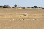
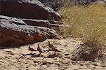
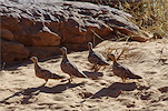
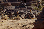
Not far from camp we came upon a flock of Crowned sandgrouse (Pterocles coronatus), a common species we have always seen in the Niola Doa area.
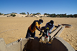
We stopped in Diona to report to the Sous-préfect, and also to fuel and take water from the well. It all went quickly, by mid-morning we were ready to leave. It was interesting to observe the evolution of the village. Five years ago Diona was just a group of thatch huts, with one or two ancient dilapidated but still working (and several more wrecked) Landcruiser pickups parked under the trees. No there were several new brick houses, a mobile tower, and a flashy new Toyota Hi-Lux in front of nearly every house...
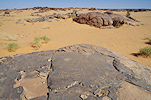
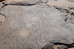
It took the rest of the morning to drive along the dismal track leading towards Niola Doa. It was slow but steady going, by midday we crossed the riverbed and were approaching the first sandstone outcrops to the north east of the Niola Doa plain. I looked at these outcrops on all previous trips, but with time always short, we did not have the time to explore. Now our schedule was more relaxed, and we made good progress, we still had an hour before lunch so we spread out to explore the rock outcrops. Not surprisingly we found several sites, both paintings and engravings.
Koen came upon a low shelter with some very well preserved pastoral paintings. After returning home and looking at Choppy et al. (1996), it became clear that by accident we have stumbled upon the "Grotte-tunel de Grand Meandre", a site also published in Simonis et al. but with its precise location having faded from memory.

We had lunch in the same cluster of rocks near the track as on the previous trip, using the time to explore the surroundings. The cluster itself already explored, with Atila and Ursula we went east, while Koen explored the terrain to the west. The area looked very promising and there was ample evidence of prehistoric habitation, but we only found a small site with paintings, plus a few pastoral engravings on the horizontal rock surfaces.
Koen found a cluster of engravings near a small rock outcrop, including a delightful modern depiction of one of the trading trucks that cross the desert between Libya and Chad.
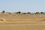
As we departed, we encountered another flock of Crowned sandgrouse, but this time they did not flee, they allowed us remarkably close for some photographs.
According to our plan we still had two full days plus this afternoon for the Niola Doa area, which we intended to use both to visit the principal known sites, and also to explore some unsurveyed areas. We started out at the "Italian panel" which now was in the good afternoon light.
We continued to the western edge of the plain, to see the "Lost panels" (so called because after having been reported in the nineteen fifties, their precise location became lost till the late nineties), which too are best visible in the late afternoon.

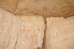
Our last stop before sunset and camp was the recently discovered site (ND 31, Gauthier & Gauthier 2018, Cahiers de l'AARS, 19) with some paintings and a Niola Doa style figure on the wall below the shelter.
Day 8. Niola Doa
We spent the night at the same spot as in 2020, however under much better circumstances, with no strong wind like last time. However with the good rains, Kram-kram (Cenchrus biflorus) was everywhere, it was hard to find a good sleeping spot. At sunrise with Attila and Koen we set out to visit the Niola Doa II sites (Gauthier & Gauthier 2018, Cahiers de l'AARS, 19) some four kilometres away, while Ursula stayed behind to explore the valley and the cluster of rocks to the south.
With the now known trail we made fast progress, in just an hour and a half we were standing in front of the Niola Doa II panel, still in very good morning light.
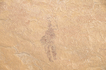
With the benefit of precise information from Yves Gauthier, this time we also found the nearby site with some very strange archaic paintings. It is very difficult to capture them as practically nothing is visible on the spot, unfortunately it appears that I left many details out of the frame. Nevertheless my impression is that the legs (the only visible feature) belong to some large animal, rather than a human figure as suggested by Yves.
Yves and party found several more sites with paintings and engravings along the south western sector of the Niola Doa II plain. While nothing extraordinary, they were well worth a visit, we started out at a nice panel of pastoral paintings in a small shelter at the side of a prominent rock outcrop.
In the middle of the plain, at some rather unassuming rock outcrops there are several clusters of engravings, mostly cattle, some camels, and several examples of curious circular or oval shapes which can be found also elsewhere (e.g.Azrenga, to the East of Niola Doa)
On the return we visited another rock with very faint paintings found by Yves and party.
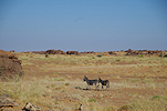
We also passed by the small but interesting site we found during our 2020 visit. Interestingly the last time we saw several people and grazing animals, now despite the denser vegatetion aside the two donkeys seen in the morning the only other animals we saw were the frequent large crater-like anthills.
We completed the round of the Niola Doa II sites far quicker than planned, we expected to be back by mid afternoon but we reached camp shortly after noon. We could afford a little nap after lunch and the long walk, a rare luxury in the desert when we are constantly on the move to make the most of our stay.
While we were away, Ursula found a very interesting site with some archaic paintings including a faint but recognisable white elephant in the main valley, not far from camp. In the afternoon that was our first stop as we started moving back towards the main areas of Niola Doa.
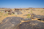
We spent most of the afternoon visiting a number of lesser sites in the western part of the Niola Doa plain, among the spectacular terrain of scattered rock pillars, starting at the fine panel of engravings found by Els during our first Ennedi expedition.
Yves Gauther and party also spent some time exploring this part of the plain, and found several sites, both paintings and engravings. One site was just a stone's throw from Els' panel on a smaller low rock with a shelter in its side with a panel depicting a series of typical Ennedi style cattle.
Among the scattered rock towers to the east Yves and part found another four sites, none of them major or unique sites, but with some fine details.
We finished the day visiting two of the principal paintings localities at Niola Doa, Choppy's "Abri des guerriers" (ND 10) and the "Abri de la colonne" (ND 17).
Day 9. Niola Doa
Our camp was adjacent to the Fuchs panels, mainly to be able to take photos of the engravings at sunrise, when they are in the best possible light.
There was another reason for the location of our camp. Yves Gauthier and party found two sites with archaic paintings in the area to the east of the Fuchs panel, we wanted to visit these before making a wide loop to explore the country between these sites and the one we found with Ursula on the previous trip. We started out at the more distant of the two archaic sites, a long shelter in the side of a low ridge with some barely recognisable paintings.
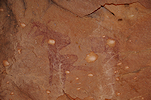
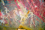
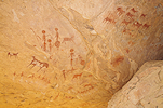
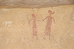
The other site (ND 32, Gauthier & Gauthier 2018) was a few hundred metres away, also among a few low rock outcrops. This one is much better preserved, with several layers of paintings including a large white bovid (Aurochs or perhaps Pelorovis ?) and groups of small human figures in white and dark colours.
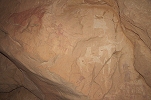
From site ND 32 looking across the Enneri Ourchigué (the watercourse bordering the Niola Doa plain to the east) we could see a jagged rocky area that was certainly worth a look. Ursula returned to the still visible camp, while the rest of us set out to explore the distant rocks. The anticipation proved correct, we did find a long shelter along the side of one of the rocky ridges with some faint but recognisable archaic white and yellow figures.
Cutting across a bend of the river we returned to the west bank, where a huge prominent shelter was visible from afar, but turned out to be empty. However only a short distance beyond we found a small shelter on the terrace above the riverbed with some faint white paintings of human figures and some unrecognisable shapes.
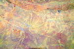
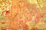
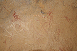
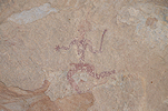
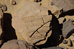
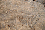
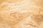
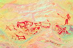
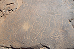
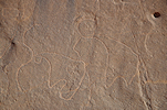
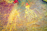
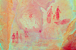
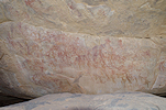
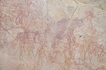
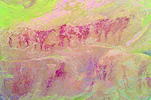
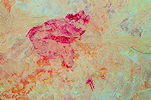
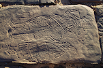
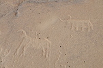
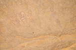
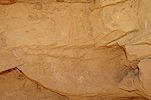
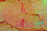
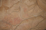
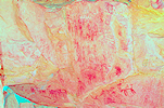
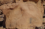
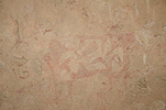
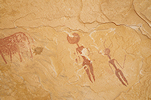
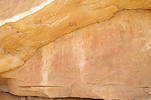
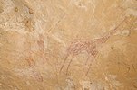
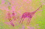
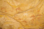
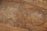
We continued on the terrace (as far as we knew the riverbed and its sides have been explored by Yves and party), and after a few hundred metres we came upon a large shelter which contained some intriguing paintings in several layers. On the spot we could only see that something was there, but later dStretch revealed two large yellow elephants underlying the more visible giraffe and human figures.
Further north the terrace flattened out, there were no obvious features that could be the focus of rock art. There was a single rock outcrop with an underlying shelter, and we did find some engravings of shield-wielding warriors, but nothing else.
We arrived at the mouth of the tributary draining the valley of the "Abri de la Danseuse", where with Ursula in January 2020 we found the site with archaic paintings. At this point we were not yet aware that we found the "Grand Meandre" site, and still beleived the "Abri du procession" to lie somewhere in the area opposite the mouth of the tributary. We did not find anything, buy Yves who also searched the area found a small site with some archaic human figures on the western bank near the site we found, which we now had the opportunity to visit.
Having reached this far, our plan was to explore the tributary and its terraces to the south, while making a beeline for camp. While the satellite imagery looked promising, the valley was a let-down. There were hardly any suitable shelters along its banks, and the few that were also turned out to be empty. A few hundred metres before reaching the plain of the "Danseuse", we turned left to explore the prominent rocks along the southern edge of the bordering terrace, again without finding anything. Finally on a rock-encircled plain we found an outcrop with a shallow shelter that contained a few painted figures, a rather meager result given the size of the explored area.
Turning towards camp we explored a few more sandy basins, again without finding anything, until we reached the well known panel of large engraved cattle a short distance above the Fuchs panels and our camp.
Again we were back earlier than planned, we had time for lunch and a little rest before setting out again in the afternoon, this time with the cars after packing camp. We visited two small sites with paintings to the west of the "Abri au bidon", both of which were found recently by Yves Gathier and party. Both have some nice scenes, though nothing exceptional.
Our next stop was the "Massif des spirales", another site reported by Choppy and Scarpa Falce, which we did not see on previous visits. We could not find the spiral engravings that gave the site its name, but readily found the shelter at the northern side with a number of fine camel period paintings.
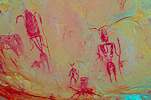
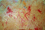
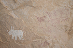
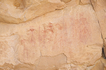
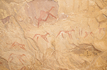
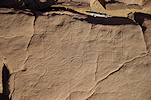
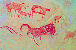
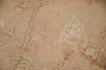
Based on the description of Choppy we expected to find all the scenes in one shelter, but as we rounded the small rocky outcrop we came upon another shelter, which contained a large panel of archaic-looking paintings which were recorded by Choppy et al. The scene is anything but clear, there are many motifs underlying the red human figures. dStretch reveals that the large animal in the lowest layer is in fact a rhinoceros. Behind and underneath the recorded panel there is a low shelter, where we found some cattle and some further archaic figures on the ceiling which were apparently not recorded earlier.
There are two more shelters with paintings at a small rock outcrop a few hundred metres to the west of the "Massif des spirales", also located by Yves and party. Later comparing the scenes, the second proved to be another panel that was assigned to the "Massif des spirales" by Choppy without mentioning it as a separate site.
Before heading to camp behind the "French panel", we paid a short visit to the strange beast in a low shelter which we found on our 2016 expedition.
After making camp we set out on foot towards the unique glacial striations we discovered by accident in 2016. We searched the area should there be any more, but found none. Apparently this outcrop represents a slightly higher bed in the sandstones, which has mostly weathered away leaving this single exposed patch on a level a little above the surrounding plain.
The Niola Doa style figures of the "Dalles des Italiens" are a short distance beyond, uniquely not on vertical walls but on the flat rock surfaces. Most of them were found in the nineties by an Italian party (hence the name), but we found several new ones in engravings a short distance from the known ones in 2016. On our return I was happy to find another panel we saw in 2016, but the location of which I forgot to record and only had vague memories.
Day 10. Niola Doa - Mourdi depression
Our camp was once again positioned to permit the photography of the "French panel" in the light of the rising sun.
Once we were done photographing the panel of engravings, we had a quick breakfast and packed camp, before starting our return journey towards Fada. Along the way we checked out a few unsurveyed rock outcrops near the track, but only found a few crude engravings.
The only remaining excitement before reaching Diona was an encounter with a rather distant band of Patas monkeys as we crossed the main riverbed before the village. We again fueled and took water from the well before continuing back on the Mourdi track.
Late afternoon as we were driving west along the track, we spotted a group of prominent rocks a few kilometres off the track. With no set goal to reach that day, we decided to investigate. Once again the hunch proved correct, both at the main cluster and at a somewhat more distant smaller rock we found engravings, including an elephant and numerous cattle in several shapes, sizes and flavors.
By sunset we reached the Oued Kika where it emerges from the plateau into the Mourdi, and made camp in the soft sand of the riverbed some distance away from the track.

Day 11. Mourdi depression - Adikougouné
We had a pleasant calm and lazy morning in the riverbed, we made good progress the previous day and were not pressed for time.
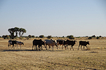
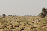
As we continued in the Mourdi depression, we saw several herds of Dorcas gazelle. While they did not let us close, they did not flee in panic either, a good sign that they are not being poached.
With time on our hands, once we entered the foothills of the Ennedi turning towards the south we started checking out likely rocks for any unreported rock art, but did not find anything till hitting the main Fada - Ounianga track.
We had more luck once proceeding on the track. Making a toilet stop near some suitable shrubs in the upper Oued Noure, we found an area of smooth rocks with many engravings (and also a well-worn trail), mostly of camels but there were also a few prehistoric cattle.
Our plan for the day was to explore the eastern edge of the large terrace, the first step of the plateau north of Fada, the northern part of which is referred to as Arsa, while the south eastern part (with some uncertainty) Gobé. We started at a series of shelters visible from afar (already noted down on our onward journey) near the northern edge of the plain. We checked them out, but they all turned out to be empty, at close range much smaller shelters that they appeared from a distance.
There was a small nearby valley between the main plateau and a smaller outlier only accessible on foot, entering the valley we soon found a shallow long shelter which did contain some faint pastoral paintings.

Rounding the outlier, we found another shelter on the outer side, this too contained some very weathered paintings.
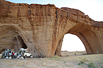
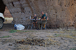
For lunch we went to the known site of Arsa, where a rock wall adjacent to a fine natural arch provides good shade for a midday rest. While Hassan prepared lunch we set out to explore, and on the far side of the rock massif found the little shelter with a number of fine camel riders (including one where two people sit on the camel) published in Simonis et al., which we failed to see on the earlier visit.
After lunch we drove some distance to the north to the edge of the cliffs bordering the terrace, where in a relatively small shelter Yves Gauthier and party found a fine panel of pastoral paintings.
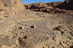
We returned to the eastern cliffs to continue our search where we left off, driving along the track and checking out the rocks beyond for any signs of a likely shelter. Gobé is actually marked as a locality on Google Earth, where a larger valley juts into the plateau towards the east. The vertical walls visible on satellite imagery looked promising, we entered the valley and searched all sides, but found absolutely nothing aside a fine layer of ripple marks formed hundreds of millions of years ago on an ancient seashore.
Continuing south we reached surveyed country, Yves and party explored this lower part of the eastern cliffs and found two shelters with paintings. The first one was a small shelter with fine mostly pastoral paintings, with a delightful little scene of a rabbit chased by dogs.

The second site was very close to the road, just above the start of the descent in the pass leading to the plains on the level of Fada.
While on Google Earth Gobé is marked to be along the eastern edge of the Arsa terrace, this does not fit Bailloud's description, who found a number of sites at the locality he referred to as Gobé. His map and description puts the position to the foot of the cliffs, on level with Faya. Based on satellite imagery these sites could lie both to the east and west of the track, somewhere at the base of the cliffs. We decided to take our chance with the western area, where a number of scattered inselbergs seemed to have suitable shelters in their sides. We reached the area before sunset, and made camp next to a small hill with a prominent shelter in its side. Checking it out, it was evident that heavy fighting took place here, the outside of the shelter was pocked with mortar impacts, with plenty of shrapnel marks inside, including on the two faint cattle, the only recognisable paintings.
Rounding the hill, we found another shelter, this time with a larger panel of Fada style pastoral paintings. In a small shelter next to it there were some white cattle and a fine camel rider. Not far from the hill there were two circular structures, probably historic Goraan tombs of the type also noted in Karkur Talh at Jebel Uweinat.
The found paintings did not match any of Bailloud's recorded scenes, later looking at various sources I concluded that the most likely name for this valley to the west of the piste is Adikougouné, where Bailloud only reported some engravings.
Day 12. Adikougouné - Fada - Mayguili
In the morning I forfeited breakfast (in retrospect, the others chose wisely) to check out the surrounding hills and shelters, but aside one small site with a few faint figures found nothing except a family of curious rock hyrax, despite the many prospective shelters. The signs of the Libyan war were everywhere, this area to the north of Fada saw some of the heaviest fighting. Spent mortars share the ground with neolithic pottery...
After packing camp we drove to the far side of the track, to the prominent rock of Séliki, which was visited earlier by Ursula in th company of Yves Gauthier. There is a large shelter in the side of the hill, with several fine panels of paintings (unfortunately some damaged by shrapnel, here too there was fighting), including some curious round-headed archaic figures under the layer of pastoral paintings.

We continued towards Fada, stopping at a hill beside the road where Djibrine knew some paintings. These later matched up with the locality published as Ehi Tighi by Simonis et al.
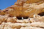
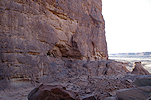
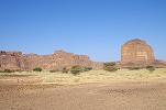
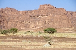
The Fada mountain contains numerous rock art sites, in fact one of the principal styles was named by Bailloud after the largest site here. However with the stops in Fada usually restricted to fueling and paperwork, we never had the opportunity to take a look at the mountain. Apparently others fared in a similar manner, as even in Simonis et al. there are no photos of Bailloud's sites on the mountain. This time we agreed that while Djibrine and the crew go into town to fuel and do their shopping, we'll be dropped off at the mountain and explore until they finish and return. We left the cars at the eastern corner of the mountain, where a sandy slope offered easy access to the prominent terrace skirting the uper cliffs of the mountain. On climbing up, we saw that this terrace is the same that formed at many other nearby places, where the softer Silurian shales (with the characteristic Arthropycus trace fossils) allowed for a more rapid erosion. Walking along the terrace we found a few minor sites with paintings, but it soon became clear that the main site was not on this terrace, but on another one much higher up the hillside.
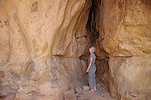
The route to the upper terrace proved to be very difficult, in the end only I managed the steep climb that had a rather uncomfortable section with no good footholds and a nasty vertical drop underneath. Reaching the top, it became clear that this terrace is a veritable fortress, with vertical walls preventing access everywhere except along the narrow rising ledge I took, which could easily be defended against any hostile invaders. There were the remains of an ancient village on the terrace, clearly the inhabitants of the Oasis used this as a refuge in times of danger. The terrace has a commanding view over the present town, any movement on the plain could have been spotted from afar.
Bailloud's Fada I site is at the centre of the terrace, a large prominent but fairly shallow shelter which just barely provided some shade at midday, and would be fully exposed to the afternoon sun.
The paintings in the shelter were a pleasant surprise. I feared that with the closeness of the town and the fighting during the war they might be damaged, but all the panels copied by Bailloud with the exquisite Fada style figures are intact, very faint but can be restored perfectly with dStretch.
I explored the rest of the terrace but could not find Fada II (now I know I should have looked a bit higher), however found ample evidence of the war, with numerous pieces of shrapnel and spent casings littering the ground, as well as a large rock with modern graffitti documenting the presence of Chadian defenders. Below on the sandy plain several camel caravans passed allowing perfect photos of the oasis, then our cars appeared at the edge of town and I made a hasty descent to join the waiting others.

For lunch we moved to Darko, the mountain abeam of the northern end of the Oasis, roughly four kilometres from the Fada mountain. Here Yves Gauthier found a shelter with some interesting archaic-looking paintings, they were certainly worth a look while Hassan prepared the midday salad from the fresh vegetables bought on the Fada market.
In reality the rocky range between Darko and Fada is one continuous mountain, split into sections by narrow sandy passes. Bailloud's sites of Hotoum and Djoki are along the central sections of this ridge, but neither have been located, and the area was never systematically searched to my knowledge. It would take a good 2-3 days to survey all parts of the mountain, something we may hopefully do on a future trip.
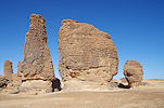
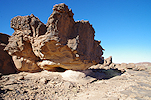
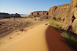
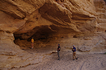
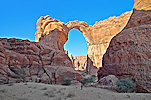
This time our hopes were focused on Mayguili, another one of Bailloud's "lost" sites, somewhere about 8-10 kilometres south of Fada. Bailloud did publish a photograph taken at Mayguili showing a valley and some rock outcrops. It was not stated whether it was taken from any of the rock art sites, but presumably so, meaning the sites had to be searched for on the top of the plateau south of Fada, rather than along the level of the plain. I have tentatively identified the likely location of the photo on Google Earth, this time we were determined to take a close look, and hopefully find the sites. With the cars we drove to the mouth of the supposed valley, and from there we continued on foot in a rapidly narrowing canyon. After a hundred metres or so we found the valley to open up again, leading towards the interior of the plateau. We passed a large but now dry guelta at the base of a dry waterfall capped by a natural arch, and some bizarre rock towers before reaching the end of the valley, blocked by an ascending slope of sand.
We climbed the sand slope, and once reaching the top and looking back towards the mouth of the valley it was clear that we were looking at the view captured on Bailloud's photo. At the base of the cliff there was a long shallow shelter, it did not take long to find a fine panel of cattle which matched Bailloud's tracing of Mayguili I.
Mayguili II could not be far. We continued back along the edge of the cliff, and soon came upon a large cavern, which however turned out to be empty, despite the attractive location.
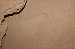
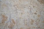
We did find Mayguili II a short distance beyond, a rather inconspicuous shelter at the base of the cliff. After a short search we did find the two dark figures after which Bailoud named his archaic style on the ceiling. While not evident with a naked eye, dStretch reveals the left figure to wield a spear and a shield, which is completely at odds with the identification of these figures as archaic. However the bigger surprise was the right wall of the shelter, which was covered with a large panel of paintings with complex superpositions. The row of small white figures that were copied by Bailloud in isolation are in reality superimposed by pastoralist paintings, and there are more of the dark round headed "Mayguili style" dark figures also superimposed by cattle.
We still had plenty of daylight left, we continued exploring the rest of the rock outcrops, and found another shelter nearby with a single Hohou style cattle depicted on the right wall.
There were several more shelters visible around the perimeter of the sandy plain at the top of the valley, we checked all but found no more paintings. We retraced our steps in the valley back to camp at the entrance of the narrow gorge, very satisfied with the results of the afternoon.
Day 13. Mayguili Taole Kokoli - Baradergolo
There was a strong but not unpleasant breeze overnight, it was only in the morning as we packed camp and looked out towards Fada that we realized there was a proper sandstorm on the plain, from which we were protected by the surrounding high cliffs.
Fortunately by the time we started the wind subsided somewhat, and we could drive in good visibility towards our next target, Egme China. As we proceeded to the west, we passed a large inselberg with a conspicuous shelter in the side a few kilometres from our route. Djibrine was not aware of any rock art there, nor was I, but it looked too promising to pass. We approached the hill, and did find some meager rock art in the shelter, defaced by some modern inscriptions dating from the latest rebellion. Koen walked a bit further in search of animal tracks, and a few dozen metres away he found a small shelter with many depictions of horses, cattle and goats in a very crude style. By accident we have stumbled upon the site of Erchigué I, recorded by Bailloud. The left wall was fully on the sun, but with a combined effort it was possible to crowd out the sunlight for photography.
We continued to the spectacular site of Egme China 01, first reported by Pier Paolo Rossi some years ago, who showed it to us on the 2018 expedition. There are numerous well preserved scenes of Fada style paintings throughout the long shelter in the side of a cliff.
We also made a quick stop at the nearby Soro Kezenanga I, arguably the finest Fada style site recorded by Bailloud. Its precise location was lost until we managed to re-locate it after a days' search during the 2018 expedition.
From Soro Kezenanga we drove another 20 kilometres towards the south east to the broad valley of Taole Kokoli, where Bailloud recorded a unique archaic leopard hunt scene. Yves Gauthier noted another seven sites in the valley, we planned to spend most of the day here to visit all.
The two shelters along the northern side of the valley are minor, with only a few cattle in the first, and a single one in the otherwise quite spectacular and promising second.
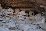
The main site of the valley (Bailloud's Taole Kokoli II) was roughly opposite on the southern side, a huge shelter that was still being utilised, there were several recent storage constructions and left-behind belongings.
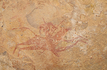
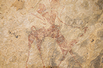
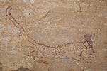
We found Bailloud's hunting scene right above a modern storage construction, it almost reached the level of the paintings but fortunately did not cover any. It is clear that it was built some time after the nineteen nineties, it does not appear on the published photos of Adriana Ravenna. The animal iss surrounded by several hunters, and there are two ostriches in dotted outline which may or may not be a part of the scene. After taking a good look at the spotted feline, based on the body proportions and shape of the tail Koen suggested that perhaps the "leopard" is in fact a cheetah, a more likely candidate in this environment.
On the right wall of the shelter there is a very faint panel of archaic human figures (the same style as in the hunting scene), they can only be truly appreciated after the photos are processed with dStretch.
Immediately to the west of Taloe Kokoli II there are several smaller and larger shelters with only a few paintings in various states of preservation.
In a small side valley there is a long shallow shelter that contains a small but very well preserved panel of Fada style paintings on a smooth patch on the ceiling.
The largest site of the Taole Kokoli valley is near the western end, a large double shelter with a terrace in front that had been fortified by a low semi-circular stone wall at some point. The paintings are a mix of the pastoralist styles of the Ennedi, in a reasonably well preserved state.
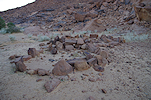
The far side of the thin long remnant of the eroded plateau that forms the southern side of the Taole Kokoli valley faces a broad open sandy plain towerds the south. The shelters of Baradergolo are just a few hundred metres south of the Taole Kokoli sites, but require a legthy circuit to the west over some rough rocky terrain to reach. After lunch at the last Taole Kokoli site we drove south, and it took nearly two hours to be again a mere 800 metres from our starting point as the crow flies. Bailloud's Baradergolo I is a large crescent-like depression in the cliffs, with a series of shelters at its base, four of which contain paintings. A broad terrace is in front that here too is enclosed by a low perimeter wall, hard to say whether for fortification or just to pen the animals.
The "dancers" are in the third painted shelter from the left, a little to the right of the centre of the crescent. The main panel of paintings is located on the ceiling of this very small shelter.
The smaller shelters to the left contain fewer and more damaged paintings, but still there are a number of noteworthy scenes,
The rightmost shelter is a veritable cave, leading deep inside the rock. It is not accessible from the main opening, but there is a low tunnel leading to the interior from the side. The walls are covered with both cattle pastoralist scenes, and many of the classic Ennedi camel riders.
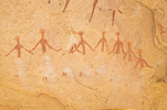
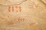
We made camp at a suitable spot a little to the east of the main sites, and spent the remaining daylight to visit Baradergolo 01, a small shelter in the side of the rocky mountain with mostly nondescript paintings, and one exceptional scene which warranted the visit. The scene is very faint, but it appears to show a row of human figures in a boat, which would be an exceptional depiction given the very few such scenes in the entire Sahara. A polichrome cattle was superimposed and partially obscures some of the details. It appears that some of the human figures extend through the "boat", which too seems to be a superposition and not necessarily a part of the original scene.
The view was still hazy from the morning sandstorm, but we could make out the mountain of Terkey about 25 kilometres towards the south beyond the sandy plain. There was also a very tempting large shelter in the rock above camp, it was too close to sunset to investigate, so we left it for the morning.
Day 14. Baraderglo - Archeï
In the morning at sunrise I made an attempt to reach the shelter above camp, while the others provided moral support from the breakfast table. I did manage to find a reasonably easy way up to the terrace on the same level as the shelter, which were connected by a 40-50cm wide ledge covered by a low overhang, with a 50 metre near vertical drop to the side. If being chased, I could have crawled along the ledge with some hesitation, but with a lesser incentive I thought it better to leave it to someone crazier than I am... At least the view was nice, but still very hazy.
Leaving camp we bumped along the grassy plain until we hit the main track leading from Fada to Archeï, which we left the previous day when visiting Taole Kokoli. We continued on the track to the point where the sandy plain suddenly gives way to a steep sandy slope that leads down to the level of Archeï and the surroundiing open desert, with an amazing view of the scattered rock formations below. There is also a pass leading down along a more circuitous gradual slope, but no doubt it would be a difficult way up in the soft sand.
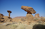
Not far from the bottom of the pass Djibrine showed us a group of amazing stone mushrooms at Toboro. Just beside them under a flat rock we found a panel of crude paintings depicting cattle and camels.
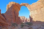
We continued towards the east on the track, and soon reached the prominent double natural arch (referred to as "Hadrian's Arch" in Choppy et al. 2002) which marks the edge of the area of Archeï.
South of the arch there were two of Choppy's recorded sites Archeï 15 and 16, which we always bypassed on previous visits, now we intended to spend the morning to find and see them. All are complex sites, Archeï 16 is a series of shelters along the southern side of a large rock island, the rightmost (16A) containing a number of the round-headed Tamada style figures.
Remaining on the same level, there are two more shelters with paintings towards the left, a small low shelter with a Hohou style figure (16B) and a large nearly vertical rock wall with some intriguing archaic-looking ostrich and horned animal figures (16C) with no ready parallels.
Archeï 15 is at the tip of a rock island a short distance to the south, a large site with several panels of paintings, including one with a number of Hohou style figures, the earliest of the Ennedi pastoralist styles. Looking at the scenes it is clear that they were copied very selectively in Choppy et al. 2002.
On the far side of the inselberg there is a long shallow shelter (15B) a good hundred metres from the tip of the island where the main panels are located. The shelter is now used by nomads to store belongings, but there are also several large panels of paintings in it. Choppy et al. copied some of the scenes, but from the description it is not evident that they are in fact a separate site.
Continuing towards the Archeï guelta we passed by the small site of Archeï 13. It is just off the main track, but on previous trips we were always pressed for time and had more important objectives.
For the benefit of Koen and Attila for whom this was their first visit to the Ennedi, we also stopped at the lovely Archeï 10 site, which contains some very fine Fada style panels, certainly worth the small detour.
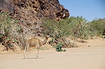
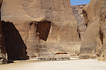
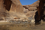
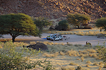
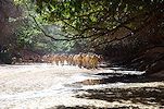
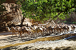
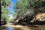
We reached the Archeï guelta by midday. Stopping for the midday rest in the shade of trees next to the Archeï 1 shelter, we visited the pools while Hassan prepared the salad for lunch. It was all eerily quiet, we were quite surprised to find only a few camels at the guelta instead of the usual hundreds. Obviously with the good rains all the wells in the area provided abundant water, there was no need to make the trek to the guelta from the grazing grounds.
After lunch we also took time to visit the nearby Archeï 1 shelters and the huge cave of Archeï 2 situated on the far bank of the riverbed.
Our main remaining target for the afternoon was the "Grande riparo" (Archeï 4), the most important site of the region. However with the panels only properly visible in the late afternoon (or early morning) once they come into the shade, we had plenty of time on our hands to find the cluster of small sites located by Yves Gauthier and party some years ago to the east of the guelta. The sites are quite unassuming, certainly not something to go out of the way for, but there is one unique depiction which resembles a fish (or something...).
When we reached the "Grande riparo" (Archeï 4) the sun was not quite low enough yet, we had to wait some time for the panels to move into the shade. However this provided an opportunity to take a good photo of the pair of cattle which are both painted AND engraved, a very rare occurrence.
Day 15. Archeï - Tokou - Anoko Arch
We spent the night near the start of the trail to make the obligatory trek to the viewing point above the Archeï guelta with Attila and Koen, while Ursula elected to have a lazy morning in camp. I was delighted to recognise that our guide was again the daughter of the local chief, who guided us in 2016 as a mischievous young girl of 11-12. Now she was a grown woman (as Djibrine later told me married with two children), but there still was the same cheeky twinkle in her eyes, so unlike any of the other women we have met in the region. We climbed up to the vantage point, and waited for the first camels to appear. The crocodiles were nowhere to be seen this time, despite the unusual quiet at the pools below.
It was mid-morning by the time we returned to the cars. We dropped our guide at their house, then drove to the well near the new village a few kilometres to the south of the guelta to refill our water containers. There was much more bustling here, the well is much closer to the grazing grounds than the guelta.

The plan for the day was to visit the cluster of sites along the eastern edge of the broad valley leading south from Archeï (opposite the mountain of Terkey). Somehow these never made it on to the itinerary in the past, though there are several important ones, some recorded by Bailloud, others reported in Simonis et al. We started out at the isolated inselberg of Breyala, with a large shelter in the side which we found full of belongings.
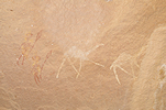
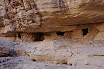
There are around two dozen rock art sites in the enclosed valley surrounding the Tokou well. Unfortunately by the time Bailloud visited he was out of sheets of paper to trace on, only two photos were published in his book (Tokou XI and XVII), so there is no record of which sites did he visit and how did he number them. One of Bailloud's sites (Tokou XI) is at the entrance of the valley, a huge shelter with several horizontal ledges. With some difficulty I could get up to the first level, where there is a large panel of the naive style cattle and horses which represents the final phase of rock art in the Ennedi. There is also a nice panel of camel riders high up on the ceiling, but without a ladder it is impossible to approach them.
There were a number of small sites at the entrance and along the southern side of a small side valley with the end open towards Archeï, providing a convenient shortcut to the well for the herds. We parked in the shade and explored the shelters while Hassan prepared lunch. There were several panels which were impossible to access, the passages and footholds leading to them must have eroded away in the intervening millenia. We had to be content with taking photos from below.
We did not yet find Bailloud's site XVII, apparently the most important in the area. After lunch we continued deeper into the valley, and there it was, just a few hundred metres further. This too was high up, but fortunately it was possible to get up along a fairly easy path, with Baillouds photographed scene of the Tokou style horse riders on the rear wall.
The Tokou XVII shelter was quite large and contained many more paintings, including a faint but fine panel of Fada style paintings, as well as several horses in the characteristic flying gallop.
Based on Bailloud's numbering there must have been many more sites at Tokou, but we did not know their precise location and searching for them would have taken up the whole afternoon at the expense of some other known sites. Thus we continued towards the south west, and just as we passed the mouth of the Tokou valley we startled a large band of Patas monkeys, who fled up the near vertical cliff with astonishing skill.
Soon we entered a broad valley between the Tokou massif and a long outlier known as Homechi. Bailloud recorded a fine site, Homechi IV along the northern side of the valley.
A short distance to the west Ursula found another site, barely qualifying as a shelter, with some nice Fada style paintings.
We were not aware of any more sites in the valley (again, Bailloud only photographed this single site, though there are a few more shelters on the outer side of the Homechi hill, which we did not visit), but there were a few pominent shelters on the southern side not far off our route which warranted a look. They all bore traces of recent habitation, a veritable ethnographic museum with all the left behind possessions. We only found a few insignificant paintings of white goats in the very last shelter to be checked.
The last site to be visited was Dahili Tili, another one photographed but not copied by Bailloud, on an outlier of the main massif a few kilometres beyond Homechi. It is a small and difficult to access shelter (not made easier by the thorny branches left there by nomads to protect the belongings placed there from hungry goats), with the panel of paintings in a small niche at the right now completely inaccessible.
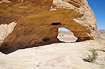
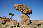
For camp we drove another 25 kilometres to the east to the Anoko Arch, a huge triple natural arch formed from an outlying block through the combined efforts of wind and water over millions of years. We intended to camp somewhere close with a good sunset view of the arch, but the ground everywhere was thickly covered with kram-kram, there was no choice but to camp at the arch itself, where only the heaps of goat and camel dung needed to be swept aside...
Day 16. Anoko - Kettara - Sini - Bachikele
After the quiet evening a howling wind arose overnight, scattering all our lighter camp equipment. We huddled against the wall of the arch for a quick breakfast before moving on. Strangely visibility remained good, apparently with so much vegetation about, the wind was unable to raise enough sand and dust.
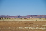
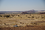
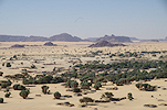
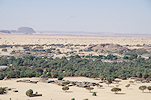
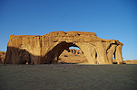
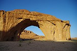
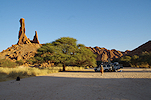
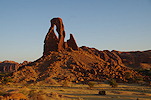
Our first stop was to be at the Aloba arch, one of the largest natural arches of the world (and to my knowledge, the largest in sandstone country, only the arches of the limestone country of China surpass it in dimensions). As we drove through the broad basin of the Oued Djoua, it was astonishing to see the amount of grass and other vegetation, the landscape reminded one more of Namibia rather than the Sahara.
We reached the Aloba Arch by mid-morning, leaving plenty of time for Attila and Koen to take photos in the perfect morning light. The play of light and shadows prompted me to play with the HDR function of my camera, in all fairness I'm not sure I like the result... The amazing backdrop also called for a group photo before moving on to Kettara.
The last time we visited this part of the Ennedi, we did not have time to visit Kettara 01, a site reported by Choppy et al. (2003) in the hills to the west of the Aloba Arch. Now we had the time, plus some added incentive as Yves Gauthier and party found some interesting archaic-looking paintings here. We merrily drove to the entrance of the valley where the GPS indicated the site at a distance of two kilometres, only to realise after covering 1.5km on not particularly easy ground that the site is in fact in the valley to the south, on the far side of the rapidly closing-in cliffs. After a trudge back to the cars (and another lesson learned on not to blindly follow a GPS) we drove with the cars right to below the shelter. It was only after the trip, comparing photos, that it became evident that Choppy's and Yves' localities are two different sites, we could not find any trace of the scenes published by Choppy (probably in another similar shelter a few hundred metres away).
We continued to the known big site of Kettara 02 a few kilometres away. In 2016 the panels were already exposed to the afternoon sun, now we made sure to arrive earlier in the morning while all were still in the shade.
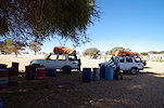
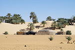
For lunch and the midday break we moved into the Sini valley, where Choppy et al. (2003) reported a number of rock art sites. The valley had a dense grove of acacias bordering the main watercourse, we settled down under the shade of some of the largest trees. We saw many large brown jewel beetles (Sternocera castanea) flying about and mating on the branches above us.

The principal site of the valley (Sini 04) was just a few hundred metres from where we stopped for lunch, we visited it while Hassan prepared the customary salad. It is not extraordinary, but contains several very well preserved pastoralist scenes.
The valley was full of small villages, with people and animals everywhere. These were no longer Tibou villages but Zaghawa, with permanent mud-walled round huts, rather than the mobile thatched houses of the Tibou nomads. While we were clearly welcome (especially after handing out some medicine to the local chief), we felt better to move on to a more quiet area for our last proper camp in the Ennedi. On the way out we stopped at one more site, Sini 06 before continuing to Bachikele.
Our last camp was at the same spot as in 2016, in the sandy riverbed under the spectacular natural arch near Bachikele village. After checking in with the village foreman, we spent the remainder of the afternoon wandering about, enjoying the spectacular scenery till sunset.
Day 17. Bachikele - Somporo - Kalait
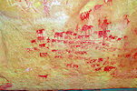
I only learned recently that the major site of Kobou (Lenssen-Erz 2012) is within walking distance of our campsite. While our crew packed camp, we set out on foot to see this large site at the side of an impressive inselberg, in a commanding position overlooking a valley. There are mostly cattle pastoralist paintings here (in a style not quite fitting into Bailloud's established categories), but Yves Gauthier found a series of archaic figures under the more recent paintings (Gauthier & Gauthier 2018). The most impressive part are the "sitting giraffes", a group of animals drawn in a strange perspective that appears elsewhere in the Sahara (e.g. Tibesti, Red Sea hills of Sudan), but only in engravings.
By the time we finished taking photographs, the cars appeared approaching in the valley, and we drove the short distance to the Bachikele guelta, another one of the spectacular natural wonders of the Ennedi, deeply hidden at the end of a long narrow canyon. Here too it was unusually quiet, we encountered a single herd of camels on their way out. The guelta itself was completely deserted when we reached it, a huge contrast with the thousands of animals cramped in on the previous visit.
This was really the formal end of the trip, the remainder was just getting back home. A few days earlier Djibrine discretely approached me with a request: his daughter in-law and newborn baby needed a hospital visit in N'Djamena, and they were somewhere in the Archeï area, could we take them with us? With a free place available in the cars, naturally we obliged, so now we drove back towards Archeï to collect her. This provided us with one last rock art site visit at Somporo, just by the track, where we checked out one locality likely to hide Choppy's Somporo 01. We did find a shelter at the likely spot (identified on Google Earth), with some horse riders in flying gallop, but later matching the photos it became clear that this is a different site in the same general area.
We collected the young woman (or rather an older girl, perhaps 17-18, we never learned her name) and the little few months old baby girl who was remarkably quiet on the entire journey, just looking at us with half frightened, half curious big dark eyes. When we stopped, she always sat separately under a shrub at some distance, with Djibrine attending to her needs. When we first saw her at the hut near Terkey, she appeared the same as all the black-clad women around her, but quickly we caught the glimpse of a colourful silk dress underneath and an expensive handbag filled with mobile phone and other modern female necessities. One particularly surprising thing to note was that the baby wore disposable diapers, with a large supply in her traveling bag. She never said a word to us, but once we were on the way, with Djibrine and Hassan in the car, she broke into a loud and lively chatter with both, apparently completely ignoring my presence.
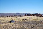
That afternoon we drove till the outskirts of Kalait (to be within mobile range for Djibrine and Hassan), making camp among some picturesque granite boulders.
Day 18. Kalait - Wadi Achim - camp before Kouba Olanga
The next morning we drove into Kalait to fuel the cars for the homeward journey. This time we intended to take the alternate route, direct across to the Bahr el Ghazal, saving many kilometres though not much time, but at least prolonging our time in the desert.
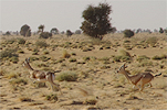
The track from Kalait to Kouba Olanga at the northern end of the Bahr el Ghazal took us through the Wadi Achim reserve, the region where the Sahara Conservation Fund released the White Oryx and Addax antelopes, which now are in their third generation, establishing a healthy population. While we did not expect to catch a glimpse of any close to the traveled track, it was still a perfect opportunity for Koen to see the area with his own eyes. We also did see some wildlife, including an unexpected encounter with a large desert monitor lizard, and several herds of Dorcas gazelle.
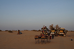
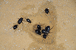
By the evening we reached a nice area of low dunes about 80 kilometres short of Kouba Olanga. One particular feature was the omnipresence of darkling beetles, there were dozens about on every dropped scrap or spilled water, in the evening it was impossible to walk back to our tents or beds without hearing the odd crunching sound underfoot.
Day 19. Kouba Olanga - camp after Moussoro
This day was pretty much an eventless long drive back towards N'Djamena. The only excitement was in the morning, when soon after camp we encountered a family of fennec foxes on the sandy plain.
We soon reached the Bahr el Ghazal, and continued on the dusty track among the dunes and increasingly dense vegetation towards Moussoro, which we reached late afternoon. After fueling we had enough time left to leave town, and drive another ten kilometres or so before stopping for the night in a patch of sandy ground some distance from the track.
Day 20. Moussoro - N'Djamena
In the morning we packed our last camp adjacent to some acacias which were full of some strange conical cocoons. The most likely culprit is some moth species, but we haven't been able to figure out exactly which.
In about two hours we reached the end of the asphalt road at Massakory. We continued pretty much non-stop to N'Djamena, as we needed to be there before 2pm to do the obligatory PCR tests. We already received the news of the spreading Omicron panic, Air France mandated a test for all travelers since a week before our planned departure. Fortunately we were prepared for this eventuality and planned on returning a day early to allow for any such change of regulations. We checked in to the Irrisor hotel, where Faris was very happy to see us back in one piece, and whisked off Attila, Koen and Ursula to the hospital for the test (me, going with Turkish through Istanbul, did not need one, proof of vaccination was enough).
Day 21. N'Djamena
This day was just a quiet day of relaxation and checking emails in the pleasant garden of the Irrisor (formerly Ibis/Novotel). The tests came back negative, and in the evening we all went to the airport to catch or flights home.
We plan to return to the Ennedi in November 2023, re-visiting Niola Doa and the many other rock art and natural wonders of the south western Ennedi. We will also spend some time trying to re-locate some of the remaining "lost" sites of Bailloud. Please visit the planned itinerary page for more details (or "like" the FJ Expeditions FaceBook page to receive notices of news and updates).