
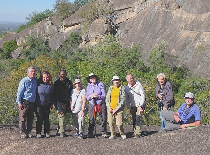
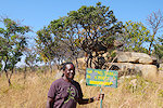
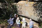
 Click on image for list of participants |
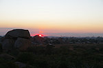
Rock Art of Zimbabwe 24th June - 11th July, 2025 |
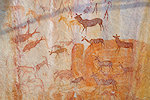
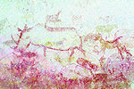
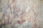
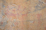
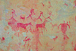
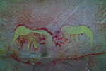
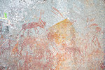
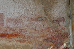
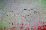
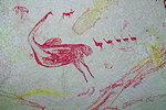
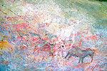
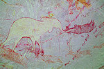
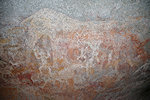
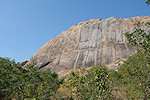
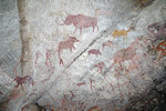
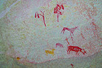
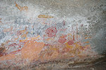
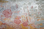
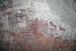
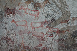
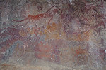
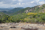
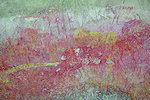
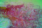
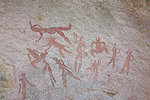
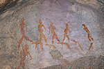
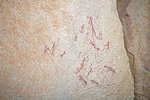
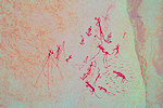
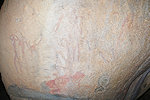
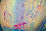
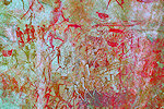
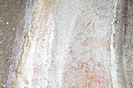
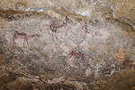
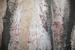
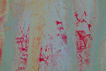
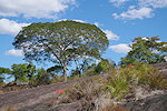
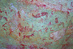
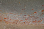
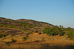
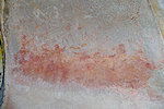
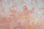
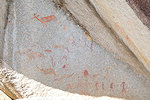
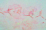
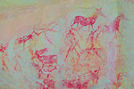
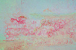
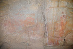
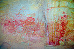
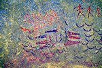
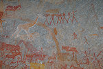
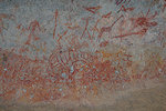
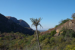
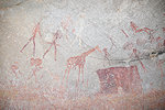
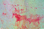
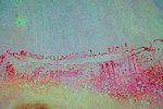
Zimbabwe is well known for its magnificent rock art, some of the finest on the African continent if not the world. This trip was long in the making, with munch conflicting information about the conditions within the country and accessibility and state of preservation of the sites. Having plucked the courage to go ahead, we found a beautiful and by African standards perfectly functioning country, very kind people, surprisingly good roads and rock art that surpassed all our expectations both in sheer quantity and quality. Our guide was Willard Nyambya, formerly of the National Museums of Zimbabwe, one of the very few locals actively engaged in the study of rock art. The sites we visited are almost all published, most importantly in Goodall, Cooke & Clark, Prehistoric Rock Art of The Federation of Rhodesia & Nyasaland (Chatto and Windus 1959), Breuil, Southern Rhodesia: The District of Fort Victoria and Other Sites, (Trianon Press 1966) and the small but very useful booklet by Cooke, A Guide to the Rock Art of Rhodesia (Trustees of the National Museums and Monuments of Rhodesia, 1974).
Day 0. Harare
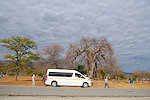
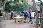
Our party arrived mostly via Johannesburg with various flights, some the day before due to connections or to recover from jetlag. The only hiccup was when Hans Peter failed to arrive with the announced Airlink flight, it quickly emerged that Lufthansa to Jo'burg had a technical problem and was delayed by nearly half a day, he was likely to miss the last connecting flight in the evening. While I was was busy looking at the best alternate options, I noticed Hans Peter sitting by the poolside merrily sharing a beer with the others. It turned out Lufthansa rebooked him via Addis Ababa and arrived just an hour late, making his own way to the hotel.
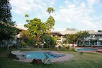
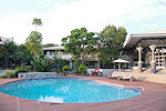
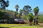
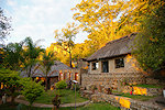
In Harare we were staying at the Cresta Lodge, a hotel somewhat removed from the city centre with a nice big garden and a fine restaurant. It was a good base, with quick access both to the airport and the main directions for our intended travels.
Day 1. Lake Chivero - Kentucky Farm
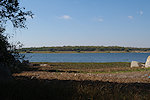
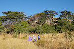
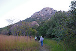
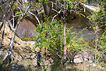
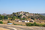
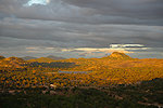
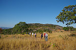
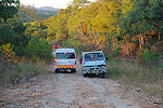
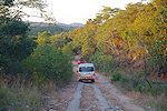
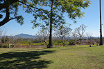
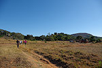
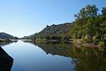
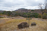
To make the most of the short winter day we had an early breakfast still in twilight. Willard arrived with the minibus driven by Rodrig, a very skilled driver who was always smiling no matter what. We set out before the mid-morning traffic, crossing the city towards the west. We reached the dam that created lake Chivero in about an hour, and entered the Lake Chivero (formerly Robert McIlwaine) National Park along its southern shores.

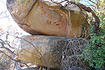
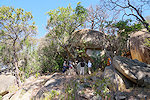
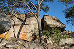
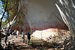
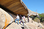
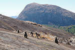
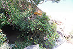
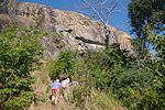
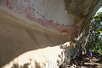
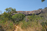
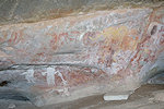
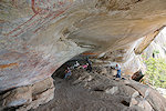
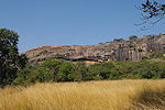
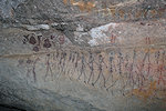
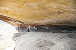
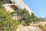
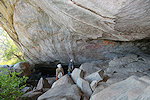
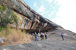
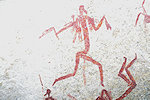
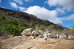
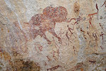
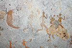
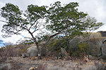
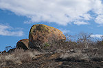
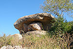
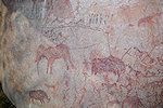
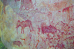
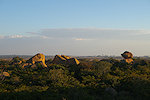
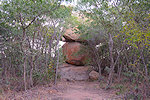
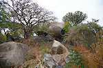
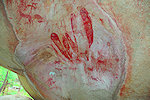
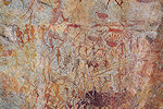
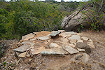
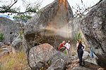
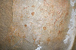
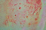
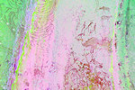
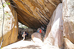
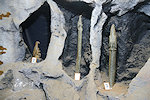
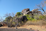
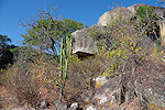
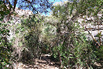
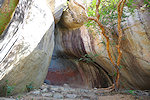
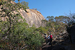
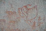
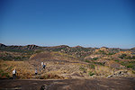
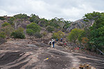
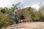
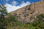
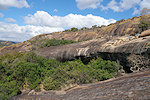
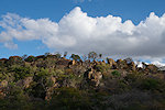
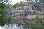
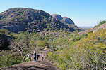
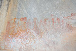
Our first target was Bushman Point, a well known major site at the eastern end of the park. Obviously it is not a frequented place, the tracks leading there are not signposted, it took some time of trial and error until finally we hit upon the right track and reached the end of the road from where a short footpath led to the cluster of huge boulders on the lakeshore. Our first encounter with rock art in Zimbabwe already surpassed all expectations, the site was much bigger than I imagined, and in a very good state of preservation, defying many of the hearsay information about vandalized rock art in Zimbabwe.

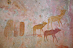
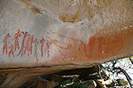
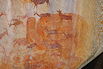
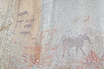
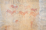
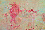
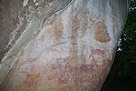
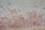
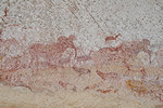
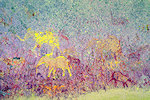
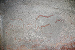
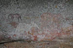
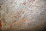
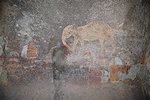
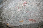
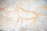
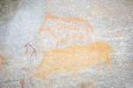
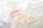
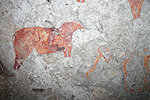
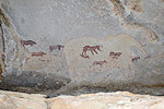
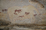
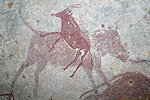
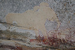
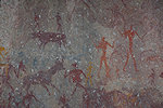
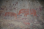
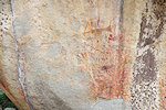
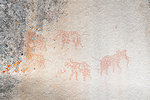
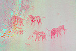
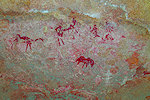
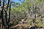
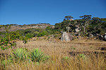
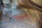
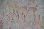
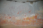
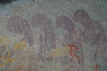
Returning to the eastern end of the park we needed to do another search for the Kudu Panel, a smaller but very fine panel of paintings reachable on a short but now almost completely overgrown footpath leading from the car track to another cluster of granite boulders. Willard did not visit this site before so we had to check all the rocks, we soon found the shelter along the southern side. The most striking are the three very fine depictions of kudus, but there is also a cute small warthog next to them.
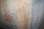
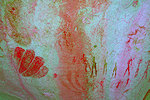
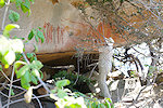
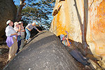
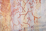
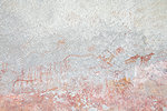
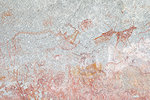
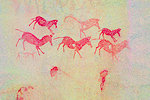
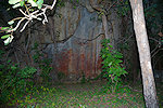
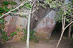
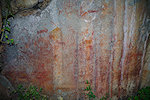
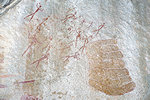
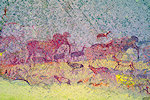
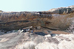
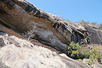
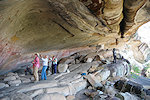
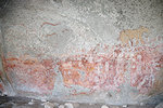
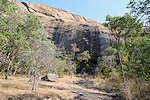
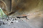
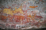
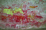
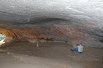
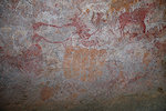
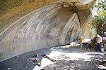
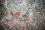
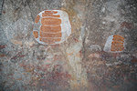
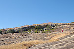
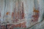
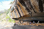
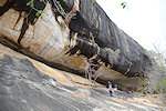
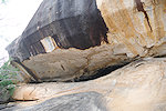
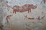
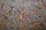
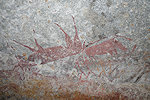
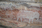
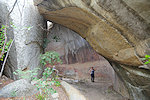
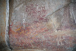
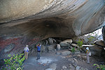
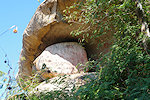
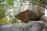
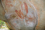
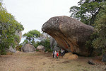
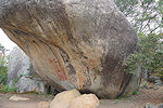
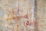
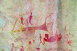
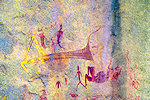
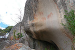
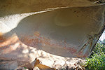
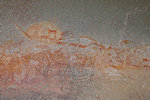
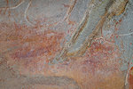
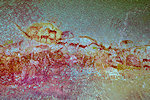
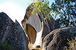
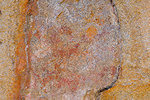
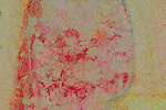
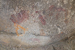
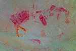
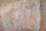
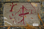
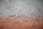
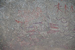
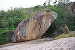
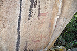
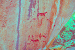
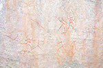
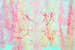
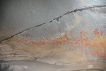
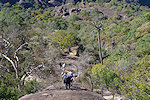
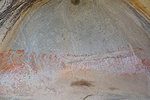
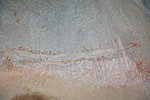
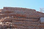
The last site and the most important one was Crocodile rock near the entrance of the park. There was an old weathered sign at the start of the footbath, but the path itself was completely overgrown, clearly there are few if any visitors. On the way we passed a smaller panel of paintings that unfortunately is damaged by the excrement of Dassies (Rock hyrax) living on the rock above. Continuing we found a very overgrown concrete stairway leading up to the rocks, with the astonishing panel clearly visible above. The paintings are astonishingly bright and well preserved, again contrary to all expectations. One observation we made was that despite the scene being referred to as a crocodile hunt in publications, the human figures and the two crocodiles are clearly two layers, the serrated line at left is not a spear held by the human figure, but the belly of the crocodile.
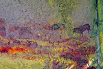
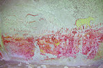
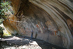
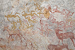
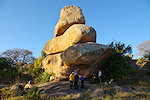
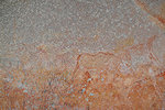
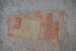
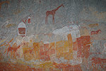
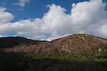
In the afternoon after a quick lunch we headed a good sixty kilometres further west, at first on good asphalt, then on smaller bumpy unsurfaced roads to Kentucky Farm. This time the directions were clear, we could drive to within a 100 metres of the low granite knoll which contained the large and astonishingly bright and well preserved panel of paintings.
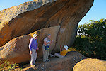
On a somewhat lower level we found another lesser but still impressive panel, which in Namibia would have been considered a major site by itself. By the time we finished taking photos it was already late afternoon, we just reached the asphalt by the time the sun set behind us, and it was pitch dark by the time we reached Harare.
Day 2. Domboshava - Ngomakurira - Mumurgwe Hill - Bindura
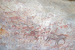
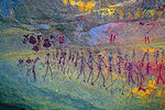
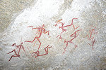
With another early start we left Harare, this time towards the north, on the first of a three day excursion to Central Mashonaland, using the town of Bindura as a base. We started at Domboshava about 30 kilometres north of Harare, due to the closeness the most visited rock art site of the Harare region. The main cave is situated quite high on a granite hill, taking a good 30 minute climb to reach it. As anticipated, this site was in a much worse state than the ones seen the previous day. It was heavily vandalized in 1998 with and despite a thorough cleaning and restoration the damage was irreversible. Still it is a very impressive panel with a multitude of human and animal figres, much larger than the panels seen the previous day (and anything known from Namibia save for a few of the largest shelters like Riesenhöhle on the Brandberg or Ekuta cave in the Erongo).

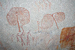
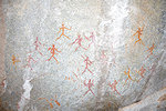
The main cave is flanked on both the eastern and western sides by two smaller satellites a few dozen metres away. The paintings in the eastern one are very faint, but the western one has a well preserved interesting panel with human figures around a tree covered with dots (swarm of bees?).
Ngomakurira is just 8 kilometres beyond Domboshava, the other site which may still be considered to bo on the Harare vicinity 'tourist trail' (but we saw no other tourists). It is a fairly tough and steep climb up to the first site, which is located not in a cave but at the base of a huge vertical cliff. Due to te exposed location and the frequent water flow over them the paintings are more weathered, and as the area is densely inhabited there are numerous charcoal graffiti (fortunately DStretch can eliminate those).
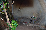
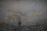
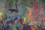
The second site at Ngomakurira is another hours' climb from the first, first up to the top of the granite mountain, then down a steep (and in places rather unpleasant) granite plate. In the end only Willard, Bruno and myself made the climb, the others went back to the bus for an afternoon rest. In the afternoon heat I wondered about our sanity, but as we reached the cave all doubt disappeared. It is a deep dark cave, with a tree growing in the middle cutting off most outside light, and it is used as a sanctuary by the local Christian sects, making it alive with offerings as it must have appeared in ancient times. The paintings themselves (two large yellow elephants and some smaller figures) are quite damaged (though some of the worst graffiti were cleaned recently), but the atmosphere of the sites more than makes up for it.
Return was the same way, we had to climb back to the top of the mountain as the steep smooth granite side offers no feasible way up (and only a very fast way down). By the time we reached the others at the bus it was well into mid-afternoon.

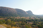
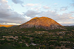
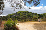
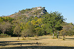
On the way to Bindura we had time for just one more site, Mumurgwe Hill (Lion's head), which we reached just before sunset. The mountain is indeed strikingly like the head of a male lion, the site with some very fine paintings is at its foot among a cluster of large boulders just beside the main road.
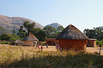
It was another hour's drive to Bindura, fortunately all on good asphalt, it was pitch dark again as we entered the town. We stayed at the simple but very pleasant Mayfair Lodges, the only available guest accommodation in town.
Day 3. Bindura - Chavadzimu - Chikupo - Bindura
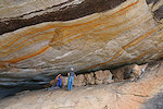
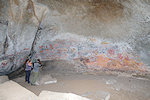
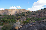
Using Bindura as a base we made a days' excursion to the finest sites of central Mashonaland. We passed the huge Nickel mine at the outskirts of Bindura and continued about a dozen kilometres south on the Harare road till Chavadzimu, where a huge shelter is just a short distance off the main road. It appears that it is very seldom visited (which is probably a good thing), it took some time to find the narrow and very overgrown path which leads from the side road up to the shelter.
The cave must have contained much more paintings than the ones visible today, there is a high band of weathering in the lower part, with the preserved scenes in a roughly 1 metre high and ~25 (!) metre wide band above. There is a multitude of layers and superpositions, with some complex scenes of humans and animals, the sheer volume of figures make it hard to make out all details on the spot.
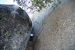
Chikupo is only three kilometres to the west of Chavadzimu, but it takes a circuitous 20 kilometres along a rather dismal track barely passable for the minibus to reach it. There are three distinct shelters in the side of the granite hill, the largest (Northern Cave) facing west and stretching for a good hundred metres along the cliff face. It is quite a challenge to reach it, as access is steep and slippery everywhere.
The walls at the northern end of the long shelter are covered with a multitude of paintings representing several layers with many superpositions, it is not easy to make out some of the individual figures. The most striking are the large elephants, and the last layer of large white human figures, the likes of which we have not seen elsewhere.
The southern part of the shelter contains some very fine scenes, not in a continuous panel but spread out in several sections. It is not possible to traverse the shelter along its length, one needs to scramble down the steep granite then climb back up again at the far end with the help of a conveniently placed tree that offers the very much needed support.
The Southern Cave is located about 200m from the Northern Cave across the valley at the base of a cliff, and is hidden from sight by a dense grove of trees. There is no easy direct route (the valley is filled with dense bush), it was better to return to the small village where we left the bus to take another path. This too is a huge cave with paintings throughout the rear wall.
The Western Cave is located on the far side of the same granite spur, facing directly west. From a distance it just appears as a crack in the granite, but close up it reveals itself as a spacious deep cave, with paintings both on the rear wall and on the low ceiling.
By the time we finished taking all our photos it was late afternoon. We returned to the small village and retraced our way along the bumpy track to the main road, this time reaching Bindura still in the last light of the day.
Day 4. Bindura - Zombepata - Harare
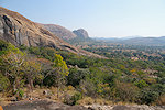
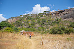
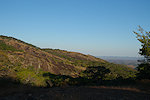
The site of Zombepata is somewhat removed from the main cluster of Mashonaland sites. It was a 100km drive from Bindura on surprisingly good roads, we covered this distance in little over an hour. The site itself is located near the summit of a large solitary granite outcrop, taking a good hour's climb to get to it. Fortunately we had a cool breeze, and some magnificent views during the ascent.
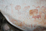
The most striking feature of Zombepata Cave are the large strange shapes of unknown meaning ("formlings" in local rock art speak) which clearly belong to the latest layer of superpositions (together with the large elephant). The older layers display the customary animal and human figures seen elsewhere. This shelter was a pleasant surprise as in published reproductions only the "formlings" are shown, omitting the rich and diverse other scenes.
By midday we were on our way down, taking another hour to reach Rodrig and the minibus parked in the shade of some trees beside a recently built but very abandoned-looking church. The drive back to Harare took less than two hours on the good road, we reached the Cresta Lodge in time for a little afternoon rest after the packed three days.

Day 5. Harare - Murehwa - Mucheka - Ruchera - Mutoko
In the morning we set out for another two day excursion, this time to Mashonaland East. Our first target was Murehwa Cave, located on the outskirts of Murehwa town, a long shelter in the side of a granite hill. Unfortunately the extensive panels of paintings are much damaged, both from dassie excrement and charcoal graffiti due to closeness of the town, but there are still a good number of interesting and well preserved details.
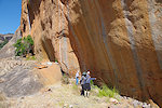
Mucheka Cave was just 15 kilometres away as the crow flies, but it was a very bumpy unpleasant 30 kilometre drive on some really bad unsurfaced roads, then a barely passable track for the last couple of kilometres. While it is one of the most magnificent rock art sites of Zimbabwe, clearly very few if any people visit it, the remote location provides excellent protection. The cave is situated quite high up a granite mountain, once there was a cleared path up to it, but now it is mostly a fight through the hillside bush from the small homestead at the foot of the hill.
On reaching the cave one first notices a fine panel of paintings on the outside wall. The entire panel is impossible to photograph in one frame, as the only place to view them is from a narrw ledge right underneath. There are some intriguing groups of human figures on the ceiling at the right side of the shelter.
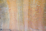
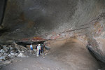
After a while one notices that the low dark opening in the centre extends deep inside. Climbing in it takes a while for ones eyes to adjust and realise that there is a spacious cave inside, and the walls are covered with spectacular and very well preserved paintings.
We took a long time to take photos and just marvel at the scenes, it was well into mid afternoon by the time we descended from the hill. after another hour of the bumpy road we reached Murehwa and the asphalt again, and continued past the town of Mutoko to Ruchera hill a few kilometres beyond. Ruchera Cave is situated in the side of the hill, a fairly easy climb compared to some other sites. The paintings are a bit more weathered, but here too there are some very fine details.
As we finished taking photos, sunset put up a very fine spectacle, the low light illuminating all the granite outcrops towards the south. We climbed off the hill and returned to Mutoko, to stay in the very pleasant Nyamakwere Lodges.
Day 6. Mutoko - Charewa - Gambarimwe - Madzimu Dzangara - Harare
After a good breakfast in the lodge we started out again, leaving Mutoko towards the west, then turning North on an absolutely dismal track. Our target was Charewa some 30 kilometres away, it says much about the road conditions that it took nearly two hours to reach the vicinity. Willard last visited many years ago, the tracks were now different, so we took a long detour on foot until we finally came within view of the shelter about midway up a granite hill.
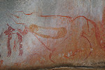
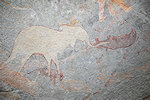
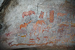
The most striking panel of paintings is at the left of the huge shelter on the rear wall, with a rather tricky access on account of the sloping slippery granite floor. A large elephant (which appears frequently elsewhere) is superimposed by a number of fine dark animal figures, the majority of them rhinoceros but also an elephant, buffalo and some harder to identify others.
The panels at the centre and right of the shelter are more conventional, with a multitude of human and animal figures, including the customary large elephants.
While we were busy taking photos Willard walked back to where Rodrig parked the bus before an impassable gully crossing, and after half an hour we saw them approaching on a track from the opposite direction. I was really impressed by Rodrig's driving skills, he could bring the low clearance 2wd bus to within a hundred metres of the hill on a track that was barely suitable for donkey carts. He could accomplish the same feat in reverse, and soon we were back on the "road" re-tracing our morning route. Gambarimwe Cave was about 20 kilometres to the south back along the track, then another kilometre off the road on a fairly clear trail. Willard knew the way this time, and after a moderate climb we were approaching the grove of trees obscuring the cluster of boulders which surrounded the huge shelter.
A continuous panel of paintings covers the rear wall for a length of over 20 metres. There are numerous superpositions, the individual layers are quite hard to make out, but the big white figures already seen at the Western Cave at Chikupo are clearly the most recent.
We descended from Gambarimwe hill the way we came. It did not register before, but here in the East the vegetation was denser than in the Harare region, all the hills were covered with a lush green canopy.
Continuing our way back, we made a little detour to visit the Madzimu Dzangara Cave near the main road. This particular site was one published by Leo Frobenius in his 1931 book on Southern African rock art, and while the site itself is not exceptional, probably the name captured the imagination of Frobenius as it became the title of his book. The cave is under a huge granite boulder visible from afar, the paintings are very weathered and also now covered with numerous charcoal graffiti due to the closeness of villages. Nevertheless, it was close to our route, it would have been a pity to give it a miss.
It was well into the mid-afternoon, we still had a good 150 kilometres to cover. We started back on the rough road to Mutoko, from where it was a smooth two hour drive back to Harare, which we reached an hour after sunset.
Day 7. Harare (Glen Norah, Epsworth Rocks)
This day was planned as a reserve in case we have a delay at any point along the way. Fortunately we didn't, so we could spend it to see a number of smaller sites scattered on the edge of Harare. We started at Glen Norah, a township at the south western edge of the city, with two localities. All these sites are located on clusters of granite boulders, the Eastern one on a rock face that is quite high up, with the original access now blocked by a large thorn bush (which is very sensibly not trimmed for protection). Willard had the foresight to arrange a large ladder for us to climb the rock to take photos.
The other site is about two kilometres to the west, also surrounded by built-up areas, and the adjacent flat area is used as the ceremonial place for the local Christian church. As we arrived there was a women's prayer session in full swing, we were at first a bit concerned to intrude, but it soon emerged that we were more than welcome to roam about and photograph the very fine panels.
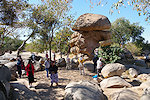
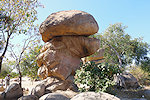
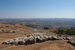
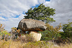
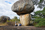
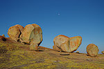
For midday we returned to the Hotel for lunch, while I went to the airport to collect Elmar, who due to other commitments could only join us at this halfway point. Elmar did arrive with Airlink from Jo'burg as planned, but minus his luggage, with a vague promise that it might come with the late evening flight. After an afternoon rest we drove a shot distance from our hotel to Epworth Rocks, a small nature reserve with some spectacular balancing rock formations (one of them even appears on the local currency). Not surprisingly there are several rock art sites scattered about the area.
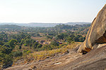
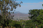
We stayed till sunset, climbing a cluster of rocks for a splendid view over the surrounding country and Harare in the distance. Fortunately later in the evening the last Airlink flight did bring Elmar's luggage, so we did not need to make any contingency plans to delay our departure the next morning. The first part of our trip making the round of the Mashonaland sites was complete, the coming plan was to make a thousand kilometre loop over ten days to the east then the south of the country, finishing up at Victoria Falls.
Day 8. Harare - Macheke - Diana's Vow - Rusape
Manicaland in the east of the country, bordering Mozambique, contains relatively fewer rock art sites, but among them arguably one of the finest in Zimbabwe. After an early breakfast we left Harare for good, heading east along another very good road. We reached the town of Macheke, about 100km to the east of Harare in little over an hour (instead of the entire morning as expected). Here Frobenuis reported a fine rock art site, which now is located in the centre of the town just a few hundred metres from the railway station. We expected the site to be much damaged, and were very pleasantly surprised to find it in a very good condition, apparently the locals respect and look after the site as we saw no charcoal graffiti like at other sites near settlements.
It took another hour to reach the Diana's Vow site (named after the farm, not in relation to the depicted scenes), a magnificent panel located under a huge solitary boulder. There is much speculation about this intriguing scene, Frobenius considered it to be a royal burial, which most likely it isn't. Having arrived much earlier than planned, we could stay to take photos or just enjoy for as long as we pleased.
On a higher terrace, among boulders behind the main shelter there are the remains of an early medieval settlement (muck later than the paintings, though the choice of location may well be intentional), typical of the high fortified chieftain's dwellings of the area.
There is another nearby rock art sites, named "Pink elephants" after the depicted scene. Willard has not visited it, we only had the rather vague description of Cooke. It was straight forward till the rocky hill by the road a couple of kilometres from Diana's Vow, but there was no obvious path and it took quite some searching until we found the panel of elephants high up on a rock on the far side of the hill.
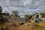
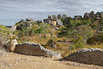
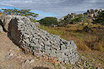
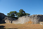
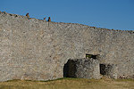
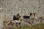
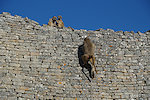
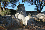
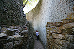
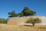
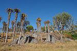
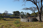
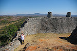
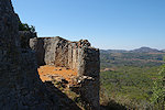
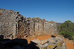
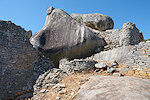
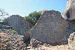
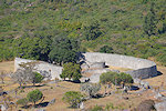
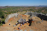
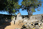
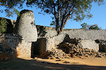
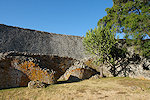
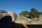
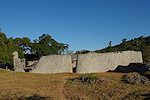
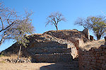
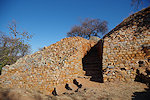
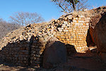
Our progress was much faster than anticipated, we still had most of the afternoon available. This permitted a visit to the ruins of Zvipadze (formerly Harleigh Farm), about a dozen kilometres from Diana's Vow back towards Rusape. As we did not plan to come this way we had no precise directions, we had to ask some locals to put us on the right tracks among the many skirting the fields. The site itself is small but quite impressive, it is a smaller and slightly later version of the Great Zimbabwe with similarly constructed dry stone walls among a very picturesque cluster of granite boulders.
On a nearby rock we unexpectedly found a small but quite impressive panel of paintings, which was completely omitted from the description of the ruins that Lorraine fortunately prepared for just in case.
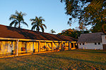
In the late afternoon we drove the remaining distance to Rusape, for once reaching our accommodation well before sunset. We stayed at the Crocodile Motel, not a particularly charming place but it had clean rooms and acceptable food, and more importantly it was the only available accommodation in town.
Day 9. Rusape - Muromo - Birchenough Bridge - Chakas Lodges
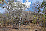
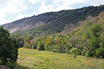
In the morning we continued in a southerly direction, first passing the town of Mutare (formerly Umtali) right on the Mozambique border, a good opportunity for a toilet and fueling stop. Here in the border zone mountains vegetation was much denser and greener than anywhere else we have been to so far in Zimbabwe.
Muromo, the other major rock art locality of Manicaland is about a hundred kilometres from Rusape. Goodall copied a very strange labyrinth-like shape here, but the location description (also of Cooke) was very vague. Fortunately Willard was able to make a visit some weeks before our trip and with some effort located the site (quite far from the settlement now called Muromo), so now we could go straight to it, a roughly one kilometre walk from the main road. Hee too there are many more depictions than shown on the reproductions, it turned out to be a much more impressive site than imagined from publications.
On his scouting trip Willard managed to locate a number of other sites in the vicinity, on a hill called Madzimbahwe near the village of Nyamhere. We left the minibus near a neatly maintained church by the main road, and walked about a kilometre again to a cluster of boulders at the foot of the hill. This first site only contained a few weathered paintings, but another one near the top of the hill had some impressive panels of paintings in a spacious cave under some huge boulders.
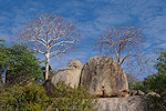
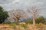
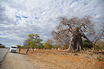
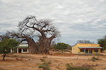
As we continued on our way south we entered baobab country, the huge trees appeared quite suddenly by the road, leafless in the winter season.
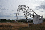
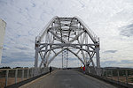
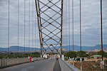
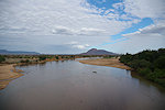
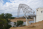
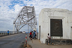
Mid-afternoon we reached Birchenough Bridge spanning the Save (Sabi) River. This impressive steel structure was at the time of ots completion in 1935 the third largest arch-suspension bridge in the world (the Sydney Harbour Bridge was the largest, the resemblance is more than coincidence, both were designed by the same architect). It was named after Sir Henry Birchenough, who chaired the private funds which financed the construction to connect the central and western parts of Rhodesia. As we were not in a hurry, we got out of the bus and walked across the bridge which still retains most of its original structure, save for a widened roadway.
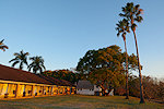
We drove another 80 kilometres past Nyka Growth Point to Chakas Lodges, a very pleasant local lakeside resort built by the artificial reservoir that supplies the water of the nearby town.
Day 10. Chakas Lodges - Masundano - Dengeni - Great Zimbabwe
The Abbé Breuil made copies at a very impressive shelter near Fort Victoria (Mashvingo today) which he called Dandabari. Goodall referred to the same site as Rumwanda, and it was described to be to the north east of Ndanga, a village about 30 kilometres to the south west of our lodge. Willard has not visited this place, and there was no information whatsoever about it anywhere on the internet (unlike most other sites). There was an asphalt road leading to Ndanga from the main Masvingo road, we drove to the village to ask around and it soon emerged that the place was thought to be on the far side of the hills to the north, inaccessible from Ndanga, we were directed to go back to the main road and take another unsurfaced track from there. There was an encouraging sign to the Rumwanda Secondary School, we drove to it to ask for any directions but nobody knew of any major rock art site. We were directed to the nearby village of Masundano, where we did find a lady who knew of a nearby rock art site, and agreed to lead us to it. It was a reasonably short and pleasant walk with some very nice scenery, but the small site under a large granite boulder was definitely not the one we were looking for.
It was suggested that we visit the village elder, who might know the site. It was a long and bumpy road, at some point we had to stop with the bus and Willard walked to the house. Apparently the discussion yielded results, as he was accompanied by one of the sons of the elder, who professed to know Rumwanda Cave. The general direction he took us looked good, but after an hours' walk from the bus it started to become clear that he has no idea about any paintings. Our guide disappeared to search for the site, but after a half hour passed without him returning we decided to return to Rodrig and the bus, any further search looked pointless.
Dengeni Cave, another site copied by the Abbé Breuil lies about 7 km to the south west of Ndanga. Willard knew the way, we re-traced our morning track and just before Ndanga turned off the asphalt to a dismal track, the worst we have seen so far on the trip. The 15 kilometres took a good hour, and it was another half an hours walk to the site situated on a hillside. Unfortunately this otherwise very impressive and well preserved site is much defaced with charcoal graffiti with nearby villages and logging in the area.

It was late afternoon by the time we got back to the bus, we just managed to reach the asphalt by sunset. It was another two hours till we reached our hotel at Great Zimababwe.
Day 11. Great Zimbabwe
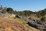
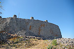
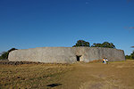
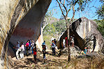
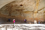
After the all day drives it was a pleasant change to stay at the same place for two nights. We stayed in the Great Zimbabwe Hotel right at the site entrance, within walking distance of the ruins, so we could make repeated visits as we pleased without being constrained by the bus. With an early breakfast we were already at the site at opening time, we were completely alone in the Great Enclosure, except for a band of baboons who appeared rather annoyed by the intruders. It was an eerie feeling, much like the Cold Lairs out of Kipling's Jungle Book.
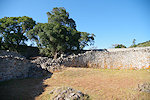
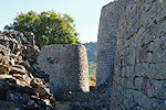
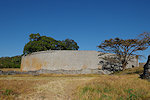
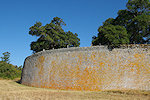
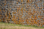
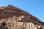
The Great Enclosure presents its most impressive side from the outside, especially the eastern side which has no openings just a continuous wall with the very fine dry stonework (not sure though how much of it is the original and how much restoration, but photos from 1906 appear to show the wall pretty much in the same state as today).
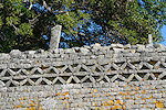
The Great Enclosure is flanked to the north by a series of smaller structures, collectively referred to as the Valley Complex. They post-date the Great Enclosure by a century or two, and while still impressive, they are of a somewhat inferior construction.
There is a small museum on the site, which houses the famed soapstone bird statues which were recovered from one of the Valley Complex ruins.
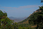
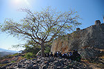
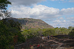
By the time our meandering visit reached the ascent point to the Hill Complex the number of visitors started to increase, mostly locals including several commendably well behaved school groups. There are two ways up to the citadel, one the steep ancient stairs, the other a longer built path with a much gentler gradient. We took the former, and after some huffing and puffing we were up at the single narrow entrance. The Hill Complex is the earliest part of the constructions at Great Zimbabwe, it was commenced in the 11th Century, a good 300 years before the Great Enclosure. The location offers some spectacular views over the other ruins and the surrounding countryside.
By midday we all started to wander back to the hotel for lunch and an afternoon rest. Our rooms were facing west towards a row of hills, and I immediately recognised that I have seen them before. Many moons ago I have managed to acquire a series of watercolours made by the noted Egyptologist F.W. Green (among others the discoverer of the Narmer palette and the painted tomb at Hierakonpolis), one of them was titled "From Zimbabwe Hotel" made in 1929 when Green made the journey to the Meeting of the British Association (where Gertrude Caton Thompson presented her studies of the Zimbabwe ruins (leaving no doubt of their medieval and Shona origin), and apparently made a visit to Great Zimbabewe afterwards in early August. The painting was clearly made from exactly the same spot, which is not surprising since the hotel with minor modifications had been in existence for over 100 years.

In the afternoon we returned to the Great Enclosure, with the interior being in a much better light than in the morning. The midday crowds have mostly disappeared, we had most of the place to ourselves once again.
For sunset we were back in the hotel to have a proper sundowner on the terrace, the first time we have managed to achieve this on our trip.
Day 12. Chamavara - Lake Kyle - Matopo Hills
In the morning we headed east along the southern shores of Lake Kylie (an artificial reservoir) towards Chamavara, another of the sites documented by the Abbé Breuil. It is only twenty kilometres to the east of Dengeni which we have visited two days earlier, but (probably very wisely) we decided not to attempt the terrible track but make the visit from the west where all but the last 3 kilometres were on asphalt. The site itself is easily accessible, with only a few hundred metres walk from where the bus needed to stop. There was a small village nearby and we provided the entertainment for the local children, but fortunately the site was well kept, there were no graffiti on the paintings.
Seeing our interest one of the bigger girls showed us two smaller satellite sites on nearby rocks, which were not mentioned in any of the published descriptions.
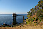
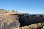
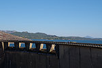
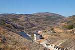
Returning the way we came we made a stop at Kyle dam, which gave rise to the huge lake behind it. Recently a small power station was added, but the dam was mainly built to ensure reliable water for the surrounding farms.
Soon after passing the dam we saw a sign saying rock paintings by the road. Willard was not aware of them, but there were painted arrows on the smooth granite to follow, which led us to a small but nice panel of paintings among some boulders near the lakeshore.
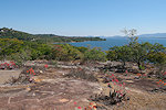
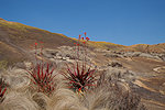
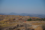
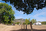
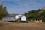
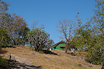
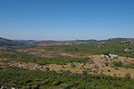
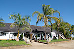
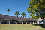
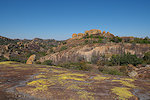
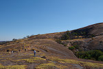
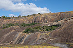
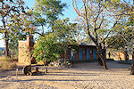
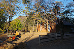
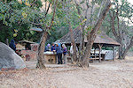
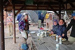
It was approaching midday, we still had a good 300 kilometres to drive, first back past Great Zimbabwe to Masvingo, then along the main road to Bulawayo and on to the Matopo Hills National Park. Along the way we passed the "Great dyke", a 2.5 billion year old geological feature that crosses almost the entire country fro north to south. Due to erosion there was not really much to see, the landscape as the same save for a number of open pit mines on both sides the road. We reached Bulawayo in the late afternoon, only stopping at a gas station to fuel, and continued to the park entrance. Thanks to Willard who was an avid boy scout, we could stay at the Gordon Park scout camp, which saved us at least two hours every day avoiding the need to leave the park by sunset and drive there again in the morning. The camp had simple but adequate rooms, running water and a lovely couple as caretakers who prepared amazingly delicious meals on the wood fire stove.
Day 13. Matopo Hills National Park
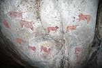
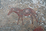
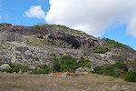
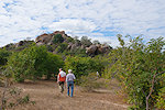
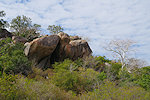
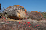
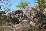
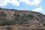
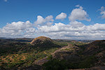
The Matopo (Matobo) hills are one of the richest rock art areas in southern Africa (comparable to the Erongo or Brandberg in Namibia), set in a beautiful landscape of forest covered granite hills. Most of the smaller sites are only accessible on foot, but the major ones may be approached on tracks suitable for our minibus. We started the morning at White Rhino Cave (named after the depicted white rhinos), which was close to Gordon Park just off the main road traversing the National Park. The shelter is on the top of a low hill accessible on a built path, and it is enclosed by a wire fence to deter any vandalism, fortunately the wire spacing is large (and far) enough to take reasonably good photos. The paintings here are very different than what e saw before, some extremely fine animal figures executed in a line drawing only, with no infill.
We continued to the central area of the park, to Pomongwe Cave, a large typical granite shelter at the foot of the hill, the rear wall of which is covered with paintings. Unfortunately in the 1960s someone thought it is a good idea to coat the paintings with linseed oil to enhance and protect them, which effectively obliterated most scenes as it weathered. There are a few remaining more visible details, but for most of the part even DStretch fails to reveal more than the faint outlines of what once was there.
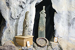
At Pomongwe there is also a small site museum that displays archaeological artifacts and some rock art copies from the region, including several sites on which I could find no published information, somewhat unsurprisingly the museum wardens had no idea either.
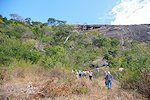
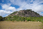
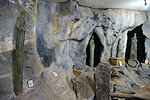
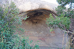
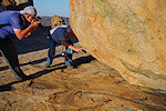
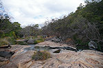
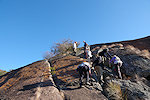
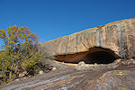
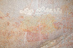
In contrast to the previous one, Nswatugi Cave is far better preserved and is certainly one of the Matopos highlights. The track leading to it is quite bad, and it takes some scrambling up the side of a hill to get to, by appearance it is very seldom visited. It is a relatively small site, the cave is only about 6-8 metres wide, but the paintings are exquisite, though with the numerous superpositions some details are really hard to make out.
Bambata cave is located in the western part of the national park, which is a closed off game area, the site is not normally open to visitors. After some discussion at the Park office we were assigned a game warden to escort us, in possession of the key to the gate that barred the track leading towards the site. Though the descriptions say the track requires a 4wd, Rodrig tackled it without a glitch, and took us to within a kilometre of the site, far better than the four needed to reach it from the main road. The cave itself is quite high up the side of a granite hill, and this one too contains some very well preserved scenes.
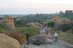
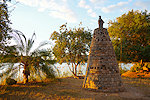
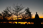
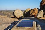
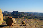
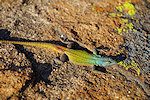
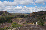
We took a long time to photograph all the details in the large cave, and also the landscape on the way back was spectacular. By the time we returned to the bus at Bambata it was well into the mid afternoon. We did not have time for any more rock art sites, but we could still visit the "View of the Word" site, a very picturesque group of granite boulders rising above the surrounding country, with the grave of Cecil Rhodes. The rocks around the gravesite were full of the rainbow coloured Common flat lizards (Platysaurus intermedius) basking in the late afternoon sun, and apparently completely used to the presence of humans. The site appears respected and well kept, with a little museum at the bottom of the trail presenting a surprisingly balanced display on the life and times of Rhodes.
Day 14. Matopo Hills National Park (trek to Inanke Cave)
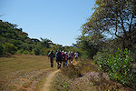
By all accounts Inanke cave is considered the finest site of the Matopo hills. It is not as readily accessible as the other sites, it requires a hike of about four kilometres both ways to reach it (variously claimed as 5 or 7, but 3.8km as measured on Google Earth) along a marked trail, with a few manageable climbs and some precarious river crossings. It takes a full day to get there and back, including a 6km drive from the main road on a barely passable track to the Toghwana dam and reservoir, where the trail starts. Shortly after passing the dam there is a small shelter with paintings just off the trail with some nice paintings.
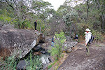
We were very lucky with the weather, it remained cloudy all morning keeping the temperature down, an ideal hiking day. After about an hour we reached two boulders with small panels of paintings near the pass leading into a higher valley. These sites were more in line with similar "landmark sites" in the Erongo or on the Brandberg, unlike the huge painted caves which have few parallels.
Beyond the two rock art sites the trail continued in a narrow and densely forested valley, with fallen treed barring the very overgrown trail every so often. We lost the trail several times, fighting through the dense vegetation to find it again, until the country opened up again and we could see where we were going.
I was the last behind the rest of the group, the others all walked past a small shrub but as I followed with eyes fixed to the ground in front of my feet to avoid tripping in some log or vine, something not quite belonging there registered on the periphery of my vision. I stepped back, and it was a nice big Puff adder (Bitis arietans) lying in ambush behind the shrub, its head almost blending in with the dry vegetation but its uncovered speckled body gave it away. They have a bad reputation for being agressive, but this one appeared very docile, it was completely unperturbed with the camera lens approaching, it finally made a reluctant slither into better light when I nudged it with a long stick. We have seen several previously on the roads in Namibia, but this was my first close encounter.
Soon after seeing the snake a prominent cave came in to view, but the trail markings continued, eventually leading up a steep but manageable granite slope. It was only on the top that the markings turned back towards the cave we already saw - this was the site we were looking for (Willard did not visit before) just the trail made a big detour circumventing the very steep rocks below the cave.
Here too the paintings cover the entire rear wall of the shelter, and are of both a very high quality, and due to the remoteness in an excellent state of preservation. We spent several hours taking in all the details and snapping photos.
Considering the time it took t reach the cave, we needed to start back towards the minibus at 2:30pm. This time we made th descent on the slope immediately below the shelter, with our Brandberg experience it proved to be perfectly passable with only a very short really steep section. We returned along the tail to the minibus in about two hours, and reached Gordon Park just before sunset.

Day 15. Matopo Hills (Silozwane & Gulubahwe Caves)
Silozwane Cave is located just outside the National Park area towards the south, driving pretty much along the same route as towards Inanke. From the car park it is a fairly long and steep climb up to the shelter, one of the most difficult in the Matopos area. It takes a good 30 minutes from the car to the cave, however the effort is well worth it, here too there are some excellent paintings in a big north facing cave which is invisible from below, only comes into sight as one rounds the corner.
Getting down from Silozwane Cave is pretty much the same effort as getting up, with an hour at the site it was late morning by the time we managed to reach the minibus.
Gulubahwe Cave is located along the eastern edge of the Matopo Hills, also outside the National Park, about 20 kilometres from Silozwane, but requiring a circuitous 50 kilometre drive to reach it along a dismal track. We drove past the turnoff to Inanke, and continued along the track which went fro bad to worse. After an hour and covering half the distance we passed a boulder near the village of Gqalaza which looked promising (and a very welcome opportunity to stretch our legs), it did not take long to find a panel of paintings on it.
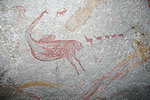
It took over 2 hours of driving to reach Gulubahwe, located right beside the "road". It was again a large cave half-way up a granite hill, with an unique depiction of a large eared serpent, seemingly ridden on the back by a number of human figures. There are no ready analogies to this strange scene among other Zimbabwean sites, but it does resemble the "eared serpents" of the Brandberg in Namibia.
We needed the same time to drive back, we reached Gordon Park just before sunset. It turned out to be a cold windy evening (probably the coldest on our trip), we cuddled around the wooden stove for warmth as dinner was prepared.
Day 16. Khami Ruins - Bulawayo - Victoria Falls
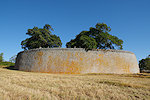
We have completed our round of the rock art sites of Zimbabwe, we only had the long drive to Victoria Falls left. Originally it was planned to take a direct flight from Bulawayo to Victoria Falls, but the route was cancelled and instead it would have required a connection via Harare, taking up the whole day. It made more sense to do the the 400 kilometre road distance to Victoria falls with the minibus, the time looked the same. However before we set out on the road we still had an items on the itinerary. The Khami Ruins on the outskirts of Bulawayo are a smaller but still impressive version of the Zimbabwe ruins, it was a major settlement after the abandonment of Great Zimbabwe, constructed in the same manner of dry stonework.
Lorraine left us at this point, having seen the falls already she preferred to have a look around in Bulawayo before taking the flight home. The rest f us continued along the road towards Victoria Falls. At first all looked good, but it soon turned out that much of the road was under construction, with frequent detours to unsurfaced bypasses. In the end the drive turned out to be closer to 7 hours rather than the expected four. Arriving in Victoria Falls we had the first mildly unpleasant experience of our trip. The Cresta Sprayview which we had booked turned out to be overbooked, they have moved us to a very pleasant boutique hotel which however was quite far from the falls, unlike the walking distance we expected.
Day 17. Victoria Falls
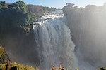
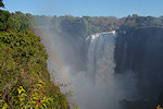
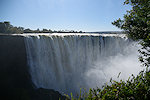
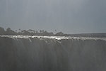
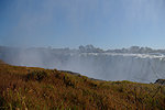
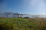
After breakfast we headed to the falls, a mixed experience after having been off the beaten track for several weeks and unaccustomed to tourist crowds. There were very good rains this year, and despite mid-July being the dry season, the Zambezi was still in almost full flow, which made the falls very impressive, but only from a side angle, as we walked along the cliff edge trail facing the falls the spray became so thick that it was pretty much impossible to see (or photograph) anything. The plastic raincoats handed out proved to be rather useful, despite my initial misgivings.
Out outbound flights were mid-afternoon, late morning we returned to the hotel change to travel clothes and drive to the airport where we bid farewell to Willard and Rodrig (who had to make the miserable drive back to Bulawayo, there being no direct road to Harare except on the Zambian side, for which they did not prepare). With the tourist crowds Victoria Falls airport is much larger and busier than Harare, fortunately all flights were on time and soon we were all on our way home to various corners of the world.
We plan to return to Zimbabwe again in July 2026, broadly along the same itinerary but also planning to visit some more remote sites that were missed on this trip. The exact itinerary will be decided as departure time draws closer. Please check the News page periodically or "like" the FJ Expeditions FaceBook page to receive notices of news and updates.