
 Click on image to start slideshow |
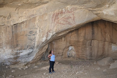
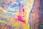
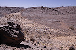
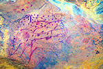
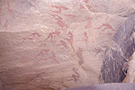
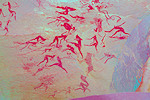
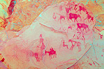
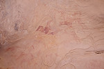
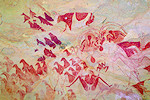
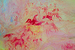
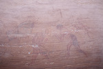
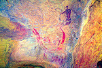
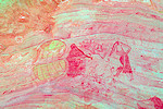
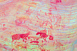
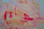
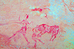
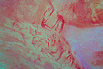
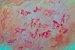
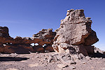
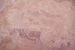
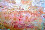
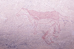
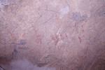
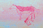
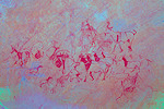
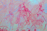
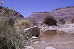
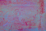
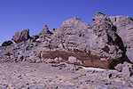
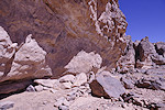
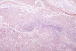
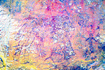
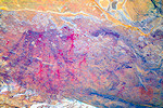
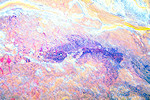
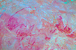
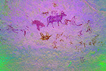
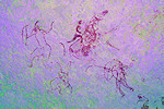
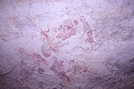
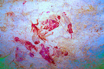
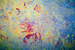
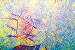
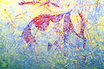
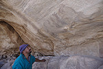
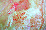
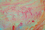
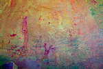
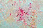
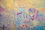
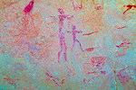
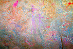
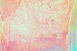
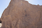
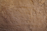
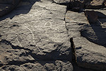
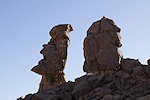
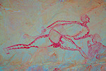
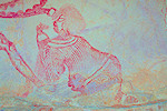
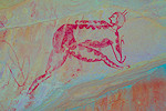
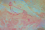
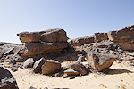
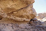
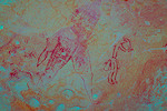
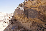
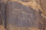
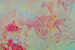
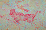
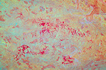
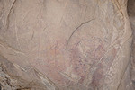
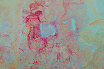
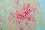
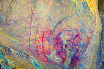
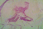
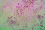
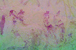
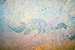
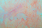
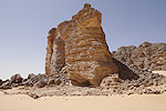
Tassili N'Ajjer, South Algeria 15th - 24th March, 2024 There is curretnly no published catalogue and accepted nomenclature of the Tassili sites, the provided site numbers are for convenience only, developed by myself utilising the topographical names used by the Lhote missions and others to be able to reference individual shelters. False colour images processed with DStretch, a freely available software developed by Jon Harman |
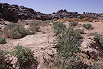
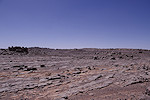
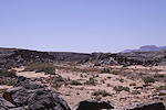
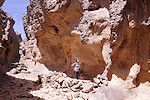
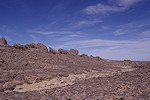
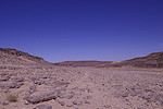
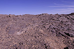
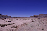
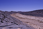
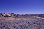
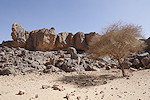
Old publications list a number of interesting rock art sites in the Central Tassili region, which we never managed to find or visit on previous trips. Taking advantage of a little lull in our schedules, this private trip was organised on a short notice to remedy this deficiency. We spent a superb ten days finding most of the sites we intended to, and thouroughly enjoying being only the two of us out in the desert.
Day 1. Djanet - Irrekam Aharhar
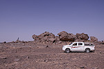
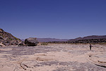
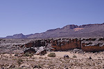
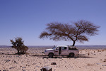
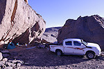
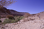
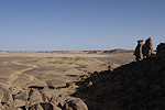
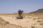
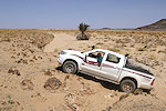
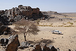
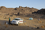
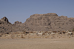
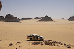
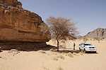
We had a very smooth journey the day earlier, all the flights were on time to the minute (even Air Algerie to Djanet!), and the new visa on arrival process worked smoothly, we both had our passports back within 20 minutes of stepping out of the plane in Algiers. Even the baggage delivery at Djanet was quicker than usual, by 2am we were comfortably asleep at the Essendilene house in Djanet. Around 9am we set out with Ochi, our driver and a Toyota HiLux pickup, after a quick stop at the Djanet market drove north along the Route National towards Bordj el Hawass and the central part of the Tassili n'Ajjer plateau.
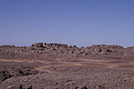
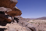
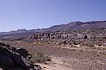
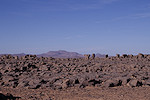
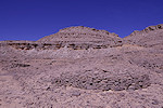
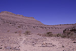
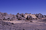
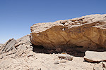
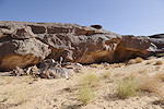
Our first objective was the Irrekam Aharhar area, where Ulrich and Brigitte Hallier found a beautiful Iheren style scene in a small niche (Hallier & Hallier 2003, Sahara 14). They have provided a rough location for the site (correct to the arc minute), which I did confirm to be substantially correct with Ulrich before he passed away last year. The location was in the middle of a rocky area (Irrekam), and it did appear a likely spot, about 3 kilometres to the west of the Route National some kilometres to the north of the Tasset junction. A series of car tracks leading in the direction were visible on Google Earth, our objective was to get as near as possible with the car then explore on foot.
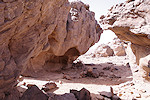
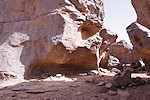
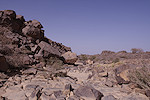
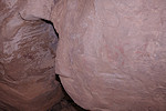
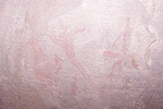
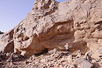
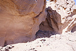
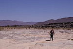
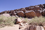
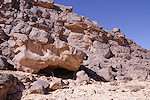
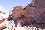
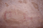
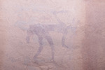
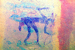
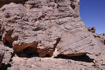
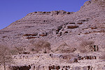
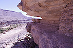
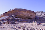
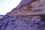
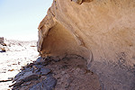
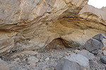
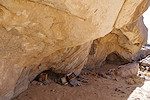
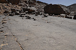
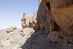
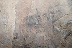
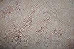
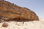
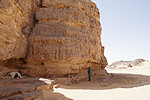
We reached the turnoff by mid-afternoon, after some searching for the right track we hit upon the correct one leading straight west. One and a half kilometres from the road we reached the first rock cluster, and along its southern side we saw a prominent shelter. Taking a closer look, we did find some faint traces of paintings, once where was an Iheren style scene in the shelter with a number of human figures, but now even with DStretch one can only make out fragments of individual figures.
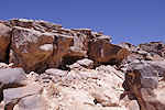
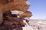
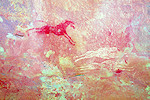
We spent some time exploring the rocks, and found another four shelters with paintings. All were very faint, the best find was a hitherto unrecorded chariot.
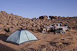
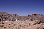
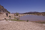
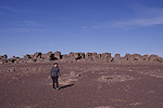
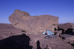
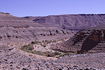
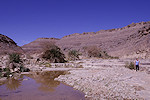
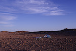
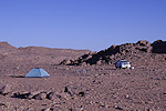
We continued along the track for another kilometre, reaching a riverbed where we were hidden from sight, and there was a patch of smooth sand to make a comfortable camp. With a couple of hours left till sunset, we immediately set out towards the most likely Irrekam.
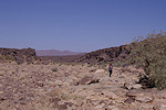
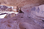
Soon after reaching the rocks on top of a low plateau, Magdi found a small shelter with some painted human figures, but a thorough search of the entire area yielded nothing more. While these rocks were the closest to the marked point, it was soon quite clear that the site must be at some other Irrekam, a few hundred metres further north (or at the ones further east).
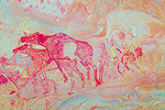
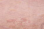
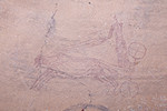
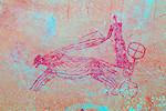
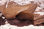
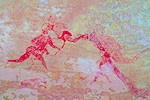
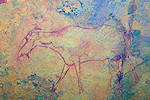
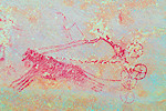
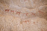
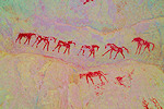
Still having some remaining daylight, we set out towards the north, and as we approached the next Irrekam zone, a large prominent shelter was clearly visible at its southern base. Our hunch was correct, we did find a series of paintings in the shelter, including a number of dark archaic looking animals and a very fine horse drawn chariot.
By this time sunset was fast approaching, we left the exploration of the rest of the rocky area for the next morning and headed back to camp to pitch the tent before darkness.
Day 2. Irrekam Aharhar
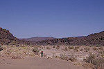
With the overnight flight and the subsequent short sleep the day earlier, we had a lazy morning, only getting out of the tent well after sunrise. We returned to the Irrekam where we left off the previous evening, and soon found a number of minor sites scattered among the rocks, none of them particularly exciting. Yet again a very thorough search failed to reveal the fine site we were looking for.

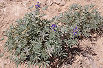
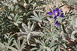
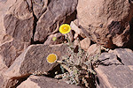
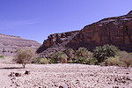
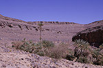
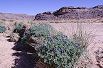
Having exhausted all possibilities, we returned to camp for a little midday rest before heading out again in the afternoon. We failed to truly appreciate it the previous evening, but now in full daylight we could see that the small valley was full of blooming and fruit bearing Blue Lupines (Lupinus pilosus).
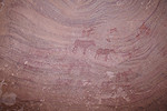
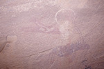
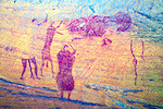
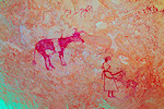
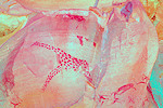
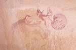
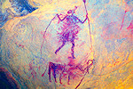
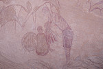
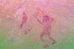
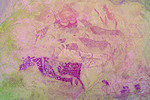
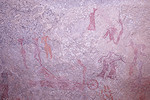
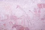
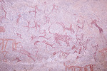
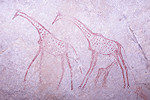
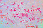
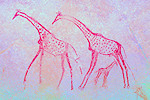
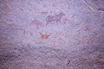
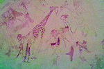
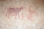
While we were away, Ochi explored the rocks near camp, and found a site with a couple of giraffes among the rocks overlooking camp, our best find so far in the area. Apparently it was an Iheren style giraffe hunt scene (there is a throwing knife wielding Iheren figure at lower right), which was more crudely retouched at some later date.
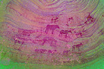
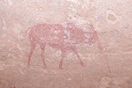
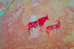
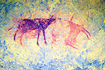
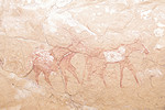
A few hundred metres to the south we found another site, a fine herd of Iheren style cattle in a shallow shelter along a prominent rock overlooking the river.
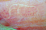
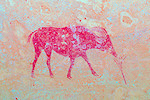
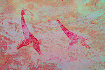
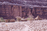
While we photographed the last site, Ochi went ahead, and found several more sites among the elongated Irrekam east of the river. One contained a fine large white elephant, another a very big cattle which was only partially filled, on the spot just the big rear legs were visible. Yet again, there was no trace of the site of the Halliers.

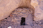
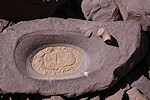
By now we have searched pretty much every likely spot fitting the description within a good half kilometre radius of the given location, failing to find the site. Magdi decided that it was enough for the day, returned to camp while I returned to the Irrekam closest to the provided coordinates to take a second look. Predictably, other than a number of nomadic storage huts, a small keyhole monument (which I failed to spot on Google Earth earlier) and numerous prehistoric remains, I found nothing new.
The Halliers have published some other minor sites found at their "Irrekam Aharhar" location in a separate article (Hallier & Hallier 2002, World of Petroglyphs 24, Stonewatch), and none of our finds so far matched any of their known sites. This clearly indicated that we were searching in the wrong place. There are a number of other Irrekam zones in every direction from the area we surveyed, visiting each would have taken at least a day (there are no more car tracks other than the one we took), so we decided to leave this for another time, and continue the following morning with the next area on our list.
Day 3. Oued Imirhou
When visiting the Frobenius Institut in Frankfurt last December, I was shown a some digitised slides from the collection of Jürgen Kunz that showed very fine Iheren style paintings, and the provided coordinates matched the known sites of the Oued Imirhou, which we visited earlier. I have contacted Jürgen, who only recalled after all this time (he visited in the 1980s) that there are shelters one after another, and the site in question was indeed one of them. I suspected that the coordinates were in error, but the only way to find out was to walk the length of the Oued Imirhou westwards, and check all shelters. Muzzolini (1989, 1995) also reported a site, Tan Rhounac with some roundhead style barbary sheep, and another site is shown on Jitka Soukopova's website (Imirhou I). There was plenty to see, so we set out early morning back towards the Route Nationale, and soon turned off towards Imirhou. The road has much improved since we first took it in 2016, the first fifteen kilometres are now surfaced, and the rest is a well maintained gravel road, we could reach our destination shortly before the village of Imirhou in just over an hour (a far cry from the half day needed last time). After showing Ochi the spot where we will return to the road in the afternoon (the road parallels the Oued Imirhou), we drove to the known sites, and descended down into the valley.
We started at the fine site of Imirhou 2, with the difficult-to-photograph lion hunt scene. This was well downstream of the marked point (Imirhou 1), and in the past we have extensively searched all rocks further downstream, I would not have expected missing such a major site we were looking for.
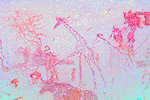
Not far from Imirhou 2 we did find a panel of paintings we missed the last time, including a fine unusual spotted giraffe.
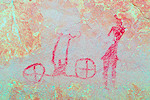
We found nothing more till reaching Imirhou 1, the fine site with both Iheren and Cabbaline style paintings, including three chariots. This site was also first reported by Jürgen Kunz, we made a thorough search of all possible surfaces but there was no trace of the scene I saw on the scanned slide.
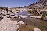
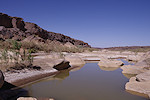
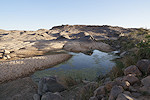
West of Imirhou 1 we followed the north bank for a good kilometre, but there were no suitable looking shelters. We soon came upon a large water-filled guelta, followed by several more. We spotted some large rocks along the south bank, we searched thoroughly but found nothing there.
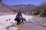
In one of the smaller shallow gueltas we were much surprised to find several schools of a yet to be identified species of small (2-3cm) fish (Coptodon sp. ?), accompanied by a few larger (approximately 5cm) adults. It is amazing how they can survive here, when these gueltas go completely dry over the summer.
Continuing along the north bank a large overhanging shelter became visible from a far distance. The location roughly corresponded with the expected place of Muzzolini's Tan Rhounac, about two kilometres west of Imirhou 1. Once we climbed up, a large panel of bright paintings was immediately visible, it did not take long to confirm that this was indeed the site seen on Jürgen's slides. We spent a long time going through the three distinct parts of the shelter (the central part is the best preserved), but strangely we did not find any trace of the two roundhead style barbary sheep that were mentioned by Muzzolini (who also mentioned other Iheren style paintings in passing). Possibly those are yet in another nearby shelter which we missed.
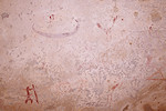
It was mid-afternoon by the time we finished with all the photos, it was time to move on as our rendez-vous point with Ochi was still another four kilometres away, and we promised to be there between five and five thirty, to allow time to find a suitable campsite before sunset. We switched over to the south side, where there were some promising shelters, and in one of them we found a row of very strange non-figurative symbols. They were very faint, hence rather old, I know of no ready parallels.
A few hundred metres further along the south bank we found the "roundhead" site presented on Jitka Soukopova's website. While the preservation of the paintings is rather poor, I'm fairly confident that the large animal is in fact a cattle.
Having found all sites we were looking for, we moved more rapidly towards the small valley where we had to ascend to the road, still a good three kilometres away. We did not find anything along this stretch, the few shelters we saw were all empty.
A few hundred metres before our exit from the valley we came upon a fallen boulder along the north bank with a shelter underneath. This did contain some smudged cabbaline paintings, probably damaged by children of the nomads who still seasonally inhabit the valley.

We reached the road and the waiting Oichi a good hour before sunset, we drove west for another 20 kilometres until we found a pleasant small wadi with trees and some soft silt in the riverbed. We drove some distance into the wadi to be out of sight from the road (though Ochi said only one car passed the whole day), and settled down into a very pleasant camping spot.

Day 4. Ouan Foras - Tin Edjedjele
The Oued Imirhou was our most distant outing from Djanet, from here we started to slowly trickle back. In the morning after reaching the Route Nationale we made a brief stop at the lovely paintings of Tissebouk, seen many times but always a delight to revisit.
Our next target was the Irrekam region of Ouan Faras, a few kilometres north of the road near the Tasset junction. We visited these sites on foot in March 2017, but on Google Earth I spotted a track leading to them, we tried it and it proved to be an easy route, within 15-20 minutes we reached the vicinity of the sites, we even found a shady parking place. The locality is known for a fine Cabbaline depiction, including a Chariot, plus two other sites we failed to find in 2017, one of them apparently some roundhead paintings. We made a thorough search of all the rocks, and did find the site with a large sitting woman figure, but the roundheads still remain elusive.

After returning to the road We made another brief detour and stop at Tabarakat (the Hallier's Tin Edjedjele II), to visit the magnificent Iheren style panel and re-take some of the scenes with my much improved photo equipment.
Mid-afternoon we reached another of our main trip objectives, the large Irrekam zones of Tin Edjedjele III & IV, about 500 metres apart a couple of kilometres to the north of the road. A good track leads to the western one (III), we found a good camping spot among the rocks and immediately set out to explore the area to find the many sites reported by the Halliers. For a good hour we found nothing but the huts and structured of the former nomad inhabitants as we systematically searched all the east-west oriented "streets", then finally we came upon the large shelter which held both of the published chariots and several other scenes familiar from the Hallier's publications.
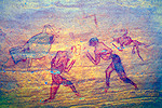
Continuing, we found another two minor sites, one of them the lion hunt scene published by the Halliers, with one of the hunters clearly having a bad day.
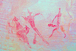
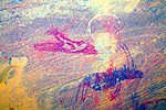
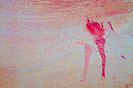
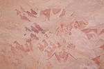
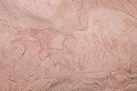
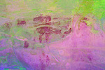
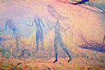
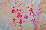
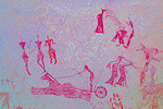
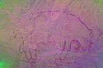
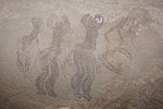
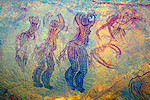
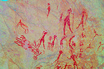
By now we completed the systematic survey of the entire Tin Edjedjele III area, we still had a good hour of daylight left so we made a brief foray over to the considerably larger Tin Edjedjele IV area about half a kilometre to the east. This time we made no systematic search, just went for a conspicuous large rock along the eastern side, and did find some very faint paintings. On the spot we could not make them out, except two human-looking figures, but DStretch revealed an amazing ensemble of therianthropes, a scene which was not recorded by the Halliers.
While I was taking the photos, Magdi explored a nearby rather inconspicuous shelter and soon I heard an excited yell. She found one of the finest scenes published by the Halliers, a small but exquisite pastoralist panel.
With sunset approaching, we left the systematic search of the area for the following day, we reached Ochi and the campsite just as the sun dipped below the horizon.
Day 5. Tin Edjedjele - Sanderfoukat
In the morning we returned to the southern tip of Tin Edjedjele IV, and started a systematic search. We soon found a number of smaller sites, including one high on our priority list, the dog headed therianthrope published by the Halliers.
Tin Edjedjele IV is substantially larger than the area III where we camped, by midday we have managed to survey about two thirds, finding three more very faint minor sites, none of which were reported by the Halliers. One scene turned out to be very interesting, with a Sefar-Ozaneare style human figure wearing the bizarre "Pompidour" hat, a very surprising find that considerably extends the geographical range of this style. Another shelter contained a nice small panel of human figures.

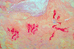
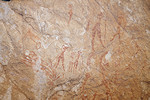
We were still missing the bulk of the sites published by the Halliers and assigned to area IV. Finally near the northern end we came upon a cluster of several shelters, all of which contained paintings, and in one of them we recognised the handprints and human figures. However again the majority of the finds, including some very fine depictions were not published.
Using this cluster of sites as base we continued to explore the remaining rock streets, and near the northern tip of the area we found nearly all of the remaining sites of the Halliers (missing only one fine Iheren style panel).
It was mid-afternoon by the time we returned to the car, which was already loaded by Ochi and ready to depart. We made only a short move, driving the few kilometres till the Iherir junction, then taking the track to where the camel trail leading to the Tadjelahine commences. The site of Sanderfoukat lies not far off this track, it is a known site that is visited on camel supported circuits, but as we always went with donkeys, we never had the opportunity to visit. We made camp among a cluster of suitable boulders, Magdi decided to take a lazy afternoon, so it was just me setting out to the sites a little over a kilometre from camp. There are two shelters here, both with some nice Iheren style scenes.
We still had an hour of daylight left by the time I returned to camp, it was nice to have a quiet lazy evening after all the near-continuous scrambling among and over the rocks over the past several days.
Day 6. Teossekit - Dider - Adjujel
Alfred Muzzolini published a very fine shelter with Cabbaline paintings (including several chariots) in the Oued upstream of the oasis of Iherir. The information was very vague, however recently I learned the precise location of this site, Teossekit. It lies in the Oued Imirhou upstream of the abandoned village of Idaren, and there is a camel pass leading down into the valley a couple of kilometres further upstream. There is a car track leading to the pass, in the morning we quickly packed camp and drove the short distance along the asphalt to the turnoff. The track was rough but passable, by mid morning we were making our descent along the well built camel trail, and in half an hour we reached the small abandoned village at the bottom of the valley.
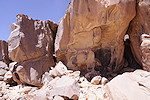
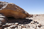
The site was about two kilometres downstream, there was an easy to follow path along the easiest route along the riverbed, within another half an hour after rounding a big bend we could clearly see the big shelter high up above the valley floor. It was starting to become hot in the valley, after the steep climb up to the shelter the shade was very much welcome, as it must have been for the ancient inhabitants.
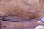
The Teossekit shelter has two levels, we found the lower one to be completely empty. However the rear wall and ceiling of the second level is almost covered with paintings. On the floor there are numerous large grinding basins. The small illustrations of Muzzolini did not really convey the size and wealth of the paintings, aside the Tamadjert shelter this is certainly the most spectacular of the Cabbaline style paintings. Muzzolini mentioned four chariots, but I only found three, the fourth appears to be just a galloping horse with a rider, partially obscured by a fine giraffe. A number of other giraffes, all executed in the same style, attest that they were still abundant at the time when horses and chariots appeared.
We started making our way back in the late morning, hoping to reach the top of the pass before the worst midday heat sets in. Fortunately a little breeze stated, and we could also afford the luxury of a quick bath in the large guelta before the pass. In the end we reached Ochi and the car at the top of the pass around twelve thirty, needing the same thirty minutes for the way up as down.
After reaching the car we made a quick visit to the store in Iherir where Oichi topped up his supplies, then we re-traced our route and turned towards the Dider plain. Since it was just by the road, we stopped at the site of In Trouia to try to find some missing sites. When in 2016 we first came here, we only found the main site with the large bear-like animal, but Giancarlo Negro published another five, that had to be in the area. I made a broad sweep around the main site, and did find one site with an archaic addax (?) and some also archaic-looking schematic barbary sheep, but not the ones we were looking for. As we had to reach our starting point for the trek to Tin Leh-Leh by the evening, we decided to move on, leaving this place for some other time.

Giancarlo Negro also published in his CD on the rock art of the Central Tassili a site with fine Iheren style paintings somewhere along the northern edge of the Dider plain. Based on the photo provided of the shelter and surroundings I tried to match it to the terrain on Google Earth, and have identified a location a few kilometres to the north of the Tin Akn road. We still had the time to make a detour, we entered the valley and indeed found some shelters beside some recent nomad structures along the northern side, but none matched the site with paintings we were looking for. We also visited a nearby fine keyhole monument, also prominently visible on Google Earth.
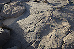
We returned to the road and continued northwards for some distance till the area of Adjujel, where we started looking for tracks leading towards the east. Our plan was to walk to the Oued Zarzawa the next morning to look for the sites of Ti Leh-Leh, and any drive in the right direction would shorten our trek. We did hit on a reasonably well traveled track, and managed to follow it for nearly two kilometres until it reached a dead end. We got out to take a look around as the spot was not particularly inviting to stay for the night, and right next to the car we found a perfect example of glacial striations from the time when the area was under the southern polar icecap in the Late Ordovican.
Fortunately we also found a nice sandy camping spot in the adjacent valley, and with some struggle we could follow a rather bad track into it to make camp and prepare for the trek the next day.
Day 7. Oued Zarzawa (Ti Leh-Leh)
Ever since I have become more acquainted with the sites of the Central Tassili, Ti Leh-Leh proved to be the most elusive. The locality (with a single photo) was published by Ginnette Aumassip in 1972 (as Oued Zarzawa). In 1990 Aldo Bocazzi published three sites in more detail (Sahara 3), suggesting that they are located in an east-west oriented lateral valley, the principal shelter facing south, at a locality referred to as Ti Leh-Leh. In 2018 we already searched an area adjoining the Oued Zarzawa before Tin Akhn (at the time, without the asphalt road, it took half a day to get there), but failed to find the sites. Last year we came close, as our guide Dagarat seemed to have recognised the name as Ti Le'-Le'(and agreed with the cameliers) that this name refers to an eastern tributary of the Oued Zarzawa. We did visit the upper section of this valley, but found nothing and there was not enough time to check out its entire length. In the mean time I have also corresponded with Donatella Boccazzi, and while there were no slides of the wider locality, some taken along their taken route pretty much confirmed that the general area is correct. This time I was determined to find the sites, if our hunch was right they should be somewhere close to the junction of Ti Le'-Le' and Zarzawa.
Our campsite was just 6.5 kilometres from the marked point, considerably closer than the 8 kilomeres from the road. A series of straight valleys led almost directly towards our destination, we could expect an easy walk of around two hours. It was possible there and back in a day, however we decided to take sleeping gear and plan for two, allowing for a more prolonged search if necessary. We set out soon after sunrise, and indeed it took just a little over two hours to reach the junction of Oued Zarzawa and Ti Le'-Le', less than two kilometres from the point we reached last October.
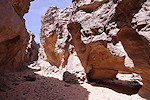
We left our packs in the shade among some large rocks at the entrance of Ti Le'-Le' and started exploring upstream, expecting to find the sites there. However as we rounded a bend and the valley opened out to the east, it soon became clear that there were no suitable shelters anywhere. We explored for a good one kilometre upstream, until we were in clear sight of the large rock we reached last October, ascertaining that the sites may be anywhere but here. Prepared for such an eventuality, Plan B was a parallel valley a few hundred metres to the south beyond a ridge, with more promising topography, with vertical cliffs casting deep shadows visible on Google Earth along the northern edge. We crossed the ridge and explored the length of the valley till the junction with Zarzawa, and again found nothing.
Our spirits were a bit dampened as the two most likely spots yielded nothing. Plan C was another east-west oriented tributary about two kilometres further, we returned to the Oued Zarzawa and trudged north, a rather difficult going in the sometimes deep and soft sand. We checked out a few large shelters along the way, but other than a few smudges of paint, found nothing meaningful.
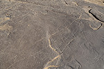
The third valley also proved to be void of any suitable shelters, we could barely find enough shade to crawl into as it was approaching midday, and was becoming unpleasantly hot in the enclosed valley. We had a rest (we must have walked another six kilometres from the point we first put down our packs), then I set out to explore the rocky area above the valley at this point. It did not match the description for the sites, but the area in general looked promising for other sites. Initially I found nothing, but at the last spot to be checked before returning to Magdi & the shade, I came upon a large shallow shelter with a high rear wall and in a small still shaded patch I noticed some very faint paintings. They were about to come out into the sun, had I arrived five minutes later I would have seen nothing. On close look they turned out to be some remarkable archaic paintings of humans, animals and fishes. Later as I checked out the rest of the wall I found a huge animal in outline, already partially out on the sun.
With the midday heat over, we walked back to the junction of the western tributary that led towards our campsite. We have exhausted all likely locations, any further search would have been just a stab in the dark. Admitting defeat we decided to go back to the car in the morning, and to spend the last hour of remaining daylight to check what is in the Oued Zarzawa towards the south. We walked less than a kilometre when we came upon a large shelter along the western bank, and looking inside we found a number of cattle and human figures in outline in an unclear style.
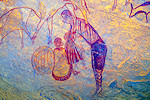
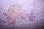
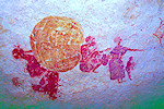
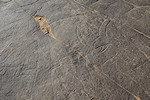
Magdi continued along the west bank, while I went to check out a promising shelter along the eastern bank. Soon I heard an excited yell, obviously Magdi found something important in a long shelter. Reaching the place, I was amazed to see the big round yellow hut with the adjacent figures, the unmistakable scene from Ti Leh-Leh 2. By complete accident we have stumbled upon the main site, not in a side valley as expected, but in the main Oued Zarzawa valley! After a quick search we found the other amazing family scene.
By now sunset was rapidly approaching. While I took the photos, Magdi went ahead to look for site 1. I soon followed, but we could not find it. We were already a good two kilometres from our packs, so we had to turn back to make it before dark, probably it was just beyond our return point.
We were still missing site 3, which had to be somewhere in the direction of our bivouac. We double-checked the unfamiliar site we found earlier, and Magdi found a very faint Iheren style panel which I completely missed earlier, it was indeed the panel of Ti Leh-Leh 3 which the Boccazzis published.
We returned to our packs in a much improved mood, and found a pleasant bivouac spot on a stretch of clean smooth rock in the riverbed nearby.
Day 8. Oued Zarzawa - Adjujel - Ouen Segofar
The long searches and the hot previous day have depleted our water reserves to the point that there was no question of staying longer, we just had enough water for the way back. Fortunately the still missing site 1 was the least important of the three, we had to leave something for a next visit. At sunrise we packed up, and made our way back along the way we came to our camp.
As we reached the car, Ochi greeted us with the news that while we were away, he made a thorough search of the area, and found a number of interesting sites. Showing the photos on his phone, in one there were some unmistakable classic roundhead style figures. We immediately started out to this site which was just across the ridge above our camp. It was a big shelter, as far as I know a completely new find, with a lovely group of the "diabolins" style roundhead figures, including at least three women in a row. Next to them two white figures more resemble the classic "martiens". Above the figures there is an impressive row of barbary sheep in red outline. We were not aware of any name for this particular area, but as the hill of Adjujel is only a couple of kilometres away, we have assigned these sites to that area.
Ochi found another three lesser sites in the immediate vicinity. While not as spectacular as the roundhead shelter, each had some noteworthy details, the first a large (~1m) human figure, the second the remnants of a large archaic animal, the third a nice pair of Iheren style figures.
Two more sites were to the south of our camp, not far from the camel trail we have taken towards the Oued Zarzawa, on the north and south sides of the same rock outcrop. The northern shelter contains a number of very faint scenes from numerous periods, there is a large archaic animal which appears to be a rhinoceros, but I'm not certain whether the "horn" is not just a product of several superpositions. The most interesting scene is just underneath, below the two readily visible figures there is a large almost invisible third. Playing with DStretch a roundhead figure appears that very much invokes some of the figures of Tan Zumeïtak. It seemingly holds a staff, but on close scrutiny it is a spear with a pointed tip with a shape that suggests metal (!?).
The south shelter also has some remarkable scenes, including an indistinct large painted elephant, and a bizarre archaic animal which is very difficult to make any sense of.
Having made the full round of Ochi's sites, we returned to camp to pack and move on. As we were back early, we still had the whole afternoon, so we decided to make it as far as Ouan Segofar, a splendid site to the east of Tin Akhn which Magdi never saw. We returned to the road, and drove till the turnoff point, where Ochi mentioned that he found a few engravings some time ago along the bank of the Oued Zarzawa a few hundred metres away, so we decided to see those before starting the bumpy 30 kilometres to Ouan Segofar. The engravings turned out to be spectacular, a pair of donkeys, a large hippo with a smaller one inside and unusually inside a shelter a faint but discernable large feline, probably a lion.
We reached the hill of Ouan Segofar mid afternoon after a nearly two hour slow bumping along the rather dismal track. We made camp in a little wadi near the ascent to the main sites, which we intended to visit the next morning. As we still had a good two hours of daylight left, I decided to visit two sites with engravings about one to two kilometres away. The first site was on smooth rocks along the edge of the Oued Torset. The engravings are much eroded, but it is possible to make out a pair of elephants, the first apparently trampling an unlucky hunter.
The second site was on the top of a small hillock at the edge of the plain bordering the valley (Ti Ouaghneuen). The scenes were much more eroded than at the first, save for a single remarkable figure, a huge Messak style therianthrope holding a stone axe in both hands. I was extremely lucky with the low light, earlier in the day practically nothing would have been visible.

On the way back to camp at sunset I found a large guelta nearby that still held some water. This explained the large number of wild donkeys in the area, they were all converging on the waterhole.
Day 9. Ouan Segofar - Adjujel
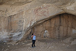
In the morning we climbed up to the spectacular main shelter with the unique huge but clearly Iheren style figures spread over the high wall at the rear. Strangely very few people know about this shelter, and even fewer visit, despite the relatively easy access.
When we first visited in October 2023 we did so at the start of our camel trek so our time was limited, now I had the opportunity to make a thorough survey of the surrounding rocks and valleys. On Google Earth two stone enclosures were spotted in front of likely shelters, by experience one usually finds rock art in such places. This time both sites were empty, but in another two shelters I did find some paintings, including the rather weathered remains of another giant figure, much less discernible than those in the main shelter.
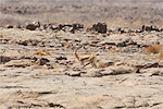
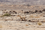
Mid morning we returned along the track to the large basin just a few kilometres east of Tin Akhn, traversed by the Oued Afifar, a larger tributary of the Oued Torset, where a number of sites have been reported in the early 2000s (Civrac et. al. 2009, Les Cahiers de l'AARS 13). Along the way we stopped at a small site with just a single but fine engraved cattle. A little further along the track we saw a solitary gazelle (Gazella dorcas), the only one we have seen on this trip.
Reaching the Oued Afifar basin, we started at the engravings of Tin Tattaït along the southern edge of the basin, scattered at several distinct clusters. Being early afternoon, the light was the worst possible, practically nothing was visible.
We needed to get to the other side of the Oued Afifar to visit the paintings of Ikmehen, there was the option of trying to make it over the steep banks, or to make a five kilometre detour along the track we came. Ochi opted for the former, we found a marginally suitable spot and after several attempts in low gear he managed to force the car up the low but steep legde. From here it was an easy few hundred metres drive to the series of large shelters flanked by a number of palm trees.

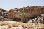
Only one of the shelters contains paintings, but those are truly impressive. There are a series of Iheren style scenes in isolated patches along the whole length of the ceiling of the huge shelter, which is large enough to have a palm tree growing right inside (not exactly helping with photography...).

There is another shelter on the far side of the ridge, containing some more weathered Iheren style paintings, but also a remarkable panel of filiform figures the like of which I have not seen elsewhere.
It was late afternoon by the time we finished photographing the two sites, we returned to the asphalt road and drove the short distance back to the Adjujel region, where we made camp just below the main Iheren style shelter, which Magdi has not seen before.
Day 10. Adjujel - Tim Ras - Djanet
The Adjujel shelter is open towards the south-west, so the light is best in the early morning (hence the reason we camped here). We climbed up and spent a long time in the shelter enjoying the exquisite paintings, some of the finest in the entire Tassili.
With no time pressure, we re-visited the small nearby site we found with Bruno last October, this time capturing the ostrich next to the faint rhinoceros, of which I could only see the tail on the photos the last time. We then did a more thorough search of the rocks further to the north and the east, but found nothing more.

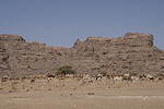
We have pretty much completed everything we wanted to do in the Central Tassili, it was time to slowly head back towards Djanet. We packed camp and drove back towards the Dider plain, then on the Route Nationale towards Bordj el Hawass and Djanet. Passing Tazerouk, just above the pass descending the plateau, we encountered an unusually large herd of camels with many newborns, being driven to new pastures.
We had one remaining place to visit before entering Djanet. A fine rock art site with chariot depictions was reported by Nadia Bahra on a conference in 2007 from the area of Timghas (Timras), a picturesque area of inselbergs just to the west of Djanet. The location information vas very vague, and Lhote in his compilation of Saharan chariots makes no mention of this site. On Googe Earth I have spotted a stone enclosure in the area which was the likely spot, fortunately on mentioning the area to Ochi he confirmed that he knows several sites there, both the chariots and the enclosure site, which are different. We turned off the road and drove among the dunes towards the first site. As we approached, we passed a large shelter at the base of an inselberg which Ochi did not know, we stopped to investigate and did find a few painted figures. We also noted that it became very hot, we have descended from the cool plateau to the sandy plain below, it was a good five degrees warmer, well above thirty at midday.
The site Ochi knew was a couple of kilometres further, a small low shelter with bright Cabbaline style paintings including a chariot on the ceiling, the site reported by Bahra.
The site with the enclosure I spotted on Google Earth was a little over a kilometre to the south, but needed a large detour due to some impassable dunes. The enclosure turned out to be modern, built by the Parc du Tassili to prevent vehicles from approaching. Inside we found a series of fairly faded paintings, including three chariots on the rear wall. To my knowledge, despite apparently being well known, this site has not been published anywhere.
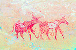
Ochi knew of two more sites which he found himself many years ago. The first one was a small shelter with Cabbaline paintings, including a striking row of six horses on the rear wall.
The last one was a cluster of three minor sites, the first two shelters had only a few faint and smudged figures, but in the third one there was a very interesting scene, unique on several counts. A fine (Iheren style ?) oryx and another antelope were both re-drawn as cows at some later time, one of them being milked, a very fine ending to our trip.
By now it became very hot, it was time to cover the remaining fifteen or so kilometres to Djanet, where we spent a lazy afternoon in the Essendilene house, getting ready for the flight home early the following morning.
We plan to return to the Tassili n'Ajjer again in October 2024, to make a sixteen day camel supported trek to the finest classic sites of the Tassili (Tamrit, Tin Tazarift, Sefar, Jabbaren), plus some lesser visited areas. The trek will be followed by a short visit to Ti Leh-Leh (Oued Zarzawa) and the newly found sites at Adjujel. Please check the News page periodically or "like" the FJ Expeditions FaceBook page to receive notices of news and updates.