
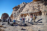
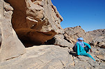
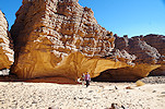
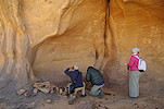
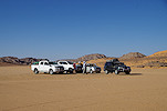
 Click on image for list of participants |
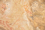
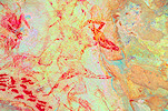
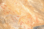
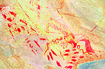
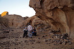
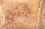
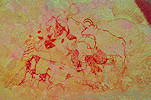
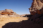
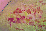
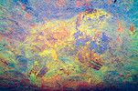
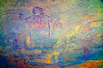
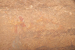
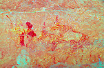
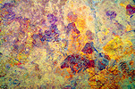
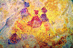
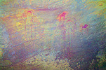
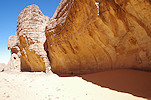
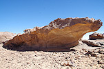
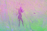
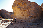
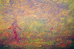
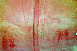
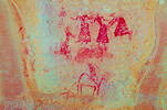
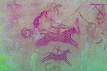
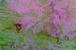
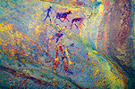
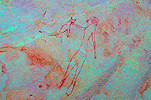
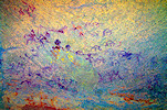
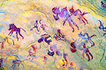
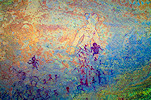
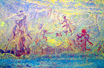
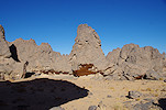
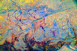
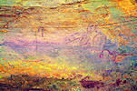
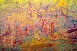
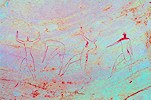
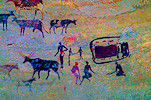
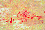
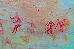
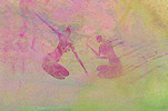
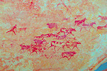
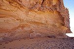
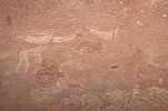
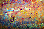
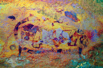
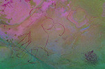
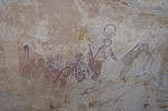
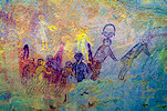
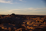
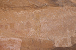
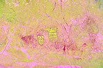
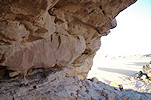
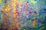
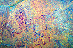
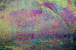
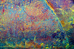
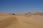
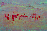
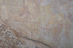
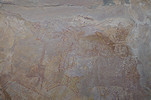
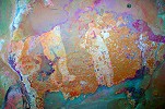
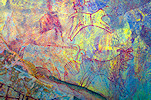
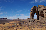
Tassili N'Ajjer & Southern Tadrart, Algeria 15th October - 5th November, 2022 There is no published catalogue and accepted nomenclature of the Tassili sites, the provided site numbers are for convenience only, developed by myself utilising the topographical names used by the Lhote missions and others to be able to reference individual shelters. False colour images processed with DStretch, a freely available software developed by Jon Harman Quick link to the start of the second part (Tadrart) of the trip account |
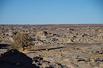
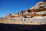
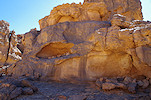
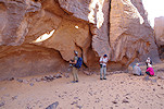
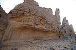
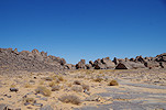
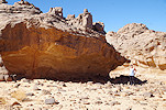
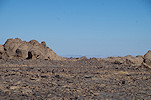
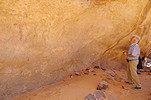
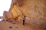
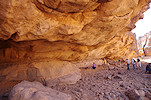
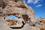
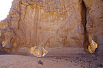
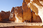
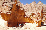
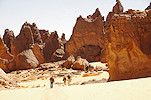
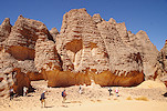
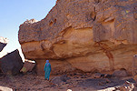
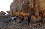
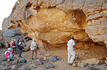
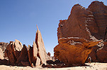
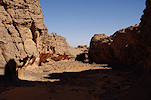
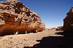
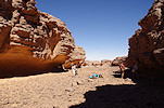
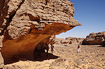
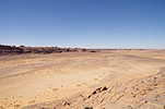
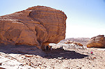
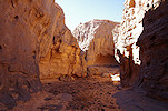
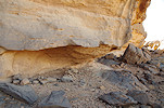
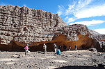
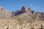
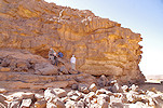
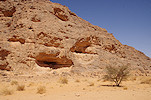
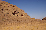
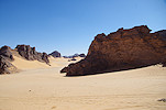
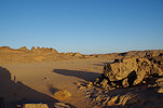
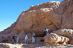
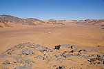
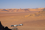
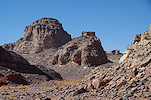
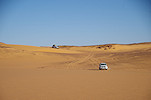
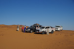
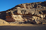
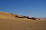
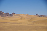
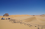
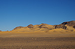
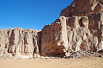
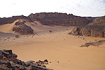
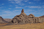
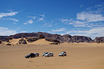
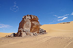
The classic sites of the Tassili n'Ajjer recorded by the Lhote expeditions of the late fifties - early sixties have been inaccessible since 2012 due to security concerns because of the closeness of the Libyan border and the ease of access to the plateau from the east. Ever since our last visit in October 2011 I was hoping to return, finally this year the Algerian authorities opened the plateau for foreign visitors, and we immediately took advantage of the opportunity. The southern part of the Tadrart plateau was also opened for travel, so after the ten day trek on the plateau we took another eight days with vehicles to visit the famed Abri Freulon and the other southern Tadrart sites.
Day 0. Algiers - Djanet
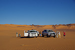
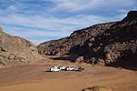
With a late evening flight to Djanet, most of our party arrived with various flights during the day from corners of the world, with a few the day before or even earlier. With the new international terminal now fully functional, the domestic flights now depart from the old international terminal, a far better experience than the old domestic one. Our flight was reasonably on time, we arrived at Djanet soon after midnight, and settled in to the Essendilene Voyages premises for what was left of the night.
Day 1. Djanet
The morning was spent in a lazy mode after the overnight flight, with the rest of the day planned for preparing all the logistics.
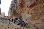
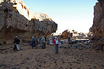
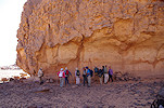
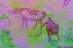
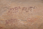
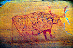
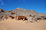
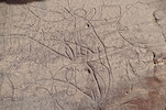
Late morning I drove to town with Salah to do our shopping, while the rest of our party set out on foot to visit the paintings and engravings near the Essendilene premises in Azelouaz (which we re-located with Magdi in November 2016). In the afternoon I continued sorting and re-packing our supplies while the others visited the "crying cows" and other nearby sites. In the evening after dinner we drove to the foot of the Akba Tafilalet to sleep there and be able to start our climb at sunrise.
Day 2. Akba Tafilalet - Tamrit
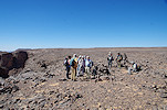
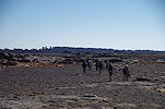
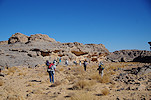
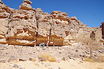
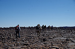
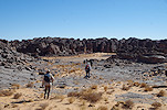
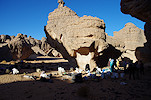
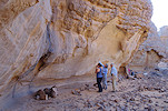
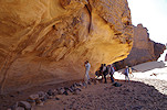
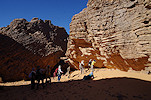
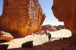
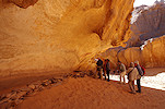
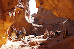
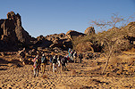
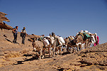
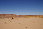
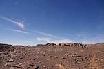
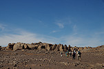
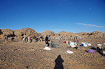
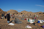
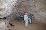
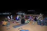
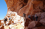
Our plan was to spend ten days up on the plateau visiting the principal sites, but also several remoter areas not on the regular tourist itinerary. Unfortunately there was only very little rain at the beginning of October, most of the gueltas on the plateau were dry, so the logistics were quite challenging with the only water available at Tamrit and Sefar, and the donkeys needing water every three days. After some negotiation with our guide Mohammed Mechar (a son of Djebrine, the guide of Henri Lhote) and the donkey herders we agreed on a manageable itinerary, and after a quick breakfast we set out on the trail towards the pass. As usual the donkeys were to follow after a lengthy loading process, overtaking us at some point then meeting again at the evening camp.

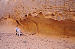
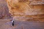
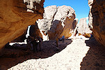
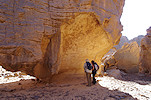
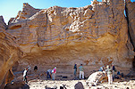
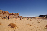
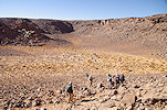
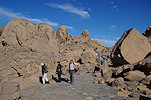
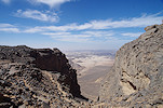
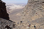
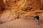
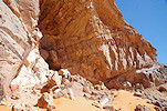
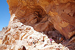
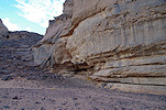
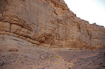
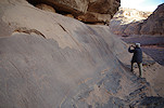
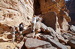
With a 600m climb over a horizontal distance of seven kilometres, the ascent of the Akba Tafilalet was to be the toughest day of our trek. The pace was set to the slowest of our party, it took all morning to climb the multiple stages of the pass, with the donkeys catching up with us just before the last step, ascending the steep zigzagging trail then disappearing on the top.
We took the more direct route unsuitable for pack animals, reaching the plateau top in the early afternoon, following a short lunch and midday rest just below.
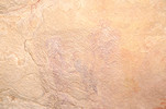
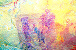
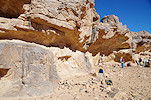
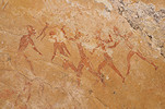
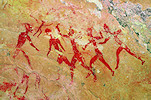
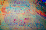
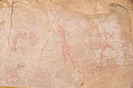
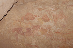
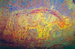
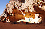
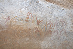
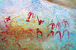
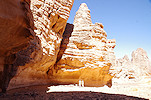
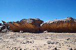
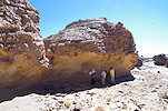
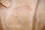
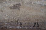
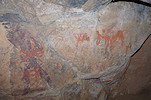
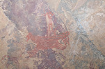
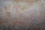
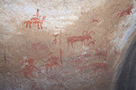
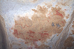
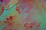
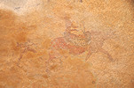
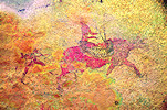
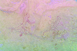
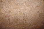
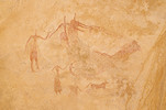
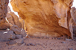
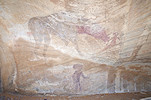
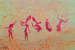
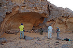
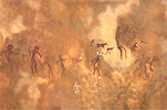
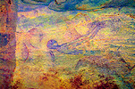
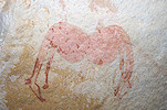
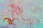
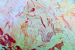
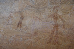
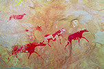
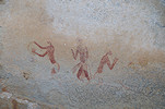
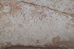
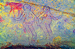
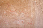
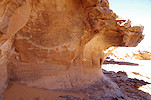
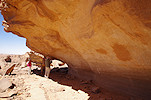
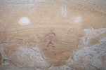
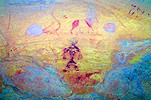
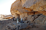
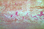
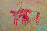
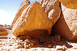
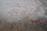
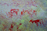
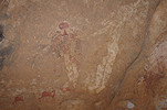
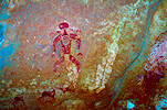
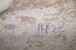
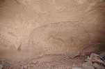
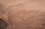
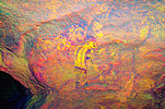
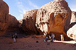
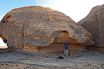
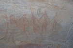
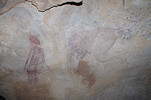
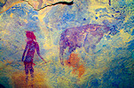
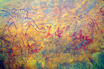
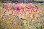
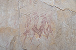
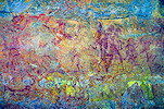
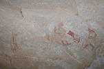
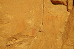
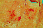
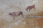
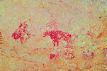
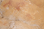
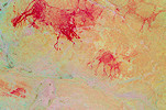
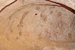
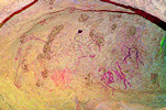
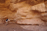
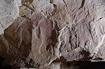
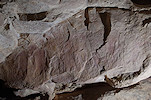
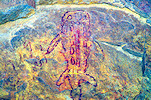
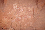
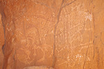
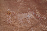
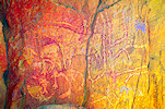
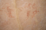
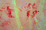
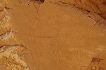
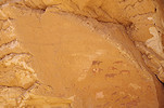
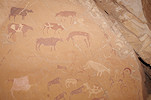
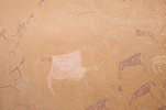
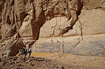
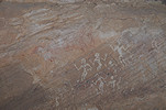
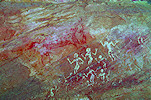
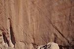
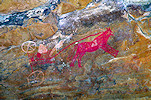
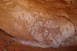
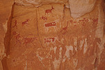
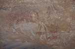
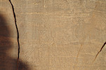
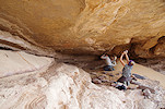
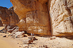
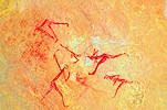
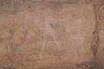
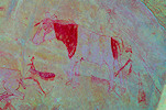
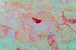
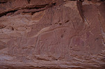
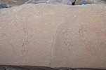
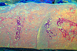
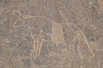
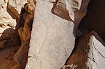
Our first target was the shelter with the famed antelopes of Tamrit, a short distance before the campsite. As we approached, Mohammed showed us a shelter (TA 1/B) only a short distance from the main site (TA 1/A) which we did not see on any of our previous visits, but later I could affirm that it was seen and copied by the Lhote mission. The paintings were extremely faint, we could only discern some partial roundhead figures, but DStretch reveals a very complex sequence of superpositions.
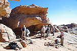
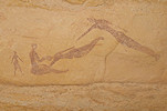
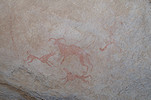
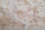
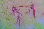
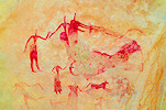
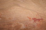
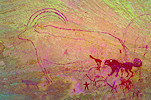
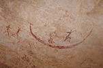
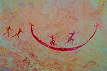
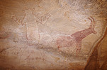
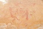
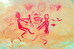
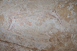
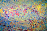
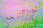
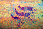
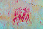
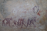
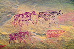
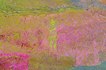
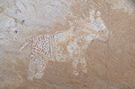
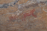
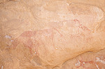
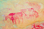
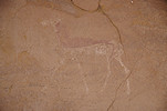
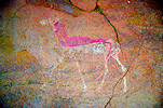
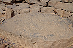
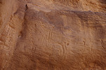
The antelopes (TA 1/A) were just a few rocks beyond, and here too there is much more than just the visible hippotragus. There is a particularly interesting group of Iheren style plumed figures of which now practically nothing is visible on the spot.
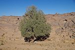
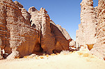
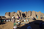
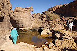
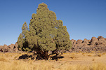
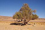
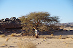
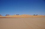
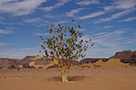
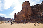
We followed the Oued Tamrit towards our campsite, encountering the first of the cypress trees (Cupressus dupreziana) along the way. Our campsite was at the foot of the rock towers, not far from the guelta.
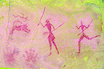
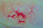
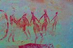
We had about an hour and half of daylight left, while some of our party decided to rest after the long climb, the rest of us went off to visit the large shelter (TA 2) in the main valley of Tamrit, with the Iheren style "hunters" copied by the Lhote mission, of which I have managed to take only a few dark and blurred shots on our last visit in October 2011
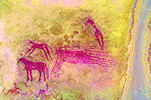
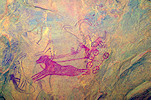
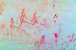
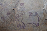
On our way back to camp, armed with some intelligence on the likely location, we searched for, and successfully found the double shelter with the horse-drawn chariots (TA 6) which were copied by the Lhote missions, but their whereabouts were not known to any of our local guides.

Day 3. Tamrit - Timenzouzine - Titeras n'Elias - In Itinen
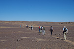
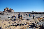
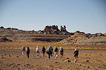
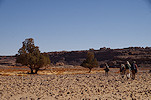
After our ascent, most of the remaining days were to be comparatively easy walks of 8-10 kilometres, with many stops at rock art sites along the way. Today was no different, we had about 8 kilometres in total to cover, our plan was to see the intervening sites in the morning and have lunch at our In Itinen camp. We started out after breakfast with light packs, the donkeys taking all our luggage and supplies to our next camp later in the morning.
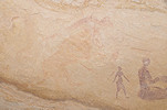
Our first objective was the locality of Timenzouzine, about two kilometres west of Tamrit. We have visited these sites on our second Tassili trip in 1993, but not since. Along the way, Mohammed showed us a little niche with a delightful little Iheren style scene inside. Mohammed said that he found this site many years ago and no other guides know about it, a claim that might even be true. No Lhote copies exist, and I have never seen any photos of it, though I'm aware of at least one part visiting it decades ago (quite possibly with Mohammed), referring to it as Ta-Mellet.
Reaching Timenzouzine, we first stopped at the large engraving of an elephant (site TM 1) at the beginning of the valley with the paintings. Sometime in the intervening nearly 30 years since our previous visit the Tassili Park erected a wooden viewing platform, quite helpful in taking photos of the rather hard to see figure.
The valley of Timenzouzine was just beyond, with long shelters on both sides, the east one (site TM 3) continuous, the west one (site TM 2) divided into several sections. We started along the western side, where a number of panels with some of the best scenes were precariously close to coming out into the rising sun, a few already requiring shading.
The finest scene is in a small shelter (TM 2/D) just at the end of the western side of the valley. It is not entirely clear what is happening, and intriguingly there appears to be (an earlier?) Iheren style feline (judging from the curved tail), which does not appear in the Lhote tracing (MNHN 57-118).
The eastern shelter (TM 3) has some large panels with very complex roundhead scenes with numerous superpositions, a group of large fishes appear on the Lhote tracing (MNHN 57-99), but on the spot very little is visible.
As we were leaving Timenzouzine, we passed a small shelter with some very faint pastoralist paintings (TM 4), which were later identified to match one of the Lhote copies (MNHN 57-77). However when reviewing all the photos taken at this locality after the trip, it became clear that we did not see many of the sites corresponding to the existing Lhote copies. It is likely that these are in the adjacent valley of which Mohammed was not aware, another lesson learned in the need for a thorough advance preparation and the limits of the knowledge of even the best local guides.
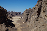
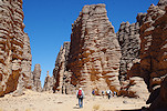
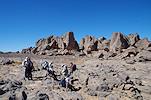
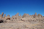
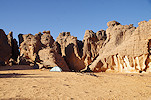
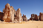
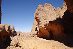
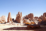
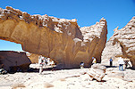
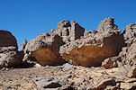
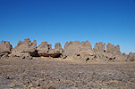
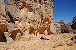
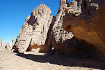
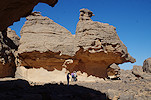
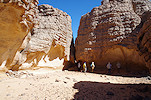
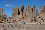
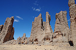
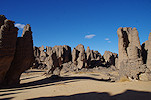
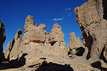
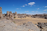
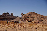
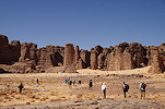
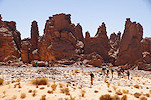
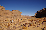
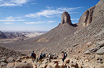
After Timenzouzine we continued through the area of amazing rock towers towards the well known sites of Titeras n'Elias.
With no time pressure to continue, we could spend a leisurely time going through all the known sites. I finally managed to find the lion hunt scene (at site EL 10) which I missed on all previous visits.
As we were about to leave towards In Itinen, Mohammed showed us a small niche above eye level, which contained the strange white "Egyptian" figures the Lhote mission have copied (MNHN 62-100) but which we failed to see previously (site TE 7).
From Titeras n'Elias we followed the broad In Itinen wadi towards the north, to the "rock city" where in 1962 Henri Lhote recorded a number of very interesting sites. As these sites were recorded after the publication of the books of both Lhote and Lajoux, the paintings are mostly unknown, the only record being the Lhote copies which till recently were inaccessible. Our donkeys have arrived to the camp among the rocks well ahead of us, we had a quick lunch and some rest before heading out in the afternoon to see the sites.
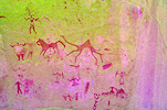
In Itinen is not on the regular tourist trail, and Mohammed admittedly knew the locality, but only a few of the paintings. Fortunately the Lhote mission prepared a reasonably accurate map of the locality based on aerial photographs, with all the shelters with paintings marked (though without any cross-reference to the copies). Tak had contacted Yves Martin, the artist who did the 1962 copies for Lhote, who from memory could identify the location of the most important Iheren style panel, but not the rest. Still, this was better than nothing, While the others erected the tents and took a short rest, I checked out the marked spot and indeed found the "Exodus" scene (site II 2) with the many mounted cattle not far from camp. We soon returned with the group, naturally a lengthy photo session ensued.
For the rest of the afternoon we systematically followed the marked shelters along the eastern part of the "rock city", starting at the one adjacent to camp (site II 5). The paintings were extremely faint, we could only discern two large "great god" figures, but checking later this site turned out to be the one with the crocodile and the chariot (MNHN 62-69).
In the "street" leading west we found another 14 shelters with paintings, some just a few figures, while others major compositions matching the Lhote copies.
We finished the day at a small true cave underneath a huge detached rock, with a number of very interesting, but unfortunately also very damaged roundhead paintings, including a hard to discern large animal with a mask between its feet (site II 21)
Day 4. Ouan Derbaouen - Ouan Agouba
The previous afternoon we have noted a large west facing shelter close to camp with some barely discernible large roundhead figures (II 3). It was fully exposed to the afternoon sun, this morning at first light we returned, and could discern (and photograph) the figures much better.
On the same 1962 expedition Henri Lhote recorded a number of spectacular sites at two localities to the west of In Itinen, Ouan Derbaouen about two kilometres away, and Ouan Agouba a further two kilometres beyond. Mohammed knew neither, however fortunately site plans existed for both, prepared by Lhote based on aerial photographs, which were fairly easy to match with Google Earth topography. Using In Itinen as a base camp, we planned to visit both on a day-trip, after breakfast we set out towards the first locality.
While the Lhote map transcribed to Google Earth waypoints proved surprisingly accurate, it did not reveal the preferred access routes. Once we reached Ouan Derbaouen, we needed some time to find the best way towards the first of the marked sites ("Le grand abri", DB 8), which we finally reached on a rather circuitous path.
We continued past a number of lesser sites, and unexpectedly came upon a small niche with the splendid scene of a white spotted cow being led through a U shaped gateway (DB 3). This scene was only known for a long time from the Lhotoe copy (MNHN 62-33), which for some reason is missing from the scanned images available online. Bernard Fouilleux finally published a photo of the site in 2007 (Sahara 18), and he commented that even with DStretch it is very hard to ascertain the accuracy of the tracing. Now with better digital imagery I can only say the same, I was unable to see many of the supposed figures shown on the Lhote tracing.
The main site of Ouan Derbaouen is a huge Iheren style panel (DB 1) that was reproduced in several publications. Yves Martin gave a good indication on its whereabouts to Tak, we had no difficulty finding it, fortunately in good shade. The main panel was very faint, but DStretch reveals many of the intricate details on close-up photographs.
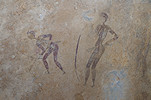
There is another smaller shelter (DB 2) about fifty metres from the main panel, also containing some fine Iheren style scenes, including a group of archers and a strange knotted rope (?).
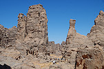
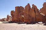
We took a long time to photograph all the scenes at the two sites, it was late morning by the time we were ready to continue towards Ouan Agouba. Fortunately the way was easy, by midday we were approaching the rock towers of the northern cluster of sites.
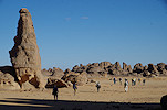
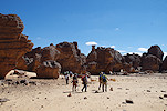
The "rock city" of Ouan Agouba faces a flat stony terrace towards the south, with a row of shelters facing the plain. After a quick lunch in a shady spot we followed the row of marked shelters along the edge of the rocks, finding panel after panel of paintings familiar from the Lhote tracings.

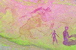
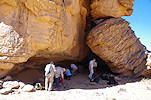
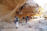
There were a number of rock faces marked with paintings on the Lhote map in the interior of the "rock city", but every attempt at moving closer was thwarted by impassable rock walls or deep drops, the interior looked impenetrable. Finally I found a difficult passage that involved an uncomfortable scramble up a narrow chute, reaching a flat terrace surrounded by shallow shelters that were full of faint but impressive roundhead paintings, including a nearly life-sized rhinoceros.
We continued along the southern edge of the "rock city", finding several more shelters with paintings, not all of which were marked on the Lhote map.

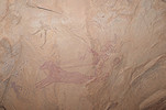
There was another cluster of paintings in the interior of the rocks, behind the last site on the edge. This time we found an easy way in, so we could all take a look at the panels, some strange, some absolutely delightful like the scene of a woman hunting a tiny rabbit.

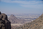
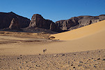
By now it was approaching 3pm, we had three hours of daylight left, of which at least an hour and a half was needed to return to our camp at In Itinen. Leaving a few marked paintings left in the northern area for a next visit, we moved to the southern area about a kilometre away, also referred to as Tin Tartaït on some Lhote copies, but not consistently. As we walked over the plateau, the edge of the Tadrart Acacus in Libya was clearly visible in a gap towards the west, a good 60 kilometres away.
We started at deep cave-like shelter (site OA 23) which contains a complex series of superpositions starting from roundhead figures to a horse-drawn chariot.
We only had time left for a very rapid survey of the nearby sites marked on the Lhote map. They were mostly late pastoral (cabbaline) or later camel period scenes.
We started making our way back towards In Itinen around 4pm, and in little over an hour we covered the four kilometres to our camp. Checking the photos against the Lhote copies after the trip, we have managed to see most of the recorded panels at Ouan Derbaouen, but there are quite a few missing at Ouan Agouba / Tin Tartaït, something for a next visit.

Day 5. In Itinen - Tin Aboteka - Tin Tazarift
We still had the western half of In Itinen to visit, our plan was to spend the morning there, while our donkeys were to move camp to Tin Tazarift, where we would end up by the evening after a detour to visit Tin Aboteka. With our next camp three kilometres away as the crow flies, and our longer route no more than four, we could afford a lazy morning and a slow start. While we packed our bags, Petra spotted some paintings right at our campsite which we haven't noticed before.
One cluster of sites is in the middle of the rocky area west of the Oued In Itinen. This looked like a good spot to leave our packs and be used as a base to explore the surrounding area, following the red marks on Lhote's map. There was a panel of paintings on practically all of the suitable looking rocks, all pastoralist scenes.
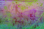
The cluster of roundhead paintings we were most eager to see were concentrated around two larger open areas near the western end of the In Itinen area. All were very faint, it requires DStretch to appreciate most of the panels.
We still had one major site missing, by process of elimination it had to be somewhere to the east of the cluster where we left our bags. After some systematic searching we found it (strangely it was not marked on the Lhote map), in the morning we passed it without seeing anything as it was fully out on the sun. Now that the sun moved and it was in the shade, we could see that the shelter was full of very faint but rather impressive paintings, the ones we were looking for based on the Lhote tracings.

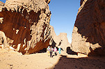
We have thoroughly searched the area and were reasonably convinced that we found all sites (as it turned out, this was not the case - after the trip there remain over a dozen Lhote copies from this locality which we could not match to any of the visited sites), so we had a quick lunch and set out towards Tin Aboteka, about two kilometres to the north. We passed through an amazing region of rock towers, and saw several promising shelters, but Mohammed said they were all empty (they indeed were, after checking).
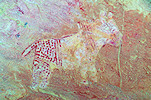
We approached Tin Aboteka from the south west, and Mohammed led us straight to the shelter with the horse-drawn chariot (AB 20), a site recorded by Lhote which we did not see on our visit in 2011. There were two more adjacent sites along the southern side of the "Esplanade" which were not recorded by the Lhote missions, one with some exceptional large figures.

There are two more sites with chariots along the "Esplanade", one on a small rock outcrop, barely visible, reported by Marie-Jean Nezondet (AB 16). The other in a large shelter along the northern side (site AB 15) was recorded by Lhote.
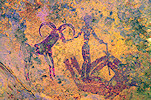
From here we continued to the well known core sites of Tin Aboteka, tightly clustered within a 100 metre radius around the site with the large unidentified animal (AB 7). We spent much of the afternoon at the highlights, including the very well known large archers (AB 4).

As we started leaving towards Tin Tazarift in the late afternoon, we passed by two panels on two sides of the same rock outcrop which we did not see in 2011. Both of them were known from Lhote copies, one (AB 1/B) showing a large baboon underneath pastoralist paintings, the other (AB 1/A) a group of humans with a bizarre headdress.
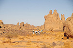
We made our way through the maze of rock towers separating Tin Aboteka from Tin Tazarift. Despite a number of suitable shelters, rock art is strangely absent from this zone.
We reached our campsite at the "main square" of Tin Tazarift just before sunset. The big roundhead site (TT 1) was just around the corner, before going to camp we stopped to photograph the site as it is out in the sun in the early morning.
Day 6. Tin Tazarift - Tin Teferiest - Sefar
In the morning as usual we packed camp and loaded the donkeys, their drivers keen to leave early as the donkeys had no water for the past three days, and there was a guelta at Sefar. We were in no hurry, our next camp was only two and a half kilometres away in a straight line. We planned to visit Tin Tazarift in the morning, then make our way to Sefar via Tin Teferiest in the afternoon. We started at the "Lotori" (TT 4) and warthog with superimposed fish (TT 3) sites, very close to camp.
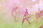
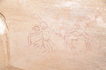
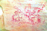
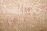
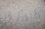
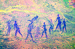
We spent the rest of the morning moving slowly along the long corridor filled many of the classic sites of Tin Tazarift. This locality has been thoroughly documented and we already visited it multiple times, so we did not expect any major surprises, but it was always a more hurried visit, now we had as much time as we liked at all the shelters. I was particularly happy to find the curious "rabbit eared" figure copied by the Lhote mission (MNHN 57-328) at site TT 7/A which I have looked for but did not find previously. This site is also a very good illustration for the caution needed when looking at the Lhote copies. Comparing the scenes, it is clear that the panel is compressed on the copy, with figures missing, distorting the composition and making unrelated scenes to appear as one.

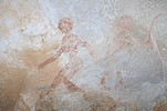
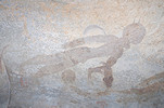
We finally saw the "Egyptian boat" shelter (TT 13/A) in good light (on previous visits it was either partially on the sun, or we reached it in near-darkness). It is hard to say what the curved object or more likely double-headed animal (for which there are several analogies) is, but almost certainly is not a boat. It appears that the two archers are aiming at the heads, both of which face the archers. Nearby we found several of the smaller scenes which we missed on the hurried visit last time, including the strange long-necked antelope at TT 13/C.
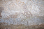
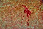
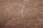
We reached the huge shelter of TT 15/A at the western end of the locality, best known for the strange double headed giraffe, but with a wealth of other scenes, both from the roundhead and pastoralist styles. Jean-Loïc showed us an easy to miss but delightful little scene of a man holding a fox or dog, which I have never noticed before.
We returned along the southern edge of Tin Tazarift to the last cluster of sites near the "great plaza" and our campsite. Here too there were several details which were either out on the sun on previous visits, or have missed them completely.
By the time we returned our campsite was empty, the donkeys have moved on to Sefar. We looked for a suitable shady spot a little beyond for a short lunch and rest, then followed them towards the east along the southern edge of the near continuous maze of rocks. We soon reached the known sites along the Tin Teferiest wadi, marking the half-way point between Tin Tazarift and Sefar.
Mohammed only knew these sites by the donkey trail, however at Tin Teferiest there is a spectacular roundhead site that was published in the book of Lajoux, and also copied (but not published) by the Lhote missions of 1959 & 1960 (MNHN 59-123, 60-215). We only had a general idea of the likely location, so the afternoon was allotted to search for this site. The likely location identified on Google Earth turned out to be empty, we spread out among the maze of rocks to search the suitable looking shelters. As we progressed, Mohammed started to recall that many decades ago, during his childhood Djibrine showed him the site we were looking for. He disappeared among the rocks, and after about five minutes we heard him yell that he found the site. It turned out to be not one, but two distinct shelters, about two dozen metres apart.
We received an extra bonus, Mohammed found a further panel of roundhead paintings a little further among the maze of rocks, which is apparently unrecorded, at least no Lhote copy or Lajoux photo are known to exist. On the spot only the roundhead figures are visible, but DStretch reveals a large complex panel of pastoral paintings that are superimposed, but strangely fainter.
While we were searching for the first site, I found a small panel with some faint paintings in the opposite direction, the most interesting being a horse (?) rider. Again DStretch reveals much more than what was visible on the spot.
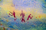
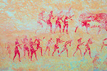
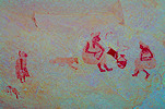
Rather satisfied with our results, we continued towards Sefar, rapidly covering the remaining one kilometre. We still had enough daylight left to make a stop at the "Amazon's shelter" (site SF 1), a large shelter with a very complex series of superpositions. There are a number of roundhead figures and scenes, plus some of the finest Iheren style scenes at Sefar, many of them so faint that they are only revealed with DStretch. Naturally we had a lengthy photo session before moving on to our campsite among the rocks bordering the Sefar wadi.

Day 7. Sefar
We were to stay for two nights at Sefar, allowing a full day to visit all the sites at an unhurried pace. After breakfast we started at the northern half of the site, at the "Great fishing god" shelter (SF 2) being closest to camp. Using the Lhote map, we also found the panel of ostriches (SF 58) copied by Lhote nearby, which none of us have seen before.
Just off the "street" of the frieze of hippotragi there is a cluster of sites surrounding an enclosed large open area ("Cirque des totems") which is not on the regular tourist trail, and which we did not see before. While all the shelters with paintings were marked on the map, only a few of the panels were actually recorded by the Lhote team.
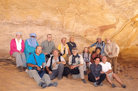
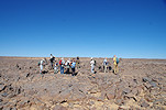
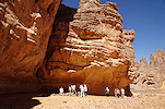
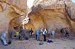
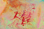
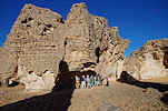
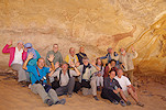
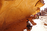
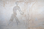
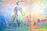
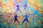
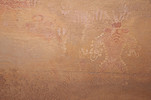
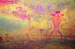
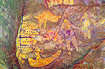
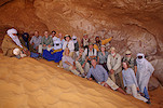
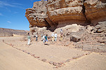
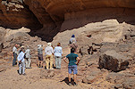
The "Great god" site (SF 9) at Sefar is arguably the most impressive among all the Tassili paintings, and is in a relatively good state of preservation in comparison with many of the other sites. Here too there are many details and hidden scenes that are only visible if looked at with DStretch. We spent a long time at the site (and the adjacent panels on all sides of the square), which was in perfect light. It was also an ideal spot to take our group photo, which was not an easy affair to assemble with such a large group.
For the rest of the morning we continued along the path through the multitude of sites towards the northern end of Sefar. These were all well known sites, we saw nothing new except for the remarkable unfinished figures at site SF 56 ("L'arracheur de dents") known from the Lajoux photo which we did not see on any of the previous visits, despite having visited the shelter itself.
By the time we saw all the sites it was well past noon. On our return to camp we passed by the site of the two large facing figures (SF 51). We saw it on our very first trip in 1991 but not since, I did not remember its precise location so I was very pleased that Mohammed showed it to us. Unfortunately the figures are very faint, one can only make them out with DStretch.
After lunch and an hour's rest we set out again, this time for the southern part of Sefar. We started at the shelter of the masks (SF 31), and this time with the help of Lhote's map we could find the nearby shelter (SF 46) with the very strange warthog (?) depiction.
Following the Lhote map rather than the usual tourist trail, we passed by a faint but interesting site (SF 49) which shows, among others, a scene with some humans running with cattle, a very unusual depicton.

We re-joined the tourist trail along the "Rue de la Negresse", following the series of shelters along its southern side. There were no surprises to be expected here, but Petra and Peter did find an interesting bent-legged human figure at site SF 39/A which was unknown to both Mohammed and myself.
We continued to the group of sites which for some reason were not known to Lhote, they only appear on the photos of Lajoux, including one of the finest pastoralist sites (SF 35) in the Sefar-Ozaneharé style. No doubt it is preserved so well because it is high up beyond reach, it was never wetted for copying or for better photographs.
Sunset was approaching, so we started moving back towards camp via the "Greek warrior" site (SF 43) which is out on the sun for most of the afternoon. We just reached it as it moved in to the shade, but still very little was visible.
We finished the day at the fine site (SF 44) on the far side of the Oued Sefar just opposite camp.
Day 8. Sefar - Tin Kani - Alanedoumen
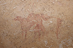
This was essentially a transit day, to cut the long distance between Sefar and Jabbaren into half. As usual by now, we packed camp and had breakfast at sunrise, and departed shortly after, with our donkeys being loaded and following later. Our first stop was at the big shelter of Tin Rassoutin about five kilometres to the south of Sefar, with some very fine late pastoral (cabbaline) paintings overlying several earlier Iheren style scenes.
Shortly after Tin Rassoutin the donkeys have caught up with us, then swiftly overtook us heading directly for the camp at Alanedoumen, while we made a small detour towards the Tin Kani paintings.
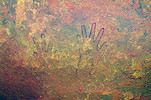
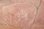
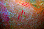
We reached the first site of Tin Kani shortly before midday. It was a pair of adjacent shelters which we visited in 2011, however thoroughly searching the first shelter we found some remarkable painted hands which we have not seen before.
Passing by a couple of lesser sites we continued to the main roundhead shelter at Tin Kani (site TK 4), with a spectacular warthog and many other figures. This was also a perfect spot for lunch and some rest before seeing some more sites in the area.
After the midday rest we took a slightly different route than last time, Mohammed showed us a number of camel period paintings which we have not seen on the previous trips.
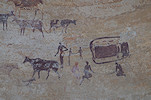
We reached Alanedoumen marked by the huge cypress tree in the valley shortly before 4pm. Our camp was adjacent to the large engraved rhinoceros and the small shelter with the two chariots, we visited both before preparing camp.
This was our longest walk to date, about 13 kilometres, most of our party called it a day and decided to take a rest, while a few of us went down to the valley a few hundred metres away to see the main paintings of this locality
Day 9. Alanedoumen - Ozaneharé - Jabbaren
This was to be our longest day, about 20 kilometres in total, as we planned to make a large detour to see the sites of Ozaneharé. We already made this trip in 2011, but at the time our guide did not know the sites, and while we had a rough idea of the locality, we could not find any of the paintings in the maze of rocks. Now I was better prepared, but Mohammed also said he knows the sites. Jean-Pierre and Tak elected to take the direct route to the Jabbaren camp, about ten kilometres from Alanedoumen.
This time we did not follow the Oued Alanedoumen, Mohammed took us on a somewhat more southerly course and we soon entered another watercourse, encountering several cypress trees and a water filled guelta before entering the Ozaneharé plain, marked by a pair of huge cypresses, larger than any I have seen before.

Ozaneharé is one of the few major rock art localities on the Tamrit plateau which was not recorded by any of the Lhote missions. The paintings were first reported by Jean-Dominique Lajoux, who made a visit in 1960 and published some of the photographs in 1962. More recently Bernard Fouilleux (Cahiers de l'AARS, 2007, 2010) and Amel Mostefaï (Cahiers de l'AARS, 2013) published short papers showing some of the sites, but there is no comprehensive record.
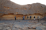
Armed with proper location information and Mohammed's memory, this time we had no difficulty finding our way up the low plateau bordering the plain to the east, and soon stood at the entrance of the small opening which Mostefaï referred to as "Culoir Tête Ronde". The shelters along both sides (sites OZ 21/A & OZ 21/B) of this one-way the "street" (the northern end is blocked) are covered with paintings, mostly of the roundhead style, hence the name. It was a bit annoying to realise that in 2011 we were searching just 100 metres further north... Unfortunately these paintings were in a rather bad state of preservation, a good illustration that while some damage is undeniably due to the wetting technique used by the Lhote team during copying (and later copycat guides and tourists), in many cases the paintings were damaged and faint already, as was the case here where no copies were made, and is far from the regular tourist trail.
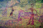
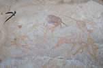
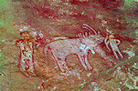
The "Culoir Bovidien" of Mostefaï (sites OZ 22/A - OZ 22/C) was in the adjacent "street", also closed towards the north. As the name indicated, we found mainly pastoral paintings here, including a totally unexpected, delightful scene of three hippopotami which I have not seen reproduced anywhere.
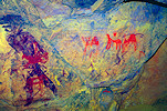
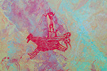
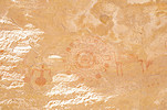
The Ozaneharé sites are located along both banks of a deep ravine cutting the plateau. The northern side is mostly composed of the "Culoir Tête Ronde" and "Culoir Bovidien" sites. While there were a few scattered sites further north, looking at the passing time (it was already close to midday) we decided to move to the southern half on the far side of the oued, with most of the better-known scenes. While we had a good idea of the location of the paintings, we did not know which shelter matched which scene. We moved to the centre of the southern area to leave our packs and start exploring. Looking at the wall next to where we unloaded (where we had no indication of any rock art, and Mohammed did not know any either), by pure accident we found the well known black rhinoceros, the most important scene at the location (site OZ 11/A). Bernard Fouilleux spotted a very fint pink rhino next to the black one, we found both right at the beginning, we did not even need to search. DStretch reveals that both rhinos are part of a hunting scene, and there is a very faint young rhino just in front of the large black one.
On the far side of the "street" with the rhinos, there were two embayments with numerous shelters (sites OZ 12/A - 12/B and OZ 13/A - 13/C), where we found a number of fine panels, some known from Lajoux's photographs.

We had a very quick lunch in the shade near our packs, then continued exploring the area behind the rhinoceros panel, towards the south. We found many painted shelters, some known from publications, some shown us by Mohammed.
We allowed ourselves till 2pm to photograph the sites, as we still had a good 10km to cover till camp, including a nearly 100 metre climb out of the broad valley to the top of the plateau towards Jabbaren. In the end we saw a good portion of the Ozaneharé sites, but we still missed some of the Lajoux photos. Picking up our packs we descended again into the broad valley, and trudged along towards its southern end, marked by several large cypress trees.
At the southern end of the valley we turned west into the Oued Tabarakat, taking a camel pass up to the plateau after a few hundred metres. It was a long walk to camp, only interrupted by a stop at a late pastoral shelter known to Mohammed, encouragingly referred to as Jabbaren already, but in reality it was still the Tabarakat area. The paintings did not appear particularly exciting, it was only at home that I discovered with DStretch a remakable Ihren style antelope-headed therianthrope underneath the sitting late pastoral figures. It was another good hour and four more kilometres till a rather exhausted party reached the Jabbaren campsite shortly after sunset.
Day 10. Aouanrhet - Jabbaren
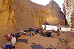
It was a bitterly cold night, with a strong wind and temperatures dropping to a few degrees above zero, rather unusual for late October. We huddled around the steaming kettle in a rather small shelter protected by a low stone wall, waiting for the sun to make things a bit better. After a quick breakfast we set out towards Aouanrhet, on the far side of the Oued Amazar, our target for the morning. While walking it did not feel so cold, and by the time we reached the far side of the valley the sun started to make things feel a bit better.
We reached Aouanrhet after about an hour, leaving our packs at the "Abri des elephants" (site AO 6) to explore the numerous sites along the eastern edge of the rocky massif. They were all well known sites, but for most of our group it was a first time visit to this locality, we spent a long time photographing all the scenes and trying to identify some of the fainter figures. I did not expect many novelties, so was rather pleased to find the row of running "Egyptian" figures in the "Abri des Egyptiens" (site AO 3) which I have missed on previous visits.
We collected our packs and passing the "hippo hunt" scene (the Lhote copy shows the hippo much closer to the boats than reality, quite possibly they are unrelated and represent different temporal layers) at site OA 11, we continued to the cluster of sites at the eastern end of the rock outcrops.
Leaving the best for last, we finished our round of Aouanrhet at the well known masked figure site (AO 1). As by now it was already past midday, we also had a quick lunch and some rest before heading back towards Jabbaren.
It took us another hour to return, climbing out of the Oued Amazar on a donkey pass at the rear of Jabbaren, making the approach from the East. This allowed us to start at the sites which are usually left to the end (hence always seen in a hurry to make it back to camp by sunset).
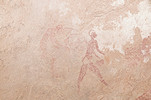
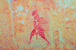
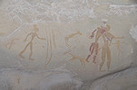
We started at the small enclosure surrounded by vertical walls with only a narrow entrance, with the delightful running archer that is among the finest representations of Tassilian art (site JA 24) near the eastern tip of the rocks hiding the Jabbaren sites. Going a little to the north, we also visited the huge bear-like animal which partially obscures a group of "Juges de paix" type roundhead (?) figures (site JA 26). Probably due to better lighting I have now found the scene which was known from the Lhote copies (MNHN 57-222) but I have not seen it before.
With Magdi we have managed to visit Jabbaren in November 2016 in a single day, taking advantage of a very brief window when day-trips were permitted. Thus I had some good photos of most of the sites in the western part of the locality, while Mohammed went off with the rest of the party to visit the row of sites, I took the opportunity to explore the western outliers. The fake "Egyptian goddesses" were found by Bernard Fouilleux somewhere in that area (Mohammed did not know where), I was hoping to find them, plus check the shelters for any other paintings. I did not find the fake panels, but did see two shelters (JA 32 & 33) with some faint pastoral and roundhead paintings, neither of which seem to have been recorded by Lhote.
There were two more sites at the eastern end of Jabbaren which we did not reach in 2016, now I had the opportunity to browse through the scenes at a leisurely pace, finding many details not captured during our 2011 visit. The others were still at the first one (JA 23) when I reached it, just about to leave for the next sites.
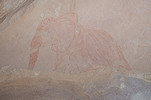
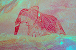
From here-on we were on well known ground, I could afford the luxury of cherry-picking the best sites and scenes as all remaining sites were more or less thoroughly photographed in 2016. I did find a few new panels though, like the elephant at JA 12, plus I have finally managed to capture the very hard to recognise large masked figure at JA 10.
With the sun sufficiently low, we started out towards the main site of Jabbaren West, the superb procession of roundhead figures (JW 3). As the shelter is facing west, this can only be photographed properly in the morning, or in the late afternoon after the sun has sunk below the bordering rocks. Fortunately it is on the way between the main site of Jabbaren and camp, so it is a perfect place to finish the day.
From the last site it was a short half an hour to camp, which we reached just before sunset. It was cold and windy again, after the sundowner and a quick dinner we packed ourselves into the (relatively) warmer tents and sleeping bags for our last night on the plateau.
Day 11. Tin Taharin - Akba Aroum - Djanet
It was another very cold night, even in the morning sun it stayed chilly in the strong wind as we packed camp and had breakfast. The donkeys left early with our bags as they had no water since Sefar, the drivers were keen to reach Djanet by midday. However we were not in such a hurry, we could afford a more leisurely descent allowing for a morning detour to the spectacular sites of Tin Taharin. The main site with the masked figures was found by Jean-Dominique Lajoux in 1960, however the others were only reported by Bernard Fouilleux and Annie Mouchet in 2006 (Sahara 17). Following the donkey train into the Oued Amazar, we backtracked a bit and left our packs at the foot of a huge boulder, to make the ascent to the locality easier.
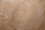
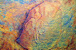
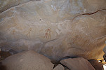
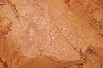
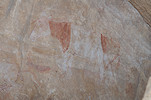
In 2011 we searched for the main site, but failed to find it hidden in the maze of rocks. We did come upon Bernard's sites purely by accident, so in 2016 we had an easier job, and after some searching did successfully locate the main site. Now with the location known we could go straight to it (site TH 1), probably the best hidden secret site of the entire Tassili. After a lengthy photo session we continued to Bernard's sites (TH 5 - TH 6) just a few dozen metres away, but requiring a good 10 minute circuitous route to get from one to another. At the latter we saw a detail not noted earlier, a roundhead figure that is superimposed on a negative handprint (or is it the other way around... ?).
The descent on the Akba Aroum takes about three hours, but as there were some slower ones in or group, to play it safe we planned for six hours to be down at the bottom, still an hour before sunset. We left Tin Taharin at 10am, and by 11am we reached the top of the pass, collecting our packs along the way. We continued with just a brief rest on the top, and by lunchtime we reached the spacious shelter just above the top of the talus slopes which marked one third of the way down.
Satisfied with our progress, we could afford a longer rest after lunch in the shelter before continuing on our way down, reaching the riverbed at the bottom and the car track beyond by half past three, a good hour and a half earlier than planned.
The only flaw in the cunning plan was that Abdou did not know about the new stretch of tracks leading right up to the bottom of the pass, built to make day-trips easier, where we were dropped off in in 2016. After waiting for an hour, we realised that something was amiss, as we agreed the cars will be waiting for us from 3pm onwards. With Mohammed we had to walk the three kilometres till the old end of the track (where the donkeys are usually offloaded), where the cars were indeed waiting. With this delay, it was around sunset that we reached Djanet with the promise of a warm shower. The first part of the trip was now over, Hideharu, Jean-Pierre and Magdi left with the overnight flight to Algiers in the small hours, while Gerdette, Luca and Marta arrived with the same flight to continue with us on the second part of the trip.
Day 12. Aït Talwaten - Tillenine
After the ten day trek (and the overnight flight for the new arrivals) this was a more relaxed day. We could afford to sleep late, and after a leisurely breakfast we set out with four cars to visit the area north of Djanet. Passing the rock towers of Tim Ras we continued along the fastest route to Aït Talwaten, the spectacular and only true "Roundhead" site not located high on the plateau. It was already midday by the time we finished taking photos, we had lunch in the shade of a nearby rock tower before moving on.
Returning via the narrow canyon we passed the cluster of wild figs (Ficus teloukat) which were now all bearing fruit. While not very wholesome, the ripe red ones did indeed taste like figs.
Our next stop was at Tilleline, some 40 kilometres to the north east of Djanet. We have visited this area with Magdi in 2016, but at the time we only saw the site published by Fabio Maestrucci and Gianna Giannelli in Sahara 23. I was aware that Nadia Bahra reported several more sites in the vicinity, but I only learned their location recently. We stared at the site Bahra called Tan el-'askar, which turned out to be a small but spectacular panel with a procession of human figures. The other (Bahra's Tedjeleh Ekrar) was only a few hundred metres further, with four human figures sporting an interesting headdress.
We returned to the main site of Tilleline, a huge rock wall which once was covered with paintings, but now they are so weathered that hardly anything is visible. The light was a bit better than last time, but still it was hard to make any sense of the scenes.
It was late afternoon by the time we returned to Djanet, where we spent another night at the Essendilene premises.
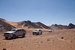
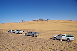
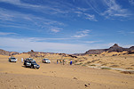
Day 13. Djanet - Tin Aressou
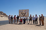
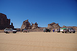
This was another lazy day, as I needed time in the morning to re-stock our supplies at the Djanet market before heading out again. It was late morning by the time we were all set, with five cars we set out on the road towards the Tadrart only driving about an hour (making the obligatory photo stop at the famous road sign, now cleared of stickers and graffiti) before stopping in a small tree-covered wadi close to the road for lunch. After a short rest we continued to the low basalt hill of Tanaout just by the roadside, with the boulders covered with engravings, many of them in a perfect afternoon light.
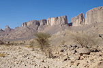
By mid-afternoon we reached Tin Aressou, with the large double shelter with some spectacular Iheren style paintings. We camped here, having the rest of the afternoon to explore and photograph the site.
On Google Earth I have spotted a potential shelter nearby, indicated by the customary semicircle of stones in front, characteristic of almost all painted shelters of the region. While the others merrily snapped away at the lion hunt and other scenes, Petra and Luca volunteered to join me for the short climb up to the far side of the valley, where indeed we did find a shelter and the stone enclosure, but there were only some unrecognisable traces of paint on a sunlit section of the shelter wall.
Day 14. Tin Akaham - Tin Hanakaten
Prior to our 2019 October trip I have identified a number of potential shelters (mostly based on the visible stone enclosures) in the Tin Akaham and Tin Hanakaten areas. Visiting some of them on the ground, almost each proved to contain some rock art (though nothing outstanding). There were a number of targets left unvisited for a future trip, mostly to the north of the principal Tin Akaham shelter. With Covid intervening, we had to wait three years for the next opportunity, in the mean time Frederique Duquesnoy and Marie-Jean Nezondet have visited the area and have found a number of small sites with paintings in the likely spots. Armed with this information we had a much easier task, we just had to follow the known points. Packing camp at Tin Aressou we set out on the track leading towards Tin Akaham and Tin Hanakaten on the far side of the asphalt road, and spent the first part of the morning visiting the row of small sites.
We reached the principal Tin Akaham shelter by the late morning, spending some time visiting the site and the small niche on the opposite side of the valley with the spectacular aurochs bull. This was the only place where we met any others, a group of Algerian tourists from the north.
Having checked all the known sites (and some likely spots, without finding anything new) in the Tin Akaham area, we moved on to Tin Hanakaten, about ten kilometres further south. We arrived early afternoon, by which time there was just about enough shade at the foot of the cliff next to the big double shelters for lunch. As we planned to camp here there was no need to hurry, after some rest we entered the caves for a lengthy photo session of all the scattered faint scenes.
A number of potential shelters were identified on Google Earth to the south of the main shelter, requiring a couple of kilometres of walking. With a smaller party we set out mid-afternoon to check them out, most were found to be empty, but in one (spotted from a distance, not from satellite imagery) we did find a faint panel with some human figures.
Day 15. Tin Hanakaten - Menkhor - Kasar
In the morning after breaking camp we visited the nearby "Abri de taureau", the absolute highlight of the area, with the paintings not quite conforming to any of the established stylistic conventions.
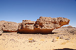
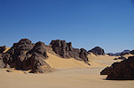
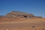
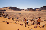
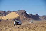
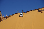
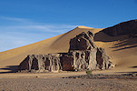
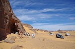
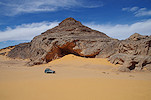
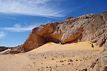
From here-on, we were mostly on uncharted territory. For the past decade the mouth of the Oued Beridj formed the southern limit of the area permitted for tourists in the Tadrart. While the southern Tassili was not explicitly off-limits, generally south of the Tin Alkoum road and west of the track leading to the Tadrart (and towards In Ezzane) was considerd a grey area, with Tin Hanakaten on the limit, being about the same latitude as the Oued Beridj. Abdou and some of our drivers vaguely recalled the tracks leading further south, but we were still very much in an exploratory mode. Our first target was Menkhor, an interesting-looking site about 50 kilometres to the south west of Tin Hanakaten, near the edge of the plateau. This site was first reported by Leone Allard-Huard (in 1987, together with some other paintings of the Tadrart), and was only ever visited by a handful of people before the area was sealed off, including Bernard Fouilleux. While we had a rough idea of the location, we expected that we would need a lengthy time to search for the paintings, so it was a pleasant surprise when as we approached the area Abdou recalled that he was here a long time ago, and was able to lead us straight to the cliff with a shallow shelter underneath. The setting was spectacular, with a sea of golden sand submerging the valleys at the edge of the plateau (and permitting relatively easy access with vehicles).
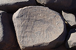
Another site, named after the nearby massif of Kasar was a further 30 kilometres to the south west. It is an unpublished locality, this too was visited by Bernard Fouilleux, who gave me the approximate coordinates some years ago, but we had little faith in their accuracy. The terrain between Menkhor and Kasar looked very rough, but one of our drivers, Kader recalled a piste going from the valley below Menchor towards the Tadrart, passing somewhere close to our target. On approach we entered several cul-de-sacs before hitting on the right path, and much to our surprise and relief we found the litle rocky hill with a shelter at the southern end right where Bernard marked it. There are some damaged paintings, but the main attraction is a group of "Kel Essouf" figures engraved on the wall of the shelter. These figures appear to be very ancient, and they are concentrated near the southern end of the Tadrart. This was our first encounter, but our plan called for many more in the coming days.
It was approaching sunset, we made camp nearby at a nice sandy patch at the foot of some rocks.
After dinner some of walked back to the shelter to photograph the "Kel Essouf" figures with side-lighting in the dark, obtaining much better results than in the diffused light of the day.
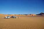
Day 16. Kasar - Abri Freulon - Aman Smerdnin
In the morning while our drivers packed camp we walked back to the site, and along the western side Michel found another shallow shelter that contained an extraordinary group of "Kel Essouf" figures with painted decoration. Checking later, these figures were recorded by Bernard, presented on the website of Jitka Soupokova, but only under the generic name of Tadrart 1 so I did not make the connection.
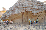
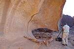
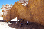
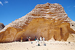
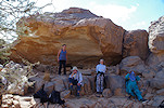
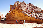
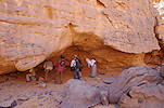
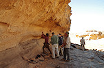
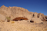
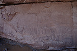
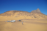
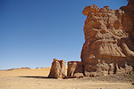
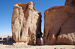
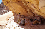
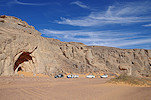
In reality we were still at the southern end of the inner Tassili, we did not realise at the time but we were a mere 50 kilometres from the Niger border. The Tadrart, the southern end of the outer Tassili was still a good 25 kilometres to the north east, fortunately on a fairly easy terrain across a series of sandy plains and valleys that offered good going. We soon hit the In Ezzane piste, and followed it till the valley leading in towards the Abri Freulon, one of the most important objectives of the second part of our trip. This huge double shelter was discovered by the French geologist, Jean-Michel Freulon in January 1951, and more recently was published in full by Ulrich & Brigitte Hallier in their Tadrart monograph (2014). We reached the hill with the prominent south-facing shelters near midday, and after a quick lunch we set out to explore them.
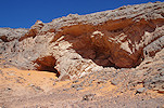
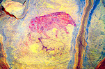
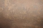
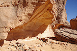
The right shelter is really just a huge void left by rock fall, with many irregular rock faces, most of them with paintings, sometimes mixed with engravings. Most panels are pastoralist scenes, but there are several negative handprints, including a series from small to large, it is tempting to think it may have been made by a family. Very high up there are two panels of very ancient looking paintings, including white ghost-like figures that closely resemble the Kel Essouf engravings, and also some strange non-figurative shapes. On the slope leading up to the right shelter I was delighted to find the lovely engraving of a giant buffalo (Syncerus antiquus) which is on the cover of Michel Tauveron's 2005 brochure on the Tadrart, with no provenance provided.
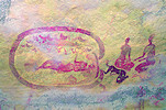
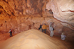
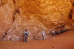
The left shelter is a proper deep cave almost completely filled with a sand dune, and at the top contains some unique paintings of the same ancient-looking type seen in the right shelter. There are no pastoral paintings in this shelter, possibly it was completely filled with sand in that period and was inaccessible. The most intriguing figure is what appears to be a man standing in a boat, but on close look (with DStretch) it can be seen that a fragment of painted rock fell away, the boat may be an extension of the strange shapes to the left.
Michel Tauveron reported another fine site just a short distance from the Abri Freulon. It is a small shelter that contains a painting of a very fine Iheren style (?) elephant, but intriguingly the smooth ceiling of the shelter alongside the painted is covered with very fine line engravings of other animals in practically the same style, including a lovely rhinoceros.
The Halliers have found another site with Kel Essouf engravings in a side valley nearby. While we had only a vague description of the locality, it was very straight forward to find, a huge shelter in the side of a prominent hill at a fork of the valley. There were numerous rather weathered and vague engravings in the shelter, and just one clear Kel Essouf figure.
There is some ambiguity in the usage of the Aman Smerdnin toponym. Freulon used it (as Aman Semmerdnin) to refer to the big shelter he found, however nowadays it is used to describe the broad circular sandy plain about 10 kilometres further west, also containing a number of rock art sites. The two areas are separated by a rocky ridge, which to the north is almost completely swamped by dunes, offering a difficult but feasible passage. After a couple of failed attempts in places where the sand was too soft, we managed to ascend to the ridge separating the two basins, and from there it was an easy way down to the flat sand plain towards the principal rock art site of the basin.
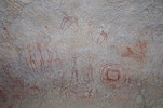
The principal site of Aman Smerdnin is a long shallow shelter at the south western end, at the entrance of the main wadi feeding the basin. There are mostly sporadic late pastoral and camel period paintings in it, but at the right end there is a rock face with a number of engraved Kel Essouf figures, and there is also a very weathered panel of paintings of the archaic type observed in the Abri Freulon.
We made camp in the little embayment to the west of the shelter, enabling a return in the evening to photograph the Kel Essouf figures and some other engravings in the shelter with a strong sidelight.
Day 17. Aman Smerdnin - South-eastern Tadart
There was another smaller shelter just next to our campsite, in the evening we checked it out without finding anything, but in the morning Abdou went to have another look, and found a little hidden panel on the ceiling, including a remarkable bull with a strange body decoration, the like of which I cannot recall seeing anywhere else.
While the drivers loaded the cars, we returned to the main shelter in the different morning light, but did not see any more than the previous afternoon and evening.
It was time to start making the move north, on our return route along the eastern edge of the Tadrart. The crossing of the dune range immediately to the north of the big Aman Smerdnin embayment was a surprisingly easy affair, going on good firm sand all the way, marked by a number of tracks. We were only interrupted by a small technical mishap, the flat tyre replaced two days earlier in the lead car got bumped on a rock along the way, became loose and started dragging on its chain in the sand. At first we did not realise why the car suddenly stopped responding to the accelerator. By the time we stopped the whole structure got deformed, and it took a while to free the tyre and move it securely to the roof rack.
North of the dune belt there is another broad open area (Tauveron calls it Aman Smerdnin North), in the middle of it there is a prominent rock spire, with a cleft at its northern tip. Remarkably, inside the cleft there is a lovely engraving of a large hornless cattle with a turned head, barely photographable due to the small distance between the two rock faces.
Another "Kel Essouf" site, called Ua-n-Seklem by Tauveron is in a broad valley a little further west, accessible by following the track towards the north along the southern end of the mostly impassable dune field filling the plain to the east of the Tadrart. This site is a relatively small shelter at the base of a cliff, with a number of Kel Essouf figures and other engravings, some of them underlying more recent pastoralist paintings.
After Ua-n-Seklem we had to cross the roughly three kilometre wide tongue of the dune field that presses against the eastern foothills of the Tadrart, separating the Aman Smerdnin area from the more visited central parts. Again there was a well defined track, and despite some more difficult softer slopes, it was a fairly easy exercise, we had all cars safely across the dunes by midday. We continued to a prominent rock outcrop, where Marie-Jean Nezondet found some late pastoralist paintings in a shelter. Much to our surprise, in another shelter close to the paintings we also found a panel of Kel Essouf figures.
With no shade about, we had a quick lunch in the lee of the cars, then proceeded to the pass a short distance away that led down to the generally flat terrain at the eastern foot of the Tadrart. The pass was a big dune piled up against a cliff, but with a good 50cm lip, bridged by a ramp built up with rocks. As each passing car effectively demolished the ramp, it needed to be rebuilt after each passing. Very clearly this is a one-way route, there is no way to get a car up at this point in the opposite direction.
Purely by chance, when waiting for the arriving party at Djanet airport I met Carine Nezondet, who arrived with the same flight. She told me about a spectacular Kel Essouf site they found recently in the area, as it was close to our planned route we could afford the slight detour. It is not accessible with cars, one needs to walk about two kilometres beyond a dune blocking the valley to reach the huge rock wall, which is covered by dozens of Kel Essouf figures.
It was rather late in the afternoon by the time we returned to the cars. We drove another ten kilometres northwards to see another small site with engravings and paintings reported by Carine and Marie-Jean, then looked for a suitable camping spot in a nearby valley.
Day 18. South-eastern Tadart - Ouan Tabarakat - Tin Uded
Now we were back on known terrain, essentially folowing the route we took in November 2018. We made a stop at the fine late pastoralist site near the entrance of the Ouen Tabarakat valley.
The plan for the rest of the day was to thoroughly explore the Ouan Tabarakat valley along its entire length. In 2018 we just made a quick dash to see the known sites near the southern end, but in the meantime Carine and Marie-Jean have found numerous other paintings and engravings in the western tributaries. One such site was a shelter with paintings, and a rock face nearby with a number of very fine line engravings.
We continued to the well known sites at the southern end, starting with the fine chariot of Muzzolini, folowed by the small fine pastoralist shelter at the very end of the valley.
For midday we returned to the principal site of the valley, the huge shelter with the wall of Kel Essouf engravings. After lunch in the shade of a nearby rock outcrop we spent a long time taking photos (including our group photo).
In the afternoon we made a slow trickle back towards the north, checking out the sites found by Carine and Marie-Jean. Some were minor with just a few coarse engravings, but a few were quite impressive panels of both paintings and engravings.
It was late afternoon by the time we saw all, we entered the Oued Tin Uded (the western main tributary of Ouan Tabarakat), passing by the big panel of Kel Essouf engravings (which were in a rather bad light), making camp opposite the long low shelter with a mix of archaic and pastoralist paintings.

With all the driving in the sand and the to and fro into the lateral valleys, we consumed far more fuel than planned, , the level in some of the cars was becoming alarmingly low. In the evening we re-planned the itinerary for the last two days. Rather than driving further north and exiting the Tadrart via the Oued In Djerane, we decided to exit via the much shorter way via the Oued Beridj. While this meant missing the In Djerane sites, it brought the opportunity to search again for the missing Marka Ouandi site of Gouarat, and see a number of other sites recorded by Carine, Marie-Jean and a few others in the southern tributary of the Oued Beridj.
Day 19. Tin Uded - Marka Ouandi
With the changed plan, we could afford a lazy morning, walking back to the Kel Essouf panel, now illuminated by the morning sun (when not obscured by clouds), then climbing up to the intriguing archaic (?) site high above the valley first reported by the Halliers.
Before leaving we also re-visited the long shelter by the camp, where in the morning light I finally found the harp player scene that was reported by Marie-Jean (the Halliers did not see it, or at least it is not mentioned in their book). This scene is unique in the Tassili, while there are several harp players depicted in the late pastoral rock art of the Ennedi, to my knowledge this is the only such known scene anywhere in Algerian rock art.
With the changed plan, we also had time to visit a fine site found by Marie-Jean near our previous campsite just outside the entrance of the valley. It requires some walking from the closest access point with cars, but well worth the effort with a fine panel of pastoralist paintings including a splendid herd of hippotragus.There are also some faint archaic paintings underneath.
Carine and Marie-Jean located several more lesser sites on rock outcrops among the dunes in the area between the mouths of the Ouan Tabarakat and the Oued Beridj, an area we just drove through in 2018 without being aware of any of these paintings. It is unclear if Tauveron knew of these sites, there are some vague points marked on some of his published maps in the area, but with no photos or description provided it is impossible to match them with known sites.
Even with this leisurely pace we were at the eastern entrance of the Oued Beridj by lunchtime. We had our lunch break in the shade of a big rock along the southern side, then we continued deeper into the valley. At one point we spotted a rock with a promising shelter in an embayment along the north side, approaching it indeed we did find a panel of late pastoral paintings. There were no car tracks leading to it, clearly the area remains to be fully explored.
We made the obligatory stop at the splendid panel of engravings referred to as Marka Ouandi. While we discussed the plan for the rest of the afternoon with Abdou and the drivers it became clear that Marka Ouandi was in fact the name of the entire southern tributary that joins the main valley a short distance upstream. This explained why we never found the site of Gouarat (Sahara 5) in the main valley, despite searching repeatedly.
We entered Marka Ouandi, and at the fork took the right turn, exploring the western branch in the afternoon. Carine and Marie-Jean found a number of sites here too, including a fine engraved rhinoceros, and a shelter with fine paintings at the very end of the valley.

It was close to sunset by the time we finished, we made camp near the end of the valley. We just had time for one more nearby site, a proper cave with a fine panel of cattle near the end, including the rare scene of a cow giving birth.
Day 20. Marka Ouandi - Oued Beridj - Djanet
Our camp was at the entrance of a small embayment, while answering the call of nature during the night, both Abdou and Joanna made some nice finds on opposite sides of the valley. Abdou found a single but very nice painting of a dama gazelle, while Joanna found a large panel of engravings with some fine depictions of cattle. Again it was clear that the valley is far from being fully explored.
Returning along the way we came, we passed a shelter near Carine's rhinoceros. This was not a reported site, but we did find several paintings and engravings inside.
We passed another set of engravings found by Carine, then continued to the eastern branch of Marka Ouandi, to a site with late pastoralist paintings.

The finest site of Marka Ouandi is on the eastern side of the eastern branch, at the edge of a small sandy plain. I was aware of this site for many years now, but without knowing what was there. Jean-Marie indicated a fine Iheren style panel, I fully expected to find Guarat's panel there, but it is a completely different site, with some very fine scenes, unfortunately very damaged.
We drove to the end of the valley, where another site with engravings was reported, including girafe and an elephant. We found the shelter at the marked spot, but it took a long search until we found the actual hardly discernible engravings on rock slabs adjacent to the shelter. On our way back we found two more sites with engravings, both apparently unrecorded.
Reaching the Oued Beridj we continued west, only stopping at the fine large panel of engraved cattle and round vessels (Faleschini's site H, dessignated "Roundhead" by the Halliers for some unfathomable reason) near the middle of the valley.
Our time was up, it was 11am, we had to start the drive back to Djanet to have enough time before the flight to Algiers in the small hours. Passing the military check-point we drove on the piste towards the asphalt road, making a brief lunch-stop before continuing. Once reaching the road it was an easy hour and a half till Djanet. Gerdette, Luca and Marta split off to see the "crying cows" with one car, while the rest of us drove straight to the Essendilene premises for a warm shower and plenty of time to sort and pack things before the flight back to Algiers in the night.
Day 21. Djanet - Algiers
For once Air Algerie was on time, with the 4am departure we were back in Algiers by 6:30am, even the luggage arrived fairly quickly, with everyone having plenty of time to catch the connecting flights back home.
We plan to return to the Tassili n'Ajjer again in October 2024, to make a sixteen day camel supported trek to the finest classic sites of the Tassili (Tamrit, Tin Tazarift, Sefar, Jabbaren), plus some lesser visited areas. The trek will be followed by a short visit to Ti Leh-Leh (Oued Zarzawa) and the newly found sites at Adjujel. Please check the News page periodically or "like" the FJ Expeditions FaceBook page to receive notices of news and updates.