
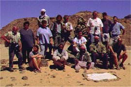
 Click on image for list of participants |
Jebel Uweinat - Gilf Kebir Expedition 18th March - 2nd April, 2000 |
Following the successful 1998 trip we had a deep desire to return and further explore the area, especially after in-depth research revealed the prolific amount of unseen rock art sites in the region. The FJ Expeditions website was set up in the summer of 1999, and the first group was assembled and ready to go by the following March. Egyptian officialdom did not fail to prove itself once again. Two weeks before departure, after everything seemingly went smoothly, we received the news from Cairo that the permits were refused. The excuse was, that with all the thrash and damage done by the just completed Dakar - Cairo rally, the Minister of Environment suspended (admittedly not without a point) all tourism in the deep Western Desert. There was some frantic arm twisting by our Cairo contacts, and finally the permits were given just three days before departure.
Day 1. - Cairo - Abu Mungar
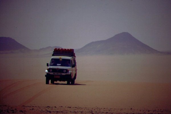
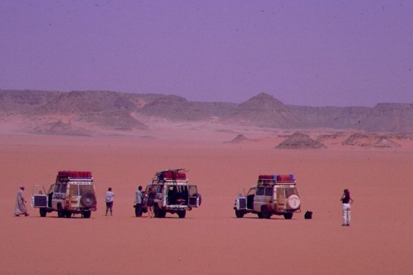
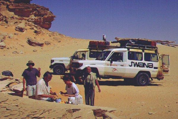
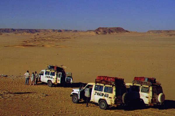
Most of the group flew together on the overnight Malév flight, and met the others and the cars in the small hours at Cairo airport. We started as soon as we loaded our gear down the long, boring road towards Dakhla. Based on our previous experience with local drivers accompanying the cars, it was agreed that aside Khaled, Chris and Werner will be driving the second and third cars, both of whom had much experience in driving in deep and soft sand. We made camp an hour before sunset at the edge of the Great Sand Sea near the road about 100 kms beyond Abu Mungar.
Day 2. - Dakhla - East Uweinat
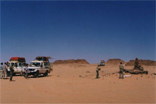
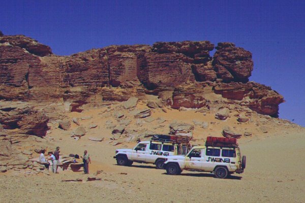
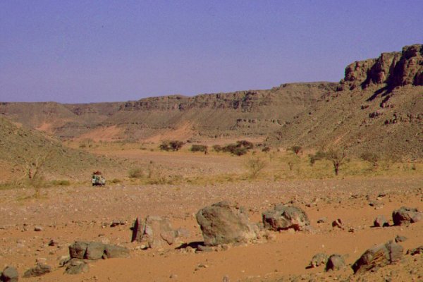
Breaking camp in the morning we drove to Dakhla, filled our fuel tanks, bought fresh vegetables, then set out on the road south. The infamous checkpoint just at the edge of the town was deserted, and we could continue south unhindered. With the heavy cars it was a slow drive south, we were planning to camp at Bir Terfawi before turning west the following morning. At the Terfawi checkpoint however after some radio exchanges we were told, that though there is nothing wrong with the permits, they need to be endorsed by the commanding officer, who is at East Uweinat. I had nightmarish visions of the 1997 events repeating as we drove south to the settlement of East Uweinat accompanied by a soldier, a further 60 kilometres south. Soon after Terfawi the road suddenly improved dramatically, with brand new reflective markings, roadsigns, steel railings in the turns, and an impeccable surface, as if we were approaching a major city. The town did turn out to be neat and fairly large, at least what we could see of it in the darkness. My fears proved to be unfounded, the commanding officer of the border units proved to be an extremely friendly gentleman. It soon became evident that he wished to see us out of genuine concern, making sure that we are well equipped and know what we're up to. Satisfied, he requested us to take along one of his soldiers, as after the mine incident in Wadi Wassa a year ago (where he was in charge of the rescue and clean up operations) he wishes to make sure noone wonders accidentally into a mined area. I asked about the possibility of driving around mines at Karkur Talh, and he confirmed that is no problem, as long as one stays on the top of the dune we observed on the previous trip. A soldier dutied to accompany us was soon ready, and we set out into the darkness. We move about 5 kilometres out into the desert, and made camp.
Day 3. - East Uweinat - camp at dunes east of Jebel Kamil
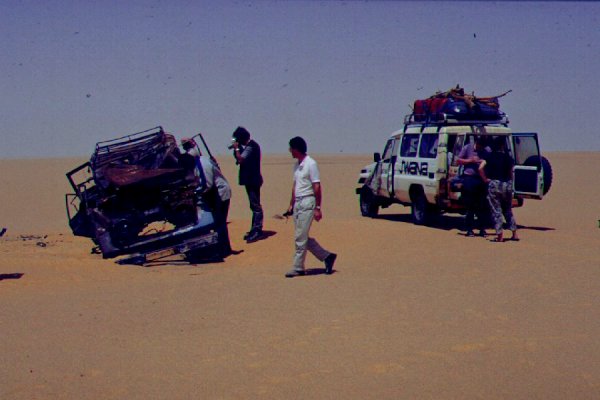
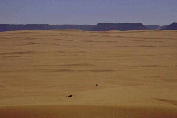
In the morning we started in earnest accross the Selima Sand Sheet. We passed a few of the huge circular irrigated fields of the agricultural project, then soon were in the untouched desert. On the sand sheet we came accross the burned out hulk of an old Landcruiser. It apparently overturned, and probably the fuel spilled from the big drum that was still in the back and ignited... (Anybody knows anything about this event ?).
This time we found an easy way accross the dunes near the midde of the Selima Sand Sheet, and soon we had Jebel Kamil in sight. Part of the group made an excursion to the peak, which proved to be the home of a pair of hawks. We found nothing other of interest except the view.
We continued west, carefully avoiding the flour like granite dust that held us up the last time. Instead of driving the full 25 kilometres north, at a point where the dunes looked passable we attempted a crossing, and made it through the 5 kilometres without any major mishap, camping at the western edge of the dunes.
Day 4. - Camp - Shaw's cave - Karkur Talh
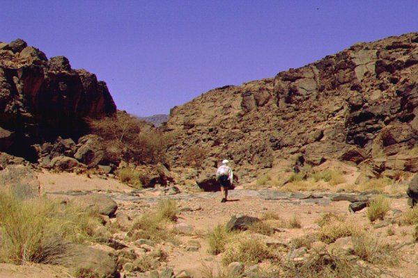
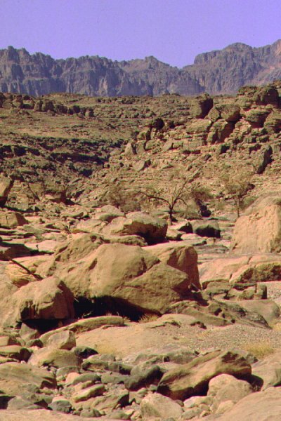
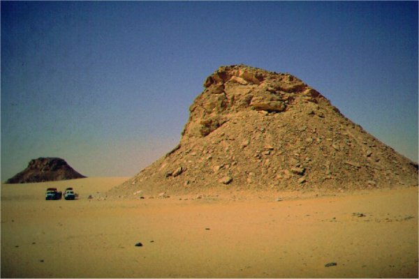
We continued towards "Eight Bells", a group of conspicious hills at the entrance of Wadi Firaq in the southern Gilf. We did not find the WWII aerodrome this time, and continued in the broad valley. We explored and succesfully tackled a pass between Wadi Firaq and Wadi Wassa.
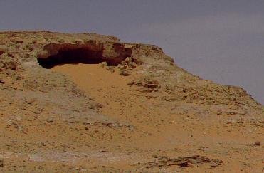
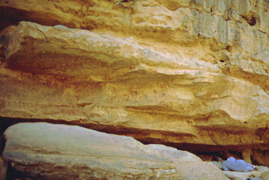
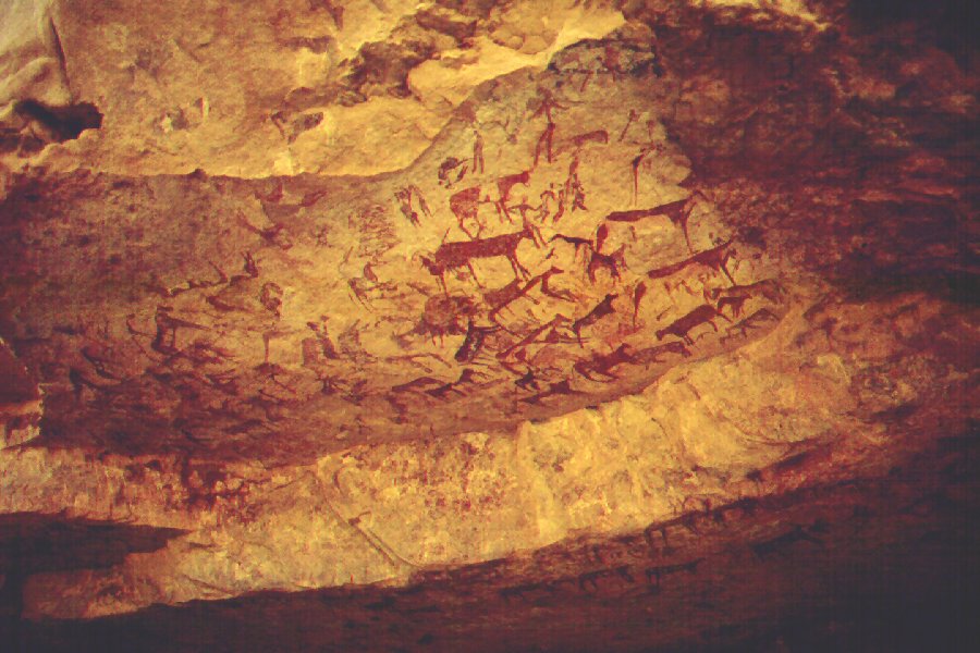
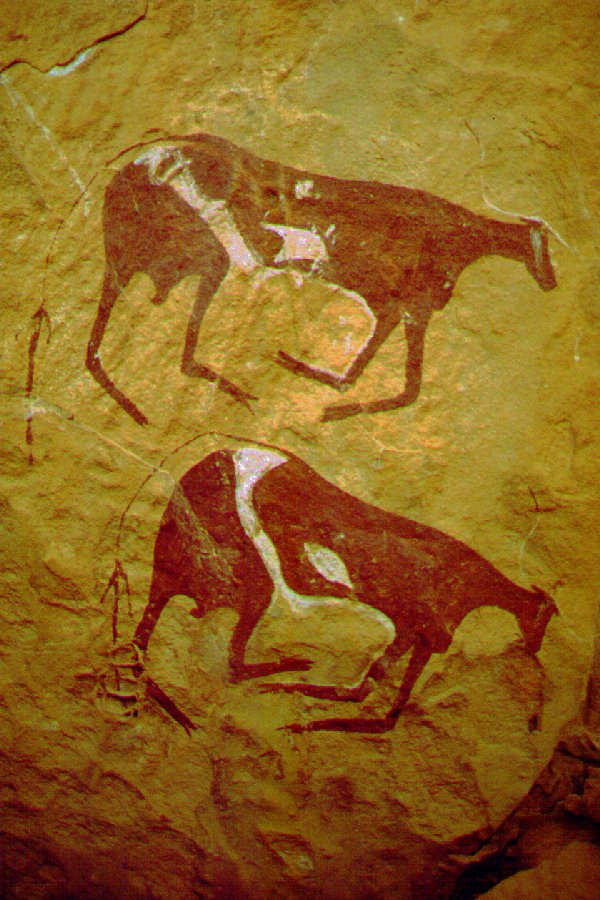
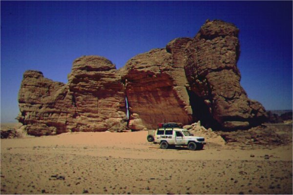
We drove west along Wadi Wassa to the small side wadi leading up to the painted rock shelter discovered by Harding-Newman and Shaw in 1935. The description of it's location was fairly vague, but after some struggling with the soft sand at the bottom of the slope, we made it up to the ridge separating the two main wadis, and after a turn we were right before the cave.
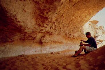
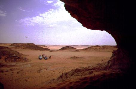
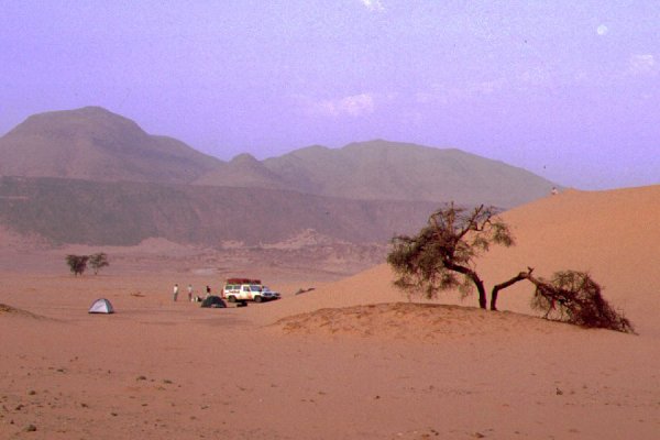
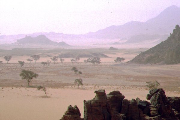
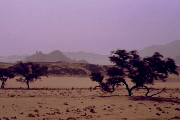
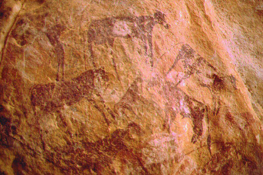
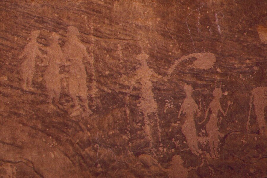
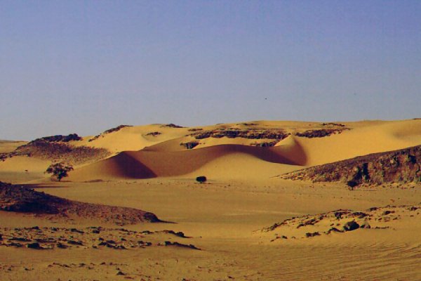
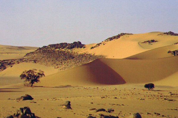
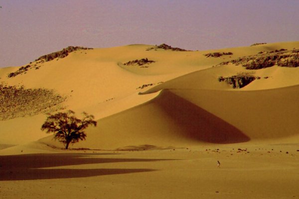
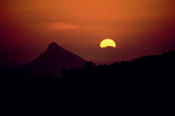
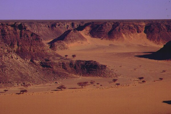
After an hour spent photographing and exploring the area we returned to Wadi Firaq along a steep straight sandy slope, and set course towards Uweinat. Unfortunately a shortcut that looked good on the map led us into a broken, rocky area to the south of Eight Bells, and wasted much time. On our way south, we passed a group of craters that were very similar in structure to Clayton's Craters further west. As we approached Uweinat a mild sandstorm brewed, and the sky was soon covered with dust. It was nearing dusk as we approached the entrance of Karkur Talh, still not seeing anything of the mass of the mountain supposedly straight before us. All of a sudden a dark patch appeared in the fog ahead - one of the two trees guarding Karkur Talh entrance. We drove up the dune and descended into the valley beyond the route was very soft and sandy, two cars got stuck, and it was quite a struggle before we had all three cars in the lee of a large dune near the small cove we explored in 1998. In the evening, armed with torches, we walked out to the cove to look for a shelter with paintings that Winkler discovered in 1938, but we missed the last time. Now, knowing where to look, we found the tiny well made human figures even in darkness.

Day 5. - Karkur Talh
Not knowing the nature of the terrain ahead, plus having sat enough in the cars, we decided to walk in to the upper reaches of the valley. We started out at first light when there was a thin mist over the camp and the valley.
We soon reached the point where we turned back with Magdi. The once lush vegetation was almost completely dry. We soon reached the border, and much to our surprise we actually found a boundary marker set on a low hill along the side of the valley. We continued into Sudan, where the valley broadens, and is filled with numerous trees and colocyths.
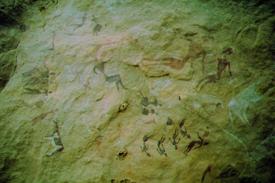
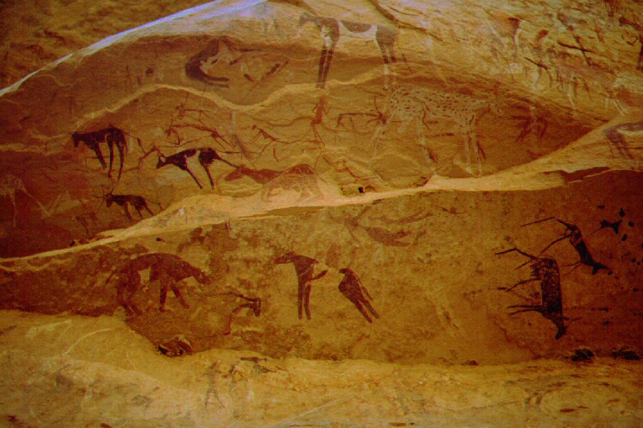
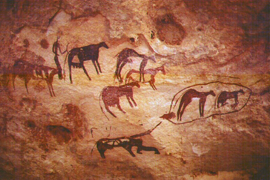
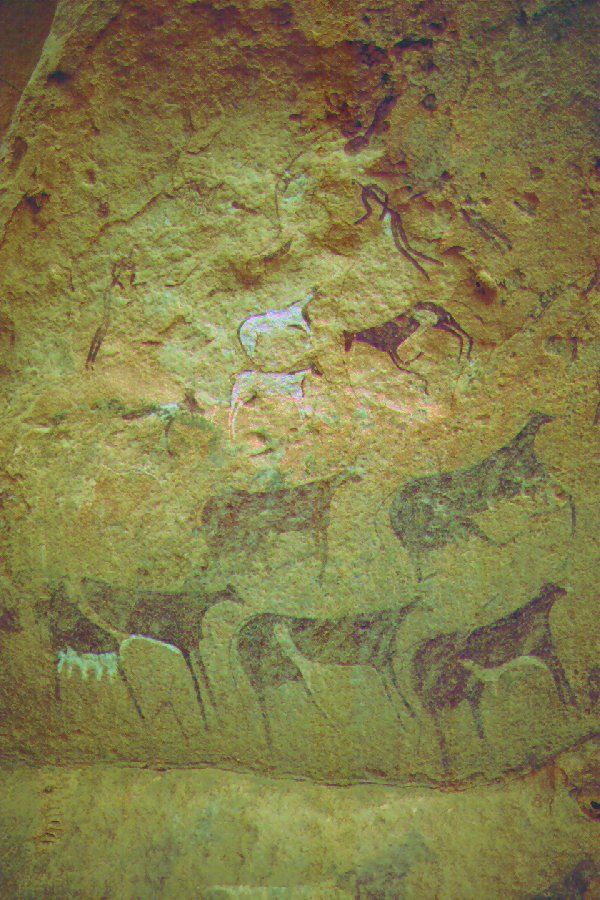
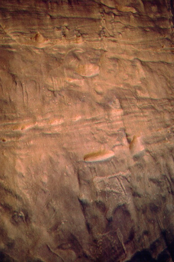
After a good two hours walk we reached a rock island, where we found the first paintings and engravings. As we continued along the south bank of the valley, it was an almost continuous row on one engraving anfte another. Curiously, after the first few, there were no more paintings.
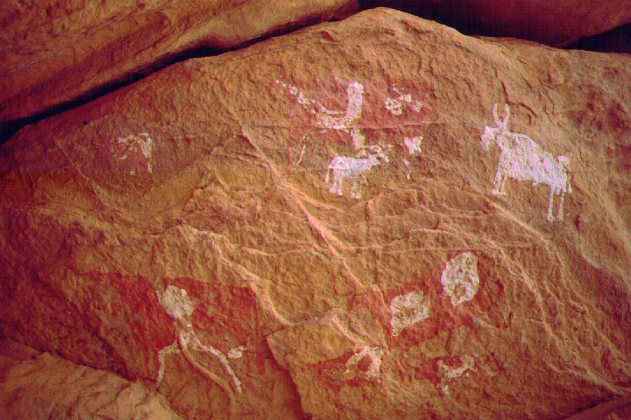
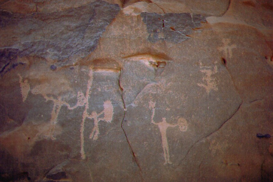
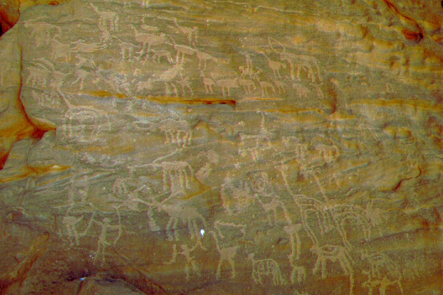
After a halt for lunch at noon, we continued up the valley. Here the engravings became scarcer, but we found a couple of painted shelters too.
At this point most of the group decided to start moving back to camp, a few of us pressed on. Harald was in the best shape (he actaually made the 200km Farafra - Dakhla trek in five days the week before our trip to prepare for the trip) and he soon disappeared behind a bend. With Bernhard and Werner we made it up to Hassanein's Giraffe rock, then to the bend beyond, but as it was mid afternoon, we had to turn back.
After a long walk we reached camp at sunset, with Harald nowhere in sight. Two hours later Harald appeared, with a gleaming face. He found what he was looking for: the magnificent paintings discovered by the belgians in 1968.
Day 6. - Karkur Talh - Clayton's Craters
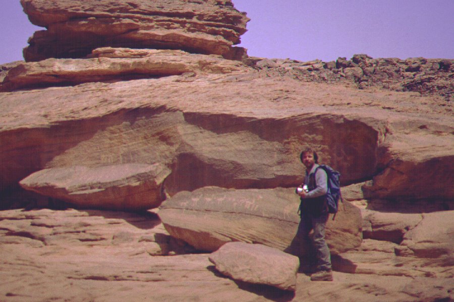
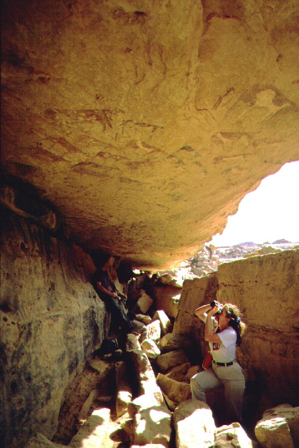
Haralds discovery changed our plans. We were to move on in the morning, but instead with one car we drove up to the end of the drivable section, and continued on foot guided by Harald. After a fairly lengthy walk we reached a long shelter along the bank of the now narrow wadi.
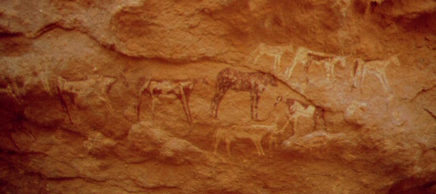
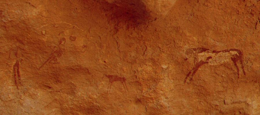
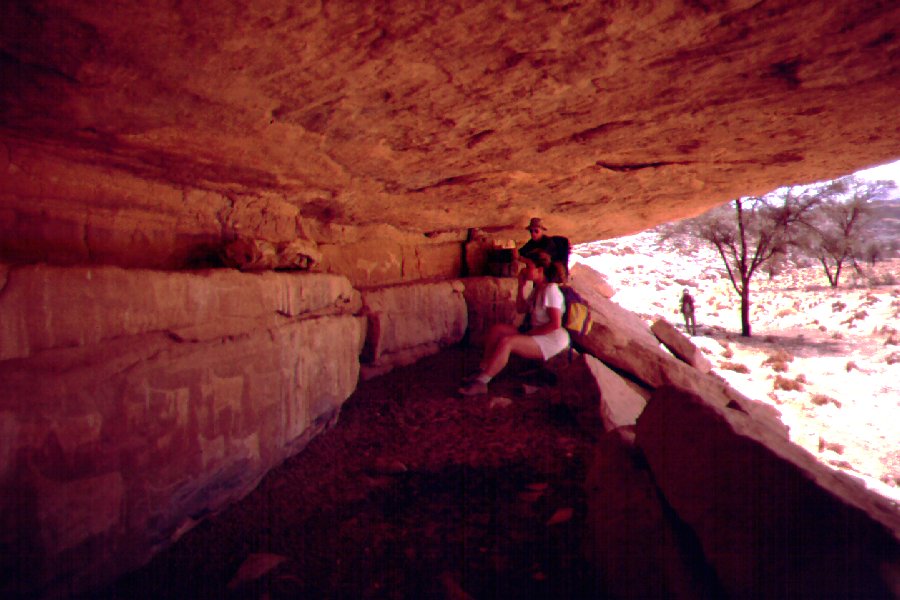
On close inspection it became evinent that the rear wall and ceiling of the shelter is filled with paintings along a stretch of 25-30 metres. This site is truly one of the most spectacular among the Saharan paintings.
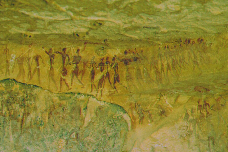
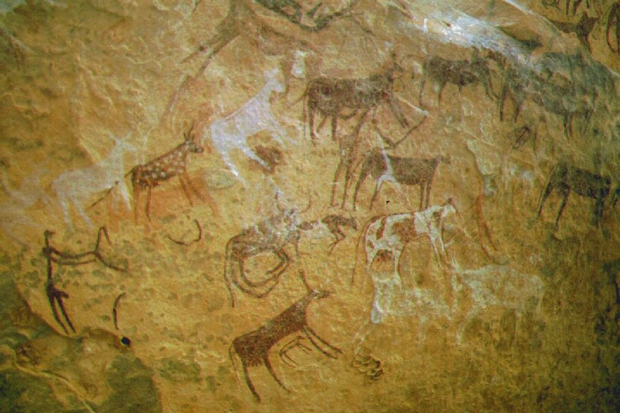
When we finished the lengthy photo sessions, we set about to explore, and found another five smaller shelters, with equally beautiful paintings in the vicinity.
Early afternoon we broke camp and drove north, camping at Clayton's Craters. We've spent the afternoon doing a much more thorough exploration than what we could do on the previous trip.
Day 7. - Clayton's Craters - Wadi Sora
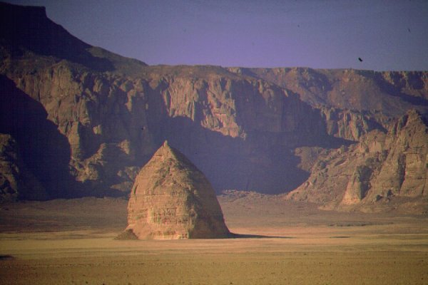
Needing no time to search this time, we've quickly located the Kemal el Din monument.
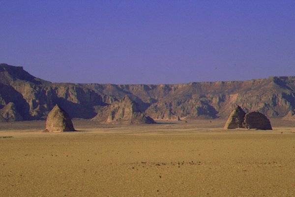
We continued north along the convoy tracks. We have reached the three prominent pionted rocky hills that Almásy called "Three Castles", and had lunch at the Eastern Castle.
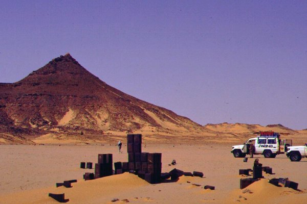
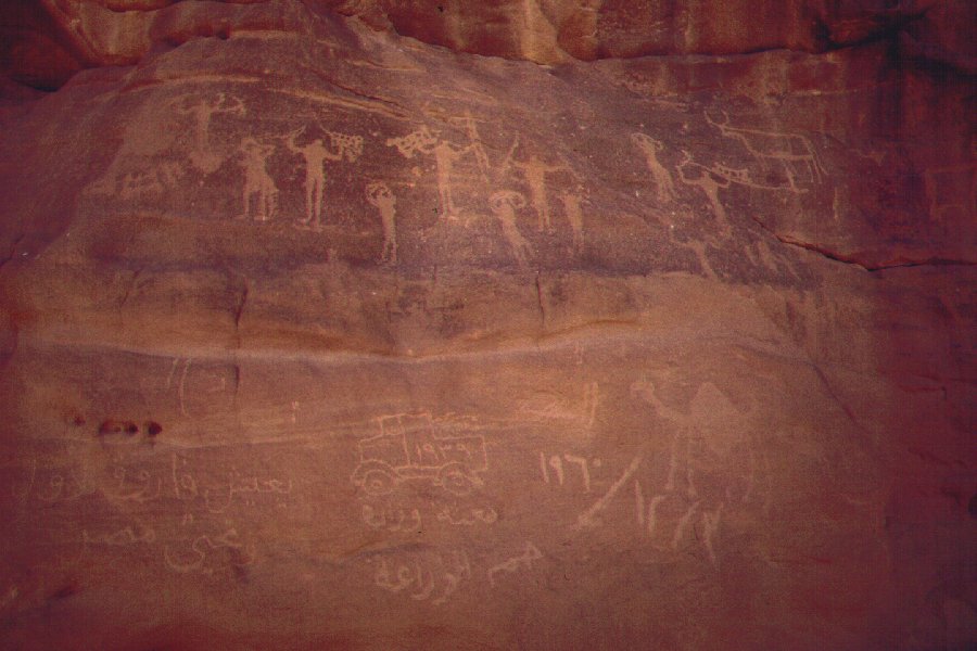
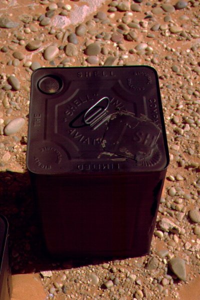
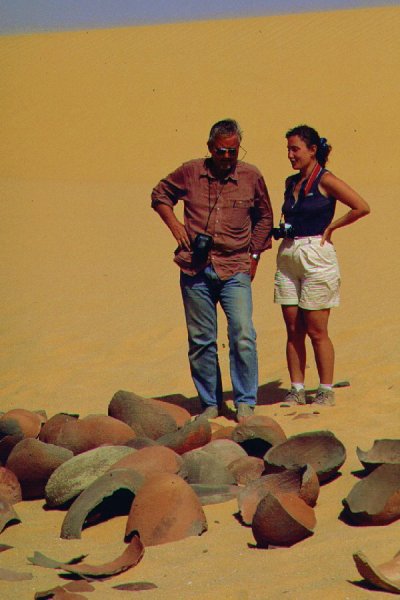
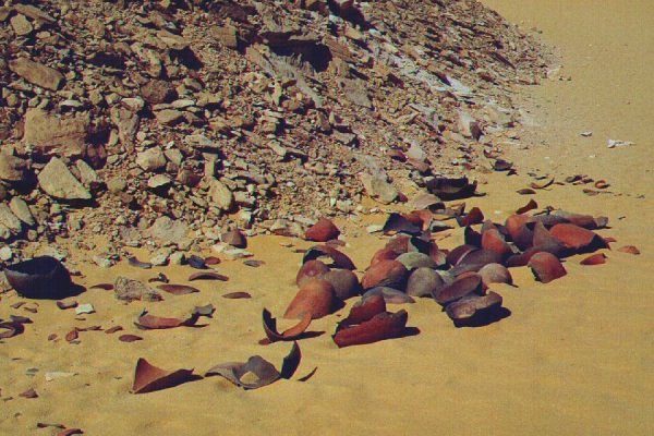
Exploring the vicinity, we found a strange heavy cylindrical container that we have not seen before or since. Possibly it is of german manufacture, and could have been discerded by Almásy during the 1942 raid (if anyone recognises the cannister, please let me know). In the shelter nearby we have found two petrol flimsies that have been re-sealed with a soldered plate - undoubtedly the two rusted through water cannisters left here by Almásy in 1932, and found again in 1942 (as reported in the Operation salaam diary).
Continuing north-west, we were in Wadi Sora by early afternoon.
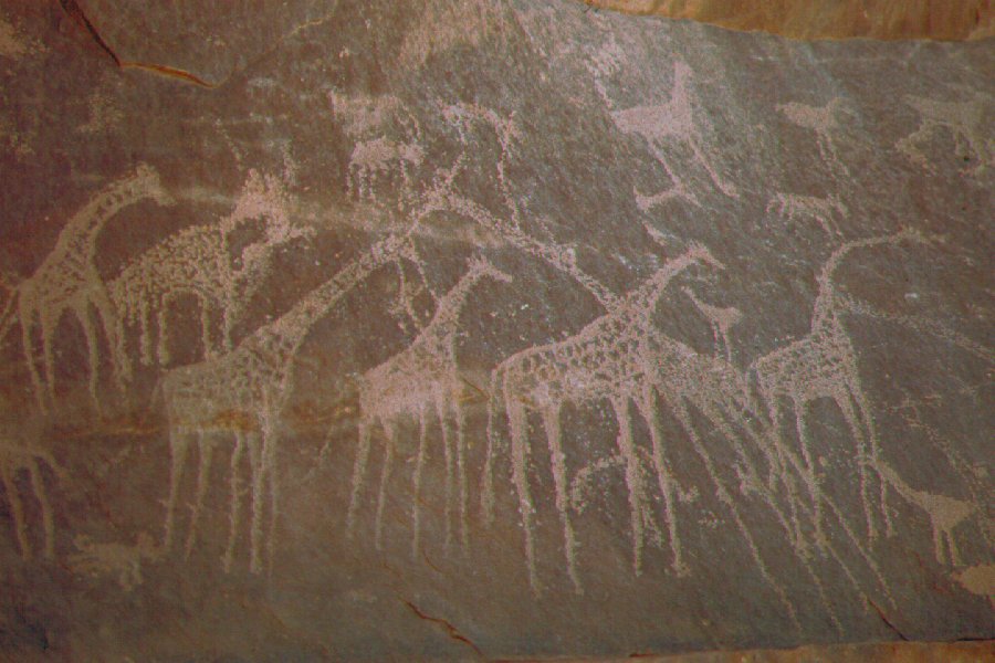
After visiting the main caves, some of us went exploring the vicinity with a single car, looking for the "giraffe cave" that Clayton found in 1931. We searched evry nook & cranny along the rock face to the west, untill at sunset we came upon a broad valley with a large solitary rock at it's entrance. There was a broken-through hollow at its center, and on the far side we soon found the faint engraved giraffes.
Day 8. - Wadi Sora - "Gap"
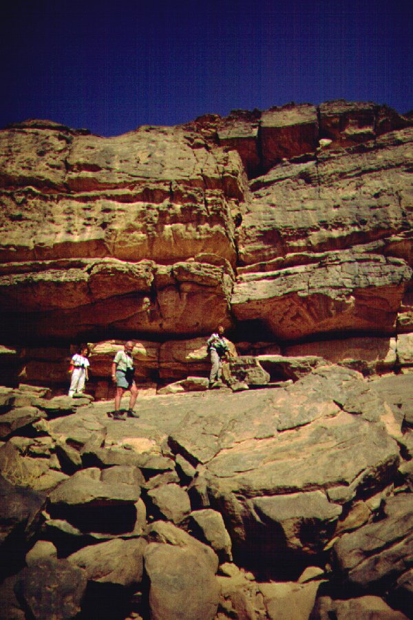
After a lazy morning we started back towards the Aqaba pass. There were many fresh tracks this time, and the upper parts of the pass were very soft, the sand churned up by the numerous passing cars. One car got badly stuck, and it was a lengthy pushing and shoving until we had all three cars up on the plateau ledge.
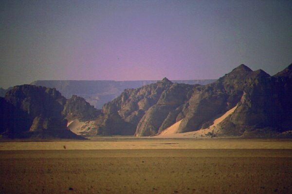
From satelite photos I have identified a possible place to cross the Gap dunes, about 60 kms to the north of the Aqaba. We drove north, stopping at a number of places for the fantastic scenery.
We and reached the isolated smaller plateau adjacent to the dunes by mid afternoon. We entered the last wadi, the end of which was completely blocked by a huge transverse dune, to make camp.
Day 9. - Accross the Gap dunes - Wadi Hamra
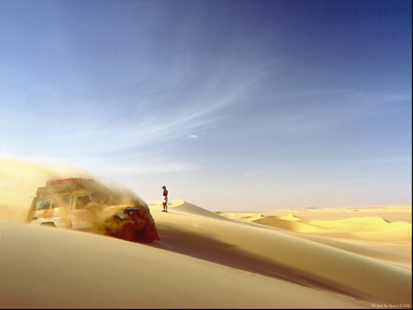
In the morning, we scaled the top of the huge whaleback dune, about 200 metres high flanking the small plateau. From it's top, we could see a straight clear path among jumbled, impassable barchans, till the valley and slope of the parallel whaleback about 5 kilometres to the west. We made it down easily, and after a little bogging in the valley at a soft spot, we continued north for another 10 kilometres along the firm side of the whaleback dune. At this point we drove up to the top, and found another open lane leading south-west, towards the far end. However the jumbled dunes started closing in, and we had no choice but to drive in among them. At this point the edge of the dunes was still about 3 kilometres. We walked in front of the cars, marking out the firm route in the sand, and this way we managed to cover the remaining distance in about two hours, without ever getting stuck. The edge of the dunes were closed by two high, parallel ranges. After some searching we found a suitable spot where both could be scaled in one go, as there was no room to maneuvre in the narrow lane between them. Six hours after starting from camp, all three cars were safely standing on firm ground on the far side of the dunes.
We continued to the mouth of Wadi Hamra, and drove up the valley till the vegetation became dense, and the sand became intense red in colour.
Day 10. - Accross the plateau to Wadi Abd el Melik
The distance separating Wadi Hamra and the eastern branch of Wadi Abd el Melik was about 8 kilometres at this point, allowing for an easy day trip. We set out at dawn, scaling the cliffs behind the camp, and built a cairn for guidance on the way back. We continued along the perfectly flat plateau top covered with brown-black gravel. Interestingly we have come upon an ancient looking path leading in the same general direction, probably made by waddan (barbary sheep). We crossed a shallow wadi, and continued west. Abruptly the land fell at our feet, and we were standing at the edge of cliffs overlooking a broad, aphiteatre like depression, with a line of trees tracing the watercourse along it's far end.
We spent some time exploring the valley, which was noticabli dryer than Wadi Hamra, then retraced our steps accross the plateau, reaching camp by late afternoon.
Day 11. - Wadi Hamra - Silica Glass area
In the morning we drove further up the valley with one car, trying to locate the rock art sites reported by Rhotert, but had no luck.
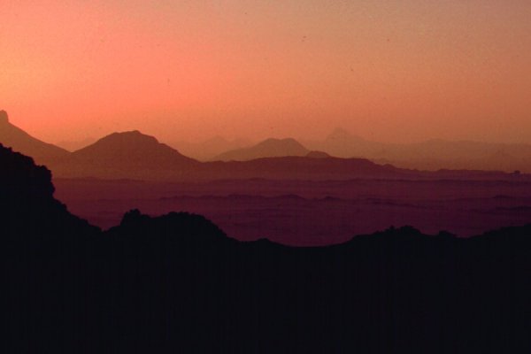
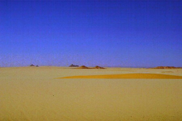
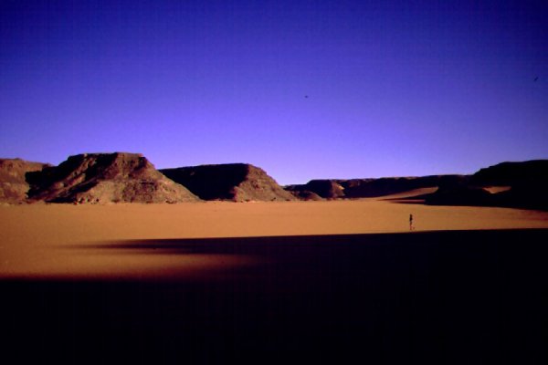
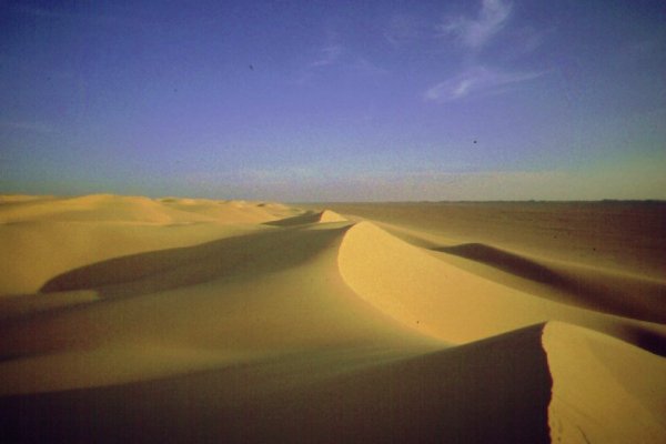
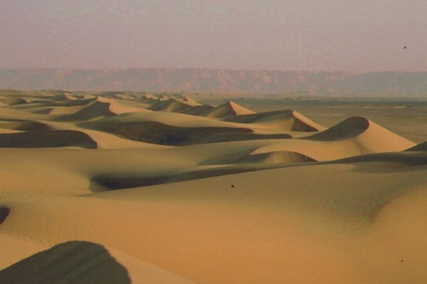
We left the valley and continued north along a broad plain between the vestiges of the Gilf and the dunes to the east till the famed Libyan Desert Glass area at the southern flanges of the Great Sand Sea. We made camp about 20 kilometres into one of the broad internune corridors, and spent the afternoon prospecting, and watching the sunset from the top of the magnificent dunes.
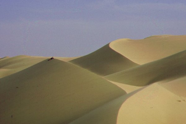
Day 12. - Silica Glass area - Great Sand Sea
With both our reserve days still unspent, we decided to make an attempt to cross the Sand Sea due west from the Silica Glass area. After a series of low dunes, we met our first formidable barrier at noon, and crossed the huge, 200 metre high crested dune range in about a hour. The next one proved to be more difficult. There were a number of parallel crested ranges on its top, and it was very difficult to find a drivable way. Two of our three cars got badly stuck in a shallow basin filled with treacherous soft sand, and it took most of our afternoon to recover and get all three cars safely down to the eastern side.
It was an exhausting struggle, and clearly everyone lost all ambition to try the remaining dozen or so similar ranges facing us until the dunes become lower, and the going easier. We made camp at the far side of the interdune corridor, and made plans to turn south along the dunes.
Day 13. - Great Sand Sea - camp before Abu Ballas
The going was easy along the corridors, and soon we broke out of the dunes near the north-east corner of the Gilf. We continued along the known route, and camped about 50 kilometres before Abu Ballas.
Day 14. - Abu Ballas - Dakhla
We visited Abu Ballas in the morning, then continued towards the tarmac road and Dakhla which we reached by mid-afternoon. We continued to the dunes behind Jebel Edmondstone to camp.
Day 15. - Dakhla - White Desert
We did some sightseeing in Dakhla in the morning before continuing north, camping at the White Desert for the night.
Day 16. - White Desert - Cairo
After a dip in one of the hot springs at Farafra, the last day was an uneventful drive up to Cairo.
See also Bernhard's site (in German) at:
www.zerzura.de